Embed Size (px)
Citation preview
( Antonio Tramontin
Professor of Architecture - Università degli Studi di Cagliari
Sardinia Region’s Committee for the Landscape and the quality of the Architecture)
Agricultural lands’ waste and the loss of identity of the Sardinian landscapes
At present, a severe warning for the identity’s loss of the Sardinian landscapes is arising in
the whole Region, comparable to the heavy coastal speculation of the Sixties.
The Regional area, even the inner lands, is affected by a huge urban sprawling, actually out of
planning control, with serious effects of diseconomy dued to the agricultural lands’waste.
Moreover, after a millennium era of agropastoral civilization, the Insular model of settlement
shaped in close textured villages (Las Villas – Sas Biddas)is going to be definitely destroyed.
Cultural and historical heritage’s lasting values may perhaps recall to common lifestyles , in a
rural word of renewed ecologies, construction materials and shared landscapes.
LANDSCAPE PLANNING IN SARDINIA
The new social awareness about the cultural heritage and the ecological behavior, raised
actually to a defence strategy, shared by the majority, towards a really conservative
landscape planning.
Any land reclamation inside the urban sprawl sectors, asks for a different attitude by the
people ,of rethinking their places’ identity, entrusting to contemporary landscapes in between
nature, land and dwelling communities.
NEW LANDSCAPES IN BETWEEN
Moving from the interstitial spaces, we can drive to landscapes in between, lying along the
land in the shape of botanical rhizomes. The rhizomatic planning may move the stratification
of the territorial marks from an invasive action (to build upon the field) to a joined activity
(living in the field).
URBAN SPRAWL PLANNING – GUIDELINES
ANALYSIS OF THE CONTEXT : Interpretation of the urban sprawling trends. Physical and
social evaluation of the regional networks, including historical and existing marks and paths.
EUROPEAN CONVENTION OF THE LANDSCAPE: The landscape as the result of the
human behavior and identity, between town and countryside, to sustain the ecological
biodiversity.
CONNECTION: The area suitability to be connected in the infrastructural network and in the
regional links.regional links.
IDENTITY: Sharing of the behaviours and the social choices ,related to the local and
historical traditions among plants, animals ,people and their environment.
ECOLOGY: The pervading naturality in the land, in order to reduce the fragmentation of
fields and cultivations, supporting the biodiversity.
AGRICULTURE: Soil suitability and sustainable farming, to shape and maintain the
landscape.
SEVEN TRANSITION PLANNING EXERCISES APPLIED TO URBAN SPRAWL
AREAS IN SARDINIA
In terms of introductory and experimental exercises, seven Sardinian exemplary areas have
been taken to consideration: the cities of Sassari, Alghero, Olbia and Quartu S. Elena, the
towns of Bosa, S. Gavino Monreale and Pula. For each of them, a diachronic comparison
has been carried out, on the basis of the photo aerial maps surveyed in the years 1954-
1977-2000-2006-2011. 1977-2000-2006-2011.
In the whole Region, from the coastal settlements to the center, agricultural areas have
been consumed by uncontrolled urban sprawling everywhere, with uniform typologies, as in
Olbia, Arzachena, Sassari, Alghero, Bosa, S.Gavino Monreale, Pula, until Quartu S.Elena in
the gulf of Cagliari.
Planning guidelines have been applied, following the issued statements, in order to simulate
a possible landscape development.
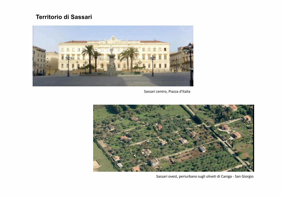
Territorio di Sassari
Sassari centro, Piazza d'Italia
Sassari ovest, periurbano sugli oliveti di Caniga - San Giorgio
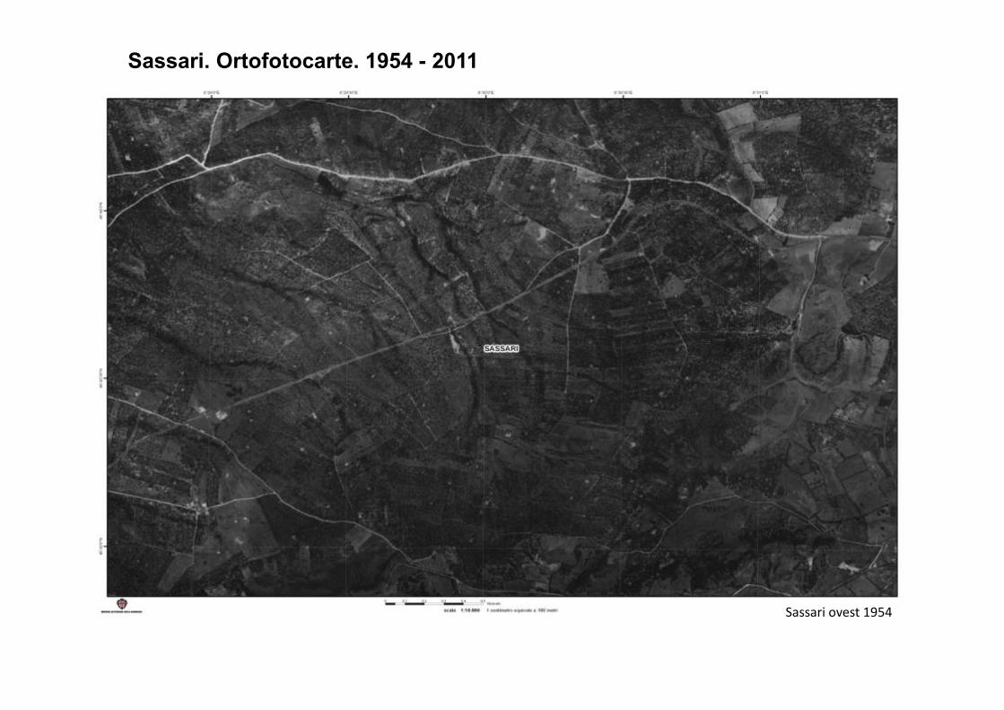
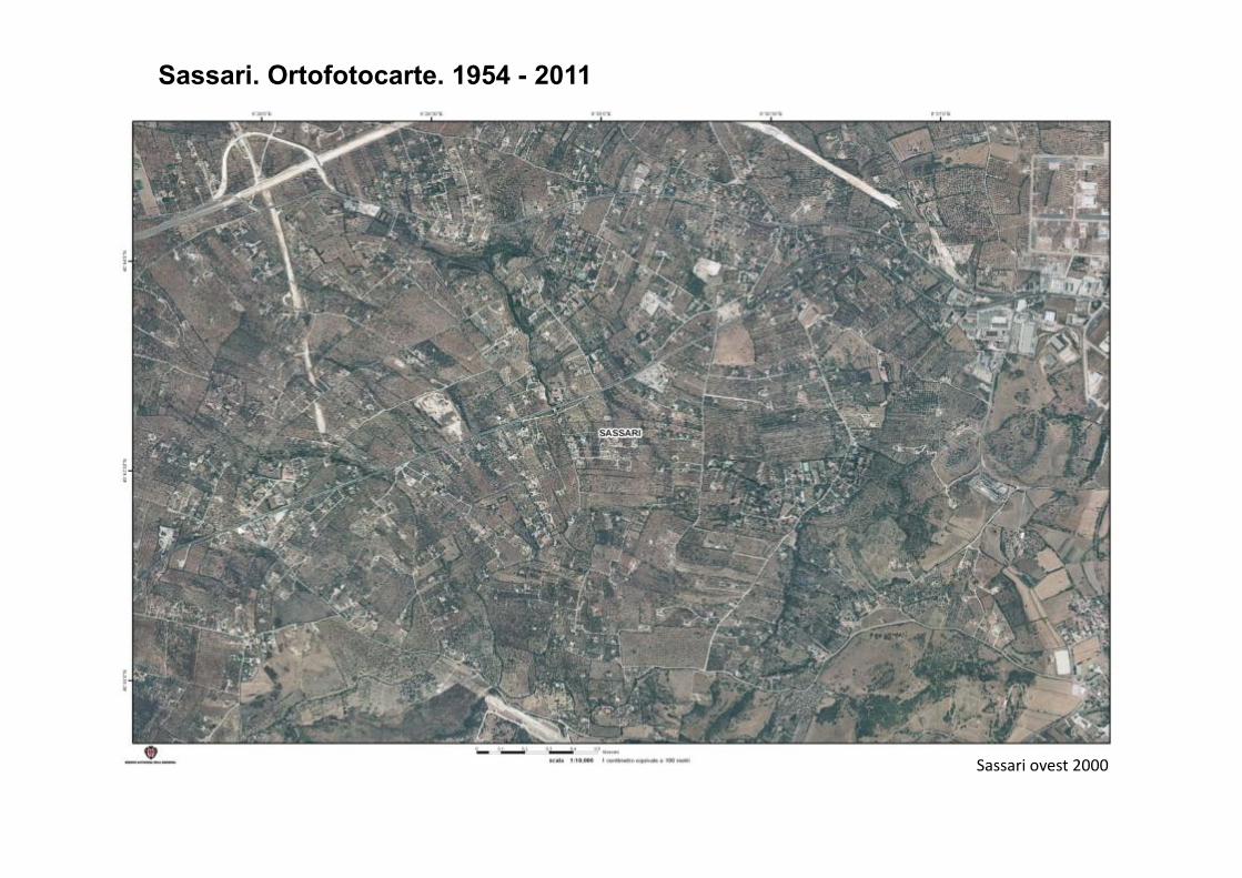
Sassari. Ortofotocarte. 1954 - 2011
Sassari ovest 1954
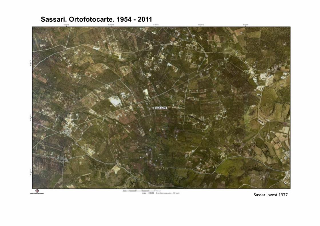
Sassari. Ortofotocarte. 1954 - 2011
Sassari ovest 1977
Sassari. Ortofotocarte. 1954 - 2011
Sassari ovest 2000
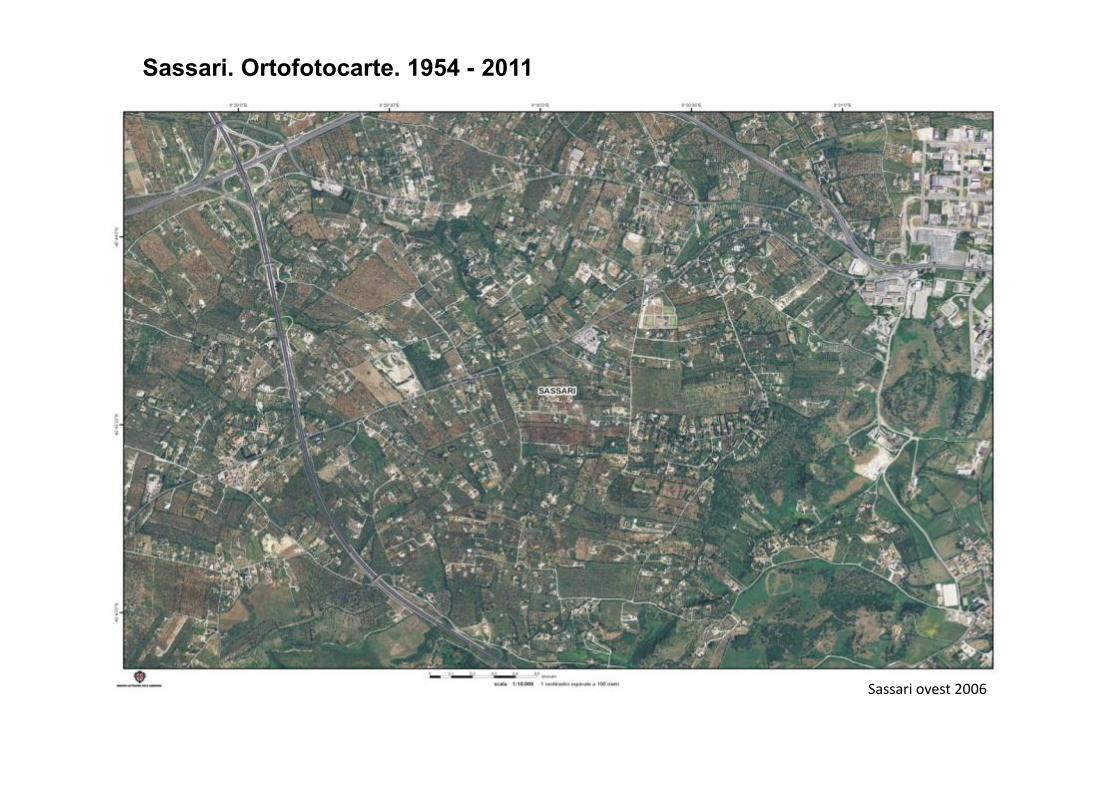
Sassari. Ortofotocarte. 1954 - 2011
Sassari ovest 2006
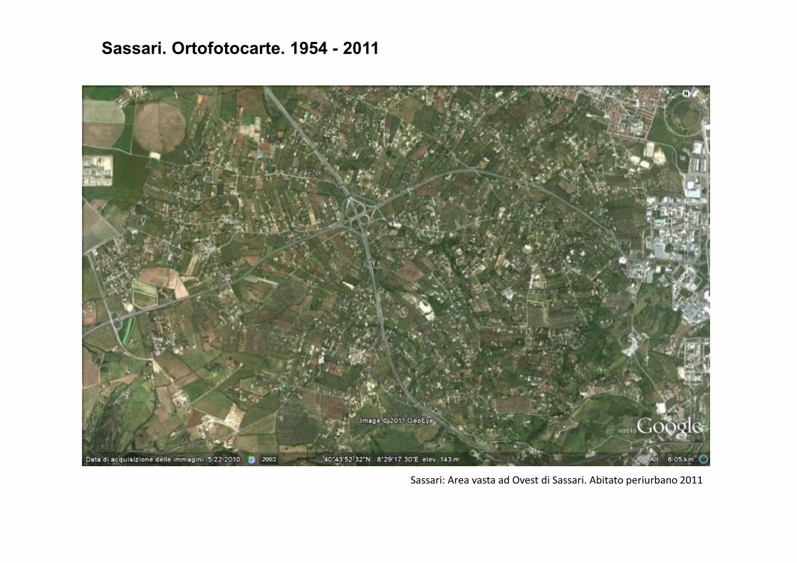
Sassari. Ortofotocarte. 1954 - 2011
Sassari: Area vasta ad Ovest di Sassari. Abitato periurbano 2011
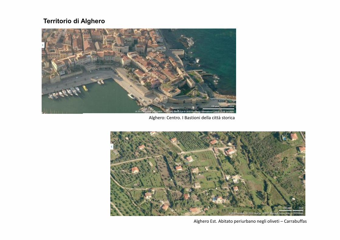
Territorio di Alghero
Alghero: Centro. I Bastioni della città storicaAlghero: Centro. I Bastioni della città storica
Alghero Est. Abitato periurbano negli oliveti – Carrabuffas
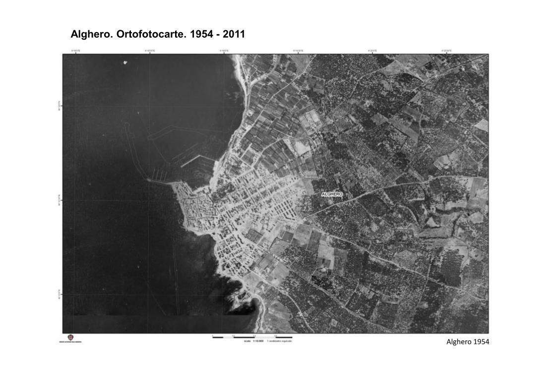
Alghero. Ortofotocarte. 1954 - 2011
Alghero 1954
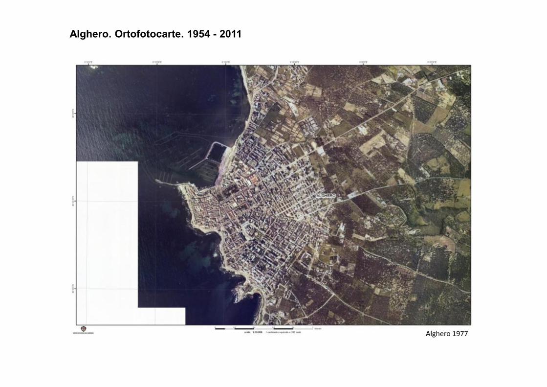
Alghero. Ortofotocarte. 1954 - 2011
Alghero 1977
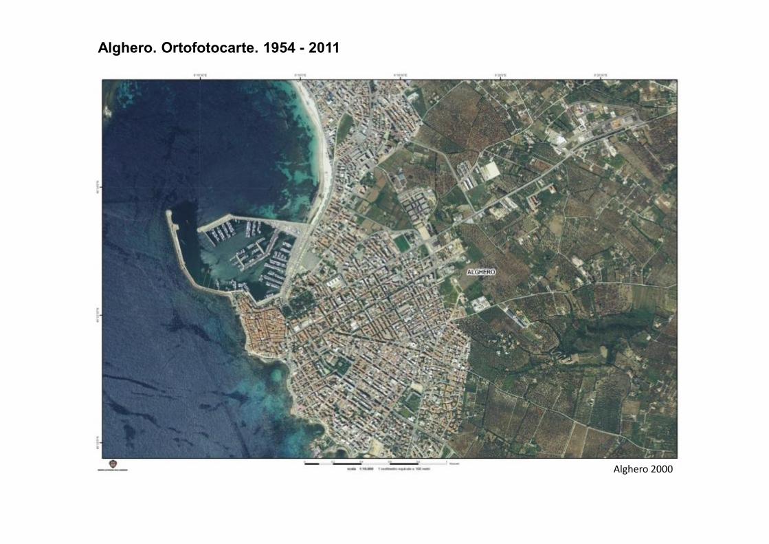
Alghero. Ortofotocarte. 1954 - 2011
Alghero 2000
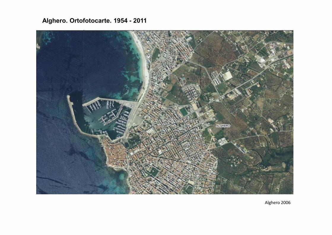
Alghero. Ortofotocarte. 1954 - 2011
Alghero 2006
Alghero. Ortofotocarte. 1954 - 2011
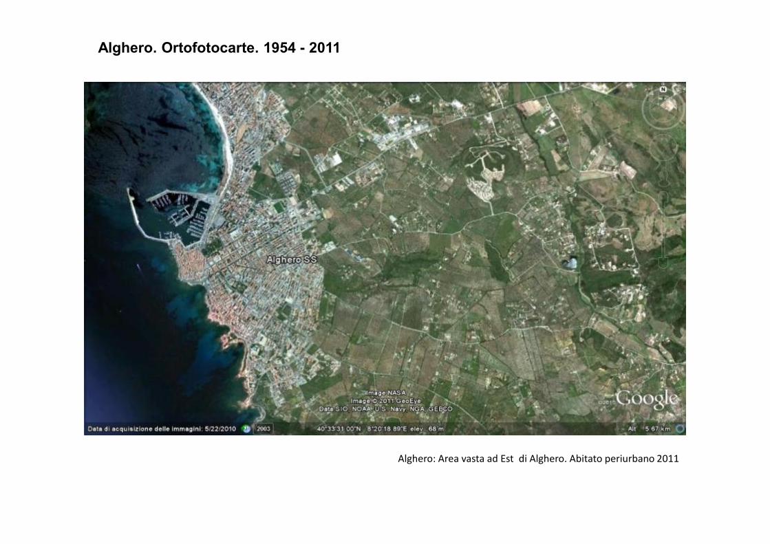
Alghero: Area vasta ad Est di Alghero. Abitato periurbano 2011
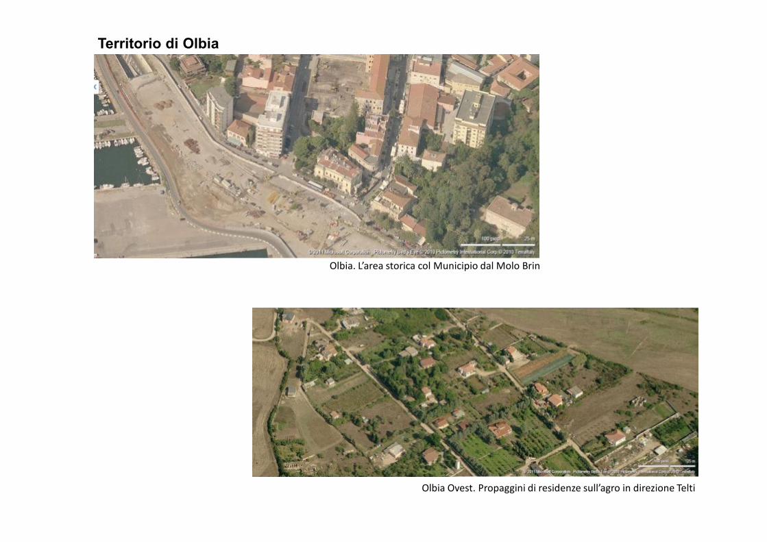
Territorio di Olbia
Olbia. L’area storica col Municipio dal Molo BrinOlbia. L’area storica col Municipio dal Molo Brin
Olbia Ovest. Propaggini di residenze sull’agro in direzione Telti
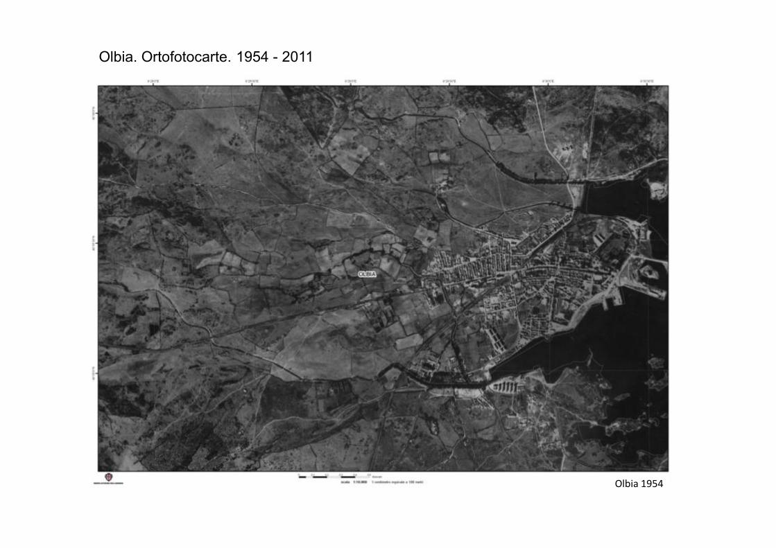
Olbia. Ortofotocarte. 1954 - 2011
Olbia 1954
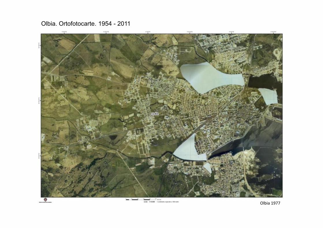
Olbia. Ortofotocarte. 1954 - 2011
Olbia 1977
Olbia. Ortofotocarte. 1954 - 2011
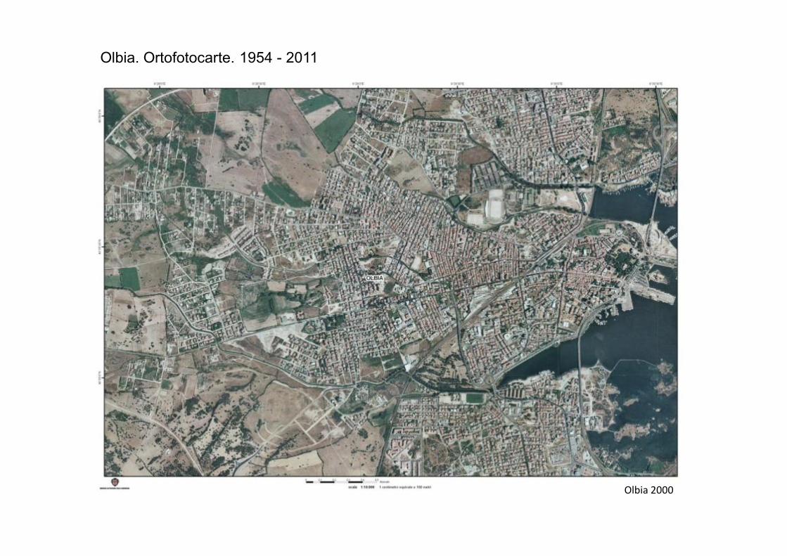
Olbia 2000
Olbia. Ortofotocarte. 1954 - 2011
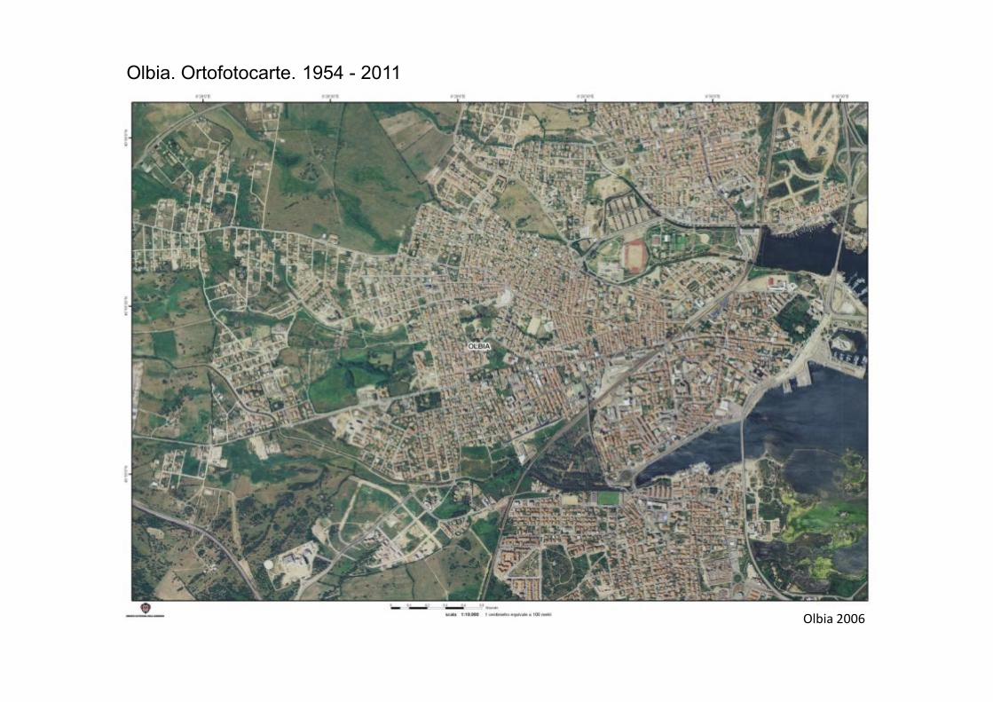
Olbia 2006
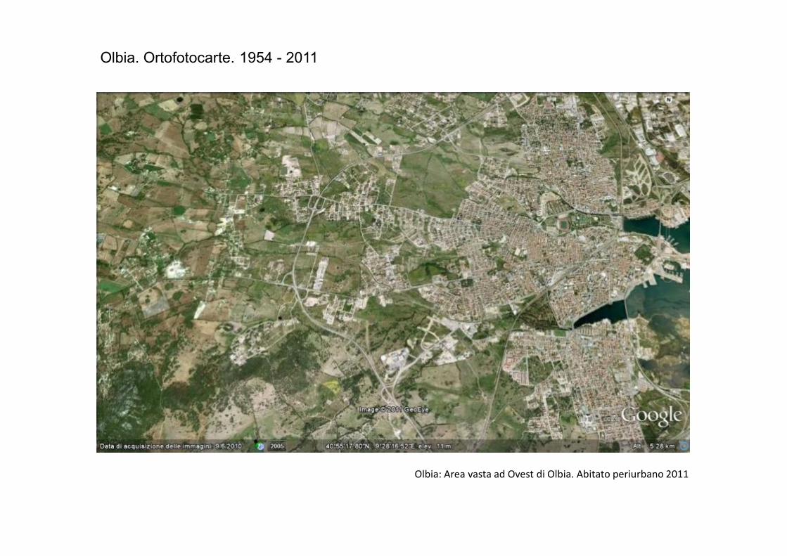
Olbia. Ortofotocarte. 1954 - 2011
Olbia: Area vasta ad Ovest di Olbia. Abitato periurbano 2011
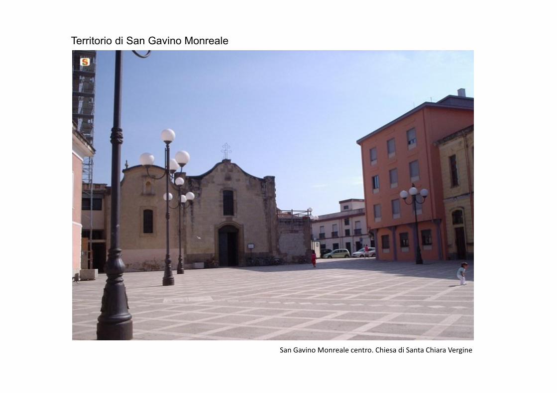
Territorio di San Gavino Monreale
San Gavino Monreale centro. Chiesa di Santa Chiara Vergine
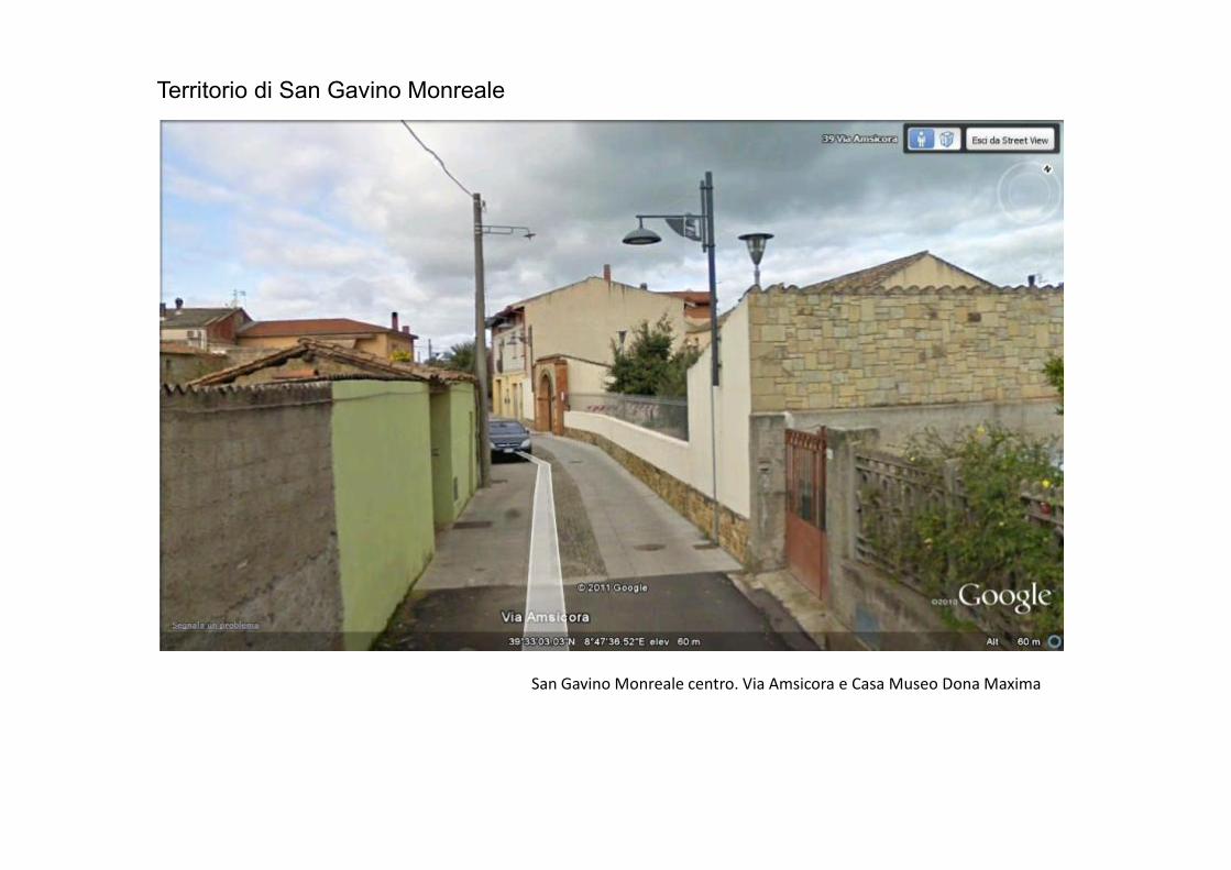
Territorio di San Gavino Monreale
San Gavino Monreale centro. Via Amsicora e Casa Museo Dona Maxima
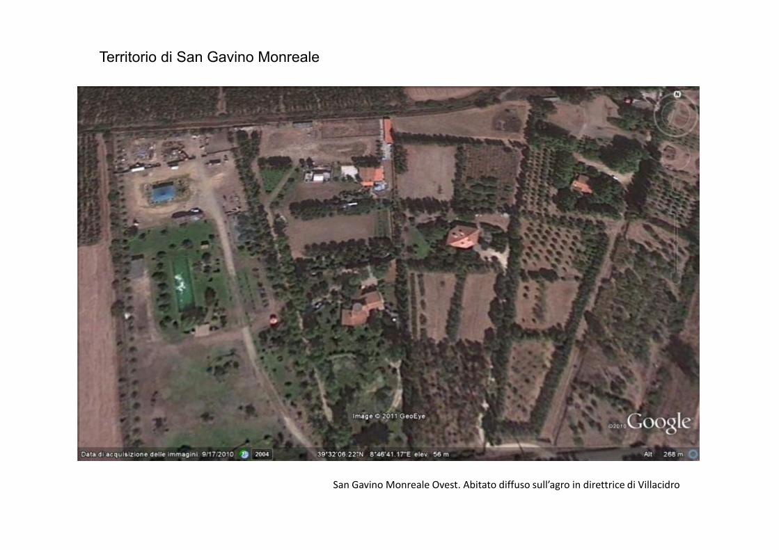
Territorio di San Gavino Monreale
San Gavino Monreale Ovest. Abitato diffuso sull’agro in direttrice di Villacidro
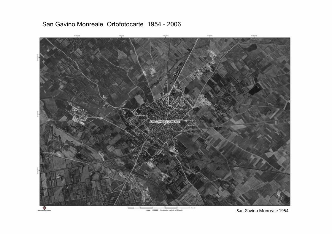
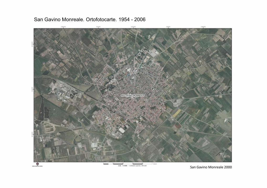
San Gavino Monreale. Ortofotocarte. 1954 - 2006
San Gavino Monreale 1954
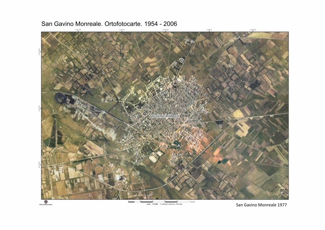
San Gavino Monreale. Ortofotocarte. 1954 - 2006
San Gavino Monreale 1977
San Gavino Monreale. Ortofotocarte. 1954 - 2006
San Gavino Monreale 2000
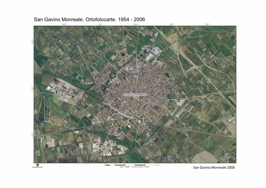
San Gavino Monreale. Ortofotocarte. 1954 - 2006
San Gavino Monreale 2006
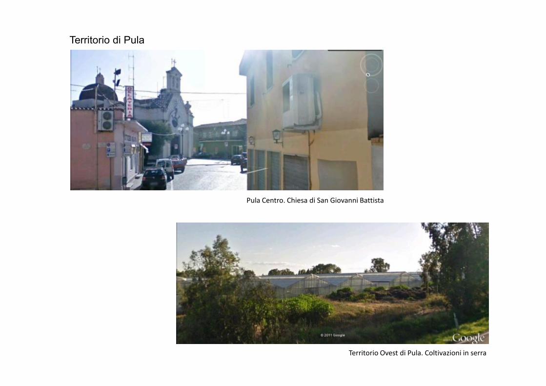
Territorio di Pula
Pula Centro. Chiesa di San Giovanni Battista
Territorio Ovest di Pula. Coltivazioni in serra
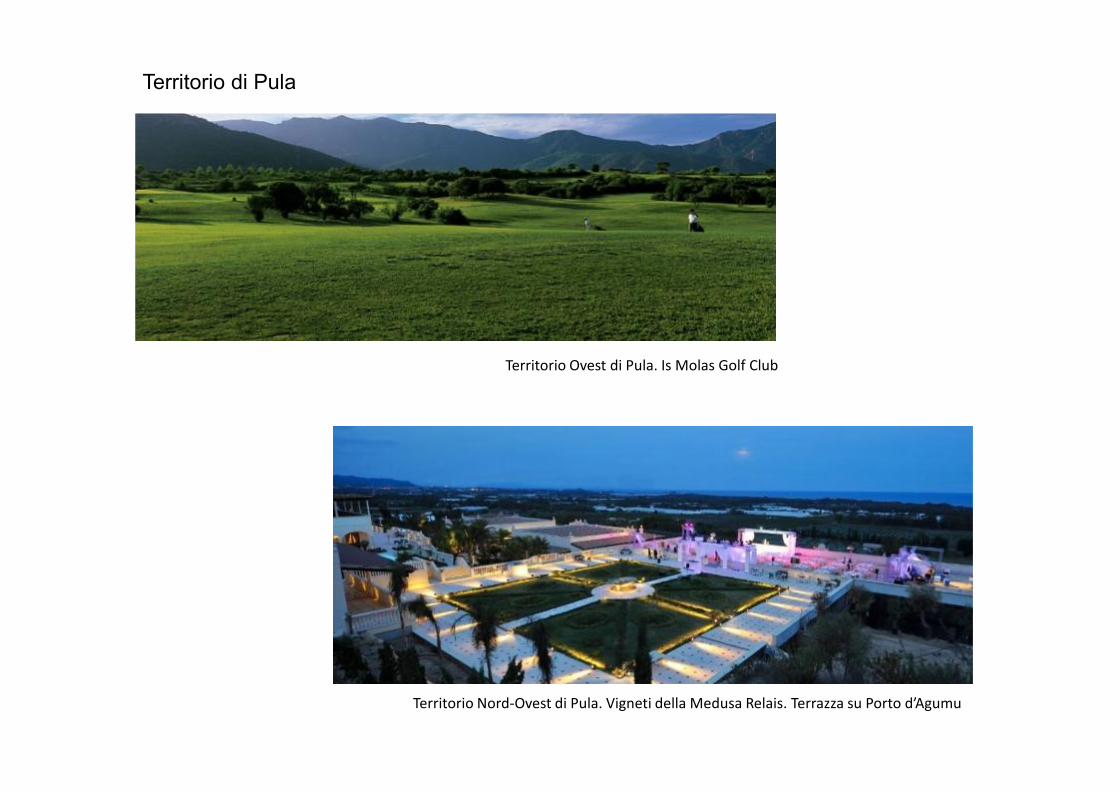
Territorio di Pula
Territorio Ovest di Pula. Is Molas Golf Club
Territorio Nord-Ovest di Pula. Vigneti della Medusa Relais. Terrazza su Porto d’Agumu

Territorio di Pula
Territorio Nord-Ovest di Pula. Parco Tecnologico Polaris
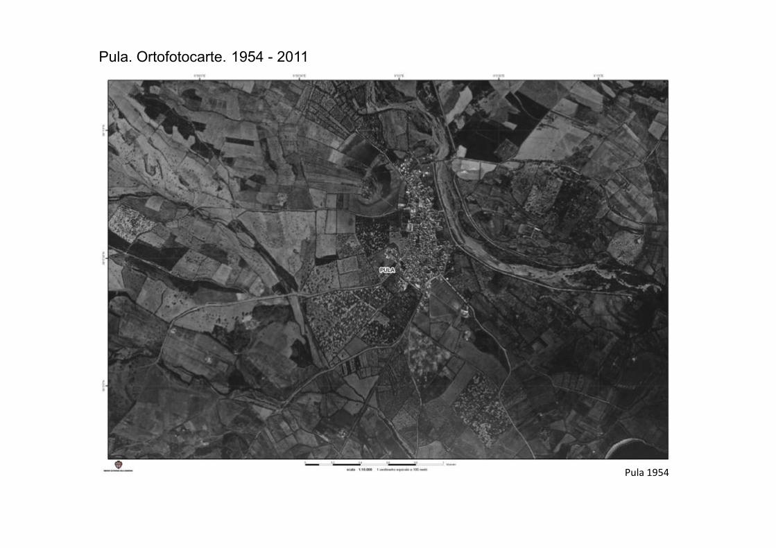
Pula. Ortofotocarte. 1954 - 2011
Pula 1954
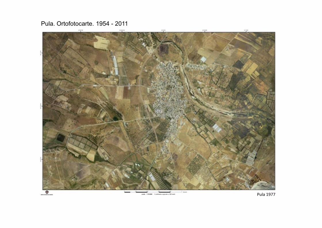
Pula. Ortofotocarte. 1954 - 2011
Pula 1977
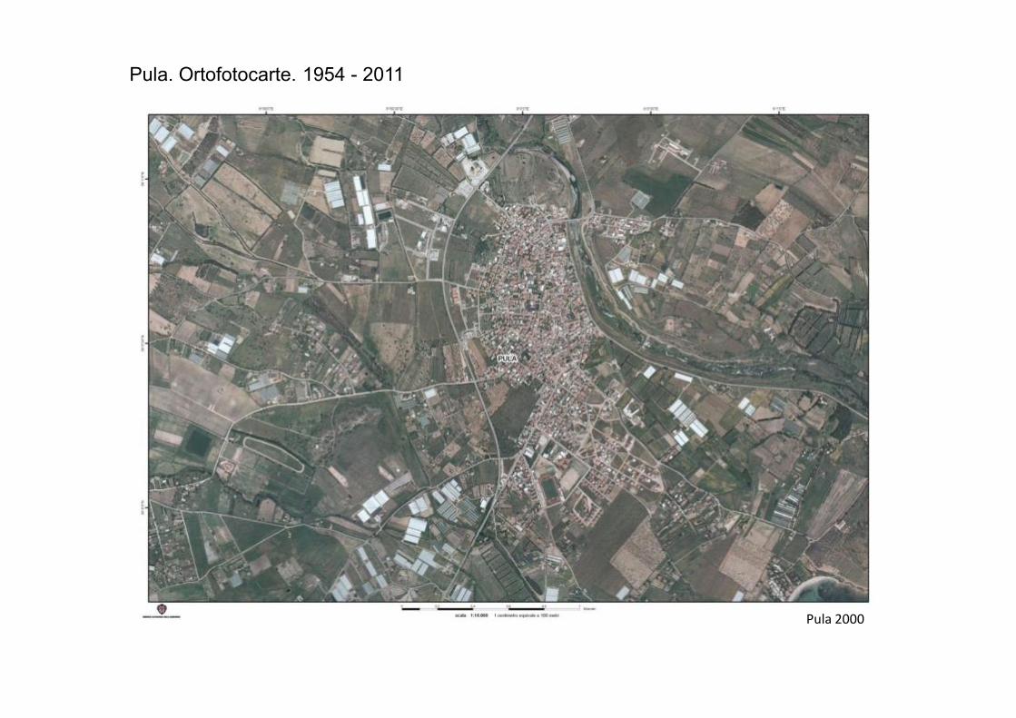
Pula. Ortofotocarte. 1954 - 2011
Pula 2000
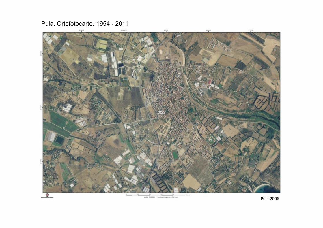
Pula. Ortofotocarte. 1954 - 2011
Pula 2006
Pula. Ortofotocarte. 1954 - 2011
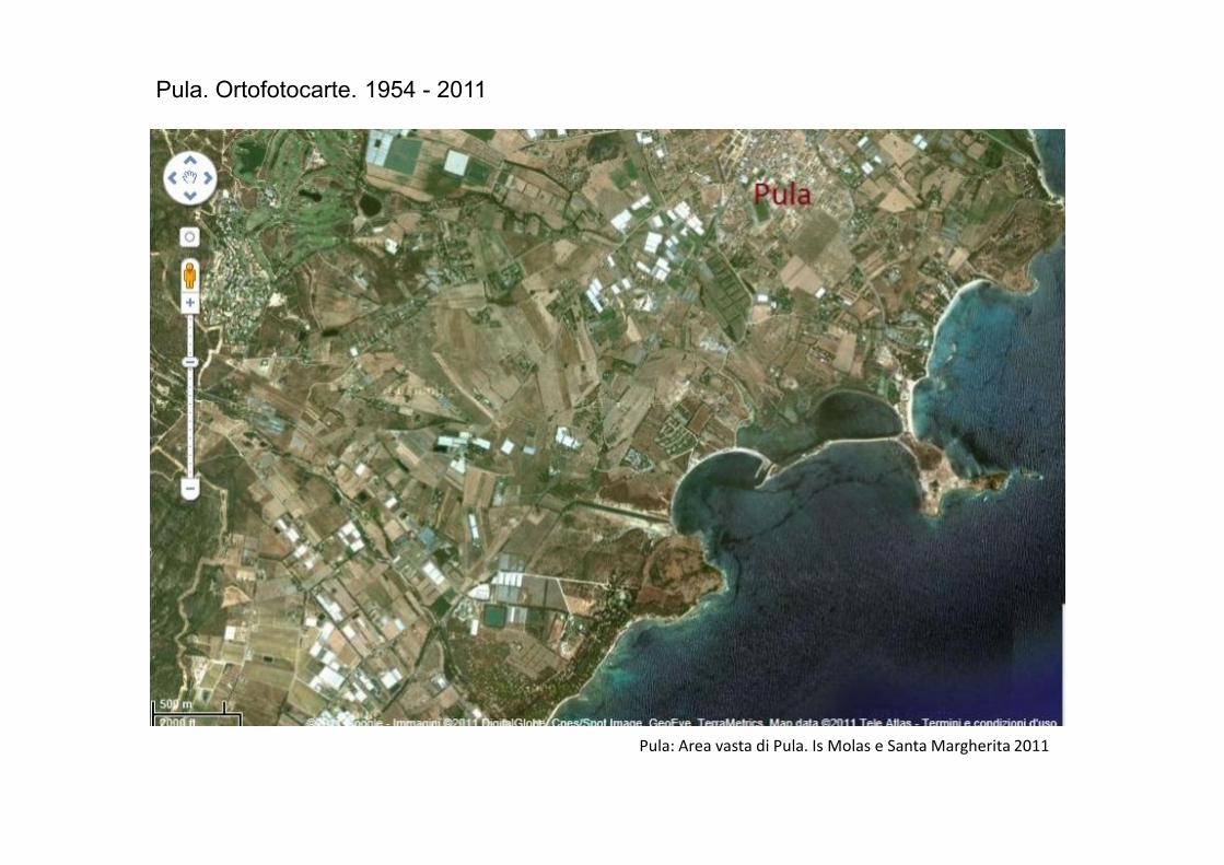
Pula: Area vasta di Pula. Is Molas e Santa Margherita 2011
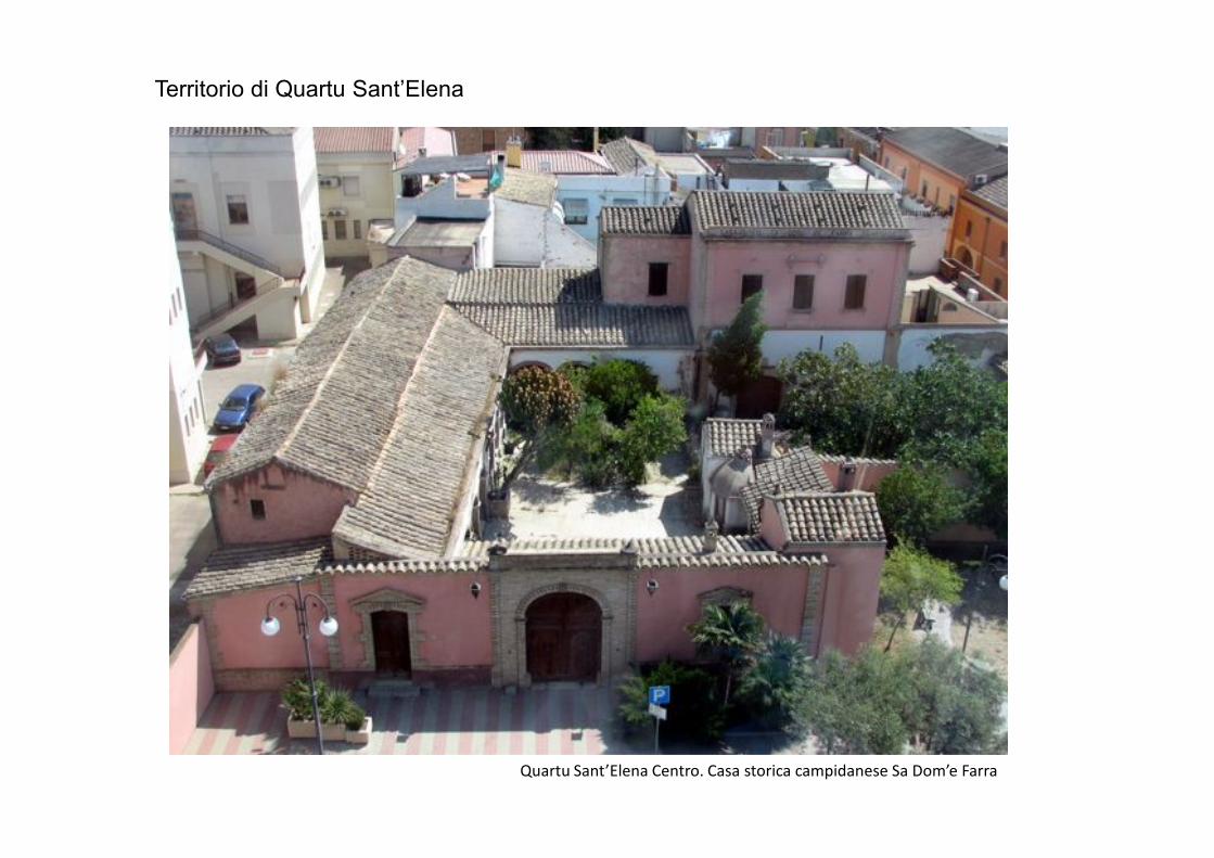
Territorio di Quartu Sant’Elena
Quartu Sant’Elena Centro. Casa storica campidanese Sa Dom’e Farra
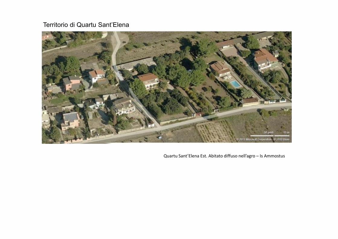
Territorio di Quartu Sant’Elena
Quartu Sant’Elena Est. Abitato diffuso nell’agro – Is Ammostus
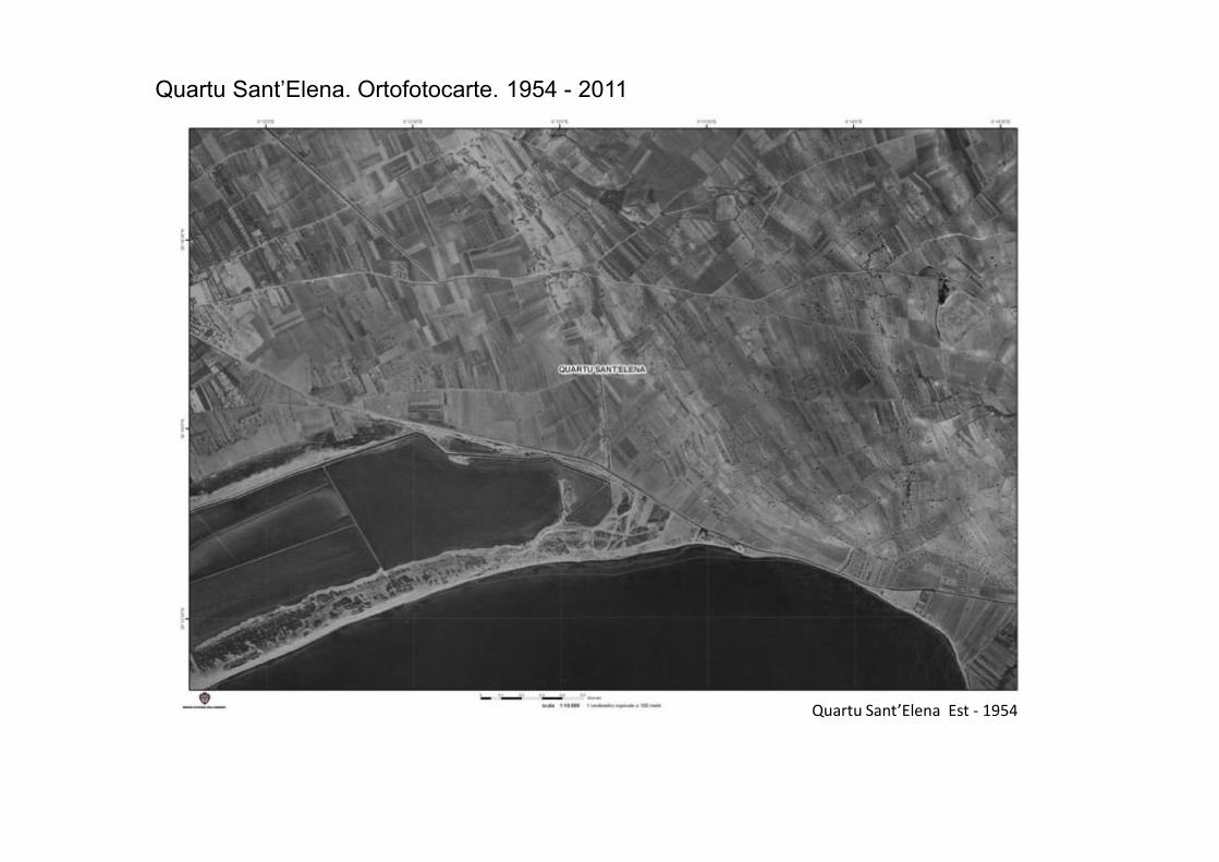
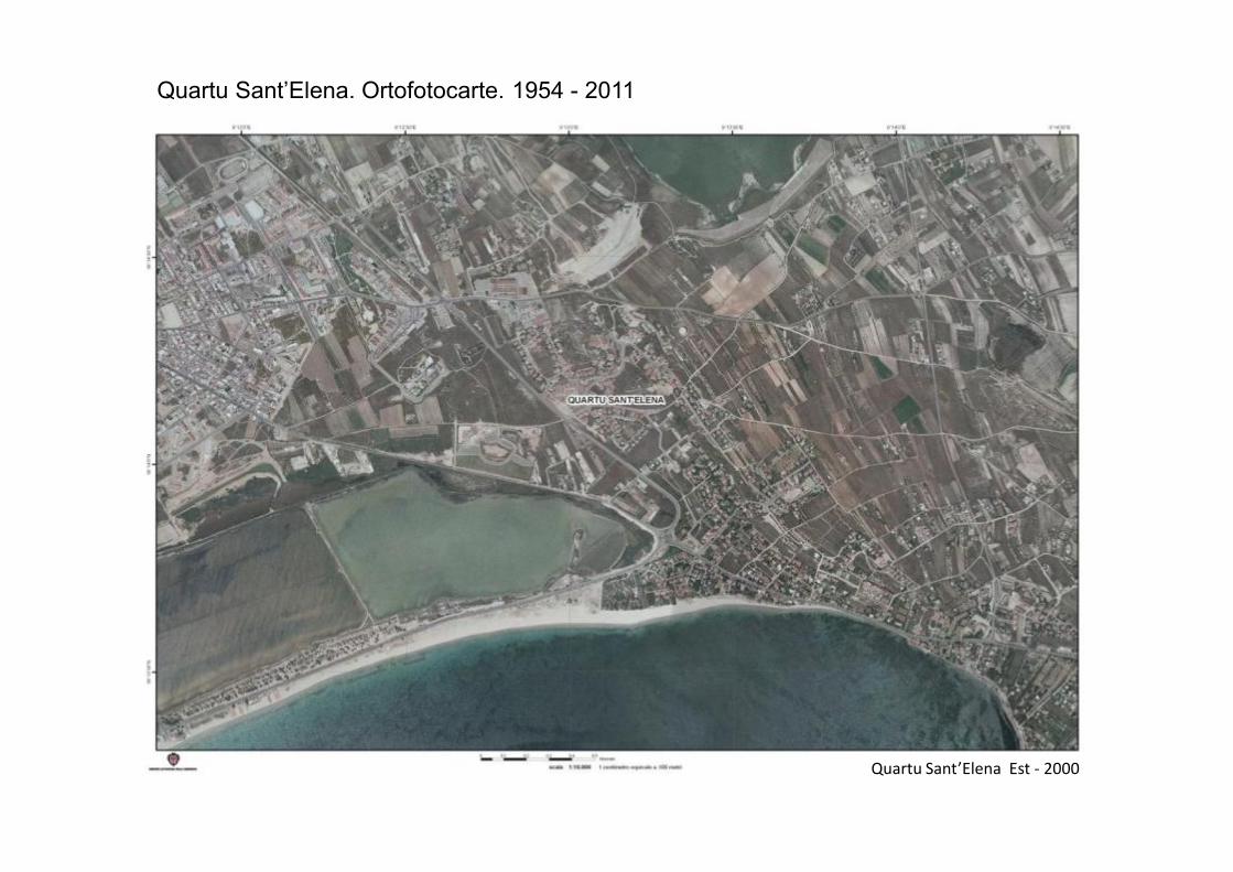
Quartu Sant’Elena. Ortofotocarte. 1954 - 2011
Quartu Sant’Elena Est - 1954

Quartu Sant’Elena. Ortofotocarte. 1954 - 2011
Quartu Sant’Elena Est - 1977
Quartu Sant’Elena. Ortofotocarte. 1954 - 2011
Quartu Sant’Elena Est - 2000
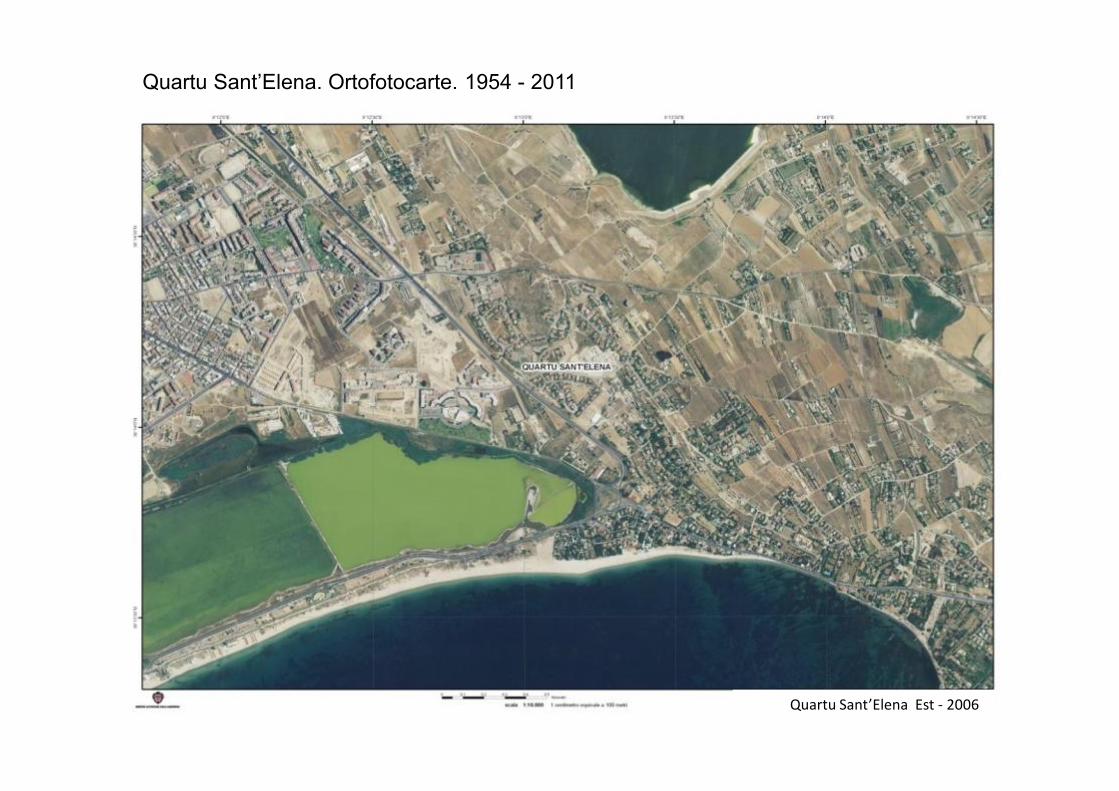
Quartu Sant’Elena. Ortofotocarte. 1954 - 2011
Quartu Sant’Elena Est - 2006
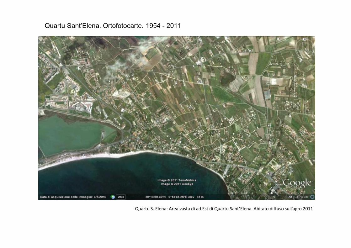
Quartu Sant’Elena. Ortofotocarte. 1954 - 2011
Quartu S. Elena: Area vasta di ad Est di Quartu Sant’Elena. Abitato diffuso sull’agro 2011
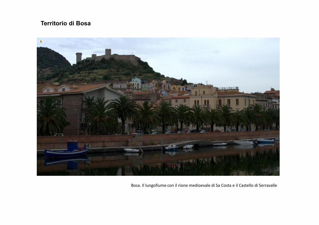
Territorio di Bosa
Bosa. Il lungofiume con il rione medioevale di Sa Costa e il Castello di Serravalle

Territorio di Bosa
Bosa. Est. Fondi e case agricole lungo l’ansa del fiume Temo dalla Chiesa Romanica di San Pietro
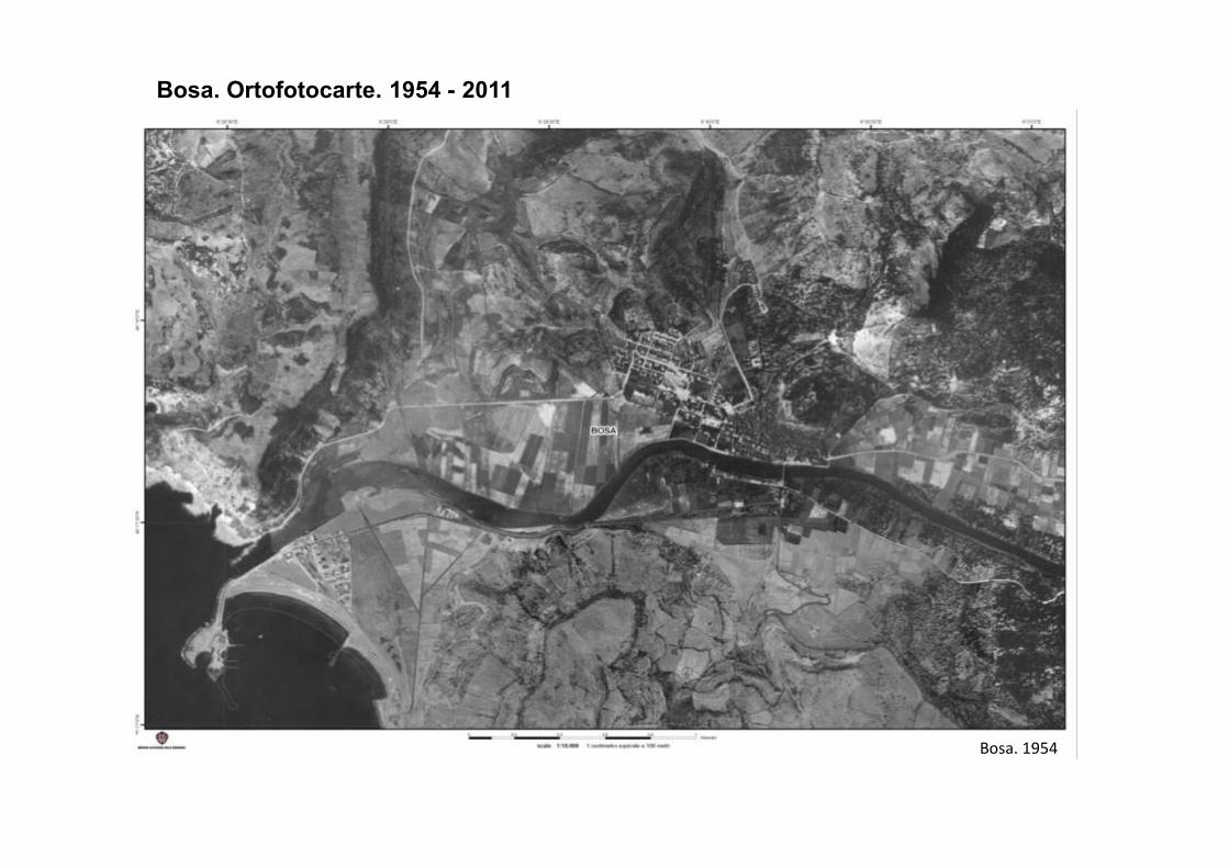
Bosa. Ortofotocarte. 1954 - 2011
Bosa. 1954
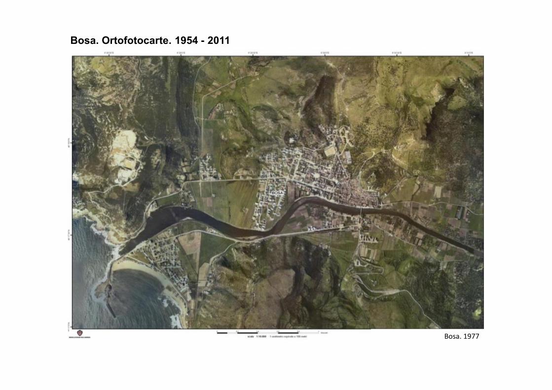
Bosa. Ortofotocarte. 1954 - 2011
Bosa. 1977
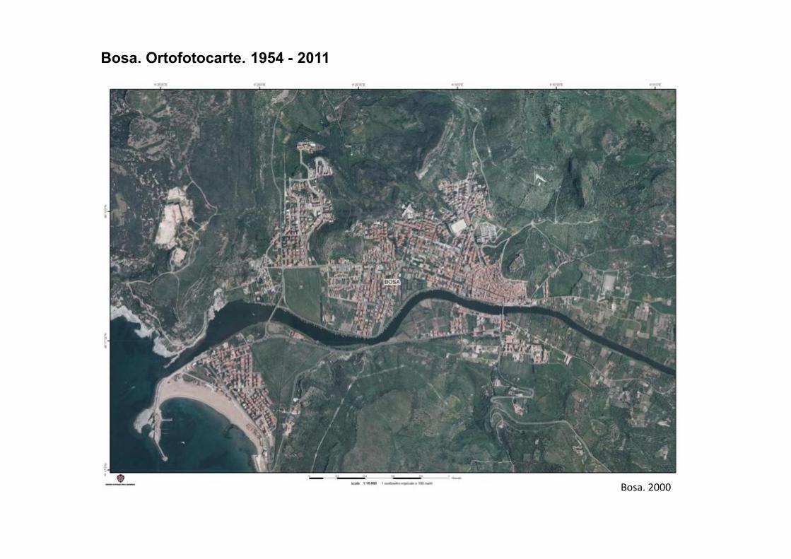
Bosa. Ortofotocarte. 1954 - 2011
Bosa. 2000
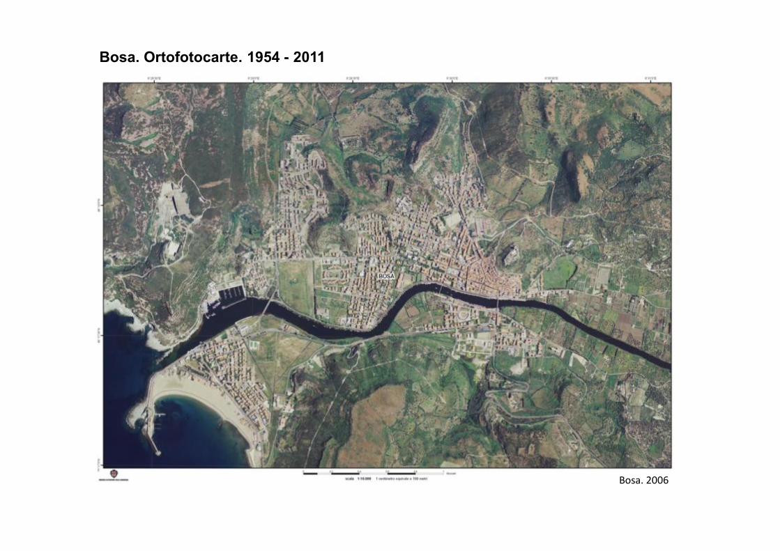
Bosa. Ortofotocarte. 1954 - 2011
Bosa. 2006
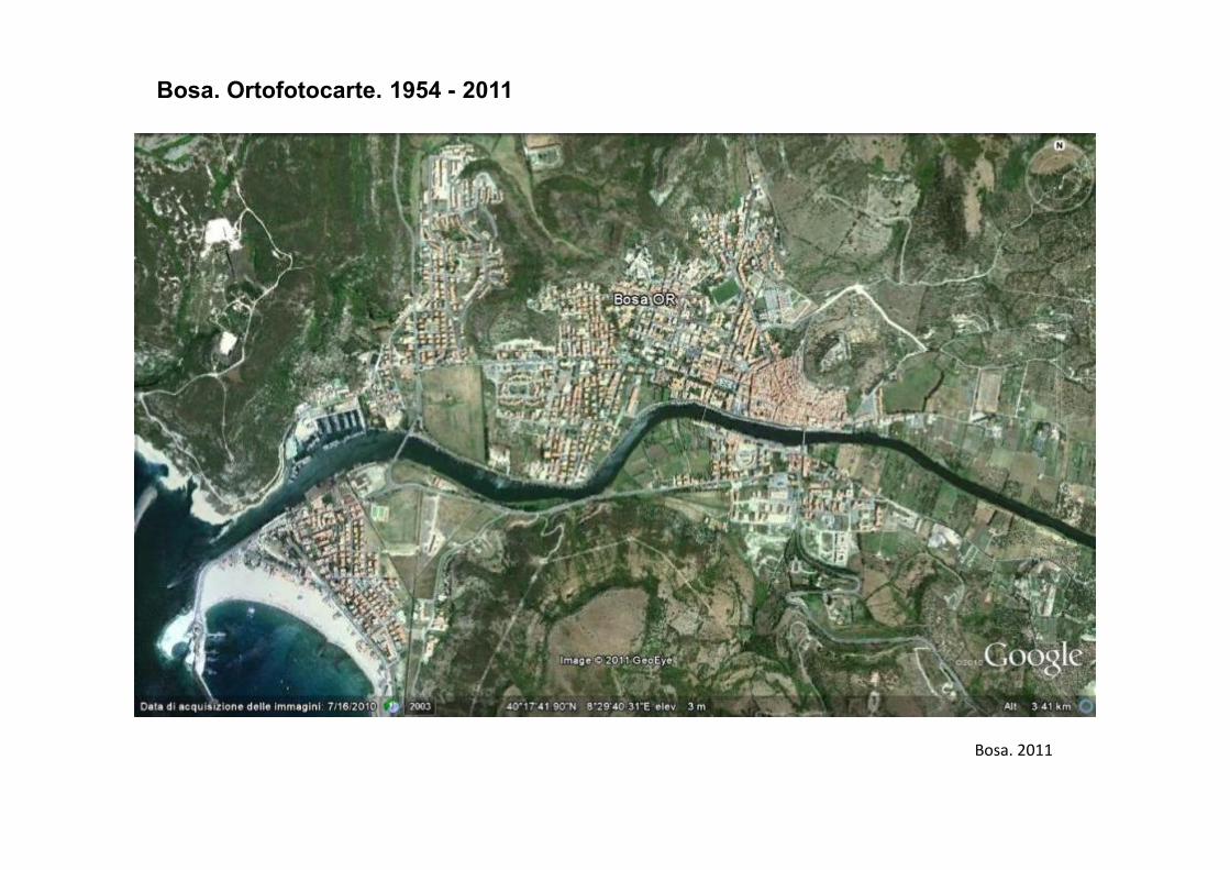
Bosa. Ortofotocarte. 1954 - 2011
Bosa. 2011
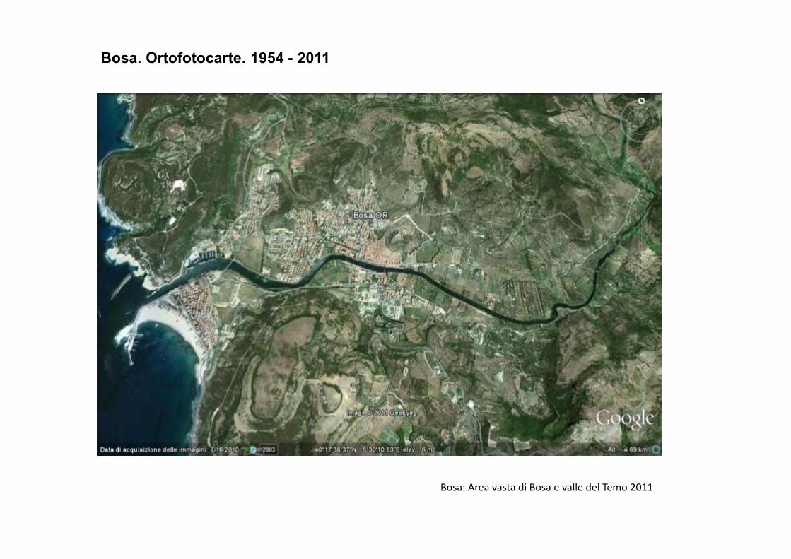
Bosa. Ortofotocarte. 1954 - 2011
Bosa: Area vasta di Bosa e valle del Temo 2011
New ecologies for the Sardinian rural landscape3
The significance of Sardinian rural space is changing. Nowadays we can point out
a likely different set of landscapes related to a new ecological everyday life, to a
renewed care regarding building materials and agricultural tools.
The countryside is tending to take on the primary role of a resource of agricultural
landscapes that are again to be contemplated and enjoyed.
Peaceful scenery of open fields along the land, freedom of moving, biodiversity of
plants and animals, pure water and an average good conservation of rural plants and animals, pure water and an average good conservation of rural
architecture.
A new market for material and immaterial goods related to nature and the
landscape, seems to become accessible for the symbolic sharing of agricultural
activities, that demand the real presence of farming along the new communities’
everyday life.
3) From a conversation with A. Aru, Cagliari, 10-2011