Embed Size (px)
Citation preview

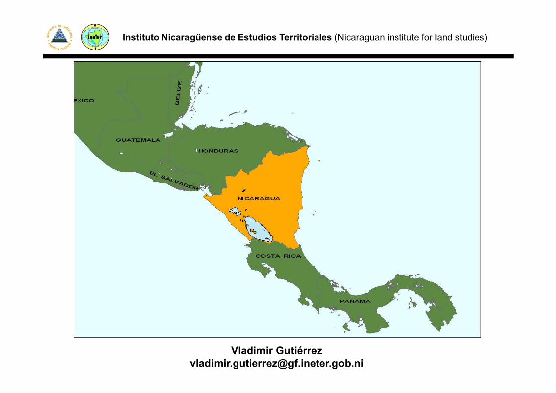
Instituto Nicaragüense de Estudios Territoriales (Nicaraguan institute for land studies)
Content:
• Short overview of Nicaragua and INETER
• Natural disaster, environmental monitoring , gand the GIS in Nicaragua.
• GIS Geo-Risk unit in INETER
Vladimir Gutié[email protected]
Instituto Nicaragüense de Estudios Territoriales (Nicaraguan institute for land studies)
Vladimir Gutié[email protected]

Instituto Nicaragüense de Estudios Territoriales (Nicaraguan institute for land studies)

Instituto Nicaragüense de Estudios Territoriales (Nicaraguan institute for land studies)
Hazard and Risk StudiesHazard Monitoring
DEFENSA
gBasic Maps
INETER CINAPRED DEFENSACIVIL
MARENA
DirectionOf Geophysics
Physical CadastreDir
MeteorologicalDir.
Water ResourcesDir.
Lan PlanningDir.
SeismicDir.
VolcanicDir.
GeologicalDir.
GIS Geo-RiskUnit

Instituto Nicaragüense de Estudios Territoriales (Nicaraguan institute for land studies)
NicaraguaPopulation:5,000,000+
Area:130,000 km2
Hazards:Hazards:EarthquakesEruptionspTsunamisHurricanesLandslidesFloods

Instituto Nicaragüense de Estudios Territoriales (Nicaraguan institute for land studies)
Disasters in Nicaragua• 1931 Managua earthquake, 2,000 killed• 1972 Managua earthquake, 10,000 killedg q

Instituto Nicaragüense de Estudios Territoriales (Nicaraguan institute for land studies)
• 1992 Tsunami, 170 killed
Destruction of restaurants and fishery facilities
Tsunami memorial
Instituto Nicaragüense de Estudios Territoriales (Nicaraguan institute for land studies)
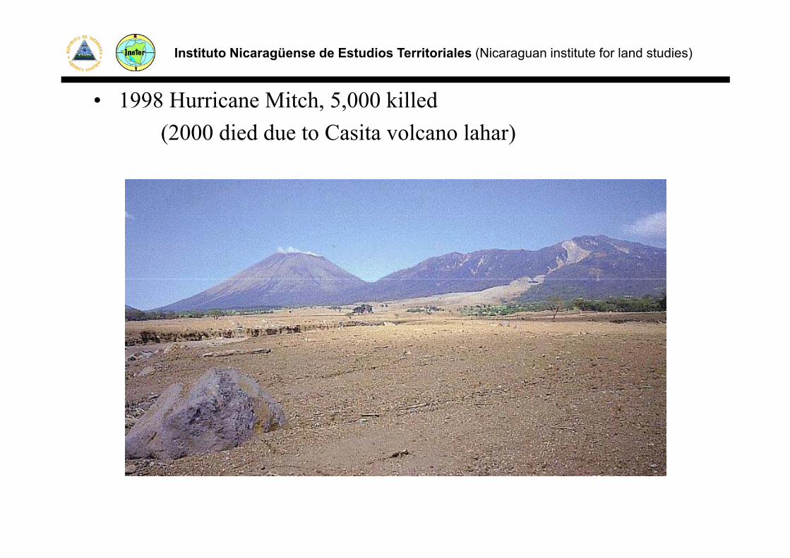
• 1998 Hurricane Mitch, 5,000 killed(2000 died due to Casita volcano lahar)

Instituto Nicaragüense de Estudios Territoriales (Nicaraguan institute for land studies)
1972 Earthquake
• Start of monitoring scientific investigation andStart of monitoring, scientific investigation and hazard mapping in NicaraguaB ildi d• Building code
• Strict construction regulations in ManaguaS c co s uc o egu o s gu

Instituto Nicaragüense de Estudios Territoriales (Nicaraguan institute for land studies)
Disasters and Politics in Nicaragua• 1972 Managua earthquake
mismanagement of international aid,political and economic suppression by Dictator Somozapolitical and economic suppression by Dictator Somoza
-> ample opposition and guerilla
• 1979 victorious Sandinista revolution• 1981 - Civil War
Di t ti dDisaster prevention secondary• 1990 Democratic Elections – end of war • 1990ies - Slow development in terms of disaster1990ies Slow development in terms of disaster
prevention implication
Instituto Nicaragüense de Estudios Territoriales (Nicaraguan institute for land studies)
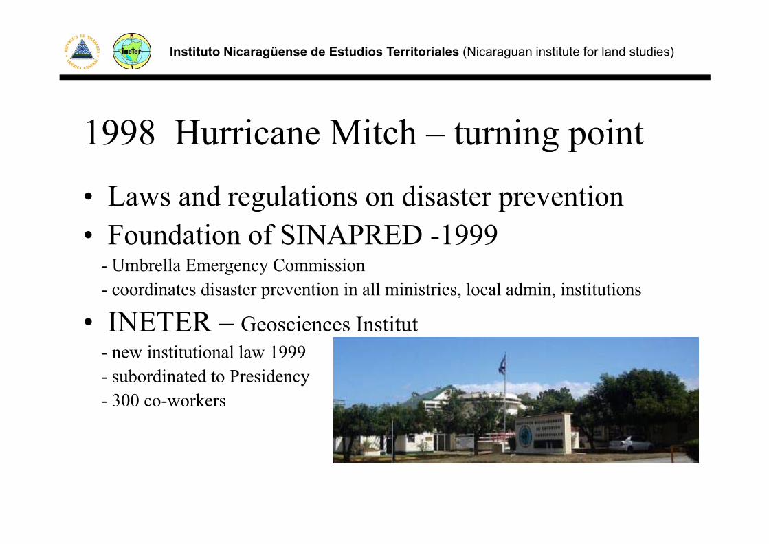
1998 Hurricane Mitch – turning pointg p
• Laws and regulations on disaster prevention g p• Foundation of SINAPRED -1999
- Umbrella Emergency Commissiong y- coordinates disaster prevention in all ministries, local admin, institutions
• INETER – Geosciences Institut- new institutional law 1999- subordinated to Presidency
300 k- 300 co-workers

Instituto Nicaragüense de Estudios Territoriales (Nicaraguan institute for land studies)
Hazard mapping projects
http://mapserver.ineter.gob.ni/website/mapas/Estudios/

Instituto Nicaragüense de Estudios Territoriales (Nicaraguan institute for land studies)
Monitoring
• Seismic Monitoring• Tsunami Warning• Volcáno MonitoringVolcáno Monitoring• Landslides Seismic network, 60+ stations
• Meteorological, Hurricane• River gauges Flood WarningRiver gauges, Flood Warning
Image of Webcam for volcano monitoring

Instituto Nicaragüense de Estudios Territoriales (Nicaraguan institute for land studies)
Seismic Monitoring
Isoseisms of a simulated Earthquake in Managua and its effects in C.A
Interactive map of seismic epicenters macroseismic intensities generated in near real time using data of the seismic network and published at INETER´s Web site.

Instituto Nicaragüense de Estudios Territoriales (Nicaraguan institute for land studies)

Instituto Nicaragüense de Estudios Territoriales (Nicaraguan institute for land studies)
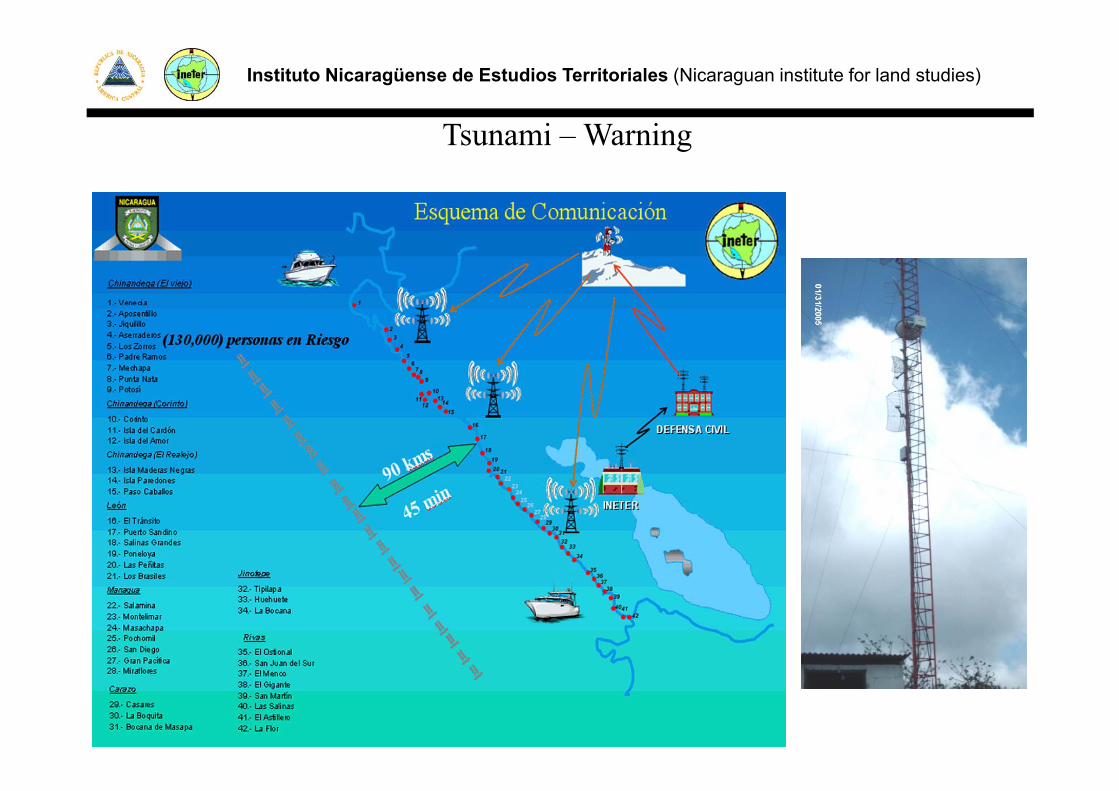
T i W iTsunami – Warning
*Seismic register Analysis – Seismic Central
*Earthquake Tsunami
45 minutes!Earthquake - Tsunami minutes!
Civil Defense - Warning to theWarning to the population
Moving the population to a secure site
Instituto Nicaragüense de Estudios Territoriales (Nicaraguan institute for land studies)
T i W iTsunami – Warning

Instituto Nicaragüense de Estudios Territoriales (Nicaraguan institute for land studies)
Volcano MonitoringA. Project: (INETER - King's College London (KCL), UK )
Antenna for images reception of Advanced Very– Antenna for images reception of Advanced Very High Resolution Radiometer (AVHRR) for a NOAA satelliteNOAA satellite
– Automatic process of the crater area temperatureM it i f h’ l d– Monitoring of ash’s clouds
– WebCamsA t ti ll di f i– Automatically sending of warning

Instituto Nicaragüense de Estudios Territoriales (Nicaraguan institute for land studies)
Geographical Information System (GIS) on Geo-Hazard:GIS Geo-Risks, is a division of the Geophysics Direction of INETER.
The necessit of s ch a s stem and the ide se of GIS co erage asThe necessity of such a system and the wide use of GIS coverage was envisioned by INETER in 1998, after the experience with the disastrous impact of Hurricane Mitch in Nicaragua. The GIS Geo-disastrous impact of Hurricane Mitch in Nicaragua. The GIS GeoRisk and GIS coverage is in development since 1999.
Cartography has been digitized and recompiled for the projects study areas and at national scale, seismic sensors register information continuously in various countries volcanoes are being electronicallycontinuously in various countries, volcanoes are being electronically monitored and water levels in major rivers automatically supervised.

Instituto Nicaragüense de Estudios Territoriales (Nicaraguan institute for land studies)
Some Features from this GeoDatabase

Instituto Nicaragüense de Estudios Territoriales (Nicaraguan institute for land studies)
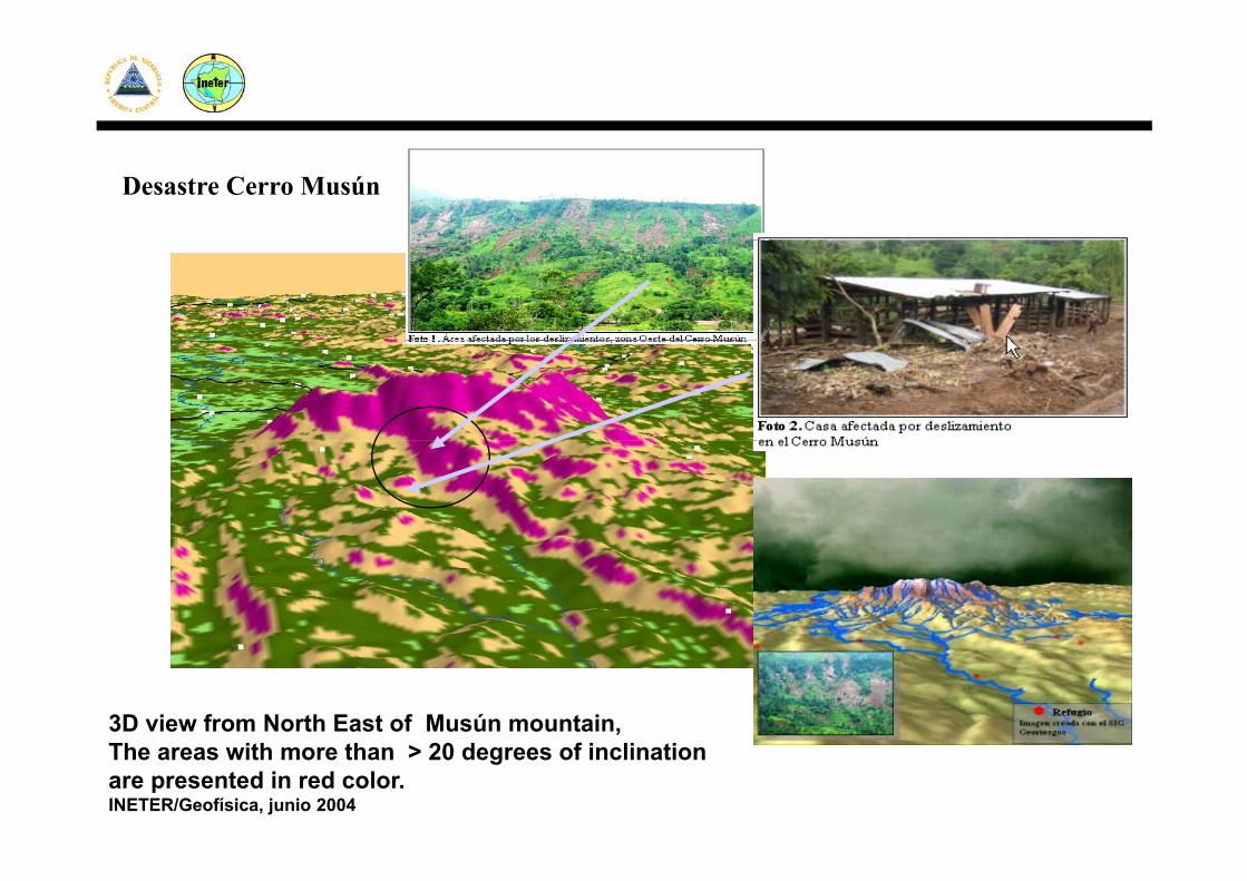
Desastre Cerro Musún
3D view from North East of Musún mountain,The areas with more than > 20 degrees of inclination are presented in red color. INETER/Geofísica, junio 2004
Instituto Nicaragüense de Estudios Territoriales (Nicaraguan institute for land studies)
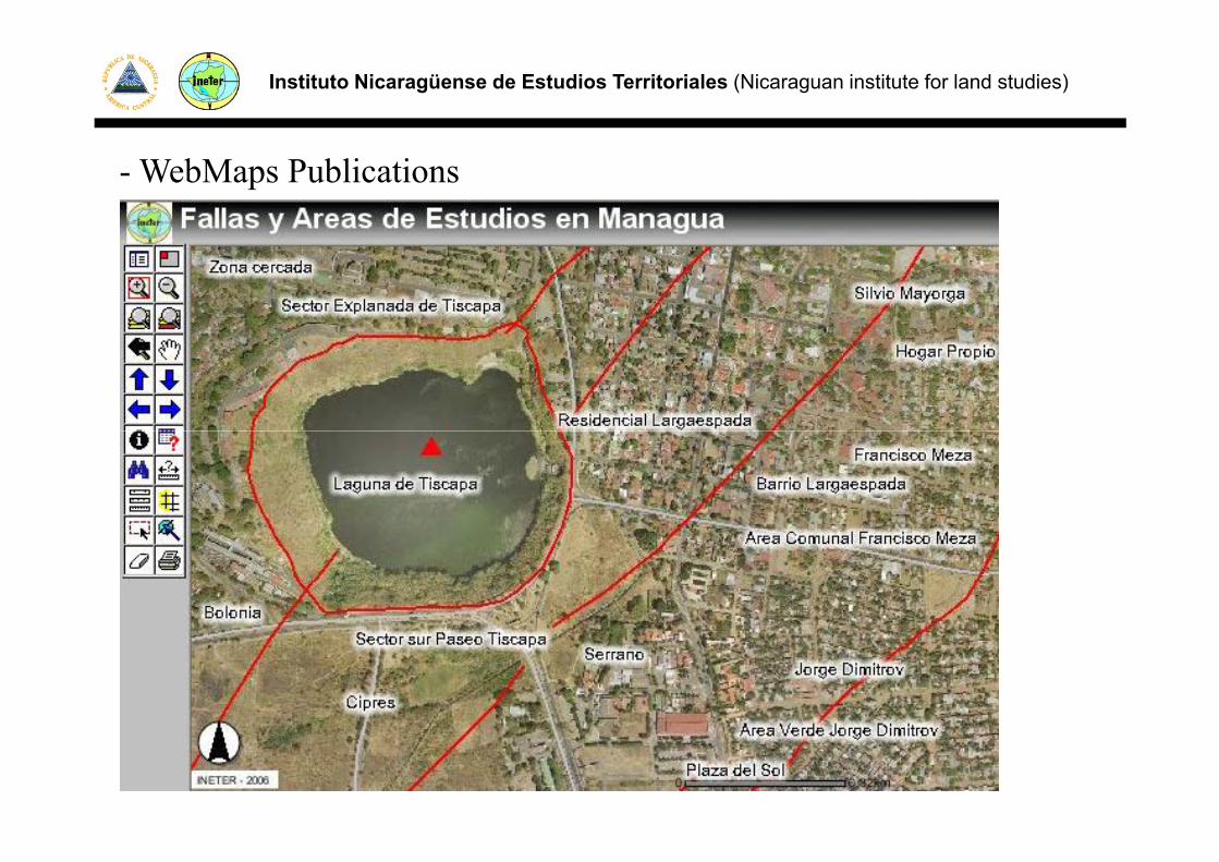
- WebMaps Publications
Instituto Nicaragüense de Estudios Territoriales (Nicaraguan institute for land studies)
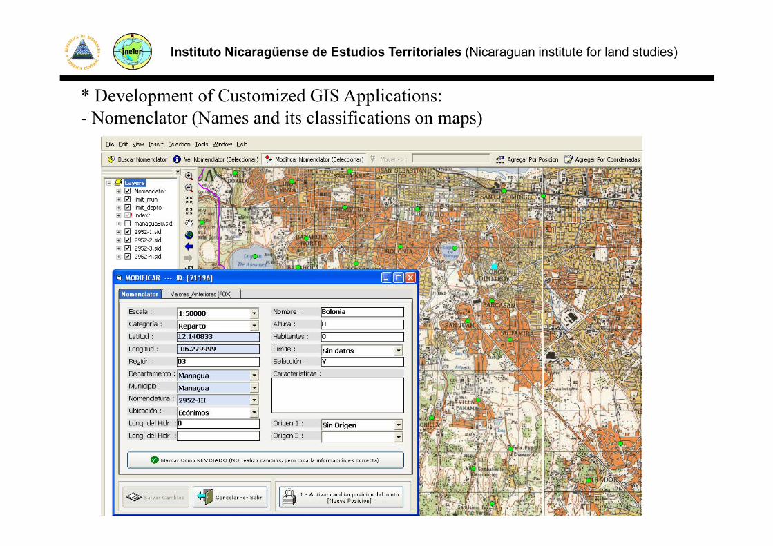
* Development of Customized GIS Applications:- Nomenclator (Names and its classifications on maps)

Instituto Nicaragüense de Estudios Territoriales (Nicaraguan institute for land studies)
Complex data model for the spatial real world elements

Instituto Nicaragüense de Estudios Territoriales (Nicaraguan institute for land studies)
- Seismic vulnerability and earthquake damage

Instituto Nicaragüense de Estudios Territoriales (Nicaraguan institute for land studies)
- Presentation on maps the rain of the meteorological telemetrically Stations (Script update the ShafeFile each 15minites).
Instituto Nicaragüense de Estudios Territoriales (Nicaraguan institute for land studies)
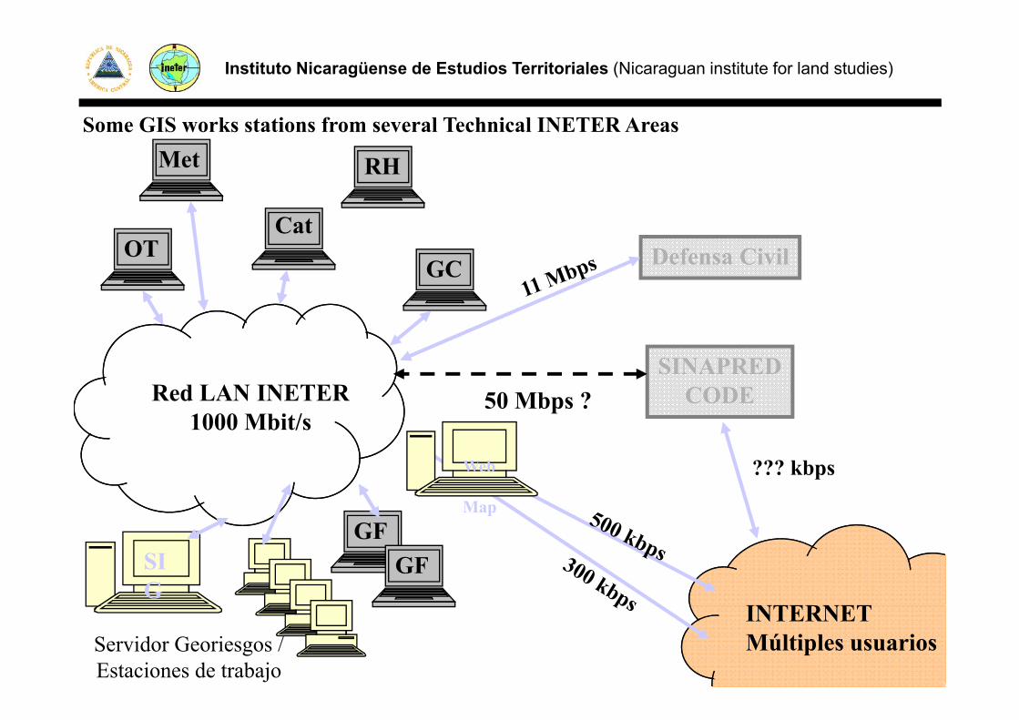
- Web, Desktops and DB Applications- GIS Geo-Data Bases administration- Application of GIS spatial analysis (spatial relationships)Application of GIS spatial analysis (spatial relationships)
- GIS LayOuts preparation (Maps creation)
Instituto Nicaragüense de Estudios Territoriales (Nicaraguan institute for land studies)
Met RH
Some GIS works stations from several Technical INETER Areas
OTCat
GC Defensa Civil
SINAPREDRed LAN INETER
1000 Mbit/s
SINAPREDCODE50 Mbps ?
GF
??? kbpsWeb
Map
SIG
INTERNET
GFGF
Servidor Georiesgos / Estaciones de trabajo
INTERNETMúltiples usuarios
Instituto Nicaragüense de Estudios Territoriales (Nicaraguan institute for land studies)
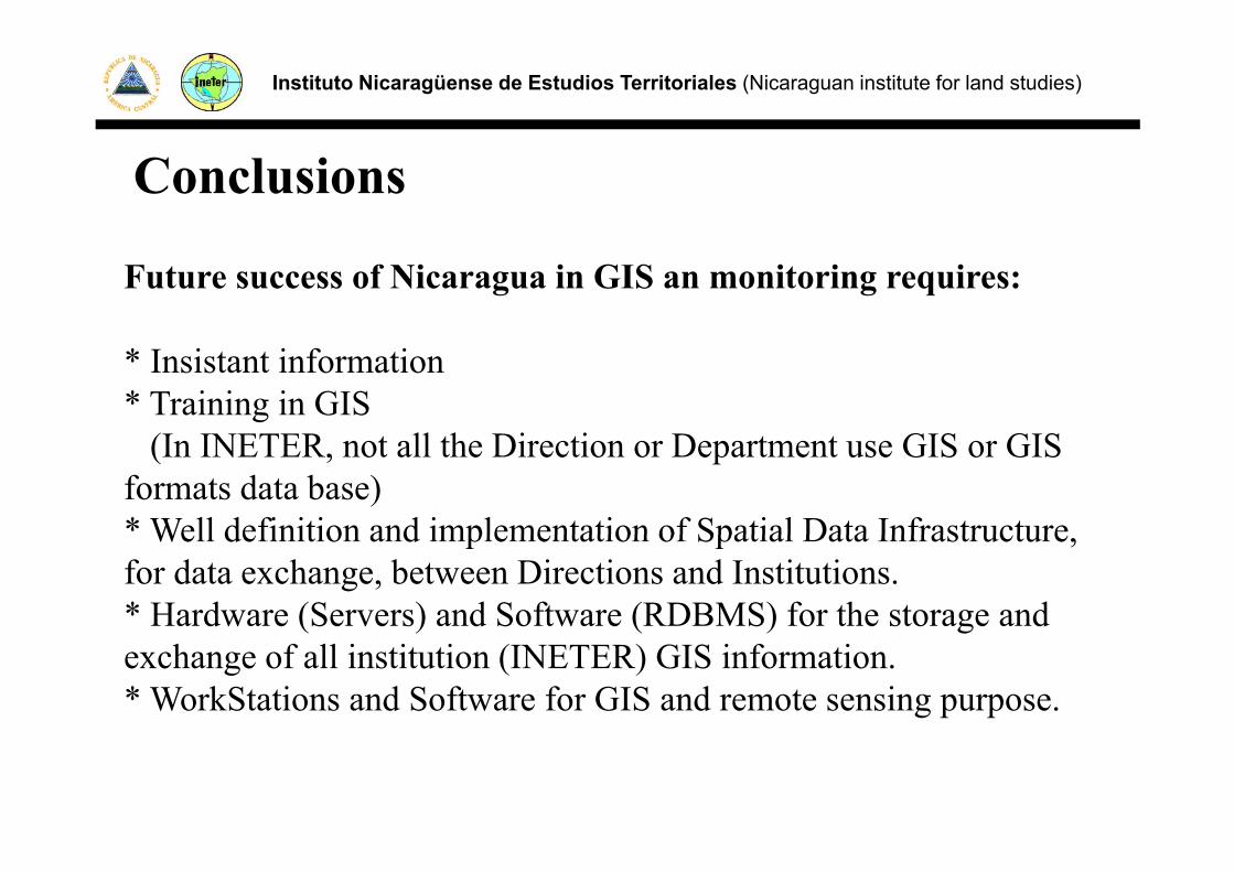
Conclusions
Future success of Nicaragua in GIS an monitoring requires:
* Insistant information* Training in GIS
(I INETER t ll th Di ti D t t GIS GIS(In INETER, not all the Direction or Department use GIS or GIS formats data base) * Well definition and implementation of Spatial Data Infrastructure Well definition and implementation of Spatial Data Infrastructure, for data exchange, between Directions and Institutions.* Hardware (Servers) and Software (RDBMS) for the storage and exchange of all institution (INETER) GIS information.* WorkStations and Software for GIS and remote sensing purpose.

Instituto Nicaragüense de Estudios Territoriales (Nicaraguan institute for land studies)
Landslide early warning system, Raining satellite images will be used (NOOA) and mixed with landslide hazard maps and Meteorological data stations.mixed with landslide hazard maps and Meteorological data stations.
ftp://www.orbit.nesdis.noaa.gov/pub/smcd/emb/f_f/hydroest/centralamerica/1hour/current.gif

Instituto Nicaragüense de Estudios Territoriales (Nicaraguan institute for land studies)

Instituto Nicaragüense de Estudios Territoriales (Nicaraguan institute for land studies)
Nicaragua is trying to reach success to gain

• THE END
• THANK YOU
• Vladimir Gutierrez