Embed Size (px)
Citation preview

Update from the North American Drought Monitor Presented to the USDM Forum
April 2015 – Reno Nevada
Trevor Hadwen
Agroclimate Specialist, National Agroclimate Information ServiceScience and Technology Branch
Agriculture and Agro-Food Canada

2
Outline
• The North American Drought Monitor (NADM)• The North American Climate Services
Partnership (NACSP)• The Mexican Drought Monitor (MDM)• The Canadian Drought Monitor (CDM)

North American Drought Monitor
• The NADM is a cooperative effort between drought experts in Canada, Mexico and the United States
• Modeled after the USDM, the objective of NADM is to monitor drought across the continent on an ongoing basis.
• A consolidation of indices and indicators into one comprehensive drought map.
• Initiated at a workshop 2002, NADM is part of a larger effort to improve the monitoring of climate extremes.
• The NADM has been delivering monthly assessments of drought severity on since March 2003.

The North American Drought Monitor (NADM) is unique example of collaboration between 3 countries (US, CN, MX) in drought monitoring, made possible because each country have:
BackgroundBackground
extensive data networks with near-real time daily observations
historical and near-real time data exchange
operational drought analyses creating National Drought Monitoring products
collaborative drought monitoring and research
common OGC-compliant IT infrastructure (web, email, ArcGIS)
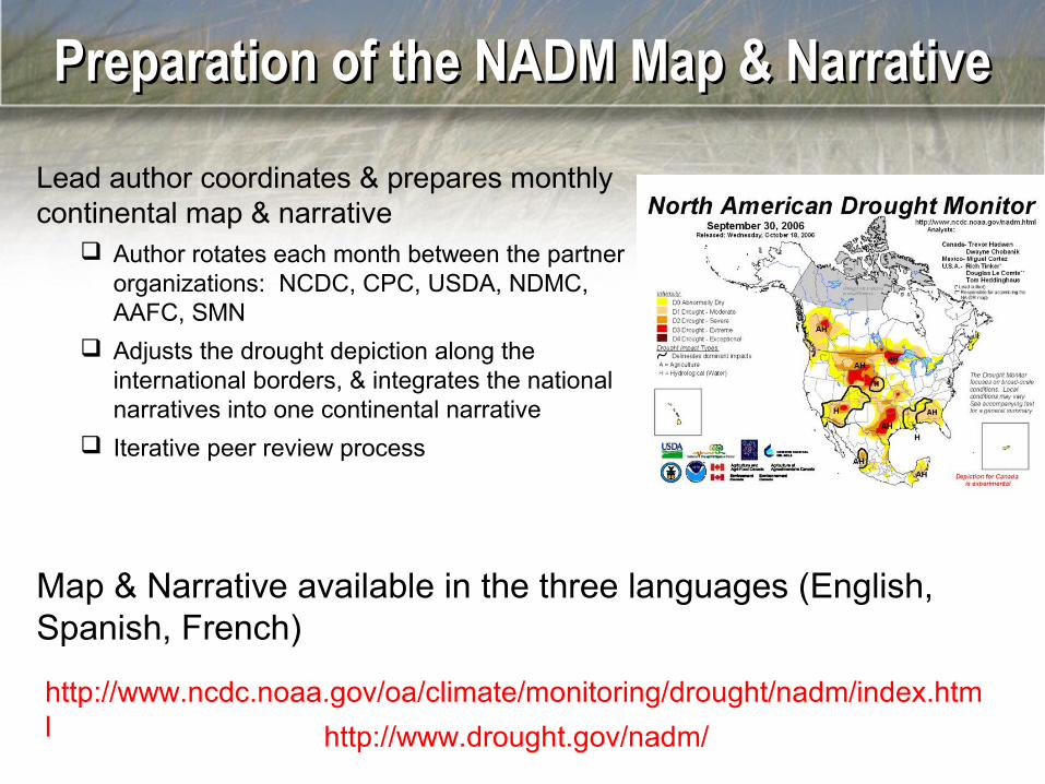
Preparation of the NADM Map & NarrativePreparation of the NADM Map & Narrative
Lead author coordinates & prepares monthly continental map & narrative
Author rotates each month between the partner organizations: NCDC, CPC, USDA, NDMC, AAFC, SMN
Adjusts the drought depiction along the international borders, & integrates the national narratives into one continental narrative
Iterative peer review process
http://www.ncdc.noaa.gov/oa/climate/monitoring/drought/nadm/index.html
Map & Narrative available in the three languages (English, Spanish, French)
http://www.drought.gov/nadm/

Drought at the International BoundariesDrought at the International Boundaries
• Drought indices covering entire continent are needed – Continental Drought Indicators Same indices, analysis period, and methodologies - this consistency
needed for depiction across international boundaries
Station based indices - SPI, Palmer Drought Indices, Percent of Long-term Average Precipitation (Standardizing period is 1951-2001) - Data provided by MSC, SMN, NOAA, with NCDC computing the indices
NOAA/NESDIS Satellite Vegetation Health NOAA/CPC Leaky Bucket Soil Moisture Percentiles
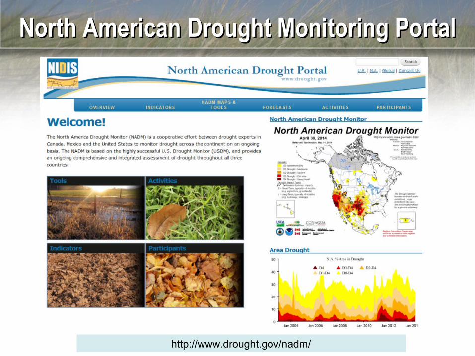
North American Drought Monitoring PortalNorth American Drought Monitoring Portal
http://www.drought.gov/nadm/

Portal ClimatologiesPortal Climatologies

NADM Portal Map Viewer Tool
Overlays of NADM and Continental Indicators

North American Drought Monitoring Portal

North American Climate Service Partnership
NACSP Objective:
•The objective of this trilateral partnership between the U.S., Canada and Mexico is to facilitate the exchange of information, technology and management practices related to the development of climate information and the delivery of integrated climate services for North America.
NACSP Goal:
•to effectively respond to an increasing demand for accessible and timely scientific data & information to make informed decisions and build resilience in our communities.
•Initial emphasis is on water.

The North American Climate Services Partnership
• The NACSP was signed by Mexico, the US, and Canada in January, 2012.
• Supports the vision / goals of the WMO Global Framework for Climate Services
• Mutual benefits of trilateral cooperation & capacity development.
• The lead agencies are NOAA, Environment Canada’s Meteorological Services and Mexico’s metrological Service (SMN).
• Although the Canadian lead is Environment Canada’s, AAFC is the lead for on drought.

NACSP Strategic Workplan (2013-2017)
NACSP Strategic Goals1.Foster the development of key partnerships with users and stakeholders. 2.Maximize the use of existing science and information by decision-makers3.Prioritize activities based on identified gaps in service delivery and end-user input4.Utilize Regional Pilot areas to implement a place-based approach5.Create opportunities to share best practices and lessons-learned•Of the seven focus areas 2 are directly related to drought and the others will enhance drought monitoring capabilities.

NACSP 2013-17 Focus Areas
1. Rio Grande-Rio Bravo (RGB) Regional Pilot Area
2. Great Lakes Regional Pilot Area
3. North American Ensemble Forecast System (NAEFS)
4. North American Seasonal Forecast System (NASFS)
5.5. North American Drought Monitor (NADM)North American Drought Monitor (NADM)
6. Coordinated Global Daily Precipitation Analysis
7. North American Seasonal Fire Assessment and Outlook
* Regional Initiatives ** Geographic Pilot Areas
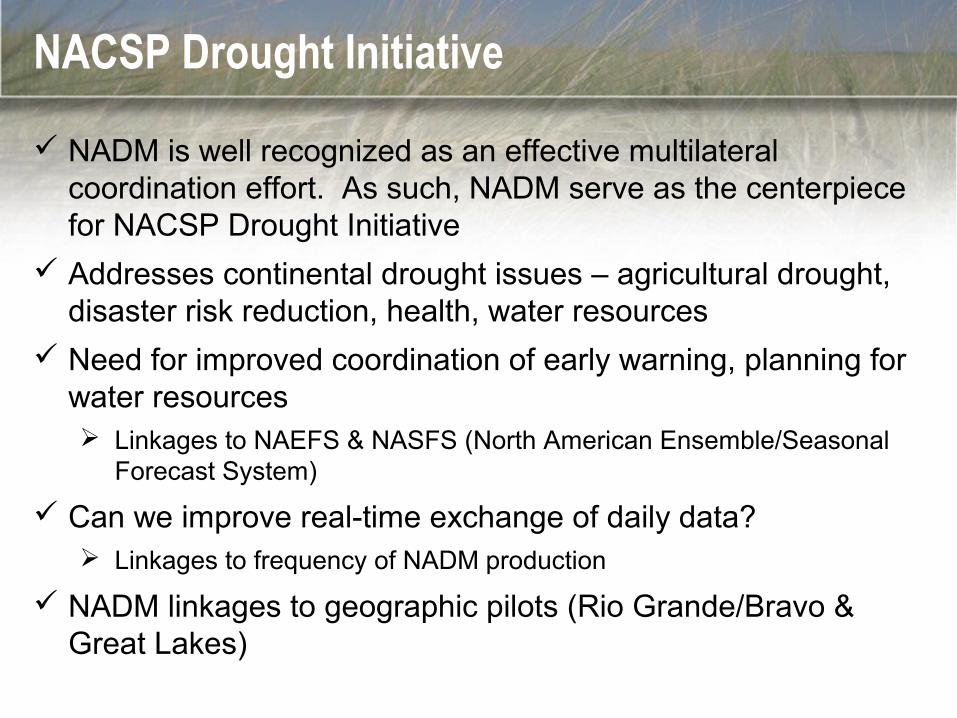
NACSP Drought Initiative
NADM is well recognized as an effective multilateral coordination effort. As such, NADM serve as the centerpiece for NACSP Drought Initiative
Addresses continental drought issues – agricultural drought, disaster risk reduction, health, water resources
Need for improved coordination of early warning, planning for water resources Linkages to NAEFS & NASFS (North American Ensemble/Seasonal
Forecast System)
Can we improve real-time exchange of daily data? Linkages to frequency of NADM production
NADM linkages to geographic pilots (Rio Grande/Bravo & Great Lakes)

NACSP Focus Area 5: NADM
Leads: Richard Heim (NOAA/NCDC); Trevor Hadwen (AAFC); Reynaldo Pascual and Adelina Albanil (SMN)
Objective: To provide map and narrative products that assess drought conditions on the continental scale which assists water managers, agricultural interests and other user communities in the United States,
Canada and Mexico.
Four Current Activities1. Scoping Activity 2. North American VegDRI 3. North American Blended Drought Indices4. Drought Definitions & Indices Study

Scoping Activity
Goal: to produce a discussion paper of role of NADM & relationship to other global drought information initiatives, programs, policy, & science in North America. Analysis will be done by each country.
17

North American VegDRI
Goal: to expand Vegetation Drought Response Index to Canada & Mexico•In 2012 Canada and the US (AAFC, USGS and the NDMC) initiated a pilot project to determine if it was feasible to extend the VegDRI monitoring process into Canada. •We are currently working to expand the pilot to all of Canada.•There is interest in expanding this pilot to Mexico as well.

North American Blended Drought Indices
Goal: To develop short- & long-term objective blended drought indices for all of North America.
•These will help in the national drought assessments as well as cross-border analyses
•The U.S.A. has been producing Blended Drought Indices in an operational fashion for some time.
19
Short-Term Blend
35% Palmer Z Index25% 3-Month Precip.20% 1-Month Precip.13% CPC Soil Model7% Palmer Drought Index
Long-Term Blend
25% Palmer Hydro. Index20% 24-Month Precip.20% 12-Month Precip.15% 6-Month Precip.10% 60-Month Precip.10% CPC Soil Model

North American Blended Drought Indices
• Canadian blends are currently being produced monthly as an experimental product.
• Canada’s blends are based on station data rather than climate district data as in the USA.
• Currently we are trying to optimize the blends for different regions of the country. 20

Drought Definitions & Indices Study
Goal: To improve the definition of drought for the diverse climate regions of North America including arid, semiarid subhumid, humid, subarctic and arctic climate zones.
21
This will be done through the development of a toolkit of drought definitions & relevant indices for North America, linked to GEO Drought Indices & Definition Study.

NACSP website
22
http://cpo.noaa.gov/Partnerships/International/TheNorthAmericanClimateServicesPartnership%28NACSP%29_b.aspx

24
Canadian Drought Monitor

25
Drought Watch Website
www.agr.gc.ca/drought
• The Drought Watch web site is one of AAFC’s most visited sites.
• The site provide timely information on weather and climate conditions and impacts throughout Canada at a national and regional scales.
• The site also includes information on best management practices for weather extremes.
• The site includes various precipitation and temperatures maps, our National Drought Model products, and agroclimate impact maps.

The commitment to our NRT system is significantThe commitment to our NRT system is significant
• Our NRT system began operation in 2006• Data are currently collected and maps processed within 12
hours of availability (0600Z + 12 hours ~ noon CDT)• Output assists AAFC with weather impacts and related risks• Combination of automated and manual processes
26

Surface Soil Moisture (SMOS animated time series 2014)
AAFC Produces Weekly, Bi-weekly and Monthly estimates April 1 to November 30 in near real time from SMOS satellite data
Coarse spatial resolution – gridded at 0.25 degrees

• Integrates daily measurements of surface wetness conditions measured by microwave satellites to determine average and anomaly conditions
Satellite Surface Soil Moisture Anomalies (SSSM)

29
Remote Sensing Products: Available Weekly
Crop Condition Assessment ProgramStatistics Canada

Agroclimate Impact Reporter
• The Agroclimate Impact Reporter (AIR) application is an online tool for the collection and reporting of agroclimate impacts (including drought) across Canada.
• Impact reports are collected through a network of registered and anonymous users as well as media input.
30
• The information gathered by AIR plays a significant and valuable role in evaluating weather and climate-related risks to Canadian agriculture and supports multi-million dollar policy and program decisions.

31
Agroclimate Impacts Maps

Next steps on NADM/NACSP-related activities
• Finish the Drought Definitions and Indices Study.• Begin a discussion paper that identifies the role of the NADM
and how it links to other global drought information initiatives, programs, policy and science in North America.
• Continue to develop short- and long-term objective blended drought indices that are regionally appropriate.
• SMN will be developing new indices including SPEI and the Streamflow Drought Index (SDI).
• The SMN is driving the creation of the National Center of Climate Services. Jointly are working on the creation of a center for Mesoamerica and the Caribbean.
• Canada to expand assessments in the Yukon and North West Territory.
• Attempt to increase the frequency to bi monthly.• Continue to increase gathering of impact information.


![DROUGHT MONITOR [IHP-VIII] - UNESDOC Databaseunesdoc.unesco.org/images/0023/002319/231937e.pdf · DROUGHT MONITOR [IHP-VIII] International Hydrological Programme. THE CONTEXT Drought](https://img.dokumen.tips/doc/110x75/5b99333609d3f26e678b70e8/drought-monitor-ihp-viii-unesdoc-drought-monitor-ihp-viii-international.jpg)