Embed Size (px)
Citation preview

The Marine Geoscience Data System and the Global Multi-Resolution
Topography Synthesis: Online Resources for
Exploring Ocean Mapping DataJohn Morton, Vicki Ferrini*, Suzanne Carbotte,
and the MGDS Team
MGDS Tools & Services• GMRT Synthesis• GeoMapApp• Marine-Geo Digital Library
Specialist
Non-specialist

GMRT Synthesis: Overview• Open-access global elevation product
– Focus on bathymetry• Support specialists & non-specialists• Multi-resolutional synthesis
– GEBCO_2014 + MBES + land + grids– MBES at full-native resolution (100m+)
• Tiled Global Compilation– Images, grids, mask– Mercator, South Polar, North Polar– 2 scheduled releases / year
(~80 cruises)• Attribution to data contributors• Access to source data• Multiple Apps for Access

Multibeam Data* Preparation• Bad navigation• Noisy outer beams• Attitude problems• Bad soundings• Instrument problems• Bad weather• Sound velocity• Attitude Offsets• Slow speed in turns• Grid weighting • Resolution (100, 50, 25 m)
*LDEO team processes swath files (public domain, primarily US Academic)

• Compilation began in 1992• Includes data from 1980 - present• Current version of GMRT (v.3.1, Nov. 2015)
• 875 Cruises• > 4.4 Million trackline km• > 175K processed swath files• 28.6 Million km2 (~8% ocean)
Multibeam Data in GMRT

GMRT Access• GMRT MapTool• Web Services • GeoMapApp• Earth Observer• Partner Products
(MB component only)– Google Ocean Basemap– Esri Ocean Basemap– GEBCO 2014
http://gmrt.marine-geo.org
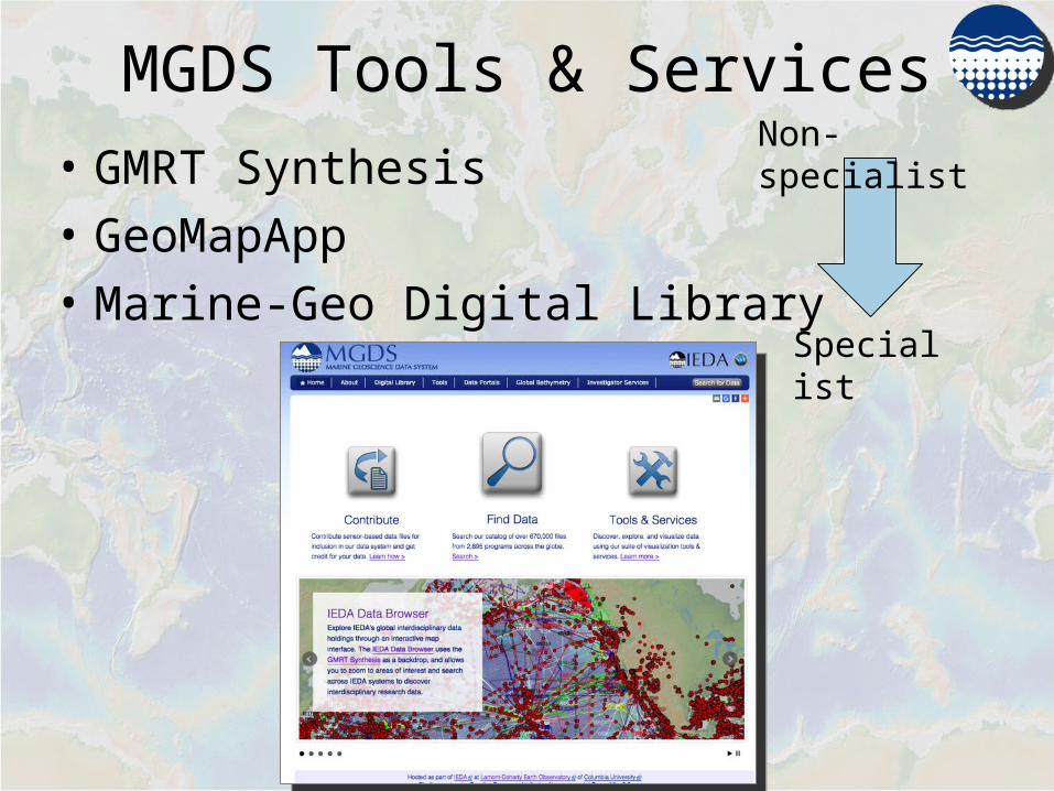
GMRT MapTool
http://www.marine-geo.org/tools/GMRTMapTool/

GMRT – Web Services• Web Map Services
– Mercator • masked, un-masked, track-lines
– South Polar • masked, un-masked, track-lines
• RESTful Web Services– GridServer– ImageServer– PointServer– ProfileServer– Attribution Service

• Desktop Java Application• Core capabilities
– Grids/images, tabular data (plot, interrogate, interact)
– Load data, save sessions• Access to 1000s of datasets
– Bathymetry, Bottom Photos, Sidescan & more!
– Links to original data sources• Custom Portals
– IODP, Seismic, Trackline geophysics, Photos
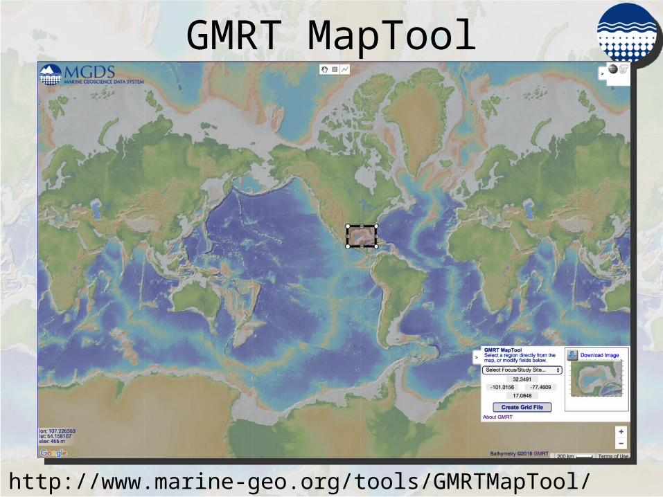
GeoMapApp

GeoMapApp
Grid Functionality


Marine-Geo Digital Library• Interactive Digital Library• > 670,000 files from > 2,600 programs • Field data + Derived Products
– Bathymetry, Photos, Interpretations– Ships, submersibles, towed platforms
• Links to Publications• Data Portals• Data DOIs• Analytics

Marine-Geo Search• Map/Text search • Multiple parameters
– Device, Data Type, Investigator, Date, Spatial Extent, Platform, Publication, etc

Select/Download

Next Steps…• GMRT
– More content!– SP rebuild (underway)– NP rebuild/web services– Derivative products (e.g. Rugosity)
• GeoMapApp– Enable functionality in web-interface
• Marine-Geo Digital Library– Enhance map interfaces– Display/access of data file content