Embed Size (px)
Citation preview
Tony SmithMelbourne Emergence Meetup
9 February 2017
Nepean Bay BarCan reinstatement and enhancement of
this natural barrier save Melbourne?
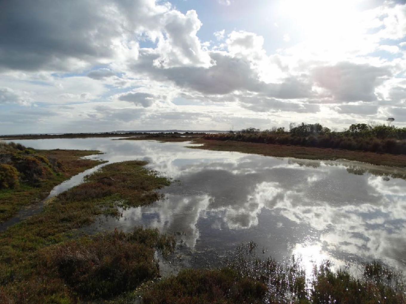
Mud Island is at the centre of
the Great Sand. Its southern
beachfront dominates the
view north from the Queenscliff-
Sorrento ferry.
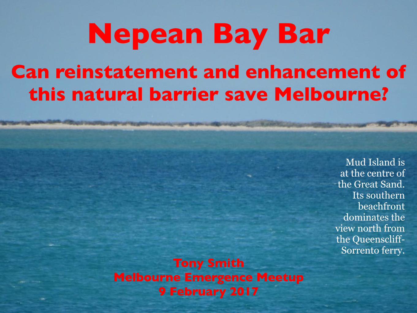
Draft Port Phillip Bay Environmental Management Plan
2017–2027
Public consultation on the draft Plan will be
open until 10 February
2017.
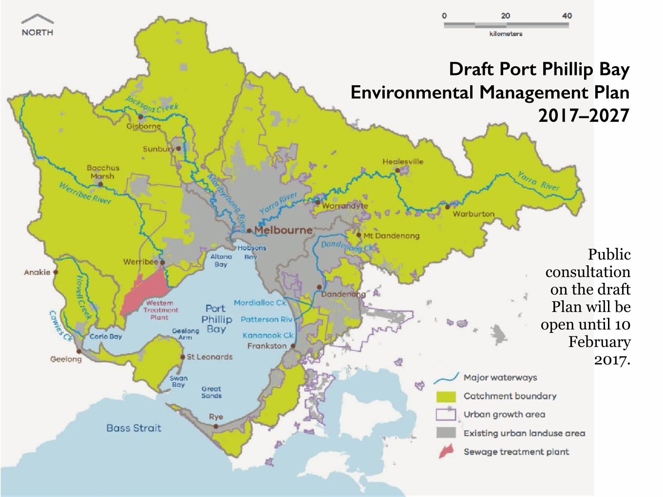
• “(P)opulation growth and climate change pose significant challenges” (ten mentions)
• “Sea levels will rise and storm surges will become more frequent” (one mention)
• Our culture is predicated on an exceptional 7,000 year period of sea level stability
• Average rate of sea level change across 140,000 years is one metre per 140 years
• Peak rate is much higher
• Several indicators of approaching critical instabilities
• Question is when, not whether, sea level rise really takes off
• Like most coastal cities, Marvellous Melbourne very vulnerable
Draft Port Phillip Bay Environmental Management Plan 2017–2027
Ignores the Elephant in the Room
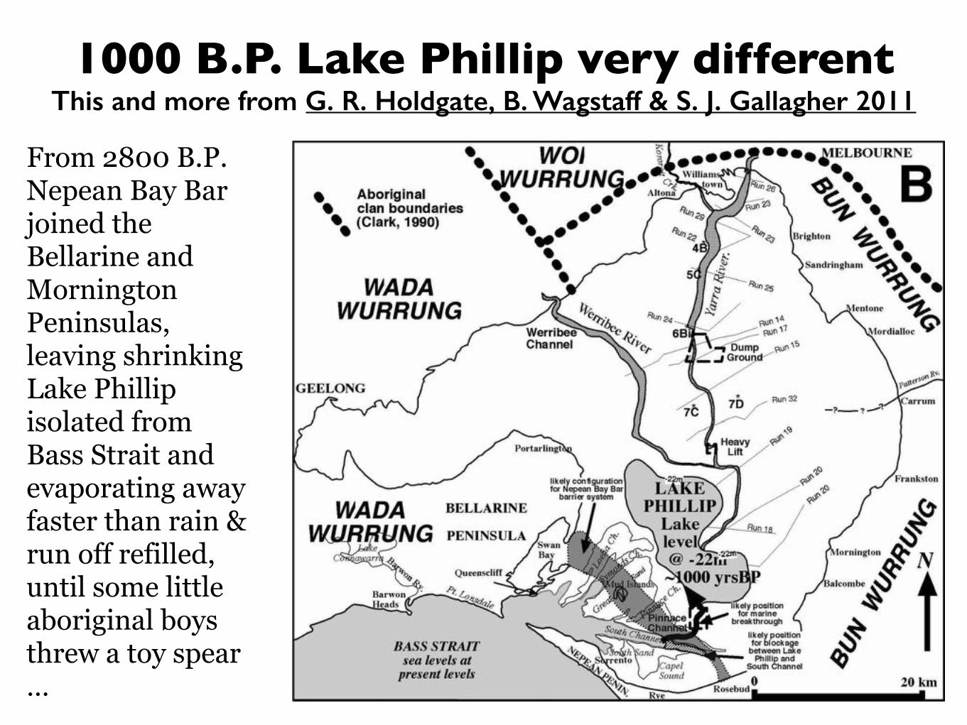
1000 B.P. Lake Phillip very differentThis and more from G. R. Holdgate, B. Wagstaff & S. J. Gallagher 2011
From 2800 B.P. Nepean Bay Bar joined the Bellarine and Mornington Peninsulas, leaving shrinking Lake Phillip isolated from Bass Strait and evaporating away faster than rain & run off refilled, until some little aboriginal boys threw a toy spear …
Where to tonight?• Geology of river deltas forming crescent beaches
• Comparisons to Zuiderzee in The Netherlands
• Public romanticisation of recent Bay environment
• RAMSAR wetlands serving bird migration tracks
• Aboriginal land occupancy and cultural knowledge
• Staged reinstatement of the Nepean Bay Bar seal
• Port capacity maintained with locks then Bay South
• Predeployment of rail and road capacity both ends
• Returning Barwon to Corio Bay to save Geelong
• Narrowing on peak rate and timing of sea level rise

River deltas forming crescent beachesin rift which failed when Australia was breaking away from Antarctica
Murray Mouth & the Coorong
Gippsland Lakes & 90 Mile Beach
Yarra & Barwon
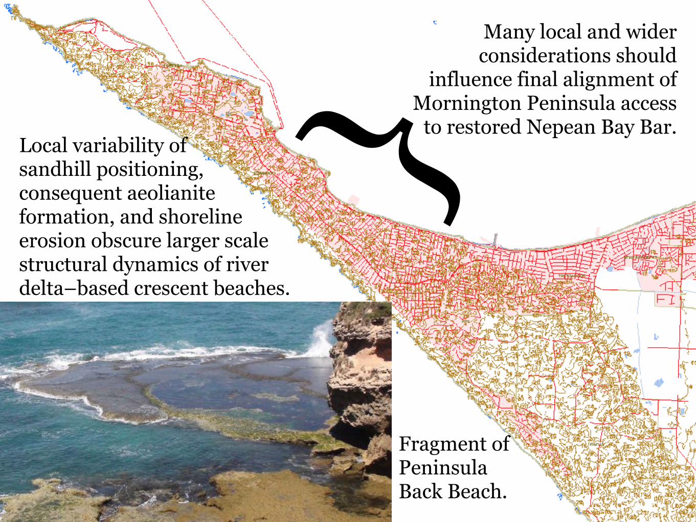
Local variability of sandhill positioning, consequent aeolianite formation, and shoreline erosion obscure larger scale structural dynamics of river delta–based crescent beaches.
}Fragment of Peninsula Back Beach.
Many local and wider considerations should
influence final alignment of Mornington Peninsula access
to restored Nepean Bay Bar.
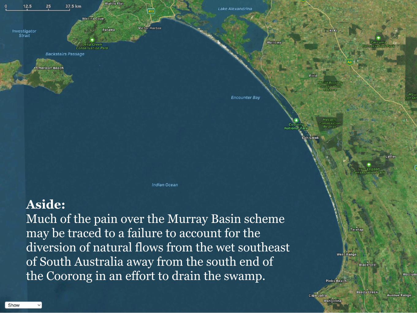
Aside: Much of the pain over the Murray Basin scheme may be traced to a failure to account for the diversion of natural flows from the wet southeast of South Australia away from the south end of the Coorong in an effort to drain the swamp.
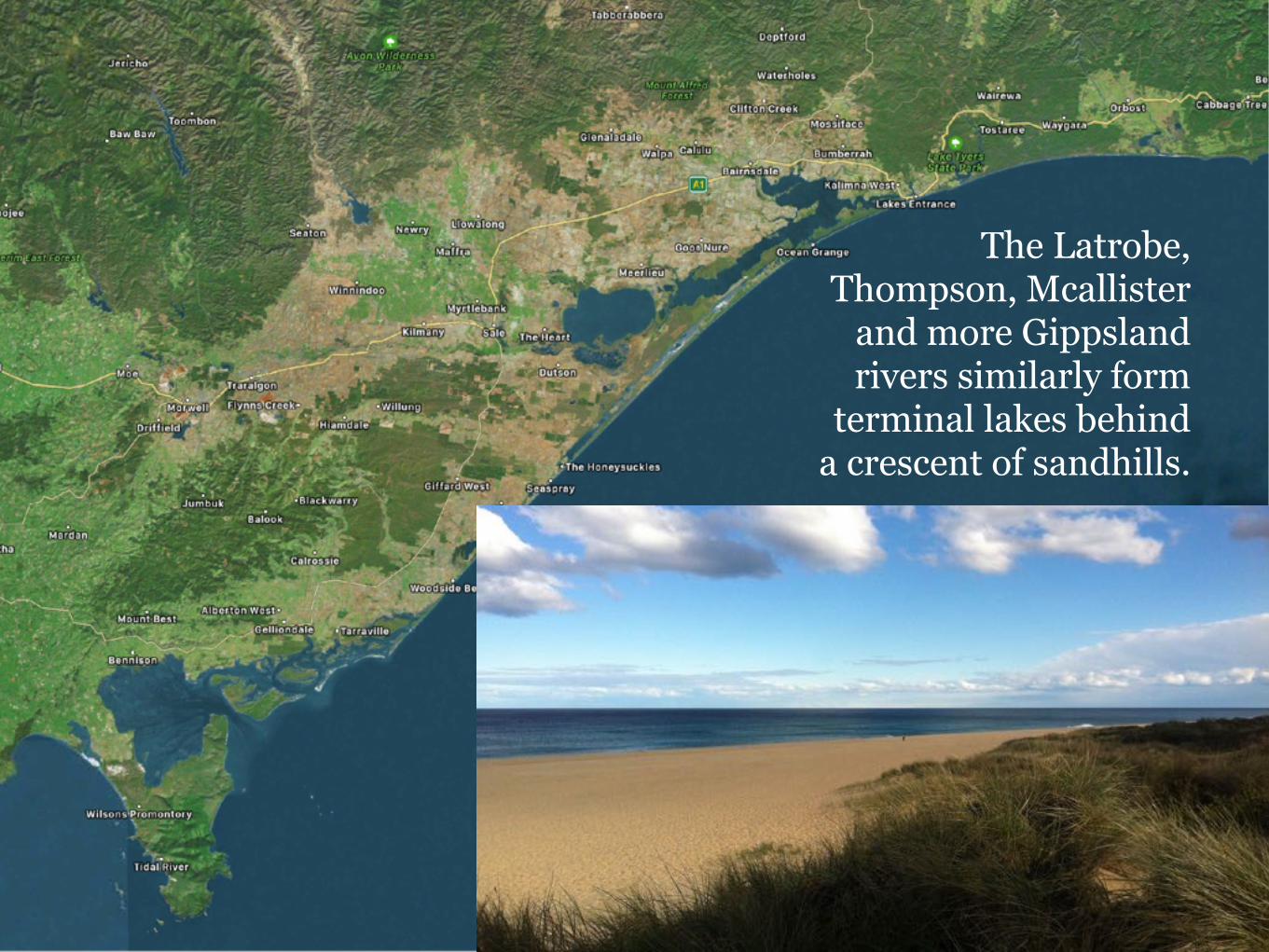
The Latrobe, Thompson, Mcallister
and more Gippsland rivers similarly form
terminal lakes behind a crescent of sandhills.
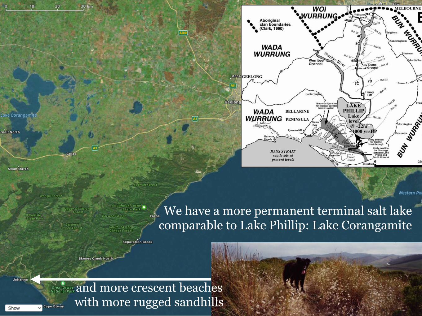
We have a more permanent terminal salt lake comparable to Lake Phillip: Lake Corangamite
and more crescent beaches with more rugged sandhills
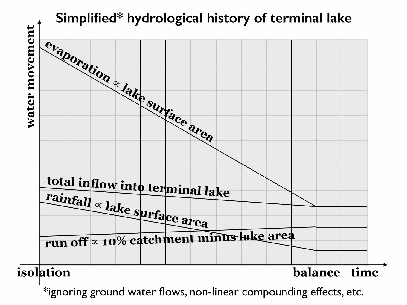
isolation
wat
er m
ovem
ent
time
evaporation ∝ lake surface area
run off ∝ 10% catchment minus lake area
rainfall ∝ lake surface area
total inflow into terminal lake
balance
Simplified* hydrological history of terminal lake
*ignoring ground water flows, non-linear compounding effects, etc.
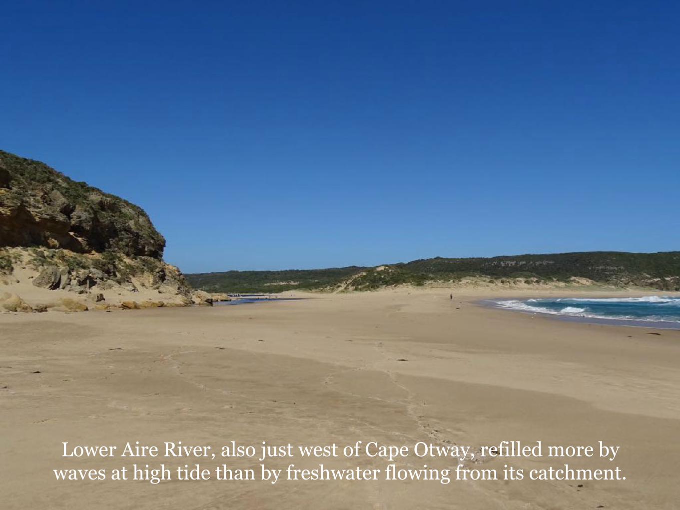
Lower Aire River, also just west of Cape Otway, refilled more by waves at high tide than by freshwater flowing from its catchment.
?
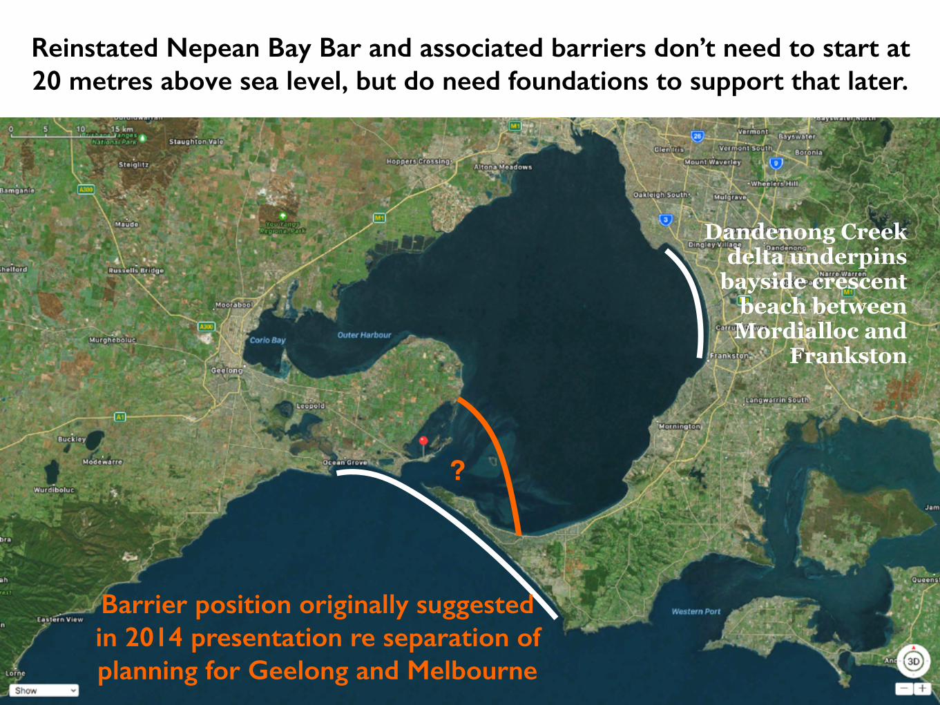
Reinstated Nepean Bay Bar and associated barriers don’t need to start at 20 metres above sea level, but do need foundations to support that later.
Barrier position originally suggested in 2014 presentation re separation of planning for Geelong and Melbourne
Dandenong Creek delta underpins
bayside crescent beach between
Mordialloc and Frankston
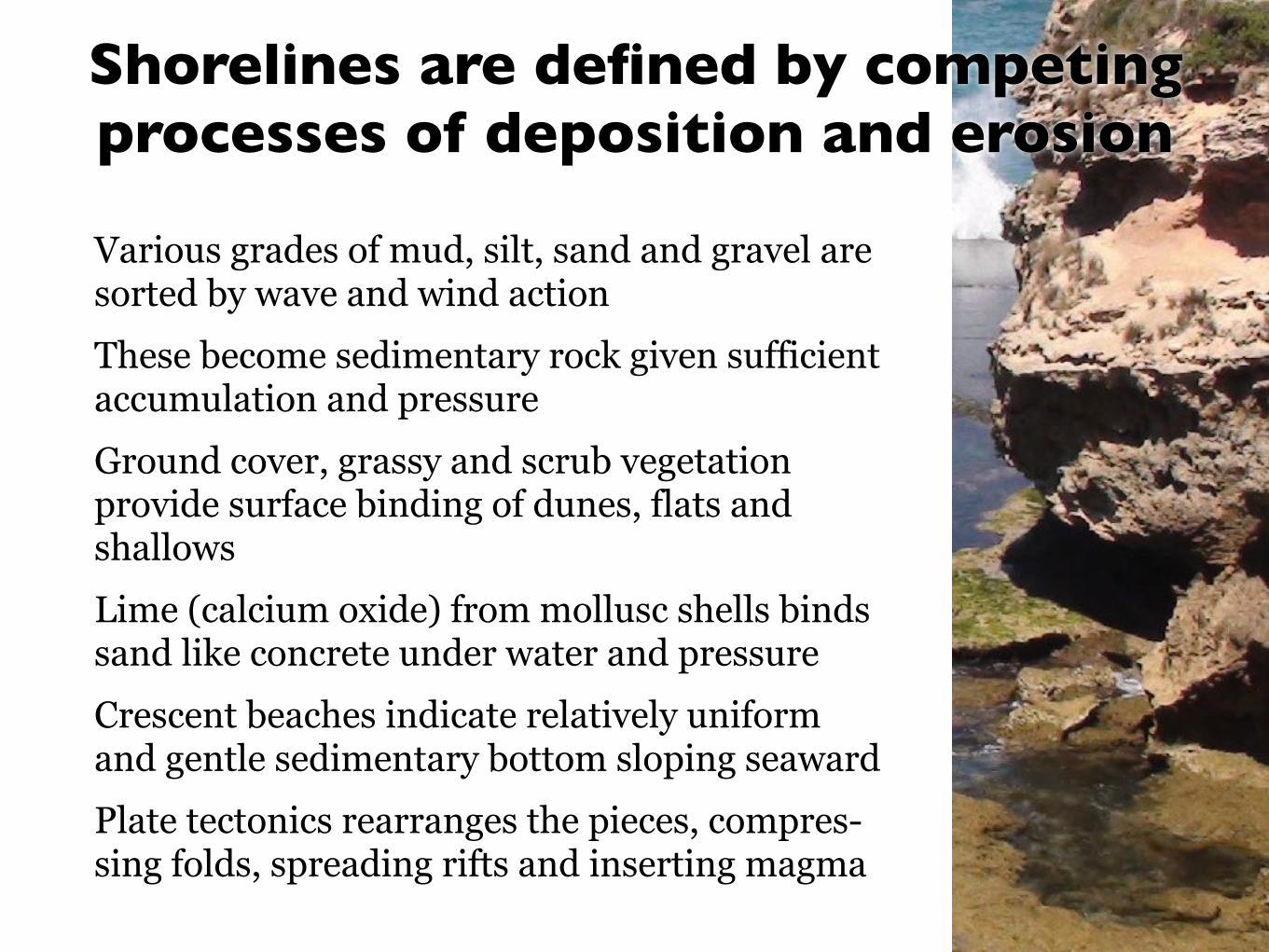
Various grades of mud, silt, sand and gravel are sorted by wave and wind action These become sedimentary rock given sufficient accumulation and pressure Ground cover, grassy and scrub vegetation provide surface binding of dunes, flats and shallows Lime (calcium oxide) from mollusc shells binds sand like concrete under water and pressure Crescent beaches indicate relatively uniform and gentle sedimentary bottom sloping seaward Plate tectonics rearranges the pieces, compres-sing folds, spreading rifts and inserting magma
Shorelines are defined by competing processes of deposition and erosionShorelines are defined by competing processes of deposition and erosion
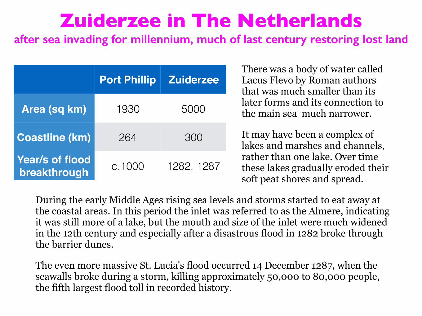
Zuiderzee in The Netherlandsafter sea invading for millennium, much of last century restoring lost land
Zuiderzee in The Netherlandsafter sea invading for millennium, much of last century restoring lost land
There was a body of water called Lacus Flevo by Roman authors that was much smaller than its later forms and its connection to the main sea much narrower.
It may have been a complex of lakes and marshes and channels, rather than one lake. Over time these lakes gradually eroded their soft peat shores and spread.
During the early Middle Ages rising sea levels and storms started to eat away at the coastal areas. In this period the inlet was referred to as the Almere, indicating it was still more of a lake, but the mouth and size of the inlet were much widened in the 12th century and especially after a disastrous flood in 1282 broke through the barrier dunes.
The even more massive St. Lucia's flood occurred 14 December 1287, when the seawalls broke during a storm, killing approximately 50,000 to 80,000 people, the fifth largest flood toll in recorded history.
Port Phillip Zuiderzee
Area (sq km) 1930 5000
Coastline (km) 264 300
Year/s of flood breakthrough c.1000 1282, 1287
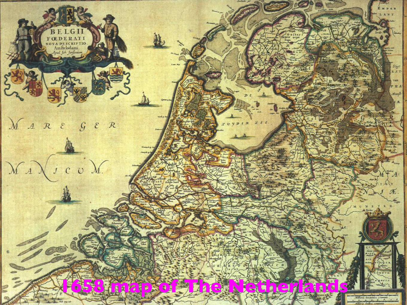
1658 map of The Netherlands1658 map of The Netherlands
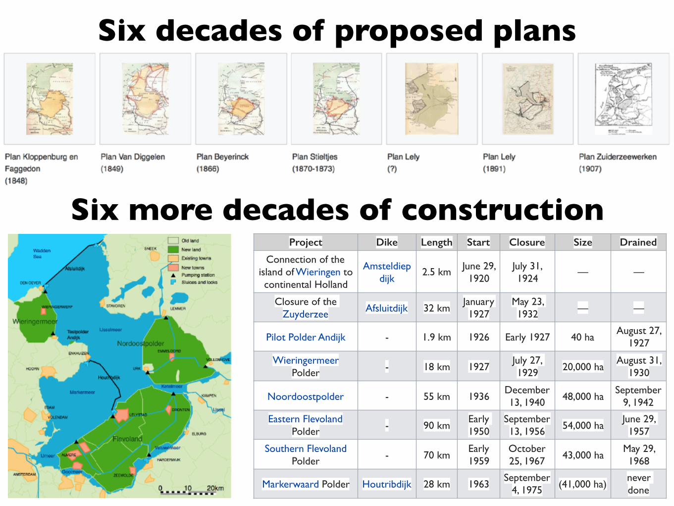
Six decades of proposed plans
Six more decades of constructionProject Dike Length Start Closure Size Drained
Connection of the island of Wieringen to continental Holland
Amsteldiepdijk
2.5 km June 29, 1920
July 31, 1924
— —
Closure of the Zuyderzee Afsluitdijk 32 km
January 1927
May 23, 1932 — —
Pilot Polder Andijk - 1.9 km 1926 Early 1927 40 haAugust 27,
1927
Wieringermeer Polder - 18 km 1927
July 27, 1929 20,000 ha
August 31, 1930
Noordoostpolder - 55 km 1936December 13, 1940 48,000 ha
September 9, 1942
Eastern Flevoland Polder - 90 km
Early 1950
September 13, 1956 54,000 ha
June 29, 1957
Southern Flevoland Polder - 70 km
Early 1959
October 25, 1967 43,000 ha
May 29, 1968
Markerwaard Polder Houtribdijk 28 km 1963September
4, 1975 (41,000 ha)never done
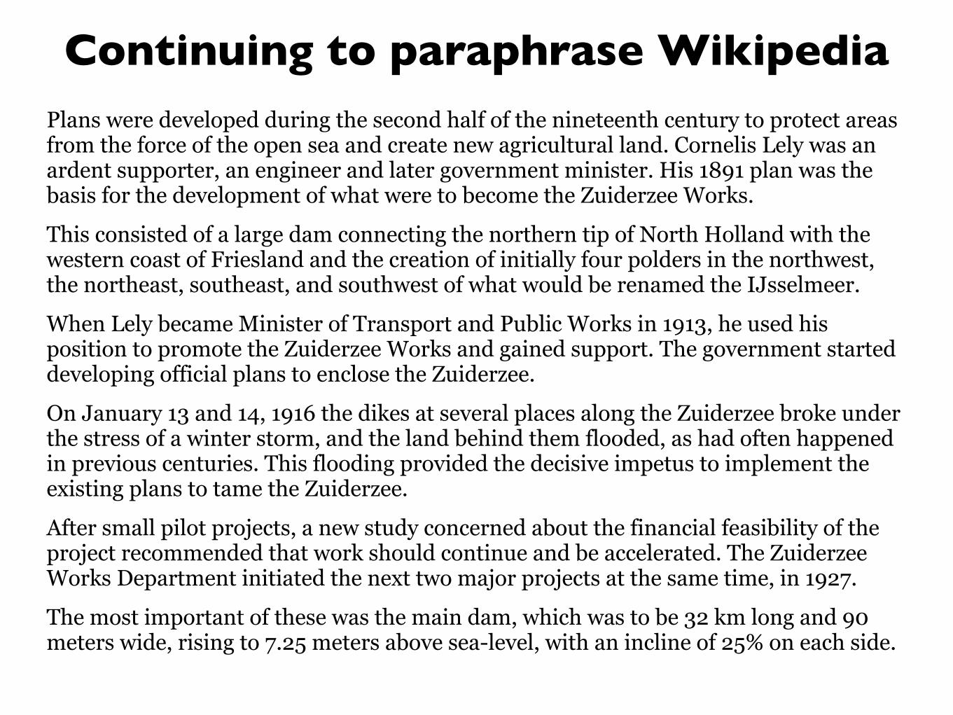
Continuing to paraphrase WikipediaPlans were developed during the second half of the nineteenth century to protect areas from the force of the open sea and create new agricultural land. Cornelis Lely was an ardent supporter, an engineer and later government minister. His 1891 plan was the basis for the development of what were to become the Zuiderzee Works.
This consisted of a large dam connecting the northern tip of North Holland with the western coast of Friesland and the creation of initially four polders in the northwest, the northeast, southeast, and southwest of what would be renamed the IJsselmeer.
When Lely became Minister of Transport and Public Works in 1913, he used his position to promote the Zuiderzee Works and gained support. The government started developing official plans to enclose the Zuiderzee.
On January 13 and 14, 1916 the dikes at several places along the Zuiderzee broke under the stress of a winter storm, and the land behind them flooded, as had often happened in previous centuries. This flooding provided the decisive impetus to implement the existing plans to tame the Zuiderzee.
After small pilot projects, a new study concerned about the financial feasibility of the project recommended that work should continue and be accelerated. The Zuiderzee Works Department initiated the next two major projects at the same time, in 1927.
The most important of these was the main dam, which was to be 32 km long and 90 meters wide, rising to 7.25 meters above sea-level, with an incline of 25% on each side.
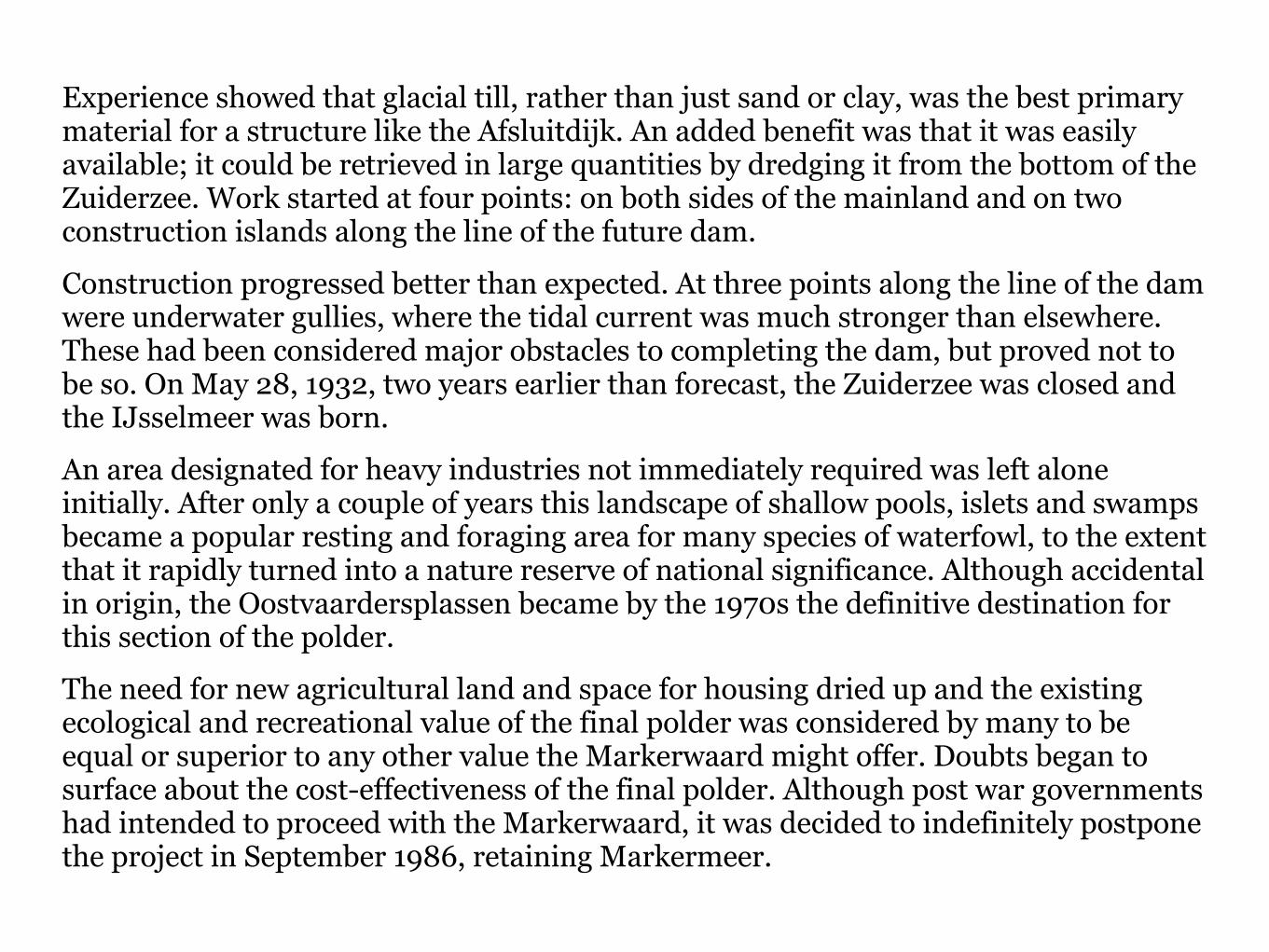
Experience showed that glacial till, rather than just sand or clay, was the best primary material for a structure like the Afsluitdijk. An added benefit was that it was easily available; it could be retrieved in large quantities by dredging it from the bottom of the Zuiderzee. Work started at four points: on both sides of the mainland and on two construction islands along the line of the future dam.
Construction progressed better than expected. At three points along the line of the dam were underwater gullies, where the tidal current was much stronger than elsewhere. These had been considered major obstacles to completing the dam, but proved not to be so. On May 28, 1932, two years earlier than forecast, the Zuiderzee was closed and the IJsselmeer was born.
An area designated for heavy industries not immediately required was left alone initially. After only a couple of years this landscape of shallow pools, islets and swamps became a popular resting and foraging area for many species of waterfowl, to the extent that it rapidly turned into a nature reserve of national significance. Although accidental in origin, the Oostvaardersplassen became by the 1970s the definitive destination for this section of the polder.
The need for new agricultural land and space for housing dried up and the existing ecological and recreational value of the final polder was considered by many to be equal or superior to any other value the Markerwaard might offer. Doubts began to surface about the cost-effectiveness of the final polder. Although post war governments had intended to proceed with the Markerwaard, it was decided to indefinitely postpone the project in September 1986, retaining Markermeer.
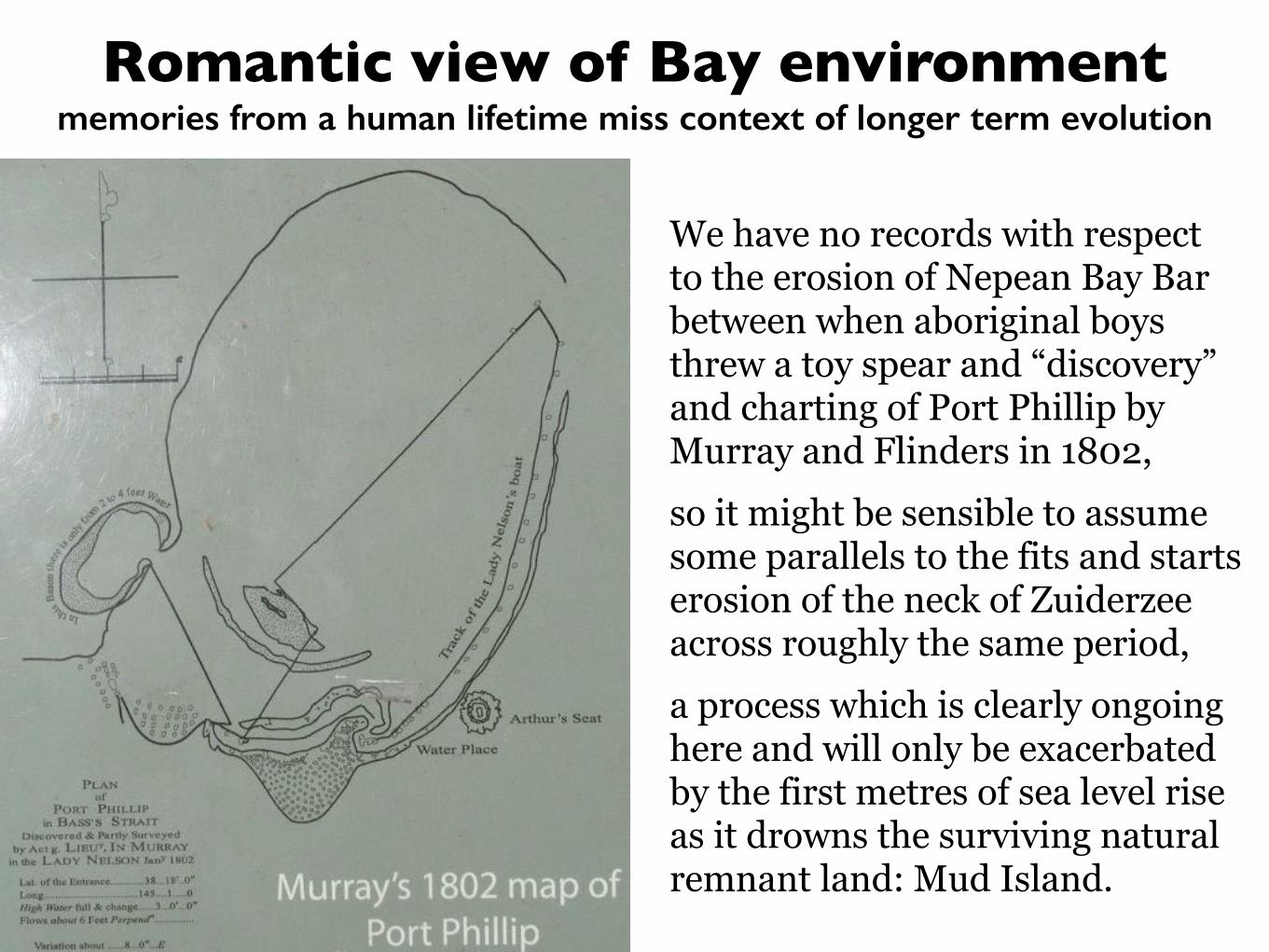
Romantic view of Bay environmentmemories from a human lifetime miss context of longer term evolution
We have no records with respect to the erosion of Nepean Bay Bar between when aboriginal boys threw a toy spear and “discovery” and charting of Port Phillip by Murray and Flinders in 1802, so it might be sensible to assume some parallels to the fits and starts erosion of the neck of Zuiderzee across roughly the same period, a process which is clearly ongoing here and will only be exacerbated by the first metres of sea level rise as it drowns the surviving natural remnant land: Mud Island.
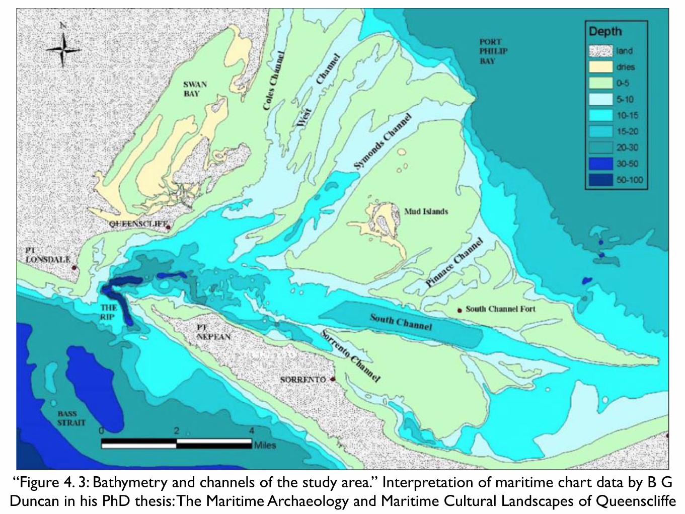
“Figure 4. 3: Bathymetry and channels of the study area.” Interpretation of maritime chart data by B G Duncan in his PhD thesis: The Maritime Archaeology and Maritime Cultural Landscapes of Queenscliffe
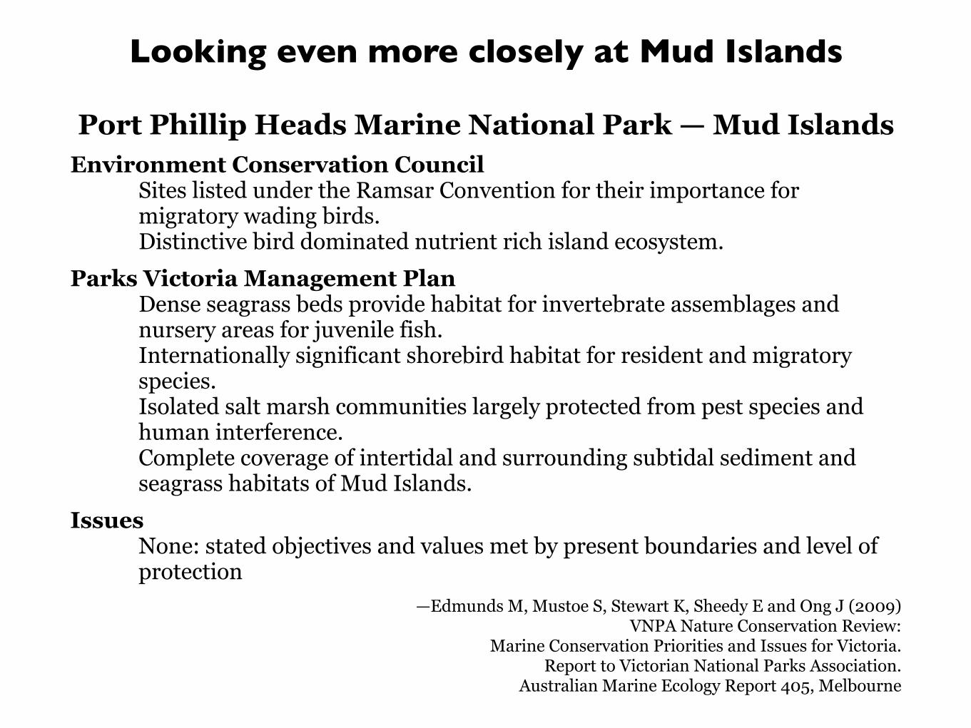
Looking even more closely at Mud Islands
Port Phillip Heads Marine National Park — Mud Islands Environment Conservation Council
Sites listed under the Ramsar Convention for their importance for migratory wading birds. Distinctive bird dominated nutrient rich island ecosystem.
Parks Victoria Management Plan Dense seagrass beds provide habitat for invertebrate assemblages and nursery areas for juvenile fish. Internationally significant shorebird habitat for resident and migratory species. Isolated salt marsh communities largely protected from pest species and human interference. Complete coverage of intertidal and surrounding subtidal sediment and seagrass habitats of Mud Islands.
Issues None: stated objectives and values met by present boundaries and level of protection
—Edmunds M, Mustoe S, Stewart K, Sheedy E and Ong J (2009) VNPA Nature Conservation Review:
Marine Conservation Priorities and Issues for Victoria. Report to Victorian National Parks Association.
Australian Marine Ecology Report 405, Melbourne
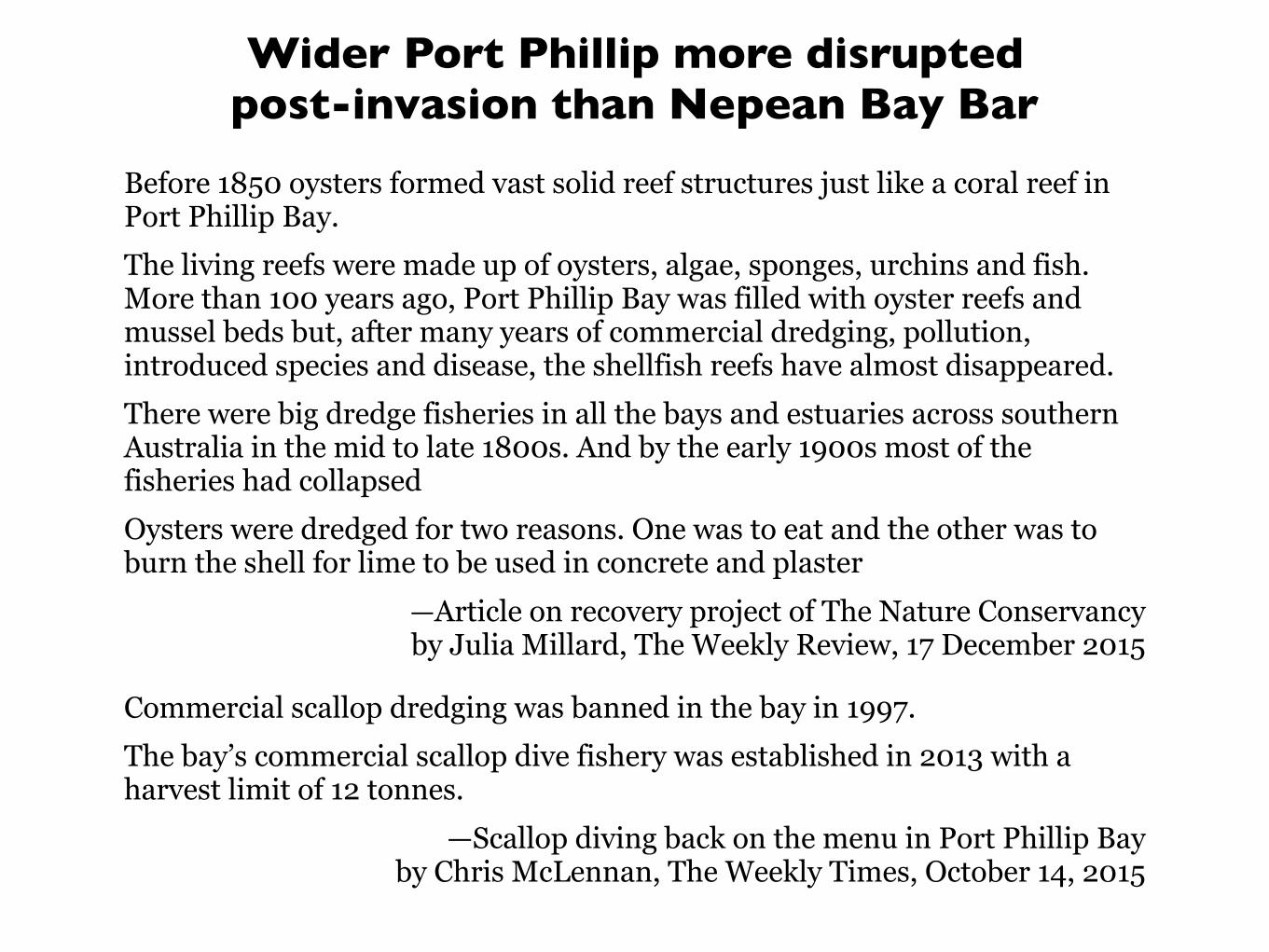
Wider Port Phillip more disrupted post-invasion than Nepean Bay Bar
Before 1850 oysters formed vast solid reef structures just like a coral reef in Port Phillip Bay. The living reefs were made up of oysters, algae, sponges, urchins and fish. More than 100 years ago, Port Phillip Bay was filled with oyster reefs and mussel beds but, after many years of commercial dredging, pollution, introduced species and disease, the shellfish reefs have almost disappeared. There were big dredge fisheries in all the bays and estuaries across southern Australia in the mid to late 1800s. And by the early 1900s most of the fisheries had collapsed Oysters were dredged for two reasons. One was to eat and the other was to burn the shell for lime to be used in concrete and plaster
—Article on recovery project of The Nature Conservancy by Julia Millard, The Weekly Review, 17 December 2015
Commercial scallop dredging was banned in the bay in 1997. The bay’s commercial scallop dive fishery was established in 2013 with a harvest limit of 12 tonnes.
—Scallop diving back on the menu in Port Phillip Bay by Chris McLennan, The Weekly Times, October 14, 2015
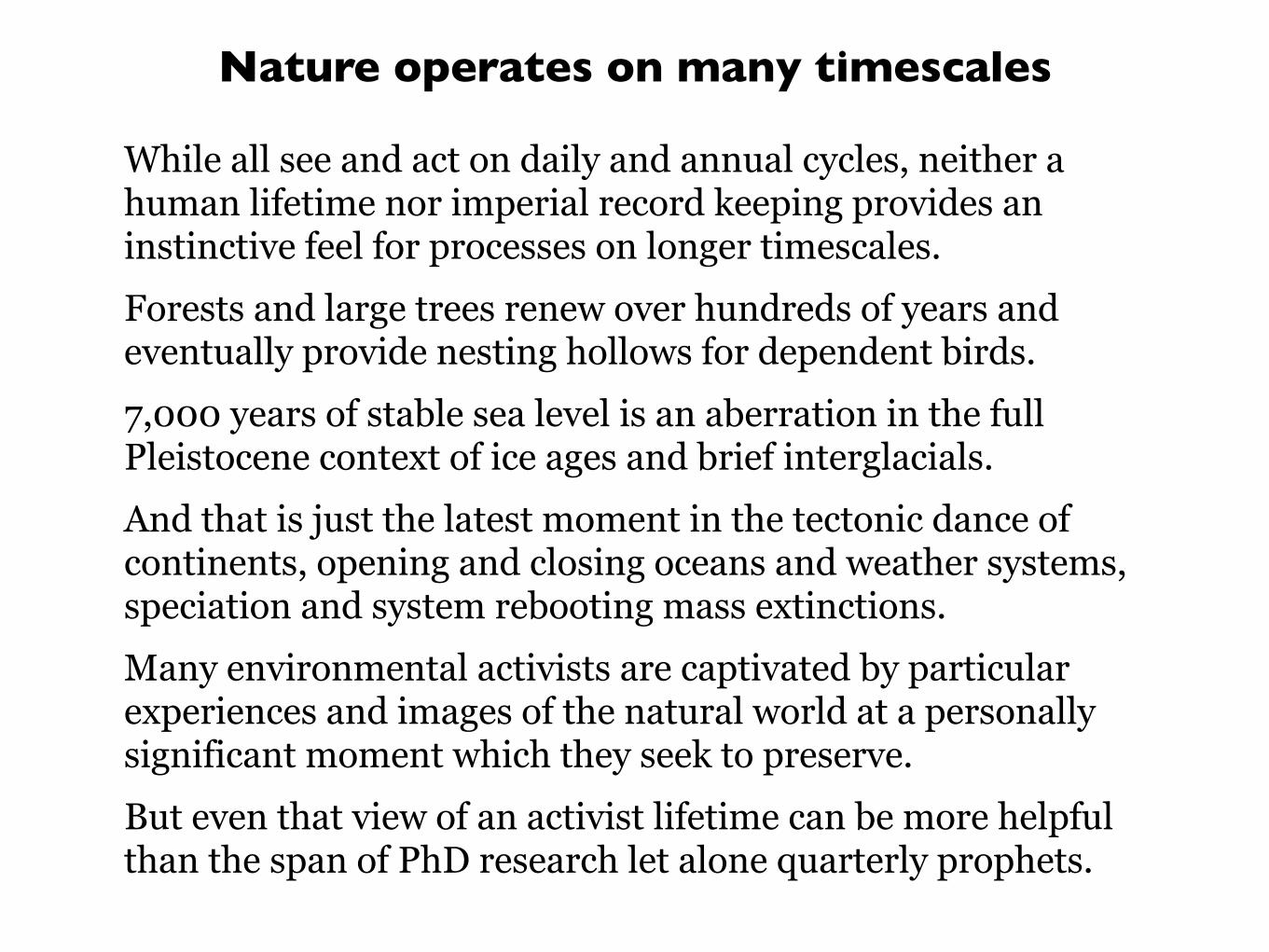
Nature operates on many timescales
While all see and act on daily and annual cycles, neither a human lifetime nor imperial record keeping provides an instinctive feel for processes on longer timescales. Forests and large trees renew over hundreds of years and eventually provide nesting hollows for dependent birds. 7,000 years of stable sea level is an aberration in the full Pleistocene context of ice ages and brief interglacials. And that is just the latest moment in the tectonic dance of continents, opening and closing oceans and weather systems, speciation and system rebooting mass extinctions. Many environmental activists are captivated by particular experiences and images of the natural world at a personally significant moment which they seek to preserve. But even that view of an activist lifetime can be more helpful than the span of PhD research let alone quarterly prophets.
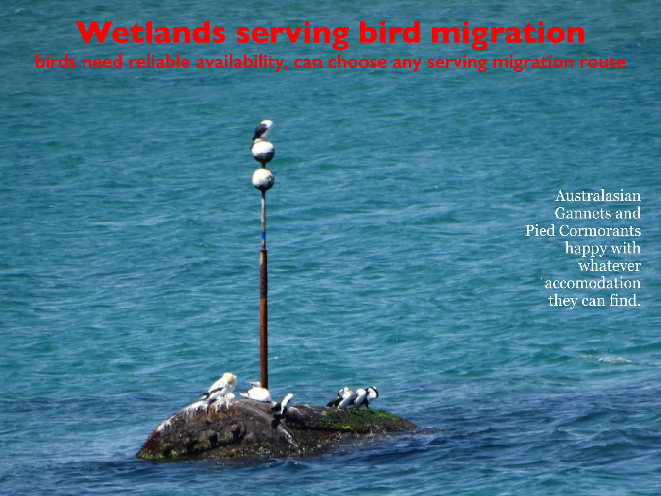
Wetlands serving bird migrationbirds need reliable availability, can choose any serving migration route
Australasian Gannets and
Pied Cormorants happy with
whatever accomodation they can find.
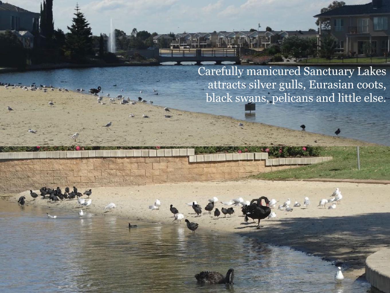
Carefully manicured Sanctuary Lakes attracts silver gulls, Eurasian coots, black swans, pelicans and little else.
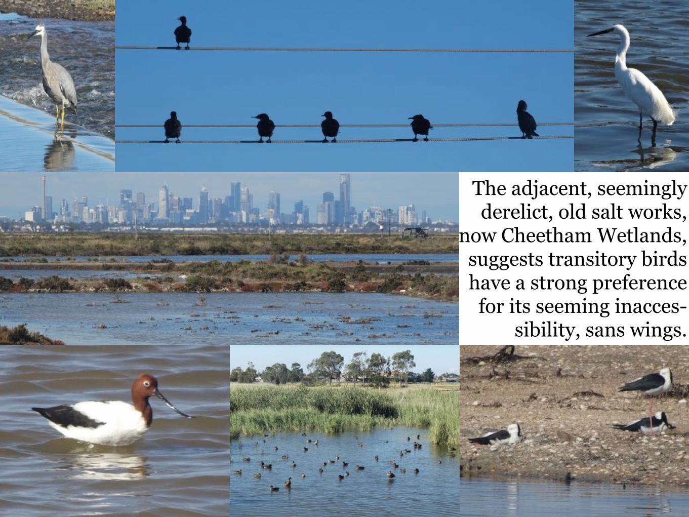
The adjacent, seemingly derelict, old salt works,
now Cheetham Wetlands, suggests transitory birds have a strong preference
for its seeming inacces-sibility, sans wings.
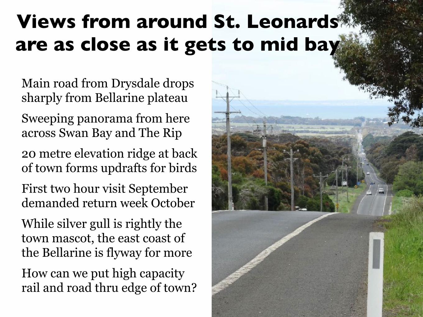
Main road from Drysdale drops sharply from Bellarine plateau Sweeping panorama from here across Swan Bay and The Rip 20 metre elevation ridge at back of town forms updrafts for birds First two hour visit September demanded return week October While silver gull is rightly the town mascot, the east coast of the Bellarine is flyway for more How can we put high capacity rail and road thru edge of town?
Views from around St. Leonards are as close as it gets to mid bay
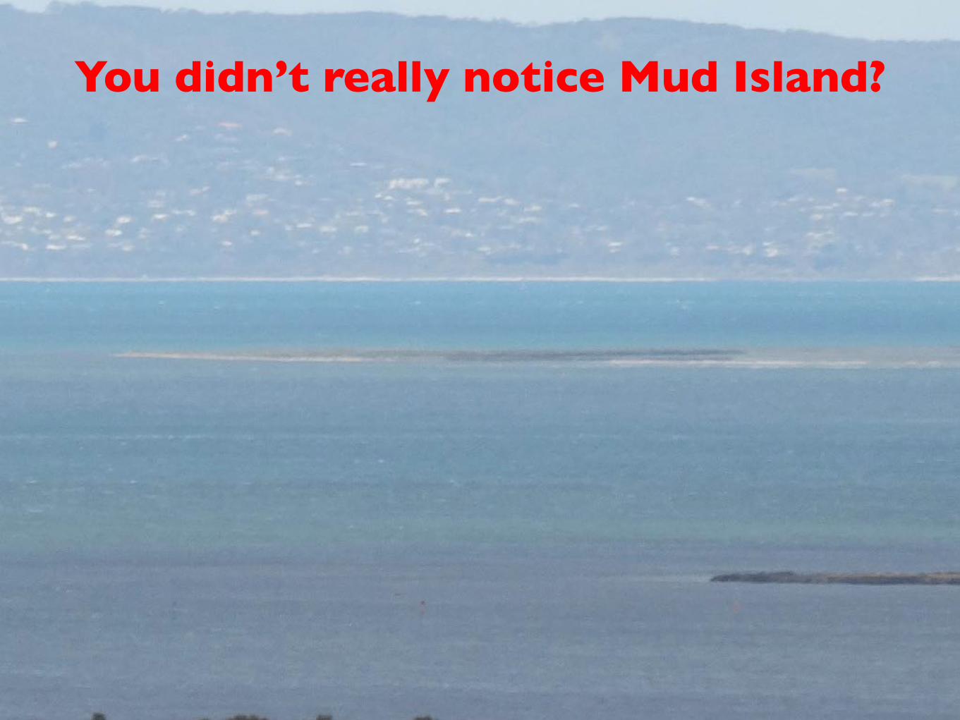
You didn’t really notice Mud Island?
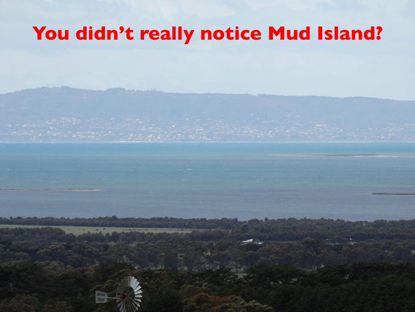
You didn’t really notice Mud Island?

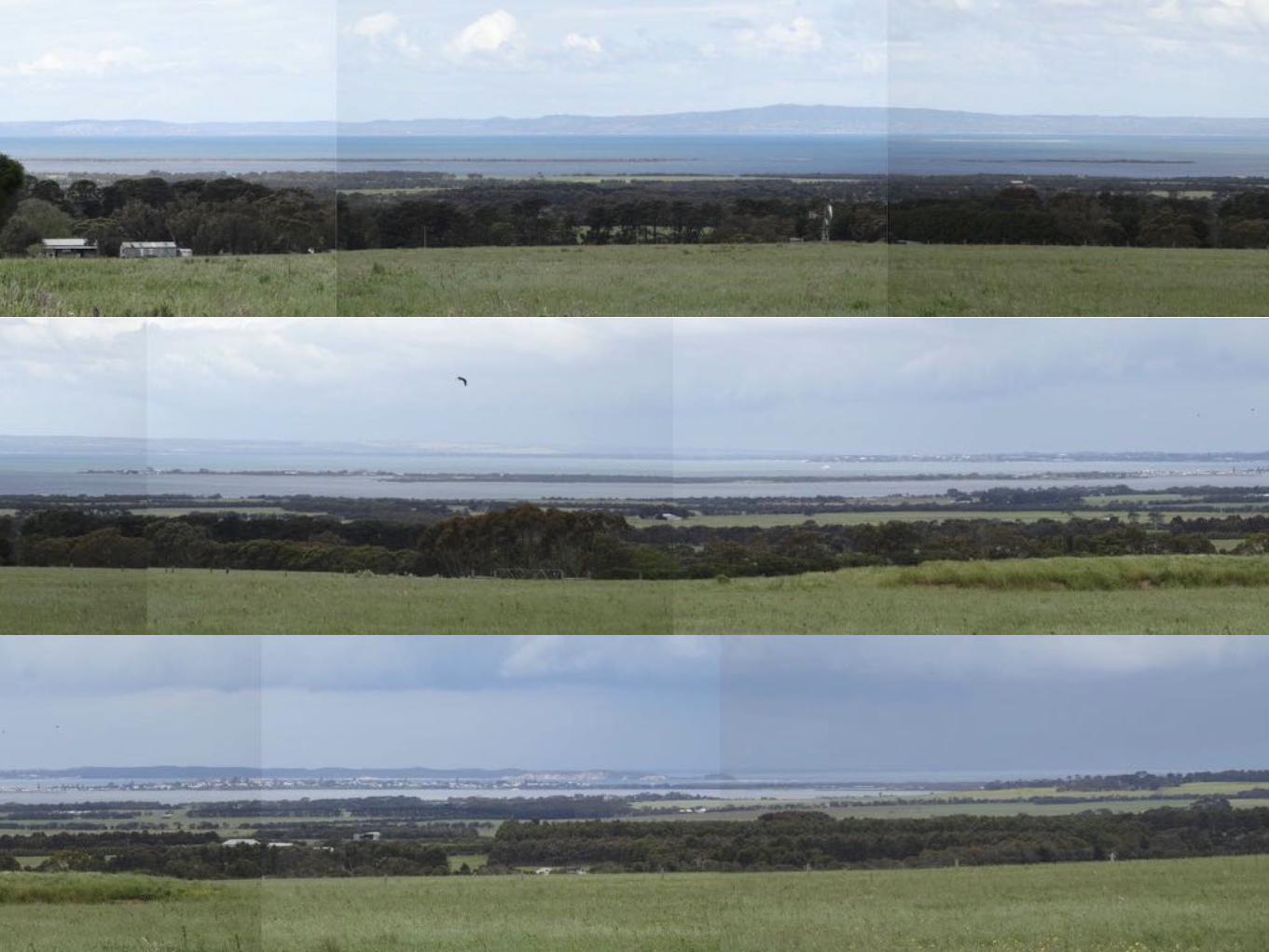
First morning of October visit climbed well-grassed
dredge spoil heap in St. Leonards Lake Reserve
adjacent to caravan park and took third pic on high
zoom thru gap in trees …
A few of the ascending layers of birds utilising updraft above the 20 metre ridge at the back of St. Leonards, a
significant resource on the flyway in the right conditions.
https://www.facebook.com/ynotds/videos/vb.725067880/10154088437682881/?type=2&theater
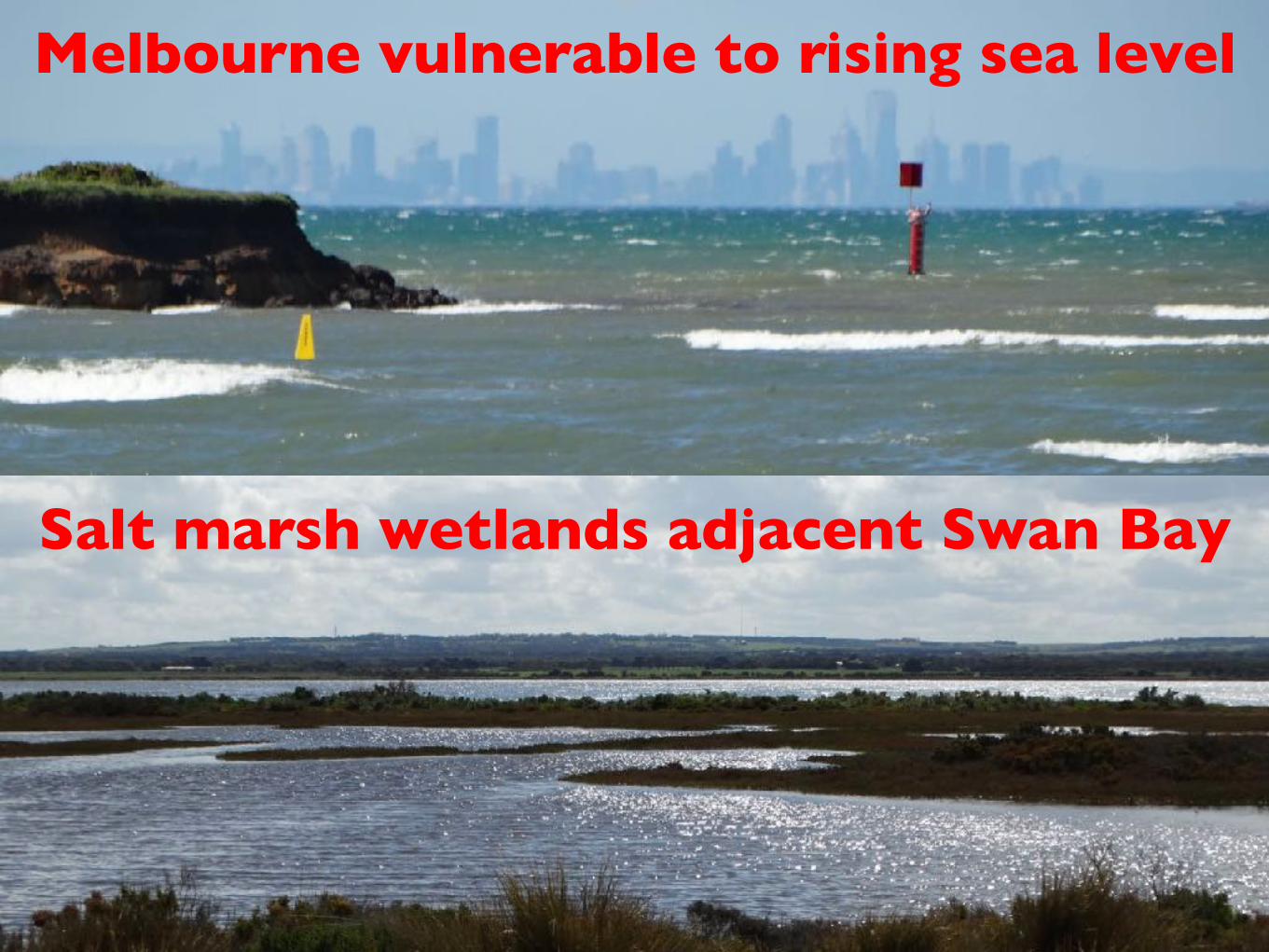
Melbourne vulnerable to rising sea level
Salt marsh wetlands adjacent Swan Bay

Now newly familiar with Ruddy Turnstones
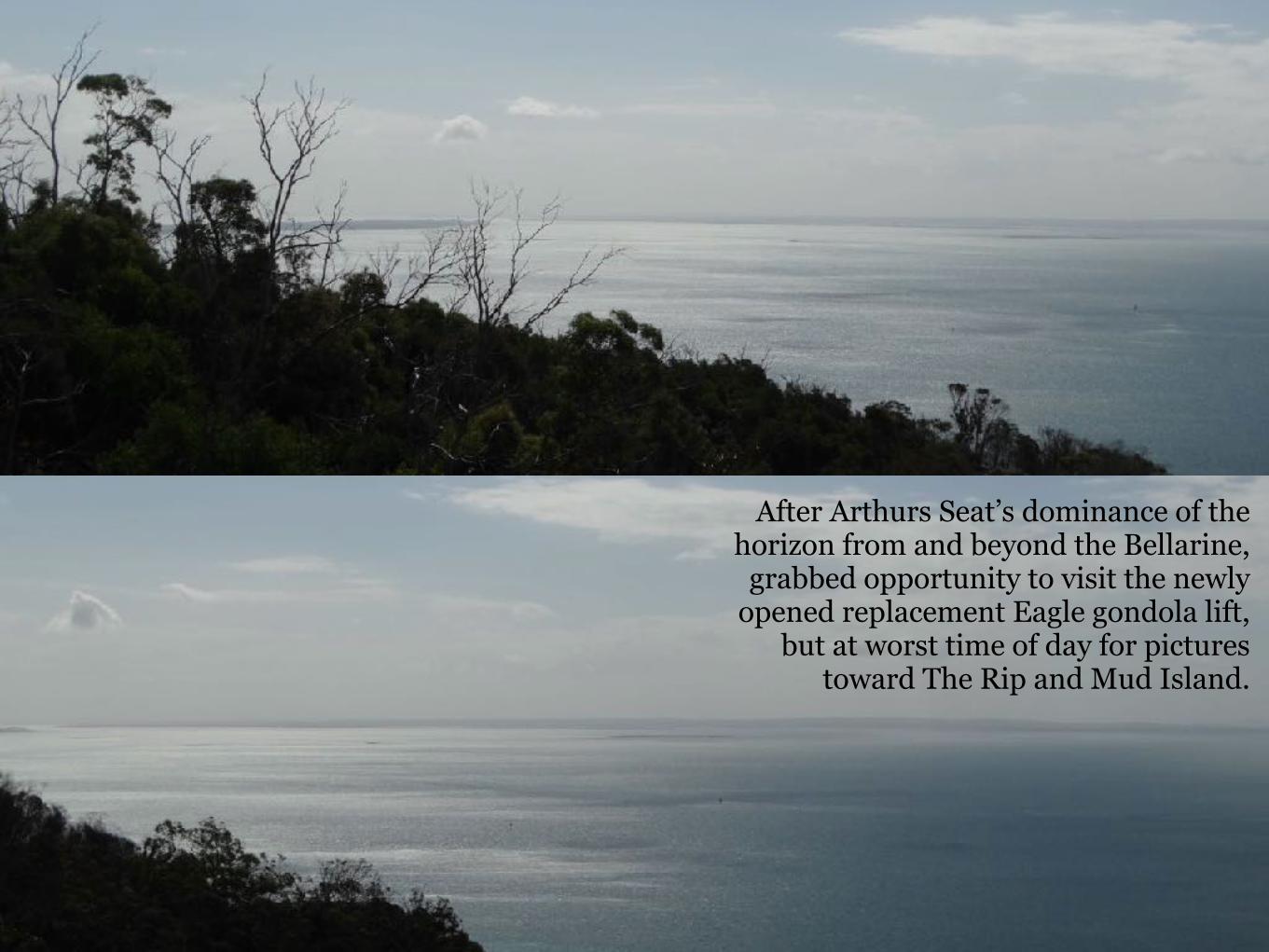
After Arthurs Seat’s dominance of the horizon from and beyond the Bellarine,
grabbed opportunity to visit the newly opened replacement Eagle gondola lift,
but at worst time of day for pictures toward The Rip and Mud Island.
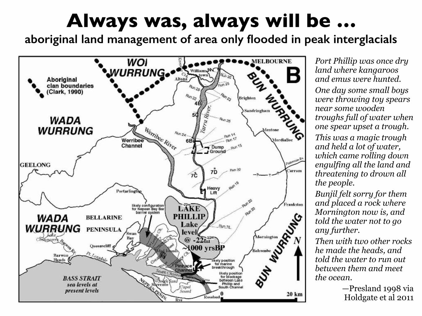
Always was, always will be …aboriginal land management of area only flooded in peak interglacials
Port Phillip was once dry land where kangaroos and emus were hunted. One day some small boys were throwing toy spears near some wooden troughs full of water when one spear upset a trough. This was a magic trough and held a lot of water, which came rolling down engulfing all the land and threatening to drown all the people. Bunjil felt sorry for them and placed a rock where Mornington now is, and told the water not to go any further. Then with two other rocks he made the heads, and told the water to run out between them and meet the ocean.
—Presland 1998 via Holdgate et al 2011
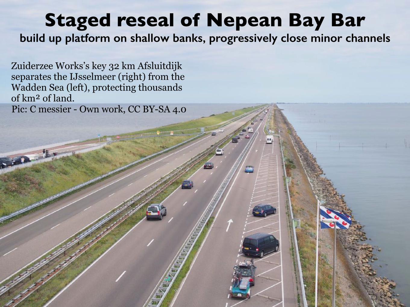
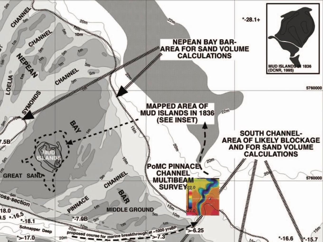
Staged reseal of Nepean Bay Barbuild up platform on shallow banks, progressively close minor channels
Zuiderzee Works’s key 32 km Afsluitdijk separates the IJsselmeer (right) from the Wadden Sea (left), protecting thousands of km² of land. Pic: C messier - Own work, CC BY-SA 4.0
Maintaining port capacityinitially locks on main channel(s), new Bay South port opposite Portsea
Many believe the recent channel deepening increased foreshore erosion in Port Phillip, downplaying coincident sea level rise. Is it possible that early closure of all but a couple of the tidal/shipping channels cutting Nepean Bay Bar might reduce erosion further north? What water level target north of the closed barrier would best facilitate lock access to port infrastructure with buffering to what outer sea level? Salinity management will be a challenge, especially if avoiding over dependence on pumping. May revive industrial salt production. The much reduced tidal bay needed to maintain a floating port across South Channel from Portsea will follow Bass Strait tides with reduced flow speeds through The Rip and potential silting of the deep channel. As data on actual rates and sources of sea level change is matched to models, safe target design allowances should narrow considerably. Despite better access to transport infrastructure, development of a new Bay West port is unlikely to be a long term proposition.

Predeploy transport capacityfreight & passenger road & rail via Drysdale & Mornington Peninsula
Originally found Holdgate et al 2011 paper searching for a way to link Mornington and Bellarine peninsulas without compromising tidally-scoured deep gutter through The Rip Restored Nepean Bay Bar will not just be a barrier against rising sea level It must carry vital transport links connecting logical growth areas It must be planned to also transport Bay South port freight Suggestions are around about SkyRail to restore the Queenscliff line as far as Drysdale which is central to the Bellarine Robert Whitehill has developed plans for long overdue return of rail to the Mornington Peninsula as far as Rye Each end demands planning reservations for sufficient capacity through and beyond both Geelong and Frankston-Dandenong Essential first steps at each end need to be prioritised
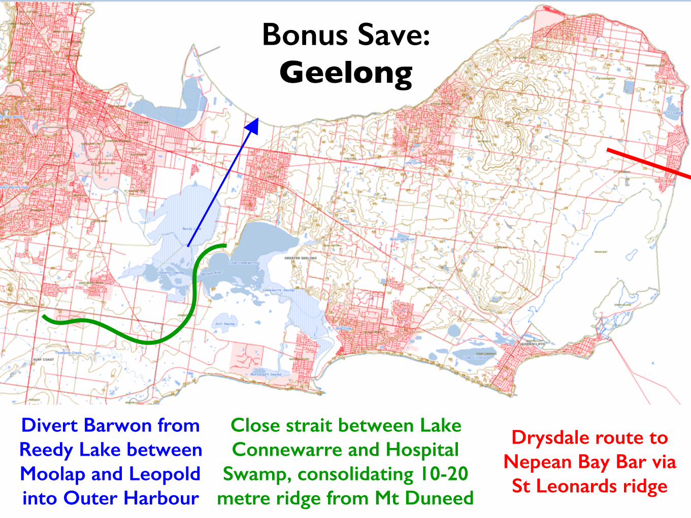
Bonus Save: Geelong
Divert Barwon from Reedy Lake between Moolap and Leopold into Outer Harbour
Close strait between Lake Connewarre and Hospital
Swamp, consolidating 10-20 metre ridge from Mt Duneed
Drysdale route to Nepean Bay Bar via St Leonards ridge
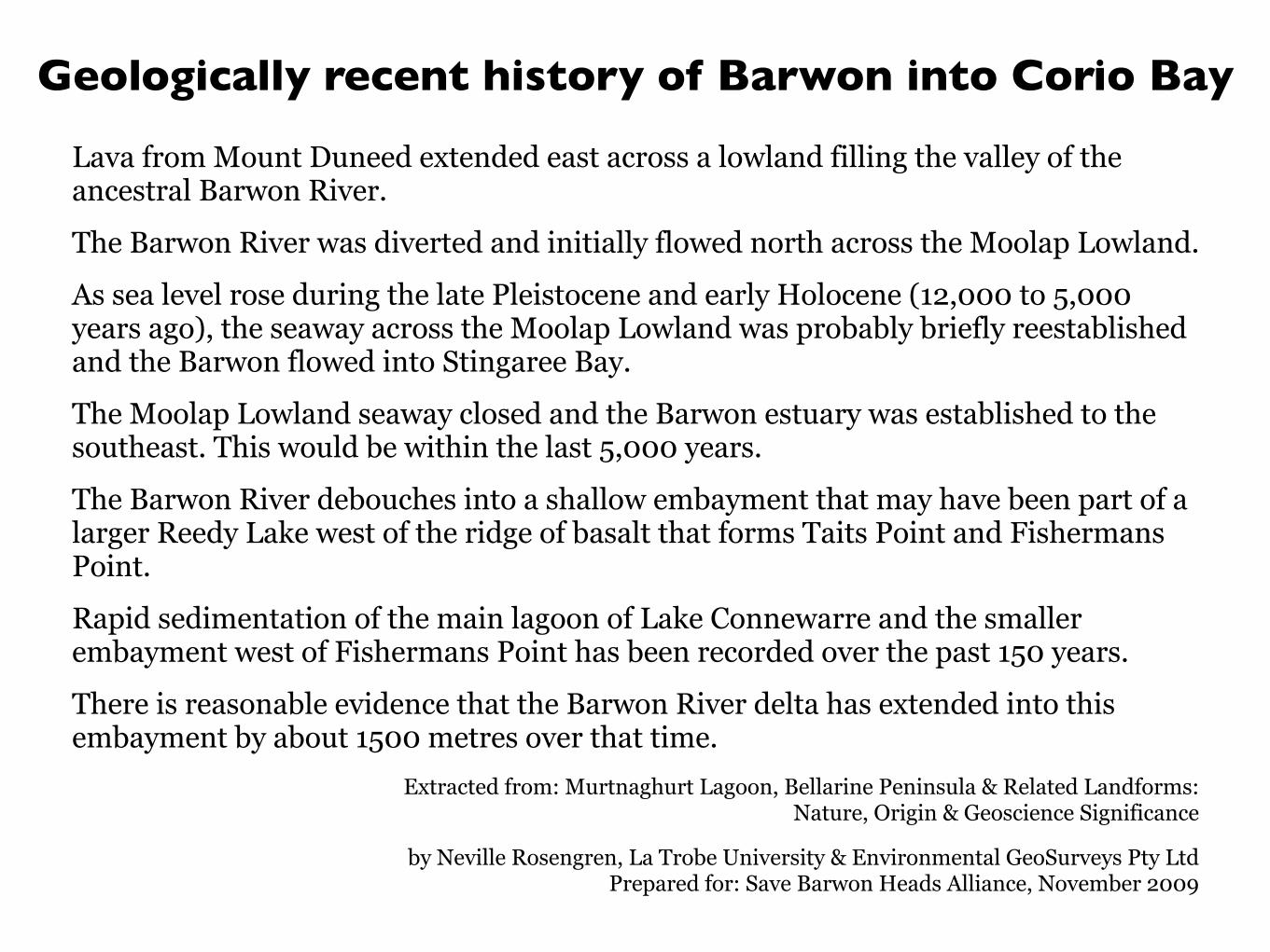
Geologically recent history of Barwon into Corio Bay
Lava from Mount Duneed extended east across a lowland filling the valley of the ancestral Barwon River.
The Barwon River was diverted and initially flowed north across the Moolap Lowland.
As sea level rose during the late Pleistocene and early Holocene (12,000 to 5,000 years ago), the seaway across the Moolap Lowland was probably briefly reestablished and the Barwon flowed into Stingaree Bay.
The Moolap Lowland seaway closed and the Barwon estuary was established to the southeast. This would be within the last 5,000 years.
The Barwon River debouches into a shallow embayment that may have been part of a larger Reedy Lake west of the ridge of basalt that forms Taits Point and Fishermans Point.
Rapid sedimentation of the main lagoon of Lake Connewarre and the smaller embayment west of Fishermans Point has been recorded over the past 150 years.
There is reasonable evidence that the Barwon River delta has extended into this embayment by about 1500 metres over that time.
Extracted from: Murtnaghurt Lagoon, Bellarine Peninsula & Related Landforms: Nature, Origin & Geoscience Significance
by Neville Rosengren, La Trobe University & Environmental GeoSurveys Pty Ltd Prepared for: Save Barwon Heads Alliance, November 2009
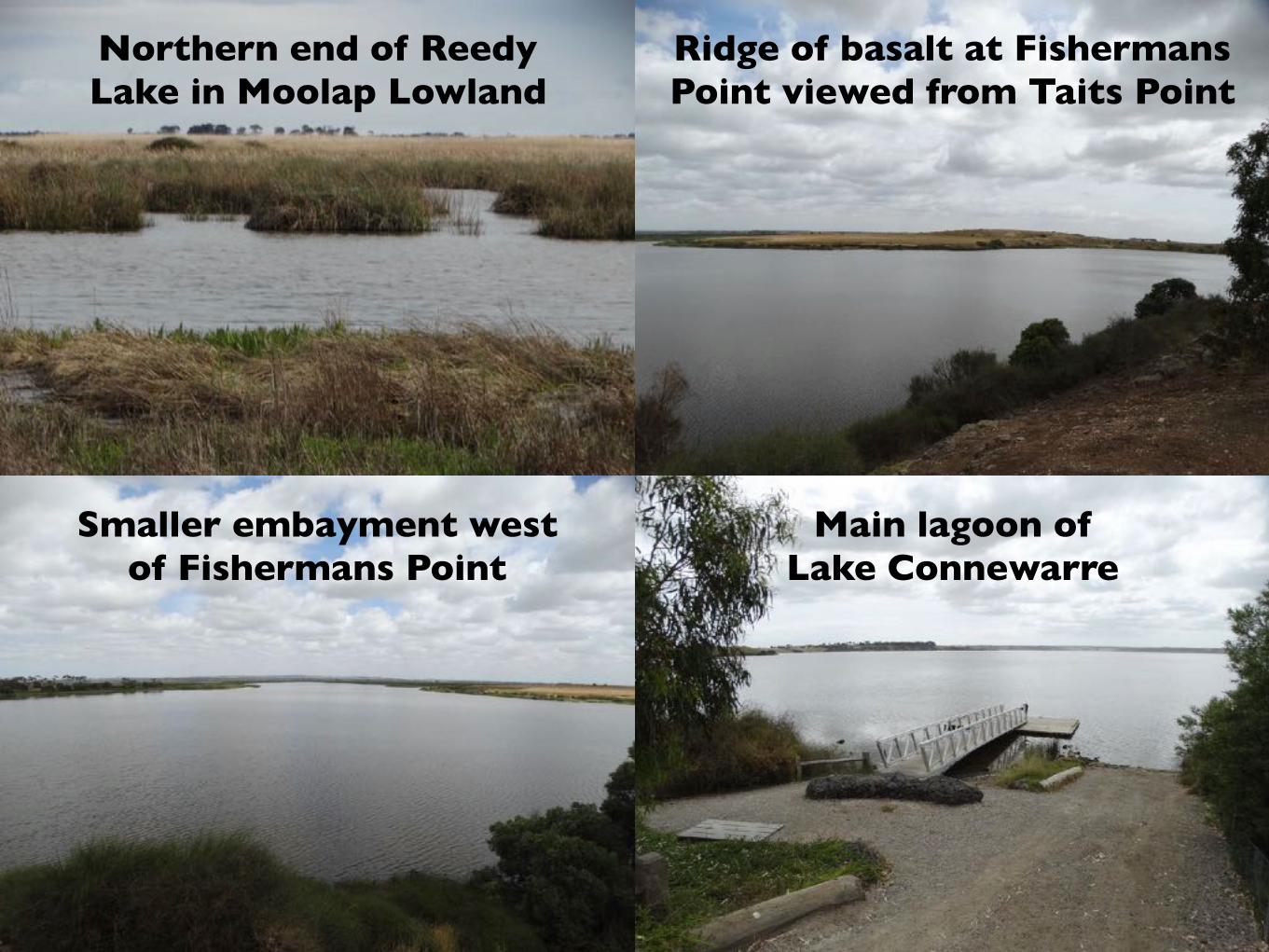
Ridge of basalt at Fishermans Point viewed from Taits Point
Northern end of Reedy Lake in Moolap Lowland
Smaller embayment west of Fishermans Point
Main lagoon of Lake Connewarre
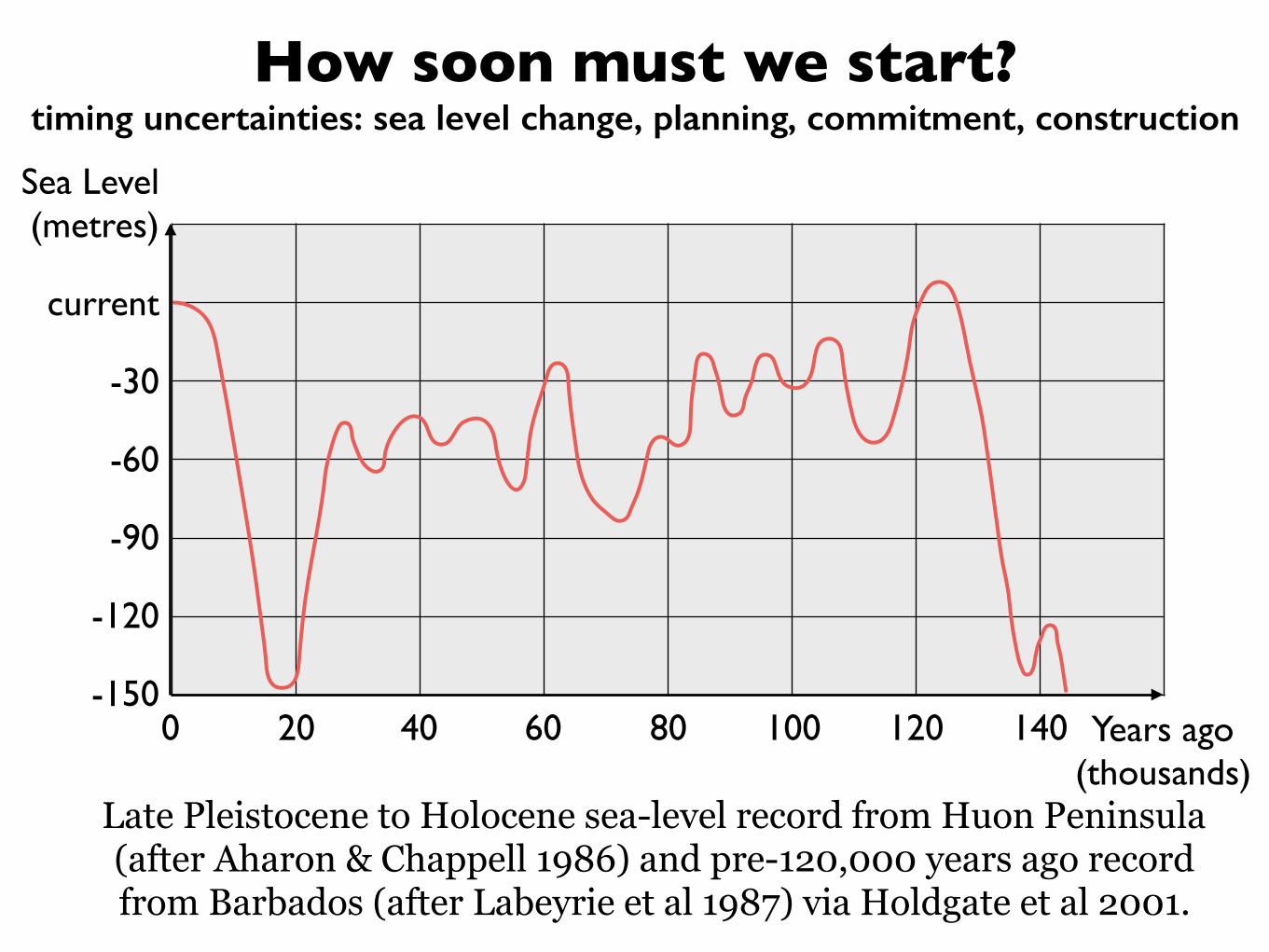
How soon must we start?timing uncertainties: sea level change, planning, commitment, construction
Sea Level (metres)
current
-30
-60
-90
-120
-1500 20 40 60 80 100 120 140 Years ago
(thousands)Late Pleistocene to Holocene sea-level record from Huon Peninsula (after Aharon & Chappell 1986) and pre-120,000 years ago record from Barbados (after Labeyrie et al 1987) via Holdgate et al 2001.
–David Spratt, 23-25 January 2017, (link to complete article)
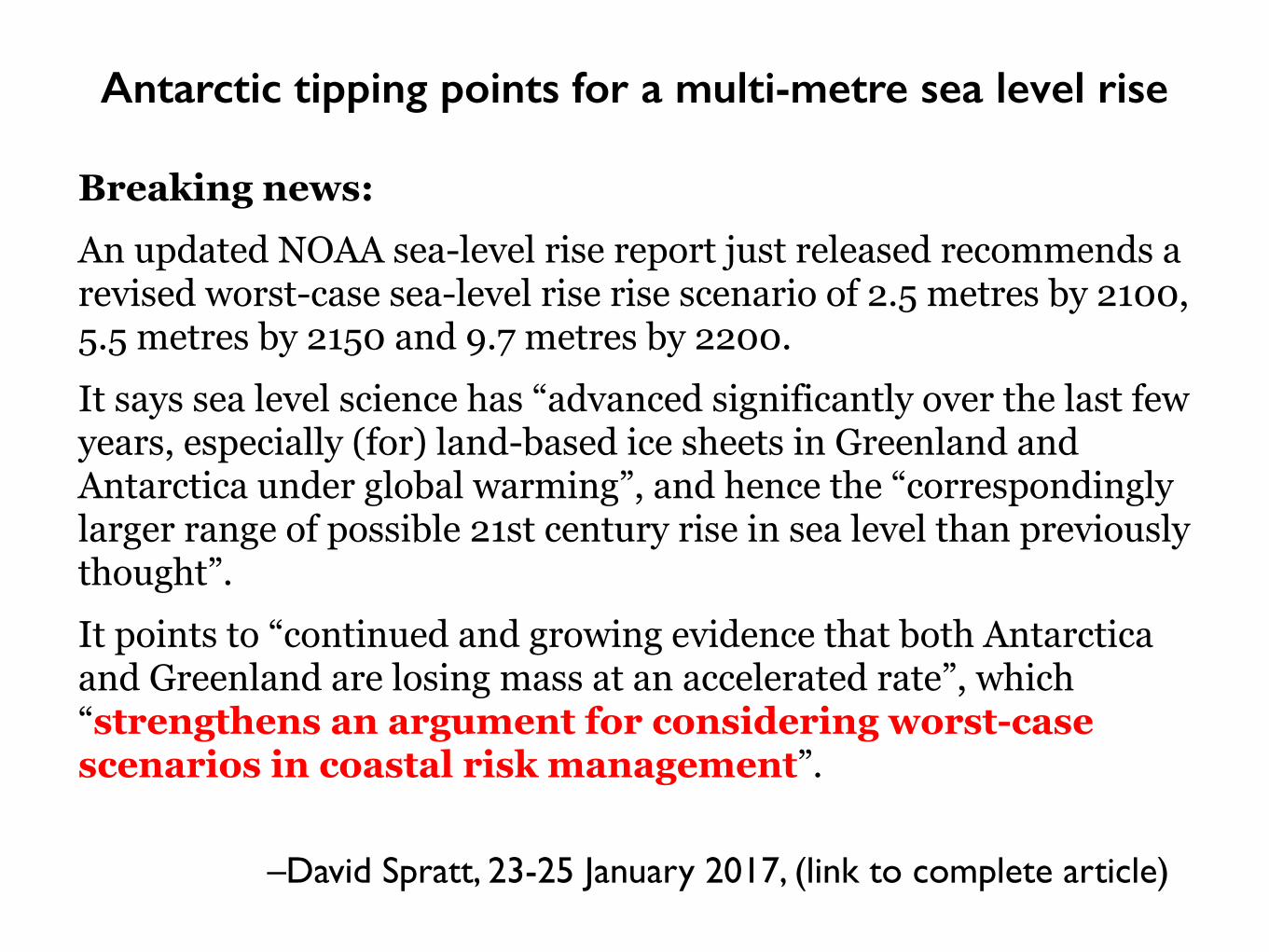
Breaking news: An updated NOAA sea-level rise report just released recommends a revised worst-case sea-level rise rise scenario of 2.5 metres by 2100, 5.5 metres by 2150 and 9.7 metres by 2200. It says sea level science has “advanced significantly over the last few years, especially (for) land-based ice sheets in Greenland and Antarctica under global warming”, and hence the “correspondingly larger range of possible 21st century rise in sea level than previously thought”. It points to “continued and growing evidence that both Antarctica and Greenland are losing mass at an accelerated rate”, which “strengthens an argument for considering worst-case scenarios in coastal risk management”.
Antarctic tipping points for a multi-metre sea level rise
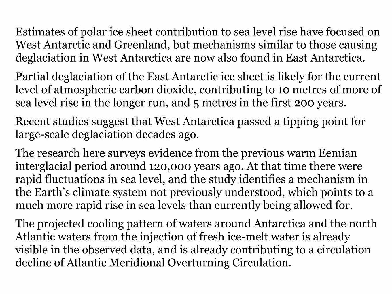
Estimates of polar ice sheet contribution to sea level rise have focused on West Antarctic and Greenland, but mechanisms similar to those causing deglaciation in West Antarctica are now also found in East Antarctica. Partial deglaciation of the East Antarctic ice sheet is likely for the current level of atmospheric carbon dioxide, contributing to 10 metres of more of sea level rise in the longer run, and 5 metres in the first 200 years. Recent studies suggest that West Antarctica passed a tipping point for large-scale deglaciation decades ago. The research here surveys evidence from the previous warm Eemian interglacial period around 120,000 years ago. At that time there were rapid fluctuations in sea level, and the study identifies a mechanism in the Earth’s climate system not previously understood, which points to a much more rapid rise in sea levels than currently being allowed for. The projected cooling pattern of waters around Antarctica and the north Atlantic waters from the injection of fresh ice-melt water is already visible in the observed data, and is already contributing to a circulation decline of Atlantic Meridional Overturning Circulation.
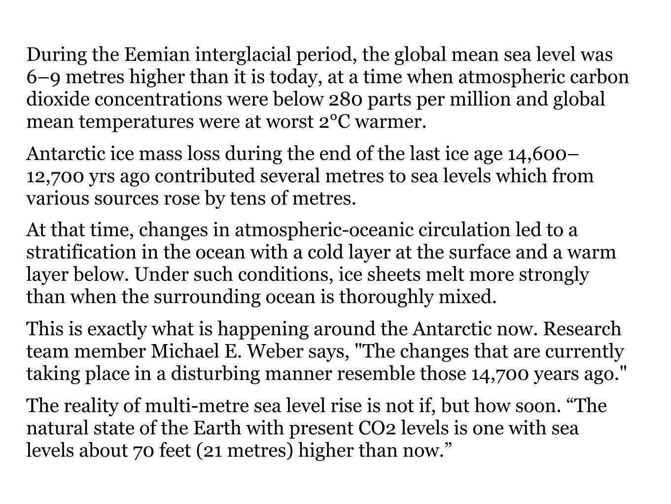
During the Eemian interglacial period, the global mean sea level was 6–9 metres higher than it is today, at a time when atmospheric carbon dioxide concentrations were below 280 parts per million and global mean temperatures were at worst 2°C warmer. Antarctic ice mass loss during the end of the last ice age 14,600–12,700 yrs ago contributed several metres to sea levels which from various sources rose by tens of metres. At that time, changes in atmospheric-oceanic circulation led to a stratification in the ocean with a cold layer at the surface and a warm layer below. Under such conditions, ice sheets melt more strongly than when the surrounding ocean is thoroughly mixed. This is exactly what is happening around the Antarctic now. Research team member Michael E. Weber says, "The changes that are currently taking place in a disturbing manner resemble those 14,700 years ago." The reality of multi-metre sea level rise is not if, but how soon. “The natural state of the Earth with present CO2 levels is one with sea levels about 70 feet (21 metres) higher than now.”
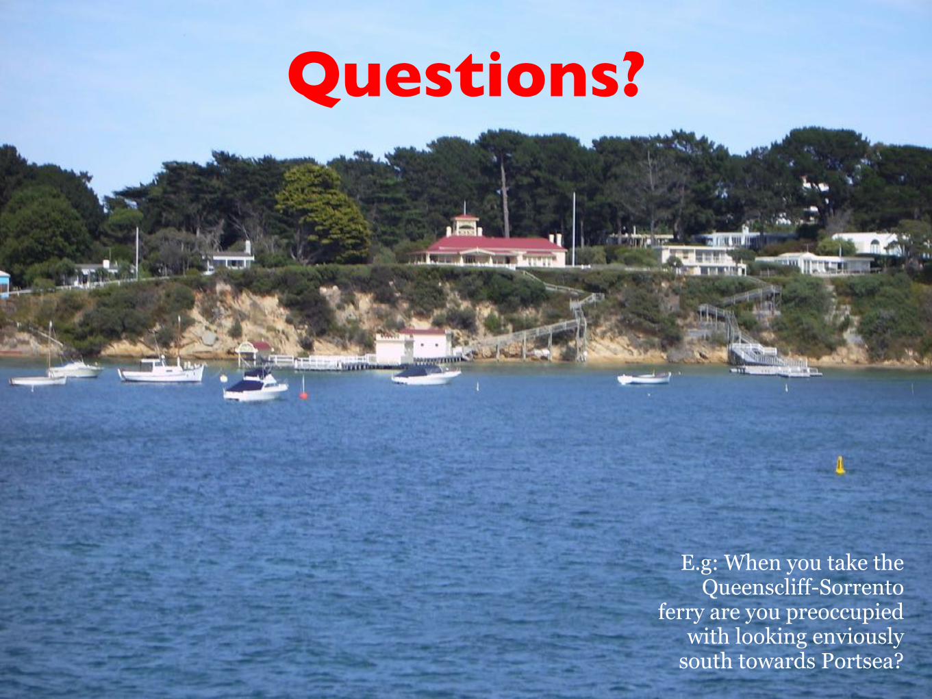
Questions?
E.g: When you take the Queenscliff-Sorrento
ferry are you preoccupied with looking enviously
south towards Portsea?