Embed Size (px)
Citation preview
Lorenzino [email protected]
GHA Live – 11/03/2015 Joint Research Centre – European Commission
1
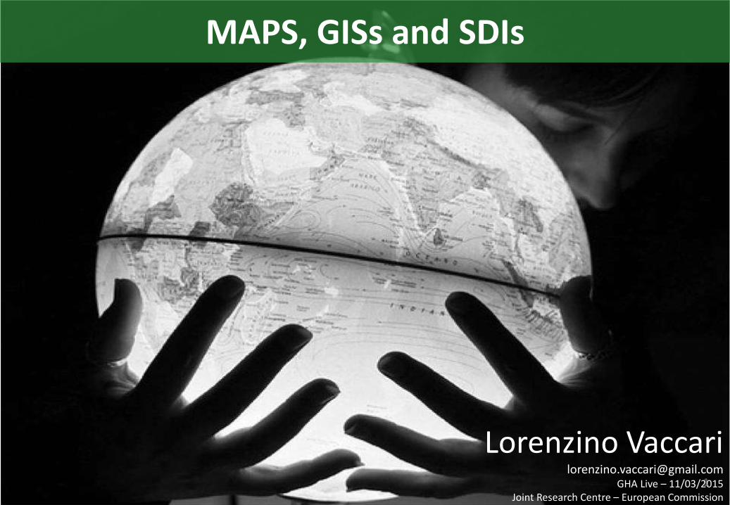
MAPS, GISs and SDIs
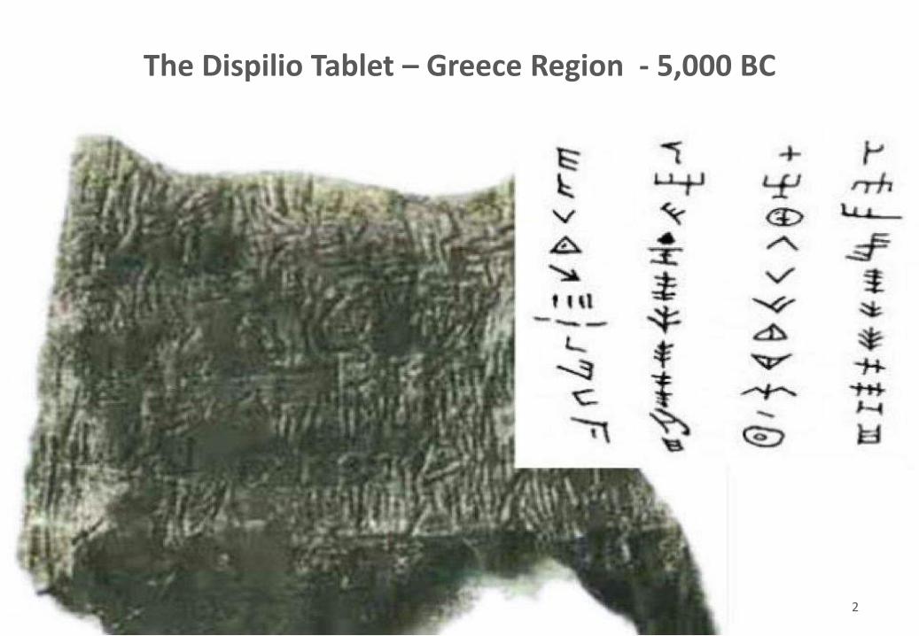
The Dispilio Tablet – Greece Region - 5,000 BC
2
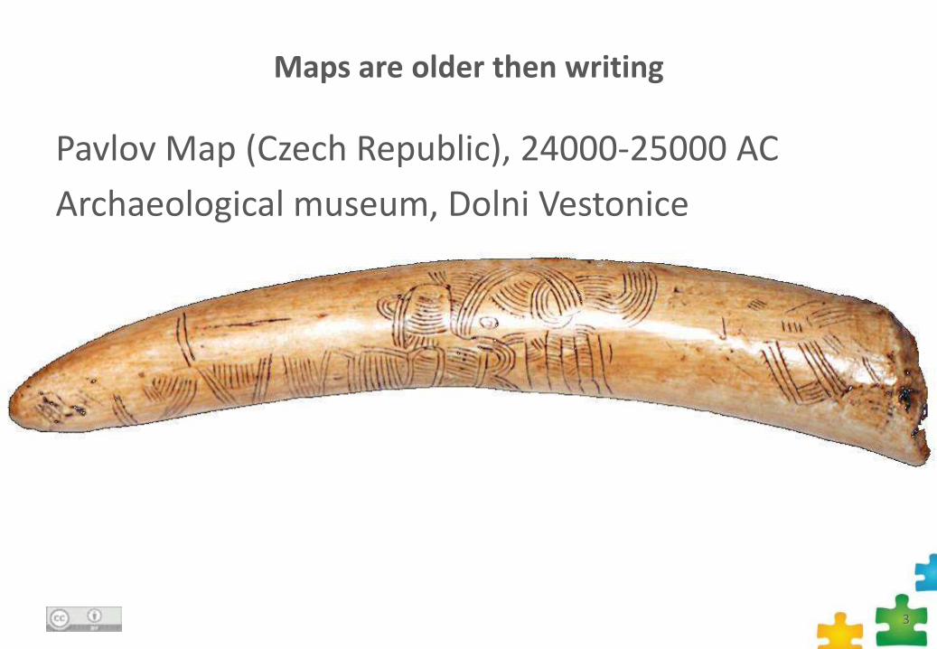
Maps are older then writing
Pavlov Map (Czech Republic), 24000-25000 AC
Archaeological museum, Dolni Vestonice
3
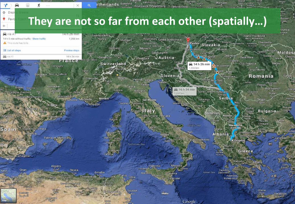
They are not so far from each other (spatially…)
4
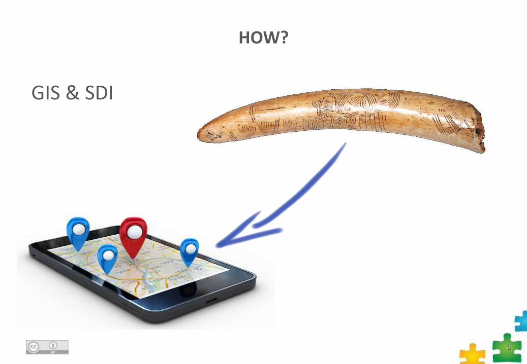
HOW?
GIS & SDI
5
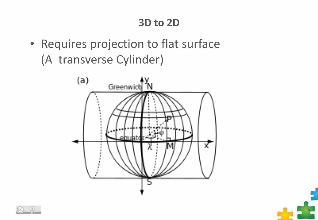
3D to 2D
• Requires projection to flat surface (A transverse Cylinder)
6
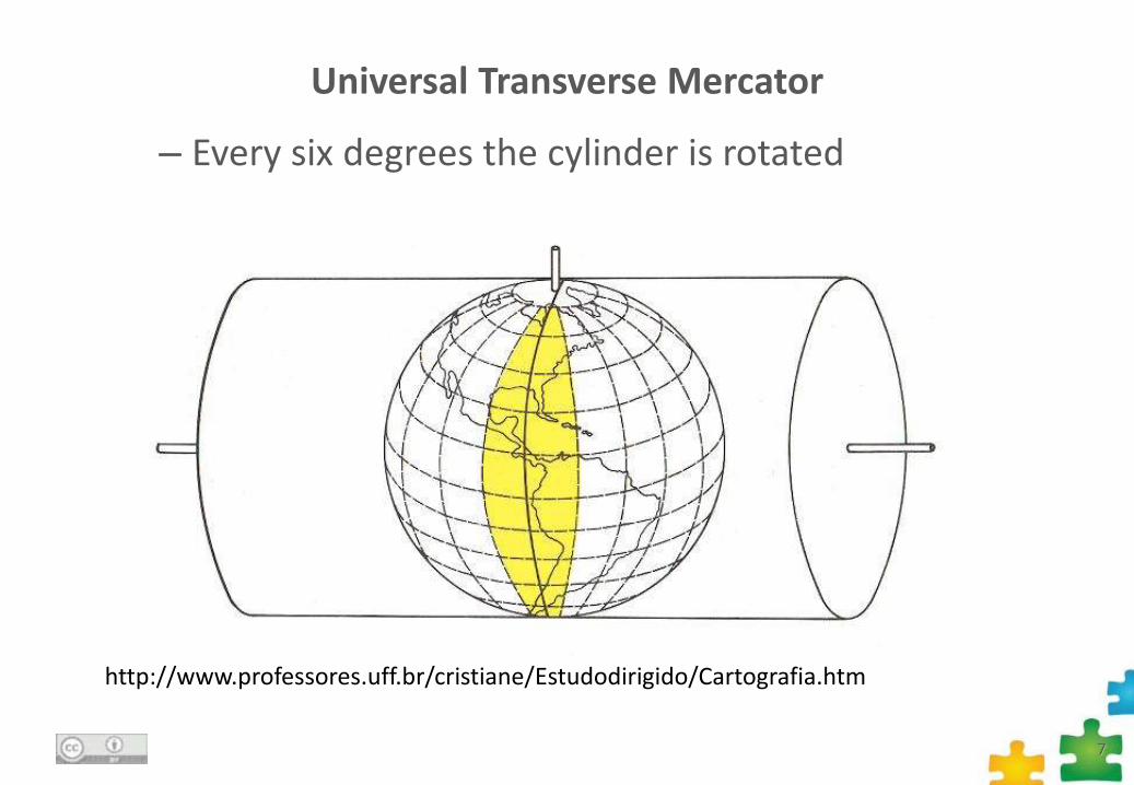
Universal Transverse Mercator
– Every six degrees the cylinder is rotated
7
http://www.professores.uff.br/cristiane/Estudodirigido/Cartografia.htm
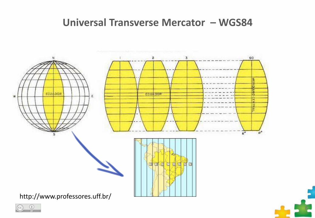
Universal Transverse Mercator – WGS84
8
http://www.professores.uff.br/
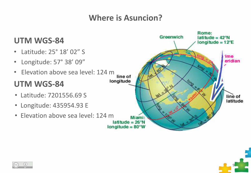
Where is Asuncion?
9
UTM WGS-84• Latitude: 25° 18’ 02” S
• Longitude: 57° 38’ 09”
• Elevation above sea level: 124 m
UTM WGS-84• Latitude: 7201556.69 S
• Longitude: 435954.93 E
• Elevation above sea level: 124 m
What is a Geographic Information System?
10http://www.jacksoncountygov.com/Modules/ShowImage.aspx?imageid=401
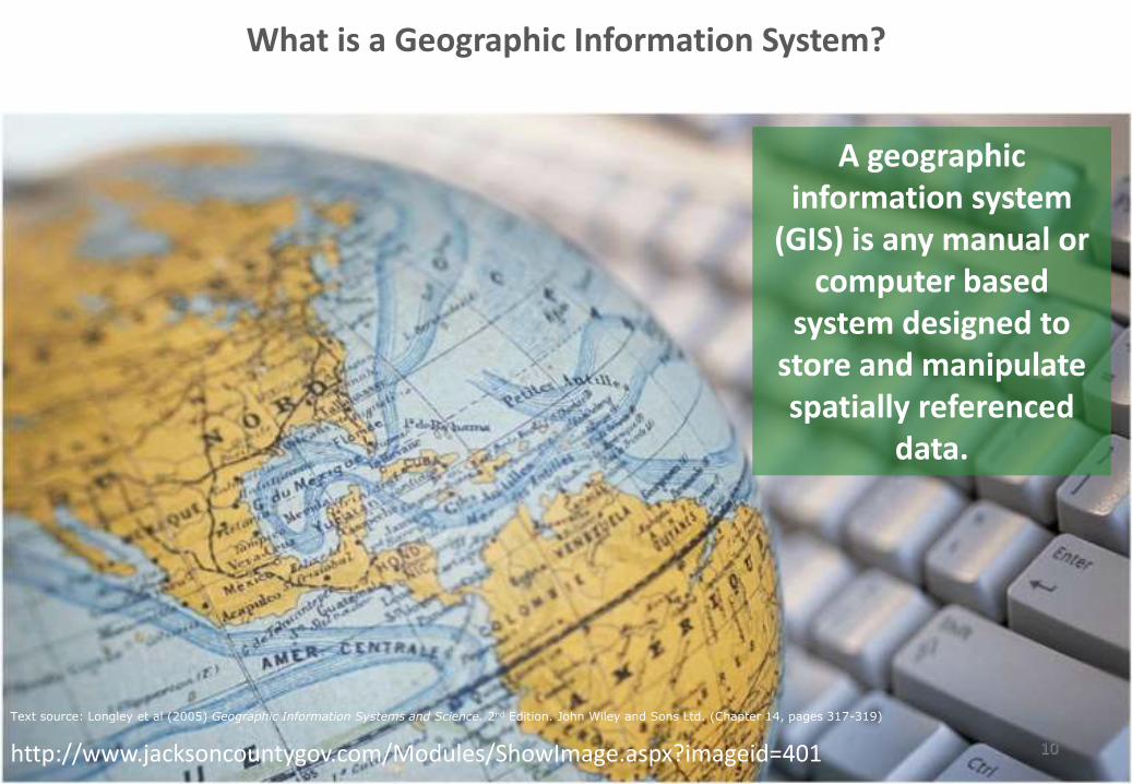
A geographic information system
(GIS) is any manual or computer based
system designed to store and manipulate spatially referenced
data.
Text source: Longley et al (2005) Geographic Information Systems and Science. 2nd Edition. John Wiley and Sons Ltd. (Chapter 14, pages 317-319)

GIS in your everyday life
11
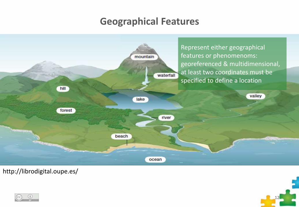
Geographical Features
12
http://librodigital.oupe.es/
Represent either geographical features or phenomenoms: georeferenced & multidimensional, at least two coordinates must be specified to define a location
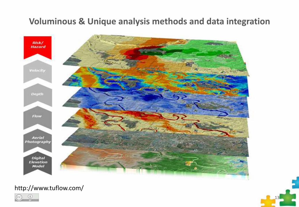
Voluminous & Unique analysis methods and data integration
13
http://www.tuflow.com/
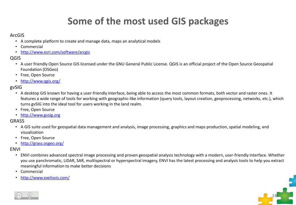
Some of the most used GIS packages
14
ArcGIS• A complete platform to create and manage data, maps an analytical models• Commercial• http://www.esri.com/software/arcgis
QGIS• A user friendly Open Source GIS licensed under the GNU General Public License. QGIS is an official project of the Open Source Geospatial
Foundation (OSGeo)• Free, Open Source
• http://www.qgis.org/
gvSIG• A desktop GIS known for having a user-friendly interface, being able to access the most common formats, both vector and raster ones. It
features a wide range of tools for working with geographic-like information (query tools, layout creation, geoprocessing, networks, etc.), which turns gvSIG into the ideal tool for users working in the land realm.
• Free, Open Source• http://www.gvsig.org
GRASS• A GIS suite used for geospatial data management and analysis, image processing, graphics and maps production, spatial modeling, and
visualization• Free, Open Source• http://grass.osgeo.org/
ENVI• ENVI combines advanced spectral image processing and proven geospatial analysis technology with a modern, user-friendly interface. Whether
you use panchromatic, LiDAR, SAR, multispectral or hyperspectral imagery, ENVI has the latest processing and analysis tools to help you extractmeaningful information to make better decisions
• Commercial
• http://www.exelisvis.com/
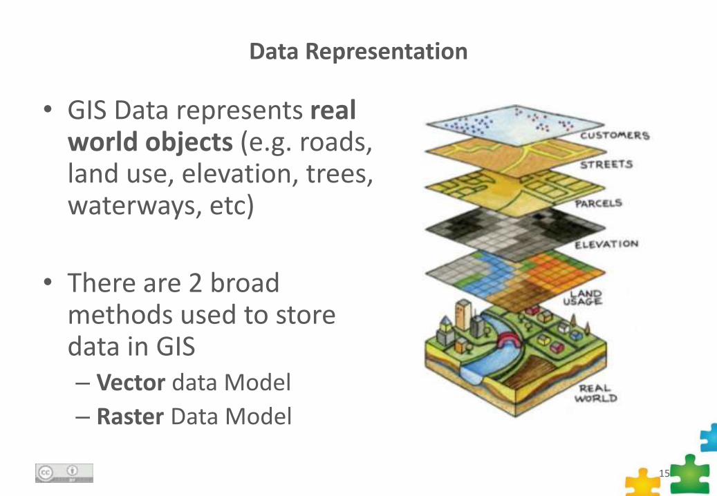
Data Representation
• GIS Data represents real world objects (e.g. roads, land use, elevation, trees, waterways, etc)
• There are 2 broad methods used to store data in GIS– Vector data Model
– Raster Data Model
15
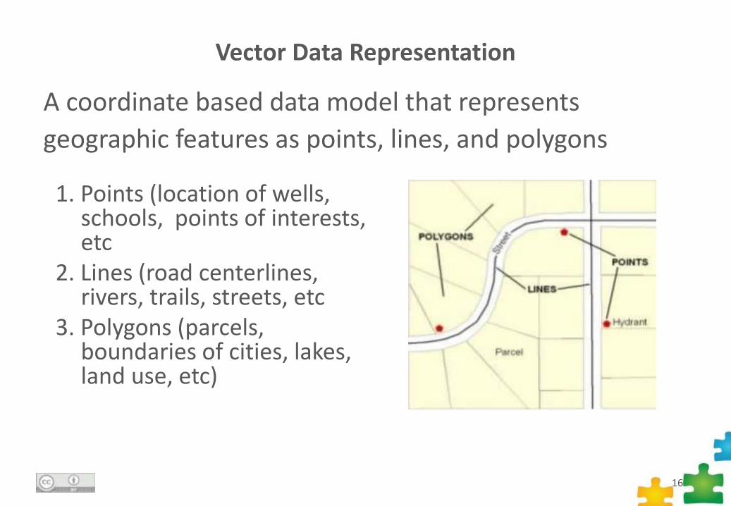
Vector Data Representation
A coordinate based data model that represents
geographic features as points, lines, and polygons
16
1. Points (location of wells, schools, points of interests, etc
2. Lines (road centerlines, rivers, trails, streets, etc
3. Polygons (parcels, boundaries of cities, lakes, land use, etc)
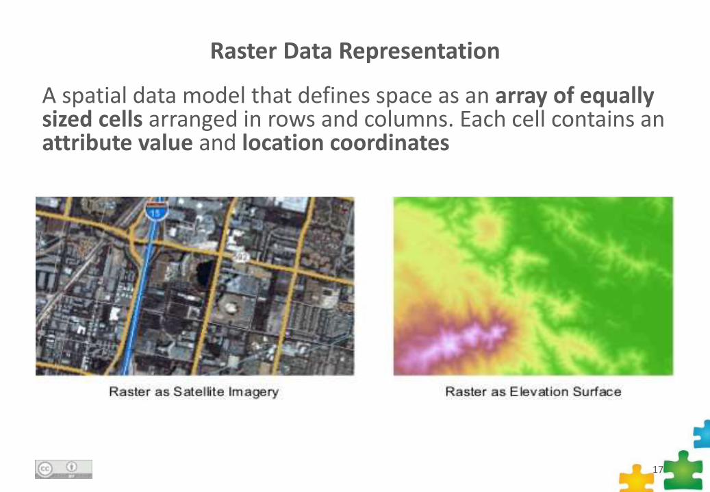
Raster Data Representation
A spatial data model that defines space as an array of equally sized cells arranged in rows and columns. Each cell contains an attribute value and location coordinates
17
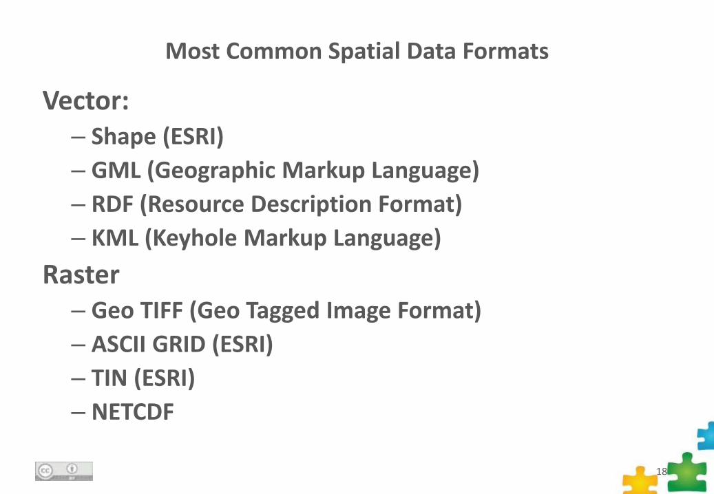
Most Common Spatial Data Formats
Vector:– Shape (ESRI)
– GML (Geographic Markup Language)
– RDF (Resource Description Format)
– KML (Keyhole Markup Language)
Raster– Geo TIFF (Geo Tagged Image Format)
– ASCII GRID (ESRI)
– TIN (ESRI)
– NETCDF
18
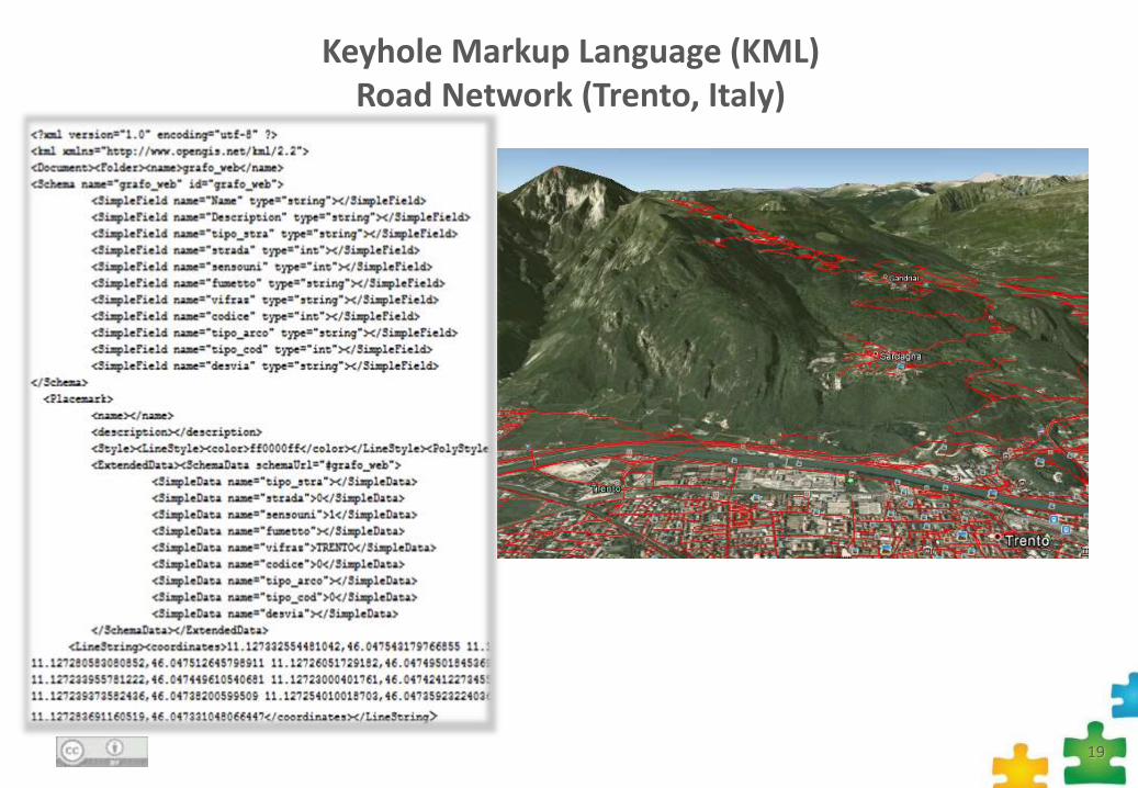
Keyhole Markup Language (KML)Road Network (Trento, Italy)
19
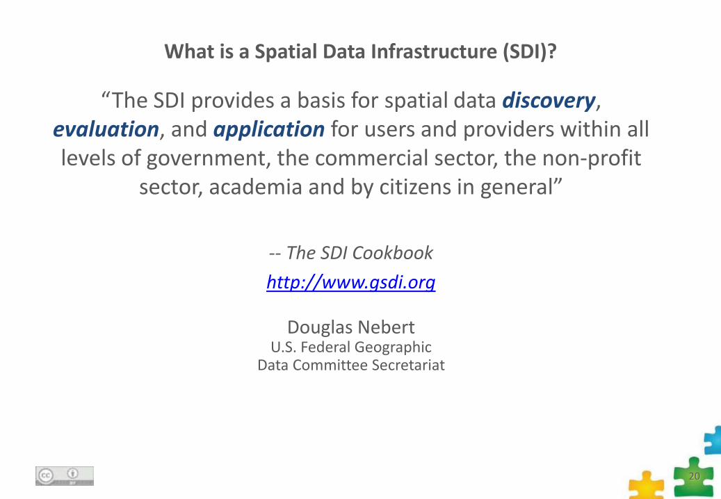
“The SDI provides a basis for spatial data discovery,evaluation, and application for users and providers within all levels of government, the commercial sector, the non-profit
sector, academia and by citizens in general”
-- The SDI Cookbook
http://www.gsdi.org
Douglas NebertU.S. Federal Geographic
Data Committee Secretariat
What is a Spatial Data Infrastructure (SDI)?
20
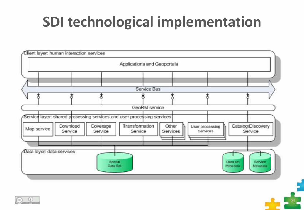
SDI technological implementation
21
INSPIRE Directive
What it is about …
22
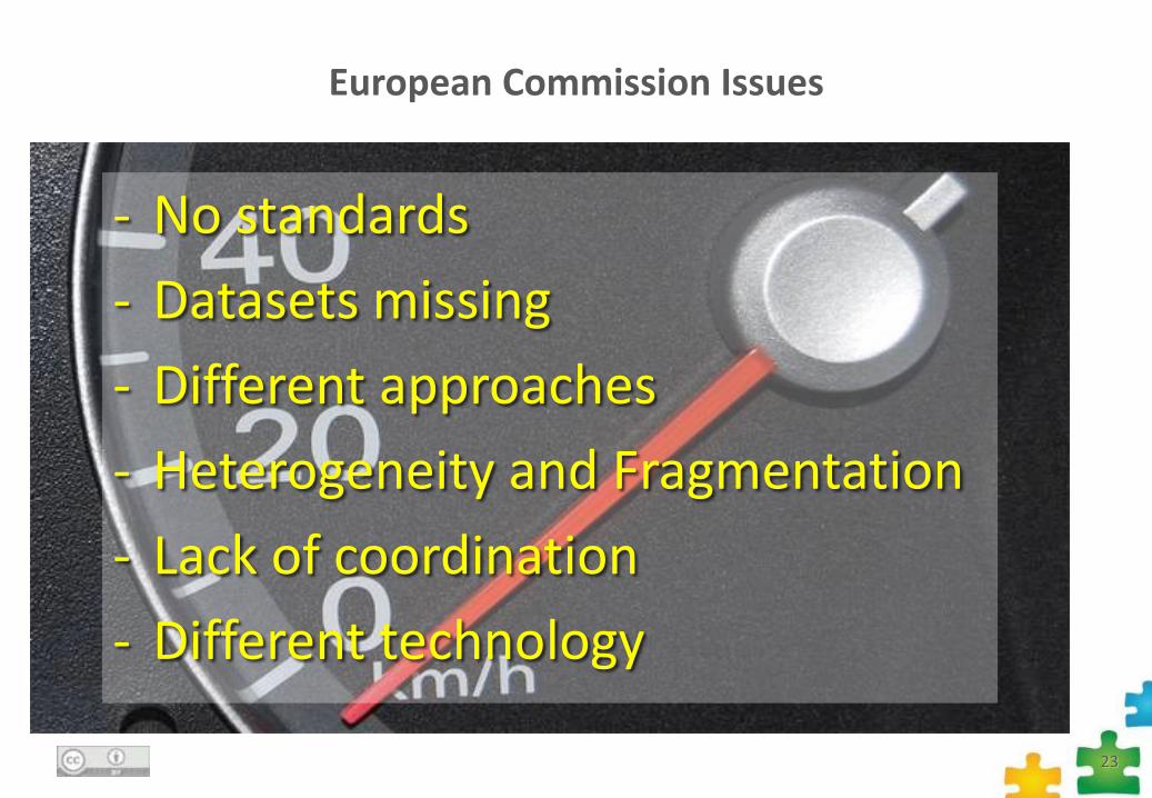
European Commission Issues
- No standards
- Datasets missing
- Different approaches
- Heterogeneity and Fragmentation
- Lack of coordination
- Different technology
23
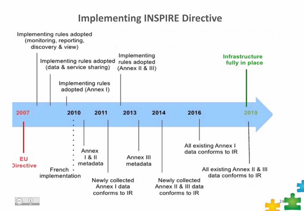
Implementing INSPIRE Directive
24
~
25
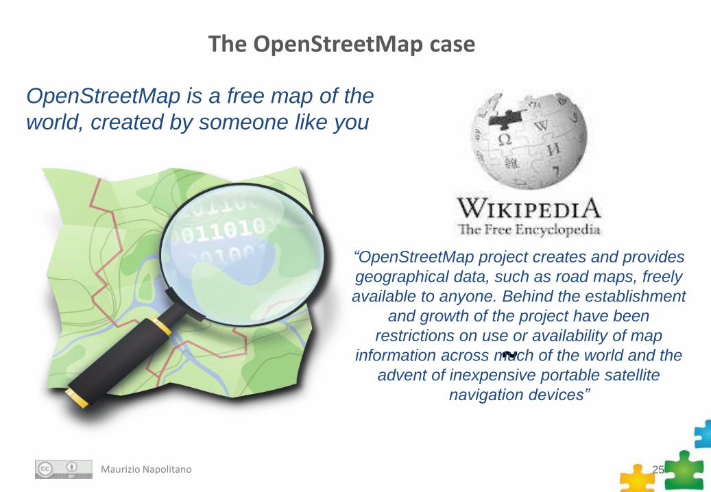
The OpenStreetMap case
Maurizio Napolitano
OpenStreetMap is a free map of the
world, created by someone like you
“OpenStreetMap project creates and provides
geographical data, such as road maps, freely
available to anyone. Behind the establishment
and growth of the project have been
restrictions on use or availability of map
information across much of the world and the
advent of inexpensive portable satellite
navigation devices”
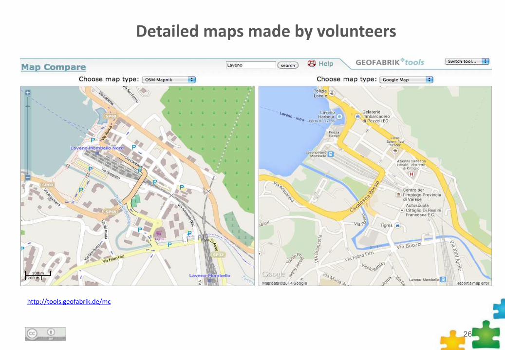
http://tools.geofabrik.de/mc
26
Detailed maps made by volunteers
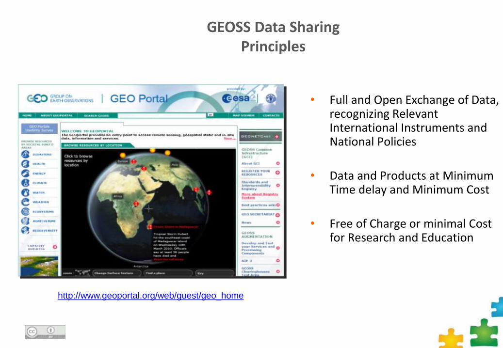
GEOSS Data Sharing Principles
• Full and Open Exchange of Data, recognizing Relevant International Instruments and National Policies
• Data and Products at Minimum Time delay and Minimum Cost
• Free of Charge or minimal Cost for Research and Education
http://www.geoportal.org/web/guest/geo_home
Thanks!!!!!
Lorenzino [email protected]
Juan [email protected]
28
Credits of the images:Maurizio Napolitano: http://www.youtube.com/watch?v=YlkjrVAW43Q
http://tigosms.net/Sms-Tigo-Paraguay.png
http://www.marketscape.com/wp-content/uploads/2013/05/lego.jpg
http://2.bp.blogspot.com/_i2j6iMAVrqc/S8vOtsBeC7I/AAAAAAAAAng/RxI_4gVRKOg/s1600/TallestLEGOTower.jpg
http://cdn3.dogomedia.com/pictures/2036/content/legotower2.jpg?1285696406
http://www.geeknaut.com/images/2011/10/weather-icon.jpg
http://a5.mzstatic.com/us/r30/Purple/v4/78/14/18/7814183e-b625-7d5f-018f-65c2206a52b4/icon_256.png
http://a1.mzstatic.com/eu/r30/Purple6/v4/db/53/ac/db53ac53-dc56-2753-cfad-57fa00acb69b/icon_256.png
http://dailyappshow.s3.amazonaws.com/wp-content/uploads/2013/09/icon.512x512-758.png
http://www.motormum.com/images/Sat-Nav-Apps/GPS-Navigation-2-Skobbler-Icon.jpg
http://msnbcmedia.msn.com/j/MSNBC/Components/Photo/_new/pb-121007-spain-tarragona-pyramid-nj-02.photoblog900.jpg