Embed Size (px)
Citation preview

Ellis Penning, Henk Steetzel, Robbin van Santen, Jasper Fiselier,
Marieke de Lange, Vincent Vuik, Sonja Ouwerkerk, Jaap van Thiel de
Vries
NATURAL FORESHORES AS AN ALTERNATIVE
TO TRADITIONAL DIKE RE-ENFORECEMENTS:
A FIELD PILOT IN THE LARGE SHALLOW LAKE MARKERMEER,
THE NETHERLANDS

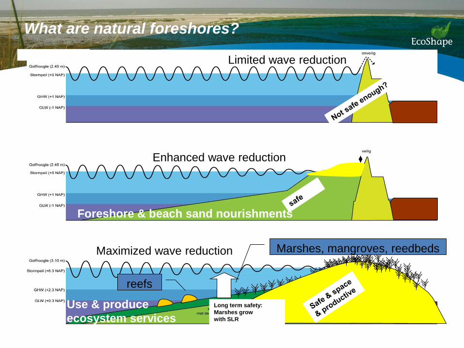
What are natural foreshores?
Long term safety:
Marshes grow
with SLR
reefs
Marshes, mangroves, reedbeds
Foreshore & beach sand nourishments
Use & produce
ecosystem services
Limited wave reduction
Enhanced wave reduction
Maximized wave reduction

What are natural foreshores?
Long term safety:
Marshes grow
with SLR
reefs
Marshes, mangroves, reedbeds
Foreshore & beach sand nourishments
Use & produce
ecosystem services
Limited wave reduction
Enhanced wave reduction
Maximized wave reduction
What are natural foreshores?
Long term safety:
Marshes grow
with SLR
reefs
Marshes, mangroves, reedbeds
Foreshore & beach sand nourishments
Use & produce
ecosystem services
Limited wave reduction
Enhanced wave reduction
Maximized wave reduction

From coastal to inland applications
Markermeer: 700 km2 Fetch: up to 40 km Avg. Depth: 2-4 meters No tides, substantial waves and water level fluctuations due to wind Managed unnatural water level: -0,4 NAP winter -0,2 NAP summer Houtridbijk splits lake Markermeer from lake IJsselmeer Houtribdijk needs maintenance (26 km)

Considerations during design phase Pilot under the National High water protection programme – innovation funds:
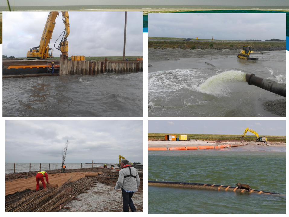
• Only sand nurishments applied from water - cheaper and faster
• Stable slope – steeper is cheaper
• Account for sediment consolidation of the underground
• Can vegetation aid the stability of
the construction during normal
and extreme situations
• Legal requirements

Details design
Section 1 en 4 : sand
Section 2 en 3: top layer mixed with clay
Vak 1 Vak 2 Vak 4 RestvakVak 3
zand
zand
zand
zand
holoceen+zand holoceen + zand
zand
zand

• Each section half planted, half empty
• Willow mats with reeds (section 3 and 4)
• Exclosures to define effect of grazing
Role of vegetation
Section 1 Section 2 Section 4 Section 3
zand
zand
zand
zand


Monitoring
4 years
• Hydrodynamics and meteorology (continuous)
wave- and flow patterns as forcing factor
• Morfodynamics (monthly)
consolidation, erosion/sedimentation due to hydrodynamics and vegetation
• Vegetation development (2x year)
safety and biodiversity

Hs = 0.9 m
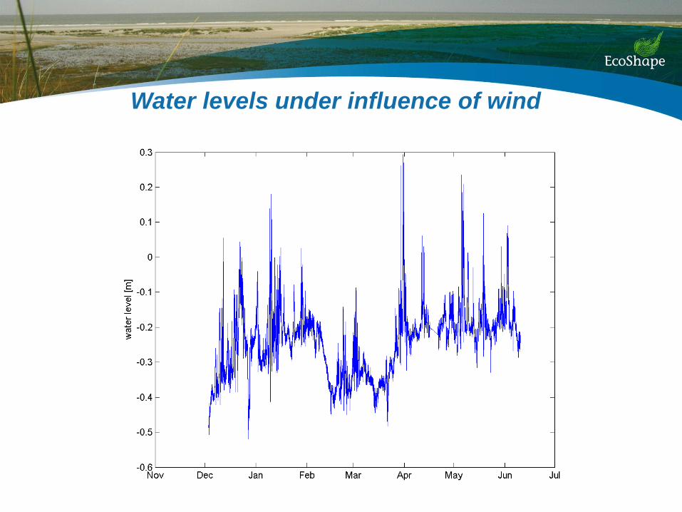
Water levels under influence of wind

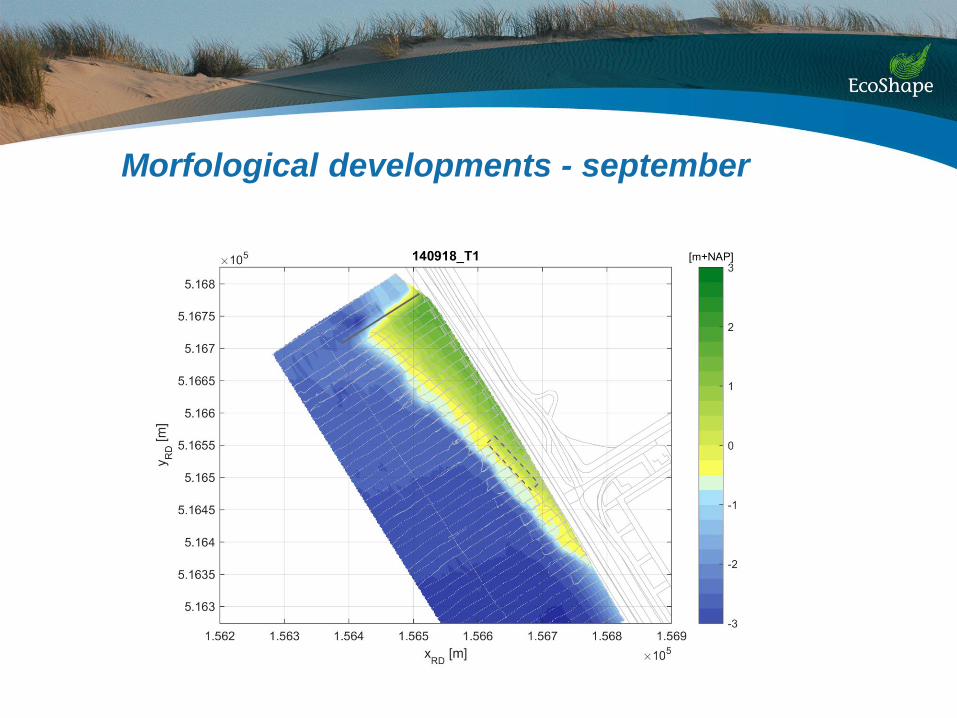
Morfological developments - september

Morfological developments - october

Morfological developments - november

Morfological developments - december

Morfological developments - january
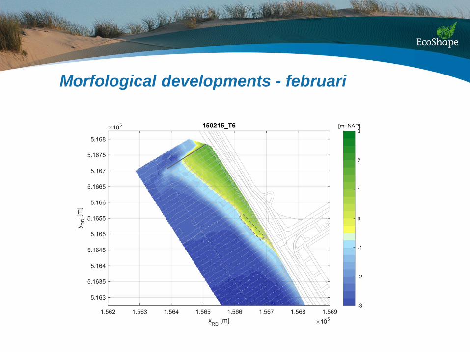
Morfological developments - februari

Morfological developments - march

Morfological developments- april

Morfological developments sept-march
Wind screen
Effect interpolation
Interaction with dike
Slope development
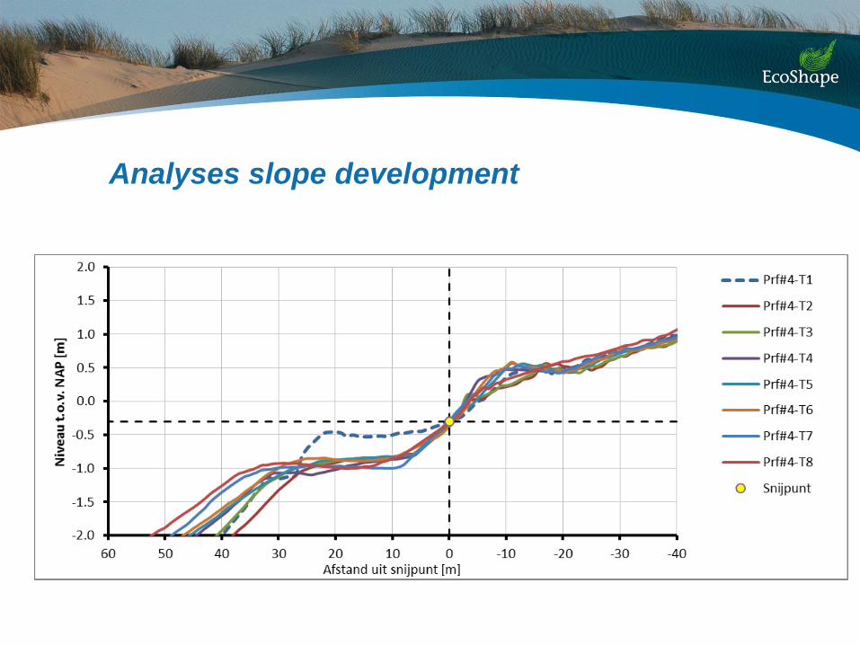
Analyses slope development

Analyses morphological developments
First impressions
• A stable, yet dynamic foreshore
• Steep slope (1 : 10) along the waterline
• Swash-berm up to NAP+0,5 m
• Underwater plateau nearly flat at -1m NAP
• Effect of coarse sand?

Sediment grain size

Role between mean grain size and slope
Design:
D50 = 200/250 µm slope 1:30/40
Present:
D50 = 350/400 µm slope 1:10

Next steps
• Monitoring until 2018
• Use of data for improvement and validation of models
• Extrapolation to other locations
• Need for testing of extreme conditions in controlled
flume experiment