Embed Size (px)
DESCRIPTION
GROUP SESSION Group 5:Measuring and Monitoring Sustainable Development The power of location: everything happens somewhere. Steven Ramage Head of Ordnance Survey International United Kingdom
Citation preview

GROUP SESSION
Group 5:Measuring and Monitoring Sustainable Development
Steven Ramage
Head of Ordnance Survey International
United Kingdom

Sustainable development: location matters

RIO+20 – SUSTAINABLE DEVELOPMENT STATISTICS
1. The world today has 7 billion people, by 2050 there will
be 9 billion: Where will they live? Moving to cities.
2. A billion and half people in the world don’t have access
to electricity: Where do they live? Innovation increasing.
3. Almost a billion people go hungry every day:
Where can food be grown or sourced or transported from?


Accurate location information assisting
better decision-making:
• Water management
• Food management
• Sustainable energy

To be able to manage water supply, we
must be informed of its infrastructure,
location and monitor its availability
Water management

Monitoring local water use: assessing and
improving water management
Source: The UN
• The Water Plant in Ouagadougou, Burkina Faso
uses a GIS-supported monitoring system to
manage efficient water use through pressure
control, automated valves and leak detection
systems.
• By monitoring water flow and use, resources
can be managed more effectively to identify
areas and times of high use and potentially
detect systemic problems such as leaks or
illegal water tapping.
• The more consistent water supply has reduced
water theft, raised local awareness of water
management and freed up money to be spent
on water quality and sanitation.
Area of distribution (top)
Identification of a leak point
(bottom)

Source: The Hydrology Project, India
• The Hydrology Project in India is
creating a hydrologic database and
Hydrological Information System (HIS)
to detail both natural and man-made
water infrastructure.
• By monitoring infrastructure, more
effective water resource planning and
management can take place, improving
the productivity and cost-effectiveness
of water related investments, whilst
aiding the future planning of
infrastructure to meet increasing
population needs.
Monitoring water issues: national and regional
management

To be able to manage food supply, we
must monitor current availability and
access to food resources
Food management: food supply
and sustainable development

Monitoring national food resources: managing
food availability
• The Census of Agriculture in Canada
provides a comprehensive picture of
agricultural activity in Canada,
supporting the development of
agri-environmental indicators,
policy analysis, land-use decision
making and other analysis or
applications and created ‘Agri Map’.
• By monitoring land use, future
food security can be planned for by
identifying areas of high
production yields and the future
potential of the crops in harvest.
Source: Government of Canada (2012)

Monitoring national food resources: managing
food access
• The Famine Early Warning System
network monitors the flow and access
to food within known national
commodity trading.
• Monitoring food flows and
understanding where food is and where
food will flow to on local, national,
regional and global scales is important
to ensure every community has access
to food helps planning for emergency
food aid in the case of famine or
disaster.
Source: USAID/FEWS/USGS

To manage sustainable food production,
we must monitor farming activities and
plan for daily and seasonal changes
Food management and
sustainable agriculture

Monitoring sustainable agriculture: planning
regional farming activities
• Conservation International’s Centre for
Applied Biodiversity Science is researching
into which crops will be the most productive
and where within the Andes regions.
• Monitoring current crop productivity – and
the environmental conditions in which they
grow – is providing data to help decide
future growing patterns and practices,
particularly in response to the change
climate.
• By integrating several separate pieces of
information about changing environmental
conditions against a land use map, future
planning decisions are made simpler and
more accurate.
Source: Conservation International

Monitoring sustainable agriculture: planning
local farming activities
Source: NOAA
• Rainwatch, developed by NOAA, is a
prototype geographic information system
that monitors monsoon rainfall and tracks
season rainfall attributes and delivers the
information directly to farmers in East
Africa to monitor precipitation and assess
the impact on their crops.
• By monitoring and delivering information
about key environmental conditions that
are location specific, farmers can pre-
empt the impact on crops and therefore
implement contingency measures, such as
increased irrigation, earlier on.

Source: International Fund for Agricultural Development (IFAD)
DOCUMENTED LAND ACQUISITIONS IN ETHIOPIA, 2004-2009
Monitoring sustainable agriculture: planning
national land use
• As demand for food increases,
the demand for usable
agricultural land will increase
and land ownership rights will
become more important.
• Location information has
provides a governance tool to
prevent land grabbing and
unsustainable agricultural
development.

To manage energy and to provide
sustainable energy we must understand
where energy is needed and how it can
best be provided
Sustainable energy

Monitoring energy: developing green energy
• Provide decision makers with crucial information required
when identifying optimal sites for green energy
generation.
• Site selection for a wind farm requires the analysis of
different datasets at the regional, district and local levels.
• To avoid areas of natural beauty, airports and prioritise
areas that have winds speeds 45 m above ground level,
location information is essential.

Source: Oxford Brookes University
Monitoring energy: monitoring and managing
energy use
• Initiative in West Oxford for community
monitoring of household energy use and
carbon footprint.
• Monitoring energy allows energy providers to
plan to meet demand, reduce energy
insecurity during and in areas of high use and
plan for future infrastructure investment; this
all depends on knowing where energy is being
used.
• Monitoring energy also allows for authorities
to target energy reduction campaigns; high
energy use or patterns of peak use can be
identified and more sustainable energy use
can be explained to energy users.

Resource management: Indonesia
• Major problem of how to balance conflicting
ideals of economic growth and maintaining
environmental quality and viability.
Using location information:
• provided a framework for the optimal
use and cost benefit of drained peatlands
in Indonesia in relation to generated
revenue. By evaluating the results
• helped to identity different crops that
can be grown viably on the drained
peatlands of Indonesia, for example,
Sago palm, Melaleuca and Gharu wood
• helped to identify suitable locations for
the processing of the cash crops and
likely local markets; such as
Berengbengkel, Pilang, Senhang, Jabiren,
Garung and the capital, Palangkaraya.

What can be achieved if we
underpin decisions with
accurate, authoritative
and maintained location
information?

Monitoring the city: creating a sustainable city
• Masdar City, Abu Dhabi: ‘The First Carbon Neutral
City’ integrates the use of GIS in every aspect to
plan the city: from ensuring the construction
process is efficient and produces zero waste to
planning the transport and energy network, to
meet potential demand, and building in
monitoring systems into the city infrastructure.
• Location is essential to help with urban planning
on any scale: from creating a new city to
expanding current infrastructure, location is
needed to ensure infrastructure is optimal in
terms of energy reduction, environmental
conservation and social development.

• The Rio Operations Centre helps the City
Authority watch and manage daily life.
• The Centre integrates information on
weather forecasts, water information,
traffic flows and any other anomalies in
daily life of the city to predict and
manage potential situations such as
flooding or traffic accidents.
• By monitoring the city and
communicating information to local
services, including traffic officers, fire
services, and flood protection officers,
contingency plans can be put in place
and the public put on alert to minimise
impacts of potential situations.
Monitoring the city: managing daily life
Source: IBM

Monitoring daily life: community food security
management
• Community in
Canada map their
own food
resources and
access to food.
• Encourages
residents to buy
all produce
locally.
Source: RamanaTandale

Source: DfT/TfL
Monitoring transport use: planning for
electric cars
London’s Smart City:
part of the Plugged In
Places Initiative.
Mapping car use to plan
electrical charge points
for most effective and
sustainable use.

Contextualising other information
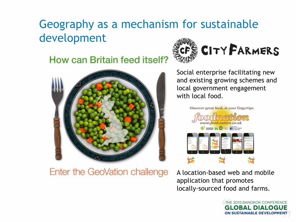
Geography as a mechanism for sustainable
development
Social enterprise facilitating new
and existing growing schemes and
local government engagement
with local food.
A location-based web and mobile
application that promotes
locally-sourced food and farms.

Location information

Location Information Framework
Location information at address level
Aggregated to suburb
or postcode
Aggregated to Local
Government area or higher
Analy
sis
and a
ggre
gati
on a
cro
ss g
eogra
phie
s
Geocoded unit level data
25 Smith St = x,y: 35.5676, 135.6587

Mapping layers to which all other information
can be connected

33


Technological developments

Where have we come from?

A solid information base

A solid information base

A solid information base

The Future We Want: 19 June 2012


• The United Nations Initiative on Global
Geospatial Information Management, an
initiative to enhance and coordinate global
geospatial information management.
• Provides a formal
mechanism under the
UN to discuss and
coordinate GGIM
activities by involving
Member States at the
highest government
level as the key
participants.
UN-GGIM – what is it?

UN-GGIM: how and why it was formed
• The Economic and Social Council of the United Nations (ECOSOC)
recognised the importance of geospatial information in national and
global development.
• As a result and following extensive consultation with Member
States, the ECOSOC meeting held in July 2011 established the UN
Committee of Experts on Global Geospatial Information
Management (UN-GGIM).
• ECOSOC encouraged ‘Member States to
hold regular high-level, multi-stakeholder
discussions on global geospatial
information, including through the
convening of global forums, with a view
to promoting a comprehensive dialogue
with all relevant actors and bodies’.
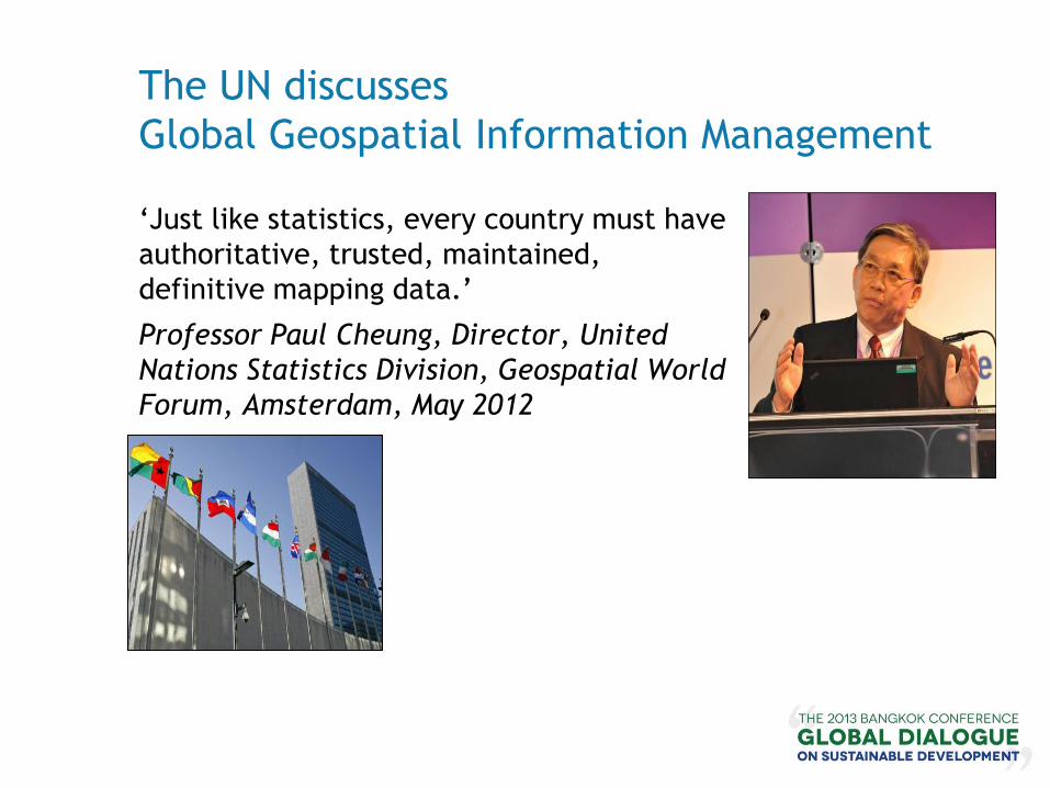
The UN discusses
Global Geospatial Information Management
‘Just like statistics, every country must have
authoritative, trusted, maintained,
definitive mapping data.’
Professor Paul Cheung, Director, United
Nations Statistics Division, Geospatial World
Forum, Amsterdam, May 2012

UN-GGIM: its role
• To play the leading role in setting the agenda with Member State governments for the development of geospatial information within each Member State and to promote its use to address key global, regional, national and local challenges.
• To provide a forum:
• to liaise, enable discussion and coordinate amongst Member states; and
• liaise, enable discussion and coordinate between Member States and international organizations.
• To ensure the provision of authoritative, trusted, maintained, definitive mapping data for each country.
• To ensure within the provision of authoritative, trusted, maintained, definitive mapping data that each country adheres to an ethical code set by the Member States.

Everything happens somewhere


![MALDIVES - Sustainable DevelopmentMALDIVES [Check Against Delivery] Sustainable Development Summit: Interactive Dialogue 2 - Tackling Inequalities, empowering women and girls, and](https://img.dokumen.tips/doc/110x75/60d10bf0aef1ab0832786724/maldives-sustainable-development-maldives-check-against-delivery-sustainable.jpg)