Embed Size (px)
Citation preview
SEPA update, February 2016
Alistair Duguid
Outline• River Basin Planning update• Barriers• Loch classification tool• eDNA

River basin management plans
• Plan for the Scotland river basin district now published at www.sepa.org.uk/water/river-basin-management-planning
• 44-page document, supported by appendices and an online data tool.
• Identifies where water bodies are affected by fish barriers, changes to physical condition, pollution, changes to flows, or invasive species.
• Sets out actions and objectives to protect and improve the water environment.
• The plan acknowledges that there are areas where more information is needed

Water environment hub
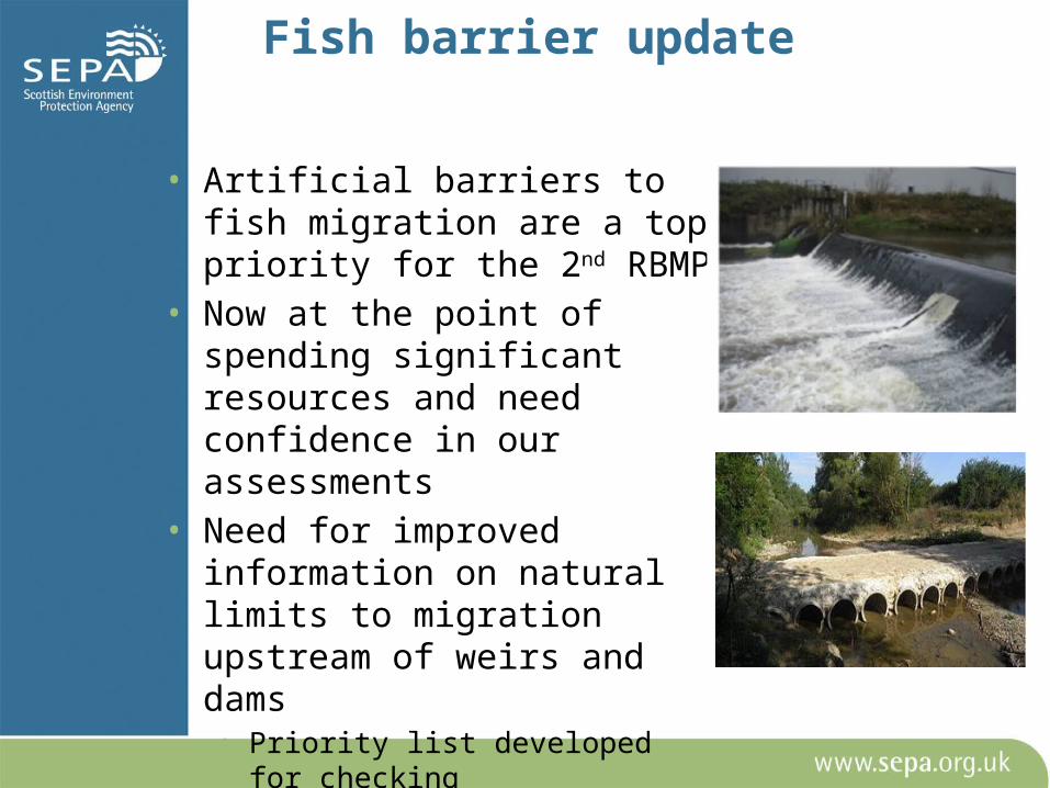
Fish barrier update
• Artificial barriers to fish migration are a top priority for the 2nd RBMP
• Now at the point of spending significant resources and need confidence in our assessments
• Need for improved information on natural limits to migration upstream of weirs and dams• Priority list developed for checking• Smartphone app to improve
information

http://www.river-obstacles.org.uk/

Loch classification
• Classification tool now developed for gillnet data
• Measures the response to nutrient pressures (TP gradient)
• NORDIC gillnet methodology• 35 lochs, wide range of sites
(MSS, SEPA SNH, Stirling Uni)• Method provides 2 results• Rule based classification• Quantitative EQR based
classification• SFINX (?)


Can we use eDNA to assess fish?• Gillnetting is expensive, time consuming,
destructive, biased and unpopular• SEPA pilot project with RZSS has shown that shed
DNA can be identified in water samples• Follow up project underway with EA, CEH &
University of Hull1: Comparing DNA traces in water samples with alternative data (gillnetting & hydroacoustic)2: Assessing sampling requirements- spatial and temporal variability

SamplingWindermere:•Offshore (70 sites)
• 5 m - transect• 20 m - transect• Midline - transect
depth profile:surfacemid-waterbottom
• Gill net sites
•Shore (40 sites)
Loch Osgaig:
• offshore (10 sites)• shore (10 sites)

Key results: species presence
Previously (ever) recorded species (16) 12S: 14 (88%)Cytb: 12 (75%)Gill netting survey 2014: 4 (25%)
Common
brea
m*Eel
Stone l
oach
Bullhe
ad*
Pike*
3-spin
ed S
B
River la
mprey
Perch*
Sea la
mprey
Minnow
*
Roach
*
Salmon
Brown t
rout*
Arctic
charr
Rudd
Tench
*
Common
carp*
Ruffe*
Sunble
ak*
Rainbo
w trout
Mudminn
ow*
Flound
er
Topmou
th gu
dgeo
n*Smelt
0
0.2
0.4
0.6
0.8
1
12S freqcytb freq
Prop
ortio
n of
site
s pre
sent
Lake Windermere (65 samples)

Key results: species abundance

Key results: species ecology
Oligotrophic association
Eutrophic association
No association
0
5
10
15
20
25
30
1945 1955 1965 1975 1985 1995 2005
Year
Mea
n SR
P in
firs
t 4 w
eeks
(mg
m-3
)North basin
South basin

Windermere results: spatial variability
00.10.20.30.40.50.60.70.80.9
1
Windermere offshore
Abramis
brama
Anguil
la an
guilla
Barbatu
la ba
rbatul
a
Cottus
gobio
Esox l
ucius
Gaster
osteu
s acu
leatus
Perca f
luviat
ilis
Phoxin
us ph
oxinu
s
Rutilus
rutilu
s
Salmo s
alar
Salmo t
rutta
Salveli
nus a
lpinu
s0
0.10.20.30.40.50.60.70.80.9
1
Windermere shore
10 speciesMissing Stone loachThree-spine stickleback
Potentially underrepresented:BullheadMinnow
11 speciesMissingArctic charr
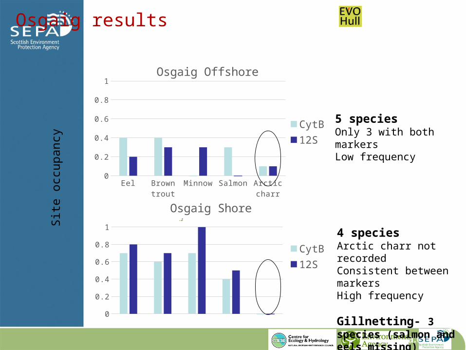
Osgaig results
Site
occ
upan
cy
00.10.20.30.40.50.60.70.80.9
1
Osgaig Shore
CytB12S
Eel Brown trout
Minnow Salmon Arctic charr
0
0.2
0.4
0.6
0.8
1Osgaig Offshore
CytB12S
4 speciesArctic charr not recordedConsistent between markersHigh frequency
Gillnetting- 3 species (salmon and eels missing)
5 speciesOnly 3 with both markersLow frequency
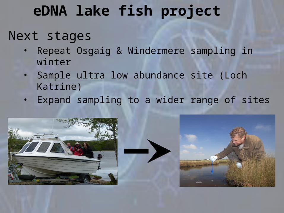
Next stages• Repeat Osgaig & Windermere sampling in winter• Sample ultra low abundance site (Loch Katrine)• Expand sampling to a wider range of sites
eDNA lake fish project

Thanks for listening!http://www.river-obstacles.org.uk/