Embed Size (px)
Citation preview

River Profiles and Fluvial Landforms
River Capture / Stream Piracy

Lear
ning
obj
ectiv
es
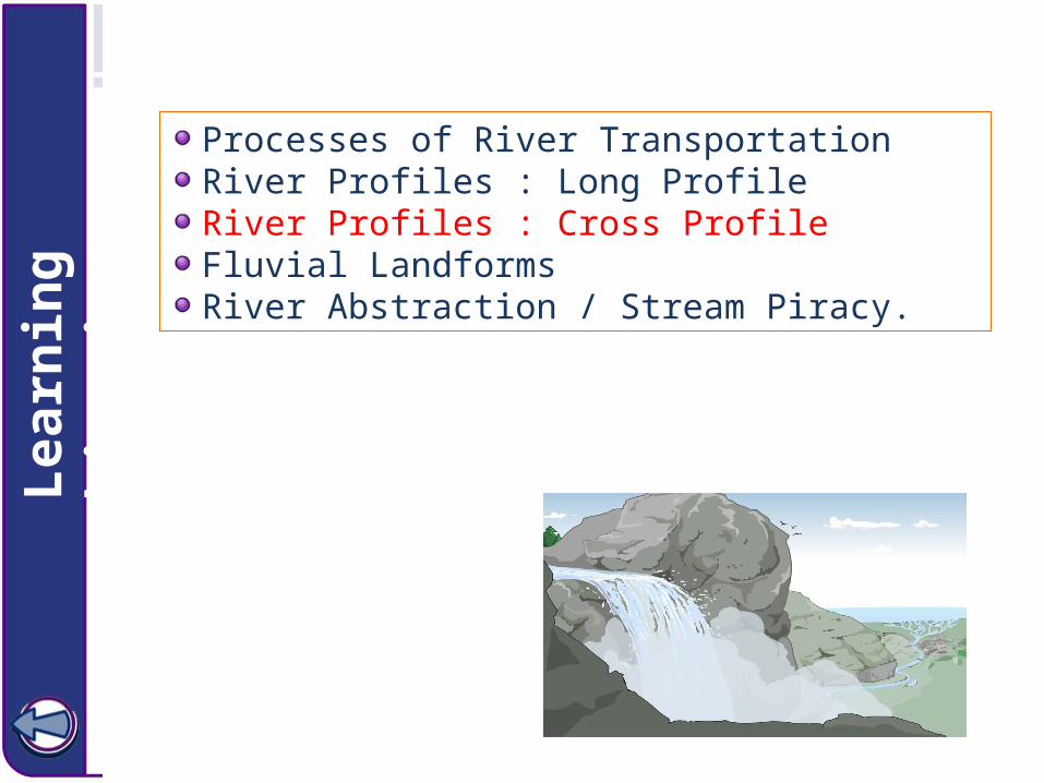
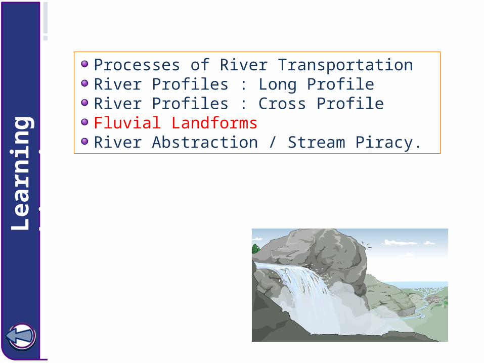
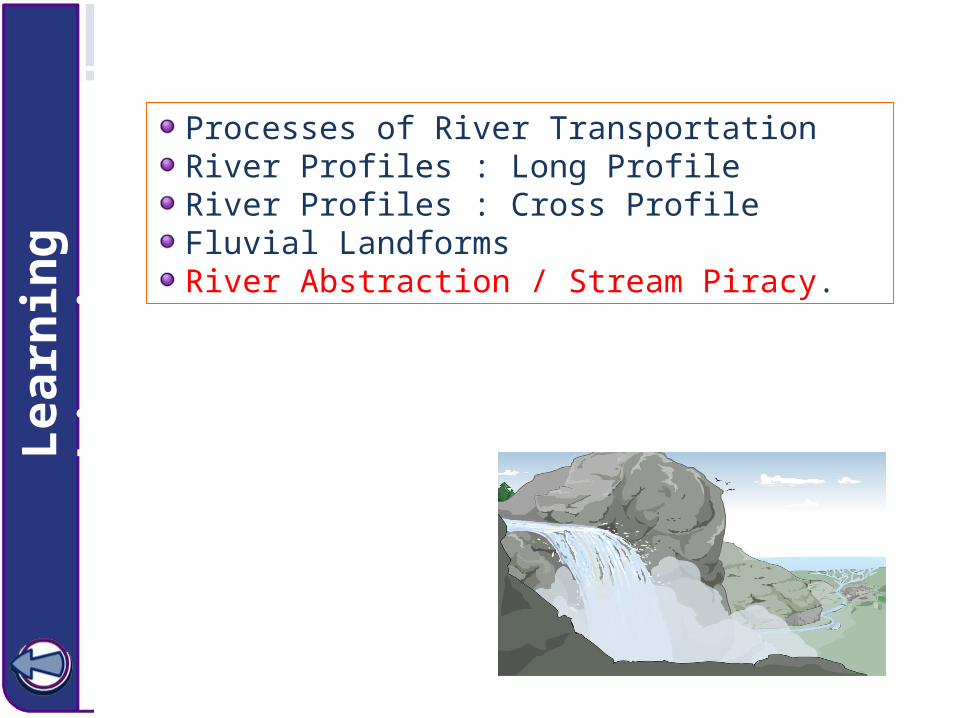
Processes of River TransportationRiver Profiles : Long ProfileRiver Profiles : Cross ProfileFluvial LandformsRiver Abstraction / Stream Piracy.

Processes of river transportation Schuters: Pg.165

Lear
ning
obj
ectiv
esProcesses of River TransportationRiver Profiles : Long ProfileRiver Profiles : Cross ProfileFluvial LandformsRiver Abstraction / Stream Piracy.

Longitudinal Profile: River from Source to Mouth
V-shaped valleyVertical erosion (Turbulent flow)WaterfallsRapidsGorgesPot-holesInterlocking spurs
Asymmetrical channelMeandersTransportationFloodplainsSlip-off slopesTruncated spurs
Large channelDepositionBraidingOx-bow lakesLarge flood plainsLeveesDeltas
River Channels Pg.127
Click for video
Longitudinal Profile is the profile of a river from it’s Source to it’s Mouth.
Youthful stage
Mature stage
Old age stage

Stages of Stream Development
Initial Stage:
Fast moving stream, narrow valley
Mature Stage:
Meanders develop, widening floodplain
Old Age Stage:
Wide floodplain, yazoo streams, and oxbow lakes develop

1 2 3
4 5 6
7 8 9
Back
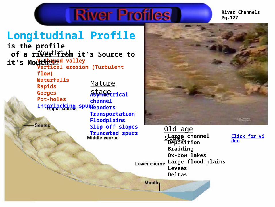
Upper Course where alternate layers of hard and soft rock is found!

BackMiddle Course!
CC- Woolyboy
Back
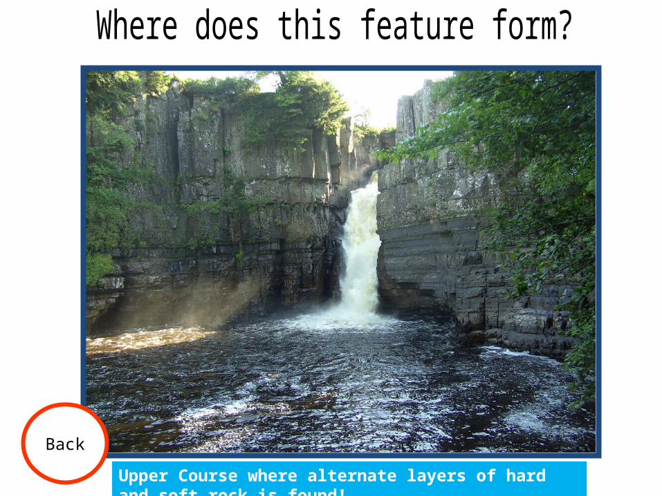
Meanders
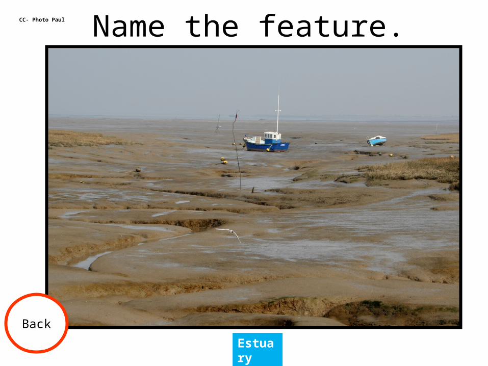
CC- Photo Paul
Back
Estuary
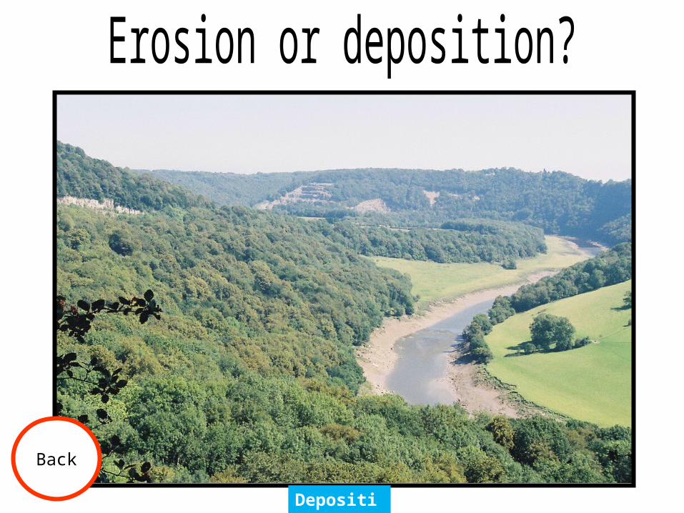
Back
Deposition

CC- Geoff Edwards
Back
Erosion

CC- Aerial Photography
Back
Middle

CC- Martin Third
Back
Flood plain

CC- ecstaticist
Back
Lower Course
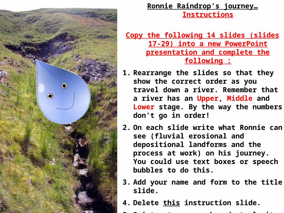
Ronnie Raindrop’s journey… Instructions
Copy the following 14 slides (slides 17-29) into a new PowerPoint presentation and complete the
following :
1. Rearrange the slides so that they show the correct order as you travel down a river. Remember that a river has an Upper, Middle and Lower stage. By the way the numbers don’t go in order!
2. On each slide write what Ronnie can see (fluvial erosional and depositional landforms and the process at work) on his journey. You could use text boxes or speech bubbles to do this.
3. Add your name and form to the title slide.
4. Delete this instruction slide.
5. Print out your work and staple it.
6. Finally, hand it to your teacher.
Well done, mission complete…

1
Source / Origin of RiverYouthful stageWatershedCatchment areaOrographic uplift Formation of clouds

7
Youthful stageV-Shaped ValleyVertical erosionTurbulent flow

5
Waterfall Youthful stageTurbulent flowAlternate layers of hard and soft rock
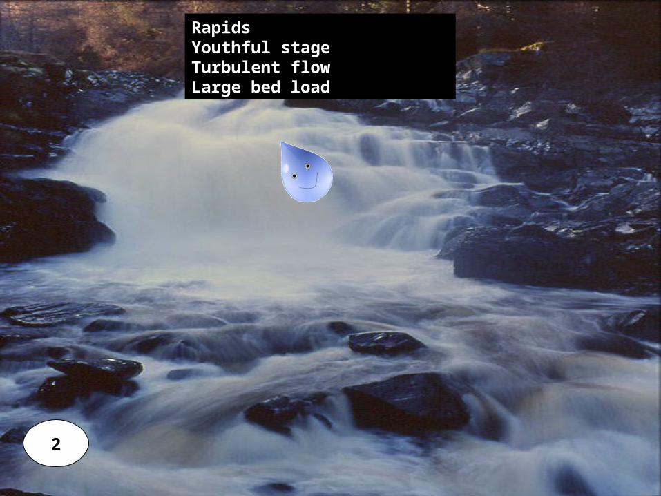
2
Rapids Youthful stageTurbulent flowLarge bed load
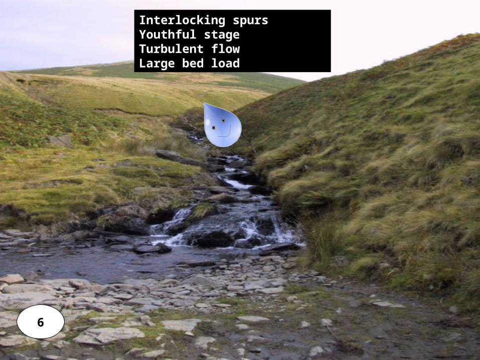
6
Interlocking spurs Youthful stageTurbulent flowLarge bed load
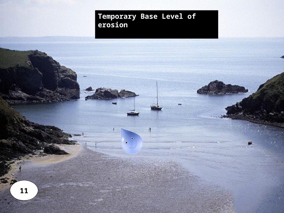
11
Temporary Base Level of erosion

3
Mature stageMeandering riverLarge channelAsymmetrical channel
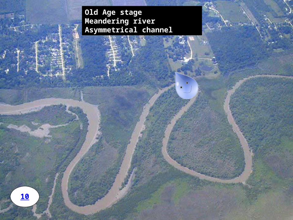
10
Old Age stageMeandering riverAsymmetrical channel

Old Age stageMeandering riverRiver flood plain
8
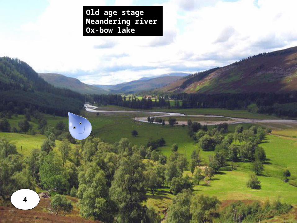
4
Old age stageMeandering riverOx-bow lake
9
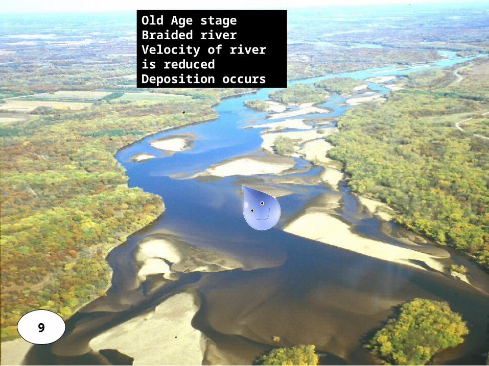
Old Age stageBraided riverVelocity of river is reducedDeposition occurs
12
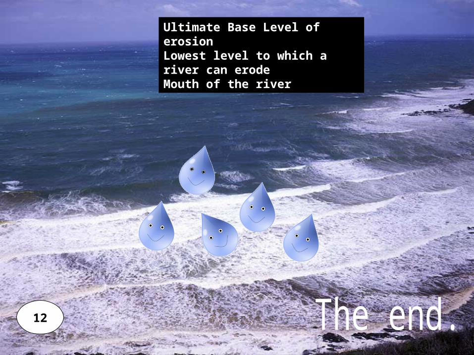
Ultimate Base Level of erosionLowest level to which a river can erodeMouth of the river

Profiles
Cross Profile
Longitudinal Profile
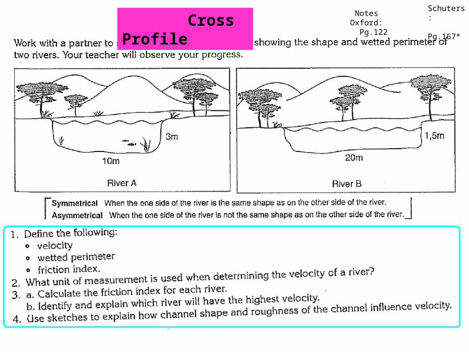
Cross ProfileIs the profile of a river from Bank to Bank
Longitudinal Profile is the profile of a river from it’s Source to it’s Mouth.

Ungraded vs. Graded Streams
Graded stream: Balance between transport capacity and sediment load.Maintained by altering the shape of the channel and stream profile.Rate of erosion = Rate of DepositionSmooth concave profile
Ungraded profile / stream: Rate of erosion is not equal to rate of deposition Rough concave profile

Graded Streams

Long Profile
1) Name the typical shape that the river strives to achieve.
Smooth concave profile. [Graded profile] Dotted line on profile
2) What is the real shape it accepts?
An uneven, concave profile, steep at the source and gentle at the mouth.
3) Name (a) a temporary (local) and (b) a permanent (ultimate) base level of erosion.
(a) Dam (b) sea (the lowest level to which a river can erode)
4) Name three ways in which the above river may be rejuvenated.
Dam wall bursting. Rising of the land. Sinking of the sea.
5) Name 3 factors that disrupted the above longitudinal profile.
Rapids, waterfall and dam
6) Where does erosion occur fastest? Give a reason for your answer.
In the middle section, stream volume and load have increased. Erosion is thus faster.

Cross Profile
1) What type of river channel will produce a
symmetrical cross profile?
Straight stream
2) Which 2 factors determine the different cross profiles that a river may display?
Climate and Geological conditions
3) Which 2 erosive processes are responsible for eroding the valley sides.
Mass wasting and undercutting
4) Account for the shape of the cross profile on a bend.
Outer bend (undercut slope) is characterized by erosion since the water flows faster.
Inner bend (slip-off slope) is characterized by deposition, since the water flows slowly.
Lear
ning
obj
ectiv
es
Processes of River TransportationRiver Profiles : Long ProfileRiver Profiles : Cross ProfileFluvial LandformsRiver Abstraction / Stream Piracy.
Cross Profile
Schuters: Pg.167*
Notes Oxford: Pg.122
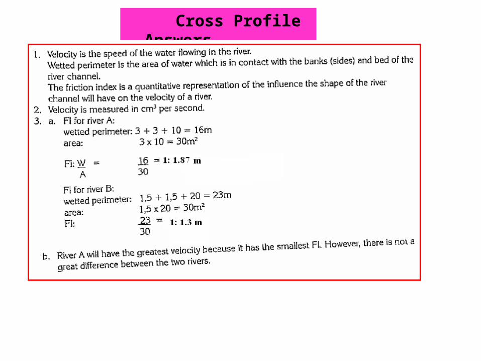
Cross Profile - Answers
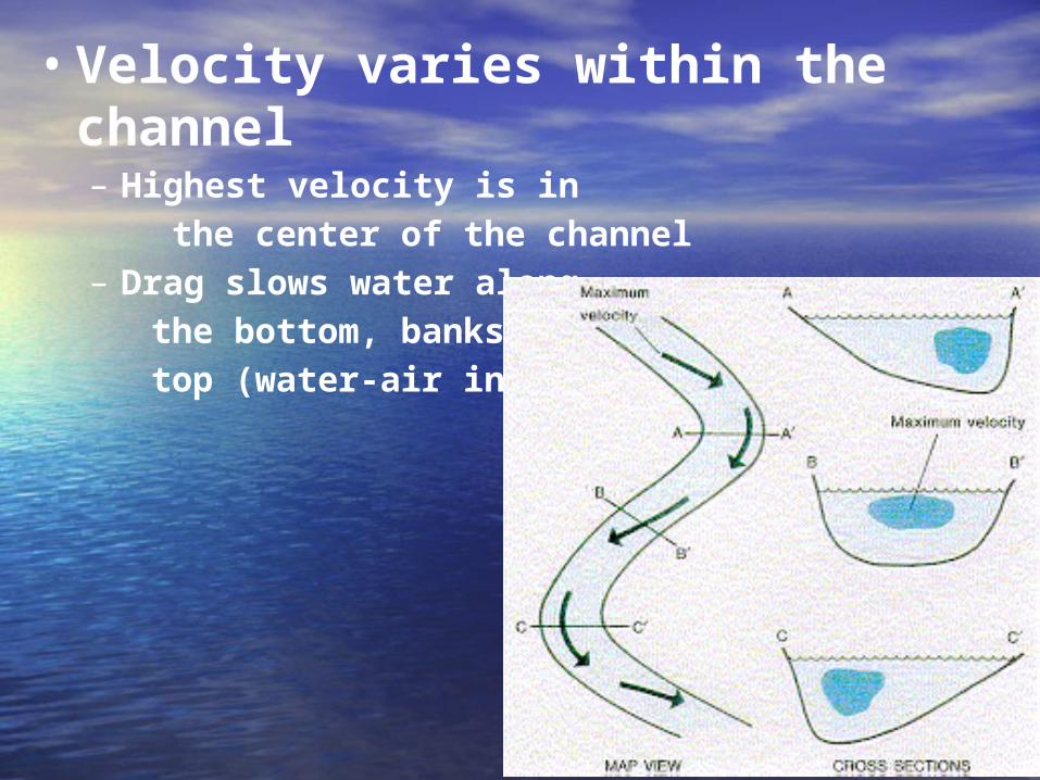
• Velocity varies within the channel– Highest velocity is in the center of the channel– Drag slows water along the bottom, banks, and top (water-air interface)
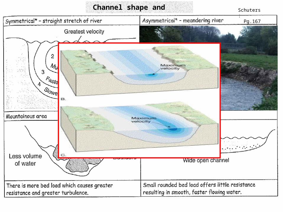
Channel shape and velocity Schuters: Pg.167
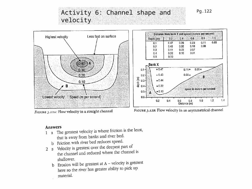
Activity 6: Channel shape and velocity Pg.122
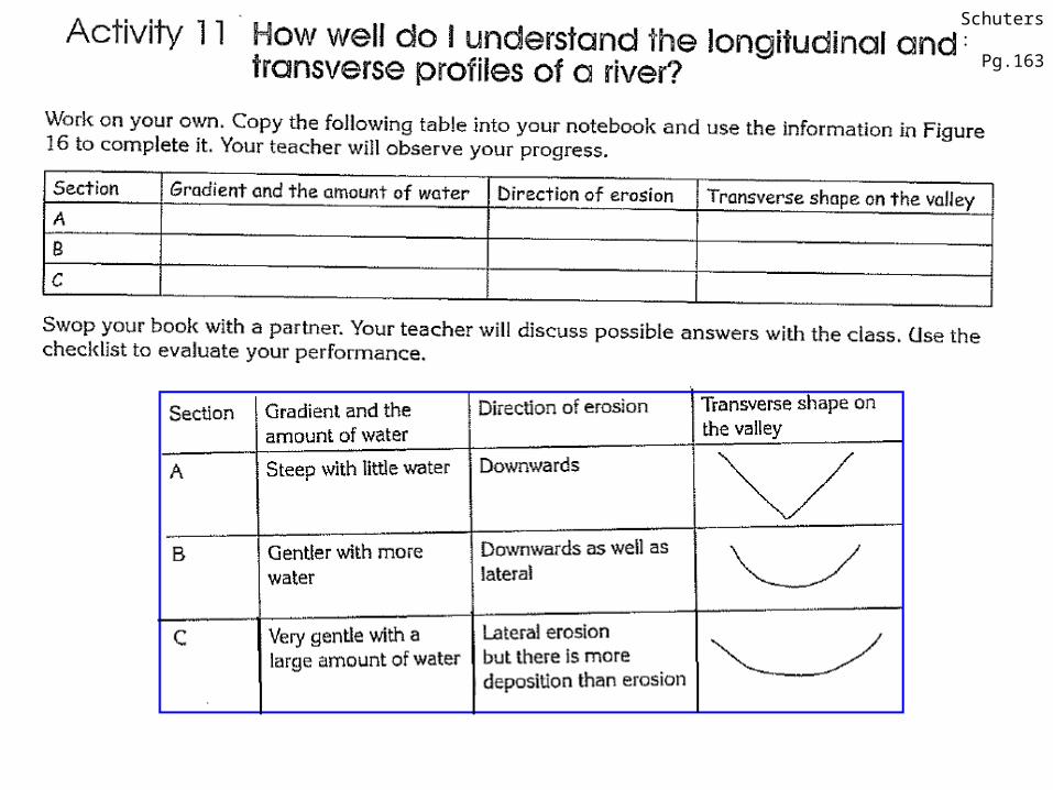
Schuters: Pg.163
Lear
ning
obj
ectiv
es
Processes of River TransportationRiver Profiles : Long ProfileRiver Profiles : Cross ProfileFluvial LandformsRiver Abstraction / Stream Piracy.

1) Meanders / Ox-bow Lake
Fluvial Landforms
River reaches flat land
Begins to meander
Velocity is highest on the outer bend - erosion – undercut bank – river cliff
Velocity is lower on the inside bend - deposition – slip-off slope – gradual slope.

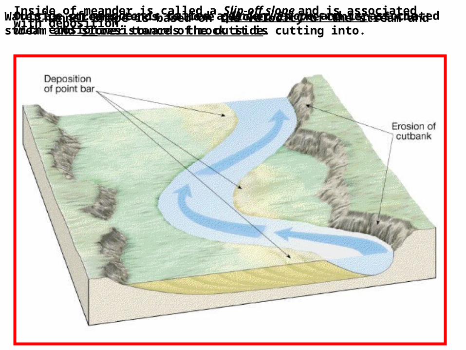
Channel shape is based on the velocity of the stream and resistance of rock it is cutting into.
Water in streams tends to move quicker in the center of the stream and slower towards the outside.
Outside of meander is called a Undercut slope and is associated with erosion.
Inside of meander is called a Slip-off slope and is associated with deposition.

Formation

Fluvial Landforms
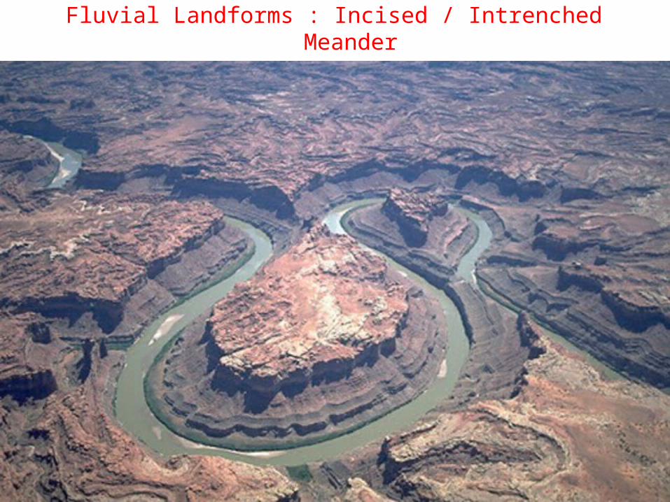
Fluvial Landforms : Incised / Intrenched Meander

Incised / Intrenched Meanders

Fluvial Landforms
2) Waterfalls
Forms when resistant layer of rock prevents vertical erosion
Softer underlying layers are eroded
Resistant layer is undermined and collapses.
Waterfall retreats upstream.
Forms a Gorge or Ravine.

Copyright © Houghton Mifflin Company. All rights reserved. Geology, 14b–52
Fluvial LandformsFormation of a Waterfall
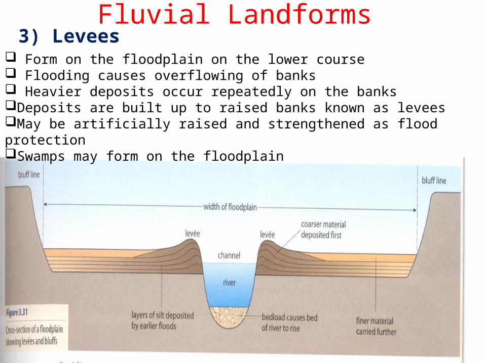
Fluvial Landforms3) Levees
Form on the floodplain on the lower course Flooding causes overflowing of banks Heavier deposits occur repeatedly on the banksDeposits are built up to raised banks known as leveesMay be artificially raised and strengthened as flood protectionSwamps may form on the floodplain
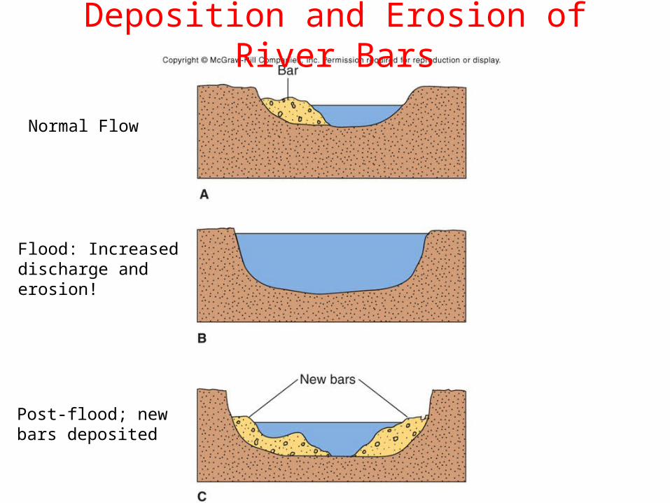
Deposition and Erosion of River Bars
Flood: Increaseddischarge anderosion!
Normal Flow
Post-flood; newbars deposited
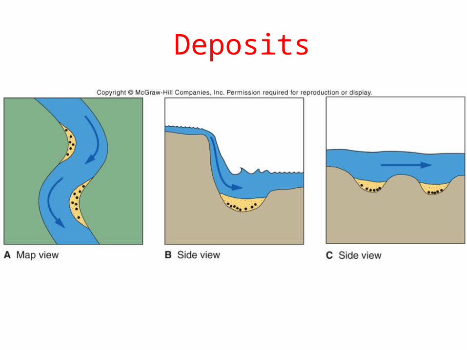
Deposits
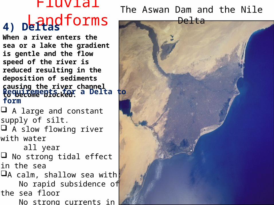
The Aswan Dam and the Nile DeltaFluvial Landforms4) Deltas
A large and constant supply of silt. A slow flowing river with water all year No strong tidal effect in the seaA calm, shallow sea with: No rapid subsidence of the sea floor No strong currents in the sea
When a river enters the sea or a lake the gradient is gentle and the flow speed of the river is reduced resulting in the deposition of sediments causing the river channel to become blocked.
Requirements for a Delta to form
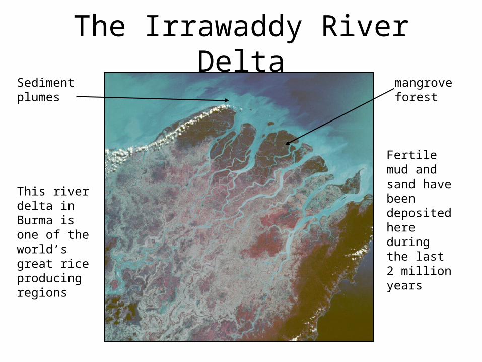
The Irrawaddy River Delta
This river delta in Burma is one of the world’s great rice producing regions
Fertile mud and sand have been deposited here during the last 2 million years
mangrove forest
Sediment plumes
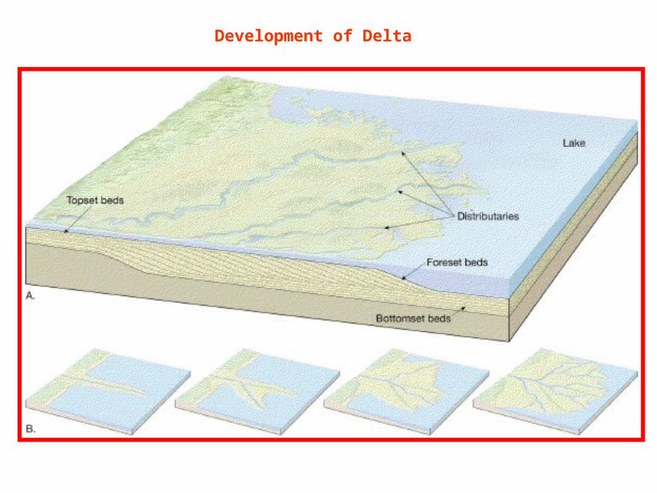
Development of Delta
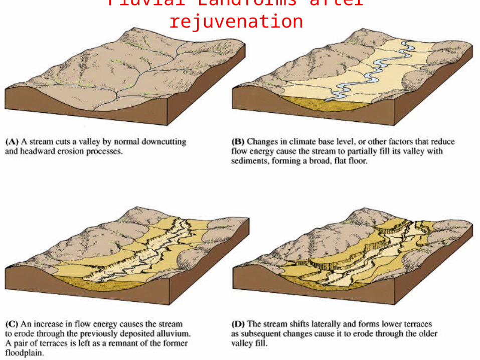
Fluvial Landforms after rejuvenation

Rejuvenation is when the river flows faster due to the following: Global drop in sea levelUplift of land Increase in rainfallRiver Capture
Rejuvenation results in: Incised rivers (rivers cut into the plain)River Terraces Knickpoints
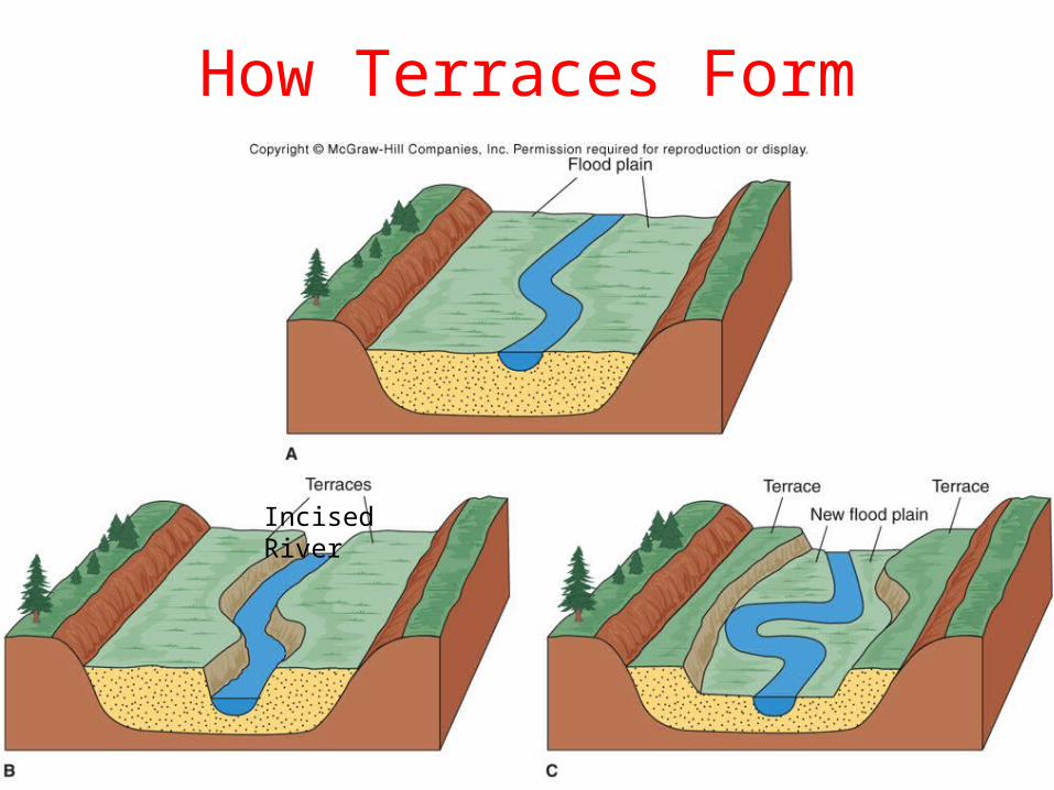
How Terraces Form
Incised River
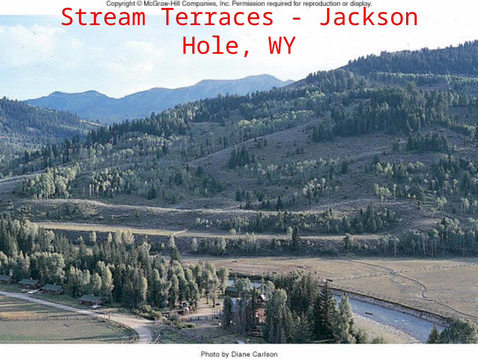
Stream Terraces - Jackson Hole, WY
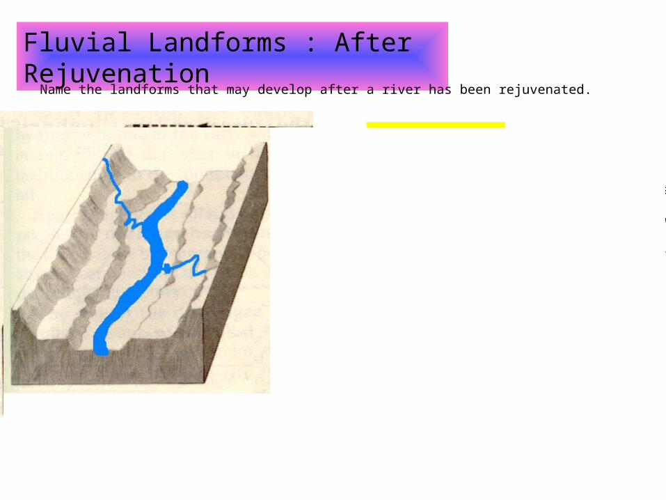
Fluvial Landforms : After Rejuvenation
Name the landforms that may develop after a river has been rejuvenated.
Intrenched Meander
These are formed when rejuvenation occurs in a stream which is already meandering
The stream now meanders in a deep, steep-sided gorge eg. Fish River Canyon and lower course of the Breede River
Valleys within Valleys
When streams are rejuvenated fairly rapidly and the base level drops substantially, a valley can be formed within a valley.
Terraces
• When rejuvenation of a river flowing on a wide valley floor (flood plain) occurs, a new valley is carved into the old one and parts of the earlier valley remain as terraces. E.g. Canyons
• Terraces may be:
Matched
Unmatched
• Such terraces can be seen along the banks of the Vaal river in the vicinity of Bloemhof, Christiana and Delport.

A Question of Rivers
1 2 3
4 5 6
7 8 9

1
a) Which stage of the river will this type of erosion take place in?
b) Which type of erosion is responsible for the formation of these circular depressions?
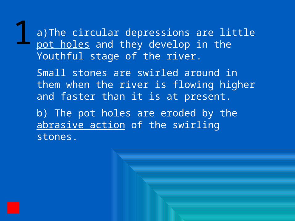
a)The circular depressions are little pot holes and they develop in the Youthful stage of the river.
Small stones are swirled around in them when the river is flowing higher and faster than it is at present.
b) The pot holes are eroded by the abrasive action of the swirling stones.
1

2
What is required for incision of the river to occur?Drag and drop the following labels in the correct position:
Fall in sea level Waterfall retreats cutting a lower valley New flood plain forms
River bluffs

2 Rejuvenation is required for incision of the river to occur.
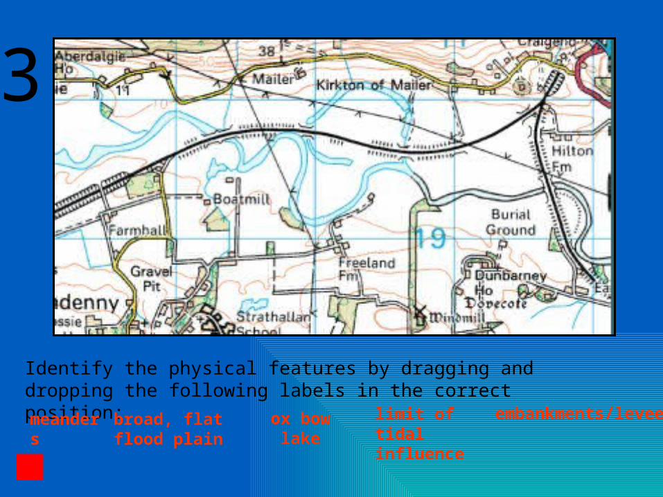
3
Identify the physical features by dragging and dropping the following labels in the correct position:
meanders broad, flat flood plain
ox bow lake limit of tidal influence
embankments/levees
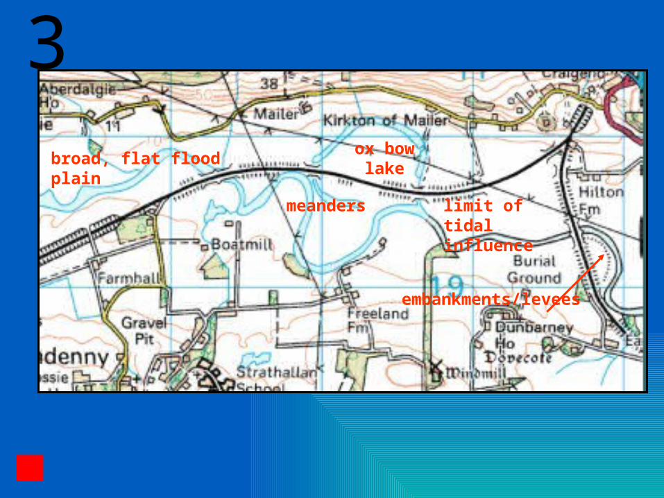
ox bow lake
limit of tidal influence
meanders
broad, flat flood plain
embankments/levees
3
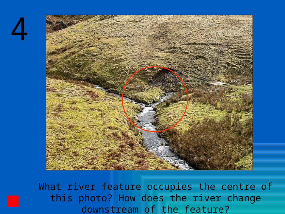
4
What river feature occupies the centre of this photo? How does the river change downstream of the
feature?
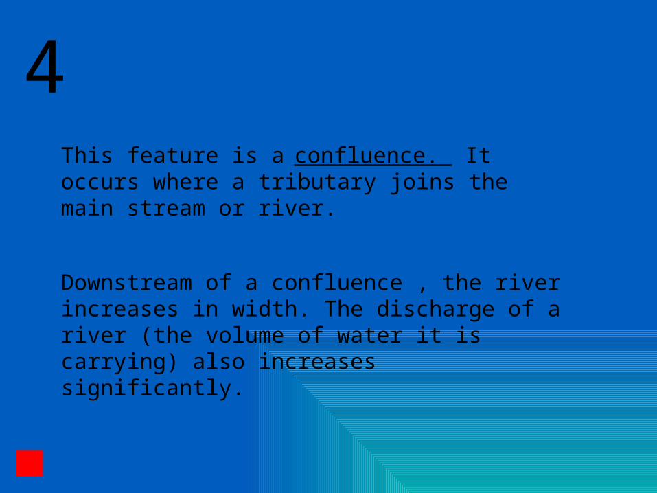
This feature is a confluence. It occurs where a tributary joins the main stream or river.
Downstream of a confluence , the river increases in width. The discharge of a river (the volume of water it is carrying) also increases significantly.
4

5 What features identify this stretch of river as part of its upper course?
interlocking spurs
steep valley sides
steep long profile
absence of flood plain
large bed load
Drag and drop the following labels in the correct position.
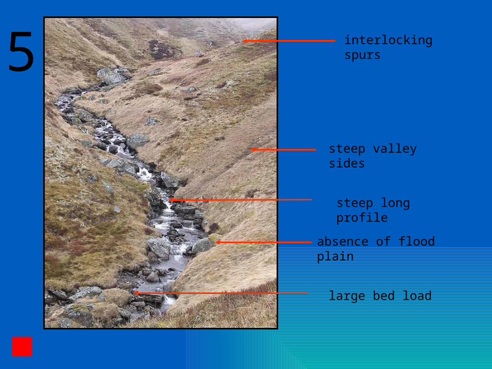
interlocking spurs
steep valley sides
absence of flood plain
steep long profile
large bed load
5
6
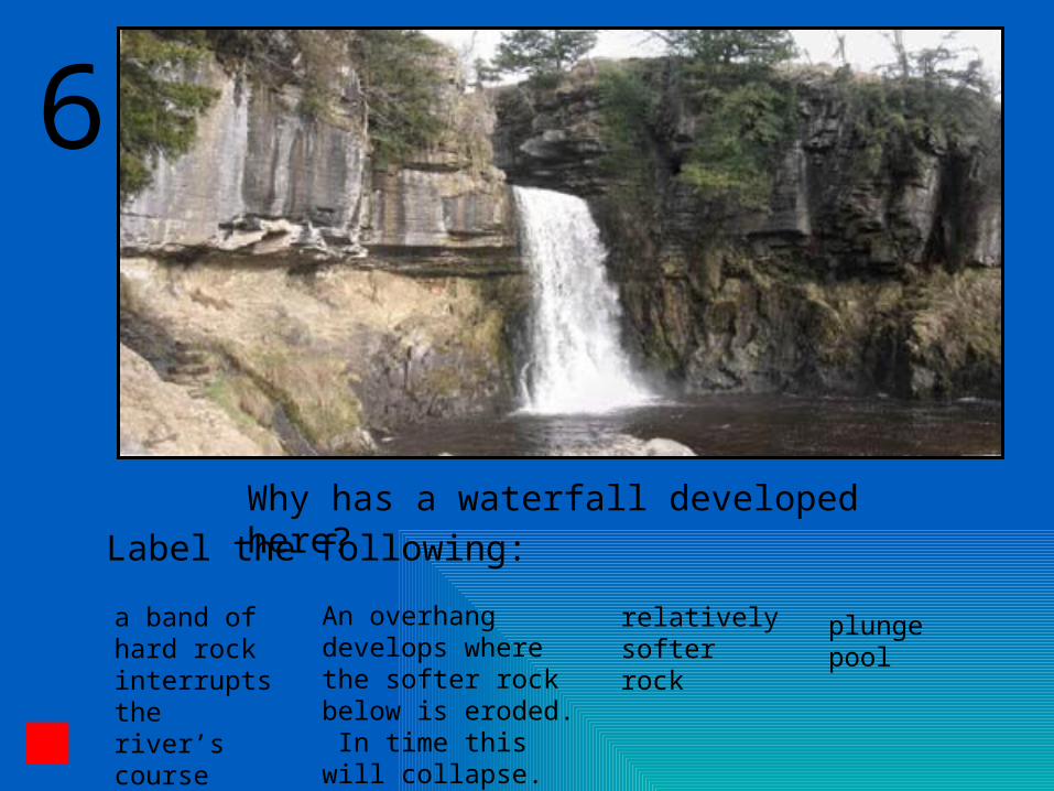
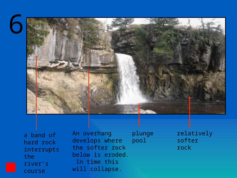
Why has a waterfall developed here?Label the following:
a band of hard rock interrupts the river’s course
An overhang develops where the softer rock below is eroded. In time this will collapse.
relatively softer rock
plunge pool
a band of hard rock interrupts the river’s course
An overhang develops where the softer rock below is eroded. In time this will collapse.
relatively softer rock
plunge pool
6

7
How would you know that this valley was not carved by the river which flows in it today?
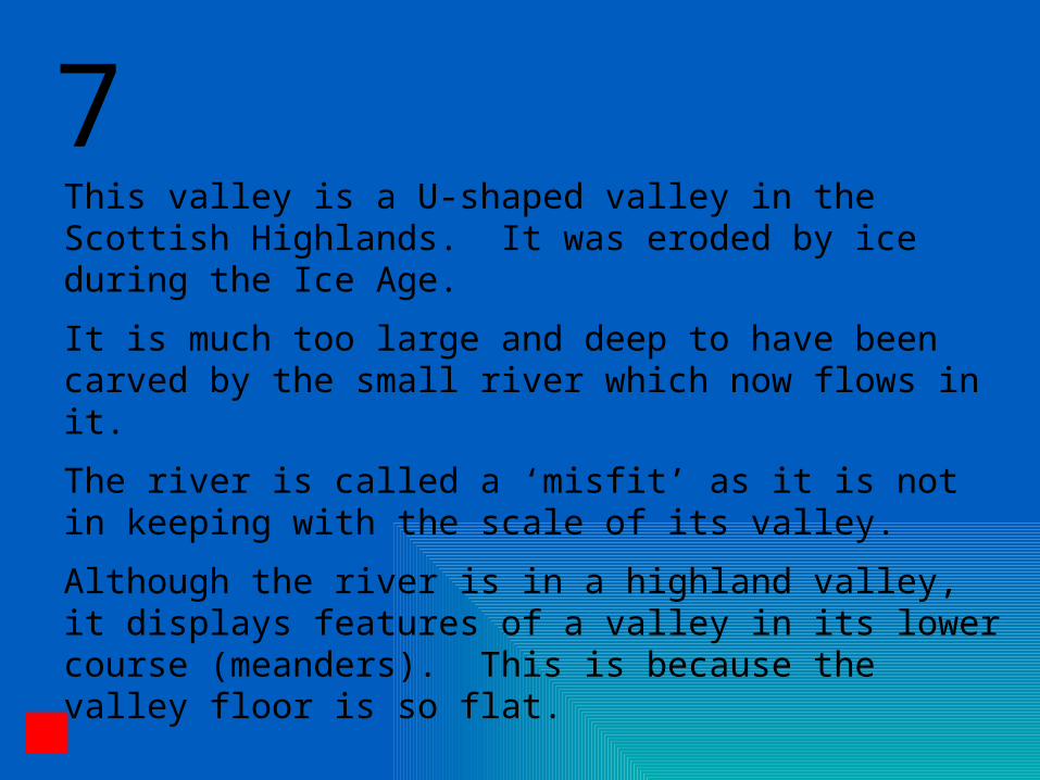
This valley is a U-shaped valley in the Scottish Highlands. It was eroded by ice during the Ice Age.
It is much too large and deep to have been carved by the small river which now flows in it.
The river is called a ‘misfit’ as it is not in keeping with the scale of its valley.
Although the river is in a highland valley, it displays features of a valley in its lower course (meanders). This is because the valley floor is so flat.
7

8
Identify the physical features by dragging and dropping the following labels in the correct position:
small tributary no flood plain steep valley sidesPerennial Straight streamsteep long profile of a tributary
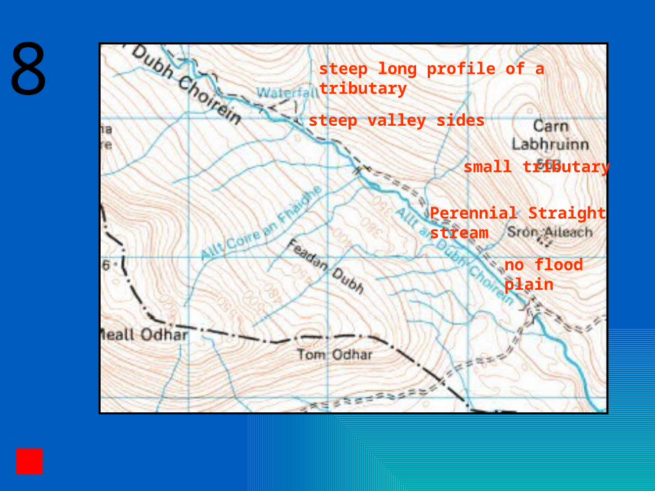
steep valley sides
small tributary
no flood plain
steep long profile of a tributary8
Perennial Straight stream
9
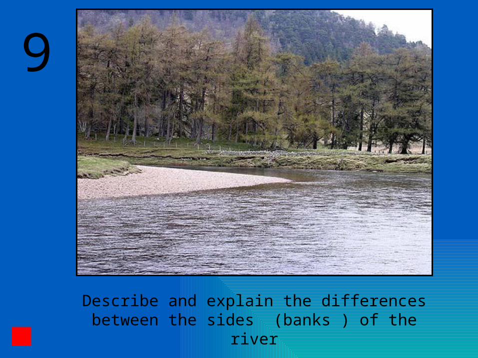
Describe and explain the differences between the sides (banks ) of the river

9
On the inside of the meander water is flowing more slowly. This results in deposition and the formation of the slip-off slope or river beach.
On the outside of the meander water is flowing more quickly. This results in erosion and the formation of a undercut slope or river cliff.
Lear
ning
obj
ectiv
es
Processes of River TransportationRiver Profiles : Long ProfileRiver Profiles : Cross ProfileFluvial LandformsRiver Abstraction / Stream Piracy.

Abstraction of a Drainage Basin
A watershed remains in the same position only if the rates of erosion on either side are equal
The river (B) flowing down the steeper gradient erodes faster and moves the watershed back from position 1 to 2
Water falling on the area between 1 and 2 will thus no longer flow down gradient B, as it had previously done, but will be captured to fall into the catchment area belonging to A
Factors favouring river abstraction
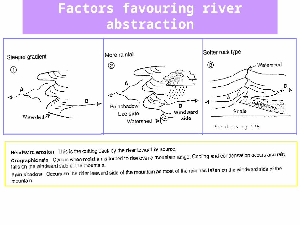
Factors favouring river abstraction
Schuters pg 176
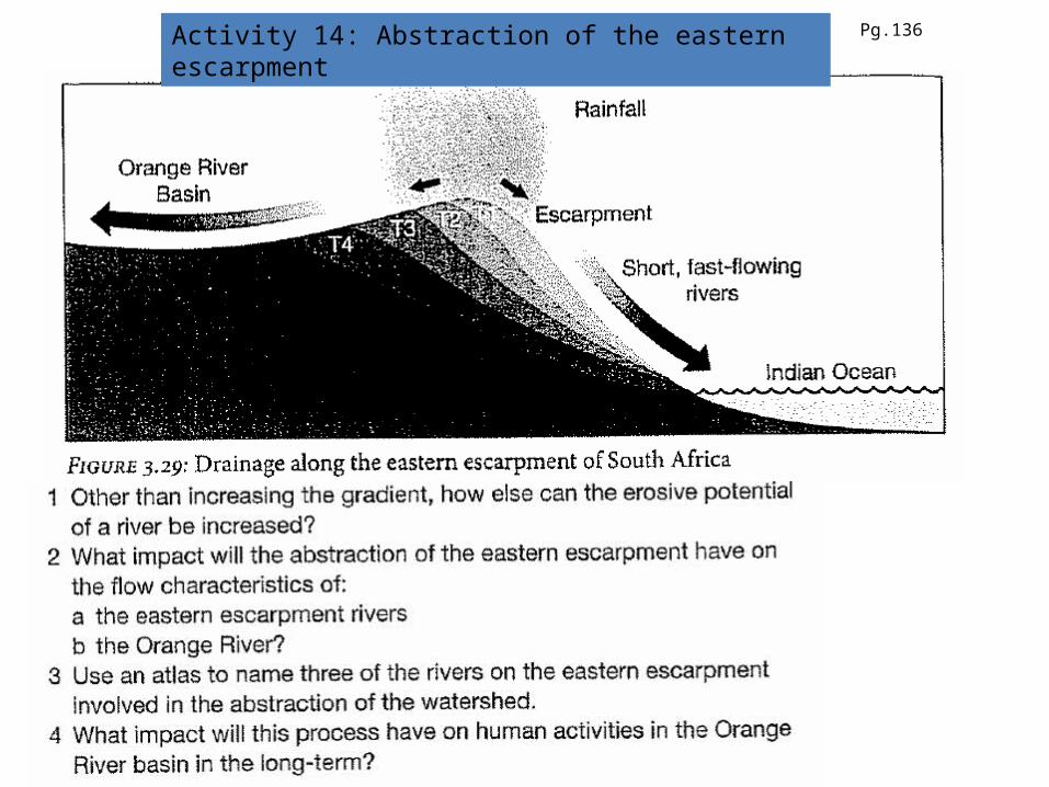
Activity 14: Abstraction of the eastern escarpment Pg.136
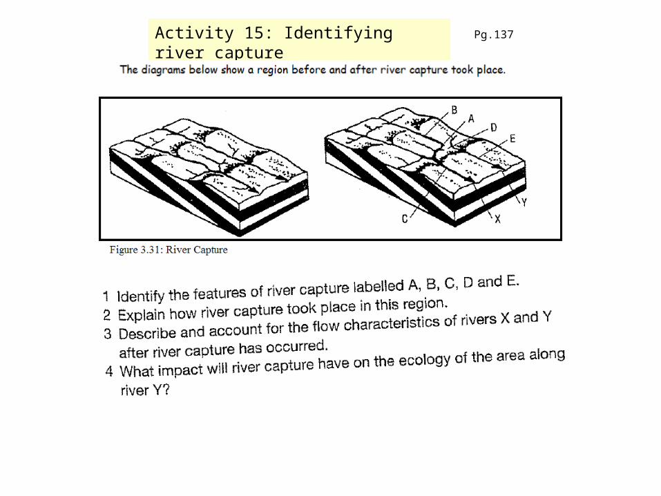
Activity 15: Identifying river capture Pg.137
Copyright © Houghton Mifflin Company. All rights reserved. Geology, 14b–88
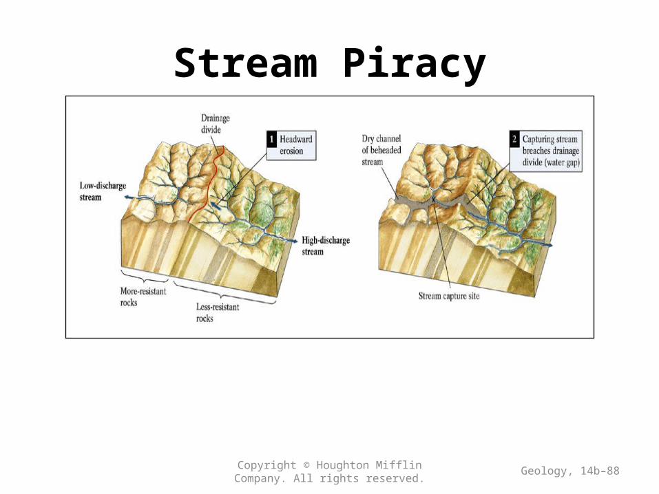
Stream Piracy
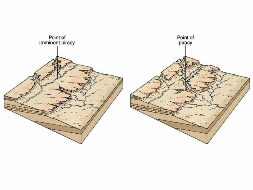
Stream Piracy
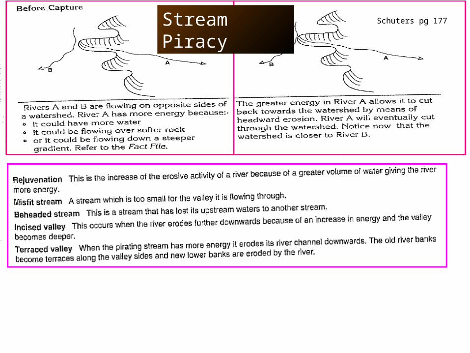
Stream Piracy Schuters pg 177
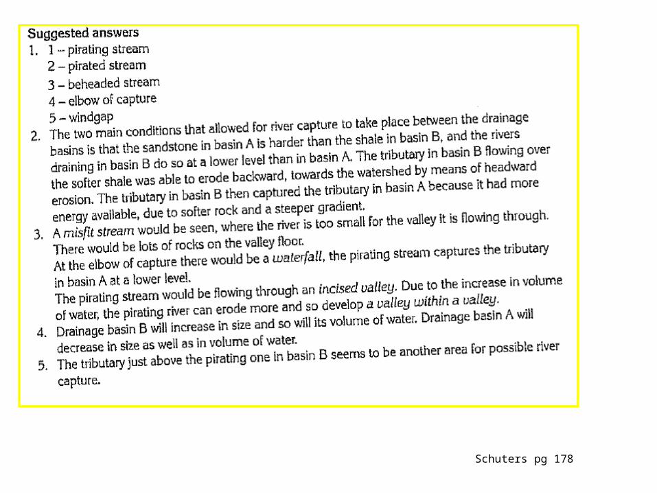
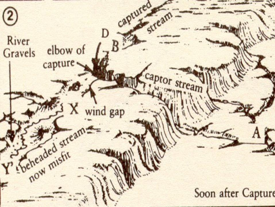
Schuters pg 178

Schuters pg 178


![Nam Ngiep - Bureau of Meteorology · 115 Lao―10 2.4 Longitudinal Profiles No 1 Name of River Nam Ngiep (Main river) Length [km] Catchment area [km2] 156 4,270 Highest peak [m] Lowest](https://img.dokumen.tips/doc/110x75/5f4d7747965068123609624d/nam-ngiep-bureau-of-115-laoa10-24-longitudinal-profiles-no-1-name-of-river.jpg)