Hiking tour B00290
Via Engiadina, stage 1: Maloja - Silvaplana
www.engadin.stmoritz.ch and GPS-Tracks.com / Page 1
Difficulty:Fitness:Popularity:
Distance: 13.1 kmTime requirement: 4½ h
Ascent: 551 mDescent: 560 mHighest point: 2037 m.a.s.l.
Region: Engadin St.MoritzStarting point: Maloja, post
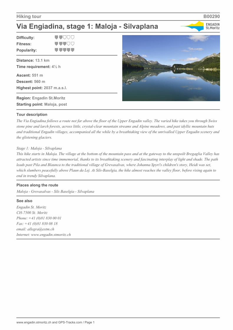
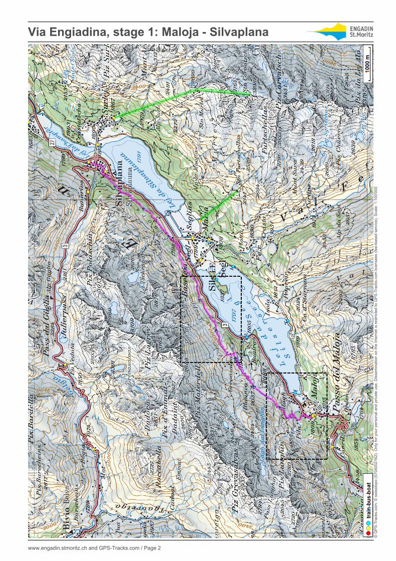
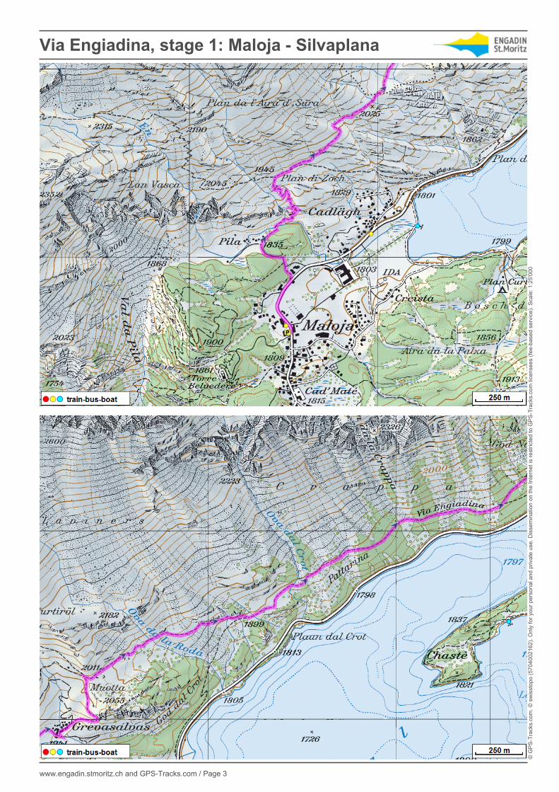
Tour descriptionThe Via Engiadina follows a route not far above the floor of the Upper Engadin valley. The varied hike takes you through Swissstone pine and larch forests, across little, crystal-clear mountain streams and Alpine meadows, and past idyllic mountain hutsand traditional Engadin villages, accompanied all the while by a breathtaking view of the unrivalled Upper Engadin scenery andthe glistening glaciers. Stage 1: Maloja - SilvaplanaThis hike starts in Maloja. The village at the bottom of the mountain pass and at the gateway to the unspoilt Bregaglia Valley hasattracted artists since time immemorial, thanks to its breathtaking scenery and fascinating interplay of light and shade. The pathleads past Pila and Blaunca to the traditional village of Grevasalvas, where Johanna Spyri's children's story, Heidi was set,which slumbers peacefully above Plaun da Lej. At Sils-Baselgia, the hike almost reaches the valley floor, before rising again toend in trendy Silvaplana.
Places along the routeMaloja - Grevasalvas - Sils Baselgia - Silvaplana
See alsoEngadin St. MoritzCH-7500 St. MoritzPhone: +41 (0)81 830 00 01Fax: +41 (0)81 830 08 18email: [email protected]: www.engadin.stmoritz.ch
Via Engiadina, stage 1: Maloja - Silvaplana
www.engadin.stmoritz.ch and GPS-Tracks.com / Page 2
© G
PS
-Tra
cks.
com
. © s
wis
stop
o (5
7040
0216
2). O
nly
for y
our p
erso
nal a
nd p
rivat
e us
e. D
isse
min
atio
n on
the
Inte
rnet
is re
stric
ted
to G
PS
-Tra
cks.
com
lice
nsee
s (fe
e-ba
sed
serv
ice)
. Sca
le: 1
:100
'000
Via Engiadina, stage 1: Maloja - Silvaplana
www.engadin.stmoritz.ch and GPS-Tracks.com / Page 3
© G
PS
-Tra
cks.
com
. © s
wis
stop
o (5
7040
0216
2). O
nly
for y
our p
erso
nal a
nd p
rivat
e us
e. D
isse
min
atio
n on
the
Inte
rnet
is re
stric
ted
to G
PS
-Tra
cks.
com
lice
nsee
s (fe
e-ba
sed
serv
ice)
. Sca
le: 1
:25'
000

Hiking tour B00290
Via Engiadina, stage 1: Maloja - Silvaplana
www.engadin.stmoritz.ch and GPS-Tracks.com / Page 4
Elevation profile
Download this tour with topo maps on your smartphone (iPhone, Android)Scan the QR code. As a result, you will receive on your smartphone tour dates and all necessarySwissTopo-maps from scale 1: 25'000, so you can use anything without cell phone reception.
Weather in the area from 22.10.2016
Saturday, in the morning sunny periods. In the afternoon sunny intervals.Sunshine 3½ h (32 %). Precipitation 0 mm (Prob. 5 %). Max. temperature 3° C. Wind 20 km/h from sw.
Sunday, sunny intervals.Sunshine 1 h (7 %). Precipitation 0 mm (Prob. 27 %). Max. temperature 4° C. Wind 24 km/h from sw.
Monday, in the morning sunny intervals. In the afternoon sunny intervals with some fog.Sunshine 2 h (18 %). Precipitation 0 mm (Prob. 27 %). Max. temperature 8° C. Wind 26 km/h from sw.
Tuesday, in the morning sunny intervals with repeated showers of rain. In the afternoon overcast.Sunshine 1 h (7 %). Precipitation 2 mm (Prob. 70 %). Max. temperature 11° C.
Source: SRF Meteo. Powered by Bündner Tourismus / Bergbahnen Graubünden
Tour created on: 08.08.2005Last change: 04.05.2016Origin: www.engadin.stmoritz.ch / GPS-Tracks.com
Recommended