Theme 5Dr Ohn Thwin
Renewable energy for geothermal potentials of Myanmar
2-5 Feb,2015
Renewable Energy for geothermal potentials of Myanmar
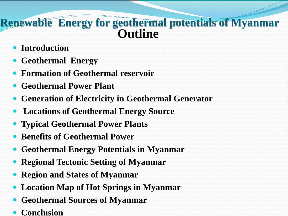
Introduction Geothermal Energy Formation of Geothermal reservoir Geothermal Power Plant Generation of Electricity in Geothermal Generator Locations of Geothermal Energy Source Typical Geothermal Power Plants Benefits of Geothermal Power Geothermal Energy Potentials in Myanmar Regional Tectonic Setting of Myanmar Region and States of Myanmar Location Map of Hot Springs in Myanmar Geothermal Sources of Myanmar Conclusion
Outline
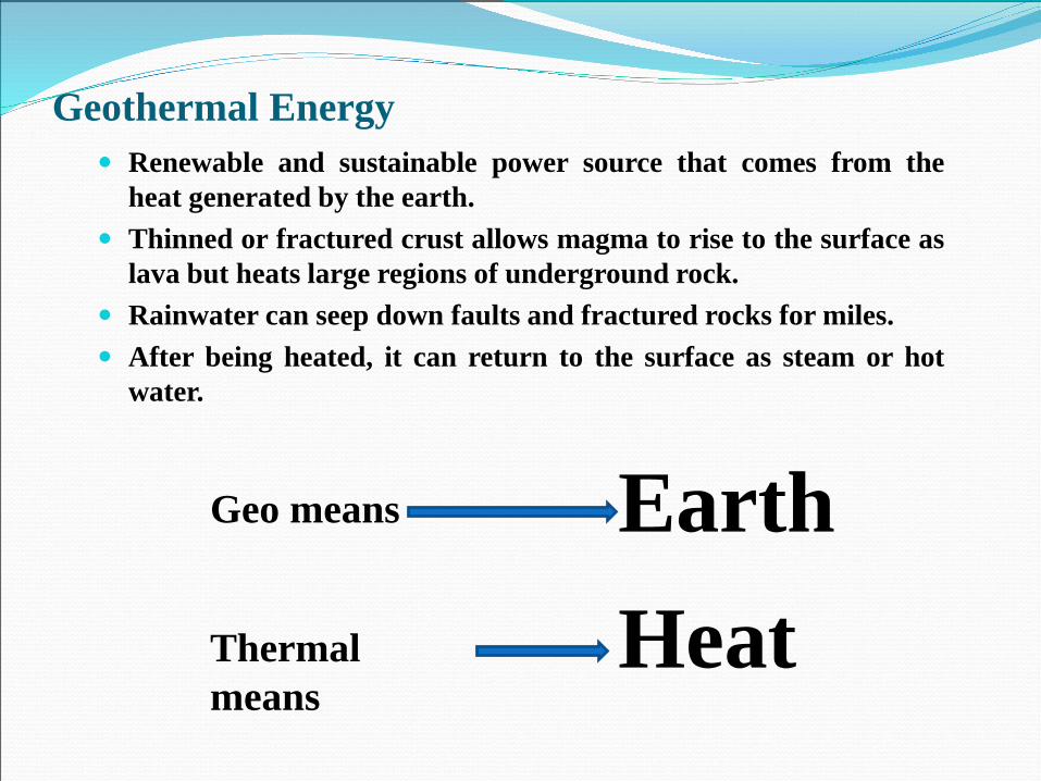
Geothermal Energy Renewable and sustainable power source that comes from the
heat generated by the earth. Thinned or fractured crust allows magma to rise to the surface as
lava but heats large regions of underground rock. Rainwater can seep down faults and fractured rocks for miles. After being heated, it can return to the surface as steam or hot
water.
Geo means
Thermal means
HeatEarth
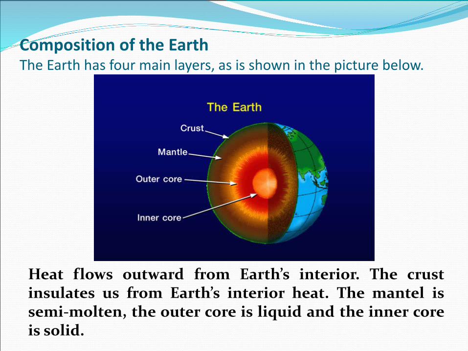
Composition of the EarthThe Earth has four main layers, as is shown in the picture below.
Heat flows outward from Earth’s interior. The crustinsulates us from Earth’s interior heat. The mantel issemi-molten, the outer core is liquid and the inner coreis solid.
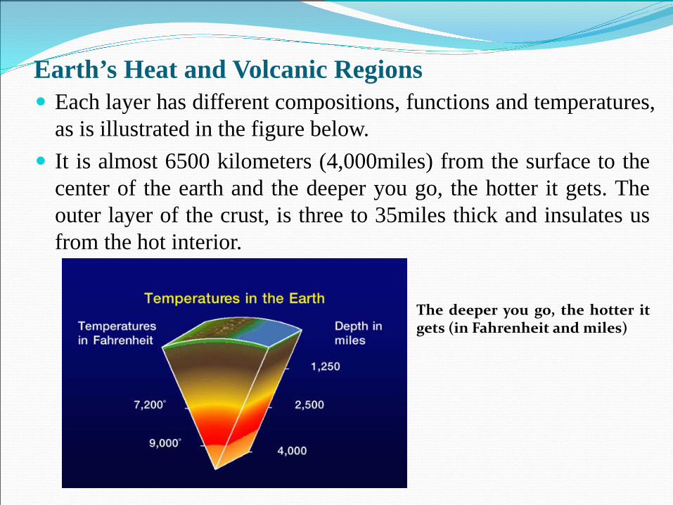
Earth’s Heat and Volcanic Regions Each layer has different compositions, functions and temperatures,
as is illustrated in the figure below. It is almost 6500 kilometers (4,000miles) from the surface to the
center of the earth and the deeper you go, the hotter it gets. Theouter layer of the crust, is three to 35miles thick and insulates usfrom the hot interior.
The deeper you go, the hotter itgets (in Fahrenheit and miles)
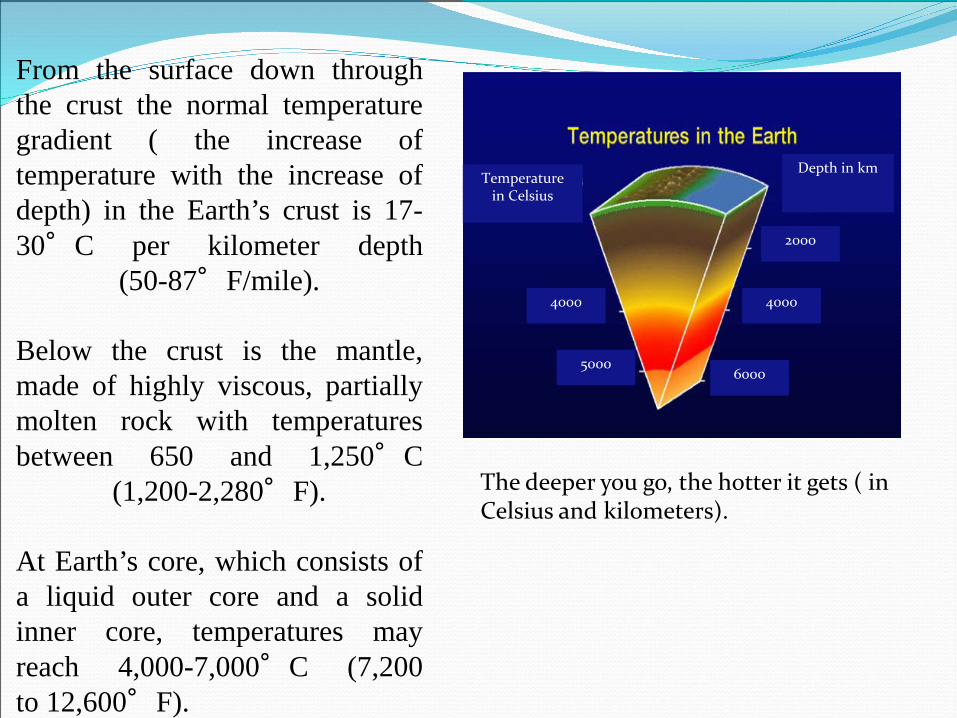
From the surface down throughthe crust the normal temperaturegradient ( the increase oftemperature with the increase ofdepth) in the Earth’s crust is 17-30°C per kilometer depth
(50-87°F/mile).
Below the crust is the mantle,made of highly viscous, partiallymolten rock with temperaturesbetween 650 and 1,250°C
(1,200-2,280°F).
At Earth’s core, which consists ofa liquid outer core and a solidinner core, temperatures mayreach 4,000-7,000°C (7,200to 12,600°F).
The deeper you go, the hotter it gets ( in Celsius and kilometers).
Depth in kmTemperature
in Celsius
2000
4000
6000
4000
5000
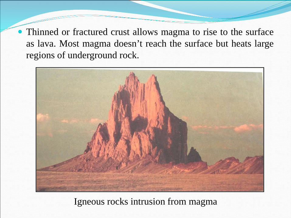
Thinned or fractured crust allows magma to rise to the surfaceas lava. Most magma doesn’t reach the surface but heats largeregions of underground rock.
Igneous rocks intrusion from magma
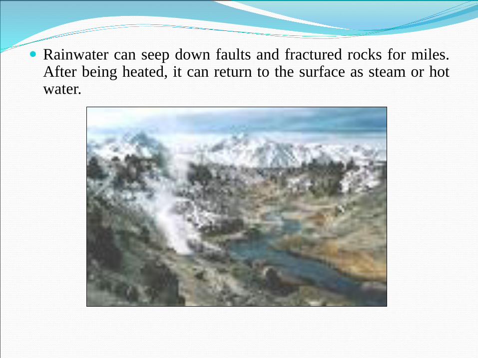
Rainwater can seep down faults and fractured rocks for miles.After being heated, it can return to the surface as steam or hotwater.
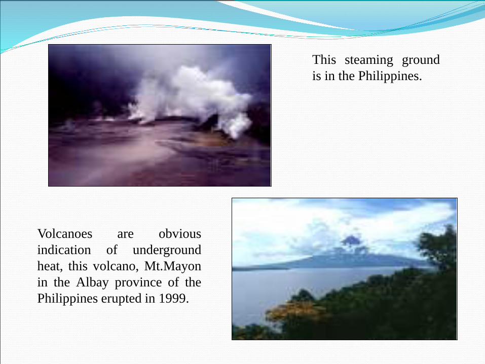
This steaming groundis in the Philippines.
Volcanoes are obviousindication of undergroundheat, this volcano, Mt.Mayonin the Albay province of thePhilippines erupted in 1999.
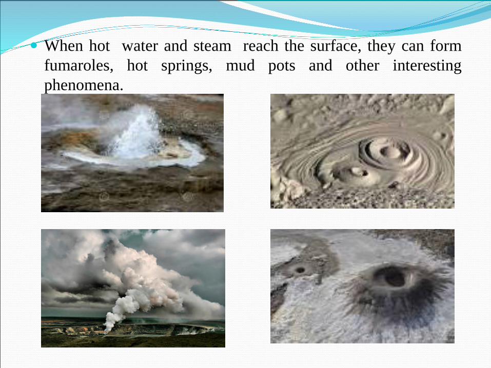
When hot water and steam reach the surface, they can formfumaroles, hot springs, mud pots and other interestingphenomena.
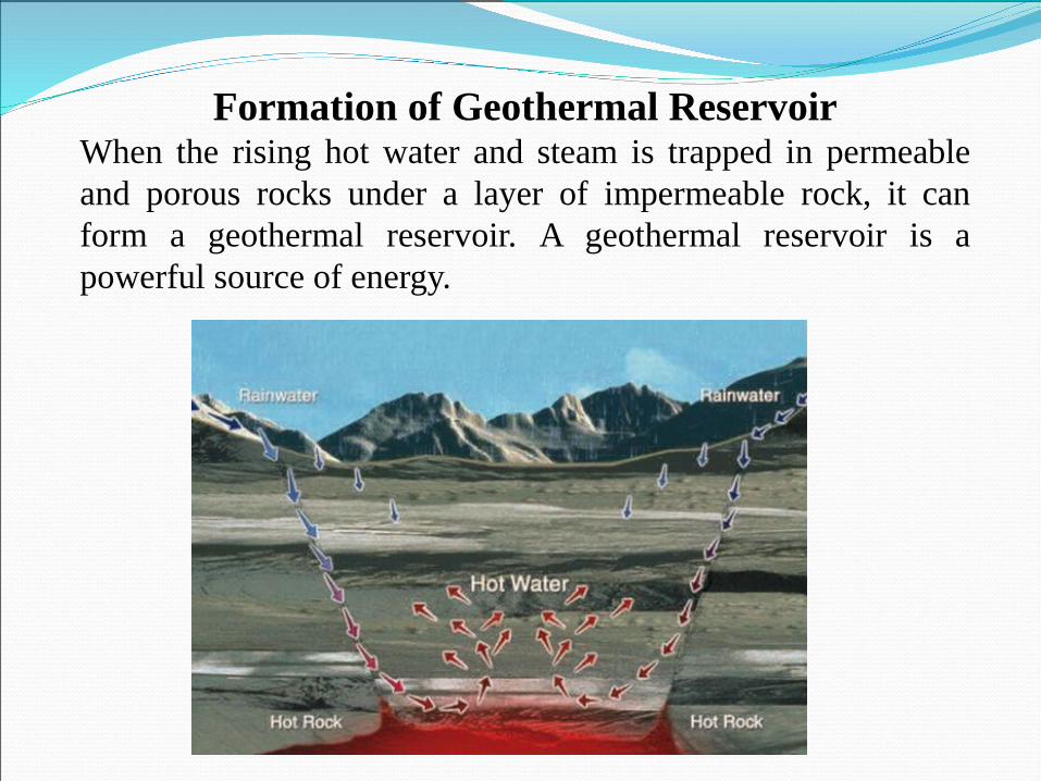
Formation of Geothermal ReservoirWhen the rising hot water and steam is trapped in permeableand porous rocks under a layer of impermeable rock, it canform a geothermal reservoir. A geothermal reservoir is apowerful source of energy.
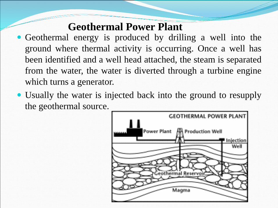
Geothermal energy is produced by drilling a well into theground where thermal activity is occurring. Once a well hasbeen identified and a well head attached, the steam is separatedfrom the water, the water is diverted through a turbine enginewhich turns a generator.
Usually the water is injected back into the ground to resupplythe geothermal source.
Geothermal Power Plant
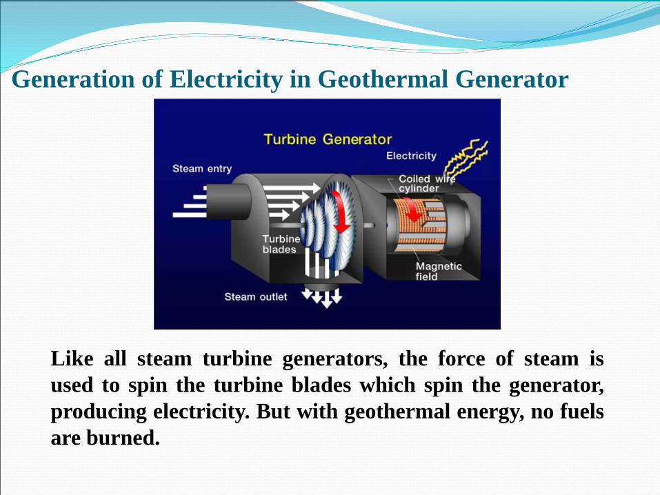
Generation of Electricity in Geothermal Generator
Like all steam turbine generators, the force of steam isused to spin the turbine blades which spin the generator,producing electricity. But with geothermal energy, no fuelsare burned.
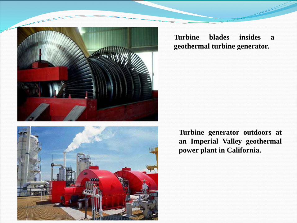
Turbine blades insides ageothermal turbine generator.
Turbine generator outdoors atan Imperial Valley geothermalpower plant in California.
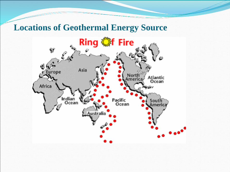
Locations of Geothermal Energy Source
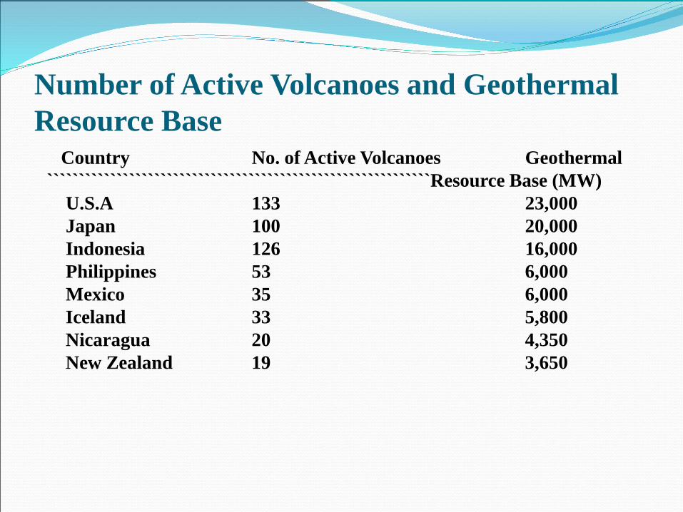
Number of Active Volcanoes and Geothermal Resource Base
Country No. of Active Volcanoes Geothermal `````````````````````````````````````````````````````````````Resource Base (MW)
U.S.A 133 23,000Japan 100 20,000Indonesia 126 16,000Philippines 53 6,000Mexico 35 6,000Iceland 33 5,800Nicaragua 20 4,350New Zealand 19 3,650
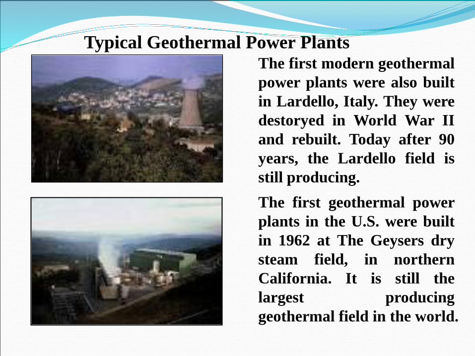
The first modern geothermalpower plants were also builtin Lardello, Italy. They weredestoryed in World War IIand rebuilt. Today after 90years, the Lardello field isstill producing.The first geothermal powerplants in the U.S. were builtin 1962 at The Geysers drysteam field, in northernCalifornia. It is still thelargest producinggeothermal field in the world.
Typical Geothermal Power Plants
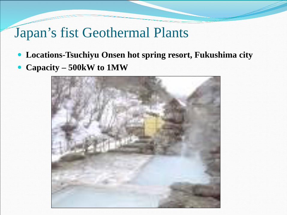
Japan’s fist Geothermal Plants Locations-Tsuchiyu Onsen hot spring resort, Fukushima city Capacity – 500kW to 1MW
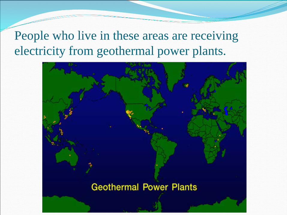
People who live in these areas are receiving electricity from geothermal power plants.
Geothermal electricity in the WorldThe International Geothermal Association (IGA) hasreported that 10,715 megawtts (MW) of geothermalpower in 24 countries is online, which is expected togenerate 67,246 GWh of electricity in 2010. IGAprojects growth to 18,500 MW by 2015.
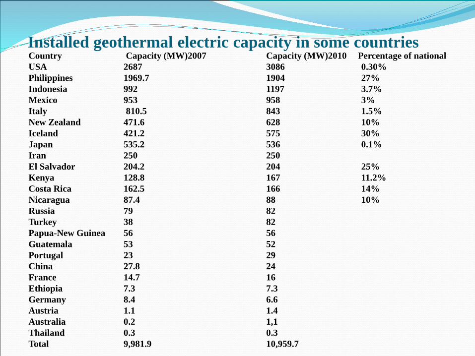
Installed geothermal electric capacity in some countriesCountry Capacity (MW)2007 Capacity (MW)2010 Percentage of nationalUSA 2687 3086 0.30%Philippines 1969.7 1904 27%Indonesia 992 1197 3.7%Mexico 953 958 3%Italy 810.5 843 1.5%New Zealand 471.6 628 10%Iceland 421.2 575 30%Japan 535.2 536 0.1%Iran 250 250El Salvador 204.2 204 25%Kenya 128.8 167 11.2%Costa Rica 162.5 166 14%Nicaragua 87.4 88 10%Russia 79 82Turkey 38 82Papua-New Guinea 56 56Guatemala 53 52Portugal 23 29China 27.8 24France 14.7 16Ethiopia 7.3 7.3Germany 8.4 6.6Austria 1.1 1.4Australia 0.2 1,1Thailand 0.3 0.3Total 9,981.9 10,959.7
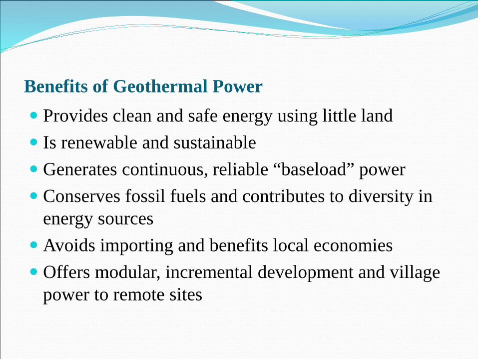
Benefits of Geothermal Power Provides clean and safe energy using little land Is renewable and sustainable Generates continuous, reliable “baseload” power Conserves fossil fuels and contributes to diversity in
energy sources Avoids importing and benefits local economies Offers modular, incremental development and village
power to remote sites
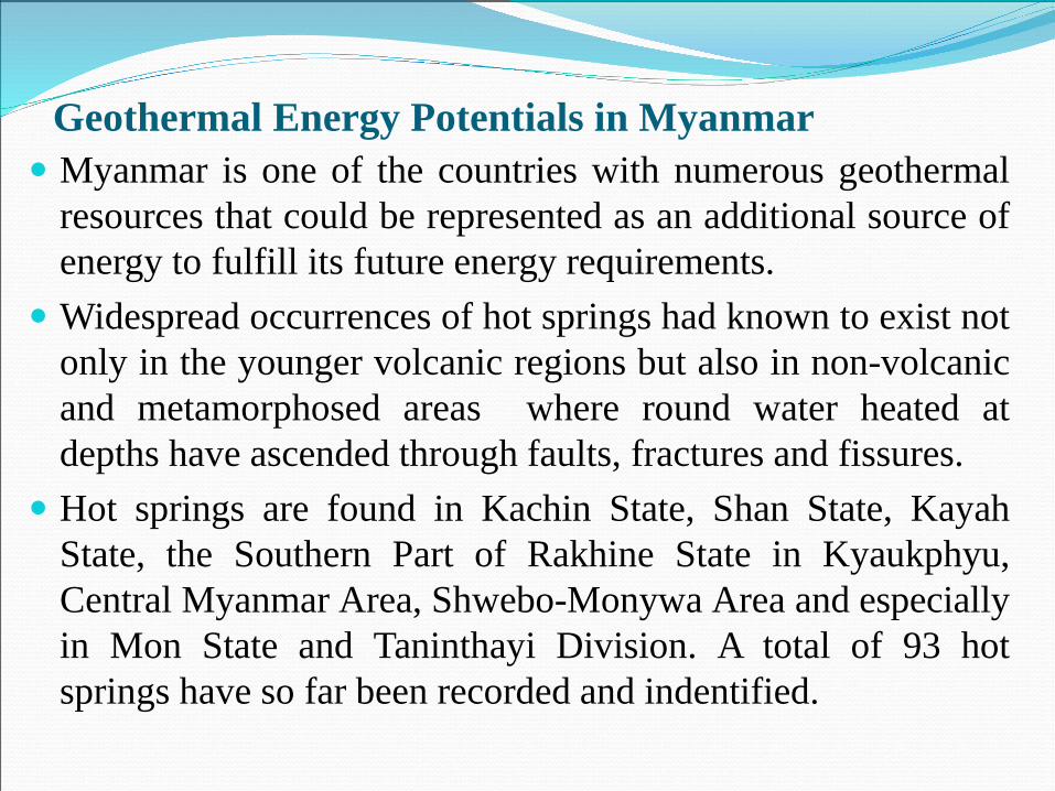
Geothermal Energy Potentials in Myanmar Myanmar is one of the countries with numerous geothermal
resources that could be represented as an additional source ofenergy to fulfill its future energy requirements.
Widespread occurrences of hot springs had known to exist notonly in the younger volcanic regions but also in non-volcanicand metamorphosed areas where round water heated atdepths have ascended through faults, fractures and fissures.
Hot springs are found in Kachin State, Shan State, KayahState, the Southern Part of Rakhine State in Kyaukphyu,Central Myanmar Area, Shwebo-Monywa Area and especiallyin Mon State and Taninthayi Division. A total of 93 hotsprings have so far been recorded and indentified.
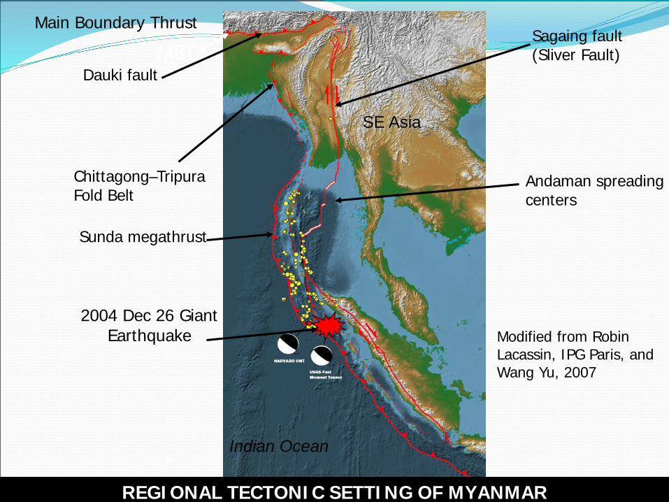
SE Asia
Indian Ocean
Modified from Robin Lacassin, IPG Paris, and Wang Yu, 2007
MBTSagaing fault(Sliver Fault)
Chittagong–TripuraFold Belt
Dauki fault
Sunda megathrust
Andaman spreading centers
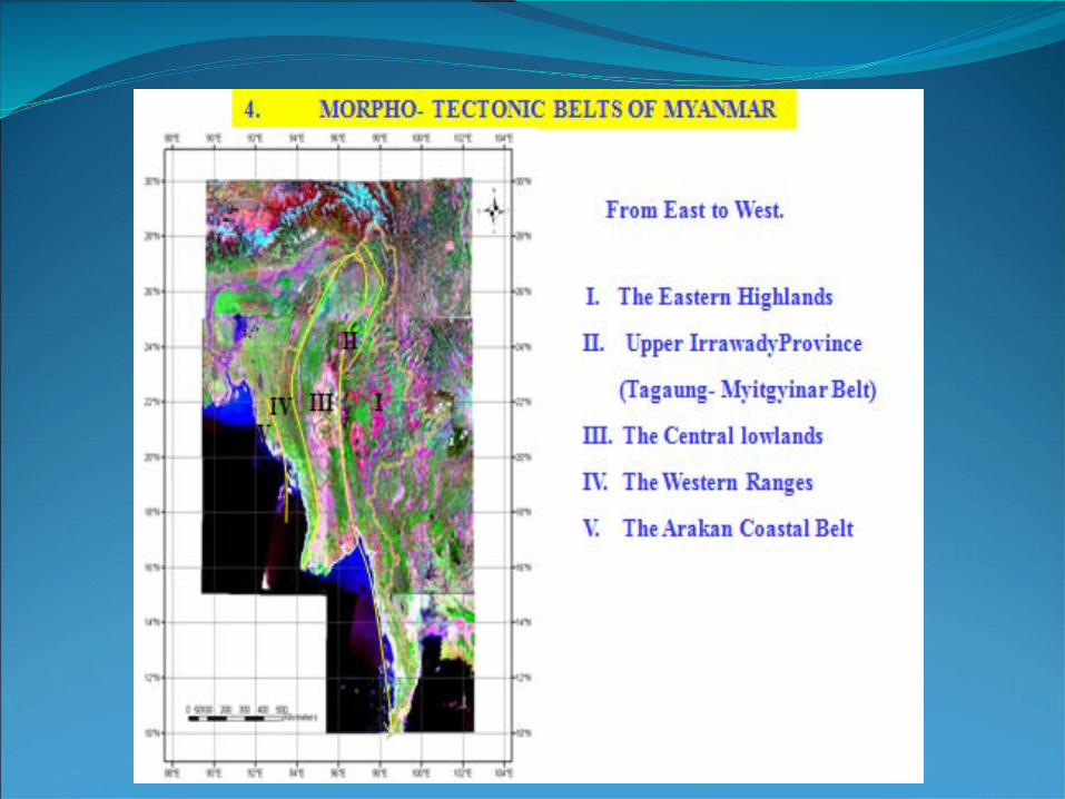
REGIONAL TECTONIC SETTING OF MYANMAR
Main Boundary Thrust
2004 Dec 26 Giant Earthquake
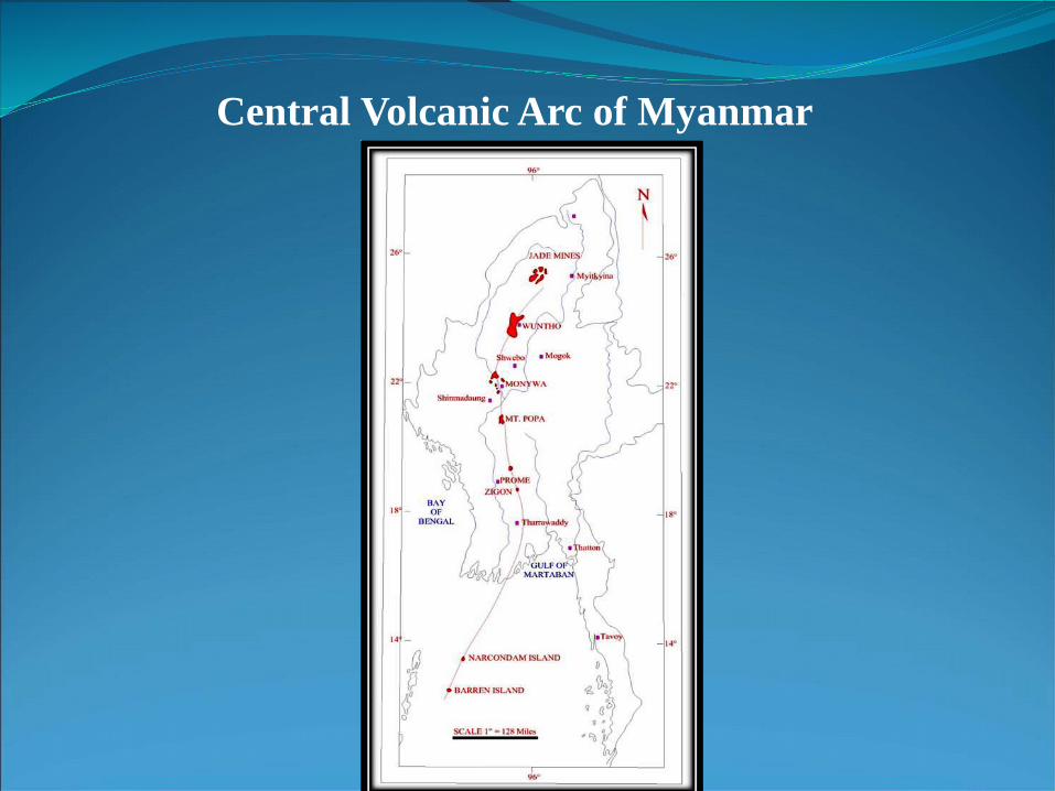
Central Volcanic Arc of Myanmar
Putao
MyitkyinaTaungthonlon
Pin-le-bu Bhamo
1
Wuntho
WESTERN GRANITOID
BELT Mogok
MonywaSalingyi
Mt.Popa
SagaingKyaukse
Pyetkaywe
Mandalay
Gu Taung
CENT
RAL Yinmabin
Pyaw bweYamethin
Tatkon
Pyinmana
Taungoo
Loikkaw
Mawchi Mine
YANGONKyeithiyoThaton
Andaman
Sea250 km
Dawei HermyingyiMine]
Myeik
Kawthaung
BANGKOK
THAILAND
Tachileik
Kengtung
EASTERN GRANITOID
BELT
CHINA
INDIA
25°
BANG
LADESH
Bay of
Bengal
LEGEND
Porphyry Cu-related
Bawdwin
Lashio
LAO P.D.R
SCALE
Western belt granitoidW-Sn related centralbelt granitoidW-Sn related, Eastern belt granitoid
Possible boundary betweengranitoid belts
Major towns
Peak of mountains
Major W-Sn mines
Major granitoid bodies in Central belt
92°
20°
15°
10°
97° 102°
25°
20°
15°
10°92° 97° 102°
1250
GRA
NITO
ID
BEL
T
2
3
4
56
7
8
9
10
11
12
11
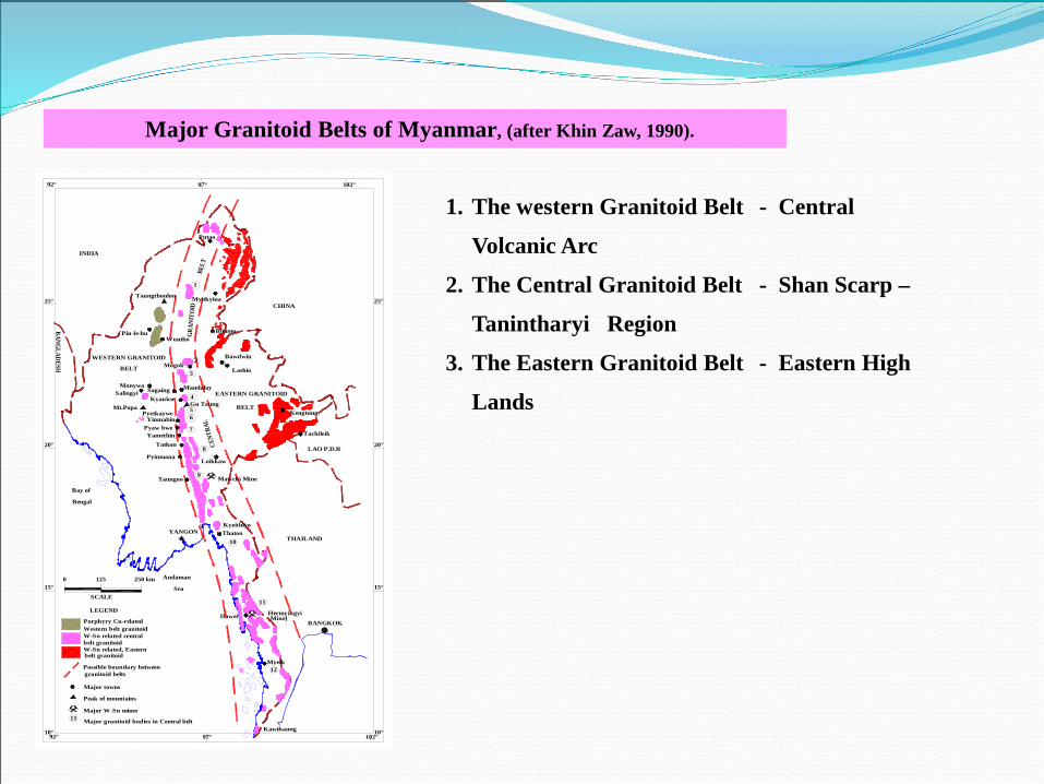
1. The western Granitoid Belt - Central
Volcanic Arc
2. The Central Granitoid Belt - Shan Scarp –
Tanintharyi Region
3. The Eastern Granitoid Belt - Eastern High
Lands
Major Granitoid Belts of Myanmar, (after Khin Zaw, 1990).
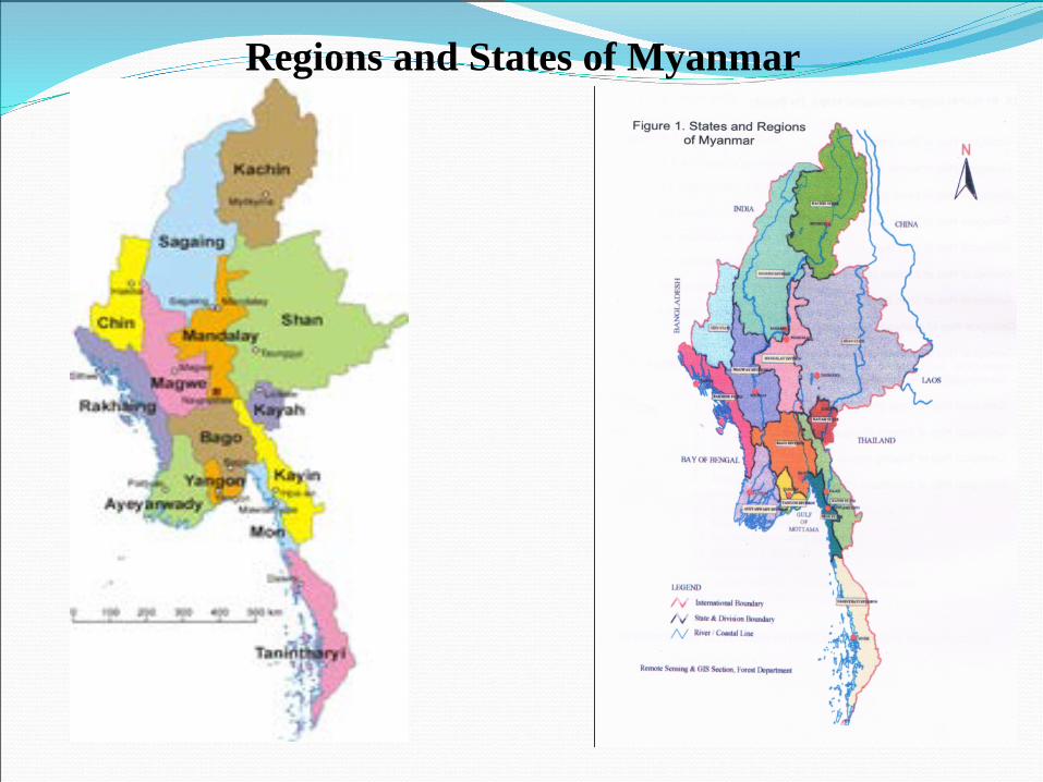
Regions and States of Myanmar
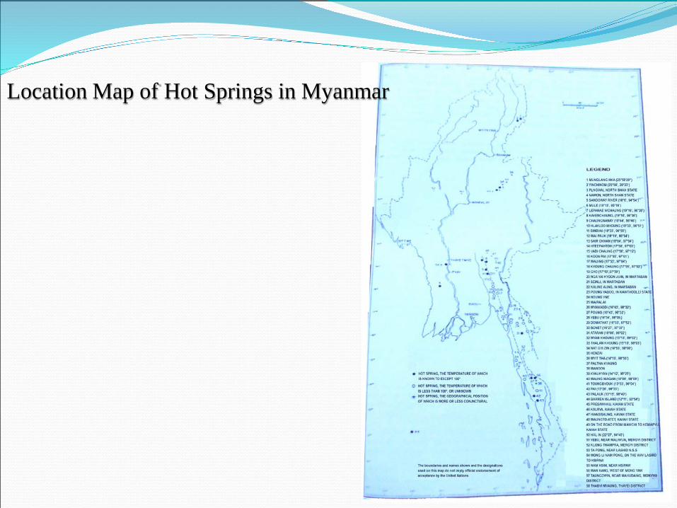
Location Map of Hot Springs in Myanmar
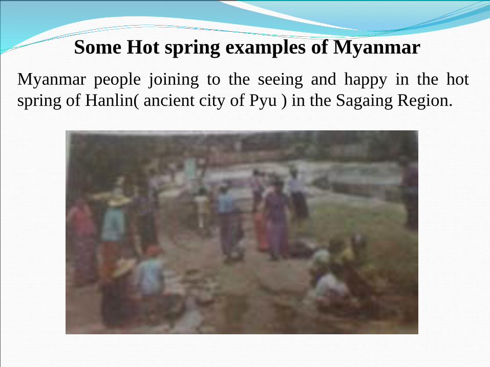
Myanmar people joining to the seeing and happy in the hotspring of Hanlin( ancient city of Pyu ) in the Sagaing Region.
Some Hot spring examples of Myanmar
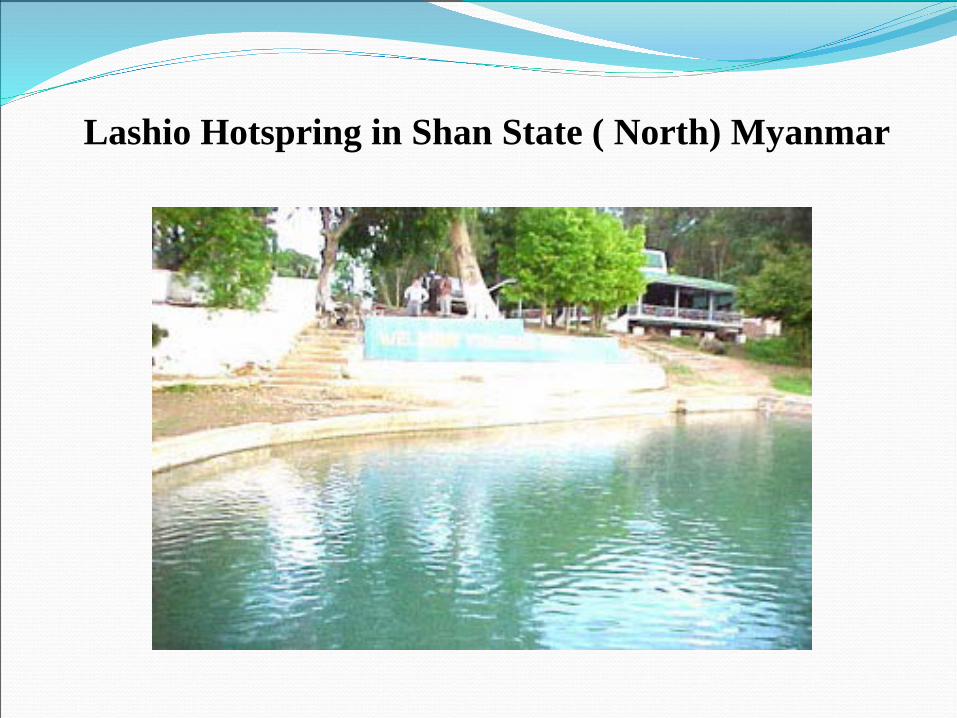
Lashio Hotspring in Shan State ( North) Myanmar
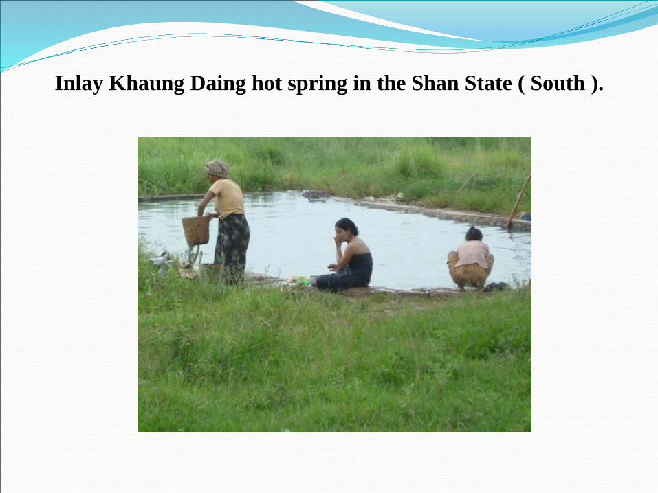
Inlay Khaung Daing hot spring in the Shan State ( South ).

Inlay Lake Khaungdaing hot spring at Tourism place
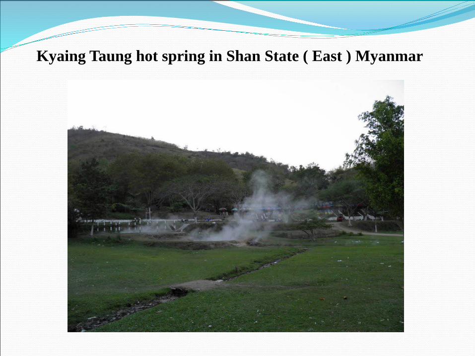
Kyaing Taung hot spring in Shan State ( East ) Myanmar
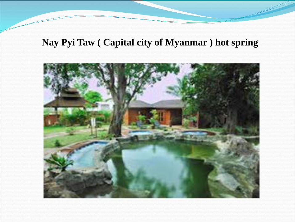
Nay Pyi Taw ( Capital city of Myanmar ) hot spring
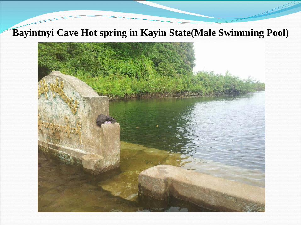
Bayintnyi Cave Hot spring in Kayin State(Male Swimming Pool)
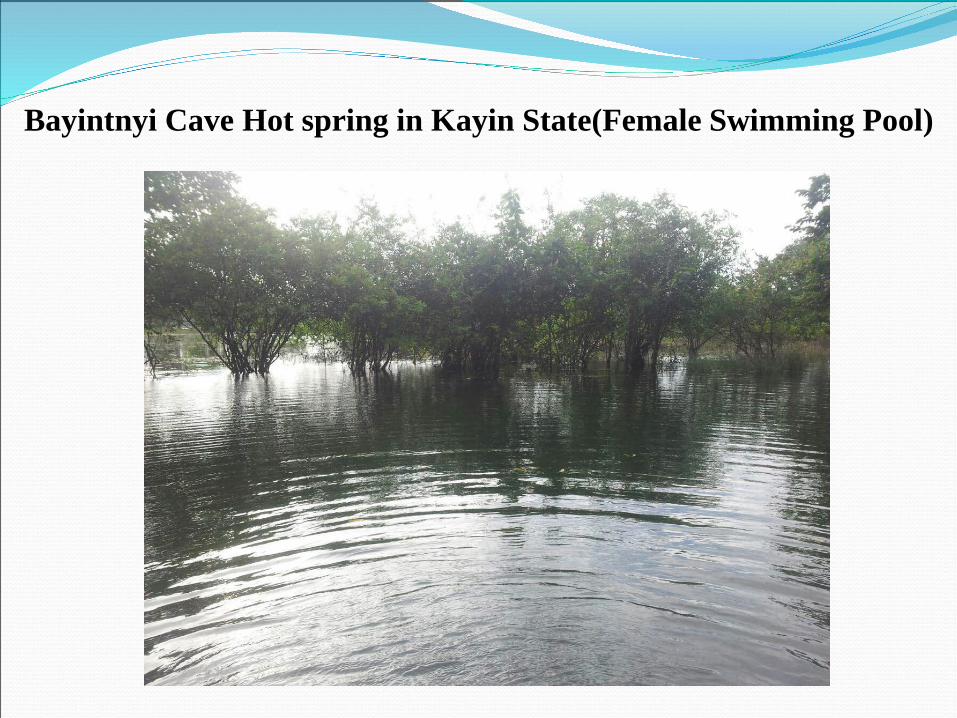
Bayintnyi Cave Hot spring in Kayin State(Female Swimming Pool)
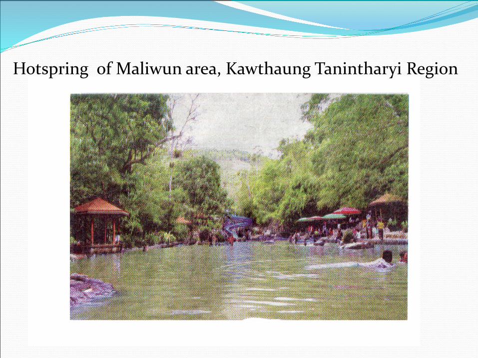
Hotspring of Maliwun area, Kawthaung Tanintharyi Region
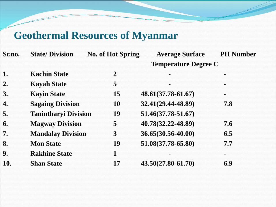
Geothermal Resources of MyanmarSr.no. State/ Division No. of Hot Spring Average Surface PH Number
Temperature Degree C1. Kachin State 2 - -2. Kayah State 5 - -3. Kayin State 15 48.61(37.78-61.67) -4. Sagaing Division 10 32.41(29.44-48.89) 7.85. Tanintharyi Division 19 51.46(37.78-51.67)6. Magway Division 5 40.78(32.22-48.89) 7.67. Mandalay Division 3 36.65(30.56-40.00) 6.58. Mon State 19 51.08(37.78-65.80) 7.79. Rakhine State 1 - -10. Shan State 17 43.50(27.80-61.70) 6.9
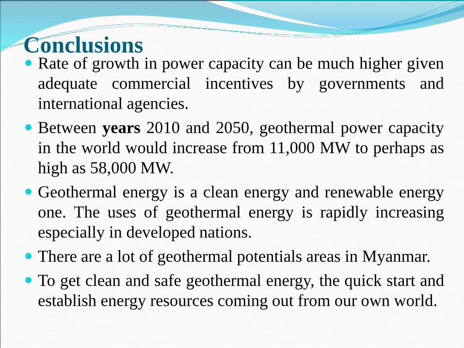
Conclusions Rate of growth in power capacity can be much higher given
adequate commercial incentives by governments andinternational agencies.
Between years 2010 and 2050, geothermal power capacityin the world would increase from 11,000 MW to perhaps ashigh as 58,000 MW.
Geothermal energy is a clean energy and renewable energyone. The uses of geothermal energy is rapidly increasingespecially in developed nations.
There are a lot of geothermal potentials areas in Myanmar. To get clean and safe geothermal energy, the quick start and
establish energy resources coming out from our own world.

Thank You VerY Much!
Recommended