Preserving State and Local Government Digital Geospatial Data Steve MorrisHead of Digital Library InitiativesNorth Carolina State University Libraries
ALA NDIIPP Symposium June 25, 2007

Note: Percentages based on the actual number of respondents to each question 2
NC Geospatial Data Archiving Project
Partnership between university library (NCSU) and state agency (NC Center for Geographic Information & Analysis)Focus on state and local geospatial content in North Carolina (state demonstration)Tied to NC OneMap initiative, which provides for seamless access to data, metadata, and inventoriesObjective: engage existing state/federal geospatial data infrastructures in preservation
Serve as catalyst for discussion within industry

Note: Percentages based on the actual number of respondents to each question 3
NCGDAP: Targeted Content
Resource TypesGIS “vector” (point/line/polygon) dataDigital orthophotography Digital mapsTabular data (e.g. assessment data)
Content ProducersMostly state, local, regional agenciesSome university, not-for-profit, commercialSelected local federal projects

Note: Percentages based on the actual number of respondents to each question 4
Targeted data: Vector data
Cadastral (tax parcels) Street centerlinesZoningTopographic contoursSchool, sheriff, fireVoting precinctsMore …
• 98 of 100 NC counties have GIS• More detailed, accurate, current• Subject to frequent update

Note: Percentages based on the actual number of respondents to each question 5
Targeted data: Digital orthophotography
• 90+ NC counties with orthophotos• 1-5 flights per county• 30-300 gb per flight

Note: Percentages based on the actual number of respondents to each question 6
GIS Software
Software project file (.mxd, .apr, …)
Data layer file (.avl, .lyr, …)
PDF map exports
Web Services-based representations
Targeted data: Cartographic

Note: Percentages based on the actual number of respondents to each question 7
Not yet targeted data: Place-based data
Mobile, LBS, and, social networking applications
Long-term cultural heritage value in non-overhead imagery: more descriptive of place and function
Oblique Imagery
DOT Videologs
Tax Dept. Photos
Street View Images
Note: Percentages based on the actual number of respondents to each question 8
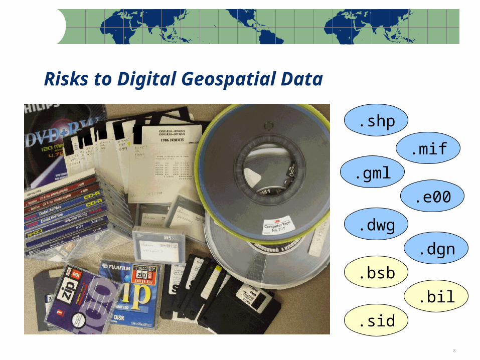
Risks to Digital Geospatial Data
.shp
.mif
.gml
.e00
.dwg
.dgn
.bsb
.bil
.sid

Note: Percentages based on the actual number of respondents to each question 9
Risks to State/Local Geospatial Data
Producer focus on current dataData overwrite as common practice
Future support of data formats in questionNo open, supported format for vector data
Shift to web services-based accessData becoming more ephemeral
Inadequate or nonexistent metadataImpedes discovery and use
Increasing use of spatial databases for data management
The whole is greater than the sum of the parts

Note: Percentages based on the actual number of respondents to each question 10
Local Applications Where GIS Is Used
0%
20%
40%
60%
80%
100%
Economic Development Emergency Management
GIS/ Mapping Planning/ Community Development
Police/ Public Safety Public Works
Utilities Water/ Waste Water
Source: NC OneMap Data Inventory 2004

Note: Percentages based on the actual number of respondents to each question 11
Temporal Data Supports Decision-Making
Land use change analysisReal estate trend analysisSite selection (past uses?)
Forecasting
Parcel Boundary Changes 2001-2004
North Raleigh, NC

Note: Percentages based on the actual number of respondents to each question 12
Suburban Development 1993/2002
Near Mecklenburg-Cabarrus County border
Temporal Data Supports Decision-Making

13
Wake County, NC
Interstate 540 / US Highway 70
Interchange
Near Raleigh/DurhamInternational Airport
2005 Wake County Ortho

14

Note: Percentages based on the actual number of respondents to each question 15
Today’s geospatial data as tomorrow’s cultural heritage
Future uses of data are difficult to anticipate (as with Sanborn Maps).

Note: Percentages based on the actual number of respondents to each question 16
Challenge: Vector Data Formats
No widely-supported, open vector formats for geospatial data
Spatial Data Transfer Standard (SDTS) not widely supportedGeography Markup Language (GML) – diversity of application schemas and profiles threatens permanent access
Spatial DatabasesThe whole is more than the sum of the parts, and the whole is very difficult to preserveCan export individual data layers for curationSome thinking of using the spatial database as the primary archival platform

Note: Percentages based on the actual number of respondents to each question 17
Challenge: Cartographic Representation
Counterpart to the map is not just the dataset but also models, symbolization, classification, annotation, etc.

Note: Percentages based on the actual number of respondents to each question 18
Challenge: Geospatial Web Services
• How to capture records from decision- making processes?• Possible: Atlas collections from automated image capture• Web 2.0 impact: Emerging tiling and caching schemes (archive target?)

Note: Percentages based on the actual number of respondents to each question 19
Challenge: Preservation Metadata
Metadata Archived?
0.0%10.0%20.0%30.0%40.0%50.0%60.0%70.0%
FGDC format Locally definedmetadata
NC OneMapmetadata starter
block
None
% o
f R
esp
on
den
ts
Results from a 2006 survey of all 100 NC counties and 25 largest NC municipalities
Note: Percentages based on the actual number of respondents to each question 20
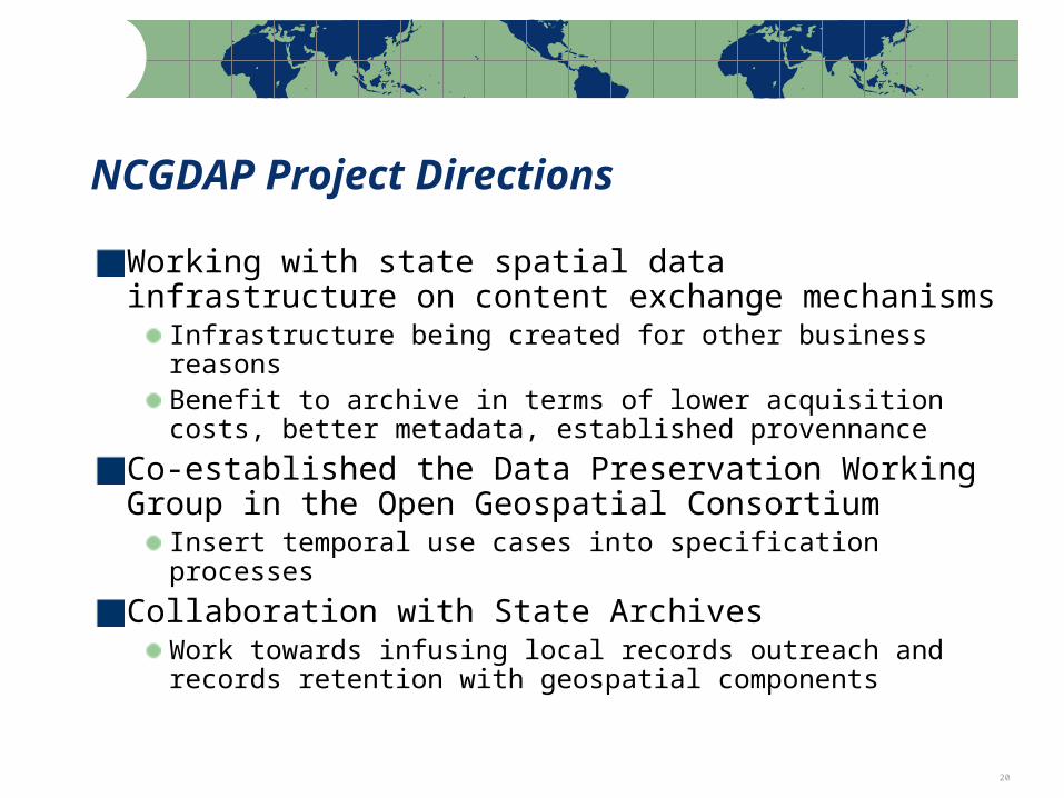
NCGDAP Project Directions
Working with state spatial data infrastructure on content exchange mechanisms
Infrastructure being created for other business reasonsBenefit to archive in terms of lower acquisition costs, better metadata, established provennance
Co-established the Data Preservation Working Group in the Open Geospatial Consortium
Insert temporal use cases into specification processes
Collaboration with State ArchivesWork towards infusing local records outreach and records retention with geospatial components

Note: Percentages based on the actual number of respondents to each question 21
Questions?
Steve MorrisHead, Digital Library InitiativesNCSU Librariesph: (919) [email protected]
http://www.lib.ncsu.edu/ncgdap
Recommended