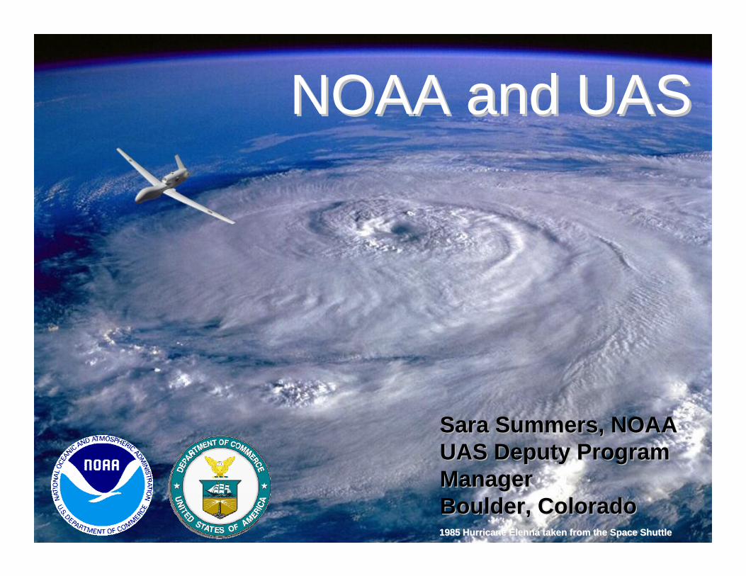
1985 Hurricane 1985 Hurricane ElennaElenna taken from the Space Shuttletaken from the Space Shuttle
Sara Summers, NOAA Sara Summers, NOAA UAS Deputy Program UAS Deputy Program ManagerManagerBoulder, Colorado Boulder, Colorado
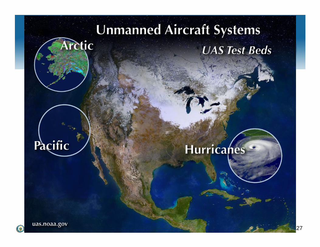
NOAA and UASNOAA and UAS

NOAA's International Arctic Campaign 2
MotivationMotivationMotivation
“We must move new but proven observing systems into an operational environment and redirect associated resources and research toward exploring new technologies, such as unmanned aerial vehicles, to meet future requirements.”
Æ VADM Conrad C. Lautenbacher,August 2005
NOAA's International Arctic Campaign 3
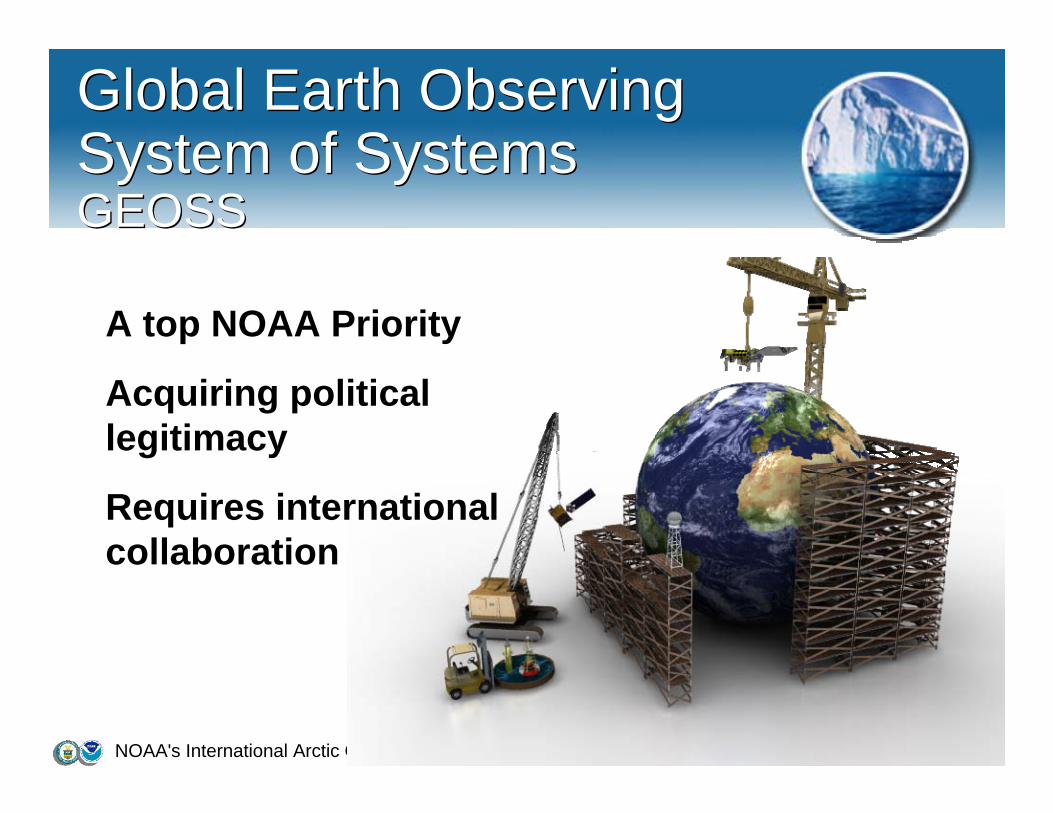
Global Earth Observing System of SystemsGEOSS
Global Earth Observing System of SystemsGEOSS
A top NOAA Priority
Acquiring political legitimacy
Requires international collaboration

NOAA's International Arctic Campaign 4
Improved Observations Hold the Key to Saving Lives, Property and Resources
Improved Observations Hold the Key to Saving Lives, Property and Resources
Examining the state of the planet’s natural resources
Improving weather forecasts
Understanding global climate change
Understanding the rate of Arctic Ice melt
Improved hurricane track and intensity predictions
Fire Weather
NOAA's International Arctic Campaign 5
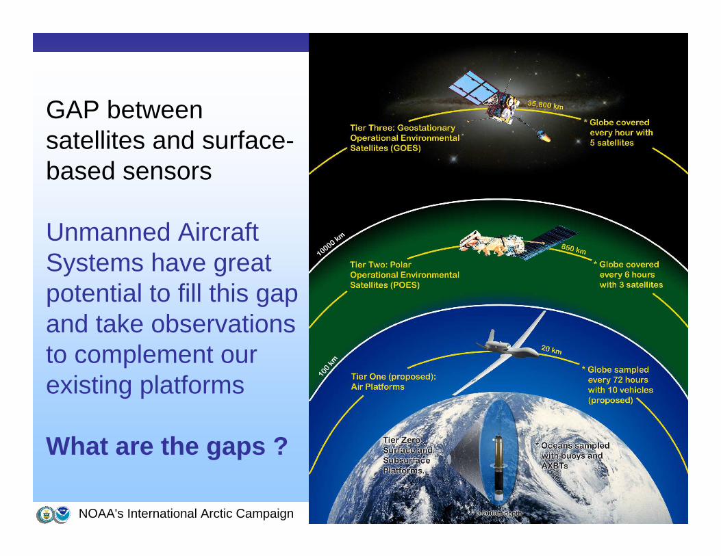
GAP between satellites and surface-based sensors
Unmanned Aircraft Systems have great potential to fill this gap and take observations to complement our existing platforms
What are the gaps ?
NOAA's International Arctic Campaign 6
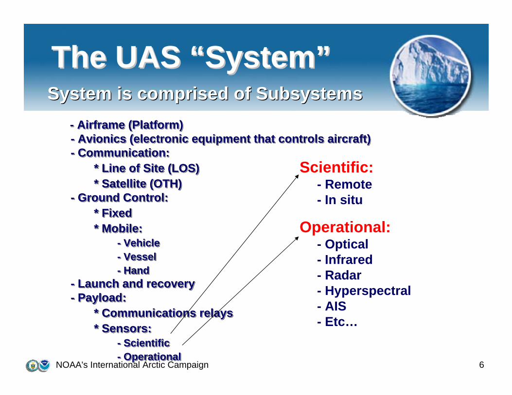
The UAS The UAS ““SystemSystem””System is comprised of Subsystems
- Airframe (Platform)- Avionics (electronic equipment that controls aircraft)- Communication:
* Line of Site (LOS)* Satellite (OTH)
- Ground Control:* Fixed* Mobile:
- Vehicle- Vessel- Hand
- Launch and recovery- Payload:
* Communications relays* Sensors:
- Scientific- Operational
System is comprised of Subsystems-- Airframe (Platform)Airframe (Platform)-- Avionics (electronic equipment that controls aircraft)Avionics (electronic equipment that controls aircraft)-- Communication:Communication:
* Line of Site (LOS)* Line of Site (LOS)* Satellite (OTH)* Satellite (OTH)
-- Ground Control:Ground Control:* Fixed* Fixed* Mobile:* Mobile:
-- VehicleVehicle-- VesselVessel-- HandHand
-- Launch and recoveryLaunch and recovery-- PayloadPayload::
* Communications relays* Communications relays* Sensors:* Sensors:
-- ScientificScientific-- OperationalOperational
Scientific: - Remote - In situ
Operational: - Optical - Infrared - Radar - Hyperspectral- AIS - Etc…
NOAA's International Arctic Campaign 7
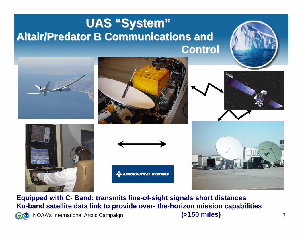
UAS UAS ““SystemSystem””Altair/Predator B Communications and Altair/Predator B Communications and
ControlControl
Equipped with C- Band: transmits line-of-sight signals short distancesKu-band satellite data link to provide over- the-horizon mission capabilities
(>150 miles)
NOAA's International Arctic Campaign 8
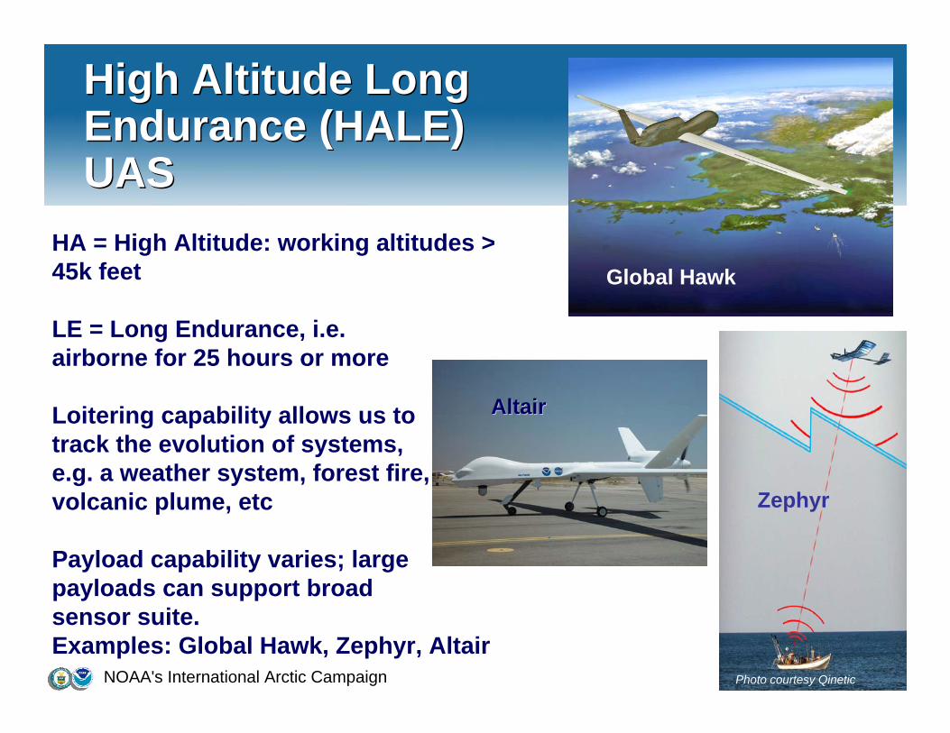
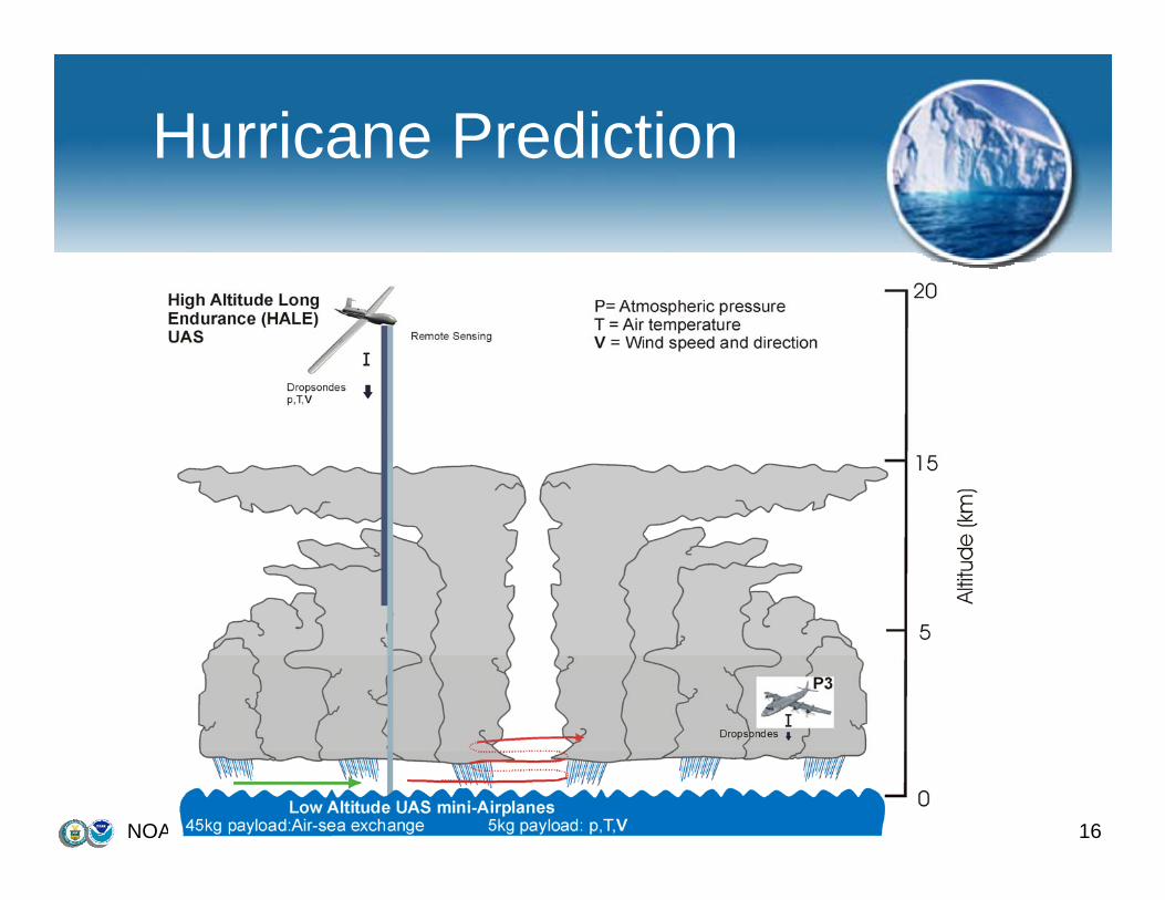
High Altitude Long Endurance (HALE) UAS
High Altitude Long Endurance (HALE) UAS
HA = High Altitude: working altitudes > 45k feet
LE = Long Endurance, i.e. airborne for 25 hours or more
Loitering capability allows us to track the evolution of systems, e.g. a weather system, forest fire, volcanic plume, etc
Payload capability varies; large payloads can support broad sensor suite.Examples: Global Hawk, Zephyr, Altair
Global Hawk
Courtesy Northrop Grumman
Photo courtesy Qinetic
ZephyrZephyr
AltairAltair
NOAA's International Arctic Campaign 9
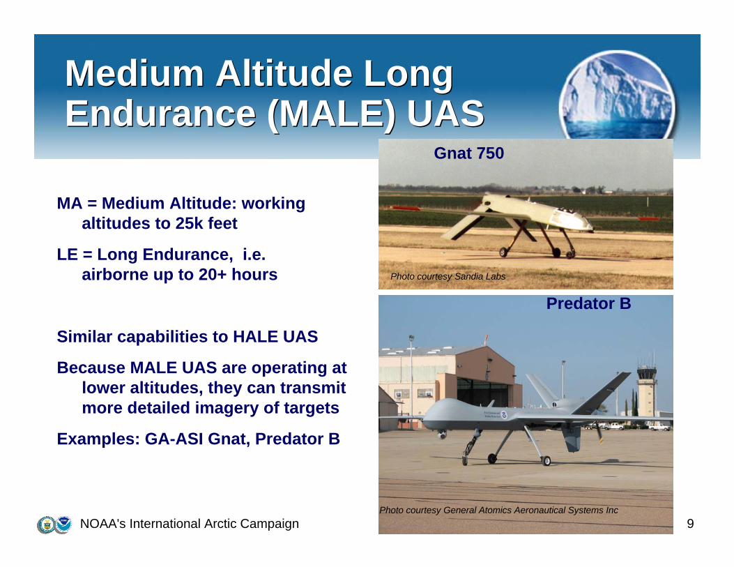
Medium Altitude Long Endurance (MALE) UASMedium Altitude Long Endurance (MALE) UAS
MA = Medium Altitude: working altitudes to 25k feet
LE = Long Endurance, i.e. airborne up to 20+ hours
Similar capabilities to HALE UAS
Because MALE UAS are operating at lower altitudes, they can transmit more detailed imagery of targets
Examples: GA-ASI Gnat, Predator B
Gnat 750
Photo courtesy Sandia Labs
Predator B
Photo courtesy General Atomics Aeronautical Systems Inc
NOAA's International Arctic Campaign 10
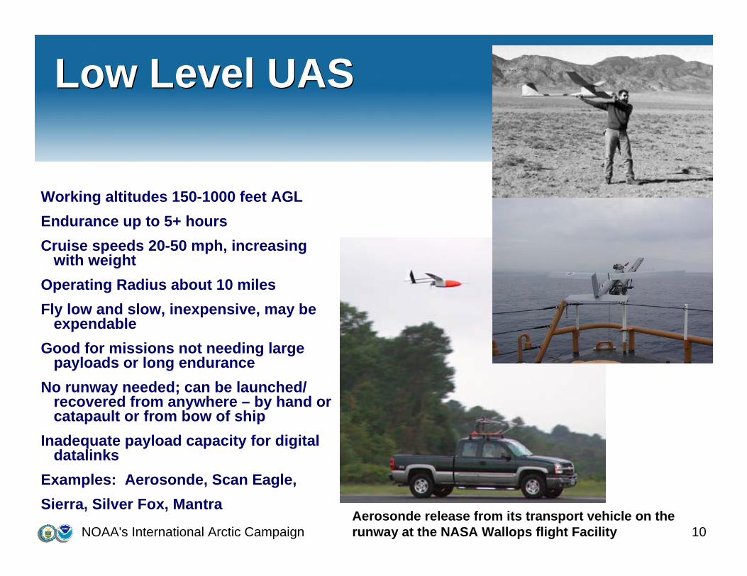
Low Level UASLow Level UAS
Working altitudes 150-1000 feet AGLEndurance up to 5+ hoursCruise speeds 20-50 mph, increasing
with weightOperating Radius about 10 milesFly low and slow, inexpensive, may be
expendableGood for missions not needing large
payloads or long enduranceNo runway needed; can be launched/
recovered from anywhere – by hand or catapault or from bow of ship
Inadequate payload capacity for digital datalinks
Examples: Aerosonde, Scan Eagle, Sierra, Silver Fox, Mantra
Aerosonde release from its transport vehicle on the runway at the NASA Wallops flight Facility
NOAA's International Arctic Campaign 11
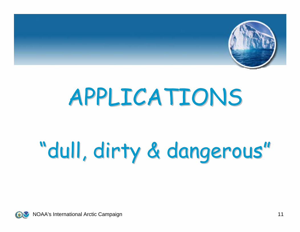
APPLICATIONSAPPLICATIONS
““dull, dirty & dangerousdull, dirty & dangerous””
NOAA's International Arctic Campaign 12
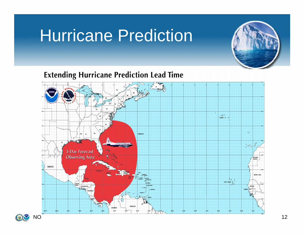
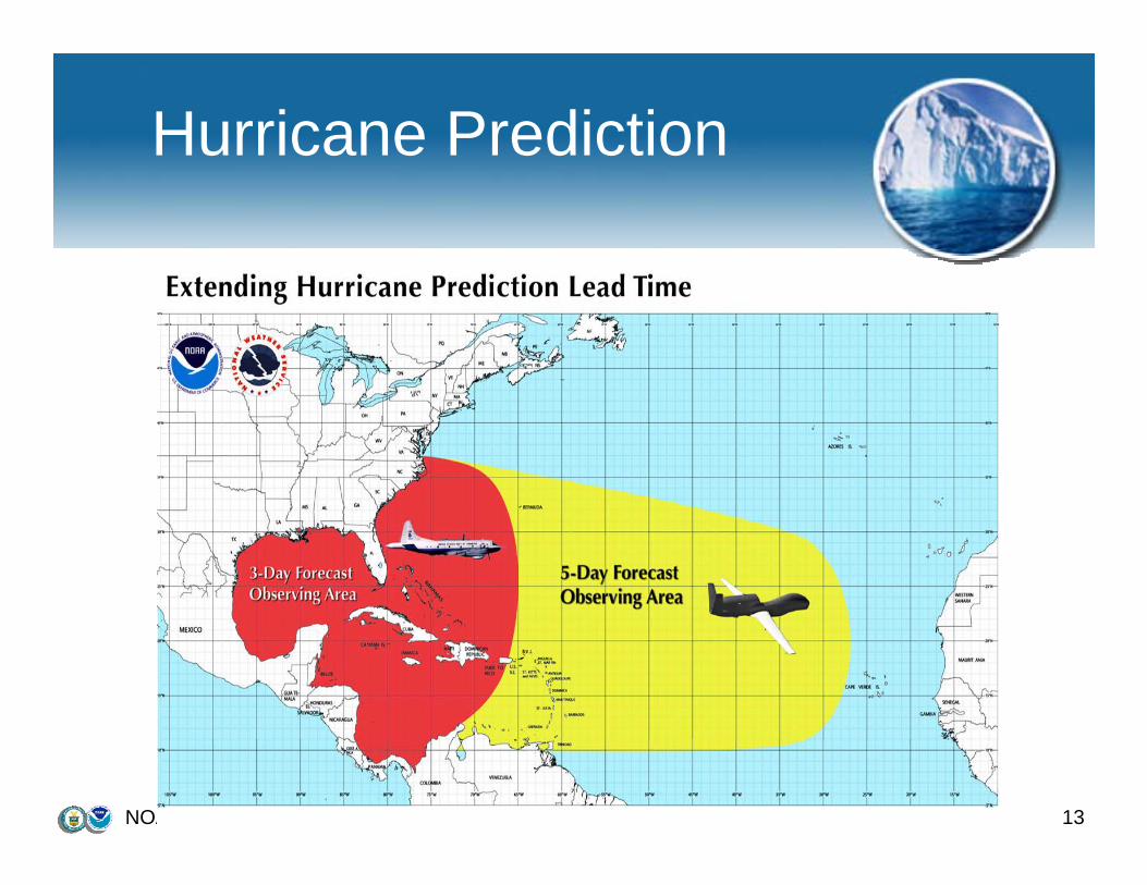
Hurricane Prediction
NOAA's International Arctic Campaign 13
Hurricane Prediction
NOAA's International Arctic Campaign 14
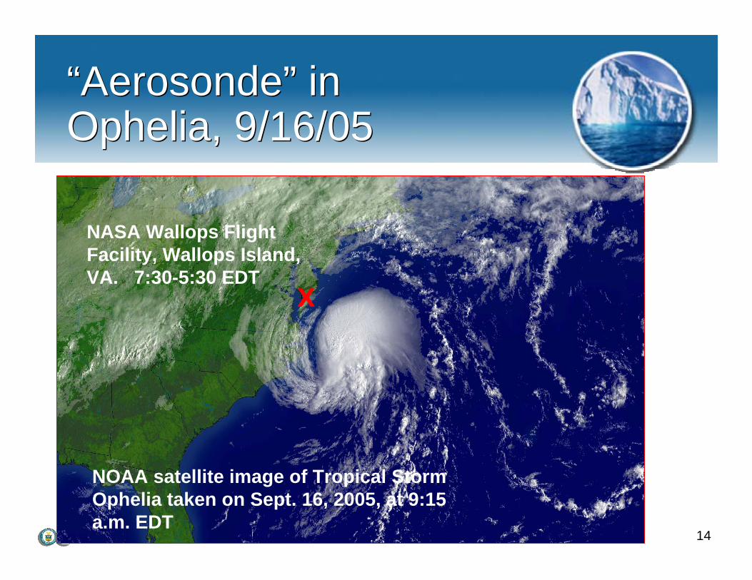
NOAA satellite image of Tropical Storm Ophelia taken on Sept. 16, 2005, at 9:15 a.m. EDT
X
NASA Wallops Flight Facility, Wallops Island, VA. 7:30-5:30 EDT
“Aerosonde” in Ophelia, 9/16/05“Aerosonde” in Ophelia, 9/16/05
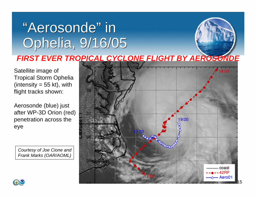
15
“Aerosonde” in Ophelia, 9/16/05“Aerosonde” in Ophelia, 9/16/05
969696
Satellite image of Tropical Storm Ophelia (intensity = 55 kt), with flight tracks shown:
Aerosonde (blue) just after WP-3D Orion (red) penetration across the eye
Courtesy of Joe Cione andFrank Marks (OAR/AOML)
FIRST EVER TROPICAL CYCLONE FLIGHT BY AEROSONDE
NOAA's International Arctic Campaign 16
Hurricane Prediction
NOAA's International Arctic Campaign 17
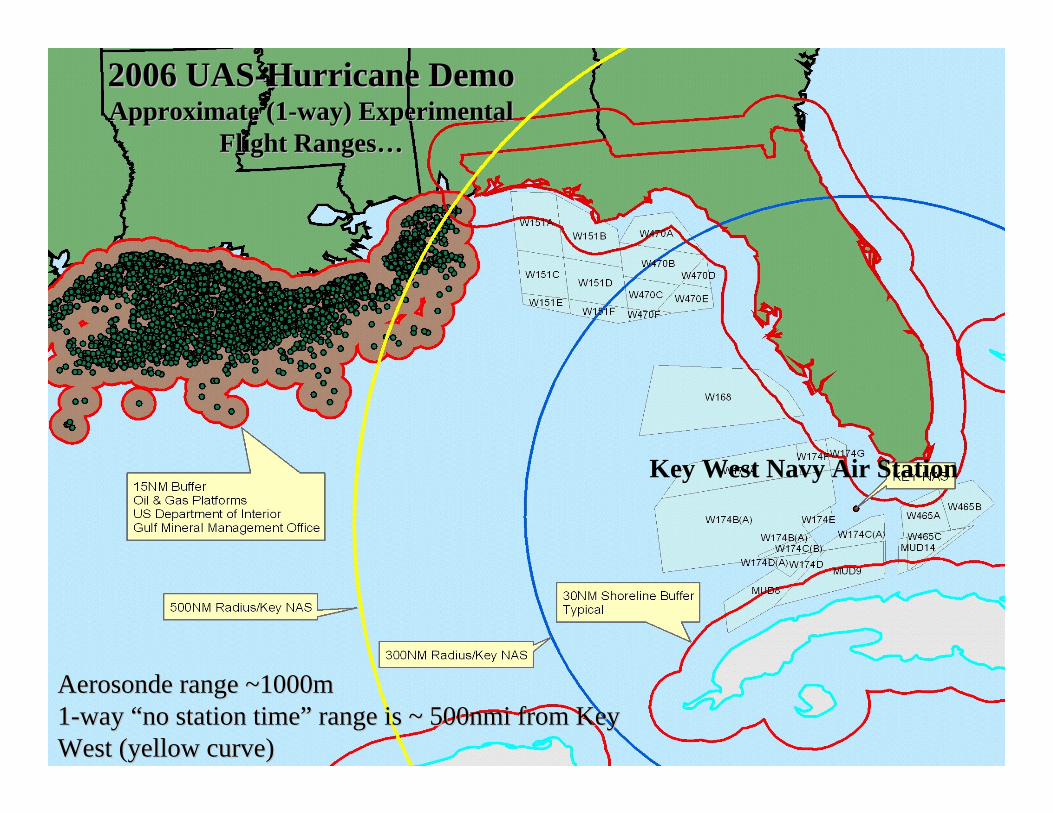
2006 Aerosonde Hurricane DemoApproximate (1-way) Experimental Flight Range…
2006 Aerosonde Hurricane 2006 Aerosonde Hurricane DemoDemoApproximate (1Approximate (1--way) way) Experimental Flight RangeExperimental Flight Range……
330nmi330nmi
X X (500nmi)(500nmi)
2006 UAS2006 UAS--Hurricane DemoHurricane DemoApproximate (1Approximate (1--way) Experimental way) Experimental
Flight RangesFlight Ranges……
AerosondeAerosonde range ~1000mrange ~1000m11--way way ““no station timeno station time”” range is ~ 500nmi from Key range is ~ 500nmi from Key West (yellow curve)West (yellow curve)
Key West Navy Air Station

NOAA's International Arctic Campaign 18
Firefighters employ hand held radios connecting them to each other, their command post, and the tankers
Firefighters receives HALE images on their PDA
Smoke jumpers & firefighters arrive
Fire Fighting Capability & PredictionFire Fighting Capability & Prediction
Courtesy Northrop GrummanCourtesy Northrop Grumman
NOAA's International Arctic Campaign 19
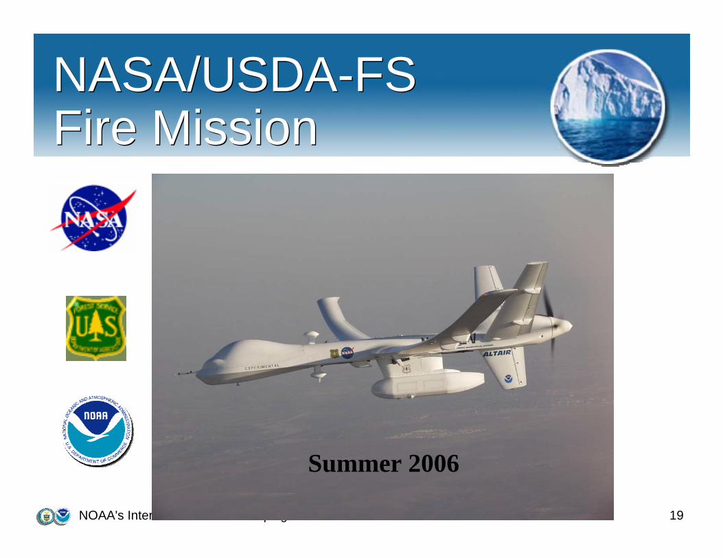
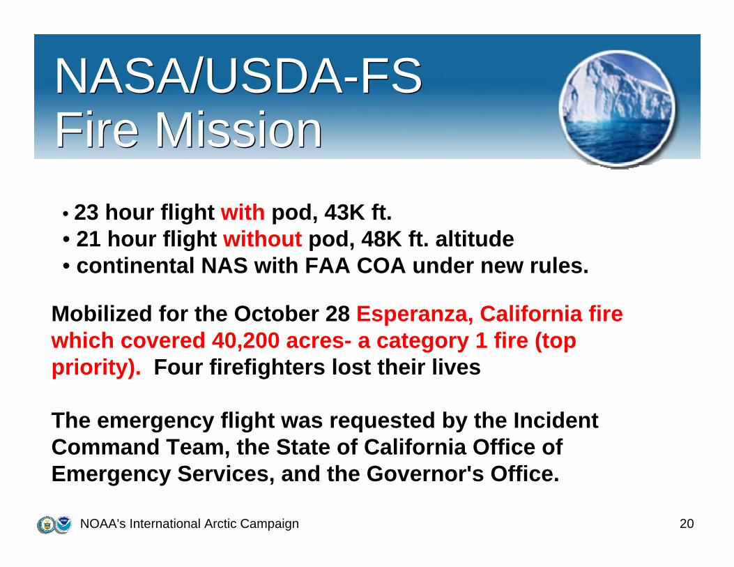
NASA/USDA-FS Fire MissionNASA/USDA-FS Fire Mission
Summer 2006
NOAA's International Arctic Campaign 20
NASA/USDA-FS Fire MissionNASA/USDA-FS Fire Mission• 23 hour flight with pod, 43K ft. • 21 hour flight without pod, 48K ft. altitude • continental NAS with FAA COA under new rules.
Mobilized for the October 28 Esperanza, California fire which covered 40,200 acres- a category 1 fire (top priority). Four firefighters lost their lives
The emergency flight was requested by the Incident Command Team, the State of California Office of Emergency Services, and the Governor's Office.
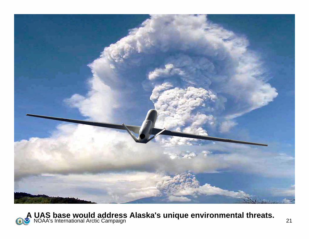
NOAA's International Arctic Campaign 21A UAS base would address Alaska's unique environmental threats.

NOAA's International Arctic Campaign 22
Arctic Ice MeltArctic Ice Melt
Existing Network:Sparse network of surface observations in the ArcticSatellite observations:Geostationary ~38,000km above the equatorInstruments have constant view of mid-lats and tropics, but a limited view of the poles.
Polar orbiting ~800kmCapture more detail because of lower altitude but complete coverage takes time. But difficulty in distinguishing between clouds and ice because radiative properties are similar – clouds and snow/ice have similartemperatures and similar albedos.
NOAA's International Arctic Campaign 23
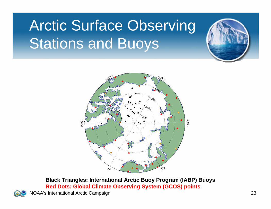
Arctic Surface Observing Stations and Buoys
Black Triangles: International Arctic Buoy Program (IABP) BuoysRed Dots: Global Climate Observing System (GCOS) points
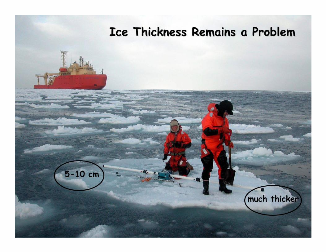
5-10 cm
much thicker
Ice Thickness Remains a Problem Ice Thickness Remains a Problem
NOAA's International Arctic Campaign 25
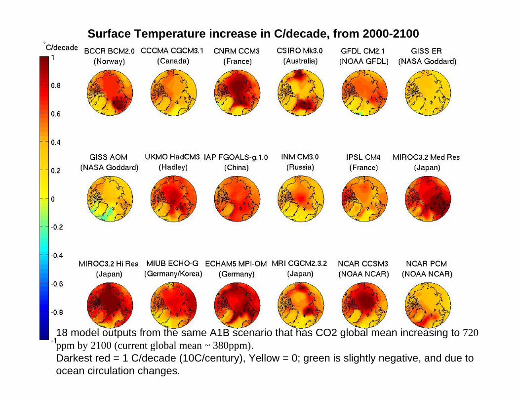
Surface Temperature increase in C/decade, from 2000-2100
18 model outputs from the same A1B scenario that has CO2 global mean increasing to 720 ppm by 2100 (current global mean ~ 380ppm).Darkest red = 1 C/decade (10C/century), Yellow = 0; green is slightly negative, and due toocean circulation changes.

NOAA's International Arctic Campaign 26
“Strawman” route for HALE UAS over the Arctic ice. Profiles of state variables and forcing are made at the 20 points shown. Under each point is a AUV to observe the temperature, salinity and ice depth at the same geographic point.
Arctic Ice MeltArctic Ice Melt
NOAA's International Arctic Campaign 27
NOAA's International Arctic Campaign 28
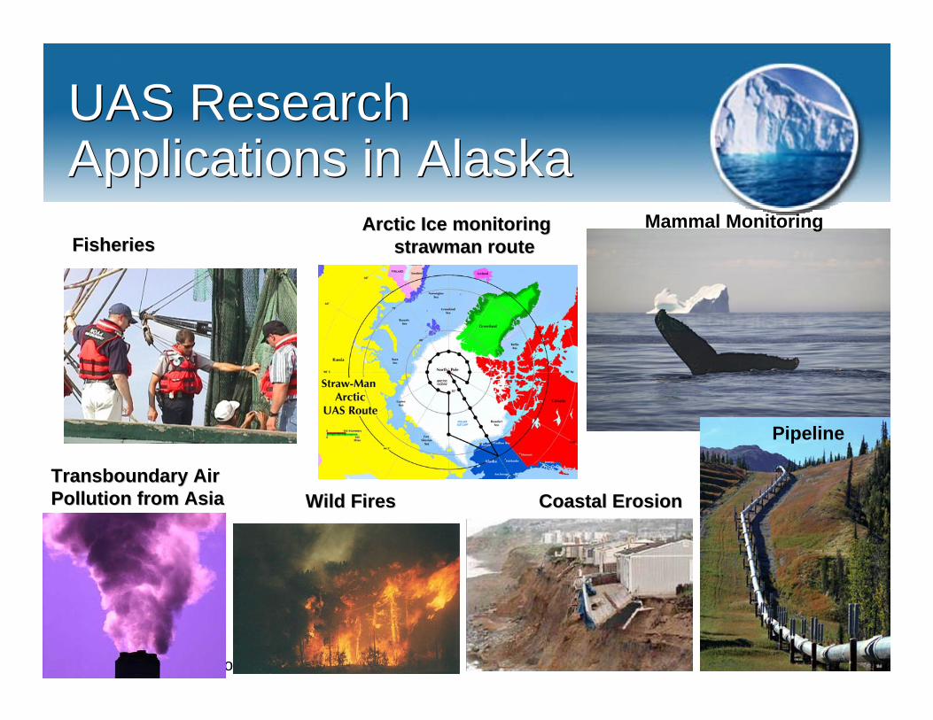
UAS Research Applications in AlaskaUAS Research Applications in Alaska
Pipeline
Wild FiresWild Fires
Mammal Monitoring
Coastal ErosionCoastal Erosion
Arctic Ice monitoringArctic Ice monitoringstrawmanstrawman routerouteFisheriesFisheries
TransboundaryTransboundary Air Air Pollution from AsiaPollution from Asia
NOAA's International Arctic Campaign 29
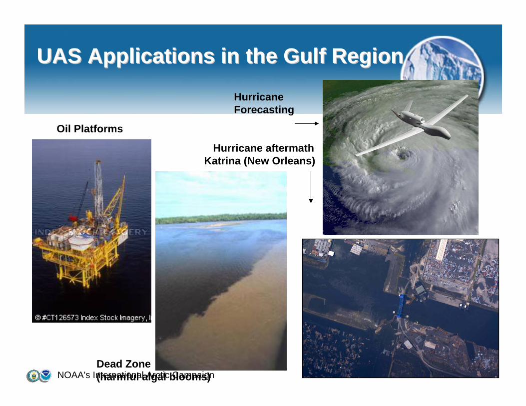
UAS Applications in the Gulf RegionUAS Applications in the Gulf Region
Dead Zone(harmful algal blooms)
Oil Platforms
HurricaneForecasting
Hurricane aftermath Katrina (New Orleans)

NOAA's International Arctic Campaign 30
UAS Applications in the PacificUAS Applications in the Pacific(35% of earth(35% of earth’’s surface)s surface)
Northwest Hawaiian Islands Marine National Monument: world’s largest marine sanctuary and one of the most pristine marine ecosystems in the world, nearly untouched by humans. 1,400 miles long, 100 miles wide, and home to more than 7,000 species, many seen nowhere else in the world
Pacific TyphoonPacific Typhoon(August 7, 2006)(August 7, 2006)
Ghost NetsGhost Nets
Atmospheric RiverAtmospheric River
NOAA's International Arctic Campaign 31
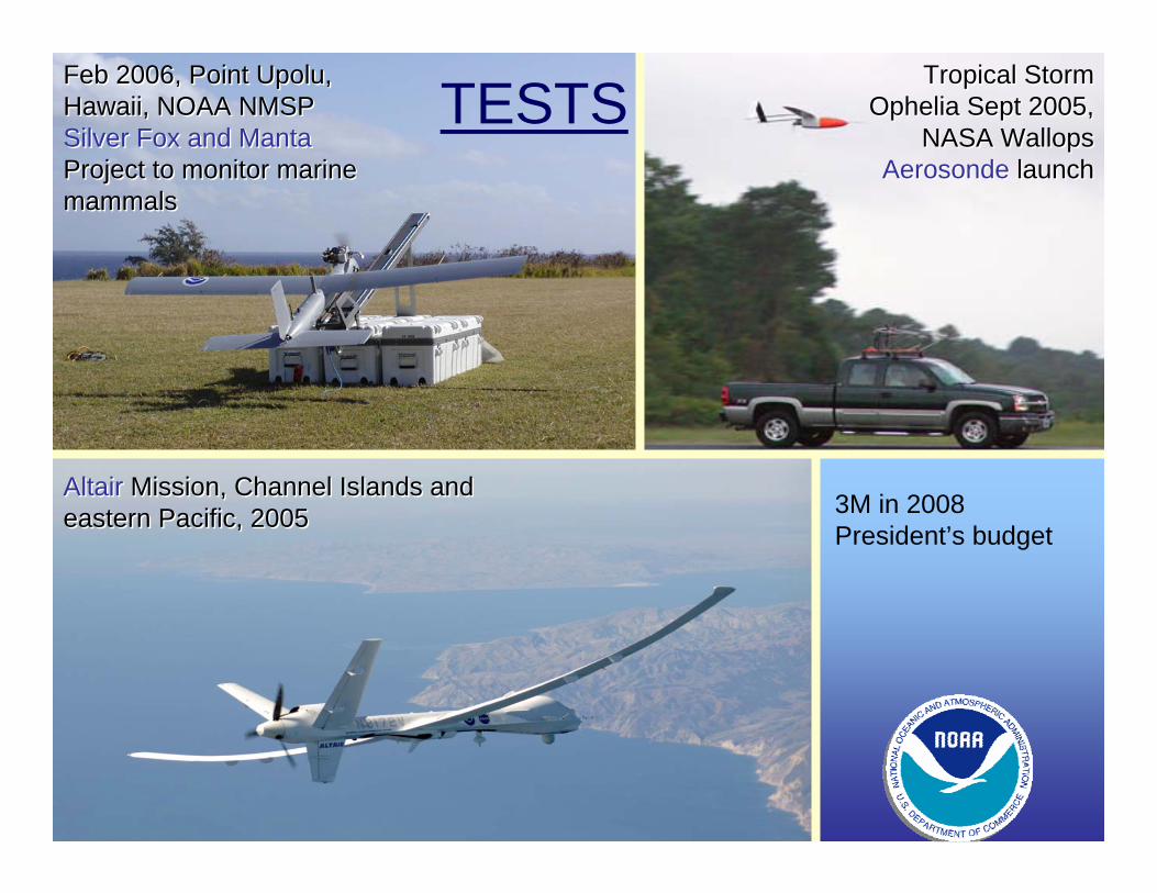
Altair Mission, Channel Islands and eastern Pacific, 2005Altair Mission, Channel Islands and eastern Pacific, 2005
Tropical Storm Ophelia Sept 2005,
NASA WallopsAerosonde launch
Tropical Storm Ophelia Sept 2005,
NASA WallopsAerosonde launch
Feb 2006, Point Upolu, Hawaii, NOAA NMSPSilver Fox and MantaProject to monitor marine mammals
Feb 2006, Point Upolu, Hawaii, NOAA NMSPSilver Fox and MantaProject to monitor marine mammals
TESTS
3M in 2008 President’s budget
NOAA's International Arctic Campaign 32
[email protected]@noaa.gov
http://www.uas.noaa.govhttp://www.uas.noaa.gov
(303) 497(303) 497--4221 4221
QUESTIONS ?
Recommended