Landslide occurrences in the hilly
areas of Bududa District and their
causes.
Kitutu Kimono Mary Goretti,Environment Information Systems Specialist.
National Environment Management Authority.
PhD Thesis.
Department of Geology,
Makerere University,
March 2010.
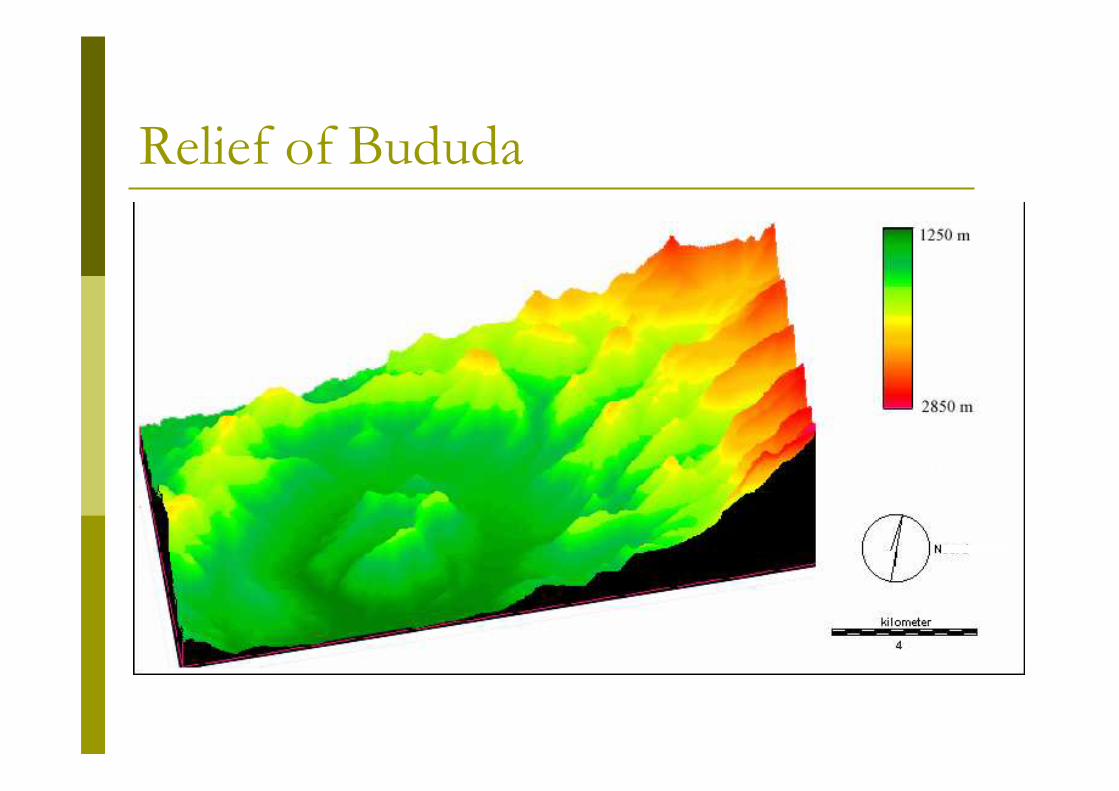
Relief of Bududa
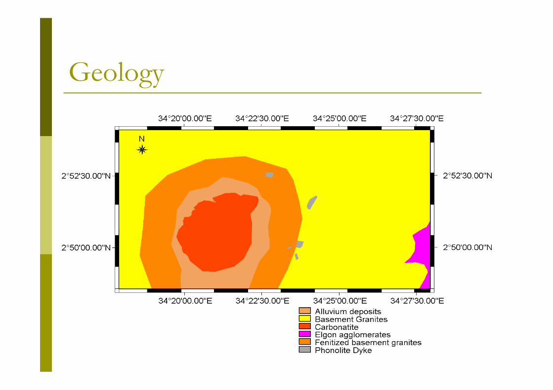
Geology
What is a landslide?
� Downward movement of rocks and soils by gravity.
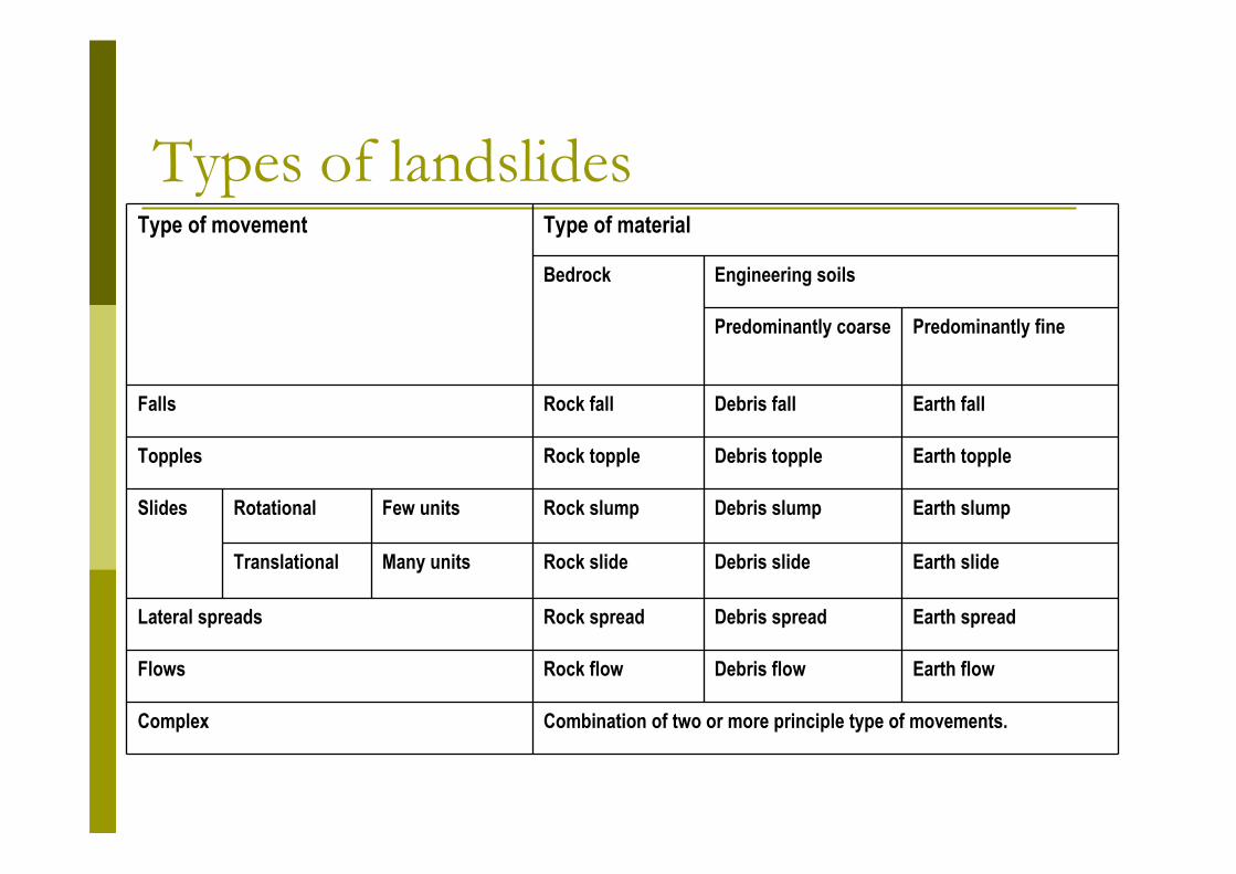
Types of landslidesType of movement Type of material
Bedrock Engineering soils
Predominantly coarse Predominantly fine
Falls Rock fall Debris fall Earth fall
Topples Rock topple Debris topple Earth topple
Slides Rotational Few units Rock slump Debris slump Earth slump
Translational Many units Rock slide Debris slide Earth slide
Lateral spreads Rock spread Debris spread Earth spread
Flows Rock flow Debris flow Earth flow
Complex Combination of two or more principle type of movements.


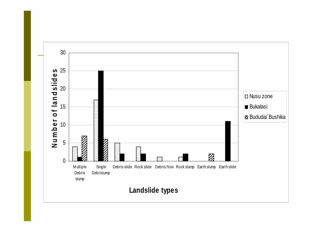
Landslide types in Bududa
0
5
10
15
20
25
30
M ult ipleDebrisslump
SingleDebrislump
Debris slide Rock slide Debris f low Rock slump Earth slump Earth slide
Landslide types
Nu
mb
er o
f la
nd
slid
es
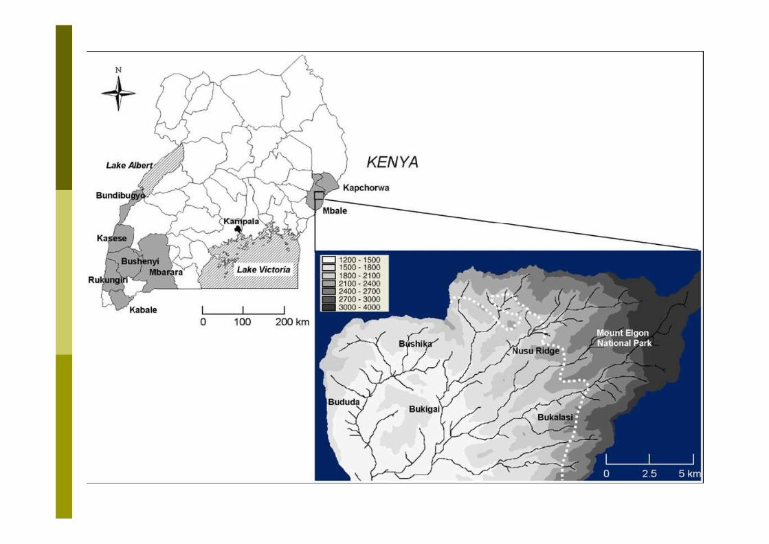
Nusu zone
Bukalasi
Bududa/ Bushika
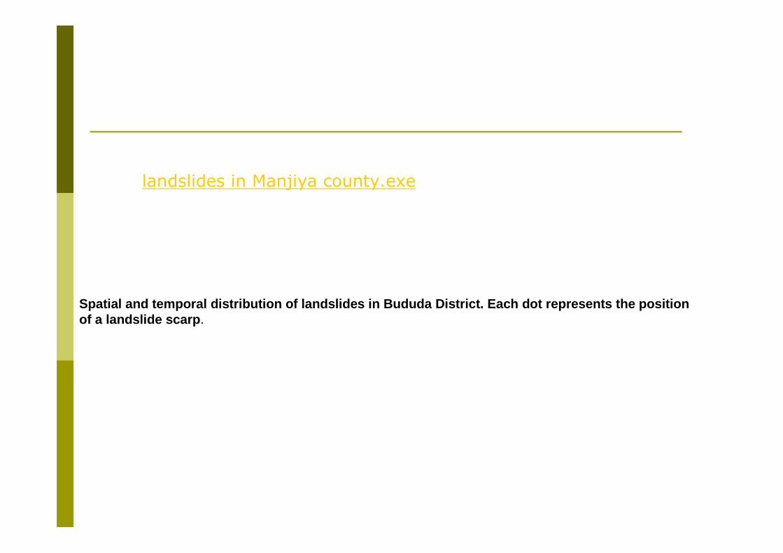
Spatial and temporal distribution of landslides in Bududa District. Each dot represents the position of a landslide scarp.
landslides in Manjiya county.exe
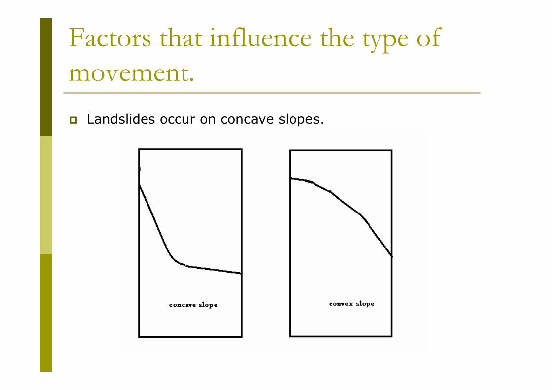
Factors that influence the type of
movement.
� Landslides occur on concave slopes.
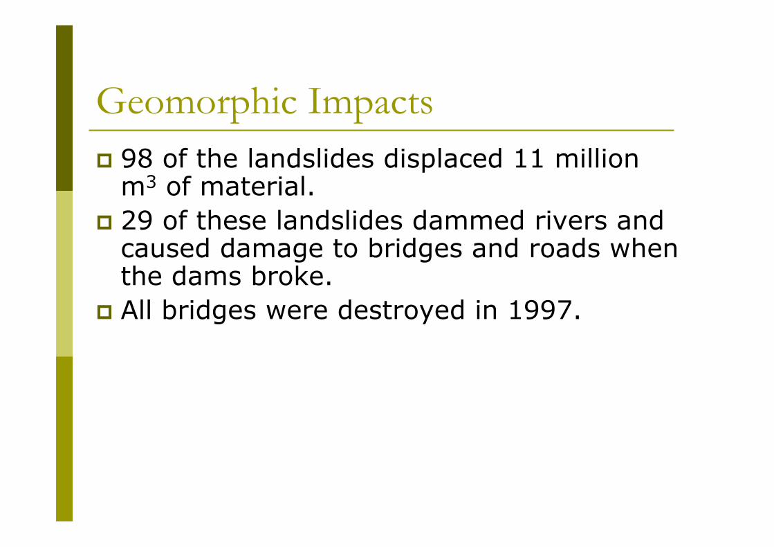
Geomorphic Impacts
� 98 of the landslides displaced 11 million m3 of material.
� 29 of these landslides dammed rivers and caused damage to bridges and roads when the dams broke.
� All bridges were destroyed in 1997.

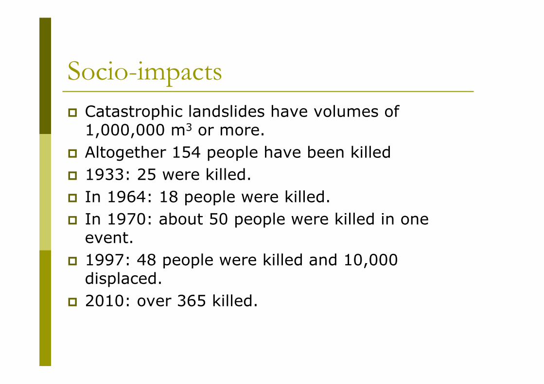
Socio-impacts
� Catastrophic landslides have volumes of 1,000,000 m3 or more.
� Altogether 154 people have been killed
� 1933: 25 were killed.
� In 1964: 18 people were killed.
� In 1970: about 50 people were killed in one event.
� 1997: 48 people were killed and 10,000 displaced.
� 2010: over 365 killed.
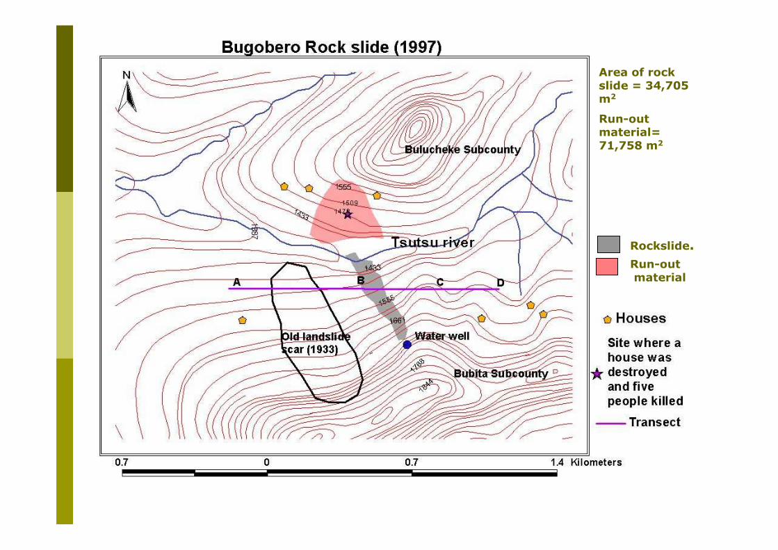
Area of rock slide = 34,705 m2
Run-out material= 71,758 m2
Rockslide.
Run-outmaterial

Topographic factors
Landslides occur between 140 to 600.
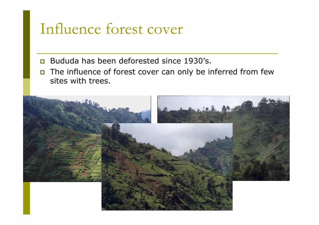
Influence forest cover
� Bududa has been deforested since 1930’s.
� The influence of forest cover can only be inferred from few sites with trees.
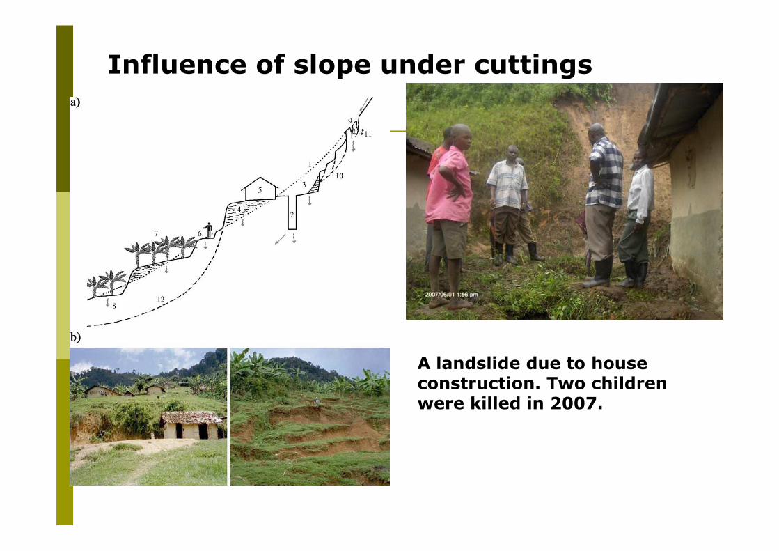
Influence of slope under cuttings
A landslide due to house construction. Two children were killed in 2007.
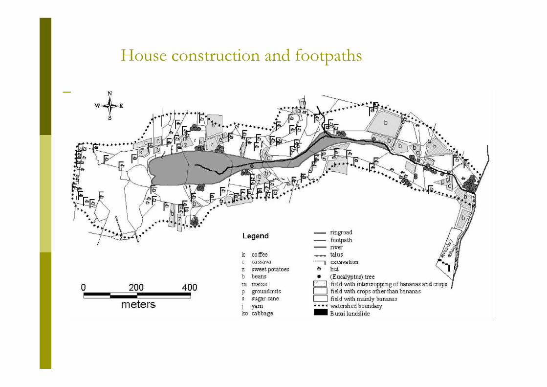
House construction and footpaths
� The watershed of the Busai landslide covers an area of 0.43 km2 and the landslide itself an area of 0.05 km2.
� The 105 houses and small agricultural plots with an average area of 50 m2 in the 0.38 km2 area outside the landslide bear witness of the high population pressure in the watershed.
� For 72% of these houses, the slope is excavated to a depth varying between 0.15 and 4.5 m with an average excavation of 1.25 m.
� Total strain increases and runoff water can concentrate and will be favored to infiltrate on the flat parts of the excavations.

� LAPSUS-LS is used to construct a landslide hazard map, and to confirm or reject the main factors for landsliding in the area.
� The model is specifically designed for the analysis of shallow landslide hazard by combining a steady state hydrologic model with a deterministic infinite slope stability model.
� In addition, soil redistribution algorithms can be applied, whereby erosion and sedimentation by landsliding can be visualized and quantified by applying a threshold critical rainfall scenario.
� The model is tested in Bududa District for its ability to delineate zones that are prone to shallow landsliding in general and to group the recent landslides into a specific landslide hazard category.
� The model confirms that, shallow landslides occur at a relatively large distance from the water divide, on the transition between steep concave and more gentle convex slope positions, which points to concentration of (sub) surface flow as the main hydrological triggering mechanism.
� LAPSUS-LS was used to group the recent shallow landslides in a specific landslide hazard class (critical rainfall values of 0.03–0.05 m day−1). By constructing a landslide hazard map and simulating future landslide scenarios with the model, slopes in Bududa District can be identified as inherently unstable and volumes of soil redistribution can yield four times higher than currently observed.
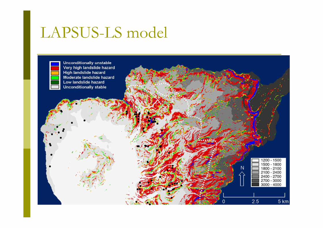
LAPSUS-LS model

•The soil types present are mainly those conditioned by topography and wet tropical climate namely Cambisols, Lixisols, Ferralsols, Leptosols, Gleysols, Nitisols and Acrisols.
•The soil type has no influence on landslides occurrences.
� The sequence shows buried soil profiles.� This sequence is localised at landslide
sites and is due to past landslide activity.
� The superposition of a soil horizon with a silty clay texture (52% clay, B2t) on a coarser, sandy silt loam horizon (6% clay, A3/E3) of an older soil creates a pore discontinuity that hinders drainage. Black manganese mottles on the ped surfaces of the illuvial clay horizon (B2t) are an indication of the reduced drainage.
� Landslides in western zone are due to soil horizon stratification that favors water stagnation in the lower horizons and they are only confined to places where there is water stagnation in the lower soil horizons.
� Local population confirm a cycle of 100 years.

Influence of rainfall
0%
10%
20%
30%
40%
50%
60%
70%
80%
90%
100%
Bulucheke Bubita Bushika Bududa
Sub county
% o
f re
spo
nd
ents
Light and continuous for days Continuous rainfall Heavy rainfall Do not know
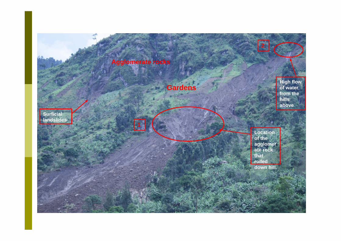
High flow of water from the hills above
Location of the agglomerate rock that rolled down hill.
1
2
Agglomerate rocks
Gardens
Surficial landslides
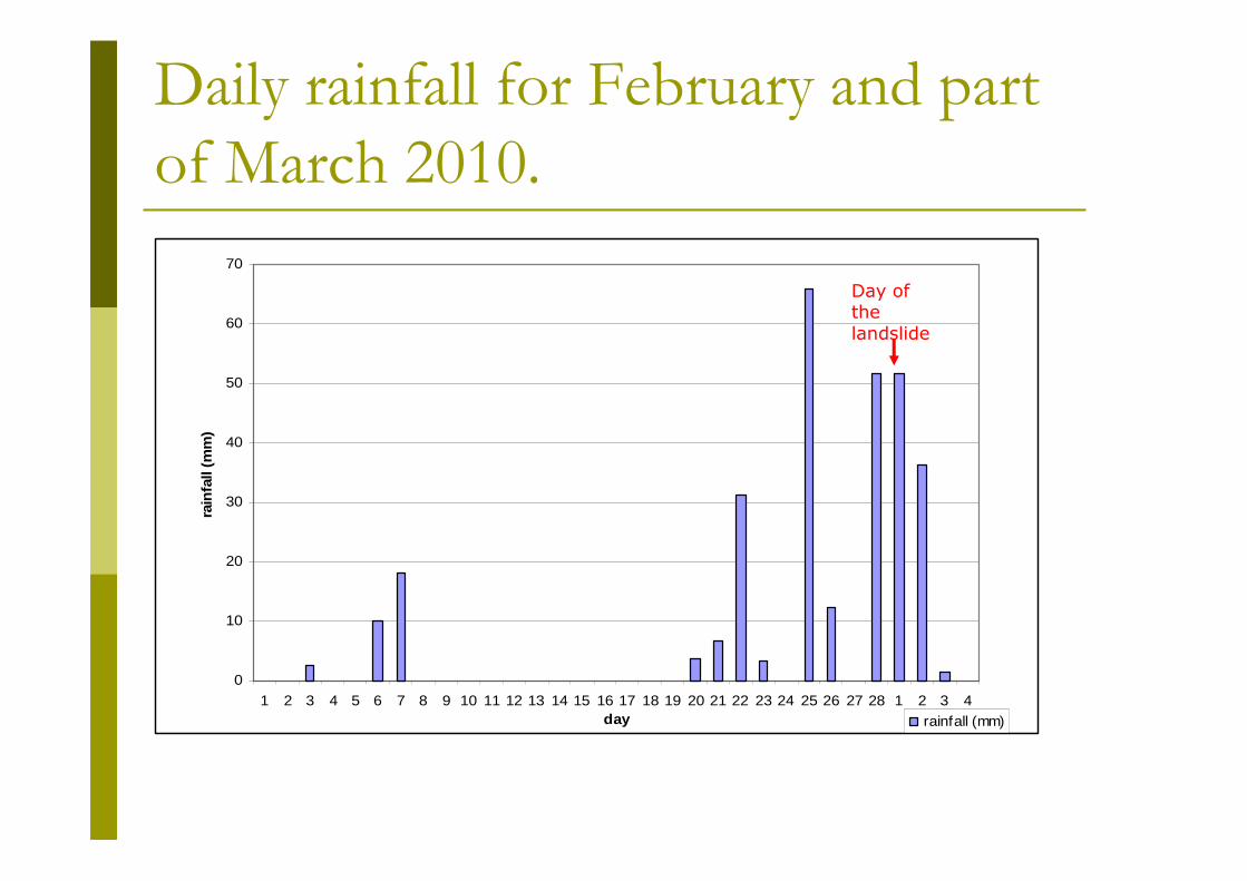
Daily rainfall for February and part
of March 2010.
0
10
20
30
40
50
60
70
1 2 3 4 5 6 7 8 9 10 11 12 13 14 15 16 17 18 19 20 21 22 23 24 25 26 27 28 1 2 3 4day
rain
fall
(mm
)
rainfall (mm)
Day of the landslide
For debris flows that commonly develop from shallow landslides during intense bursts of rainfall.
For deep-seated landslides that are usually triggered byprolonged rainfall.
Causes of the debris flow on 1st March
2010.
� Due to the high and continuous rainfall for five days there was concentrated water flow at point 2.
� This was the main triggering factor of this debris flow.� The concentrated flow saturated the soils into fluid. This resulted
in high pore pressure enough to liquefy the soils. � Part of the rock at point 1 gave way releasing the debris at high
speeds downslope, which mobilized more material on its way down.
� The debris spread out an area of 10 hectares and destroying everything in its path.
� The length of the debris flow was 800 meters and its width varied between 70 to 255 meters. The landslide was smaller at the top but it widened as the debris moved down slope.
� The depth of the scar is about 20m. A lot of water flows from the scars when it rains causing further saturation of the debris andmoving it further down.
� The volume of debris displaced was 2,768,000 m3. � The higher slope is 670 and the lower slope is 100.
Recommendations� Farmers to be involved in landslide hazard management
and develop an early warning system as a cheaper means of reducing and avoiding the risk and loss from landslides in Bududa District.
� To strengthen programmes that target education of the youth so that they can get alternative jobs this will reduce the pressure on land.
� To promote intensive agro-forestry on the slopes especially growing of economic trees such as fruit and timber trees.
� Stabilisation of slopes will reduce the costs of maintaining bridges and roads.
� Farmers should avoid settling in areas of high risk.� Development and enforcement of by- laws in the
management of the mountainous area. � Population control methods should be enforced.
Recommended


