Installation and Operation Manual for mobile GInfo (GInfoMap) on Andriod-based Device
Version 2.1
Slope Safety Division
July 2016
Any feedback and comments on the use of the mobile GInfo should be provided to GE/ES3, Slope Safety Division
Procedures for installing mobile GInfo (mGInfo) app in Android-based devices
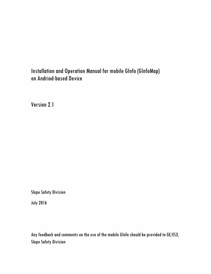
A. REGISTRATION
Only registered Android-based devices will be allowed to run the mGInfo application. After first installation (see Section B for details) of the mGInfo, please launch the application and carry out the on-line registration as follows (re-registration is not required when updated version of mGInfo is installed, unless the settings of your mobile device has been changed): In the Login page, click the 'Registration' icon and input 'CEDD Post' and 'Name' for on-line registration. Anonymous registration will not be entertained. Please then press the 'Submit' button. Registration will normally be activated within one working day.
'Login Page '
Click here for on-line registration
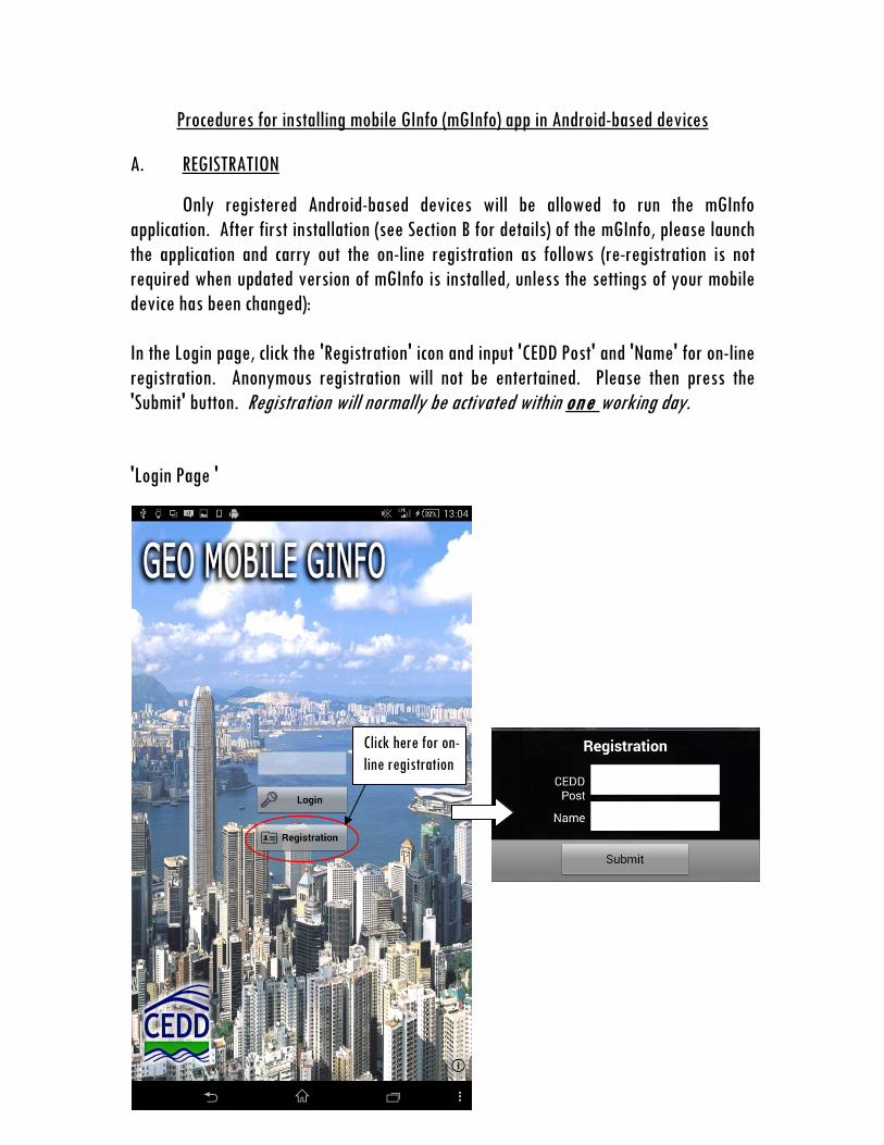
B. INSTALLATION
(a) Download the app (naming ‘GInfoMap.apk’) from the GInfo portal via the following link: http://ginfo.cedd.hksarg/arcgisweb/mobileapps/mobileapps.aspx
(b) Copy the apk file to your device with USB connection to a PC (Create a folder
'Download' in your device and drag the apk file into this folder)
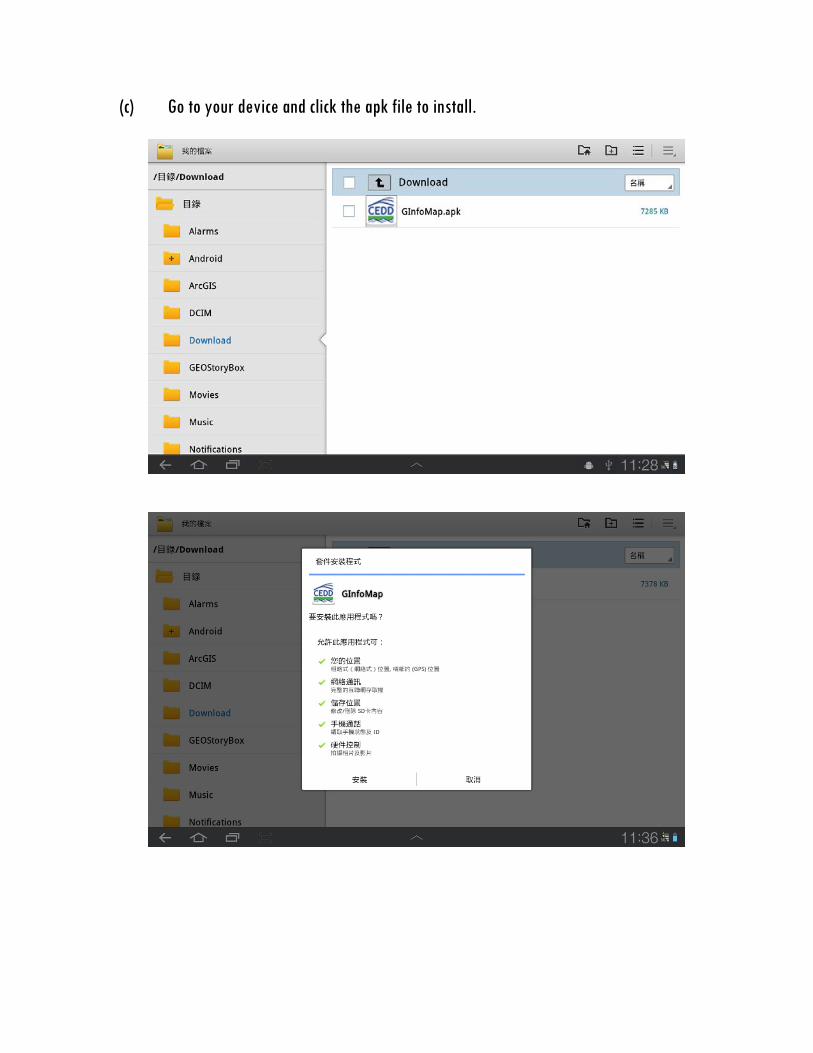
(c) Go to your device and click the apk file to install.
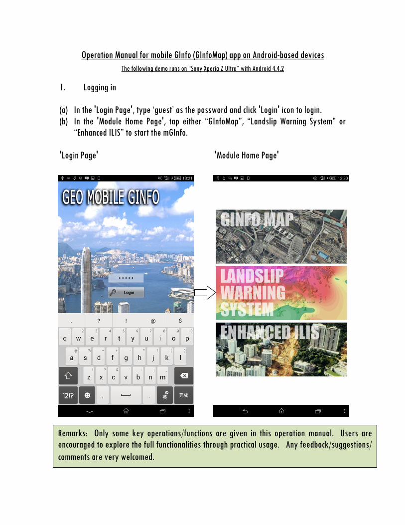
Operation Manual for mobile GInfo (GInfoMap) app on Android-based devices The following demo runs on “Sony Xperia Z Ultra” with Android 4.4.2
1. Logging in (a) In the 'Login Page', type ‘guest’ as the password and click 'Login' icon to login. (b) In the 'Module Home Page', tap either “GInfoMap”, “Landslip Warning System” or
“Enhanced ILIS” to start the mGInfo. 'Login Page' 'Module Home Page'
Remarks: Only some key operations/functions are given in this operation manual. Users are encouraged to explore the full functionalities through practical usage. Any feedback/suggestions/ comments are very welcomed.

2. Function keys in GInfoMap module
Turn on/off of overlay maps
Switch to Languages
Use GPS to locate the position of the device
Change of schema
Turn on/off layers in the schema Query
Switch to Landslip Warning System
Switch to eILIS
To ‘Module Home Page’
Allow rotation
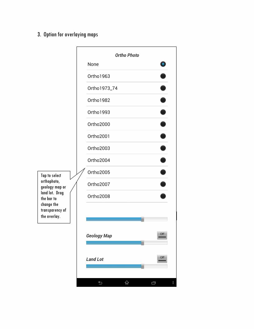
3. Option for overlaying maps
Tap to select orthophoto, geology map or land lot. Drag the bar to change the transparency of the overlay.
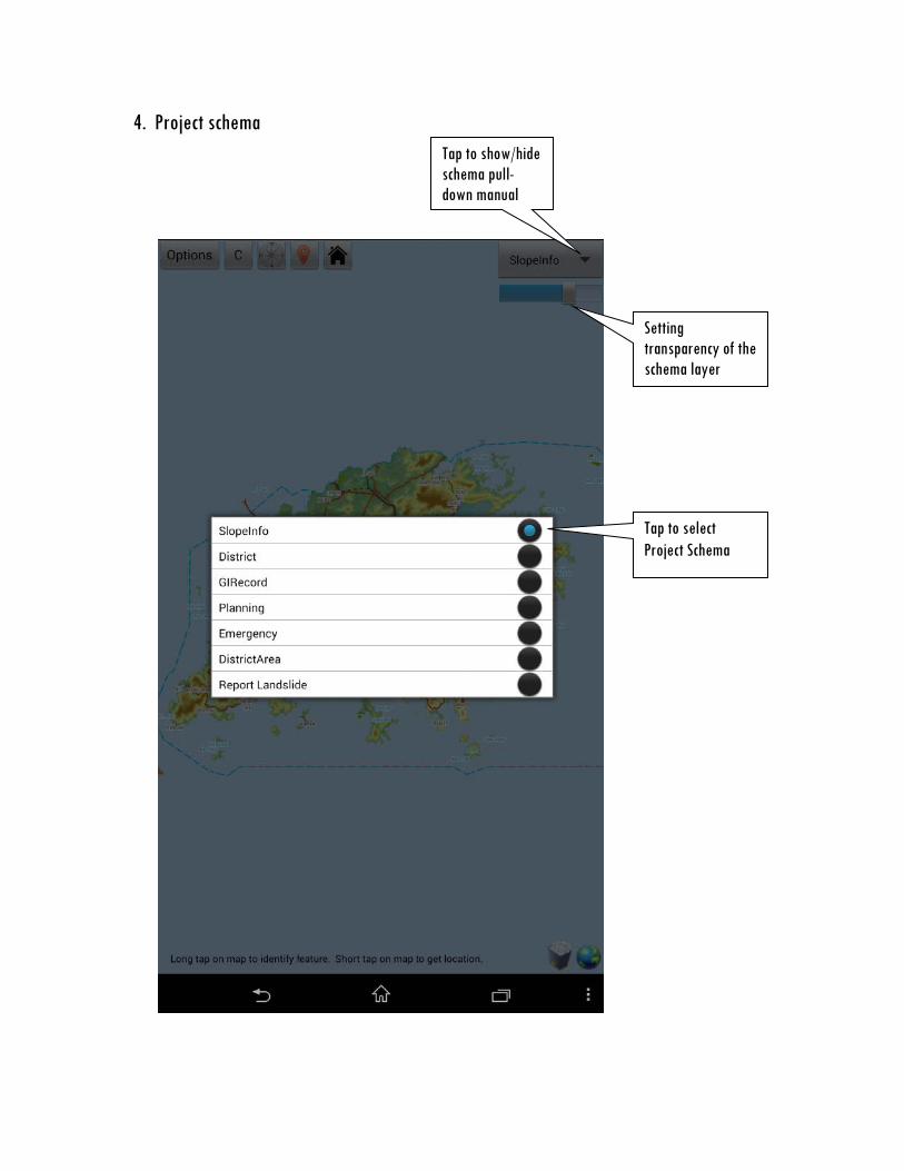
4. Project schema
Tap to show/hide schema pull-down manual
Setting transparency of the schema layer
Tap to select Project Schema
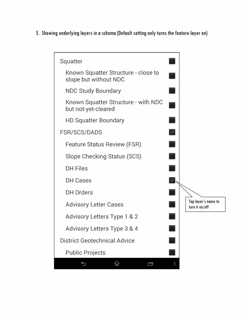
5. Showing underlying layers in a schema (Default setting only turns the feature layer on)
Tap layer’s name to turn it on/off
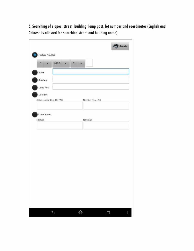
6. Searching of slopes, street, building, lamp post, lot number and coordinates (English and Chinese is allowed for searching street and building name)
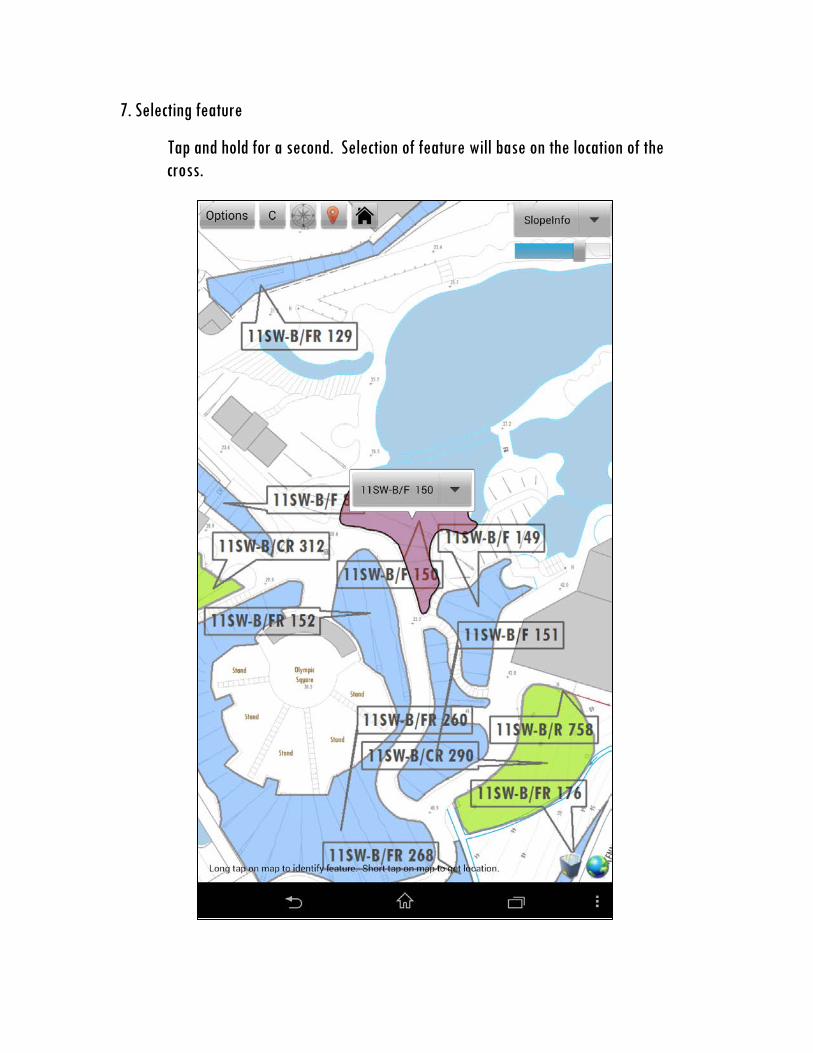
7. Selecting feature
Tap and hold for a second. Selection of feature will base on the location of the cross.
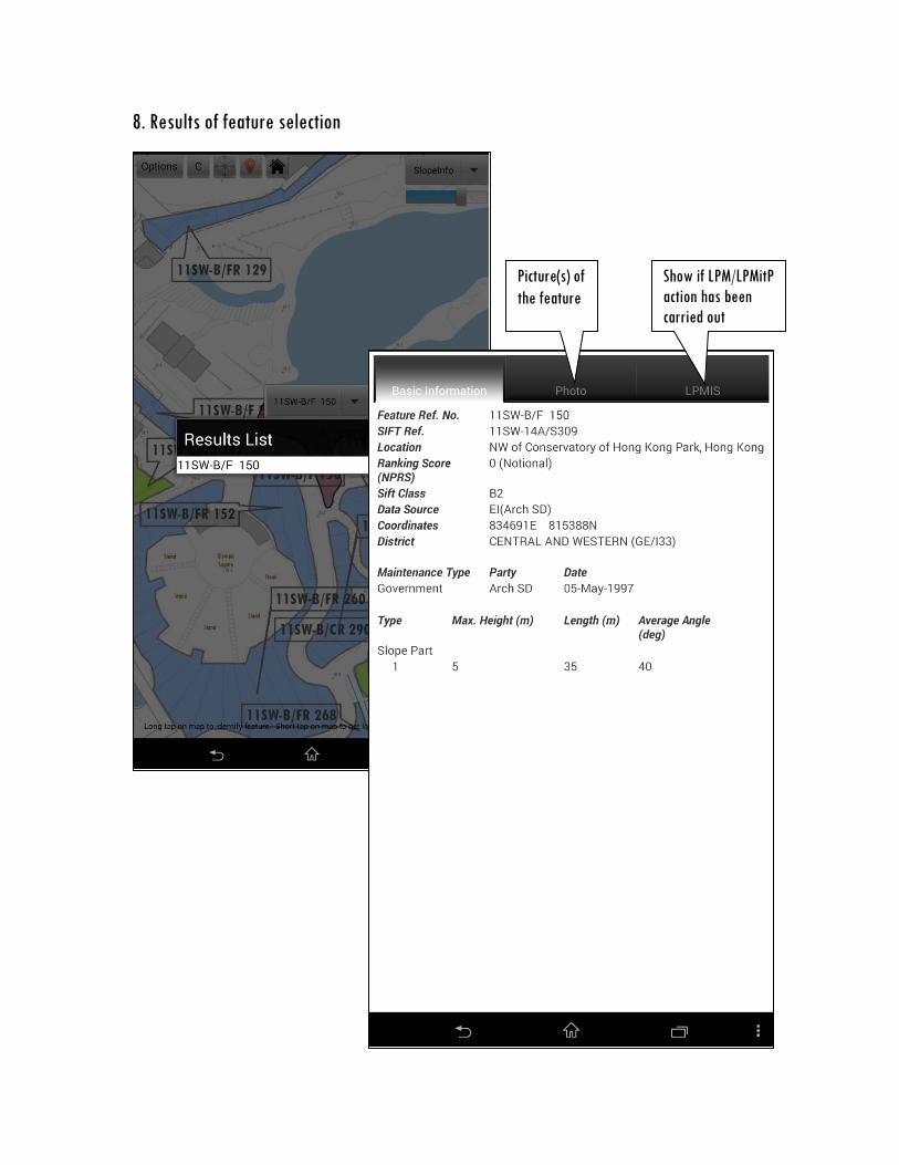
8. Results of feature selection
Show if LPM/LPMitP action has been carried out
Picture(s) of the feature

9. Landslip Warning System Module
Tap to refresh data
Tap to 'Module Home Page'
Other rainstorms-related HKO warnings will appear (e.g. Landslip Warning, Black, Red and Amber Rainstorm Warning, Special announcement on flooding in the Northern New Territories.)
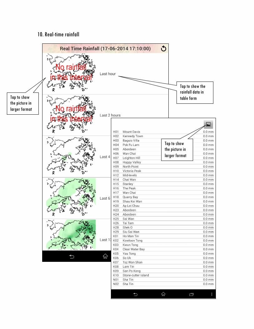
10. Real-time rainfall
Tap to show the rainfall data in table form Tap to show
the picture in larger format
Tap to show the picture in larger format

11. Radar and Satellite images
Tap to show the picture in larger format
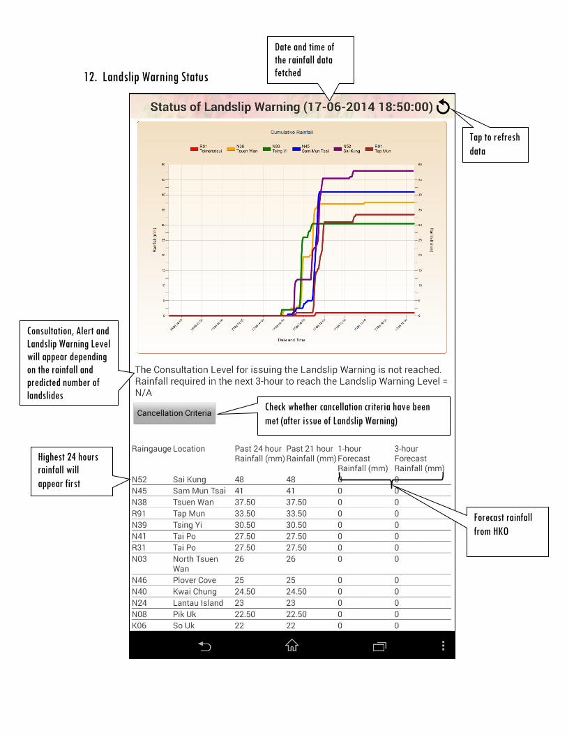
12. Landslip Warning Status
Check whether cancellation criteria have been met (after issue of Landslip Warning)
Tap to refresh data
Date and time of the rainfall data fetched
Consultation, Alert and Landslip Warning Level will appear depending on the rainfall and predicted number of landslides
Highest 24 hours rainfall will appear first
Forecast rainfall from HKO
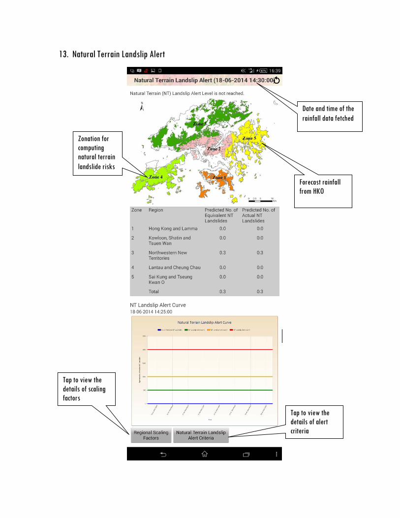
13. Natural Terrain Landslip Alert
Date and time of the rainfall data fetched
Zonation for computing natural terrain landslide risks
Forecast rainfall from HKO
Tap to view the details of alert criteria
Tap to view the details of scaling factors

14. Enhanced ILIS - Summary Page
Tap to show the reported incidents on map
To Search Incident Page
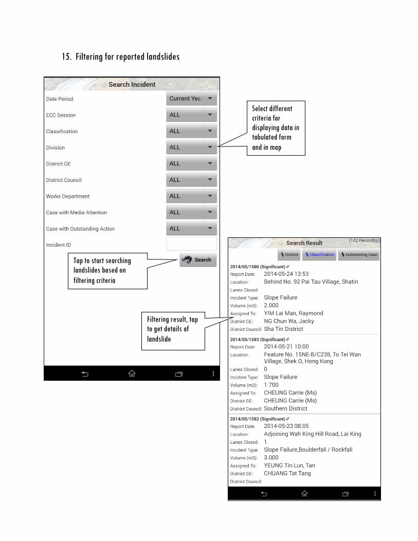
15. Filtering for reported landslides
Select different criteria for displaying data in tabulated form and in map
Tap to start searching landslides based on filtering criteria
Filtering result, tap to get details of landslide

16. Enhanced ILIS - Map Page
Legend of landslide cases shown on map
Use GPS to locate the position of the device.
Switch to Languages
Refresh data
Fit the map
Show Land Lot
District Council Distribution
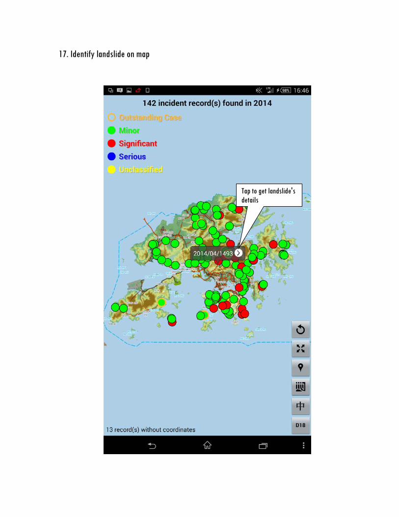
17. Identify landslide on map
Tap to get landslide's details
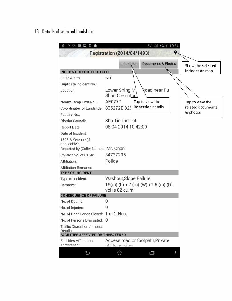
18. Details of selected landslide
Show the selected Incident on map
Tap to view the related documents & photos
Tap to view the inspection details
Recommended