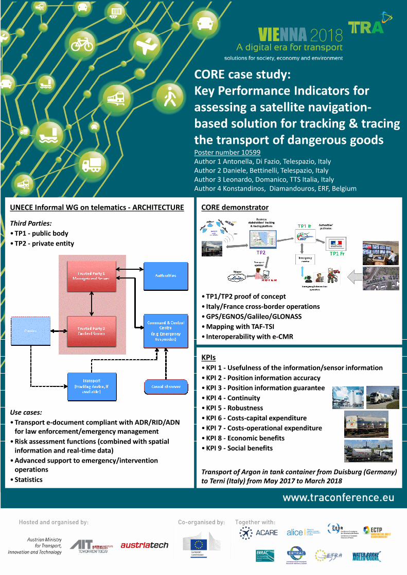
CORE case study:
Key Performance Indicators for
assessing a satellite navigation-
based solution for tracking & tracing
the transport of dangerous goodsPoster number 10599
Author 1 Antonella, Di Fazio, Telespazio, Italy
Author 2 Daniele, Bettinelli, Telespazio, Italy
Author 3 Leonardo, Domanico, TTS Italia, Italy
Author 4 Konstandinos, Diamandouros, ERF, Belgium
CORE demonstrator
• TP1/TP2 proof of concept
• Italy/France cross-border operations
• GPS/EGNOS/Galileo/GLONASS
• Mapping with TAF-TSI
• Interoperability with e-CMR
UNECE Informal WG on telematics - ARCHITECTURE
Third Parties:
• TP1 - public body
• TP2 - private entity
Use cases:
• Transport e-document compliant with ADR/RID/ADN
for law enforcement/emergency management
• Risk assessment functions (combined with spatial
information and real-time data)
• Advanced support to emergency/intervention
operations
• Statistics
KPIs
• KPI 1 - Usefulness of the information/sensor information
• KPI 2 - Position information accuracy
• KPI 3 - Position information guarantee
• KPI 4 - Continuity
• KPI 5 - Robustness
• KPI 6 - Costs-capital expenditure
• KPI 7 - Costs-operational expenditure
• KPI 8 - Economic benefits
• KPI 9 - Social benefits
Transport of Argon in tank container from Duisburg (Germany)
to Terni (Italy) from May 2017 to March 2018
Recommended