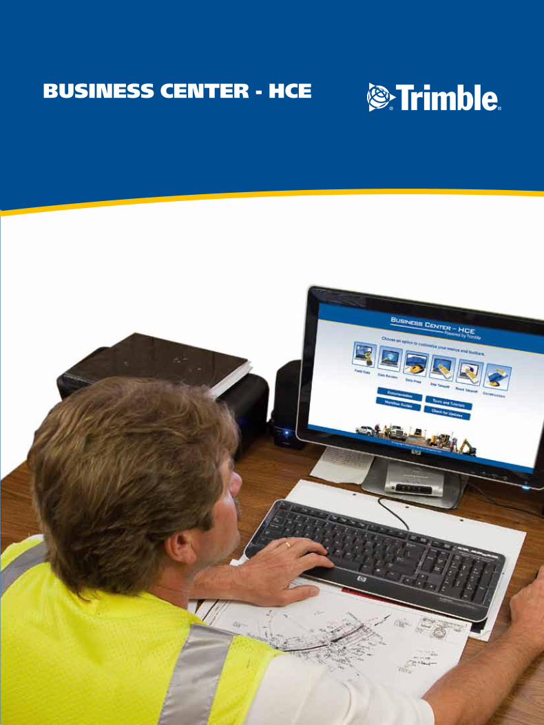
Business Center - HCe

IT'S EASY TO GET STARTED
Begin with the free Core Product, which makes managing data for Trimble
3D machine control and site positioning systems easier and more seamless
than ever before. The free Core Product gives you the opportunity to try
the power of Business Center - HCE at no charge.
Then contact your local SITECH® Technology Distributor for information
about additional modules to extend the software's functionality, or to
schedule a solution demonstration.
Just go to www.trimble.com/powerofsoftware,
enter your registration information and download
the Core Product for free.
connecting your construction site
Business Center—Heavy Construction Edition (HCE)
from Trimble is the only office software you need
to manage, analyze and process site and highway
construction data.
As part of the Connected Office solution,
Business Center - HCE has powerful tools to
help control data flow between the office and the
field. You can easily combine and manage data from
multiple sources to generate accurate, integrated
results, and then share these results with the entire
project team. Business Center—HCE can help you
decrease costly mistakes and increase productivity in
the office and on the construction job site.
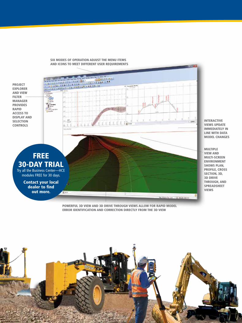
InteractIve vIews update ImmedIately In lIne wIth data model changes
sIX modes of operatIon adJust the menu Items and Icons to meet dIfferent user requIrements
proJect eXplorer and vIew fIlter manager provIdes rapId access to dIsplay and selectIon controls
multIple vIew and multI-screen envIronment shows plan, profIle, cross sectIon, 3d, 3d drIve through, and spreadsheet vIews
powerful 3d vIew and 3d drIve through vIews allow for rapId model error IdentIfIcatIon and correctIon dIrectly from the 3d vIew
free 30-day trIal
Try all the Business Center—HCE modules FREE for 30 days.
contact your local dealer to find
out more.
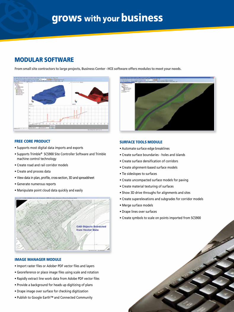
mODulAR SOfTwAREfrom small site contractors to large projects, Business Center - HCE software offers modules to meet your needs.
fREE CORE PRODuCT
• Supports most digital data imports and exports
• Supports Trimble® SCS900 Site Controller Software and Trimble machine control technology
• Create road and rail corridor models
• Create and process data
• View data in plan, profile, cross-section, 3D and spreadsheet
• Generate numerous reports
• Manipulate point cloud data quickly and easily
ImAGE mAnAGER mODulE
• Import raster files or Adobe® PDF vector files and layers
• Georeference or place image files using scale and rotation
• Rapidly extract line work data from Adobe PDF vector files
• Provide a background for heads up digitizing of plans
• Drape image over surface for checking digitization
• Publish to Google Earth™ and Connected Community
grows with your business
SuRfACE TOOlS mODulE
• Automate surface edge breaklines
• Create surface boundaries - holes and islands
• Create surface densification of corridors
• Create alignment-based surface models
• Tie sideslopes to surfaces
• Create uncompacted surface models for paving
• Create material texturing of surfaces
• Show 3D drive throughs for alignments and sites
• Create superelevations and subgrades for corridor models
• Merge surface models
• Drape lines over surfaces
• Create symbols to scale on points imported from SCS900
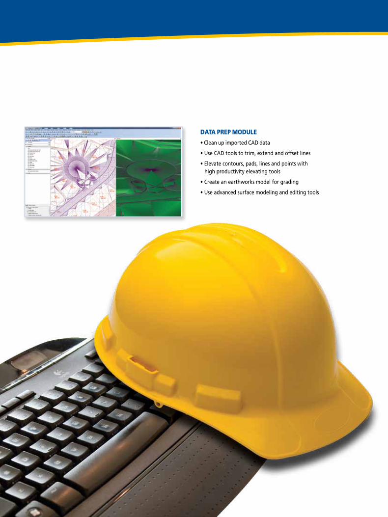
DATA PREP mODulE
• Clean up imported CAD data
• Use CAD tools to trim, extend and offset lines
• Elevate contours, pads, lines and points with high productivity elevating tools
• Create an earthworks model for grading
• Use advanced surface modeling and editing tools
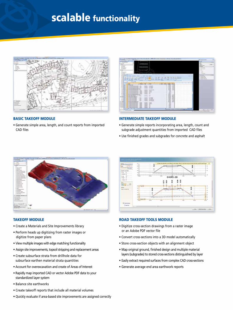
InTERmEDIATE TAkEOff mODulE
• Generate simple reports incorporating area, length, count and subgrade adjustment quantities from imported CAD files
• Use finished grades and subgrades for concrete and asphalt
ROAD TAkEOff TOOlS mODulE
• Digitize cross-section drawings from a raster image or an Adobe PDF vector file
• Convert cross-sections into a 3D model automatically
• Store cross-section objects with an alignment object
• Map original ground, finished design and multiple material layers (subgrades) to stored cross-sections distinguished by layer
• Easily extract required surfaces from complex CAD cross-sections
• Generate average end area earthwork reports
scalable functionality
BASIC TAkEOff mODulE
• Generate simple area, length, and count reports from imported CAD files
TAkEOff mODulE
• Create a Materials and Site Improvements library
• Perform heads up digitizing from raster images or digitize from paper plans
• View multiple images with edge matching functionality
• Assign site improvements, topsoil stripping and replacement areas
• Create subsurface strata from drillhole data for subsurface earthen material strata quantities
• Account for overexcavation and create of Areas of Interest
• Rapidly map imported CAD or vector Adobe PDF data to your standardized layer system
• Balance site earthworks
• Create takeoff reports that include all material volumes
• Quickly evaluate if area-based site improvements are assigned correctly
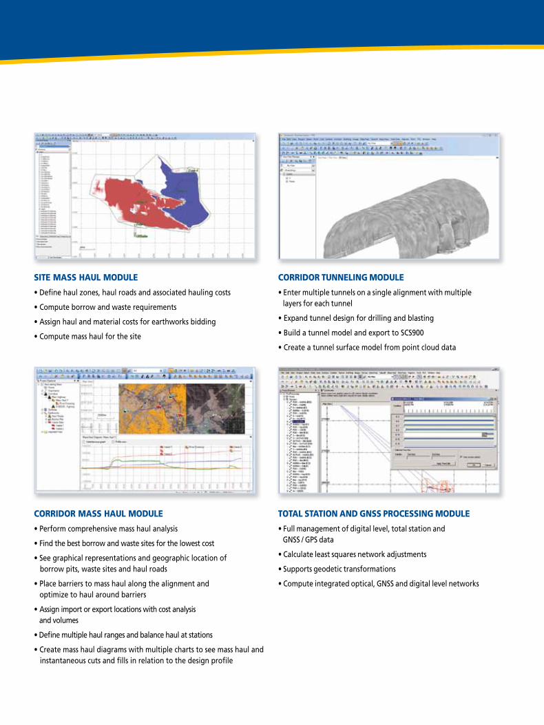
SITE mASS HAul mODulE
• Define haul zones, haul roads and associated hauling costs
• Compute borrow and waste requirements
• Assign haul and material costs for earthworks bidding
• Compute mass haul for the site
CORRIDOR mASS HAul mODulE
• Perform comprehensive mass haul analysis
• Find the best borrow and waste sites for the lowest cost
• See graphical representations and geographic location of borrow pits, waste sites and haul roads
• Place barriers to mass haul along the alignment and optimize to haul around barriers
• Assign import or export locations with cost analysis and volumes
• Define multiple haul ranges and balance haul at stations
• Create mass haul diagrams with multiple charts to see mass haul and instantaneous cuts and fills in relation to the design profile
CORRIDOR TunnElInG mODulE
• Enter multiple tunnels on a single alignment with multiple layers for each tunnel
• Expand tunnel design for drilling and blasting
• Build a tunnel model and export to SCS900
• Create a tunnel surface model from point cloud data
TOTAl STATIOn AnD GnSS PROCESSInG mODulE
• Full management of digital level, total station and GNSS / GPS data
• Calculate least squares network adjustments
• Supports geodetic transformations
• Compute integrated optical, GNSS and digital level networks
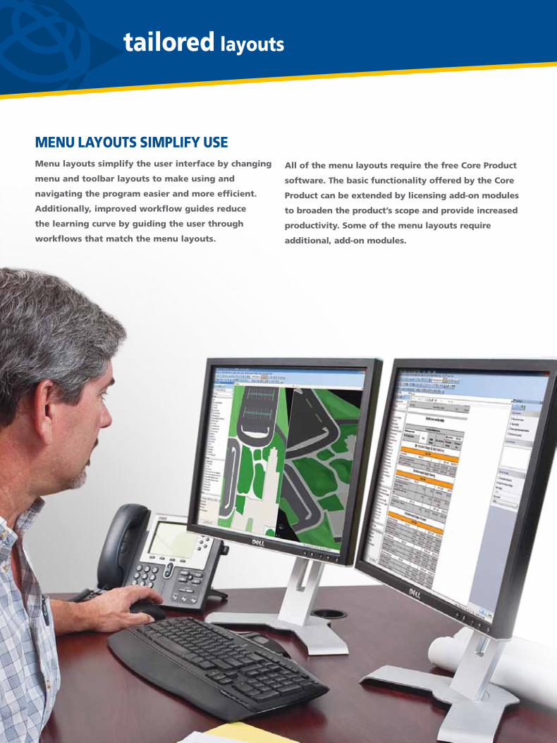
mEnu lAYOuTS SImPlIfY uSEmenu layouts simplify the user interface by changing
menu and toolbar layouts to make using and
navigating the program easier and more efficient.
Additionally, improved workflow guides reduce
the learning curve by guiding the user through
workflows that match the menu layouts.
tailored layouts
All of the menu layouts require the free Core Product
software. The basic functionality offered by the Core
Product can be extended by licensing add-on modules
to broaden the product’s scope and provide increased
productivity. Some of the menu layouts require
additional, add-on modules.
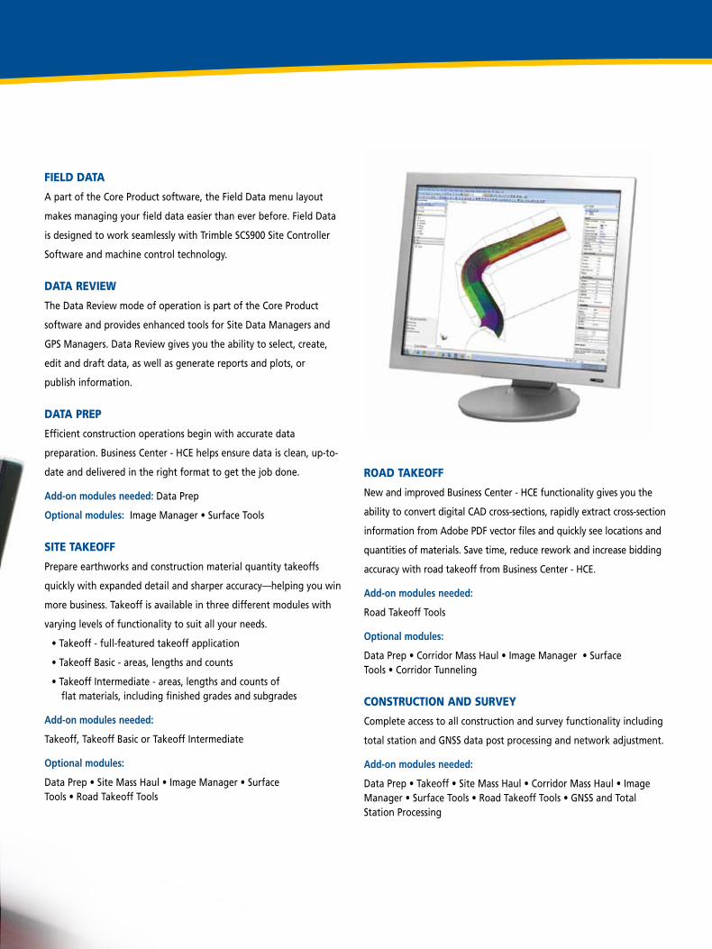
ROAD TAkEOff New and improved Business Center - HCE functionality gives you the
ability to convert digital CAD cross-sections, rapidly extract cross-section
information from Adobe PDF vector files and quickly see locations and
quantities of materials. Save time, reduce rework and increase bidding
accuracy with road takeoff from Business Center - HCE.
Add-on modules needed:
Road Takeoff Tools
Optional modules:
Data Prep • Corridor Mass Haul • Image Manager • Surface Tools • Corridor Tunneling
COnSTRuCTIOn AnD SuRvEY Complete access to all construction and survey functionality including
total station and GNSS data post processing and network adjustment.
Add-on modules needed:
Data Prep • Takeoff • Site Mass Haul • Corridor Mass Haul • Image Manager • Surface Tools • Road Takeoff Tools • GNSS and Total Station Processing
fIElD DATA A part of the Core Product software, the Field Data menu layout
makes managing your field data easier than ever before. Field Data
is designed to work seamlessly with Trimble SCS900 Site Controller
Software and machine control technology.
DATA REvIEw The Data Review mode of operation is part of the Core Product
software and provides enhanced tools for Site Data Managers and
GPS Managers. Data Review gives you the ability to select, create,
edit and draft data, as well as generate reports and plots, or
publish information.
DATA PREP Efficient construction operations begin with accurate data
preparation. Business Center - HCE helps ensure data is clean, up-to-
date and delivered in the right format to get the job done.
Add-on modules needed: Data Prep
Optional modules: Image Manager • Surface Tools
SITE TAkEOff Prepare earthworks and construction material quantity takeoffs
quickly with expanded detail and sharper accuracy—helping you win
more business. Takeoff is available in three different modules with
varying levels of functionality to suit all your needs.
• Takeoff - full-featured takeoff application
• Takeoff Basic - areas, lengths and counts
• Takeoff Intermediate - areas, lengths and counts of flat materials, including finished grades and subgrades
Add-on modules needed:
Takeoff, Takeoff Basic or Takeoff Intermediate
Optional modules:
Data Prep • Site Mass Haul • Image Manager • Surface Tools • Road Takeoff Tools
F1
F2
F3
SITE ENGINEER
GRADE CHECKER
REMOTE SUPPORT
SUPERVISOR
CONTRACTOR MAIN OFFICE
Cut/FillMapMaMaMappppp
Digital Terrain Model
DiDiDiDi iigigitttatalllll
Digital Terrain Model
connect for more profit
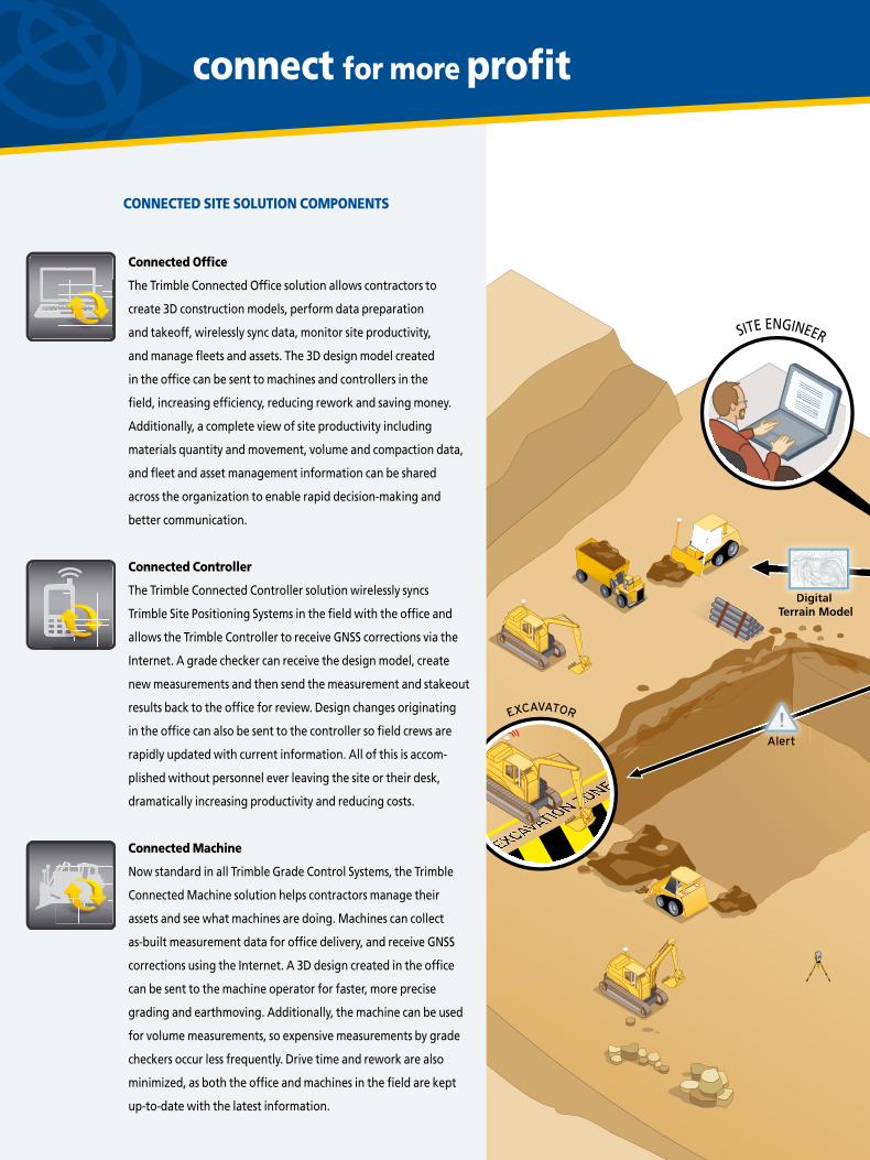
Connected Office
The Trimble Connected Office solution allows contractors to
create 3D construction models, perform data preparation
and takeoff, wirelessly sync data, monitor site productivity,
and manage fleets and assets. The 3D design model created
in the office can be sent to machines and controllers in the
field, increasing efficiency, reducing rework and saving money.
Additionally, a complete view of site productivity including
materials quantity and movement, volume and compaction data,
and fleet and asset management information can be shared
across the organization to enable rapid decision-making and
better communication.
Connected Controller
The Trimble Connected Controller solution wirelessly syncs
Trimble Site Positioning Systems in the field with the office and
allows the Trimble Controller to receive GNSS corrections via the
Internet. A grade checker can receive the design model, create
new measurements and then send the measurement and stakeout
results back to the office for review. Design changes originating
in the office can also be sent to the controller so field crews are
rapidly updated with current information. All of this is accom-
plished without personnel ever leaving the site or their desk,
dramatically increasing productivity and reducing costs.
Connected machine
Now standard in all Trimble Grade Control Systems, the Trimble
Connected Machine solution helps contractors manage their
assets and see what machines are doing. Machines can collect
as-built measurement data for office delivery, and receive GNSS
corrections using the Internet. A 3D design created in the office
can be sent to the machine operator for faster, more precise
grading and earthmoving. Additionally, the machine can be used
for volume measurements, so expensive measurements by grade
checkers occur less frequently. Drive time and rework are also
minimized, as both the office and machines in the field are kept
up-to-date with the latest information.
COnnECTED SITE SOluTIOn COmPOnEnTS

F1
F2
F3
SITE ENGINEER
GRADE CHECKER
REMOTE SUPPORT
SUPERVISOR
CONTRACTOR MAIN OFFICE
Cut/FillMapMaMaMappppp
Digital Terrain Model
DiDiDiDi iigigitttatalllll
Digital Terrain Model
THE TRImBlE COnnECTED SITE
When used together, Connected Office, Connected Controller and Connected Machine solutions revolutionize the way construction is
done and create the Trimble Connected Site.® The Trimble Connected Site transforms the construction industry by utilizing technology to
improve efficiency and productivity, while minimizing waste and expense. With the potential to save time and cost at every stage, and
virtually eliminate steps in the plan design, construct and operate process, the Trimble Connected Site can improve the efficiency and
sustainability of construction projects, resulting in the earlier completion of a higher quality project at a lower cost.

Your SITECH® HEavY CIvIl ConSTruCTIon TECHnologY ProvIdEr
© 2011-2012, Trimble Navigation Limited. All rights reserved. Trimble, the Globe & Triangle logo, SITECH and Connected Site are trademarks of Trimble Navigation Limited, registered in the United States and other countries. VisionLink is a trademark of Trimble Navigation Limited. Adobe is a registered trademark of Adobe Systems Incorporated in the United States and/or other countries. All other trademarks are the property of their respective owners. PN 022482-2272C-12 (04/12)
norTH aMErICaTrimble Heavy Civil Construction Division 10355 Westmoor Drive, Suite #100Westminster, Colorado 80021USA800-361-1249 (Toll Free)+1-937-245-5154 Phone+1-937-233-9441 Faxwww.trimble.com
EuroPETrimble Germany GmbH Am Prime Parc 1165479 RaunheimGERMANY+49-6142-2100-0 Phone+49-6142-2100-550 Fax
aFrICa & MIddlE EaSTTrimble Export Middle-East P.O. Box 17760LOB18 1606 / 1607 JAFZ ViewDubaiUAE+971-4-886-5410 Phone +971-4-886-5411 Fax
aSIa-PaCIFICTrimble Navigation Singapore PTE Ltd.80 Marine Parade Road, #22-06Parkway ParadeSingapore, 449269SINGAPORE+65 6348 2212 Phone+65 6348 2232 Fax
CHInaTrimble Beijing20F, Central Tower, China Overseas Plaza,No.8 Yard, Guang Hua Dong Li, Chaoyang District, Beijing, PRCCHINA 100020+86-10-8857-7575 Phone+86-10-8857-7161 Faxwww.trimble.com.cn
TrIMblE: THE ConSTruCTIon TECHnologY STandardTrimble provides the tools and support to let you integrate planning, design, site positioning, machine control and asset
management information throughout the construction life cycle for more efficient operations and higher profits. Visit
your SITECH® technology dealer today to learn how easy it is to utilize technology that makes significant improvements in
project workflow, dramatically increases your production, improves your accuracy and lowers your operating costs.
Recommended