2015 Height Modernization Partner Meeting April 14, 2015
• In 2014, NGS awarded a five-year grant to a consortium of spatial reference centers and geodetic stakeholders in Texas, Louisiana, Mississippi, Alabama, and Florida knows as the Gulf Coast Spatial Reference Consortium (GCSRC).
• The grant activities directly supports NOAA’s goals and objectives outlined for Resilient Coastal Communities and Economies. Specific targets include:• Enhanced geodetic control infrastructure• Support education, capacity building and technological outreach; • Coordinate partnerships with geodetic stakeholder groups• Data distribution, tools, and resources for analysis.
• Consortium partners include Texas A&M University – Corpus Christi, Louisiana State University, The University of Southern Mississippi,
Alabama Department of Transportation, and Florida Atlantic University.
Northern Gulf Coast Height Modernization Grant
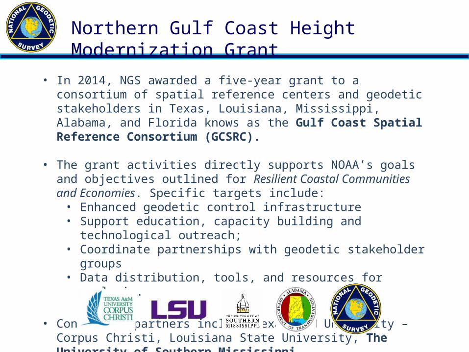
• To extend GNSS multi-station height modernization network observations along the northern Gulf of Mexico from Texas to the Florida Keys incorporating tide gauge benchmarks, existing coastal CORS stations, and stable NGS vertical control benchmarks.
Goals and Objectives – GPS Campaign

• To provide accurate geodetic 3D positions using NGS standards in the common National Spatial Reference System that is well connected to the International Terrestrial Reference Frame. These 3D positions form the basis for the ongoing long-term monitoring of the relative sea-level and subsidence change along the northern Gulf of Mexico in the coming decades.
Goals and Objectives – 3D Positioning
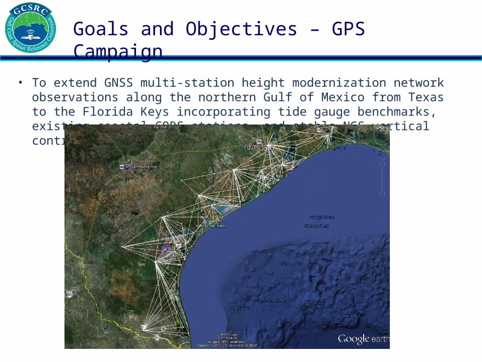
• Expand the number of CORS stations on tide gauges along the northern Gulf of Mexico to assist in accurate 3D positioning and to monitor subsidence rates adjacent to accurate sea level observations.
Goals and Objectives - CORS Installations
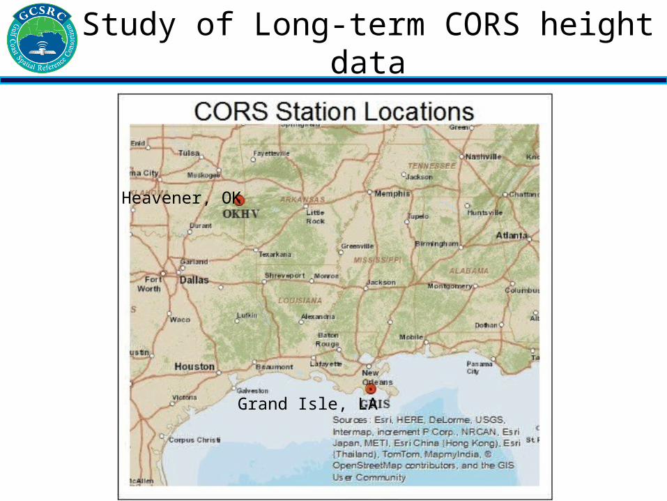
Study of Long-term CORS height data
Heavener, OK
Grand Isle, LA
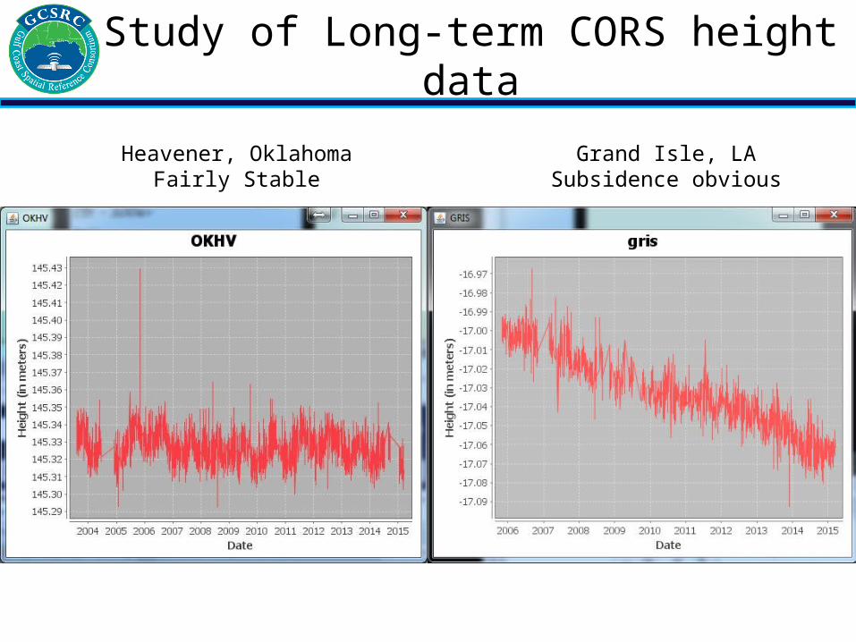
Study of Long-term CORS height data
Heavener, OklahomaFairly Stable
Grand Isle, LASubsidence obvious

CORS Installation Cedar Key, FL CORS Installation St. Petersburg, FL CORS Installation Fernandina Beach, FL
CORS Installations adjacent CO-OPS tide gauges

Florida 4 CORS Installations 2014

Texas 5 CORS Installations 2014 (white stations)
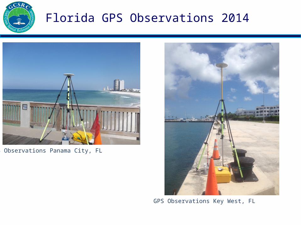
GPS Observations Panama City, FL
Florida GPS Observations 2014
GPS Observations Key West, FL

Florida GPS Network 2014

Florida GPS Network Description
• Network consists of 34 points• All points occupied > 4 hrs. minimum and 2
sessions minimum, 18 sessions total.• New CORS occupied 24 hr. sessions (Duration).• Vertically constrained 7 first order points
(ellipsoid height).• Ran Checks into Orthometric first order points
and constrained if Orthometric Height < 4cm.• Horizontally constrained 7 points (all CORS)• 2 Far CORS (> 1000km for better Trop. model)
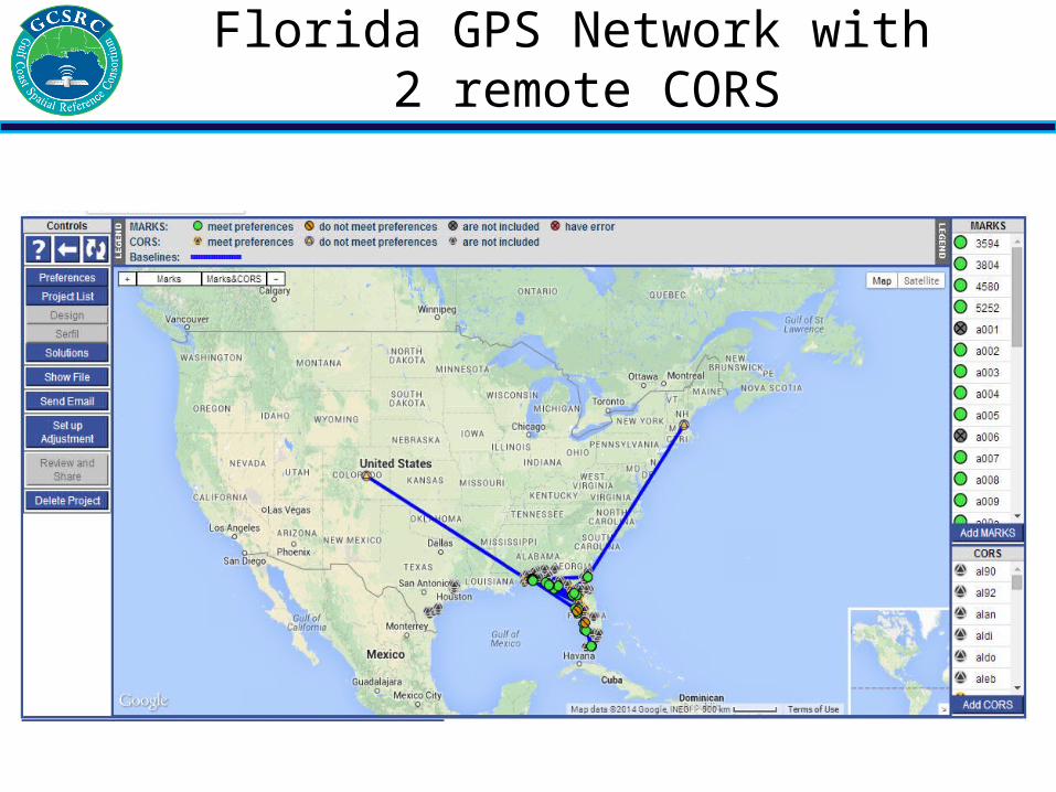
Florida GPS Network with 2 remote CORS

Florida GPS Network Survey 2014
• New CORS Stations (4)• Historical Tidal stations to be Blue
booked (6)• Existing Tidal Station Checks (5)• Existing Vertical First Order marks used
(12)• Existing Second Order Vertical marks
used (2)• Existing marks in suspected
subsidence areas (3)• Existing CORS used (9)

This year Activities:• CORS Site Selection: LSU-LSRC & TAMU-CBI
Conducted Site Selection Surveys: – Apalachicola, FL– Weeks Bay, AL– Port Sulphur, LA– Port Fourchon, LA– Cypremort Point, LA
LA, AL, FL GPS Network Survey 2015
This year Activities• Establish Reference
Heights at CORS:– Activity in the Planning Stage
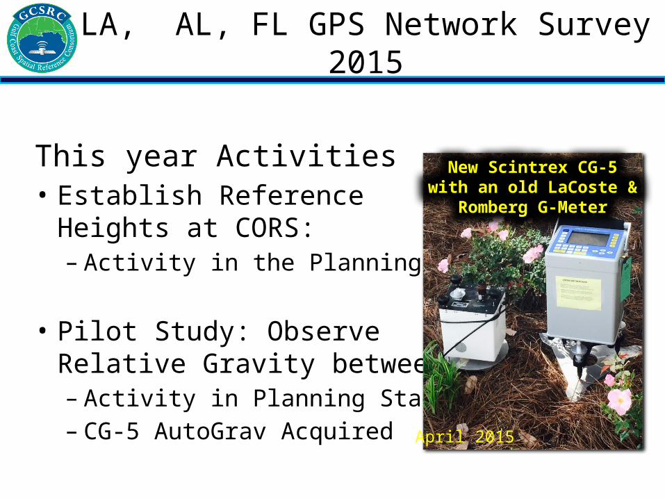
• Pilot Study: Observe Relative Gravity between CORS– Activity in Planning Stage– CG-5 AutoGrav Acquired
New Scintrex CG-5 with an old LaCoste & Romberg G-Meter
April 2015
LA, AL, FL GPS Network Survey 2015

Manage and Distribute Geodetic Data and Information:
• CORS Network Management
• Distribute CORS Data
TX, LA, MS, AL, FL CORS Network

Study AreaNERR SET Sites
Aransas NWR
Goose Island
Mission-Aransas NERR SET Sites(Sediment Elevation Tables)
TAMUCC Marsh Observatory (geodetic test site)
Intensify Marsh Elevation Measurements with Terrestrial Lidar Scanning (TLS)

Pulse Repetition Rate 300 kHz to 100 kHz
Max. Range for Natural Target (p= 90%)
High Speed Mode: 350 m Long Range Mode: 600 m
Max. Number of Targets per Pulse Single to many returns
Accuracy 5 mm at 100 m range
Image from NGS NOAA site
Full-waveform digitization
photo Ulrich et. al., 2011
Laser Scanner Specifications

• Support education, capacity building, and technology transfer through regional forums and meetings. Workshops will be coordinated with participants from NOAA, NGS, and other NHMP partners. Professional development units and/or continuing education credits will be awarded to event participants.
Goals and Objectives – Education and Outreach
2014 Height Mod Workshop hosted by LSU
2015 Height Mod Session by CBI at TSPS Symposium

Thanks for Listening
Recommended