Embed Size (px)
Citation preview

Following are pages that show all plan amendments adopted by the county and the cities in the county and submitted to DLCD since January of 1987. The list shows the county amendments first and then the cities alphabetically. Within a jurisdiction the amendments are sorted by adoption date with the older ones first. Page numbering returns to page 1 with each city.
For each amendment the first line includes the name of the jurisdiction, local file number, DLCD file number, local adoption date and any LUBA case number for those amendments that were appealed to LUBA. We have not provided information on LUBA decisions, but provide the case number to indicate that the amendment was appealed.
Below the amendment identification information are descriptions labeled "Proposed Desc." and "Adopted Desc." The Proposed Description is a more complete description of the amendment as it was proposed amendment and submitted to DLCD . This is the description that accompanied DLCD's Proposed Notice of Amendments. The adopted amendment description is a more limited description or is missing. Both descriptions are provided because not all amendments went through the department's proposed amendment process and to note changes to a proposed amendment prior to adoption.
Fonts are not consistent in the document. These are an artifact of the input process and do not affect the data content. No doubt you will discover some errors in this database. The data has been converted from one database program to another and includes more than 12,000 records in both theproposed and adopted plan amendment databases.
The department provides this general information to assist local governments and others in determining when local land use changes were made. Itis our best effort at identifying adopted amendments but should always be verified with the appropriate local government before proceeding.
Please let your regional representative know if we can be of any additional assistance with respect to this data.
Yamhill County
Page Number : 1

LUBA #Adoption DateLocal File # DLCD File #Yamhill CountyPA/Z-4-87 005-87BYamhill County 12/10/1985
Adopted Desc.
Amend the comprehensive plan and zoning from AFLH/AF-20 to VLDR/VLDR-5 for approximately 80 acres located approx. 5 miles northwest of Newberg on the southeast side of McCormick Hill Road.
Proposed Desc.
G-20-86 001-87AYamhill County 4/15/1987
AMENDMENTS TO THE ZONING ORDINANCE TEXT RELATED TO PERIODIC REVIEW.Adopted Desc.
See <PA>PA.TRACKSHEETS.3, pages 13 and 14, for more information.Proposed Desc.
PAZ-1-87 002-87AYamhill County 7/1/1987
PLAN AND ZONE MAP AMENDMENT FROM 5 ACRE ZONE TO 2.5 ACRE ZONE. THE AMENDMENT INCLUDES A CHANGED EXCEPTION FROM REASONS TO B&C.
Adopted Desc.
Amend the comprehensive plan and zoning from Agriculture and Forestry Small Holding (AF-10) to Very Low Density Residential (VLDR-5) for approximatley 60 acres located northwest of Newberg on the east side of Balk Peak Road.
Proposed Desc.
PAZ-2-87 003-87AYamhill County 8/26/1987
Adopted Desc.
Amend the comprehensive plan and zoning from Commercial Forestry (F-40) to Agriculture Forestry Large Holding (AF-20) for approximately 60 acres located at the north end of Spirit Mountain Road, north of Grand Ronde Agency.
Proposed Desc.
PA/Z-5-87 001-88AYamhill County 3/23/1988
INCLUDES AN EXCEPTION.Adopted Desc.
Amend the comprehensive plan and zoning from AFLH/AF-20 to VLDR/VLDR 2 1/2 for approximately 46 acres located approximately 2 miles west of McMinnville on the north side of Baker Creek Road at the intersection of Marjo Lane. The proposal also requires an exception.
Proposed Desc.
Page Number : 1

LUBA #Adoption DateLocal File # DLCD File #Yamhill CountyPA/Z-4-87 005-87BYamhill County 4/6/1988
INCLUDES AN EXCEPTION.Adopted Desc.
Amend the comprehensive plan and zoning from AFLH/AF-20 to VLDR/VLDR-5 for approximately 80 acres located approx. 5 miles northwest of Newberg on the southeast side of McCormick Hill Road.
Proposed Desc.
PA/Z-1-88 002-88AYamhill County 4/13/1988
ROCK OF AGES. INCLUDES AN EXCEPTION.Adopted Desc.
Amend the comprehensive plan and zoning from AFLH/EF-40 to PAI (Public Assembly Institutional) for approximately 10 acres located at 15600 S.W. Rock of Ages Road. The proposal also includes an exception.
Proposed Desc.
88028
G-20-86 005-88Yamhill County 8/17/1988
CHANGES TO THE PERIODIC REVIEW ORDER AND RELATED PLANNING DOCUMENTS IN RESPONSE TO LCDC REMAND ORDER 87-RA-306.
Adopted Desc.
NOTE: This is a revised proposal.Proposed Desc.
PA/Z-3-88 004-88Yamhill County 9/21/1988
INCLUDES AN EXCEPTION.Adopted Desc.
Amend the comprehensive plan and zoning from AFLH/AF-20 (Agriculture-Forest Large Holding/Agriculture-Forest-20) toVLDR/VLDR-2 1/2 (Very Low Density Residential/Very Low Density Residential-2 1/2) for 16 acres located 6 miles northwest of McMinnville.
Proposed Desc.
G-20-86 005-88Yamhill County 12/28/1988
HISTORIC LANDMARKS AS PART OF THE PERIODIC REVIEW PLAN UPDATE IN RESPONSE TO LCDC REMAND ORDER 87-RA-306.
Adopted Desc.
NOTE: This is a revised proposal.Proposed Desc.
Page Number : 2

LUBA #Adoption DateLocal File # DLCD File #Yamhill CountyG-20-87 001-89Yamhill County 2/1/1989
FLOODPLAIN REGULATIONS.Adopted Desc.
Amend the zoning ordinance's floodplain regulations to conform with revised Federal Emergency Management Agency regulations.
Proposed Desc.
NA 002-89Yamhill County 4/6/1989
REQUIRE CONSENT OF OWNER PRIOR TO PROPERTY'S DESIGNATION AS A HISTORIC LANDMARK. ALLOWS EXISTING STRUCTURES TO BE REMOVED FROM THE LIST OF DESIGNATED LANDMARKS UPONWRITTEN REQUEST OF OWNER WITHIN 60 DAYS.
Adopted Desc.
Amend the zoning ordinance to require that no historic landmark shall be designated without owner's consent and to allow 60 days from the effective date of the ordinance for nonconsenting owners to have designation removed. This proposal relates to periodic review requirements.
Proposed Desc.
ANX 892 001-89Yamhill County 5/24/1989
EXPAND SHERIDAN UGB FOR TRAINING FACILITIES FOR FEDERAL BUREAU OF PRISONS. INCLUDES AN EXCEPTON. ADOPTED BY YAMHILL COUNTY.
Adopted Desc.
Amend the comprehensive plan and zoning from county AF-40 (Agricultural) to PF (Public Facilities) for 8.2 acres located at 27094 S.W. Ballston Road. The proposal will expand the UGB and includes an exception.
Proposed Desc.
NA 003-89Yamhill County 8/23/1989
AMENDS ZONING ORDINANCE.Adopted Desc.
Amend the zoning ordinance to: 1) increase setback for dwellings adjacent to commercial timberland; 2) combine rural residential, highway and neighborhood commercial zones 3) provide for rural community zone. SEE PA.TRACKSHEETS FOR MORE INFORMATION.
Proposed Desc.
PA891 002-89Yamhill County 10/4/1989
ADD 18.3 ACRES TO THE CITY OF SHERIDAN'S UGB. CHANGE PLAN AND ZONE DESIGNATION FROM COUNTY TO CITY.
Adopted Desc.
Amend the Urban Growth Boundary to add 18 acres zoned Agriculture/Forest. City of Sheridan.Proposed Desc.
Page Number : 3

LUBA #Adoption DateLocal File # DLCD File #Yamhill CountyPAZ 1-90 007-90Yamhill County 7/25/1990
Adopted Desc.
Amend the comprehensive plan from Ag/Forest Large Holding to Ag/Forest Small Holding and zoning from EFU-40 (Exclusive Farm Use-40) to AF-10 (Agriculture-Forest-10) for approximately 13 acres at 20405 NE Herring Lane, Newberg. The proposal includes an exception. NOTE: The proposal was submitted without text. NOTE: This proposal has a revised hearing date.
Proposed Desc.
G-7-89-90 009-90Yamhill County 7/25/1990
Adopted Desc.
Amend the zoning ordinance from AF20 (Agriculture Forest-20) and EF40 (Exclusive Farm-40) and F-40 (Forest-40) to EFU 1, 2, and 3 (Exclusive Farm Use) and AF-10 (Agriculture/ Forest-10) and F-40 Scenic and Watershed Overlays for the entire county . This proposal is in response to the periodic review requirements for Goal 3, Agland Preservation, and Goal 5, Walker Creek Wetland.
Proposed Desc.
NA 004-89Yamhill County 12/12/1990
Adopted Desc.
Amend the comprehensive plan and zoning to adopt: 1) Procedures for review of applications for new farm dwellings and parcels; 2) Application of policies for protection of riparian areas; 3) Partitions in the big game winter range overlay zone; and 4) Protection of Pigeon Mineral Spring sites. NOTE: This proposal relates to the periodic review requirments.
Proposed Desc.
G-3-90 018-90Yamhill County 1/30/1991
Adopted Desc.
Amend the comprehensive plan to add one new transportation policy and two new commercial development policies. Changes are in connection with potential new routes through or around Newberg and Dundee.
Proposed Desc.
PAZ 02-90 017-90Yamhill County 4/10/1991
Adopted Desc.
Amend the comprehensive plan and zoning ordinance from AF-20 (Agricultural/Foresty-20 acre minimum) to VLDR-5 (Very Low Density Residenitla-5 acre minimum) for 10.1 acres located at 23205 Holly Hill Road, Hillsboro, and includes an exception.
Proposed Desc.
Page Number : 4

LUBA #Adoption DateLocal File # DLCD File #Yamhill CountyZ 3-91 002-91Yamhill County 5/1/1991
Adopted Desc.
Amend the zoning from EF-40 (Exclusive Farm Use-40) to VLDR 2-1/2 (Very Low Density Residential) for 29 acres located east of and adjacent to the city limits of Yamhill, on the south side of Highway 47. NOTE: The proposal was submitted without text.
Proposed Desc.
Z 4-91 006-91Yamhill County 8/7/1991
Adopted Desc.
Amend zoning from AF-10 (Agricultural-10) to VLDR-2 1/2 (Very Low Density Residential-2 1/2) for approximately 37 acres located on the south side of Dayton Avenue, approximately one-half mile west of Newberg.
Proposed Desc.
Z 5-91 008-91Yamhill County 8/22/1991
Adopted Desc.
Amend the zoning from VLDR-2 1/2 (Very Low Density Residential-2 1/2) to VLDR-1 (Very Low Density Residential-1) for 4 acres located at the south end of Locks Loop, near Lafayette. NOTE: The proposal was submitted without text.
Proposed Desc.
Z 6-91 010-91Yamhill County 10/16/1991
Adopted Desc.
Amend the zoning from AF-10 (Agriculture and Forest-10) to VLDR 2 1/2 (Very Low Density Residential) for approximatley 20 acres west of Springbrook Road approximatly one mile north of Highway 99W, near Newberg. NOTE: The proposal was submitted without text.
Proposed Desc.
PAZ 3-91 009-91Yamhill County 10/31/1991
Adopted Desc.
Amend the comprehensive plan and zoning from Ag/Forest Large Holding to Very Low Density Residential for 2 acres located south of Dundee on the west side of Highway 99W. The proposal includes an exception and was submitted without text.
Proposed Desc.
Page Number : 5

LUBA #Adoption DateLocal File # DLCD File #Yamhill CountyG-2-91 013-91Yamhill County 3/3/1992
Adopted Desc.
Amend the zoning ordinance to make change regarding new legislation, notice procedures, unsurveyed plats, and general housekeeping updates.
Proposed Desc.
PAZ 01-92 002-92Yamhill County 4/17/1992
Adopted Desc.
Amend the comprehensive plan from Agriculture/Forestry Large Holding to Public and zoning from EF-40 (Exclusive Farm Use-40) to PALF (Public Airport and Landing Field) for 6.0 acres located approximately three and one-half miles west of Newberg on te east side of Dopp Road. The proposal includes an exception.
Proposed Desc.
PAZ 04-91 012-91Yamhill County 4/20/1992
Adopted Desc.
Amend the comprehensive plan from Very Low Density Residential to Industrial and zoning from AF-10 (Agriculture Forestry) to RI (Resource Industrial) for 2.0 acres southwest of Newberg on the northwest side of Highway 99W. The proposal includes an exception. NOTE: The proposal was submitted without text.
Proposed Desc.
Z-02-92 003-92Yamhill County 5/27/1992
Adopted Desc.
Amend the zoning from AF-10 (Agriculture/Forest-10) to VLDR (Very Low Density Residential-2 1/2) for 12.15 acres located on the north side of Dayton Avenue, approximately one quarter mile west of the City of Newberg.
Proposed Desc.
PAZ 3-92 006-92Yamhill County 6/5/1992
AF-10 to Public Works/Safety.Adopted Desc.
Amend the comprehensive plan and zoning from AF-10 (Agriculture/Forestry Small Holding) to PWS (Public Works/ Safety) for 1.5 acres located approximately one mile north of Willamina on the west side of Willamina Creek Road. The proposal includes an exception. NOTE: The proposal was sumbitted without text.
Proposed Desc.
Page Number : 6

LUBA #Adoption DateLocal File # DLCD File #Yamhill CountyG 3-92 007-92Yamhill County 8/6/1992
Adopted Desc.
Amend the zoning ordinance to approve standards for dwellings in conjunction with confined animal and poultry operations in the EFU (Exclusive Farm Use) zones.
Proposed Desc.
G-4-92 009-92Yamhill County 10/4/1992
Adopted Desc.
Amend the zoning ordinance to revise the roadway dedication requirement of the Land Division Ordinance.Proposed Desc.
G-05-92 011-92Yamhill County 10/28/1992
Standards for Goal 4.Adopted Desc.
Amend the zoning ordinance to establish standards as prescribed by the Goal 4 forest rule.Proposed Desc.
G-20-86 005-88Yamhill County 12/16/1992
Final periodic review order, regarding Pigeon Mineral Springs, comply with RA 91-792, 87 RA 306.Adopted Desc.
NOTE: This is a revised proposal.Proposed Desc.
PAZ 5-92 013-92Yamhill County 12/23/1992
AFLH (Ag/Forest Large Holding) to Quarry for 51 ac.Adopted Desc.
Amend the comprehensive plan from Agriculture/Forestry Large Holding to Quarry and zoning from EF-40 (Exclusive Farm Use) to MR (Mineral Resource) for approximately 50 acres located approximately five miles southeast of McMinnville on the east side of Starr Quarry Road.
Proposed Desc.
Page Number : 7

LUBA #Adoption DateLocal File # DLCD File #Yamhill CountyPAZ 3-93 003-93Yamhill County 3/31/1993
Adopted Desc.
Amend the comprehensive plan from Agriculture/Forestry Large Holding to Public and zoning from AF-20 (Agriculture/ Forestry) to PWS (Public Works/Safety) for less than one acre located east of Bald Peak Road, south of the Washington County line. The proposal includes an exception and was submitted without text.
Proposed Desc.
Z 1-93 004-93Yamhill County 4/12/1993
Adopted Desc.
Amend the zoning from AF-20 (Agriculture/Forestry) to VLDR-5 (Very Low Density Residential) for approximately 10.0 acres located on Cherry Hill Road, inside the City of Sheridan urban growth boundary. NOTE: This proposal was submitted without text.
Proposed Desc.
PA Z 1-93 001-93Yamhill County 4/22/1993
Adopted Desc.
Amend the comprehensive plan and zoning from AF-20 (Agriculture/Forestry Large Holding) to MR-1 (Quarry) for approximately 5 acres located east of the City of Amity on the north side of State Highway 153.
Proposed Desc.
PAZ 2-93 002-93Yamhill County 4/22/1993
Adopted Desc.
Amend the comprehensive plan and zoning from AF-10 (Agriculture/Forestry Small Holding) to LI (Light Industrial) for approximately 1.5 acres located west of the City of Dundee urban growth boundary and north of the Niederberger. NOTE: This proposal was submitted without text.
Proposed Desc.
PAZ 4-92 010-92Yamhill County 5/12/1993
Adopted Desc.
Amend the comprehensive plan from AFLH (Agriculture/Forestry Large Holding) to C (Commercial) and zoning from EF-40 (Exlcusive Farm Use) to HC (Highway/Tourist Commercial) for 7.0 acres located near the intersection of Highway 18 and Durham Lane, McMinnville. The proposal includes an exception. Note: This is a revised proposal and addresses the new transportaton rule.
Proposed Desc.
Page Number : 8

LUBA #Adoption DateLocal File # DLCD File #Yamhill CountyG 1-93 005-93Yamhill County 6/29/1993
Conditions to approvals for dwellings in conjunction with farm use.Adopted Desc.
Amend the zoning ordinance to provide the county with the authority to attach conditions to approvals for dwellings in conjunction with farm use through a zoning ordinance amendment.
Proposed Desc.
Z 3-93 006-93Yamhill County 6/30/1993
Change in density.Adopted Desc.
Amend the zoning from VLDR-9000 (Very Low Density Residential) to VLDR-1 (Very Low Density Residential) for 9.0 acres located at 13430 Stoller Road, east of Lafayette.
Proposed Desc.
G 2-93 008-93Yamhill County 11/10/1993
Adopted Desc.
Amend the comprehensive plan and zoning from AFLH/F (Agriculture/Forestry Large Holding) to AF-10 (Agriculture Forestry Small Holding) for approximately 1,374.0 acres for the area south and east of McMinnville. The property is bordered by Moores Valley Road and Puddy Gulch Road. The proposal includes an exception.
Proposed Desc.
G 2-02 009-93Yamhill County 11/10/1993
Adopted Desc.
Amend the comprehensive plan from AFLH (Agriculture/Forest Large Holding) to AFSH (Agriculture/Forest Small Holding) and zoning from AF-20, EF-40 to AF-10 for approximately 974 acres located in nine separate areas between norht and east of the City of McMinnville.
Proposed Desc.
PAZ 4-93 007-93Yamhill County 12/1/1993
AF-20 to AF-10 for 30.0 acres.Adopted Desc.
Amend the comprehensive plan and zoning from AF-20 (Agriculture/Forest Large Holding) to AF-10 (Agriculture/ Forest Small Holding) for 30.0 acres approximately two miles southwest of Hopewell at the end of Jerssalem Hill Road. The proposal includes an exception. Note: This proposal was submitted without text.
Proposed Desc.
Page Number : 9

LUBA #Adoption DateLocal File # DLCD File #Yamhill CountyUGB 1-93 004-93Yamhill County 12/10/1993
Adopted by county and city.Adopted Desc.
Amend the urban growth boundary to include approximately 13 acres. Amend the comprehensive plan from Very Low Density Residential to Park . The property is located north of Columbia Drive between Crater Lane and Chehalem Drive. This is part of a previously submitted proposal. NOTE: See old proposed notice. Yamhill County DLCD File #004-98 is the co-adoption related file to this.
Proposed Desc.
NA 012-93Yamhill County 12/29/1993
Adopting the final periodic review order and compyling with 91-RA 792 (Walker Flat).Adopted Desc.
Amend the comprehensive plan and zoning ordinance to recognizing Walker Flat as a significant fish and wildlife habitat, natural area and wetland resource, and to complete the Goal 5 process for the Walker Creek area consistant with LCDC Order #91-RA-793.
Proposed Desc.
G-5-93 011-93Yamhill County 12/29/1993
Adopted Desc.
Amend the comprehensive plan, zoning ordinance and the zoning maps to comply with HB 3361 (Farm and Forest) rule.Proposed Desc.
G-5-93 011-93Yamhill County 12/29/1993
Adopted Desc.
Amend the comprehensive plan, zoning ordinance and the zoning maps to comply with HB 3361 (Farm and Forest) rule.Proposed Desc.
PAZ 1-94 001-94Yamhill County 4/14/1994
Adopted Desc.
Amend the comprehensive plan and zoning from EF-40 (Agricutural/Forest Large Holding) to HC (Highway Commercial) for 0.42 acre located at the intersection of State Highway 18 and Gopher Valley Road, 2 miles east of Sheridan. This proposal was submitted without text.
Proposed Desc.
Page Number : 10

LUBA #Adoption DateLocal File # DLCD File #Yamhill CountyZ 1-94 003-94Yamhill County 5/5/1994
Adopted Desc.
Amend the zoning from AF-20 (Agriculture/Forestry) to VLDR-5 (Very Low Density Residential) for approximately 7.0 acres located north of Cherry Hill Road, within the City of Sheridan's urban growth boundary. This proposal was submitted without text.
Proposed Desc.
Z 2-94 004-94Yamhill County 5/5/1994
Adopted Desc.
Amend the zoning from EF-40 (Exclusive Farm Use) to VLDR-2 (Very Low Density Residential) for 9.6 acres located between Fletcher Road and Highway 18 within the City of Dayton's urban growth boundary. This proposal was submitted without text.
Proposed Desc.
PA 3-93 002-94Yamhill County 5/19/1994
Adopted Desc.
Amend the comprehensive plan from LDR (Low Density Residential) to LDR/SP, Low Density Residential/Specific Plan), MDR/SP (Medium Density Residential/Specific Plan), and COM/SP (Commercial/Specific Plan) for 150 acres located inside the urban growth boundary, east of North College Street, Newberg.
Proposed Desc.
Z 3-94 008-94Yamhill County 8/4/1994
Adopted Desc.
Amend the zoning from AF-10 (Agriculture/Forestry) to HI (Heavy Industrial) for 31 acres located west of the City of Sheridan city limits. This proposal will allow for the expansion of an existing timber mill operation.
Proposed Desc.
PAZ 2-94 005-94Yamhill County 8/4/1994
Adopted Desc.
Amend the comprehensive plan from Public to Very Low Density Residential and zoning from PAI (Public Assembly Institutional) to VLDR-5 (Very Low Density Residential) for 2.25 acres located at the corner of Bald Peak and Holly Hill Roads. This proposal has already been excepted from statewide resource planning goals.
Proposed Desc.
Page Number : 11

LUBA #Adoption DateLocal File # DLCD File #Yamhill CountyPA 2-94 006-94Yamhill County 9/9/1994
Adopted Desc.
Amend the comprehensive plan from AFLH (Agriculture/Forestry Large Holding) to Q (Quarry) for 75.5 acres; add this siteto the aggregate sites inventory list; and allow a conditional use permit for the operation located east of Grand Island Junction, along the Willamette River. This proposal was submitted without text.
Proposed Desc.
PA 3-94 012-94Yamhill County 12/7/1994
Adopted Desc.
Amend the comprehensive plan (and zoning) from LDR Low Density Residential (and AF-10 Ag/Forestry Small Holding) to Low Density (and R-1 Single Family Residential) to expand the City of Dundee's UGB for six acres located at 751 SW 11th Street, Dundee. This proposal includes an exception.
Proposed Desc.
G-1-94 011-94Yamhill County 12/8/1994
Adopted Desc.
Amend the zoning ordinance provisions regarding commercial activities in conjunction with farm use, farm stands, and wineries. Amends the county mass gathering ordinance.
Proposed Desc.
PAZ 6-94 013-94Yamhill County 12/12/1994
Adopted Desc.
Amend the comprehensive plan (and zoning) from Agriculture/ Forest Small Holding (and AF-10) to Heavy Industrial (and HI) for approximately 4.5 acres. This amendment was submitted without text.
Proposed Desc.
Z-4-94 014-94Yamhill County 12/21/1994
Adopted Desc.
Amend the zoning map from AF-10 to AF-20 for 40 acres and a site design review to allow construction of a winery. This proposal was received without text.
Proposed Desc.
Page Number : 12

LUBA #Adoption DateLocal File # DLCD File #Yamhill CountyG-8-94 018-94Yamhill County 3/15/1995
Adopted Desc.
Amend the comprehensive plan (and zoning) from Public Facilities (and PAI) to Exclusive Farm Use (and EF-80) for 1.5 acres located on Wallace Road, Dayton.
Proposed Desc.
PAZ-1-95 001-95Yamhill County 4/12/1995
Adopted Desc.
Amend the comprehensive plan map (and zoning map) from Agriculture Forest Large Holding (and AF-20) to Public Facilities (and PA1) on 40 acres located at Camp Yamhill.
Proposed Desc.
PA 3-94 012-94Yamhill County 5/1/1995
Adopted Desc.
Amend the comprehensive plan (and zoning) from LDR Low Density Residential (and AF-10 Ag/Forestry Small Holding) to Low Density (and R-1 Single Family Residential) to expand the City of Dundee's UGB for six acres located at 751 SW 11th Street, Dundee. This proposal includes an exception.
Proposed Desc.
G-9-94 002-95Yamhill County 5/10/1995
Adopted Desc.
Amend the comprehensive plan and land use regulations to: 1) Move the definition of "owner" in the zoning ordinance so it only applies to Lot of Record dwellings; and 2) Add policies stating the county will be no less or no more restrictive than the provisions for dwellings found in HB 3661. This proposal involves all lands in the F, EF, and AF-20 districts.
Proposed Desc.
G-9-94 019-94Yamhill County 5/10/1995
Adopted Desc.
Amend the comprehensive plan and land use regulation to clarify the definition of "owner" from HB 3661 and other related changes.
Proposed Desc.
Page Number : 13

LUBA #Adoption DateLocal File # DLCD File #Yamhill CountyG-7-94 020-94Yamhill County 5/11/1995
Adopted Desc.
Amend the comprehensive plan map (and zoning map) from Agriculture/Forestry Large Holding (and AF-20) to Agriculture/Forestry Small Holding (and AF-10) for 131.70 acres located on Cherry Hill Road. This proposal includes an exception.
Proposed Desc.
G-7-94 022-94Yamhill County 5/11/1995
Adopted Desc.
Amend the comprehensive plan map (and zoning map) from Agriculture/Forestry Large Holding (and AF-20) to Agriculture/Forestry Small Holding (and AF-10) on 131.7 acres located on Cherry Hill Road. This proposal requires an exception. This proposal was received without text.
Proposed Desc.
G-01-95 004-95Yamhill County 5/17/1995
Adopted Desc.
Amend the Historic Preservation Ordinance to add owner's consent as a criterion for approval of an historic landmark designation. The same criterion will apply to removing a landmark designation.
Proposed Desc.
PAZ 8-94 017-94Yamhill County 6/28/1995
Adopted Desc.
Amend the comprehensive plan (and zoning) from Commercial Forestry (and F-80) to Parks and Recreation (and RecreationCommercial) for 12 acres located west of and adjacent to the Flying M Ranch. This proposal will allow for expansion of recreation and lodging facilities and it includes an exception.
Proposed Desc.
PAZ 2-95 005-95Yamhill County 7/5/1995
Adopted Desc.
Amend the comprehensive plan (and zoning) from Agriculture Forestry Large Holding (and EF-40, AF-20) to Very Low Density Residential (and VLDR 2 1/2) and Public Facilities (and PAI) for 6 acres located on the east side of Highway 47 in Cove Orchard. This proposal includes an exception.
Proposed Desc.
Page Number : 14

LUBA #Adoption DateLocal File # DLCD File #Yamhill CountyG-6-94 016-94Yamhill County 7/20/1995
Adopted Desc.
Amend the comprehensive plan map (and zoning) for the designation of Urban Reserve Areas surrounding Newberg involving approximately 1,916 acres at six separate areas.
Proposed Desc.
LC-02-95 006-95Yamhill County 8/23/1995
Adopted Desc.
Amend the comprehensive plan map to add "Fernwood Pioneer Cemetery" (situated on 1 acre in Newberg) to the county's Goal 4 Historical Resource Inventory. This proposal was received without text.
Proposed Desc.
G-02-95 009-95Yamhill County 9/9/1995
Adopted Desc.
Amend the zoning ordinance to adopt a Landmarks Ordinance to promote the historic, educational, cultural, economic and general welfare of the public through the preservation, restoration and protection of buildings, structures and appurtenances, sites, places and elements of historic and archaeological value and interest. Amended notice received July 17, 1995, adopting original Polk County Landmarks Ordinance as Yamhill County Landmarks Ordinance.
Proposed Desc.
PAZ-05-95 010-95Yamhill County 10/12/1995
Adopted Desc.
Amend the comprehensive plan (and zoning) from Agriculture Forest Small Holding (and AF-10) to Agriculture Forestry Large Holding (and AF-40) on 88 acres located on Earlwood Road, five miles southwest of Newberg and .33 mile north of Wilsonville Road.
Proposed Desc.
LR-01-95 012-95Yamhill County 3/20/1996
Adopted Desc.
Amend the comprehensive plan map to remove structures from the Landmarks Inventory as provided for in HB 2124. This proposal was received without text.
Proposed Desc.
Page Number : 15

LUBA #Adoption DateLocal File # DLCD File #Yamhill CountyG-3-95 011-95Yamhill County 3/27/1996
Adopted Desc.
Amend the comprehensive plan to adopt the Transportation System Plan. This proposal was received without text.Proposed Desc.
PAZ-6-95 014-95Yamhill County 5/8/1996
Adopted Desc.
Amend the comprehensive plan (and zoning) maps from Agriculture/Forestry Small Holding (and AF-10) to Commercial (and RC) on nine acres located at the southwest corner of the intersection of Grand Ronde Road and Highway 22.
Proposed Desc.
G-1-96 013-95Yamhill County 5/22/1996
Adopted Desc.
Amend the Forest, Exclusive Farm Use, and Agriculture/Forestry sections of the zoning ordinance to comply with state rules and the 1995 legislation.
Proposed Desc.
PAZ-7-95 015-95Yamhill County 5/23/1996
Adopted Desc.
Amend the comprehensive plan (and zoning) maps from Very Low Density Residential (and VLDR-2 1/2) to Public (and PWS) on 15 acres located at the St. Paul Highway and Wynooski Road.
Proposed Desc.
PAZ-01-96 004-96Yamhill County 6/19/1996
Adopted Desc.
Amend the comprehensive plan (and zoning) maps from AFSH, Agriculture/Forestry Small Holding (and AF-10) to VLDR, Very Low Density Residential (and VLDR 2.5) on approximately 9.6 acres located at 33025 Northeast Old Parrett MountainRoad in the Newberg area.
Proposed Desc.
Page Number : 16

LUBA #Adoption DateLocal File # DLCD File #Yamhill CountyPAZ-01-96 004-96Yamhill County 6/19/1996
Adopted Desc.
Amend the comprehensive plan (and zoning) maps from AFSH, Agriculture/Forestry Small Holding (and AF-10) to VLDR, Very Low Density Residential (and VLDR 2.5) on approximately 9.6 acres located at 33025 Northeast Old Parrett MountainRoad in the Newberg area.
Proposed Desc.
PAZ-01-96 006-96Yamhill County 6/19/1996
Adopted Desc.
Amend the comprehensive plan (and zoning) from Agriculture/Forestry (and AF-10) to Very Low Density Residential (and VLDR-2.5) on approximately 9.6 acres located at 33025 North East Old Parrett Mountain Road.
Proposed Desc.
PAZ 5-93 010-93Yamhill County 8/28/1996
Adopted Desc.
This is a revised proposal with a new hearing date. Quarry 80 acres.Proposed Desc.
G-4-96 010-96Yamhill County 10/2/1996
Adopted Desc.
Amend the zoning ordinance to require continuous ownership for lot of record dwellings.Proposed Desc.
Z-02-96 003-96Yamhill County 11/6/1996
Adopted Desc.
Amend the zoning map from Exclusive Farm Use (EFU) to Agriculture/Forestry (AF-40) to allow a "forest template dwelling" on 44.4 acres located south of the west end of Cummins Road. NOTE: Revision rec'd 7/16/96 added 80 acres to request for a total of 124.4 acres. (Original request rec'd 3/22/96.)
Proposed Desc.
Page Number : 17

LUBA #Adoption DateLocal File # DLCD File #Yamhill CountyZ-05-96 015-96Yamhill County 2/13/1997
Adopted Desc.
Amend the zoning map from Agriculture/Forestry Small Holding (AF-10) to Very Low Density Residential (VLDR-2.5) on 7.9 acres located at 23600 N. Highway 99W, Newberg.
Proposed Desc.
PAZ-06-96 013-96Yamhill County 2/26/1997
Adopted Desc.
Amend the urban growth boundary to de-annex 13 acres located adjacent to the sewer treatment plant and annex in 13 acres located south of Main Street, City of Yamhill. Also amend the comprehensive plan map (and zoning map) from Urban (and Residential) to Agriculture / Forestry Large Holding (and Exclusive Farm Use) on the first tract and from Agriculture / Forestry Large Holding (and Exclusive Farm Use) to Urban (and Residential) on the second tract. Related City of Yamhill file: 002-96 (7881).
Proposed Desc.
G-1-97 001-97Yamhill County 4/9/1997
Adopted Desc.
Amend the land use code to raise the maximum building height from 25 feet to 35 feet in the Very Low Density Residential Districts; to allow Hearings Officer review of Type B appeals; and to change notice of public hearings requirements to Oregon Revised Statutes standards.
Proposed Desc.
G-Z-97 003-97Yamhill County 5/28/1997
Adopted Desc.
Amend the zoning ordinance to revise the mineral resource zone section and the public works / safety zone section to allow parks as a conditional use.
Proposed Desc.
2-03-96 005-96Yamhill County 6/21/1997
Adopted Desc.
Amend the zoning ordinance from Agriculture Forestry (and AF-10) to Residential (and VLDR-2.5) on 10.04 acre. This proposal was received without text.
Proposed Desc.
Page Number : 18

LUBA #Adoption DateLocal File # DLCD File #Yamhill CountyPA-02-96 002-97Yamhill County 6/23/1997
Adopted Desc.
Amend the comprehensive plan map (and zoning map) from Very Low Density Residential (and VLDR 2.5) to Industrial (and Heavy Industrial, HI) on approximately 10 acres located at 2808 S. Wynooski Road, Newberg. Purpose is to build a Waste to Fuel Processing Plant at the location.
Proposed Desc.
PAZ-01-97 004-97Yamhill County 6/26/1997
Adopted Desc.
Amend the comprehensive plan (and zoning) from Agriculture Forest Small Holding (and AF-10) to Industrial (and RI) for 1.5 acres located on Three Trees Lane, near the City of Amity. The proposal includes an exception.
Proposed Desc.
PAZ-02-97 005-97Yamhill County 9/11/1997
Adopted Desc.
Amend the comprehensive plan map (and zoning map) from Very Low Density Residential (and VLDR-1 acre) to Industrial (and RI, Resource Industrial) for 2 acres located northeast and adjacent to Dundee. This proposal includes an exception.
Proposed Desc.
PAZ-4-97, C-14-97 006-97Yamhill County 10/23/1997
Luba remanded the County's decision (adopted).Adopted Desc.
Amend the comprehensive plan map (and zoning map) from Exclusive Farm Use (and EF-20) to Very Low Density Residential (and VLDR - 2 1/2) on 3 to 4 acres in Cove Orchard. This proposal includes an exception.
Proposed Desc.
97-236
Z-01-97 007-97Yamhill County 12/4/1997
Adopted Desc.
Amend the zoning map from Very Low Density Residential (VLDR-2 1/2) to VLDR-1 for 4.23 acres located at 1545 SW Old Sheridan Road in McMinnville.
Proposed Desc.
Page Number : 19

LUBA #Adoption DateLocal File # DLCD File #Yamhill CountyZ-04-97 013-97Yamhill County 3/5/1998
Adopted Desc.
Amend the zoning map from Exclusive Farm Use (EF-80) to Agriculture/Forestry (AF-80) for 668 acres located at 10660 Youngberg Hill Road.
Proposed Desc.
G-01-98 014-97Yamhill County 3/19/1998
Adopted Desc.
Amend the zoning ordinance text to allow for "Housekeeping" corrections. Proposed Desc.
Z 03-97 011-97Yamhill County 5/14/1998
Adopted Desc.
Amend the zoning map from AF-10 to VLDR-2 1/2 for 5.22 acres located at NE Dillon Road. This proposal was received with only 43 days notice.
Proposed Desc.
G-03-98 003-98Yamhill County 7/9/1998
Adopted Desc.
Amend the zoning ordinance making various changes to the text.Proposed Desc.
PAZ-02-98 005-98Yamhill County 7/16/1998
Adopted Desc.
Amend the comprehensive plan map (and zone map) from Agriculture/Forest Large Holding AFLH (and AF-20) to Parks and Recreation (and Parks and Recreation/Open Space PRO) for 1.0 acre located along Baker Creek Road in McMinnville. This proposal was received with only 44 days notice and includes an exception.
Proposed Desc.
Page Number : 20

LUBA #Adoption DateLocal File # DLCD File #Yamhill CountyG-02-98 001-98Yamhill County 7/30/1998
Adopted Desc.
Amend the zoning ordinance to change language to make the "forest template" and "lot of record" dwellings more restrictive. Additional text adopted 8/13/1998.
Proposed Desc.
Z-01-98 002-98Yamhill County 8/4/1998
Adopted Desc.
Amend the zone map from PWS Public Works/Safety and Mineral Resource to Heavy Industrial for 20 acres just south of Newberg.
Proposed Desc.
G-02-98 001-98Yamhill County 8/13/1998
Adopted Desc.
Amend the zoning ordinance to change language to make the "forest template" and "lot of record" dwellings more restrictive. Additional text adopted 8/13/1998.
Proposed Desc.
PAZ-6-98 007-98Yamhill County 8/20/1998
Adopted Desc.
Amend the comprehensive plan map (and zoning map) from Agriculture Forestry Small Holding (and AF-10) to Industrial (and Heavy Industrial) to allow an equipment maintenance and office facility for a rock crushing operation. Proposal states that an exception to goal3 was taken in 1980.
Proposed Desc.
PAZ-8-98 009-98Yamhill County 8/20/1998
Adopted Desc.
Amend the comprehensive plan map (and zoning map) from Agriculture Forestry Large Holding (and Exclusive Farm - 80 acres, EF-80) to Industrial (and Light Industrial, LI) on 5.3 acres located on the east side of Schatz Road, just south of Highway 18, adjacent to the City of Sheridan. This proposal includes an exception to Goal 3.
Proposed Desc.
Page Number : 21

LUBA #Adoption DateLocal File # DLCD File #Yamhill CountyPAZ-5-98/SDR-5-98 008-98Yamhill County 9/10/1998
Adopted Desc.
Amend the comprehensive plan map (and zoning map) from Agriculture Forest Large Holding, AFLH, (and Exclusive Farm Use, EF-80) to Industrial, I (and Light Industrial, LI) on .54 acres located northeast of the Southern Pacific Railroad and south of Hawn Creek county road near St. Joseph. An exception is involved.
Proposed Desc.
PAZ-07-98 010-98Yamhill County 9/12/1998
Adopted Desc.
Amend the comprehensive plan map (and zoning map) from Agriculture Forestry Small Holding (and AF-10) to Very Low Density Residential (and VLDR - 2 1/2) on 14 acres located south of and adjacent to the City of Amity.
Proposed Desc.
Z-02-98 013-98Yamhill County 1/7/1999
Adopted Desc.
Amend the zoning map from Exclusive Farm Use (EF-80) to Very Low Density Residential (VLDR 2.5) and approve a building permit in the floodplain on a 1.38 acre parcel located within the UGB of Sheridan.
Proposed Desc.
G-05-98 011-98Yamhill County 1/14/1999
Adopted Desc.
Amend the land use regulations to: (1) add municipal water or wastewater treatment facility to the definition of utility; (2) restrict entertainment on the farm and forest zones (AF & EF) not directly related to the sale or production of an agricultural or forest product; (3) change the Mineral Resource District (MR-1 and MR-2 zones) to comply with Goal 5; (4) amend Type A procedures to allow the Planning Director the discretion to process certain land use applications as Type B; (5) define when a utility facility is "necessary" to be located in an exclusive farm use zone; and (6) clarify lot-line adjustment language in the farm and forest zones (AF and EF) that the transfer of a dwelling should result in no increase in dwellings without appropriate land use approval.
Proposed Desc.
PAZ-09-98 014-98Yamhill County 1/21/1999
Adopted Desc.
Amend the comprehensive plan map (and zoning map) from Agriculture / Forestry Large Holding, AFLH (and EF-20) to Agriculture / Forestry Small Holdling, AFSH (and AF-10) on 2.6 acres located between Highway 47, Cove Orchard Road, Beaver Street, and Demmer Street at the north end of Cove Orchard. This proposal includes an exception.
Proposed Desc.
Page Number : 22

LUBA #Adoption DateLocal File # DLCD File #Yamhill CountyPAZ-01-99 002-99Yamhill County 4/15/1999
Adopted Desc.
Amend the comprehensive plan map (and zoning map) from Ag/Forest Large Holding (and EF-80) to Public (and PALF) for 7.3 acres to expand the Chehalem Airpark. This proposal includes an exception.
Proposed Desc.
G-03-99 003-99Yamhill County 5/27/1999
Same.Adopted Desc.
Approval of a temporary exception to Statewide Planning Goal 3 (Agricultural Goal) to allow the County Classic Horse Show to have a mass gathering of 3,000 to 5,000 people. This Proposal was received with an exception.
Proposed Desc.
PAZ-02-99 004-99Yamhill County 6/14/1999
Adopted Desc.
Amend the comprehensive plan map (and zoning map) from VLDR, Very Low Density Residential to AFLH, Agriculture Forestry Large Holding (and VLDR-2.5, Very Low Density Residential-2.5 to EFU-80, Exclusive Farm Use District-80) for 2.5 acres, located north of Meadow Lake Road, just west of Carlton.
Proposed Desc.
PAZ-04-95 007-95Yamhill County 7/8/1999
Adopted Desc.
Amend the comprehensive plan (and zoning maps) from Agriculture Forestry Large Holding (and AF-20) to Very Low Density Residential (and VLDR-5) on 60 acres located on the top of Bald Peak. This proposal includes an exception.
Proposed Desc.
Z-01-98 002-98Yamhill County 11/5/1999
Adopted version: The zone change for 2 acres was denied the adopted version allowed only 18 acres. The Willamette Greenway Permit was withdrawn.
Adopted Desc.
Amend the zone map from PWS Public Works/Safety and Mineral Resource to Heavy Industrial for 20 acres just south of Newberg.
Proposed Desc.
Page Number : 23

LUBA #Adoption DateLocal File # DLCD File #Yamhill CountyPAZ-03-99/SDR-14-99 006-99Yamhill County 2/10/2000
Same.Adopted Desc.
Amend the comprehensive plan map (and the zoning map) from City/UC, City/Urban Commercial to County-AG/FLH, County-Agriculture/Forestry Large Holding for 4.66 acres; and move County-AG/FLH, County-Agriculture Large Holding to City-FUR, City-Future Urbanizable for 3.61 acres (and from City/C-3, General Commercial to County/EF-80, County/Exclusive Farm Use-80 for 4.66; and County/EF-80, County/Exclusive Farm Use to City/PAI, City Public Assembly Institutional for 3.61 acres) trading 4.66 acres in the City of McMinnville, for 3.61 acres in the County; and adjusting the Urban Growth Boundary line to reflect the land trade. This proposal includes an exception.
Proposed Desc.
PAZ 5-93 010-93Yamhill County 3/9/2000
Same.Adopted Desc.
This is a revised proposal with a new hearing date. Quarry 80 acres.Proposed Desc.
PAZ-04-99 007-99Yamhill County 3/24/2000
Same.Adopted Desc.
Amend the comprehensive plan map (and the zoning map) from AFSH, Agriculture/Forest Small Holding to I, Industrial (and from AF-10, Agriculture/Forestry Small Holding to IR, Reserve Industrial) for approximately 2.75 acres, located at 16825 Chehalem Drive north of City of Newberg.
Proposed Desc.
PAZ-05-97 012-98Yamhill County 3/31/2000
The exception and zoning change from EF-80 to VLDR 2.5 for that portion outside of Dayton's UGB was denied.Adopted Desc.
Amend the comprehensive plan map (and zoning map) from Residential and Ag/Forest Large Holding (and EF-80) to Residential and Very Low Density Residential (and VLDR-1 and VLDR 2 1/2) on 34.4 acres partially located within the urban growth boundary of the City of Dayton. This proposal includes an exception.
Proposed Desc.
G-4-97 012-97Yamhill County 5/17/2000
Several proposal amendments were pulled for review at a later date.Adopted Desc.
Amend the zoning ordinance to incorporate changes made in state laws, administrative rule and court decisions. Proposed Desc.
Page Number : 24

LUBA #Adoption DateLocal File # DLCD File #Yamhill CountyPAZ-02-00 002-00Yamhill County 7/27/2000
Same.Adopted Desc.
Amend the comprehensive plan map (and the zoning map) from AFLH, Agriculture/Forestry Large Holding to VLDR, Very Low Density Residential (and from EF-20, Exclusive Farm Use to VLDR2.5, Very Low Density Residential) for 1.1 acres, located in a triangle formed by Grant/Graham and Cove Orchard Roads, approximately 6.9 miles north of the City of Yamhill. This proposal includes an exception to Statewide Planning Goal 3.
Proposed Desc.
PAZ-04-00 005-00Yamhill County 12/14/2000
Same.Adopted Desc.
Amend the comprehensive plan map (and the zoning map) from AFLH, Agriculture/Forest Large Holding to I, Industrial (and from EF-80, Exclusive Farm Use to LI, Light Industrial) for 1.1 acres, located at 28570 NE Highway 47, one mile south of the City of Gaston.
Proposed Desc.
PAZ-05-00 003-00Yamhill County 1/25/2001
Same.Adopted Desc.
Amend the comprehensive plan map (and the zoning map) from VLDR, Very Low Density Residential to C, Commercial (and from VLDR-2.5, Very Low Density Residential-2.5 to CN, Neighborhood Commercial) for 0.49 acres, located at 205 NE Bienz Road outside the City of Dundee.
Proposed Desc.
Z-03-00 006-00Yamhill County 3/1/2001
All but the southern and eastern 160 feet of property was rezoned to HI, Heavy Industrial. The approved was granted with a limited use overlay which contains 6 conditions.
Adopted Desc.
Amend the zoning map from AF-10, Agriculture /Forestry Small Holding to HI, Heavy Industrial to allow an asphalt batch plant on 19.68 acres, located at 1409 Sandoz Road near the northwest corner of Wynooski and Sandoz Road.
Proposed Desc.
PAZ-08-00 008-00Yamhill County 3/8/2001
same except an error was made in the original notice, zoning change was from VLDR-2 1/2, it was actually AF-10.Adopted Desc.
Amend the comprehensive plan map (and the zoning map) from VLDR, Very Low Density Residential to P, Public (and from VLDR-2.5, Very Low Density Residential-2.5 acres to PAI, Public Assembly Institutional) for 4.60 acres, located between 24177 and 24279 Dayton Avenue, 1 mile south of downtown Newberg. This proposal was received without a final hearing date, which will be determined at a later date.
Proposed Desc.
Page Number : 25

LUBA #Adoption DateLocal File # DLCD File #Yamhill CountyPAZ-01-01 001-01Yamhill County 4/26/2001
Same.Adopted Desc.
Amend the comprehensive plan map (and the zoning map) from Agriculture/Forestry Small Holding to Industrial (and from AF-10, Agriculture/Forestry Small Holding to RI, Resource Industrial) for 1.00 acre, located on Bell Road north of the City of Newberg. This proposal was received without text, and without notice of a final hearing date.
Proposed Desc.
G-01-01 002-01Yamhill County 6/14/2001
Eliminated the part to allow the storage and distribution of explosives for farm, forest and mineral resource uses ion the mineral resource zone.
Adopted Desc.
Amend the zoning ordinance to add storage and distribution of explosives and related materials for farm, forest, and mineral resource uses, as a permitted use in Mineral Resource District-1 and Mineral Resource Distict-2 zones; and add commercial storage and distribution of explosives and related materials as a conditional use in Mineral Resource Districts. This proposal was received with notice of a final hearing date.
Proposed Desc.
Z-02-00 009-00Yamhill County 6/23/2001
Same. Remanded back to County on 01/10/2002.Adopted Desc.
Amend the zoning map from AF-10, Agriculture/Forestry Small Holding to VLDR 2.5, Very Low Density Residential for three tax lots on approximately 27.00 acres, located at 23545, 23550, and 23570 Highway 99W, south of the City of Newberg.
Proposed Desc.
2001-114
PAZ-02-01 004-01Yamhill County 7/26/2001
Same.Adopted Desc.
Amend the comprehensive plan map (and the zoning map) from Agriculture/Forestry Large Holding (and AF-20 Ag/Forestry Large Holding) to Agriculture/Forestry Small Holding (and AF-10 Agriculture/Forestry Small Holding) for approximately 15.00 acres, located at 7840 Hillview Drive, Amity. This proposal includes an exception to Statewide Planning Goal 3.
Proposed Desc.
PAZ-05-01 008-01Yamhill County 1/10/2002
Adopted the zone change portion of the request.Adopted Desc.
Amend the comprehensive plan map (and the zoning map) from AFSH, Agriculture Forestry Small Holding to AFLH, Agriculture Forestry Large Holding (and from AF-10, Agriculture Forestry Small Holding to EF-40, Exclusive Farm-40 Acre) for four parcels on 19.24 acres to allow construction of a winery, located on the south side of Herring Lane; east of 2405 Herring Lane; and west of the Cityof Newberg off of Highway 240. This proposal was received with 43 days notice before the first evidentiary hearing, and without notice of a final hearing that will be determined at a later date.
Proposed Desc.
Page Number : 26

LUBA #Adoption DateLocal File # DLCD File #Yamhill CountyPAZ-03-01 007-01Yamhill County 1/10/2002
Same.Adopted Desc.
Amend the comprehensive plan map (and the zoning map) from AFLH, Agriculture/Forestry Large Holding to AFSH, Agriculture/Forestry Small Holding (and the zoning map from EF-80, Exclusive Farm Use-80 acre to AF-10, Agriculture/Forestry-10 acre) for approximately 10.00 acres, located on the south side of Bald Peak Road, and approximately 0.25 mile west of the intersection of Ornduff and Bald Peak Roads. This proposal includes exceptions to Statewide Planning Goals 3 Agriculture Lands and 14 Urbanization.
Proposed Desc.
Z-01-01 001-02Yamhill County 4/18/2002
Same.Adopted Desc.
Amend the zoning map from AF-10, Agriculture/Forestry Small Holding to VLDR-2.5, Very Low Density Residential-2.5 acre for approximately 13.51 acres, located at 9155, 9461, 9600 Laughter Lane; south of the City of Amity and west of State Highway 99W. This proposal was received with 44 days notice before the first evidentiary hearing.
Proposed Desc.
Z-02-00 009-00RYamhill County 5/2/2002
Same. This adoption is a re-approval of LUBA 2001-0114 remand back to the County on January 10, 2002.Adopted Desc.
Amend the zoning map from AF-10, Agriculture/Forestry Small Holding to VLDR 2.5, Very Low Density Residential for three tax lots on approximately 27.00 acres, located at 23545, 23550, and 23570 Highway 99W, south of the City of Newberg.
Proposed Desc.
PAZ-06-01 010-01Yamhill County 5/9/2002
Same.Adopted Desc.
Amend the comprehensive plan map (and the zoning map) from AFLH, Agriculture/Forestry Large Holding to AFSH, Agriculture/Forestry Small Holding (and from EF-80, Exclusive Farm Use to Agriculture/Forest Small Holding) for approximately 24.00 acres, located approximately 0.75 miles west of the intersection of Fox Ridge and North Hill Road on the north side of Fox Ridge Road near the city of McMinnville. This proposal was received with an exception to Statewide Planning Goal 2.
Proposed Desc.
PA-04-01 012-01Yamhill County 5/16/2002
Adoption of Providence Health Systems request for annexation and UGB adjustment of 37.20 acres.Adopted Desc.
Amend the comprehensive plan map (and the zoning map) from VDLR, Very Low Density Residential to PQ, Public/Quasi-Public (and from VDLR-2.5, Very Low Density Residential-2.5 acre to I, Institutional; EF-40, Exclusive Farm Use-40 acre to I, Institutional) for 37.20 acres of a 42.90 acre site, located on the south side of Highway 99W, east of Springbrook Street, at 4100 and 4300 Portland Road. If the voters of Newberg approval the annexation in the November 2002 general election, the property will be annexed into the City of Newberg; and if approved, the UGB - Urban Growth Boundary of Newberg will be moved to include the 37.20 acres. This proposal is related to City of Newberg DLCD File No. 006-01 (11817).
Proposed Desc.
Page Number : 27

LUBA #Adoption DateLocal File # DLCD File #Yamhill CountyPAZ-08-01 011-01Yamhill County 5/16/2002
The original proposal included a CP Map amendment. zoning text amendment and zonig map change. only the CP text was amended.Adopted Desc.
Amend the comprehensive plan to implement and add a new element called the City of Newberg River Master Plan consisting of changes in nine chapters, thirty-two subsections. Amend the development code to implement the River Master Plan by adding a new district called the Riverfront Commercial District and define the standards, uses, policies, transportation and pedestrian issues, public facility needs for the RCD in twelve sections, forty-four subsections. Amend the zoning ordinance to implement the RCD and add a new a section called "908, Urbanizable Area Overlay District" consisting of five subsections. Amend the comprehensive plan and zoning maps to implement the the River Commercial District by identifying six zoning map areas, and county zoning map areas; identify five comprehensive plan map areas. The Riverfront Master Plan district is located on the north side of the Yamhill River, and in the general area of River Road South, east of College Street, portions of 14th Street, portions of 12th Street, portions of Ninth Street, portions of First Street, Rogers Landing Road, Blaine Street, and Waterfront Road. This proposal was received with 44 days notice before the first evidentiary hearing, and the file hearing will be determined at a later date. This proposal is related City of Newberg proposal DLCD File Number 003-01 (11555).
Proposed Desc.
PAZ-03-02/SDR-06-02 003-02Yamhill County 8/22/2002
Same.Adopted Desc.
Amend the comprehensive plan map (and the zoning map) from AFLH, Agriculture Forest Large Holding to P, Public (and from EF-80, Exclusive Farm Use to PWS, Public Works/Safety) for 5.00 acres, for Riverbend Landfill in order to develop a public drop facility for solid waste and recycable materials, located 13469 S.W. Highway 18; and take a reasons exception to Statewide Plannning Goal 3 - Agricultural Lands. This proposal was received without notice of a final hearing.
Proposed Desc.
G-01-02 007-02Yamhill County 12/5/2002
Same.Adopted Desc.
Amend the Zoning Ordinance with updates necessary due to 1999 and 2001 Legistive actions and administrative rule changes. Sections revised include 200 - Definitions and Rules of Construction, and the following Districts: 401- Forestry (F-80), 402- Exclusive Farm Use (EF-40, EF-20), 403- Agriculture/Forestry (AF-20, AF-40, AF-80), 404- Mineral Resource (MR), 501- Agriculture/Forestry Small Holding (AF-10), 502- Very Low Density Residential (VLDR-5, VLDR-2 1/2, VLDR-1), 601- Recreation Commercial, 703- Heavy Industrial (HI), and 904- Limited Use Overlay (LU). Also revised are Sections: 1012- Bed and Breakfast Facilities, 1101- Site Design Review Process and Standards, 1203- Variance Criteria and Requirements, 1300- Application Procedures, and 1400- Administrative Provisions. This Proposal received with 44 days notice before the first evidentiary hearing.
Proposed Desc.
G-03-01 009-01Yamhill County 12/19/2002
Same.Adopted Desc.
Amend the zoning ordinance to restore two subsections previous repealed on January 1, 2000, to allow the Forest Template Dwelling inthe F-80 Forest District Zone, similar to the AF-20, AF-40 and AF-80 Agricultural/Forestry Zone. This proposal was received without notice of a final hearing date.
Proposed Desc.
Page Number : 28

LUBA #Adoption DateLocal File # DLCD File #Yamhill CountyPAZ-05-02 010-02Yamhill County 3/20/2003
The northern portions of Tax lots 5424-1001 and 5423-1402, totaling approximately four acres were added to the request.Adopted Desc.
Amend the comprehensive plan map from Ag/Forestry Small Holding (AFLH) to Quarry (Q) and a zoning map change from Exclusive Farm Use (EF-40) to Mineral Resources (MR-2) on 68.00 acres, located at 9365 SE Amity Road 3 miles east of Amity.
Proposed Desc.
PAZ-01-03 004-03Yamhill County 9/18/2003
Same.Adopted Desc.
Amend the comprehensive plan map (and the zoning map) from Agriculture/Forestry Large Holding to Agriculture/Forestry Small Holding (and from EF-20, Exclusive Farm Use to AF-10, Agriculture/Forestry Small Holding) for approximately 9.93 acres, located approximately 750 feet west of the intersection of Stone Road and Highway 240, on the south side of Highway 240. This proposal includes an exception to Statewide Planning Goal 3 - Agricultural Lands.
Proposed Desc.
PAZ-04-03 006-03Yamhill County 1/15/2004
Same.Adopted Desc.
Amend the comprehensive plan map (and the zoning map) from VLDR, Very Low Density Residential to I, Industrial (and from VLDR, Very Low Density Residential to LI, Light Industrial) for three parcels on approximately 4.65 acres, located at 3200 N.E. Lone Oak Road, on the south side of State Highway 99W. This proposal was received without notice of a final hearing.
Proposed Desc.
PAZ-04-02 004-02Yamhill County 1/22/2004
Same.Adopted Desc.
Amend the comprehensive plan and zoning maps from County AFLH, Agriculture Forest Large Holdings to City LDR, City Low Density Residential for four parcels on 20.58 acres, located at 4701 and 4709 E. Fernwood Road. The four parcels will be annexed into the city and the southeast portion of the Urban Growth Boundary will be moved to include the parcels. The proposal is related to the City of Newberg DLCD File No. 003-02 (12124). This proposal was received with 26 days notice before the first evidentiary hearing, without text, or notice of a final hearing.
Proposed Desc.
Z-01-03 007-03Yamhill County 2/19/2004
The applicant requested a zone change from AF-10, Agriculture/Forestry Small Holdings to VLDR-2.5, Very Low density Residential. The County approved the zonbe change to VLDR-5 Very Low Density Residential.
Adopted Desc.
Amend the zoning map from AF-40 Agriculture/Forestry to VLDR 2.5 Very Low Density Residential for three parcels on 28.50 acres, located at 9600, 9461, and 9155 Laughter Lane; south of the City of Amity. This proposal includes irrevocably exceptions to Statewide Planning Goal 3 - Agricultural Lands, Goal 4 - Forest Lands, and 14 - Urbanization.
Proposed Desc.
Page Number : 29

LUBA #Adoption DateLocal File # DLCD File #Yamhill CountyPAZ-02-03 008-03Yamhill County 5/13/2004
Same.Adopted Desc.
Amend the comprehensive plan map (and the zoning map) from Agriculture/Forestry Large Holding to Agriculture/Forestry Small Holding (and from EF-20, Exclusive Farm Use to AF-10, Agriculture/Forestry Small Holding) for three tax lots on approximately 38.71 acres, located approximately 0.5 mile south of the intersection of Bald Peak Road and Chehalem Drive, on the north side of Chehalem Drive. This proposal includes a reasons exception to Statewide Planning Goal 3 - Agricultural Lands to allow a rural residence. LUBA APPEAL: Appealed to LUBA by Friends of Yamhill County on 06/04/2004 under LUBA No. 2004-089. Remanded back to County on 09/21/2004.
Proposed Desc.
Z-01-04 002-04Yamhill County 5/25/2004
Same.Adopted Desc.
Amend the zoning map from RI, Resource Industrial to LI, Light Industrial for approximately 4.50 acres, located south of the City of Gaston at 29025 Highway 47. This map change is to accommodate the demand for food packaging and processing industries. This proposal was received with 44 days notice before the first evidentiary hearing.
Proposed Desc.
G-01-04 001-04Yamhill County 5/25/2004
Same.Adopted Desc.
Amend the zoning ordinance Section 502-03 (K) to add the use of parks and other recreational uses to the conditional use section of the Very Low Density Residential zone. This proposal was received without notice of a final hearing.
Proposed Desc.
PAZ-01-04 003-04Yamhill County 5/25/2004
Same.Adopted Desc.
Amend the comprehensive plan map (and the zoning map) from AFLH, Agriculture/Forestry Large Holding to AFSH, Agriculture/Forestry Small Holding (and from EF-40, Exclusive Farm Use-40 to AF-10, Agriculture/Forestry Small Holding) for approximately 37.50 acres, located 4.0 miles west of the City of Newberg, at 12879 N.E. Dudley Road. This proposal includes committed exceptions to Statewide Planning Goals 3 - Agricultural Lands and 4 - Forest Lands. This proposal was received with 44 days notice before the first evidentiary hearing.
Proposed Desc.
PAZ-05-03 005-03Yamhill County 8/19/2004
Same.Adopted Desc.
Amend the comprehensive plan (and the zoning map) from AFLH, Agricultural/Forest Large Holding to Q, Quarry (and from EF-80, Exclusive Farm Use to MR-2, Mineral Resource) for two tax lots on approximately 169.00 acres known as the Heister Site, located approximately 3.0 miles southeast of the City of Dayton, and approximately 1.0 mile east of State Highway 221. Amend the comprehensive plan to add the Heister site of 169.00 acres to the list of significant mineral and aggregate sites, and allow mining at the site. This proposal was received without notice of a final hearing. Appealed to Land Use Board of Appeals for DLCD File No. 005-03on September 9, 2004 under LUBA No. 2004-147.
Proposed Desc.
Page Number : 30

LUBA #Adoption DateLocal File # DLCD File #Yamhill CountyG-03-04 004-04Yamhill County 9/3/2004
Amendments proposed but not adopted were: to add golf courses as a conditional use in the AF-10 Rural Residential zone; Allow the Forest template dwelling on land plan designated for Agriculture/Forestry Large Holding (including EF zones).
Adopted Desc.
Amend the Zoning Ordinance in the following areas to comply with LCDC's administrative rules: (1) add the term "preparation," and phrase "products or by-products raised on such land"; (2) add golf courses as a conditional use in the AF-10 zone and allow them to have "snack shacks" on the course as an accessory use; (3) require the County to use City floodzone standards if more restrictive for property within the UGB; (4) reinstate the ability to reconfigure a lot, parcel or tract prior to application for a "Forest Template" dwelling in order to receive dwelling approvals, add the 160-acre square template option for a "Forest Template" dwelling, and allow "Forest Template" dwellings to be applied for on property plan designated AFLH; (5) reinstate "Guest Houses" in the VLDR and AF-10 zones; (6) allow community centers under the conditional use/site design review standards in the VLDR, and AF-10 zone; (7) allow division of land in the AF-10 zone if parcel contains two or more pre-existing dwellings; (8) add a category of "Minor Home Occupation" to the Home Occupation Standards; (9) add the conversion of an existing building for a temporary hardship dwelling in the AF-10 and VLDR zones; (10) Allow approval of a temporary hardship dwelling to include the construction of an addition to an existing residence. This proposal was received without notice of a final hearing.
Proposed Desc.
G-02-04 005-04Yamhill County 9/30/2004
Same.Adopted Desc.
This proposal is for the Newberg-Dundee Transportation Improvement Project (Newberg-Dundee Bypass or NDTIP) and east Dundee Interchange, which will bypass the Cities of Newberg and Dundee. Include in this proposal are three exceptions to the following statewide planning goals: a reason exception to 3-Agricultural Lands, 11-Public Facilites and Services, and 14-Urbanization. Amend the comprehensive plan and transportation system plan to add policies for the NDTIP project. Amend the zoning ordinance to add Section 908-Interchange Overlay District for the NDTIP. Amend the comprehensive plan and zoning maps to add the Newberg-DundeeBypass Route and add a overlay district to the zoning maps for the NDTIP. Adopt a Intergovernmental Agreement for the Newberg-Dundee Transportation Improvement Project. This proposal was received without a final hearing date, which will be determined at a later date. Revised Notice: The revised notice changes the first evidentiary hearing from June 17, 2004 to June 24, 2004. LUBA APPEAL: Received appeal from Land Use Board of Appeals on 10/15/2004 under LUBA NOs. 2004-169, 2004-171, 2004-172, 2004-173. LUBA APPEAL: Received appeal from Land Use Board of Appeals on 11/03/2004 under LUBA NOs. 2004-177, 2004-180.
Proposed Desc.
Page Number : 31

LUBA #Adoption DateLocal File # DLCD File #AmityN/A 001-87AAmity 11/9/1992
Adopted Desc.
Amend the comprehensive plan and zoning ordinance to make changes related to the periodic review plan update.Proposed Desc.
Z-1-96 002-96Amity 12/3/1996
Adopted Desc.
Amend the zoning map from Low Density Residential (R-1) to High Density Residential (R-3) on 1.18 acres located on 6th Street near its intersection with Stanley, tax lot 5429 BA 2000.
Proposed Desc.
UGB-1-97 002-97Amity 10/6/1998
Adopted Desc.
Amend the urban growth boundary to add 4.63 acres. Amend the comprehensive plan map (and zoning) from Agriculture/Forestry Large Holding (and EF-80) to Urbanizable (and R-1) for the subject acres located on Nursey Avenue. This proposal includes an exception.
Proposed Desc.
CP/ZC 05-99 002-00Amity 3/14/2000
Same.Adopted Desc.
Amend the comprehensive plan map (and the zoning map) from I, Industrial to C, Commercial (and from IL, Light Industrial to CG, General Commercial) for 0.40 acres, located at 111 5th Street. This proposal was received after the first evidentiary hearing of November 23, 1999, and with 19 days before the final hearing.
Proposed Desc.
03-01-01 001-02Amity 8/12/2003
Same.Adopted Desc.
Amend the development code to (1) reduce minimum lot sizes; (2) provide density ranges; (3) increase lot coverage; (4) allow triplexes in R-2 zones; (5) allow attached homes in the R-2 and R-3 zones; (6) allow nursing homes and assisted living centers in R-2 and R-3 zones; (7) increase density standards for public utility districts; and (8) revise accessory building requirements. This proposal was received with 36 days notice before the first evidentiary hearing.
Proposed Desc.
Page Number : 1

LUBA #Adoption DateLocal File # DLCD File #CarltonORD. 549 001-91Carlton 1/13/1992
Adopted Desc.
Amend the zoning ordinance to comply with state legislation regarding subdivisions and partitions.Proposed Desc.
PAZ 6-92 001-92Carlton 7/27/1992
Adopted Desc.
Amend the comprehensive plan and zoning from Agriculture- Holding (9 acres), Residential (4.2 acres), Industrial (3.3 acres) to Residential (13.6 acres) and Industrial (3.3 acres). The parcel is norht of Garfield Street and east of Yamhill Street and totals approximately 16.9 acres.
Proposed Desc.
NA 001-93Carlton 1/10/1994
Adopted Desc.
Amend the zoning ordinance to increase the minimum lot size from 7000 square feet to 7500 square feet in the Ag-Holding zone and the Suburban Residential (R-1) zone. Also limit duplexes to corner lots in the R-1 zone.
Proposed Desc.
NA 001-94Carlton 4/12/1994
Adopted Desc.
Amend the zoning ordinance to comply with the state law (HB 2835) relating to the placement of manufactured homes.Proposed Desc.
NA 001-94Carlton 4/12/1994
Adopted Desc.
Amend the zoning ordinance to comply with the state law (HB 2835) relating to the placement of manufactured homes.Proposed Desc.
Page Number : 1

LUBA #Adoption DateLocal File # DLCD File #CarltonZC 1-95 001-95Carlton 12/11/1995
Adopted Desc.
Amend the General Commercial Zone allowing for studio apartments on the second story of commercial buildings as a conditional use.
Proposed Desc.
PAZ-97 001-97Carlton 10/13/1997
Adopted Desc.
Amend the comprehensive plan map (and zoning map) from Commercial (and General Commercial) to Residential (and Suburban Residential, R-1) on 2.69 acres located between E. Washington Street, S. Second Street, and E. Harrison Street in the Cloverlawn Addition.
Proposed Desc.
PAZ-8-00 001-00Carlton 2/12/2001
Same.Adopted Desc.
Amend the zoning map from PF, Public Facility to SR, Suburban Residential for the eastern portion (approximately 0.925 acres) of a estimated 1.85 acre parcel of property, located south of 3rd Street.
Proposed Desc.
CP-2000 001-01Carlton 10/8/2001
Same.Adopted Desc.
Amend the comprehensive plan and planning altas Chapters: Findings, Goals, and Policies to revise and update Statewide Goal 7, Natural Hazards and Statewide Goal 11, Public Facilities in thirty-nine areas.
Proposed Desc.
619 001-03Carlton 12/10/2003
Some typographical and formtting changes only.Adopted Desc.
Adopt a new modern City of Carlton Development Code consisting of three chapters, eight sections, and fifty-three subsections to replace in its entirety the 1979 Zone Code and 1992 Subdivision Ordinance.
Proposed Desc.
Page Number : 2

LUBA #Adoption DateLocal File # DLCD File #CarltonLA04-01 001-04Carlton 7/12/2004
Same.Adopted Desc.
Amend the development code to add design standards for properties zone Commercial Business or Commercial Industrial, allow staff to refer minor variances to the Planning Commission, and provide expiration dates for conditional use permits and variance approvals. This proposal was received with 38 days notice before the first evidentiary hearing.
Proposed Desc.
CPMA/ZC 04-03 004-04Carlton 11/8/2004
Same.Adopted Desc.
Amend the comprehensive plan map (and the zoning map) from Agricultural-Holding to Residential (and from Agricultural-Holding to Suburban Residential) for 5.71 acres, located at 751 S. 2nd Street. This proposal was received without text.
Proposed Desc.
Page Number : 3

LUBA #Adoption DateLocal File # DLCD File #DaytonN/A 001-87ADayton 4/11/1988
PERMIT RESIDENTIAL USE IN COMMERCIAL ZONING DISTRICT AND TO CHANGE THE NAME OF THISZONE TO COMMERCIAL RESIDENTIAL
Adopted Desc.
Amend the text of the Commercial Zoning District to permit residential use, i.e., to change this zone to a Commercial/ Residential District in all areas of the city.
Proposed Desc.
ZC 93-2 002-93Dayton 10/4/1993
Same.Adopted Desc.
Amend the comprehensive plan and zoning from VLDR (Residential) to Commercial for 2.01 acres located at 600 Ferry Street.
Proposed Desc.
Z 93-4 003-93Dayton 11/1/1993
Same.Adopted Desc.
Amend the comprehensive plan from Open Space to Residential and zoning from Yamhill County AF-20 (Agriculture/Forest-20) to R-1 (Low Density Residential) for 1.0 acre located at 16010 Kreder Road.
Proposed Desc.
Annex/ZC97-1 001-97Dayton 10/7/1997
Adopted Desc.
Amend the comprehensive plan map (and zoning map) from Residential (and LDR 9000) to Residential (and R-1) and to annex 3.95 acres located inside the UGB. This proposal was received without a map.
Proposed Desc.
Annex/ZC97-2 002-97Dayton 5/4/1998
Adopted Desc.
Amend the comprehensive plan map (and zoning map) from Residential/Open Space (and AFZO/Cemetery) to PPF (and PPF/Cemetery) and to annex 34.82 acres located at SE 1/4, sec 17, inside the UGB.
Proposed Desc.
Page Number : 1

LUBA #Adoption DateLocal File # DLCD File #DaytonZC & Subdivision98-1 002-98Dayton 11/2/1998
ADOPTION Combined with DLCD FILE #001-98 Local File # ANNEX98-1 These two were adopted together on November 2, 1998, by the City.
Adopted Desc.
Amend the zoning map from Yamhill County Low Density Residential 9000 to city Single Family Residential (R-1) on approximately 2 acres of recently annexed property located on the north side of Ash Street and 7th Street.
Proposed Desc.
DEVCODE00-1 002-00Dayton 7/11/2000
Same.Adopted Desc.
Amend the development code to change the name of the MHP, Mobile Home Park zone to R-3, Medium Density Residential with no change in the types of permitted or prohibited uses. This proposal was received with 39 days notice before the first evidentiary hearing, and without text.
Proposed Desc.
DEVCODE00-2 003-00Dayton 7/11/2000
Same.Adopted Desc.
Amend the development code to change the name of the GC, General Commercial to C, Commercial with no change in the type of permitted or prohibited uses. This proposal was received with 39 days notice before the first evidentiary hearing, and without text.
Proposed Desc.
DEVCODE00-3 004-00Dayton 7/11/2000
Same.Adopted Desc.
Amend the development code to change the name of the GI, General Industrial to I, Industrial with no change in the types of permitted or prohibited uses. This proposal was received with 39 days notice before the first evidentiary hearing, and without text.
Proposed Desc.
DEVCODE00-4 005-00Dayton 7/11/2000
Same.Adopted Desc.
Amend the development code to change the name of the PPF, Park and Public Facility to P, Public with no change in the type of permitted or prohibited uses. This proposal was received with 39 days notice before the first evidentiary hearing, and without text.
Proposed Desc.
Page Number : 2

LUBA #Adoption DateLocal File # DLCD File #DaytonLUDCA01-01 006-00Dayton 6/4/2001
The number of units for the minimum requirements for open space dropped from 20 to 4-16. Certain Recreational buildings may be allowed within the open space area. Ordinance 530.
Adopted Desc.
Amend the land use and development code to add a new section numbered 7.2.306.06 and named "Contiguous Open Space Provisions for Multifamily Residential Developments" in 4 subsections to establish minimum open spaces in apartment complex developments. This proposal was received with 42 days notice before the first evidentiary hearing.
Proposed Desc.
ANNEX ZC CPA 01-01 001-01Dayton 11/5/2001
The area proposed for commercial zone was reduced from 5.70 acres to 2.00 acres. The area proposed for industrial zone was increased from 25.30 acres to 29.00 acres.
Adopted Desc.
Amend the comprehensive plan map (and the zoning map) from I, Industrial to C, Commercial for 5.70 acres (and from EFU-40, Exclusive Farm Use-40 acre to I, Industrial for 25.30 acres; EFU-40, Exclusive Farm Use-40 acre to C, Commercial for 5.70 acres) for a total of 31.00 acres, located east of 16205 SE Kreder Road, northeast of the City of Dayton along Highway 18, and annex the 31.00 acre parcel into the City. This proposal was received with 44 days notice before the first evidentiary hearing.
Proposed Desc.
Annex, MajPar CU-SDR 001-02Dayton 6/3/2002
Same.Adopted Desc.
Amend the zoning map from County AF-10, County Agriculture/Forestry Small Holdings to City R-1, City Single Family Residential for 4.00 acres, located west of the City of Dayton on the Amity-Dayton Highway and Flower Lane. This proposal was received without text or maps. This proposal's first hearing has been rescheduled from March 12, 2002 to April 9, 2002.
Proposed Desc.
ZC00-3 001-03Dayton 12/1/2003
Same.Adopted Desc.
Amend the comprehensive plan and zoning map from C, Commercial to C/R, Commercial/Residential for forty parcels on 8.32 acres, located throughout the City. This proposal was received without text.
Proposed Desc.
None 001-04Dayton 8/16/2004
Same.Adopted Desc.
Amend the comprehensive plan to include new policies to support the development of the Newberg-Dundee Bypass and to protect the planned function and capacity of the Bypass and Interchanges to serve primarily longer-distance through trips. The policies will limit zone changes and Urban Growth Boundary changes within 0.25 mile of the proposed new City of Dayton Interchange in the interim period before an IAMP - Interchange Area Management Plan is adopted. Appealed to Land Use Board of Appeals for DLCD File No. 001-04 on September 9, 2004 under LUBA No. 2004-146.
Proposed Desc.
Page Number : 3

LUBA #Adoption DateLocal File # DLCD File #DundeeUGB Amend. 002-87BDundee 11/2/1987
Adopted Desc.
Amend the Dundee urban growth boundary to include a 0.7 acre parcel. Amend the comprehensive plan designation from Residential to Commercial. The parcel is located between Highway 99 W and the Southern Pacific Railroad.
Proposed Desc.
ZC-1-88 001-88Dundee 8/1/1988
Adopted Desc.
Amend the comprehensive plan and zoning from R-2 (Medium Density Residential) to C (Commercial) for approximately 1.37 acres located on the northeast corner of Highway 99W and 5th Street.
Proposed Desc.
N/A 003-87BDundee 10/1/1990
Adopted Desc.
NOTE: This is a revised proposal.Proposed Desc.
PA/2C 91-1 001-91Dundee 2/3/1993
Adopted Desc.
Amend the comprehensive plan from Low Density Residential to Medium Density Residential and zoning from R-2 (SingleFamily Residential) to R-3 (Two Family Residential) for approximately 0.93 acre located at 160 West First Street.
Proposed Desc.
Z 93-6 002-93Dundee 9/13/1993
Adopted Desc.
Amend the comprehensive plan and zoning from R-2 (Medium Density Residential) to C (Commercial) for 0.43 acre located at 12th Street and Highway 99W.
Proposed Desc.
Page Number : 1

LUBA #Adoption DateLocal File # DLCD File #DundeeNA 004-93Dundee 3/7/1994
Adopted Desc.
Amend the zoning ordinance to comply with state law (HB 2835) relating to the placement of manufactured housing.Proposed Desc.
Z 93-5 001-93Dundee 9/13/1994
Adopted Desc.
Amend the comprehensive plan and zoning from Industrial to R-2 (Low Density Residential) for 1.66 acres located at 266 SE Edwards Drive. This proposal was submitted without text.
Proposed Desc.
Ord 95-1 001-95Dundee 5/1/1995
Adopted Desc.
Amend the existing zoning and subdivision ordinances with a uniform development code.Proposed Desc.
001-01Dundee 8/28/2001
The original proposal was for four tracts of land (a total of approximately 2.085 acres). However the property owner opted to remove one tract of land before the ist evidentiary hearing.
Adopted Desc.
Amend the comprehensive plan map (and the zoning map) from Residential to Community Commercial (and from R-3, Residential-3 to CC, Community Commercial for 4 parcels on 2.085 acres, located on the west side of Highway 99W between SW 1st and 3rd Streets, on the north side of SW 3rd Street, and on the south side of SW 1st Street. This proposal was received with 44 days notice before the first evidentiary hearing.
Proposed Desc.
AOI-25,ZC..26,CMA.27 004-01Dundee 2/4/2002
The comprehensive plan map amendment (Case File CMA 01-27) was removed from the application. It was not necessary.Adopted Desc.
Amend the comprehensive plan map and zoning map from VLDR, Very Low Density) to C, Community Commercial and annex into the city limits approximately 0.70 acres located between Oregon Highway 99W and the Willamette Pacific Railroad Right-of-Way, and directly across from the entrance to SW 1st Street to correct a recent land-use decision error. This proposal was received with 41 days notice before the first evidentiary hearing.
Proposed Desc.
Page Number : 2

LUBA #Adoption DateLocal File # DLCD File #Dundee001-01RDundee 7/1/2002
The original proposal was for four tracts of land (a total of approximately 2.085 acres). However, the property owner opted to remove one tract of land before the first hearing. Also, original proposal was for community commercial. On remand from LUBA, parties reached agreement to go Central Business District.
Adopted Desc.
Amend the comprehensive plan map (and the zoning map) from Residential to Community Commercial (and from R-3, Residential-3 to CC, Community Commercial for 4 parcels on 2.085 acres, located on the west side of Highway 99W between SW 1st and 3rd Streets, on the north side of SW 3rd Street, and on the south side of SW 1st Street. This proposal was received with 44 days notice before the first evidentiary hearing.
Proposed Desc.
CMA 02-19/ ZC 02-20 001-03Dundee 5/5/2003
Same.Adopted Desc.
Amend the comprehensive plan map (and the zoning map) from Residential to Commercial (and from R-2, Medium Density Residential to C, Community Commercial) for approximately 0.788 acre, located at 1326 Highway 99W. This proposal was received with 44 days notice before the first evidentiary hearing.
Proposed Desc.
ZC 04-04 /CMA 002-04Dundee 7/6/2004
Same.Adopted Desc.
Amend the comprehensive plan map (the zoning map) from Residential to Commercial (and from Medium Density Residential to Community Commercial) for 1.05 acres, located at 225 N. Highway 99W, and east of Highway 99W. This proposal was received with 44 days notice before the first evidentiary hearing.
Proposed Desc.
CPA 04-08 003-04Dundee 8/16/2004
Same.Adopted Desc.
Amend the transportation element of the comprehensive plan to adopt new policies to support the Newberg-Dundee Transportation Improvement Project (Newberg-Dundee Bypass or NDTIP) location decision goal exception process, and the east Dundee Interchange. Revised Notice: The revised notice changes the first evidentiary hearing and final hearing dates from June 14, 2004 to June 16, 2004. Appealed to Land Use Board of Appeals for DLCD File No. 003-04 on September 7, 2004 under LUBA No. 2004-145. Appealed to Land Use Board of Appeals for DLCD File No. 003-04 on September 9, 2004 under LUBA No. 2004-144 and on September 13, 2004 under LUBA No. 2004-148. LUBA APPEAL: Received appeal from Land Use Board of Appeals on 11/03/2004 under LUBA NOs. 2004-183, 2004-184.
Proposed Desc.
LUR A 04-03 001-04Dundee 9/20/2004
Same.Adopted Desc.
Amend the subdivision ordinance to revise and restructure the standards and criteria for PUDs, Planned Unit Developments with the City Limits. This proposal was received with 44 days notice before the first evidentiary hearing.
Proposed Desc.
Page Number : 3

LUBA #Adoption DateLocal File # DLCD File #Dundee
Page Number : 4

LUBA #Adoption DateLocal File # DLCD File #LafayetteN/A 001-87ALafayette 9/22/1987
Adopted Desc.
Amend the comprehensive plan and zoning ordinance to: 1) include provision regarding violations of the ordinance; 2) amend Federal Emergency Management Agency identified floodplain standards in the Restricted Development Overlay Zone; and 3) set standards for recreational vehicle parks and campground facilities.
Proposed Desc.
NA 001-88Lafayette 12/8/1988
Adopted Desc.
Amend the zoning ordinance to establish procedures for mobile home installation permits. Establish minimum standards for mobile home units and placement of dwellings.
Proposed Desc.
NA 001-89Lafayette 2/8/1990
Adopted Desc.
Amend the zoning ordinance to: 1) establish standards for Bed and Breakfast Inns; 2) amend residential districts to establish Bed and Breakfast Inns as a conditional use; 3) establish a temporary permit process; 4) amend General Commercial and Industrial districts to require design review for alterations of use which would require different development standards; and 5) establish the partition plat process.
Proposed Desc.
NA 001-90Lafayette 10/11/1990
Adopted Desc.
Amend the zoning ordinance to increase the maximum occupancy of a recreational vehicle in an RV park or campground from 14 days to 120 days.
Proposed Desc.
NA 002-90Lafayette 9/26/1991
Adopted Desc.
Amend the zoning ordinance to add provisions relating to penalties for persons violating the Development Ordinance.Proposed Desc.
Page Number : 1

LUBA #Adoption DateLocal File # DLCD File #LafayetteOrd. 438 001-91Lafayette 9/26/1991
Adopted Desc.
Amend the zoning ordinance to regulate placement of mobile homes and replace the "age" standard with performance standards. Also provide an enforcement process.
Proposed Desc.
Z 93-1 001-93Lafayette 3/11/1993
Adopted Desc.
Amend the comprehensive plan and zoning from Medium Density Residential to Residential Commercial for 9.0 acres located at 211 W 3rd Street.
Proposed Desc.
G 93-1 002-93Lafayette 2/10/1994
Adopted Desc.
Amend the comprehensive plan to add new Transportation Policies and make changes to the future street plan.Proposed Desc.
GRD 94-1 001-94Lafayette 5/11/1995
Adopted Desc.
Implement the goals and policies of the development code and provide methods of administering and enforcing provisions. This is a complete revision of the zoning ordinance and development code.
Proposed Desc.
Ord Amend 98-1 001-98Lafayette 10/22/1998
Same.Adopted Desc.
Amend the zoning and development ordinance text to revise when a site development review application is required for a change in occupancy. This proposal was received without text.
Proposed Desc.
Page Number : 2

LUBA #Adoption DateLocal File # DLCD File #LafayetteOrd Amend 98-2 002-98Lafayette 10/22/1998
Same.Adopted Desc.
Amend the land use ordinance to establish a Limited Use Overlay (LUO) zone to restrict permitted use in the zone and require all other uses to be subject to conditional use approval.
Proposed Desc.
01-07-05 001-01Lafayette 8/23/2001
Population estimates increased from 5,200 to 5,257.Adopted Desc.
Amend the comprehensive plan and the planning altas to update and establish new population projections to the year 2024, with a population of 5,200 people. This proposal was received with 20 days notice before the first evidentiary and final hearings.
Proposed Desc.
02-08-16 002-02Lafayette 12/12/2002
City retained recycling center, wrecking yards, and junkyards as conditionally permitted use.Adopted Desc.
Amend the Zoning and Development Ordinance to no longer allow as conditionally permitted activities in the Industrial Zone "recycling depots, excluding composting" and "wrecking, demolition, and junk yards." This would eliminate Section 2.107.03A and B, and add 2.107.03I to the Industrial Zone text. This proposal was received 41 days before the first evidentiary hearing.
Proposed Desc.
03-01-01 004-02Lafayette 5/22/2003
Same.Adopted Desc.
Amend the zoning and development ordinance in the following areas: (1) clarify that conditions prevail over the density language or ordinance language when unclear; (2) limit subdivision bonding to 5% of the development's value; (3) increase sign area for individual signs in the downtown area. This proposal was received with 42 days notice before the first evidentiary hearing.
Proposed Desc.
01-08-07 002-01Lafayette 9/11/2003
Same.Adopted Desc.
Adopt a new Transportation System Plan consisting of five chapters, seventeen subsections, six diagrams, and six maps. Amend the comprehensive plan transportation goals and policies to implement the TSP. Amend the development code to implement the TSP and comply with the Transportation Planning Rule.
Proposed Desc.
Page Number : 3

LUBA #Adoption DateLocal File # DLCD File #McMinnvilleG 1-90 001-90McMinnville 5/22/1990
COMPLY WITH SB 358.Adopted Desc.
Amend the zoning ordinance to comply with Senate Bill 358 relating to partitioning and subdivisions and revise procedures for approving minor patritions.
Proposed Desc.
G 3-90 003-90McMinnville 10/9/1990
Adopted Desc.
Amend the zoning ordinance to: SEE: PA LONG TRACKSHEETS.Proposed Desc.
G 5-90 004-90McMinnville 1/8/1991
Adopted Desc.
Amend the zoning ordinance to comply with state legislation regarding manufactured housing. Permit zone changes to allow manufactured housing on residentially designated property in six dispersed areas. Amend the area affected by the Northeast Residential Planned Development Overlay so that it does not overlap with the area affected by the Mobile Home Planned Development Overlay.
Proposed Desc.
G 4-90 006-90McMinnville 1/8/1991
Adopted Desc.
Amend the zoning ordinance to permit siting opportunities for traditional families and households of handicapped persons in residential zones.
Proposed Desc.
G 5-90 004-90McMinnville 8/13/1991
Adopted Desc.
Amend the zoning ordinance to comply with state legislation regarding manufactured housing. Permit zone changes to allow manufactured housing on residentially designated property in six dispersed areas. Amend the area affected by the Northeast Residential Planned Development Overlay so that it does not overlap with the area affected by the Mobile Home Planned Development Overlay.
Proposed Desc.
Page Number : 1

LUBA #Adoption DateLocal File # DLCD File #McMinnvilleG 1-91 001-91McMinnville 12/10/1991
Adopted Desc.
Amend the comprehensive plan to redesignate approximately 98 acres of Residential and Industrial land within the Urban Growth Boundary to Commercial. This proposal is in response to periodic review.
Proposed Desc.
G-2-91 002-91McMinnville 2/11/1992
Requirement from DLCD periodic review. Airport overlay zone.Adopted Desc.
Amend the zoning ordinance to add an airport overlay zone for the McMinnville Municipal Airport which would restrict the establishment of any structure or use of land which would unreasonably obstruct the safe flight of aircraft landing and takingoff from the airport.
Proposed Desc.
G 2-91 003-91McMinnville 2/11/1992
Adopted Desc.
Amend the comprehensive plan to create an airport overlay ordinance for the McMinnville Municipal Airport to control uses of the land which could unreasonably obstruct the safe flight of aircraft.
Proposed Desc.
G-3-91 001-92McMinnville 8/11/1992
Adopted Desc.
Amend the M-1 (Light Industrial) zone to: (1) revise the "purpose" section; (2) delete and add certain permitted and conditional uses; and (3) add the design and perimeter treatment standards. Also add a new "similar use" to the zoning ordinance.
Proposed Desc.
A90-10 002-90McMinnville 4/27/1993
Zoning requirement in order to comply, relating to periodic review.Adopted Desc.
Amend the zoning ordinance to allow city-wide revisions in the zoning map in conjuction with Aquatic and Shorelands, zone amendments, Residential and Commercial zone amendments, and the inclusions of other miscellaneous amendments in the IN (Institutional) zone.
Proposed Desc.
Page Number : 2

LUBA #Adoption DateLocal File # DLCD File #McMinnvilleG2-93 001-93McMinnville 1/25/1994
Adopted Desc.
Amend the zoning ordinance to allow a "Weapons Training Facility" as a conditional use in the Flood Area zone.Proposed Desc.
G 3-93 001-94McMinnville 4/12/1994
Adopted Desc.
Amend the zoning ordinance to comply with the state law (HB 2835) relating to the placement of manufactured housing.Proposed Desc.
G 1-94 002-94McMinnville 6/28/1994
Adopted Desc.
Amend the zoning ordinance to add "hospital, medical offices and ancillary hospital uses" as a permitted use in the M-L (Limited Light Industrial) zone.
Proposed Desc.
G 4-94 004-94McMinnville 11/22/1994
Adopted Desc.
Amend the comprehensive plan relating to the Three Mile Planned Development Overlay (Ord. 4131) which would place restrictions on signage and remove outdated provisions. This proposal was submitted without text.
Proposed Desc.
CPA 1-98/ZC 1-98 001-98McMinnville 4/14/1998
Adopted Desc.
Amend the comprehensive plan map (and zone map) from Mixed Use Urban (and Agricultural-Holding) to Commercial (and C-3 PD) for 30 acres located north of McMinnville Municipal Airport. This proposal will allow construction of Captain Michael King Smith Evergreen Aviation Educational Center.
Proposed Desc.
Page Number : 3

LUBA #Adoption DateLocal File # DLCD File #McMinnvilleCPA 3-98/ZC 6-98 002-98McMinnville 6/23/1998
Adopted Desc.
Amend the comprehensive plan map (and zone map) from Industrial (and EF-40 Exclusive Farm Use-40 acre minimum) to Commercial (and C-3 General Commercial Planned Development) for 11 acres.
Proposed Desc.
G 2-98 003-98McMinnville 6/23/1998
Adopted Desc.
Amend the comprehensive plan and annexation ordinance to revise sanitary sewer adequacy definitions.Proposed Desc.
CPA4&5-98/ZC9&10-98 004-98McMinnville 7/14/1998
Adopted Desc.
Amend the comprehensive plan map (and zoning map) from Industrial (and M-1, Light Industrial) to Commercial and Residential (and C-3 PD, General Commercial Planned Development on 28 acres; and R-4 PD, Multi-Family Residential Planned Development on 87 acres) located at the Hewlett-Packard campus; north of Booth Bend Road, southeast of S. Highway 99W. (Total of 115 acres.)
Proposed Desc.
G 1-01 001-01McMinnville 5/22/2001
Through the public review process, modifications were made to elements of the proposed amendment regarding: land located with in Tier Two Water Service area; Land with slopes of 25% or greater; increasing the projected aggregate number of persons per household; Modifications to Chapter 5, more detailed housing needs analysis; modifications to school district and park need projections.
Adopted Desc.
Amend the comprehensive plan to revise the population projections, residential land supply and residential needs forecast; adopt the residential lands analysis consisting of six chapters and six appendices to determine the current and future needs within the City's Urban Growth Boundary; and to be consistent with the requirements of HB 2709.
Proposed Desc.
CPA 2-01/ZC 2-01 003-01McMinnville 7/24/2001
Same.Adopted Desc.
Amend the comprehensive plan map (and the zoning map) from Mixed-Use Urban to Commercial (and from M-UU, Mixed-Use Urban to C-3 PD, General Commercial Planned Development) for 2.60 acres, located at 2300 Three Mile Lane to permit construction of a building to house a retail/wholesale business.
Proposed Desc.
Page Number : 4

LUBA #Adoption DateLocal File # DLCD File #McMinnvilleCPA 1-01/ZC 1-01 002-01McMinnville 9/25/2001
Same.Adopted Desc.
Amend the comprehensive plan map (and the zoning map) from Residential to Commercial (and from AH, Agricultural Holding to O-R, Office Residential) for 9.00 acres, located at 2855 Three Mile Lane to permit future mix of residential and commercial use.
Proposed Desc.
G 4-02 001-02McMinnville 11/12/2002
Same.Adopted Desc.
Amend the Comprehensive Plan Text and Map to revise and add the "Interchange Area Management Plan" for the Highway 18 / 99W South Interchange. Purpose is to plan short, medium and long term improvements and address future development needs. This proposal was received 44 days before the first evidentiary hearing.
Proposed Desc.
Page Number : 5

LUBA #Adoption DateLocal File # DLCD File #NewbergN/A 002-87ANewberg 4/6/1987
AMEND THE PLAN FROM MEDIUM DENSITY RESIDENTIAL TO INDUSTRIAL AND ZONING FROM YAMHILL COUNTY'S VERY LOW DENSITY RESIDENT- IAL-1 TO NEWBERG'S M-1 (LIMITED INDUSTRIAL) FOR APPROX. 1.8 ACRES. ANNEXATION IS ALSO PROPOSED.
Adopted Desc.
Amend the comprehensive plan from Medium Density Residential (MDR) to Industrial (IND) and zoning from Yamhill County's VLDR-1 (Very Low Density Residential-1) to Newberg's M-1 (Limited Industrial) for approximately 1.80 acres located at 512 S. Springbrook Road. Annexation of the property to the City of Newberg is proposed as a complementary action. The applicants propose establishment of a machine shop on the site.
Proposed Desc.
PR-9-87 004-87BNewberg 10/5/1987
Adopted Desc.
Amend the comprehensive plan and/or zoning designations for 16 separate areas.Proposed Desc.
PR-9-87 006-87BNewberg 10/5/1987
Adopted Desc.
Amend the comprehensive plan and zoning from Public/Quasi- Public (PQ) to Medium-Density Residential (R-2) or Industrial for approximately 6.6 acres located at 502 St. Paul Highway.
Proposed Desc.
PR-9-87 005-87BNewberg 10/5/1987
Adopted Desc.
Fmend the comprehensive plan and zoning from Medium Density Residential (R-2) and Community Commercial (C-2) to Community Commercial (C-2) for approximately 0.04 acre located at 2211 Portland Rd.
Proposed Desc.
Z-3/C-2-87 007-87BNewberg 3/7/1988
PLAN FROM LDR, MDR AND IND TO MIX-SD; ZONE FROM R-1, R-2, M-1 AND M-2 TO SD, SPRINGBROOK DISTRICT FOR 195 ACRES
Adopted Desc.
Amend the comprehensive plan from LDR, MDR and IND to MIX-SD and zoning from R-1, R-2, M-1, and M-2 to SD, Springbrook District for approximately 195 acres located north of Crestview Drive.
Proposed Desc.
Page Number : 1

LUBA #Adoption DateLocal File # DLCD File #NewbergANX-1/C-1 002-88Newberg 5/17/1988
Adopted Desc.
Amend the comprehensive plan from Industrial to Medium Density Residential and zoning from (City) M-1, Limited Industrial and (County) AF-10, Agriculture/Forestry Small Holding District to R-2, Medium Density Residential for approximately 2 acres located on South College Street.
Proposed Desc.
G-10-88 003-88Newberg 8/1/1988
Adopted Desc.
Amend the zoning ordinance to allow amphitheaters as an outright permitted use in the M-1, Limited Industrial zone.Proposed Desc.
88071
ANX-6-88 005-88Newberg 10/3/1988
Adopted Desc.
Amend the comprehensive plan from Medium Density Residential to Industrial and zoning from (County) VLDR-2.5 (Very Low Density Residential-2.5) to (City) M-2 (Light Industrial) for 4 acres located at 1708 S. Sandoz Road.
Proposed Desc.
C-2/Z-2-88 006-88Newberg 10/3/1988
Adopted Desc.
Amend the comprehensive plan from High Density Residential to Commercial and zoning from R-3 (High Density Residential) to C-2 (Community Commercial) for 0.62 acre located at 501 Sitka Avenue.
Proposed Desc.
Z-4-88 009-88Newberg 12/5/1988
Adopted Desc.
Amend the zoning ordinance from R-2 (Medium Density Residential) to R-P (Residential-Professional) for 0.21 acres located at 510 Villa Road.
Proposed Desc.
Page Number : 2

LUBA #Adoption DateLocal File # DLCD File #NewbergZ-5-88 010-88Newberg 2/8/1989
ADOPT DENSITY SUB-DISTRICT OVERLAY ZONE TO INCREASE NUMBER OF DWELLING UNITS PER ACRE.
Adopted Desc.
Amend the zoning from R-1 (Low Density Residential) to R-1 (Low Density Residential 5 units an acre) for 6.29 acres located between Foothills Drive and Quail Drive. This change allows an increase in number of allowed lots in an proposed subdivision.
Proposed Desc.
Z-3-88 008-88Newberg 3/6/1989
Adopted Desc.
Amend the zoning from R-P (Residential-Professional) to C-2 (Community Commericial) for 0.31 acres located at 200 N. River Street.
Proposed Desc.
ANX Z/Z-1 001-89Newberg 7/6/1989
FROM LOW DENSITY RESIDENTIAL, MEDIUM DENSITY RESIDENTIAL, AND INDUSTRIAL TO COMMERCIAL.
Adopted Desc.
Amend the comprehensive plan and zoning from Low Density Residential, Medium Density Residential, and Industrial to Commercial for 6 parcels totaling 25.27 acres located north of the Springbrook Mountainview Intersection.
Proposed Desc.
NA 004-89Newberg 2/5/1990
MODIFICATION OF STREET CLASSIFICATION; REDESIGNATION OF PROPOSED MINOR ARTERIAL AS A COLLECTOR AND READJUSTMENT OF LOCATION OF A COLLECTOR ON THE COMP. PLAN MAP.
Adopted Desc.
Amend the comprehensive plan to recognize and adopt a transportation system for the northeast area of Newberg.Proposed Desc.
CPA-1/CUP 003-90Newberg 3/12/1990
Adopted Desc.
Amend the comprehensive plan from Proposed Park to Low Density Residential for 7.81 acres abutting the west side of Hillsboro-Silverton Highway #219 and immediately north Jaquith Park.
Proposed Desc.
Page Number : 3

LUBA #Adoption DateLocal File # DLCD File #NewbergG-10-89 002-90Newberg 3/12/1990
ADD BUILDING MATERIAL SALES TO THE USE LIST WITHIN THE C-2 (COMMUNITY COMMERCIAL) ZONE.
Adopted Desc.
Amend the zoning ordinance to add "Building material sales" as a permitted use in the C-2 (Community Commercial) zone.Proposed Desc.
G-11-86 001-90Newberg 3/21/1990
TO PERMIT SOME LIGHT INDUSTRIAL USES IN THE C-2 (COMMUNITY COMMERCIAL) ZONE.Adopted Desc.
Amend the zoning ordinance to permit some light industrial uses in the C-2 (Community Commercial) zone.Proposed Desc.
PR 003-89Newberg 2/19/1991
Adopted Desc.
Amend the comprehensive plan and zoning ordinance to make changes related to the periodic review update.Proposed Desc.
G 3-91 001-91Newberg 4/3/1991
Adopted Desc.
Amend the comprehensive plan and zoning ordinance regarding filling and grading within general hazard subdistricts.Proposed Desc.
G 5-91 002-91Newberg 5/6/1991
Adopted Desc.
Amend the comprehensive plan to repeal the existing Citizen Involvement Advisory Committee process and replace it with a new system to facilitate greater citizen participation.
Proposed Desc.
Page Number : 4

LUBA #Adoption DateLocal File # DLCD File #NewbergPR 4-90 004-90Newberg 5/21/1991
Adopted Desc.
Amend the comprehensive plan and zoning ordinance to: 1) respond to periodic review requirement; 2) revise comprehensive plan goals and policies; 3) revise policies related to public facilities; 4) allow manufactured housing in the Single Family Residential zone; and 5) create a new Historic Overlay zone.
Proposed Desc.
Z-1-91 003-91Newberg 6/3/1991
Adopted Desc.
Amend the comprehensive plan from Industrial to Medium Density Residential and zoning from M-2 (Light Industrial) to R-2 (Medium Density Residential) for approximately 1 acre located at 1017 North Meridian.
Proposed Desc.
Z 2-91 005-91Newberg 6/3/1991
Adopted Desc.
Amend the comprehensive plan from Medium Density Residential to Commercial and zoning from R-2 (Medium Density Residential) to RP (Residential Professional) for 0.36 acre located at 1508 E. First Street. NOTE: The proposal was submitted without text.
Proposed Desc.
CPA 3-91 004-91Newberg 7/16/1991
Adopted Desc.
Amend the comprehensive plan and zoning from R-1 (Low Density Residential) to R-3 (High Density Residential) for approximately 7.1 acres located west of Highway 219, north of downtown. NOTE: The proposal was submitted without text.
Proposed Desc.
PR 003-89Newberg 11/17/1992
First adoption, March 1, 1991; Second adoption December 21, 1992.Adopted Desc.
Amend the comprehensive plan and zoning ordinance to make changes related to the periodic review update.Proposed Desc.
Page Number : 5

LUBA #Adoption DateLocal File # DLCD File #NewbergZ 4-91 006-91Newberg 11/17/1992
Adopted Desc.
Amend the zoning ordinance to add "RV park" as a conditional use in the C-2 (Community Commercial) zone. NOTE: The proposal was submitted without text.
Proposed Desc.
G-9-91 001-92Newberg 11/17/1992
Adopted Desc.
Amend the zoning ordinance to replace the park expansion section and add a system development charge for parks. The system development charge will be implemented by a separate ordinance.
Proposed Desc.
G 16-91 010-91Newberg 11/17/1992
Adopted Desc.
Amend the comprehensive plan and zoning ordinance to allow manufactured home parks in the R-3 (High Density Residential) zone.
Proposed Desc.
CPA 1-93 005-93Newberg 9/7/1993
Adopted Desc.
Amend the comprehensive plan and zoning from R-2 (Medium Density Residential) to HDR (High Density Residential) for 4.25 acres located at 9th and College.
Proposed Desc.
CPA-2/Z-2-93 008-93Newberg 11/1/1993
Adopted Desc.
Amend the comprehensive plan and zoning from R-1 (Low Density Residential) to C-2 (Commercial) for 300 square feet located at 111 S. Harrison.
Proposed Desc.
Page Number : 6

LUBA #Adoption DateLocal File # DLCD File #NewbergUGB 2-93 007-93Newberg 12/6/1993
Adopted Desc.
Amend the urban growth boundary to include 10.0 acres. Amend the comprehensive plan and zoning from VLDR (Very Low Density Residential) to M-3 (Industrial) located at 2808 S. Wynooski Road. The proposal includes an exception.
Proposed Desc.
UGB 1-93 004-93Newberg 12/6/1993
This adoption was from the city. Additional acreage was added.Adopted Desc.
Amend the urban growth boundary to include approximately 13 acres. Amend the comprehensive plan from Very Low Density Residential to Park . The property is located north of Columbia Drive between Crater Lane and Chehalem Drive. This is part of a previously submitted proposal. NOTE: See old proposed notice. Yamhill County DLCD File #004-98 is the co-adoption related file to this.
Proposed Desc.
GR 3-92 006-93Newberg 4/19/1994
Adopted Desc.
Amend the comprehensive plan and zoning maps to allow for a 150-acre development site. Establish a master plan with various plan and zoning changes located within the urban growth boundary near the northern edge of the city.
Proposed Desc.
NA 001-94Newberg 6/6/1994
Adopted Desc.
Amend the zoning ordinance to comply with the state law (HB 2835) relating to the placement of manufactured housing.Proposed Desc.
G-8-92 002-93Newberg 8/1/1994
Adopted Desc.
Amend the comprehensive plan and zoning to adopt the Transportation System Plan and implement language. Note: This proposal includes a new addendum report and a new hearing date.
Proposed Desc.
Page Number : 7

LUBA #Adoption DateLocal File # DLCD File #NewbergANX-8/Z-1094 005-94Newberg 1/3/1995
Adopted Desc.
Amend the zoning map from county LDR (Low Density Residential) to city R-1/SP (Residential-1 acre) for approximately 11,200 square feet located north of Henry Road and and east of North College.
Proposed Desc.
CPA-2/Z-9-94 006-94Newberg 1/17/1995
Adopted Desc.
Amend the comprehensive plan map (and zoning map) from Industrial (and M-2) to Multiple Density Residential (and R-2) for approximately 3 acres located between North College and North Howard, East Franklin and East Vermillion.
Proposed Desc.
ANX-9/2-1195 003-94Newberg 2/6/1995
Adopted Desc.
Amend the zoning map from county AF-10 (Agriculture Forest 10 acres) to city R-1/SPR and R-2/SP (Residential) for approximately 5 acres located at 3504 N. College.
Proposed Desc.
/anx-10 001-95Newberg 3/20/1995
Adopted Desc.
Amend the zoning map from county VLDR-1 to city R-2 for annexation of 16,000 sq. ft. within the urban growth boundary located west of Springbrrok, south of Highway 99W, north of East Second.
Proposed Desc.
G-6-93 004-94Newberg 3/20/1995
Adopted Desc.
Amend the Newberg and Yamhill County comprehensive plans to create an urban reserve area. Amend the urban growth management agreement between the city and the county.
Proposed Desc.
Page Number : 8

LUBA #Adoption DateLocal File # DLCD File #NewbergANX-1-95 003-95Newberg 6/5/1995
Adopted Desc.
Amend the zoning map to annex 50 X 65 square feet into the city and change the zoning from Yamhill County LDR to city Medium Density Residential R-2, located at 1701 East Eleventh.
Proposed Desc.
ANX-2-95 002-95Newberg 6/19/1995
Adopted Desc.
Amend the zoning map to annex .75 acre into the city and change the zoning from Yamhill County VLDR-1 to city R-1, Low Density Residential, located on North Main, west of Crestview.
Proposed Desc.
ANX-4-95 006-95Newberg 10/2/1995
Adopted Desc.
Amend the comprehensive plan (and zoning) from Yamhill County Agriculture Forestry-10 to city Medium Density Residential/Open Space (and R-2/OS) on 3.28 acres located southwest of Old Highway 99W.
Proposed Desc.
ANX-5-95 007-95Newberg 11/6/1995
Adopted Desc.
Amend the zoning ordinance from Yamhill County Agriculture-Forest (AF-10) to city Medium Density Residential (R-2) to annex 7.21 acres located at 808 South Springbrook Road. This proposal was received without text.
Proposed Desc.
Z 4-91 006-91Newberg 11/17/1995
Adopted Desc.
Amend the zoning ordinance to add "RV park" as a conditional use in the C-2 (Community Commercial) zone. NOTE: The proposal was submitted without text.
Proposed Desc.
Page Number : 9

LUBA #Adoption DateLocal File # DLCD File #NewbergANX-6-96 001-96Newberg 4/1/1996
Adopted Desc.
Amend the zoning map from Yamhill County VLDR 2.5 to city R-1/SP and R-2/SP to annex 11 acres located at 3805 Northeast College.
Proposed Desc.
ANX-7-96 002-96Newberg 5/20/1996
Adopted Desc.
Amend the zoning map from Yamhill County AF-10 to city R-2 to annex 3.8 acres located at 505 South Springbrook Road.Proposed Desc.
ANX-8-96 003-96Newberg 5/20/1996
Adopted Desc.
Amend the zoning map from Yamhill County VLDR-1 to R-2 to annex 3.97 acres located at 112 North Springbrook Road.Proposed Desc.
ANX-9-96 004-96Newberg 5/20/1996
Adopted Desc.
Amend the zoning map from Yamhill County AF10/VLDR1/VLDR2.5 to city R-1, R-1-05/R-2/R-2-OS/M-2 to annex 250 acres within the urban growth boundary located north of city limits.
Proposed Desc.
ANX-10-96 006-96Newberg 6/17/1996
Adopted Desc.
Amend the zoning map from Yamhill County to city M-3 to annex 10 acres located at 2808 South Wynooski Road. This proposal was received without text.
Proposed Desc.
Page Number : 10
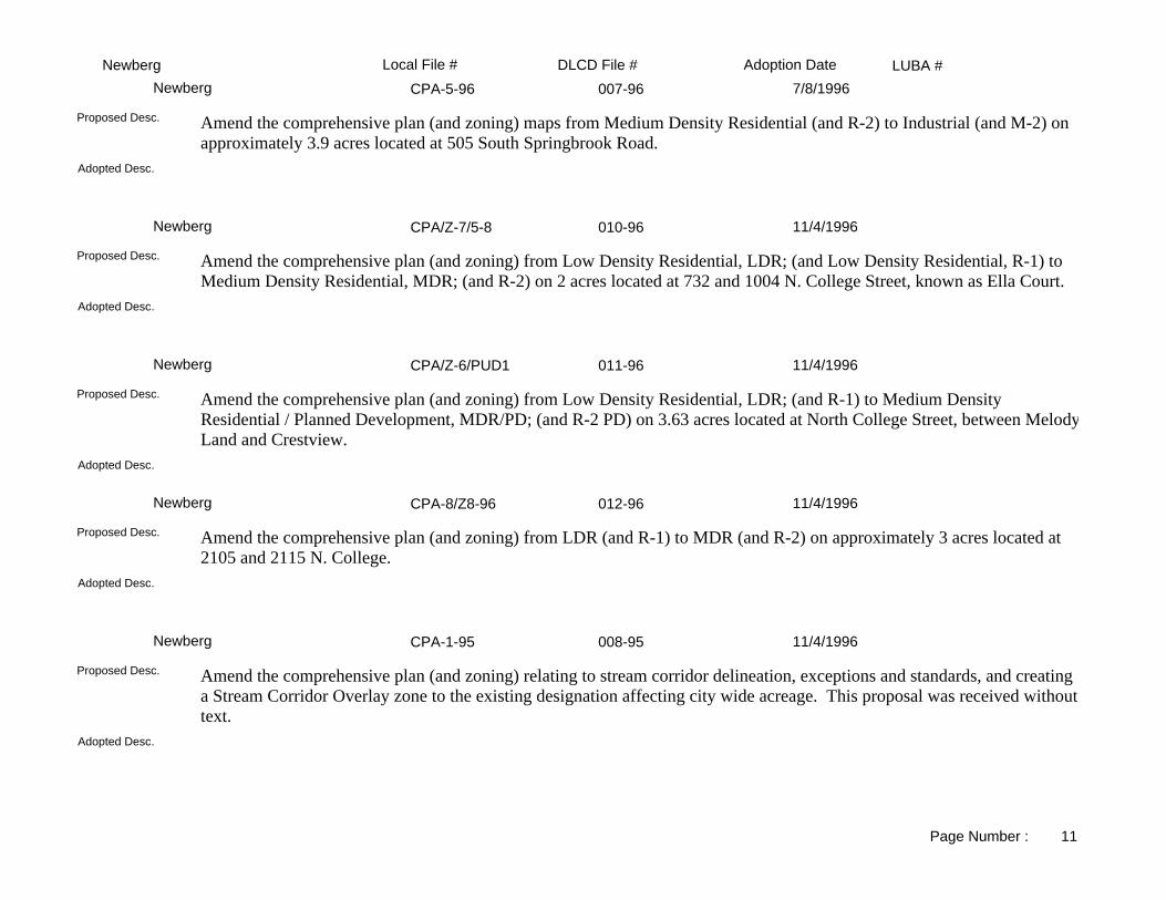
LUBA #Adoption DateLocal File # DLCD File #NewbergCPA-5-96 007-96Newberg 7/8/1996
Adopted Desc.
Amend the comprehensive plan (and zoning) maps from Medium Density Residential (and R-2) to Industrial (and M-2) on approximately 3.9 acres located at 505 South Springbrook Road.
Proposed Desc.
CPA/Z-7/5-8 010-96Newberg 11/4/1996
Adopted Desc.
Amend the comprehensive plan (and zoning) from Low Density Residential, LDR; (and Low Density Residential, R-1) to Medium Density Residential, MDR; (and R-2) on 2 acres located at 732 and 1004 N. College Street, known as Ella Court.
Proposed Desc.
CPA/Z-6/PUD1 011-96Newberg 11/4/1996
Adopted Desc.
Amend the comprehensive plan (and zoning) from Low Density Residential, LDR; (and R-1) to Medium Density Residential / Planned Development, MDR/PD; (and R-2 PD) on 3.63 acres located at North College Street, between MelodyLand and Crestview.
Proposed Desc.
CPA-8/Z8-96 012-96Newberg 11/4/1996
Adopted Desc.
Amend the comprehensive plan (and zoning) from LDR (and R-1) to MDR (and R-2) on approximately 3 acres located at 2105 and 2115 N. College.
Proposed Desc.
CPA-1-95 008-95Newberg 11/4/1996
Adopted Desc.
Amend the comprehensive plan (and zoning) relating to stream corridor delineation, exceptions and standards, and creating a Stream Corridor Overlay zone to the existing designation affecting city wide acreage. This proposal was received without text.
Proposed Desc.
Page Number : 11

LUBA #Adoption DateLocal File # DLCD File #NewbergANX-11-96 005-96Newberg 12/2/1996
Adopted Desc.
Amend the zoning map from Yamhill County MDR to city R-2 to annex approximately .34 acre located east of Pacific on 11th Street.
Proposed Desc.
ANX-14-96 008-96Newberg 12/2/1996
Adopted Desc.
Amend the zoning map from county to city Low Density Residential/Specific Plan Overlay and Medium Density Residential/Specific Plan Overlay to annex approximately 4.5 acres into the urban growth boundary located at 3608 N. College.
Proposed Desc.
G-19-96 009-96Newberg 12/2/1996
Adopted Desc.
Amend the Development Code to correct errors, clarify, define, and include standards on various items.Proposed Desc.
G-10-94 004-95Newberg 12/4/1996
Adopted Desc.
Amend the zoning ordinance to comply with limited land use legislation requirements.Proposed Desc.
CPA/Z9-96 013-96Newberg 2/18/1997
Adopted Desc.
Amend the comprehensive plan map and zoning map from older blueprint style to newer color copy. This proposal was received with only 40 days notice.
Proposed Desc.
Page Number : 12

LUBA #Adoption DateLocal File # DLCD File #NewbergCPA,Z-10-97 002-97Newberg 3/3/1997
Adopted Desc.
Amend the comprehensive plan map and zoning map from Light Industrial (M-2) to Medium Density Residential (R-2) on .42 acre located at 905 N. Meridan Street.
Proposed Desc.
CPA-3-96 003-97Newberg 5/5/1997
Adopted Desc.
Amend the comprehensive plan and zoning to create a new Institutional Zone where existing institutions are located, and an Institutional Overlay Zone for adjacent areas. Includes map changes from residential and commercial zones to public and institutional. Approximately 100 acres are involved. Location is between Portland Road and Pennington Drive, and east of Meridan Street.
Proposed Desc.
G-16-96 004-97Newberg 7/7/1997
Adopted Desc.
Amend the development code revising the language regarding processing annexations.Proposed Desc.
ANX-15-97 005-97Newberg 7/7/1997
Adopted Desc.
Amend the zoning from Yamhill County Single Family Residential (SFR) to city Residential (R-1/SP) to allow annexation of approximately 15.85 acres located at 1217 East Henry Road.
Proposed Desc.
ANX-16-97 006-97Newberg 7/7/1997
Adopted Desc.
Amend the zoning map from County to R-2 and annexation of .24 acres located at 816 South Springbrook.Proposed Desc.
Page Number : 13

LUBA #Adoption DateLocal File # DLCD File #NewbergZ-11-97 008-97Newberg 9/6/1997
Adopted Desc.
Amend the comprehensive plan map (and zoning map) from Medium Density Residential (and R-2) to Residential Professional (and RP) on .3 acre located at 105 Parkview Drive.
Proposed Desc.
G-35-98 001-98Newberg 11/2/1998
Adopted Desc.
Amend the development code text to revise signage definitions and regulations.Proposed Desc.
CPA-11/Z-12-98 003-98Newberg 12/7/1998
Adopted Desc.
Amend the comprehensive plan map (and zoning map) from Medium Density Residential (and R-2) to High Density Residential (and R-3) on 3.78 acres located south of 9th Street and Meridan Street and between College Street and River Street.
Proposed Desc.
G-39-98 002-98Newberg 12/7/1998
Adopted Desc.
Amend the development code text to revise the procedures for processing annexation applications.Proposed Desc.
CPA12-98/Z13-98 004-98Newberg 1/4/1999
Adopted Desc.
Amend the comprehensive plan map (and zoning map) from Low Density Residential (and R-1) to Medium Density Residential (and R-2) for 3.6 acres located at 1306 Crestview, 1404 Crestview, 1418 Crestview, 1715 Villa, and 1801 Villa.
Proposed Desc.
Page Number : 14

LUBA #Adoption DateLocal File # DLCD File #NewbergCPA-14/Z-14-99 004-99Newberg 9/7/1999
Same.Adopted Desc.
Amend the comprehensive plan map (and zoning map) from IND/MDR/LDR, Industrial/Medium Density Residential/Lite Density Residential to COM/IND/HDR/MDR/M-1, Commercial/Industrial/High Density Residential/Limited Industrial (and M-1/R-2/R-1, Limited Industrial/Medium Density Residential/Single Family Residential to C-2/R-P/R-3/R-2/R-1/M-1, Community Commercial/Residential Professional/High Density Residential/Medium Density Residential/ Single Family Residential/Limited Industrial) for 284 acres, located in the Eastern area of the City. Amend the zoning ordinance to add the specific plan changes to the ordinance.
Proposed Desc.
ANX-21-98 005-98Newberg 10/18/1999
SameAdopted Desc.
Amend the zoning map to annex into the city 6 acres located north of Main Street and south of Foothills Drive, and rezone the property from Yamhill County to city to R-1.
Proposed Desc.
ANX 20-98 006-98Newberg 10/18/1999
Same.Adopted Desc.
Amend the zoning map from Yamhill County AF-10 to city M-2 for 7.9 acres of property to be annexed into the city, located at the 700 block of S. Springbrook, near Highway 219.
Proposed Desc.
G-63-00 002-00Newberg 7/3/2000
Same.Adopted Desc.
Amend the development code to add and delete text to the following sections: 10.34.020 "Partition Requirements - Type II"; 10.34.030 "Subdivision Requirements - Type II and Type III"; 10.34.090 "Tentative Plan Expiration Date". This proposal was received with 33 daysnotice before the first evidentiary hearing.
Proposed Desc.
G-53-99 005-00Newberg 11/6/2000
The original amendment also included home occupation standards. The proposed occupation standards were removed from consideration and tabled. All other proposed changes were adopted with very minor text modifications.
Adopted Desc.
Proposed Desc.
Page Number : 15

LUBA #Adoption DateLocal File # DLCD File #NewbergZ-18-00 009-00Newberg 1/2/2001
Same.Adopted Desc.
Amend the zoning map from R-2, Medium Density Residential to R-P, Residential-Professional for .143 acres, located at 1308 E. First Street. This proposal was received with 29 days notice before the first evidentiary hearing date.
Proposed Desc.
CPA 16-00 010-00Newberg 5/21/2001
Same.Adopted Desc.
Amend the zoning ordinance to add a new sections: 10.40.420 "Community Facilities District" in 3 subsections to create a new Community Facilities Zoning District.
Proposed Desc.
H-12-01 002-01Newberg 8/10/2001
Original proposal removed historic designation entirely.Adopted Desc.
Amend the comprehensive plan and development code to remove a historic landmark designation from one parcel on 7.55 acres, located at 4020 Portland Road. This proposal was received with 29 days notice before the first evidentiary hearing.
Proposed Desc.
UGB-2-01 004-01Newberg 12/20/2001
Same.Adopted Desc.
Amend the comprehensive plan map from Urban Reserve Area to a mixture of Low Density Residential and Medium Density Residential for nine parcels on approximately 46.00 acres, located between Crater Lane and Chehalem Drive, south of Foothills Drive, and primarily north of the east-west extension of Mountainview. The City's Urban Growth Boundary will be expanded to include the nineparcels. This proposal was received with 44 days notice before the first evidentiary hearing.
Proposed Desc.
GR-18-99 007-00Newberg 4/1/2002
Sign standards for the C-3 zone were increased.Adopted Desc.
Amend the zoning map from C-2, Community Commercial to C-3, Central Business District for approximately 23.00 acres, located between Herbert Hoover Park on the east, railroad tracks on the west, and Highway 99W through downtown. Amend the development code to delete and add new text to the following sections: 10.20 DISTRICTS AND THEIR AMENDMENT in 2 areas, add and renumber subsections; 10.28.010 SITE DESIGN REVIEW in 2 areas, and add 11 new subsections; 10.40 ZONING DISTRICTS in 2 areas, and add 9 new allowed uses in building and uses permitted conditionally in accordance with a Type III procedure; 10.44.500 CIVIC CORRIDOR OVERLAY (CC) SUB-DISTRICT in 6 areas, and add 12 subsections; 10.50 BUILDINGS,SITE DESIGN AND MISCELLANEOUS STANDARDS in 14 areas;
Proposed Desc.
Page Number : 16

LUBA #Adoption DateLocal File # DLCD File #NewbergGR-20-99 003-01Newberg 4/15/2002
The most substantive change to the plan was the elimination of the proposed Urbanizable Overlay for the Yamhill County Zoning map. Stronger language was written in the Yamhill County Comprehensive Plan to aide the Riverfronts' transition form rural to urban uses.
Adopted Desc.
Amend the comprehensive plan to implement and add a new element called the River Master Plan consisting of changes in nine chapters, thirty-two subsections. Amend the development code to implement the River Master Plan by adding a new district called the Riverfront Commercial District and define the standards, uses, policies, transportation and pedestrian issues, public facility needs for the RCD in twelve sections, forty-four subsections. Amend the zoning ordinance to implement the RCD and add a new a section called "908, Urbanizable Area Overlay District" consisting of five subsections. Amend the comprehensive plan and zoning maps to implement the the River Commercial District by identifying six zoning map areas, and county zoning map areas; identify five comprehensive plan map areas. The Riverfront Master Plan district is located on the north side of the Yamhill River, and in the general area of River Road South, east of College Street, portions of 14th Street, portions of 12th Street, portions of Ninth Street, portions of First Street, Rogers Landing Road, Blaine Street, and Waterfront Road. This proposal was received with 44 days notice before the first evidentiary hearing, and is related to Yamhill County proposal DLCD File Number 011-01 (11846).
Proposed Desc.
ANX-25-01 005-01Newberg 6/21/2002
Same.Adopted Desc.
Amend the zoning map from County LDR-9000, Low Density Residential-9,000 square feet to City LDR, City Low Density Residential for 0.96 acre, located at 1901 N. Main Street, and annex the parcel into the City. This proposal was received with 27 days notice beforethe first evidentiary hearing.
Proposed Desc.
UGB-4-01/ANX-27-01 006-01Newberg 9/4/2002
Original request included 37.5 acres. The adopted ordinances reduced the site size to approximately 29.2 acres.Adopted Desc.
Amend the comprehensive plan map (and the zoning map) from VDLR, Very Low Density Residential to PQ, Public/Quasi-Public (and from VDLR-2.5, Very Low Density Residential-2.5 acre to I, Institutional; EF-40, Exclusive Farm Use-40 acre to I, Institutional) for 37.20 acres of a 42.90 acre site, located on the south side of Highway 99W, east of Springbrook Street, at 4100 and 4300 Portland Road. If the voters approval the annexation in the November 2002 general election, the property will be annexed into the city; and if approved, the UGB - Urban Growth Boundary will be moved to include the 37.20 acres. This proposal is related to Yamhill County DLCD File No. 012-01 (11853).
Proposed Desc.
ANX-28-01 001-02Newberg 12/2/2002
Same.Adopted Desc.
Amend the zoning map from County AF-10, County Agriculture/Foresty Small Holding to CityR-1/8 DUA, City Low Density Residential Developable Urban Area; County AF-10, County Agriculture/Foresty Small Holding to City R-1, City Low Density Residential; County AF-10, County Agriculture/Foresty Small Holding to City R-2, City Medium Density Residential; County AF-10, County Agriculture/Foresty Small Holding to City CF, City Commercial Future; County VLDR-1, County Very Low Density Residential-1 acre to City R-1/8 DUA, City Low Density Residential Developable Urban Area; County VLDR-1, County Very Low Density Residential-1 acre to City R-1, City Low Density Residential; County VLDR-1, County Very Low Density Residential-1 acre to City R-2, Medium Density Residential; County VLDR-1, County Very Low Density Residential-1 acre to City CF, Commercial Future for eleven parcels on 65.00 acres, located between Crater Lane and Main Street, south of North Valley.
Proposed Desc.
Page Number : 17

LUBA #Adoption DateLocal File # DLCD File #NewbergG-90-02 005-02Newberg 1/9/2003
Same.Adopted Desc.
Amend the development code to allow various food processing uses outright or conditionally in manufacturing zones, particularly the M-2 zone. This proposal was received with 22 days notice before the first evidentiary hearing, and the city has determined that emergency circumstances exist.
Proposed Desc.
UGB-3-01/ANX-26-01 002-02Newberg 1/21/2003
Same.Adopted Desc.
Amend the comprehensive plan and zoning maps from County Unclassified ROW, County Unclassified Right Of Way to City ROW, City Right Of Way for 3.86 acres, located on Fernwood Road between Springbrook Road and to the eastern city limits. Annex Fernwood Road right-of-way into the city and adjust the southeast Urban Growth Boundary to include the road right-of-way.
Proposed Desc.
CPA-18-03/Z-19-03 002-03Newberg 4/7/2003
Same.Adopted Desc.
Amend the comprehensive plan map (and the zoning map) from COM, Commercial to PQ, Public/Quasi Public (and from C-2, Community Commercial to I, Institutional) for 8.50 acres, located at 4020 Portland Road, to allow construction of a hospital. This proposal was received with 21 days notice before the first evidentiary hearing.
Proposed Desc.
CPA-20-03/Z-20-03 005-03Newberg 5/5/2003
Same.Adopted Desc.
Amend the comprehensive plan map (and the zoning map) from LDR, Low Density Residential to P/PQ, Public/Quasi-Public for 35.76 acres (and from R-1, Low Density Residential to I, Institutional for 23.88 acres) for two tax lots, located south side of Mountainview Drive, the west side of Villa Road, the north side of Crestview Drive, and the east side of College Street. This proposal was received with 41 days notice before the first evidentiary hearing.
Proposed Desc.
CPA-22-03/Z-21-03 004-03Newberg 5/5/2003
Same.Adopted Desc.
Amend the comprehensive plan map (and the zoning map) from LDR, Low Density Residential to Medium Density Residential (and from R-1, Low Density Residential to R-2, Medium Density Residential) for three parcels on 2.28 acres, located in the 800 block of N. Main Street, north of E. Illinois Street. This proposal was received with 44 days notice before the first evidentiary hearing.
Proposed Desc.
Page Number : 18

LUBA #Adoption DateLocal File # DLCD File #NewbergG-93-03 006-03Newberg 6/2/2003
Same.Adopted Desc.
Amend the development code to allow drive-up service windows as permitted or conditional uses in the C-3, Central Business District. This proposal was received with 43 days notice before the first evidentiary hearing.
Proposed Desc.
UGB-3-01/ANX-26-01 002-02ANewberg 9/2/2003
Same.Adopted Desc.
Amend the comprehensive plan and zoning maps from County Unclassified ROW, County Unclassified Right Of Way to City ROW, City Right Of Way for 3.86 acres, located on Fernwood Road between Springbrook Road and to the eastern city limits. Annex Fernwood Road right-of-way into the city and adjust the southeast Urban Growth Boundary to include the road right-of-way.
Proposed Desc.
UGB-7-03/CPA-21-03 003-03Newberg 9/15/2003
This adoption amends the comprehensive plan recreation policies and land use needs tables. The ordinance did not originally include revisions to land use policies or tables. After county adoption of the land use request. A "Blue Notice" will be sent.
Adopted Desc.
Amend the comprehensive plan map from EF-40 and EF-20, Exclusive Farm-40 acre minimum and EF-20, Exclusive Farm-20 acre minimum to P, Park and P/SC, Park/Stream Corridor Overlay for four parcels on 181.70 acres, located adjacent to the southeast side of the City, and is located east of Springbrook Road, north of Wilsonville Road, and south of Fernwood Road. The parcels is adjacent to the City's Urban Growth Boundary/City Limits and the Urban Reserve Area commonly known as URA-D. Amend the UGB to include the acreage to build a public golf course. This proposal was related to Yamhill County DLCD File No. 002-03 (12738) and local file No. PA-01-03.
Proposed Desc.
ANX 30-03 010-03Newberg 10/6/2003
Same.Adopted Desc.
Amend the zoning map from County LDR-9000, County Low Density Residential-9,000 square feet to City R-1, Single Family Residential for four parcels on 3.33 acres, located on the west side of North Main Street at 1203C, and annex the parcel into the City. This proposal was received with 41 days notice before the first evidentiary hearing.
Proposed Desc.
UGB-5-02 003-02Newberg 10/6/2003
Same.Adopted Desc.
Amend the comprehensive plan and zoning maps from County AFLH, Agriculture Forest Large Holdings to City LDR, City Low Density Residential for four parcels on 20.58 acres, located at 4701 and 4709 E. Fernwood Road. The four parcels will be annexed into the city and the southeast portion of the Urban Growth Boundary will be moved to include the parcels.
Proposed Desc.
Page Number : 19

LUBA #Adoption DateLocal File # DLCD File #NewbergG-94-03 008-03Newberg 11/6/2003
Record hearing rules were modified.Adopted Desc.
Adopt procedures for conducting record hearings and add the section to the development code. Amend the development code text to modify rules for modification of applications. This proposal was received with 28 days notice before the first evidentiary hearing.
Proposed Desc.
CPA 23-031/Z-22-03 011-03Newberg 3/15/2004
Adopted version has different zoning and comprehensive plan districts adopted.Adopted Desc.
Amend the ccomprehensive plan map (and the zoning map) from Industrial to Low Density Residential (and the zoning map) from M-2, Industrial to R-P, Residential-Professional) for 1.87 acres, located on the east side of Emery Drive and on the south side of Crestview Drive; to build a Head Start facility for low income children and families. This proposal was received with 44 days notice before the first evidentiary hearing.
Proposed Desc.
CPA 24-04 001-04Newberg 9/20/2004
Adds several uses to the list of prohibited uses in industrial zones near the interchanges. Adds policies to protect neighborhoods near the bypass
Adopted Desc.
Amend the comprehensive plan and development code to include new policies to support the development of the Newberg-Dundee Bypass and to protect the planned function and capacity of the Bypass and Interchanges to serve primarily longer-distance through trips. The policies will limit zone changes and Urban Growth Boundary changes within 0.25 mile of the proposed new City of Dayton Interchange in the interim period before an IAMP - Interchange Area Management Plan is adopted. Revised Notice: The revised notice received on July 26, 2004, changes the final hearing or next hearing date from September 07, 2004 to August 16, 2004. LUBA APPEAL: Received appeal from Land Use Board of Appeals on 10/15/2004 under LUBA NOs. 2004-168, 2004-170, 2004-174.
Proposed Desc.
Page Number : 20

LUBA #Adoption DateLocal File # DLCD File #SheridanPA/ZC 1-87 001-87ASheridan 4/21/1987
AMEND PLAN AND ZONING FROM LIGHT INDUSTRIAL (LI) TO COMMERCIAL (C).Adopted Desc.
Amend the comprehensive plan and zoning from Light Industrial (LI) to Commercial (C) for approximately 0.5 acre located at the southwest corner of the intersection of Bridge and Mill Streets. The applicant proposes to use the vacant building on the site as a restaurant.
Proposed Desc.
TXT 88-1 002-88Sheridan 5/18/1988
ADOPTS PROCEDURES AND STANDARDS FOR ESTABLISHMENT OF RECREATIONAL VEHICLE PARKS IN THE CITY.
Adopted Desc.
Amend the zoning ordinance to: 1) allow Recreational Vehicle Parks as a conditional use in the C-Commercial zone; and 2) adopt Recreational Vehicle Park Development Standards regulating setbacks, screening, space size, length of stay, road width and application procedures.
Proposed Desc.
ZO-88-3 005-88Sheridan 2/17/1989
Adopted Desc.
Amend the comprehensive plan and zoning ordinance from Residential Limited Commercial to Commercial for 0.4 acre located at 145 NE Hill Street.
Proposed Desc.
ANX 892 001-89Sheridan 6/7/1989
EXPAND SHERIDAN'S UGB. INCLUDES AN EXCEPTION.Adopted Desc.
Amend the comprehensive plan and zoning from county AF-40 (Agricultural) to PF (Public Facilities) for 8.2 acres located at 27094 S.W. Ballston Road. The proposal will expand the UGB and includes an exception.
Proposed Desc.
PA891 002-89Sheridan 8/15/1989
ADD 22 ACRES ZONED VLDR-5.Adopted Desc.
Amend the Urban Growth Boundary to add 18 acres zoned Agriculture/Forest. City of Sheridan.Proposed Desc.
Page Number : 1

LUBA #Adoption DateLocal File # DLCD File #SheridanN/A 003-88Sheridan 1/15/1991
Adopts an airport overlay zone. Establishs standards for area for mulit-family housing.
Adopted Desc.
Amend the comprehensive plan and zoning ordinance to make changes related to the periodic review plan update. NOTE: This is a revised proposal with a new hearing date.
Proposed Desc.
ANX 1-91 003-91Sheridan 6/3/1991
Adopted Desc.
Amend the comprehensive plan from Yamhill County Residential -5 to city Residential-3 and zoning from county VLDR-5 (Very Low Density Residential) to city R-1 (Residential) for 1 acre located at 725 NW Evans Street.
Proposed Desc.
ANX-291 002-91Sheridan 6/18/1991
Adopted Desc.
Amend the comprehensive plan from Yamhill County Residential to city Residential and zoning from county LDR (Low Density Residential) to city R-1 (Restricted Residential) for 7.5 acres located at the north end of Hill Street, east of NE Center Street.
Proposed Desc.
G 92-1 001-92Sheridan 8/20/1992
Manufactured homes.Adopted Desc.
Amend the zoning ordinance to allow manufactured home sites on individual lots within the city limits.Proposed Desc.
N/A 003-88Sheridan 9/15/1992
Adopted Desc.
Amend the comprehensive plan and zoning ordinance to make changes related to the periodic review plan update. NOTE: This is a revised proposal with a new hearing date.
Proposed Desc.
Page Number : 2

LUBA #Adoption DateLocal File # DLCD File #SheridanG 93-1 001-93Sheridan 6/23/1993
Adopted Desc.
Amend the comprehensive plan to address policies regarding the Housing Element.Proposed Desc.
Z 93-3 002-93Sheridan 9/7/1993
Adopted Desc.
Amend the comprehensive plan and zoning from Commercial to Mixed Residential for 1.0 acre located between Monroe and Mill Streets and Water and Mill Streets.
Proposed Desc.
Z 93-5 004-93Sheridan 1/4/1994
Adopted Desc.
Amend the comprehensive plan and zoning from Low Density Residential to Industrial for 1.23 acres located at 1210 West Main.
Proposed Desc.
94-1 001-94Sheridan 4/18/1994
Adopted Desc.
Amend the zoning ordinance to comply with the state law (Hb 2835) relating to the placement of manufactured housing. Also adds criteria relating to variance and elimate R-4 disticts. This amendment relates to periodic review and is under an RA (Required Amendments Order).
Proposed Desc.
GRD 94-2 004-94Sheridan 10/4/1994
Adopted Desc.
Amend the zoning ordinance to update floodplain provisions and standards regarding manufactured homes adjacent to historic structures.
Proposed Desc.
Page Number : 3

LUBA #Adoption DateLocal File # DLCD File #SheridanOrd 95-1 001-95Sheridan 6/20/1995
Adopted Desc.
Amend the land use regulations to: 1) Eliminate review requirements for lot line adjustments; 2) Establish two types of home occupations; 3) Amend Type 1 applications; and, 4) Establish a new section: Procedures and Criteria for Amendmentsto the Plan Map.
Proposed Desc.
N/A 002-95Sheridan 7/20/1995
Adopted Desc.
Amend the comprehensive plan (and zoning) from Commercial (and C) to Residential (and R-2) for 8.21 acres, and from Residential (and R-1) to Residential (and R-2) for 1.73 acres located off Bridge and Jefferson along Highway 18.
Proposed Desc.
ZC/P-95-1 003-95Sheridan 12/18/1995
Adopted Desc.
Amend the comprehensive plan (and zoning) from Residential (and Very Low Density Residential-5) to Residential (and Low Density Residential) on 7.16 acres located at the northeast corner of Gutbrod Road and Canyon Road.
Proposed Desc.
ZC 95-1 001-96Sheridan 2/26/1996
Adopted Desc.
Amend the zoning map from Low Density Residential (R1) to Medium Density Residential (R2) on approximately 9 acres located on West Main Street adjacent to the railroad tracks.
Proposed Desc.
ORD 95-2 005-95Sheridan 7/15/1996
Adopted Desc.
Amend the land use regulations to: (1) Require completion of garage prior to occupancy on an in-fill manufactured home; (2) Clarify in-fill manufactured homes to be subject to off-street parking requirements; and, (3) Requires installation of all off-street parking/loading improvements prior to occupancy of primary building.
Proposed Desc.
Page Number : 4

LUBA #Adoption DateLocal File # DLCD File #SheridanZC9601 001-97Sheridan 5/5/1997
Adopted Desc.
Amend the zoning map from Commercial (C) and Low Density Residential (R1) to Mixed Residential (R3) on 3.25 acres located on the south side of West Main Street, west of North Bridge Street and bordered on the south by the South Yamhill River.
Proposed Desc.
ORD 97-1 002-97Sheridan 5/19/1997
Adopted Desc.
Amend the zoning ordinance to establish a limited use overlay zone. This proposal was received without text and with only 14 days notice.
Proposed Desc.
ORD 97-2 003-97Sheridan 6/16/1997
Adopted Desc.
Amend the zoning ordinance to restrict livestock within city limits, prohibit sales of farm produce grown on site, and "grandfather" the allowance of existing livestock and farm related activities. This proposal was received without text and with only 14 days notice.
Proposed Desc.
ORD 97-4 005-97Sheridan 9/15/1997
Adopted Desc.
Amend the Sheridan development code regarding attached single family homes within the Medium Density Residential (R-2) and Mixed Residential (R-3) zones, and development provisions for planned unit developments.
Proposed Desc.
G 92-3 002-92Sheridan 5/3/1998
Adopted Desc.
Repeal and Replace the zoning and subdivision ordinance with a unified development code.Proposed Desc.
Page Number : 5

LUBA #Adoption DateLocal File # DLCD File #Sheridan98-01-01 001-98Sheridan 5/18/1998
Adopted Desc.
Amend the development code to specifically prohibit recreational vehicle parks and campgrounds as a retail service business permitted in the Commercial Zone.
Proposed Desc.
98-05-13 003-98Sheridan 8/3/1998
Adopted Desc.
Amend the comprehensive plan map to extend the urban growth boundary and change designation from AG - Forest Large Holdings toResidential on 1.38 acres located at the south side of Highway 18B and East Main Street, This proposal includes an exception.
Proposed Desc.
98-05-14 004-98Sheridan 8/3/1998
Adopted Desc.
Amend the urban growth boundary and amend the comprehensive plan map from AG - Forest Large Holding to Residential (A11) on 16.26 acres located east of Ballston Road and known as Greencrest Memorial Park. This proposal was received with 38 days notice and includes an exception.
Proposed Desc.
99-03-03 001-99Sheridan 5/17/1999
Adopted Desc.
Amend the comprehensive plan map (and zoning map), from IG, Industrial General to UPUB-R, Public Facility/Residential (and EFU-80, Exclusive Farm Use to UPUB-MR, Public Facility/Mixed Residential) for approximately 18 acres north of Orchard Avenue and North of West Main Street near the Airport. This notice received with 31 days notice.
Proposed Desc.
98-06-16 005-98Sheridan 8/16/1999
Adopted version: New Exterior Finish requirements for structures less than 150 feet in area.Adopted Desc.
Amend the development code to revise residential accessory structure regulations.Proposed Desc.
Page Number : 6

LUBA #Adoption DateLocal File # DLCD File #Sheridan99-07-09 002-99Sheridan 1/20/2000
Same.Adopted Desc.
Amend the comprehensive plan, planning atlas and development ordinance to adopt the Transportation System Plan.Proposed Desc.
00-03-02 004-00Sheridan 8/21/2000
Same.Adopted Desc.
Amend the development code to establish sign regulations for single family homes and duplexes (Medium Family Residential). This proposal was received with 40 days notice before the first evidentiary hearing.
Proposed Desc.
00-03-04 003-00Sheridan 8/21/2000
Same.Adopted Desc.
Amend the development code to add new regulations for fencing and buffering requirements. This proposal was received with only 41 days notice before the first evidentiary hearing date.
Proposed Desc.
00-03-03 002-00Sheridan 8/21/2000
Same.Adopted Desc.
Amend the development code section 2.110.02-Definition to define "basement" and "bridges" under the definition of "development"; andsection 2.110.03-General Provisions to identify the appropriate date of the Flood Insurance Rate Maps, and transfer the enforcement from the City Recorder to the City Manager. This proposal was received with 41 days notice before the first evidentiary hearing date.
Proposed Desc.
02-01-01 001-01Sheridan 5/21/2002
Same.Adopted Desc.
Amend the zoning map from EFU-80, Exclusive Farm Use-80 acre to R-1, Low Density Residential; and P, Public to R-1, Low Density Residential for three tax lots on 16.26 acres, located on the southeast corner of the intersection of State Highway 18 and Ballston Road.The property is to be annexed into the City.
Proposed Desc.
Page Number : 7

LUBA #Adoption DateLocal File # DLCD File #Sheridan02-07-10 003-02Sheridan 1/6/2003
Same.Adopted Desc.
Amend the Comprehensive Plan text, "Economy of the City" element, to add a policy statement that the City shall provide sufficient commercial zoned land to provide for a community shopping center.
Proposed Desc.
02-01=04 002-02Sheridan 1/6/2003
Same.Adopted Desc.
Amend the comprehensive plan to add a new policy titled "Economy of the City" to establish a policy to provide sufficient Commercial Zoned land for a Community Shopping Center. This proposal was received with 43 days notice before the first evidentiary hearing.
Proposed Desc.
02-01-03 001-02Sheridan 1/6/2003
Same.Adopted Desc.
Amend the development ordinance to revise the ordinance in the following areas: Definitions - establish definitions for Assisted Living Centers and Nursing Facilities (Homes); allow Assisted Living Centers and Nursing Facilities within the R-2, Medium Density Residential District and R-3, Mixed Residential District; add a new Subsection 2.112.06, Development Standards - to establish a new Highway Commercial Zone to require all businesses follow specific standards for new and existing developments. This proposal was received with 43 days notice before the first evidentiary hearing.
Proposed Desc.
04-01-01 002-04Sheridan 5/17/2004
Same.Adopted Desc.
Amend the zoning map from County VLDR-5, County Very Low Density Residential-5 acre to City R-1, City Low Density Residential for approximately 2.20 acres, located on the west side of Center Street and south of Hilyard Street. The parcel will be annexed into the City and partitioned into three parcels. This proposal was received without text.
Proposed Desc.
Page Number : 8

LUBA #Adoption DateLocal File # DLCD File #WillaminaPeriodic Rv. 001-87AWillamina 5/14/1987
PLAN AND ZONING IN CONJUNCTION WITH PERIODIC REVIEW PLAN UPDATE.Adopted Desc.
Amend the comprehensive plan and zoning ordinance to make changes related to the city's periodic review plan update. The amendments include revisions to the plan and zoning maps.
Proposed Desc.
CPA 96-2 002-96Willamina 7/25/1996
Adopted Desc.
Amend the comprehensive plan (and zoning) from Medium Density Residential (and MR) to Commercial (and C) on .49 acres located at 330 NW Main Street.
Proposed Desc.
L-01-01 001-01Willamina 2/14/2002
Proposed amendment allowed residential use above commecial use, not below.Adopted Desc.
Amend the zoning ordinance to allow Residential Use as a permitted accessory use in a Commercial Use zone as long as the living quarters are equal to or less than the floor area devoted to the commercial use.
Proposed Desc.
ZC 99-01 001-99Willamina 11/5/2002
Same.Adopted Desc.
Amend the comprehensive plan map (and zoning map) from Industrial (and County Heavy Industrial) to Public Assembly/Institution (and Public Assembly/Institution) for 1.3 acres located south of State Highway 57.
Proposed Desc.
A/ZC 00-01 001-00Willamina 11/5/2002
Same.Adopted Desc.
Amend the zoning map from EFU, Exclusive Farm Use to R-1, Single Family Residential for 12.51 acres, located south of Willamina River and west of Ash Street, to be annexed into the City. This proposal was received with 20 days notice before the first evidentiary hearing.
Proposed Desc.
Page Number : 1

LUBA #Adoption DateLocal File # DLCD File #WillaminaL-03-01 001-03Willamina 6/26/2003
Same.Adopted Desc.
Amend the comprehensive plan map (and the zoning map) from Low-Density Residential to PAI, Public Assembly/Institutional; Low-Density Residential to P, Public/Open Space for 37.87 acres (and from R-1, Single Family Residential to PAI, Public Assembly/Institutional; R-1, Single Family Residential to P, Public/Open Space for 8.70 acres. The parcels are located in the following areas: the 8.70 acres is located north of S.W. Lamson Avenue, between Ash Street on the west and Maple Street on the east; the 37.87 acres is located on the north side of the West Valley Highway in the south side of the City. This proposal was received without text, and was received with 34 days notice before the first evidentiary hearing.
Proposed Desc.
L-03-01 001-03AWillamina 10/9/2003
Annexation and zoning change for 21.76 acres, rather than the noticed 14.00 acres.Adopted Desc.
Amend the comprehensive plan map (and the zoning map) from Low-Density Residential to PAI, Public Assembly/Institutional; Low-Density Residential to P, Public/Open Space for 37.87 acres (and from R-1, Single Family Residential to PAI, Public Assembly/Institutional; R-1, Single Family Residential to P, Public/Open Space for 8.70 acres. The parcels are located in the following areas: the 8.70 acres is located north of S.W. Lamson Avenue, between Ash Street on the west and Maple Street on the east; the 37.87 acres is located on the north side of the West Valley Highway in the south side of the City. This proposal was received without text, and was received with 34 days notice before the first evidentiary hearing.
Proposed Desc.
Page Number : 2

LUBA #Adoption DateLocal File # DLCD File #YamhillN/A 001-87BYamhill 1/27/1988
FLOODPLAIN REGULATIONSAdopted Desc.
Amend the zoning ordinance's floodplain regulations to conform with revised Federal Emergency Management Agency regulations.
Proposed Desc.
NA 001-91Yamhill 2/26/1992
Adopted Desc.
Amend the comprehensive plan from Residential to Residential and Limited Commercial and zoning from R-3 (Multi-Family Residential) to RLC (Residential, Limited Commercial) for 1.67 acres bounded by Second Street, Third Street, Olive Street, and Maple Street. Also amend the zoning ordinance to comply with state statutes regarding notificationprocess.
Proposed Desc.
PA-99-01 001-99Yamhill 5/24/2000
Same.Adopted Desc.
Amend the planning altas to revise, add,and delete text, the last update was 12/12/1986. This proposal was originally submitted as partof Task No. 4 under Periodic Review, and the city has opt out of Periodic Review.
Proposed Desc.
LUR-99-01 003-99Yamhill 5/24/2000
Same.Adopted Desc.
Amend the land use regulations to revise, add, and delete text, the last update was 12/12/1986. This proposal was originally submitted as part of Task No. 4 under Periodic Review, and the city has opt out of Periodic Review.
Proposed Desc.
CP-99-01 002-99Yamhill 5/24/2000
Same.Adopted Desc.
Amend the comprehensive plan to revise, add, and delete text, the last update was 12/12/1986. This proposal was originally submitted as part of Task No. 4 under Periodic Review, and the city has opt out of Periodic Review.
Proposed Desc.
Page Number : 1