Embed Size (px)
Citation preview

Yakima River Canyon OR 134-04
Wilderness Characteristics I \Inventory Results
"· Road Inventory Points r
)
e!j·· · · · · · · · · · · · · · · ···· ····Photo Location
Boundary Features ; ~
I+---------+ · · · · · · · · · · · · · · · · · · · · · · · · Powerline
Unit Evaluation I I
c::::::::ll · · · · · · No- Wilderness Characteristics , " I
Surface Jurisdiction
· · · · · · · · · ······U.S. Dept. of Defense
- · · · · · · · · WA Dept. of Fish and Wildlife ···· U.S. Bureau of Land Management \
I · · · · · · ·WA Dept. of Natural Resources
Unique ID Evaluation
249 N
250 N
251 N
Total
Acres
1660
2974
1281
5,915
No warranty is made by th e Bureau of La nd Management as to the accuracy. reliabi lity, o r completen ess of these data for indi vidual or aggregate use with other data. Original data were compiled from vari ous sources. This • infonnation may not meet Nati ona l Map Accuracy Standards. This product was developed through digita l means and may be updated without notification. Miles
Draft - Oct 19, 2011 R20E

Year 2009 . Inventory Unit Number/Name: Yakima River Canyon (OR 134-04)
FORMl
DOCUMENTATION OF BLM WILDERNESS INVENTORY FINDINGS ON RECORD:
1. Is there existing BLM wilderness inventory information on all or part of this area?
No X (Go to Form 2) Yes (if more than one unit is within the area, list the names/numqers ofthose units.): a) Inventory Source: --------
b) Inventory Unit Name(s)INumber(s): _________
c) Map Name(s)/Number(s):________
d) BLM District(s)/Field Office(s): ________
Much of these lands was acquired by the BLM recently and has not been inventoried wilderness character previously. Some of the lands, chiefly along the river corridor, were previously not inventoried by BLM during the FLPMA Section 603 Wilderness inventory effort in 1979 to 1981 since at that time they were isolated parcels of public lands less than 5,000 acres in size. Since these ands have been blocked up, the total area is now larger than 5,000 acres in size and is considered in this planning effort under FLPMA Section 201.
2. BLM Inventory Findings on Record:
Existing inventory information regarding wilderness characteristics (if more than one BLM inventory unit is associated with the area, list each unit and answer each question individually for each inventory unit):
Existing inventory information regarding wilderness characteristics1:
Inventory Source: ______________
Unit#/ Name
Size (historic acres)
Natural Condition? YIN
Outstanding Solitude? YIN
Outstanding Primitive & Unconfmed Recreation? YIN
Supplemental Values? YIN

FORM2 Use additional pages as necessary
DOCUMENTATION OF CURRENT WILDERNESS INVENTORY CONDITIONS
a. Unit Number/Name Yakima River Canyon Unit (OR134-04)
(1) Is the unit of sufficient size?
Yes ___,X~-- No ____
There are approximately 5,494 acres of public land included within the Inventory Unit. There are two parcels of private lands in holdings within the boundary of the Inventory Unit, but these are not under consideration in his effort.
The lands are located in the Yakima Canyon, which runs north to south for a distance of approximately 24 miles between the communities of Ellensburg and Yakima, Washington. The lands are located just east of the Cascade Mountain Range. There is a Washington State Fish and Wildlife Management Unit, the Wenas Wildlife Area, located adjacent to much of the public lands on the west, but mostly across the river, a railroad and highway.
DESCRIPTION OF CURRENT CONDITIONS:
The boundary is described as being Washington State Highway 81 on the west, private property and Washington State lands to the south, Interstate Highway 82 and private lands along the east side, and private lands along the northern boundary.
The lands are located in an arid climate. The average annual rainfall is seven to 1 0 inches with mist falling between October and January. Snowfall ranges from 15 to 30 inches with accumulated depths of five to 20 inches.
During the warmest months of the year temperatures commonly range from the highs of 95 degrees to lows of 55 degrees. It is not uncommon for temperatures to be in excess of 10 degrees.
The lands rise steeply to the summit of Selah Butte (922 feet high). The topography varies from steep slopes and high ridges to small coves and bottom lands near the Yakima River and along the creeks
Washington State Highway 821 is designated as a State Scenic Byway in the Canyon. The lands in the Canyon are managed as VRM Class II or as uninventoried, if recently acquired).
Vegetation is big Sage brush and Blue Bunch wheatgrass, with some Cusick bluegrass and Idaho fescue found in the higher elevations and northern exposures where he soil is moderately deep. There are some ponderosa pine along the bottomland with aspen, alder, dogwood, cottonwood and willows.
The wildlife found on the unit include Mule Deer, Rocky Mountain Elk, California Bighorn Sheep, and cougar as well as chukar, partridge, sage grouse, and eleven species of raptors (The Yakima River Canyon has one of the highest concentrations ofnesting raptors in Washington State.).
The BLM has designated portions of the lands as the Yakima River Canyon, for the protection of resource values. (Recreation, Scenery, Wildlife, Special Status plants).
There are four special status plant species present: Tauschia hooveri, Astralgus columbianus, Erigeron baslalticus, Lomatium tuberosum
There are significant historic and prehistoric sites located along the river corridor.
The BLM has developed and operates an extensive recreation operation, based on water recreation and camping opportunities along the river corridor. The area is a fee demonstration project. BLM issues commercial recreation permits in the canyon corridor, but all are water based and none occur on the affected lands.
There is a communication site located on a private in holding on T. 14 N., R. 19 E., Section 3. This site as two power lines associated with it, and a maintained access road runs to it from the south (Selah Creek Road). See attached Road Analysis Form)
There is an abandoned farmhouse located on public lands at T. 15 N., R 28 E., Section 26.
There are a number ofhistoric vehicle routes which wander through the area. These are impassable for the most part, have closed signs on them, and appear to be naturally rehabbing, with the exception of a two-track vehicle route which runs
north from the communication site to the northern boundary. This route appears to receive little use but the tracks are visible for some distance. See attached Road Analysis Form.
The lands are grazed under commercial permit issued by the BLM as the Burbank Creek Allotment.
(2) Is the unit in a natural condition? Yes No X N/A.___
Description:
The area has a number of range improvements (fence lines) located on it. None of these features are substantially noticeable, other than locally in some places. However, in T. 15 N., R 19 E., Section 26, a segment of Burbank Road isolates a portion of the inventory unit from the rest of the area. This small and thin area lacks naturalness since there two fence lines along both sides of the road in the foreground of the view shed, which is highly restricted by topography.
The Ranch Building noted above is a substantially noticeable structure and is not in a natural condition. The area surrounding the site is approximately 3 acres in SIZe
There are two power lines which bisect he unit, and which detract substantially from the natural character. These power lines are readily visible from many locations in the unit. The main north-south power line also has an access road associated with it, although it does not appear to have been used recently.
(3) Does the unit (or the remainder of the unit if a portion has been excluded due to unnaturalness and the remainder is of sufficient size) have outstanding opportunities for solitude?
Yes ____ N/A.___No_....;x~--
Description:
Although use levels appear to be very low, the strong topography and the dimensions of the unit results in many areas being affected by the actions conducted on much of the rest of the unit, particularly along the river corridor.
4) Does the unit (or the remainder of the unit if a portion has been excluded due to unnaturalness and the remainder is of sufficient size) have outstanding opportunities for primitive and unconfined recreation?
Yes ____ N/A,___No_....;X~--

Description:
The area has limited vegetation screening, although there is substantial topography and the remnants of the vehicle route system available for use. The BLM issues no commercial, organized, or competitive use permits and there is no marketing being done by any individual or group for is primitive recreational experiences outside of the river use.
(5) Does the unit have supplemental values?
Yes --=X:.,:.___ NIANo ---- ---
Description:
A portion of the lands were designated as the Yakima Canyon Area of Critical Environmental Concern (ACEC) in recognition of their resource values. Botanical resources include three Washington State Sensitive plants: Astragalus misellus var pauper, Lomatium tuberosum and Pediocactus simpsonii var robustior, and one Washington State Threatened plant: Erigeron basalticus.
Cultural values include lithic scatters, rock cairns, quarries, talus pits, trash scatters and domestic structures.
Summary of Findings and Conclusion
Unit Name and Number: -~Y;::_ak=i;:.:.m~a:...:R~i~v.,:;er~C=an~vz.::o~n...,('""'O"""R:.=:.l"""'3::....4,_-""-04..:..).___
Summary
The two power lines completely bisect the unit into several smaller pieces, none of which are larger than 5,000 acres in size.
Burbank Road also isolates a small portion of the unit in the north from the rest of the unit, and the existence of the range facilities in the small area reduce this area's naturalness and eliminate its opportunity for solitude and primitive recreation.
The sights and sounds of the activities occurring on the adjacent lands, namely Interstate Highway 82 and the Washington State Highway 821, the Railroad, and the developed recreation sites, can sufficiently be of a scale to overwhelm the opportunity for solitude and primitive recreation within at least a portion of the unit.
The abandoned Ranch buildings are not in a natural condition and are substantially noticeable.
Results ofAnalysis:

1. Does the area meet any of the size requirements? Yes X No
2. Does the area appear to be natural? Yes X No
3. Does the area offer outstanding opportunities for solitude or a primitive and unconfined type of recreation? Yes _X No NA
4. Does the area have supplemental values? X Yes No NA
Conclusion
The current area management emphasis, specified by the RMP, is for protection of resources and enhancement of recreational opportunities.
Check One:
__ The area-or a portion of the area- has wilderness character.
X The area does not have wilderness character.
Prepared by:
Team Members:
Karen Kelleher- Field Office Manager Diane Priebe -Recreation Tim Finger - Wilderness Molly Boyter - Botany J Vacca - Wildlife Tim Nicoulin- Law Enforcement Dana Peterson - Range William Schurger - lands and Realty Francoise Sweeney- Archeologist
Approved by:
~ JO!If:/1 •I
Field Manager Date

REFERENCES:
1. Realty References:
Master Title Plats T. 15 N., R. 19 E. T. 14 N., R. 19 E.
Realty Case Files:
2. Recreation/Wilderness Program Reference:
BLM Yakima River Recreation Area Opportunities Site Map, March 2008 BLM Yakima Canyon Map
Engineering program Reference:
BLM Spokane District Route Inventory (F AMS)
3. Range Program Reference:
Range Allotment Files, Burbank Range Alotment
4. GIS Program reference:
BLM Resource Data-Wildlife, vegetation, fuels, watershed, visual Aerial Photos, FY 2009 Google Earth
5. Mineral Program Reference:
BLM geographic report for case recordation and mining claim status in LR 2000.
6. Planning and NEPA references:
DOl, Bureau ofLand Management Mineral Management Status Map, 1/100,000 Scale Topographic Map, 2008
Yakima River Recreation Management Plan, signed December 1988.
Spokane District Resource Management Plan, signed May, 1987
This form documents information that constitutes an inventory finding on wilderness characteristics. It does not represent a formal/and use allocation or a final agency decision subject to administrative remedies under either 43 CFRparts 4 or 1610.5-2.
H-6300-1-WILDERNESS INVENTORY MAINTENANCE IN BLM OREGON/WASHINGTON
APPENDIX C- ROAD* ANALYSIS
(Factors to consider when determining whether a route is a road for wilderness inventory purposes.)
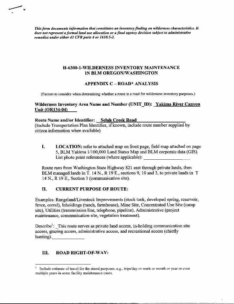
Wilderness Inventory Area Name and Number (UNIT ID): Yakima River Canyon Unit (OR134-04)
Route Name and/or Identifier: -~S.:::;el~a~h~C~r!:::ee:::!k~R~o=.:a::.::d:....__________ (Include Transportation Plan Identifier, if known, include route number supplied by citizen information when available)
I. LOCATION: refer to attached map on front page, field map attached on page 5, BLM Yakima 1/100,000 Land Status Map and BLM corporate data (GIS). List photo point references (where applicable): _________
Route runs from Washington State Highway 821 east through private lands, then BLM managed lands in T. 14 N., R 19 E., sections 9, 10 and 3, to private lands in T 14 N., R 19 E., Section 3 (communication site).
II. CURRENT PURPOSE OF ROUTE:
Examples: Rangeland/Livestock Improvements (stock tank, developed spring, reservoir, fence, corral), Inholdings (ranch, farmhouse), Mine Site, Concentrated Use Site (camp site), Utilities (transmission line, telephone, pipeline), Administrative (project maintenance, communication site, vegetation treatment).
Describe1: _This route serves as private land access, in-holding communication site
access, grazing access, administrative access, and recreational access (chiefly hunting).______
III. ROAD RIGHT-OF-WAY:
1 Include estimate of travel for the stated purposes, e.g., trips/day or week or month or year or even multiple years in some facility maintenance cases.

Is a road right-of-way associated with this route? Yes __ No __ Unknown _X_
These lands were acquired recently and the MTPs show no information on the route, however he road serves a commercial purpose as well as for casual use.
IV. CONSTRUCTION (Is there evidence that the route was originally constructed using mechanical means?)
Yes X No-- ----
Examples: Paved Bladed X Graveled X Roadside ---- -- - Berms X Cut/Fill Other --- ----
Describe: _This route ahs evidence of significant construction frorm its start o is terminus ----------------
V. IMPROVEMENTS (Is there evidence of improvements to facilitate access?)
Yes X No --- -----
By Hand Tools By Machine__X_ --
Examples: Culverts ____ Stream Crossings ____ Bridges ___ Drainage
X Barriers Other
Describe: -----------------------------
VI. MAINTENANCE (Is there evidence ofmaintenance that would ensure continued use?):
A. Is there Evidence or Documentation of Maintenance using hand tools or machinery? Yes X No -------
Hand Tools _(YIN)___ Machine __X__(Y IN) ___
Explrun: ___________________________
B. If the route is in passable condition, but there is no evidence ofmaintenance, would mechanical maintenance with hand tools or machines be approved by BLM to meet the purpose(s) of the route in the event this route became impassable? Yes No

-- -- ------------
Comments: _This route would not be allowed to fall into disrepair due to the private residences and communication site ---------------------
VII. REGULAR AND CONTINUOUS USE:
Yes X No -- -- --------
Describe evidence (e.g., direct: vehicle tracks observed, or indirect: evidence of use associated with purpose of the route, such as maintenance of facility that route accesses) and other rationale for whether use has occurred and will continue to occur on a relatively regular basis (i.e., regular use relative to the purpose(s) of the route). ________
VIII. CONCLUSION: To meet the definition of a road, items IV or V, and VI-A orB, and VII must be checked yes. Road: Yes X No Explanation:
Evaluator( s ): _Finger___________ Date: 7/30/09--~~~~--------------
* road: An access route which has been improved and maintained by mechanical means to insure relatively regular and continuous use. A way maintained solely by the passage of vehicles does not constitute a road.
a. "Improved and maintained"- Actions taken physically by people to keep the road open to vehicle traffic. "Improved" does not necessarily mean formal construction. "Maintained" does not necessarily mean annual maintenance.
b. "Mechanical means"- Use ofhand or power machinery or tools.
c. "Relatively regular and continuous use" -Vehicular use that has occurred and will continue to occur on a relatively regular basis. Examples are: access roads for equipment to maintain a stock water tank or other established water sources; access roads to maintained recreation sites or facilities; or access roads to mining claims.

This form documents information that constitutes an inventory finding on wilderness characteristics. It does not represent a formal/and use allocation or a final agency decision subject to administrative remedies under either 43 CFR parts 4 or 1610.5-2.
H-6300-1-WILDERNESS INVENTORY MAINTENANCE IN BLM OREGON/WASHINGTON
APPENDIX C- ROAD* ANALYSIS
(Factors to consider when determining whether a route is a road for wilderness inventory purposes.)
Wilderness Inventory Area Name and Number (UNIT_ID): Yakima River Canyon Unit (OR134-04)
Route Name and/or Identifier: _B:::..:::u~r.:;:b.::a~n~k:..:C::::.r:...:e::..:e::::k:...;R~o.::a::::d~--------(Include Transportation Plan Identifier, if known, include route number supplied by citizen information when available)
I. LOCATION: :r;efer to attached map on front page, field map attached on page 5, BLM Yakima 11100,000 Land Status Map and BLM corporate data (GIS). List photo point references (where applicable): _________
Route runs from Washington State Highway 821 east in T 15 N., R 19 E., Section 28 through a segment ofpublic lands, then private lands, then another short segment of BLM managed lands, then private lands, finally exiting the unit in T. 15 N., R 19 E., section 25.
II. CURRENT PURPOSE OF ROUTE:
Examples: Rangeland/Livestock Improvements (stock tank, developed spring, reservoir, fence, corral), Inholdings (ranch, farmhouse), Mine Site, Concentrated Use Site (camp site), Utilities (transmission line, telephone, pipeline), Administrative (project maintenance, communication site, vegetation treatment).
Describe1: _This route serves as private land access, grazing access, administrative
access, and recreational access (chiefly hunting) .._______
III. ROAD RIGHT-OF-WAY:

---------------
Is a road right-of-way associated with this route? Yes __ No __ Unknown_X_
These lands were acquired recently and the MTPs show no information on the route, however the road serves a commercial purpose as well as for casual use. There are a number of residences and agricultural lands located its course.
IV. CONSTRUCTION (Is there evidence that the route was originally constructed using mechanical means?)
Yes X No -- ----
Examples: Paved Bladed X ---- .___ Graveled X
'-----Roadside
Berms X Cut/Fill Other --- ----
Describe: _This route has evidence of significant construction from its start to is terminus
V. IMPROVEMENTS (Is there evidence of improvements to facilitate access?)
Yes X No --- -----
By Hand Tools __ By Machine_X_
Examples: Culverts ____ Stream Crossings ____ Bridges ___ Drainage
X Barriers Other
Describe: ------------------------------------------------------
VI. MAINTENANCE (Is there evidence ofmaintenance that would ensure continued use?):
A. Is there Evidence or Documentation ofMaintenance using hand tools or machinery? Yes X No -------
Hand Tools (YIN)___ Machine __X __ (Y IN)___
Explain:---------------------------
B. Ifthe route is in passable condition, but there is no evidence ofmaintenance, would mechanical maintenance with hand tools or machines be approved by BLM to meet the purpose(s) ofthe route in the event this route became impassable?

---- -----
-------
Yes No
Comments: _This route would not be allowed to fall into disrepair due to the private residences and agricultural operations __________________
VII. REGULAR AND CONTINUOUS USE:
Yes X No
Describe evidence (e.g., direct: vehicle tracks observed, or indirect: evidence of use associated with purpose of the route, such as maintenance of facility that route accesses) and other rationale for whether use has occurred and will continue to occur on a relatively regular basis (i.e., regular use relative to the purpose(s) of the route). _______
VIII. CONCLUSION: To meet the definition of a road, items IV or V, and VI-A orB, and VII must be checked yes. Road: Yes X No Explanation:
Evaluator(s): _Finger______ Date: __..:....;7/'-=3-=-0:...::/0=9~------
* road: An access route which has been improved and maintained by mechanical means to insure relatively regular and continuous use. A way maintained solely by the passage ofvehicles does not constitute a road.
a. "Improved and maintained" - Actions taken physically by people to keep the road open to vehicle traffic. "Improved" does not necessarily mean formal construction. "Maintained" does not necessarily mean annual maintenance.
b. "Mechanical means"- Use ofhand or power machinery or tools.
c. "Relatively regular and continuous use" - Vehicular use that has occurred and will continue to occur on a relatively regular basis. Examples are: access roads for equipment to maintain a stock water tank or other established water sources; access roads to maintained recreation sites or facilities; or access roads to mining claims.

H-6300-1-WILDERNESS INVENTORY MAINTENANCE IN BLM OREGON/WASHINGTON
APPENDIX D- PHOTO LOG
Photographer(s): Finger
Inventory Area Name & No.: Yakima River Canyon (OR134-04)
Date Frame #
Camera Direction
Description GPSIUTM Location
Township Range Sec.
7/30/09 1 southwest Power line and service road
T 15N. R 19 E. 25
7/30/09 2 east Power line from highway
T 15N. R 19 E. 33
7/30/09 3 north Power line from comm. site
T 14N R. 19 E.
3
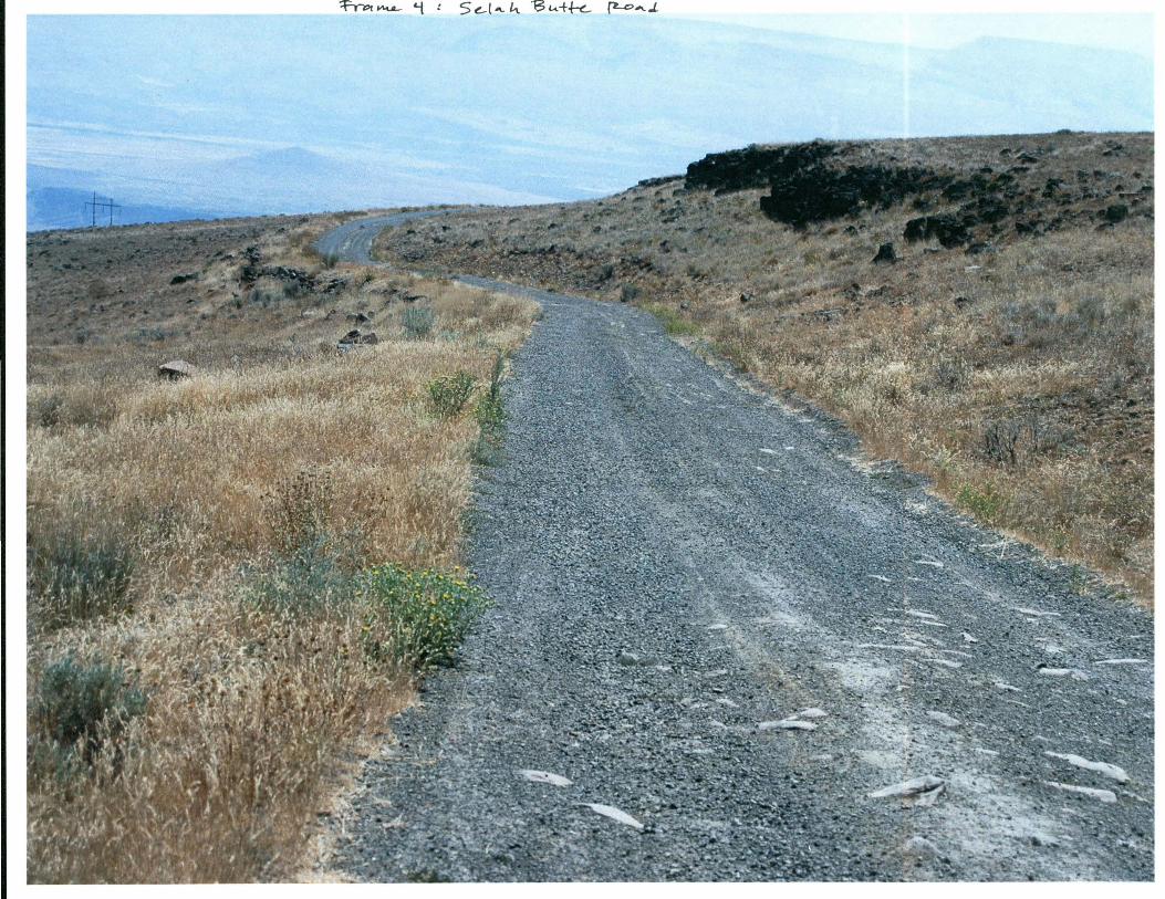
7/30/09 4 south Selah c-ek-Bu+t. Road ~/
T 14N. R. 19 E.
3
7/30/09 5 north 2-track route
T 14N. R 19E. 3
1