Embed Size (px)
Citation preview

1 in = 1,450 miles
World Map ProjectionCreated By: Joseph KaberleinCreated for: CE 547 GIS in Water Resources EngineeringDate: 2.17.2020
Objective: To produce a reperesentation of the Earth and its continents using a projected coordinate system.Map Info:Projection: World Natural Earth IIFalse_Easting: 0.0False_Northing: 0.0Central_Meridian: 0.0Linear Unit: Meter (1.0)
The Natural Earth II is a new pseudocylindrical projection with a highly rounded shape. At high latitudes the meridians bend steeplyinward to short pole lines.

^̀
^̀ ^̀
^̀
^̀
^̀
^̀
^̀^̀
^̀
^̀
^̀
^̀
^̀
^̀
^̀^̀
^̀
^̀
^̀
^̀
^̀
^̀^̀
^̀
^̀
^̀
^̀
^̀
^̀
^̀
^̀
^̀
^̀
^̀^̀
^̀
^̀
^̀
^̀
^̀
^̀^̀
^̀
^̀
^̀
^̀
^̀
Dover
Boise
Salem
Austin
Topeka
Denver
BostonAlbanyPierre
Helena
Jackson
PhoenixAtlanta
Raleigh
TrentonLincoln
LansingMadison
Concord
Augusta
Olympia
ColumbiaSanta Fe
Richmond
ColumbusCheyenne
HartfordSt. Paul
Bismarck
Frankfort
Annapolis
Montpelier
Montgomery
Charleston
Sacramento HarrisburgDes Moines
Providence
Baton Rouge Tallahassee
Little Rock
Carson CitySpringfield
Indianapolis
Oklahoma City
Jefferson City
Salt Lake City
Nashville-Davidson
USA Map ProjectionCreated by: Joseph KaberleinCreated for: CE 547 GIS in Water Resources EngineeringDate: 2.16.2020
³0 270 540 810 1,080135Miles
Highest Elevation
Most Populous
LegendCapital CitiesPOP1990
^̀ 10,000
^̀ 100,000
^̀ 1,000,000
Projection: AlbersFalse Easting: 0.0False Northing: 0.0Central Meridian: -96.0Standard Parallel 1: 29.5Standard Parallel 2: 45.5Datum: NAD1983
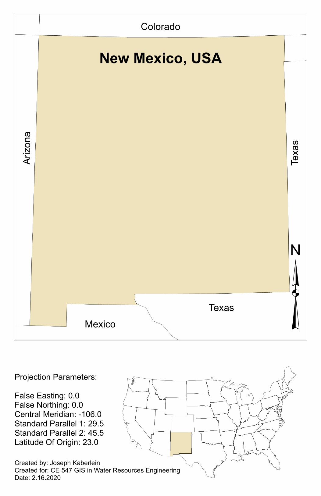
Created by: Joseph KaberleinCreated for: CE 547 GIS in Water Resources EngineeringDate: 2.16.2020
New Mexico, USAColorado
Arizo
na
Texa
sTexas
Mexico ³Projection Parameters:False Easting: 0.0False Northing: 0.0Central Meridian: -106.0Standard Parallel 1: 29.5Standard Parallel 2: 45.5Latitude Of Origin: 23.0