Embed Size (px)
Citation preview

ss
WIND ENERGY AND NEBRASKA’S WILDLIFE
Avian Assessment Guidance for Wind Energy Facilities
Draft Version 3.1
February 2012

Avian Assessment Guidance for Wind Energy Facilities in Nebraska 3.1 Draft, February 2012
2 | P a g e
This document is in draft format and has not been finalized.

Avian Assessment Guidance for Wind Energy Facilities in Nebraska 3.1 Draft, February 2012
3 | P a g e
INTRODUCTION Birds are potentially more vulnerable to impacts from wind development than other non-volant species. A key component for evaluating the risk of impacts of wind energy facilities on Nebraska’s birds is an avian assessment. This document provides information and technical guidance to assist wind energy project proponents with conducting an avian assessment that meets standards and expectations developed by staff of the Nebraska Game and Parks Commission (Commission) and the U.S. Fish and Wildlife Service Nebraska Field Office (NEFO; collectively referred to as Agencies). Following these guidelines is voluntary. Wind developers are encouraged to contact and work with the Agencies early and often in the process of siting a wind energy facility in Nebraska. This document was developed to make the siting process as efficient as possible. It is in all parties’ interest to direct time and resources toward surveys and assessments that are defensible and avoid work that produces unreliable results. There is uncertainty about the impacts of wind development on some bird species. This document will be improved and revised as we increase our understanding of these impacts. Additionally, as uncertainties are reduced, survey efforts can be redirected to the most important priorities. Thus, suggestions and comments that will improve this document are welcome at any time. Please see below on where comments and suggestions should be directed.
CONTACTS For initial inquiries regarding proposed projects, questions about the environmental review process, and requests for environmental reviews, please contact:
Michelle Koch, Environmental Analyst Supervisor Nebraska Game and Parks Commission 2200 N. 33rd Street, Lincoln, NE 68503 Phone: (402) 471-5438; Email: [email protected]
Martha Tacha, Wildlife Biologist U.S. Fish and Wildlife Service 203 West Second Street, Grand Island, Nebraska 68801 Phone: 308-382-6468, Extension 19; Email: martha_tacha @fws.gov
For technical questions regarding avian surveys, to have avian survey protocols reviewed, or to submit comments or suggestions about this document, please contact:
Joel Jorgensen, Nongame Bird Program Manager Nebraska Game and Parks Commission 2200 N. 33rd Street, Lincoln, NE 68503 Phone: (402) 471-5440; Email: [email protected]
For questions about wind and wildlife research and interactions, the Nebraska Wind and Wildlife Working Group, and Guidelines for Wind Energy and Wildlife Resource Management in Nebraska, please contact:
Caroline Jezierski, Wind and Wildlife Project Coordinator Nebraska Cooperative Fish and Wildlife Research Unit School of Natural Resources University of Nebraska —Lincoln 3310 Holdrege Street Lincoln, NE 68583-0973 Phone: (402) 471-5631; Email: [email protected]
Avian Assessment Guidance for Wind Energy Facilities in Nebraska 3.1 Draft, February 2012
4 | P a g e
TERMS AND DEFINITIONS
Agencies: Specifically refers to the Nebraska Game and Parks Commission and the Nebraska Field Office of the U.S. Fish and Wildlife Service. Breeder: Displays, courts, mates, nests and raises young. Casual: Occurs less than regularly. Fall Migrant: Transient during portions of the period from August through December. Final Avian Assessment Report: A document that summarizes methods and results of the pre-construction and post-construction surveys and compares any observed changes in bird species’ occurrence, distribution, and/or abundance. Lek: A lek is a location where males of certain species gather and competitively display for the purpose of mating. Greater Prairie-Chicken and Sharp-tailed Grouse are lekking species. Local: Occurs in a relatively small area. Operational Monitoring: Monitoring of operating turbines to look for carcasses of volant species. Permanent Resident: Occurs year-round. Project Proponent: The business or entity that is developing, constructing, and operating the wind facility and any consultants, contractors, or sub-contractors that are working on behalf of or are representing the business or entity. Pre-construction survey(s): Survey(s) conducted prior to project construction. Post-construction survey(s): Survey(s) conducted following project construction. Pre-construction Avian Assessment Report: A document that summarizes methods and results of the pre-construction surveys. Raptor: Any bird of the Accipitriformes, Falconiformes or Strigiformes including, but not limited to, eagles, falcons, harriers, caracaras, osprey, hawks, eagles, owls, kites, and vultures. Regular: Species occurs annually. Reports: Collectively refers to the Pre-construction Assessment Report or the Final Avian Assessment Report.
Spring Migrant: Transient during portions of the period from February through June. Winter resident: Occurs during spring and fall migration and winter. All images in this document are the property of Joel Jorgensen or the Nebraska Game and Parks Commission. Unauthorized use is strictly prohibited.

Avian Assessment Guidance for Wind Energy Facilities in Nebraska 3.1 Draft, February 2012
5 | P a g e
GENERAL GUIDELINES In order to complete an avian assessment, project proponents planning to develop wind facilities should conduct pre- and post-construction avian surveys in the project area. Project proponents should review this document and consider conducting the following assessments and surveys:
1) Whooping Crane Desktop Stopover Risk Assessment
2) Mountain Plover Survey
3) Breeding Bird Survey
4) Nesting Raptor Survey
5) Prairie Grouse Survey
The Whooping Crane Risk Assessment, Mountain Plover and Prairie Grouse surveys are only applicable for portions of Nebraska where the species occur. Commission and NEFO may request targeted surveys to evaluate specific concerns unique to the project area after reviewing all available information. For example, project sites where threatened and endangered avian species are known to occur, sites located within key migratory stopover sites, and areas where species of high conservation concern occur may require additional surveys. Surveys should use appropriate and defensible sampling designs and survey methods. It will be in the interest of the project proponents to have their sampling designs and survey methods reviewed internally, as well as by outside experts and Agency personnel, prior to the start of field work. The pre-survey review process will identify shortcomings or flaws that can be addressed before data are collected and analyzed. Post-construction survey sampling design and survey methods should replicate pre-construction sampling design and survey methodology. The following sections detail specific guidelines outlined for each survey. However, all details pertaining to survey methods are not covered in this document. In addition, unexpected logistical problems may alter some aspects of methodology. It is ultimately the responsibility of the project proponent to conduct defensible surveys. All survey reports submitted to the Commission will be reviewed and written comments may be provided to the project proponents.

Avian Assessment Guidance for Wind Energy Facilities in Nebraska 3.1 Draft, February 2012
6 | P a g e
SUGGESTED TIMELINE The following timeline is provided to assist project proponents with their project planning.
Two years prior to project construction
Review Nebraska’s Wind and Wildlife map and Guidelines for Wind Energy and Wildlife Resource Management in Nebraska.
Complete Whooping Crane Desktop Risk Assessment (if needed).
Contact Agency personnel for specific information regarding the project’s avian assessment needs and objectives.
Develop survey methods and send them to Agency staff for review before 1 March.
Incorporate Agency comments into survey protocols by 1 April.
April - two years prior to project construction
Conduct Nesting Raptor Survey – Year 1
Conduct Prairie Grouse Survey – Year 1
June - two years prior to project construction
Conduct Breeding Bird Survey – Year 1
April - one year prior to project construction
Conduct Nesting Raptor Survey – Year 2
Conduct Prairie Grouse Survey – Year 2
June - one year prior to project construction
Conduct Breeding Bird Survey – Year 2
Upon assessment completion or no less than six months prior to project construction
Submit pre-construction survey report and assessment.
Wind Facility Project Construction
First April following project completion
Conduct Nesting Raptor Survey – Year 1
Conduct Prairie Grouse Survey – Year 1
First June following project completion
Conduct Breeding Bird Survey – Year 1
Second April following project completion
Conduct Nesting Raptor Survey – Year 2
Conduct Prairie Grouse Survey – Year 2
Second June following project completion
Conduct Breeding Bird Survey – Year 2
Submit Final Avian Assessment Report

Avian Assessment Guidance for Wind Energy Facilities in Nebraska 3.1 Draft, February 2012
7 | P a g e
WHOOPING CRANE DESKTOP STOPOVER RISK ASSESSMENT
Avian Assessment Guidance for Wind Energy Facilities in Nebraska 3.1 Draft, February 2012
8 | P a g e
The Whooping Crane is critically imperiled and is both state and federally listed as endangered. As of December 2010, the Aransas-Wood Buffalo Population (AWBP) of Whooping Cranes totaled approximately 270 individuals. This is the only wild, self-sustaining population in the world. The entire population migrates through Nebraska annually in spring and fall. Whooping Cranes are long-lived species with low rates of reproduction. Loss of breeding adults has serious demographic consequences for the population. Reed (2004) concluded that a minimal increase (3%) in annual adult mortality would make the AWBP population unviable. Thus, additional sources of mortality would have major consequences for Whooping Crane conservation. Wind power development is rapidly expanding in the Whooping Crane’s migration corridor and the species may be negatively impacted by wind power development. Whooping Cranes may collide with wind turbines and associated infrastructure such as power lines. Numerous (n=59) Whooping Crane mortalities have occurred as a result of collisions with power lines. There are also concerns that Whooping Cranes may avoid areas with wind turbines. The species may no longer use high quality habitats because of wind project disturbances and be displaced to low quality habitat for roosting. If this is the case, Whooping Cranes will lose crucial stopover habitat if wind power facilities are developed in the species’ migration corridor. Project proponents should acknowledge and react to these concerns by evaluating the effect of a proposed wind project. The outcome of such an evaluation could show a range of expected scenarios ranging from no effect to large numbers of mortalities and/or habitat loss. This assessment uses existing information about: 1) Whooping Crane migration ecology, 2) location of the proposed project site relative to the Whooping Crane migration corridor, and 3) a GIS analysis of wetland and habitat resources located within and adjacent to the proposed project site. This assessment is then used to complete a fatal-flaw analysis which may indicate construction and operation of a wind project in a particular area is inappropriate due to Whooping Crane concerns. Alternatively, the assessment may show there is relatively low risk of negative impacts to Whooping Cranes. In this case, the assessment will assist the project proponent with developing mitigation and contingency plans designed to minimize negative impacts on the species. All proposed projects within the Whooping Crane migration corridor should conduct a desktop risk analysis before significant investments have been made in project development. The Whooping Crane migration corridor is shown in Figure 1. OBJECTIVE To conduct a preliminary assessment of the potential for Whooping Crane interactions (e.g. migratory stopover) with a proposed wind facility and to identify and prioritize key concerns requiring additional study and possible mitigation. DATA COLLECTION AND REVIEW
1) In addition to general Whooping Crane information, project proponents should review pertinent literature on Whooping Crane migration ecology and wind guidance. At a minimum, the review should include the following documents:
Austin, J.E., and A.L. Richert. 2001. A comprehensive review of observational and site evaluation data
of migrant whooping cranes in the United States, 1943-1999. U.S. Geological Survey, Northern Prairie Wildlife Research Center, Jamestown, ND. Northern Prairie Wildlife Research Center Online. http://www.npwrc.usgs.gov/resource/birds/wcdata/index.htm (Version 01JUL2003).
Armbruster, M.J. 1990. Characterization of habitat used by Whooping Cranes during migration. U.S. Fish and Wildlife Service Biological Report 90(4), 16 pages. Available at: http://www.dtic.mil/cgi-bin/GetTRDoc?AD=ADA322847&Location=U2&doc=GetTRDoc.pdf
U.S. Fish and Wildlife Service. 2009. Whooping Cranes and wind development: an issue paper. U.S. Fish and Wildlife Service Regions 2 and 6. Avaiable at: ftp://wiley.kars.ku.edu/windresource/Whooping_Crane_and_Wind_Development_FWS_%20April%202009.pdf

Avian Assessment Guidance for Wind Energy Facilities in Nebraska 3.1 Draft, February 2012
9 | P a g e
2) Information on Nebraska’s wetlands should be reviewed. At a minimum, the review should include the
following document:
LaGrange, T. 2005. Guide to Nebraska Wetlands and Their Conservation Needs. Nebraska Game and Parks Commission, Lincoln, Nebraska. Available at: http://outdoornebraska.ne.gov/wildlife/programs/wetlands/pdf/wetlandsguide.pdf
Figure 1. Whooping Crane migration corridor through central Nebraska. Corridor based on 95% of all compiled records (Map developed from data from Tacha et al. 2009).
3) A review of confirmed Whooping Crane records should be conducted to determine whether any Whooping Crane stopovers have been documented, 1) within the proposed project boundary, and 2) outside, but within 80 kilometers (50 miles), of the proposed project boundary. Updated versions of this database and associated guidance document on how to use the data are available from the Commission. Reviewing the database guidance document is mandatory when using the Whooping Crane database.
4) National Wetlands Inventory (NWI) and Soil Survey Geographic (SSURGO) data should be acquired from the Nebraska GIS Clearinghouse (http://www.dnr.state.ne.us/databank/spat.html).
5) An inventory of all wetlands and wetland soils using the two data sets (NWI and SSRUGO) should be completed for 1) the area within the proposed project boundary, and 2) the area within five (5) miles of the proposed project boundary. Detailed information about NWI maps is available at: http://www.fws.gov/wetlands/, and detailed information about soils is available at: http://websoilsurvey.nrcs.usda.gov/app/WebSoilSurvey.aspx.

Avian Assessment Guidance for Wind Energy Facilities in Nebraska 3.1 Draft, February 2012
10 | P a g e
REPORTING
1) Reports should follow a standard format of introduction, methods, results, and discussion/conclusions.
2) A table listing and a map(s) showing all Whooping Crane records within the proposed project boundary and within ten (10) miles of the boundary should be included in the report.
3) Map(s) and table(s) listing all NWI wetlands within the proposed project boundary and the associated information or fields: Wetland, System (palustrine, lacustrine, or riverine), Subsystem, Class, Water Regime, Special Modifiers, and Size should be included.
4) Map(s) and table(s) listing all NWI wetlands within five (5) miles of the project boundary and the associated information or fields: Wetland, System (palustrine, lacustrine, or riverine), Subsystem, Class, Water Regime, Special Modifiers, and Size should be included.
5) Map(s) and table(s) listing all SSURGO hydric (wetland) soil map units (e.g., Scott, Fillmore, etc.) within the proposed project boundary should be included. A list of hydric soils is available at: http://soils.usda.gov/use/hydric/.
6) Map(s) and table(s) listing all SSURGO hydric (wetland) soil map units (e.g., Scott, Fillmore, etc.) within five (5) miles of the project boundary should be included. A list of hydric soils is available at: http://soils.usda.gov/use/hydric/.
7) The report should be provided to the Agencies two (2) years prior to the start of construction.
8) At the time the report is submitted, a meeting should be scheduled with Agency representatives to discuss next steps.
Avian Assessment Guidance for Wind Energy Facilities in Nebraska 3.1 Draft, February 2012
11 | P a g e
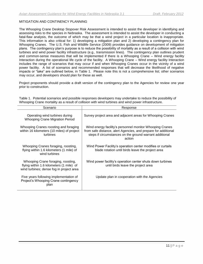
MITIGATION AND CONTINENCY PLANNING The Whooping Crane Desktop Stopover Risk Assessment is intended to assist the developer in identifying and assessing risks to the species in Nebraska. The assessment is intended to assist the developer in conducting a fatal-flaw analysis, the outcome of which may be that a wind project in a particular location is inappropriate. This information is also critical for: 1) developing a mitigation plan and 2) developing a contingency plan for Whooping Cranes. The U.S. Fish and Wildlife Service (2009) provides guidance on development of mitigation plans. The contingency plan’s purpose is to reduce the possibility of mortality as a result of a collision with wind turbines and wind power facility infrastructure (e.g., transmission lines). The contingency plan outlines prudent and common-sense measures that will be implemented if there is a Whooping Crane – Wind energy facility Interaction during the operational life cycle of the facility. A Whooping Crane – Wind energy facility Interaction includes the range of scenarios that may occur if and when Whooping Cranes occur in the vicinity of a wind power facility. A list of scenarios and recommended responses that will decrease the likelihood of negative impacts or “take” are outlined below, in Table 1. Please note this is not a comprehensive list; other scenarios may occur, and developers should plan for these as well. Project proponents should provide a draft version of the contingency plan to the Agencies for review one year prior to construction. Table 1. Potential scenarios and possible responses developers may undertake to reduce the possibility of Whooping Crane mortality as a result of collision with wind turbines and wind power infrastructure.
Scenario Response
Operating wind turbines during
Whooping Crane Migration Period
Whooping Cranes roosting and foraging within 16 kilometers (10 miles) of project
turbines
Whooping Cranes foraging, roosting, flying within 1.6 kilometers (1 mile) of
wind turbines
Whooping Crane foraging, roosting, flying within 1.6 kilometers (1 mile) of
wind turbines; dense fog in project area
Five years following implementation of Project’s Whooping Crane contingency
plan
Survey project area and adjacent areas for Whooping Cranes
Wind energy facility’s personnel monitor Whooping Cranes from safe distance, alert Agencies, and prepare for additional
steps if circumstances on the ground warrant additional action
Wind Power Facility’s operation center modifies or curtails
blade rotation until birds leave the project area
Wind power facility’s operation center shuts down turbines until birds leave the project area
Update plan in cooperation with the Agencies

Avian Assessment Guidance for Wind Energy Facilities in Nebraska 3.1 Draft, February 2012
12 | P a g e
MOUNTAIN PLOVER SURVEY

Avian Assessment Guidance for Wind Energy Facilities in Nebraska 3.1 Draft, February 2012
13 | P a g e
The Mountain Plover (Charadrius montanus) is a robin-sized shorebird that inhabits upland areas in the western Great Plains. Unlike most other shorebirds, Mountain Plovers are rarely found near water. The Mountain Plover is state-listed as threatened and is currently a candidate species under the federal Endangered Species Act. Mountain Plover range covers the southwest panhandle of Nebraska (Figure 2). Mountain Plovers breed in this area in fallow agricultural fields and disturbed short-grass prairie (Figure 3). Mountain Plovers and their nests are cryptically-colored and are difficult to detect. Thus, Mountain Plover is a species that requires focused effort to effectively survey. Nebraska’s Mountain Plovers have been studied for over a decade. Research has been led by Rocky Mountain Bird Observatory and the Commission and has been conducted in close cooperation with local landowners. As a result, the distribution of Mountains Plovers is relatively well understood. Specific locations of nests are not known during any one year, thus the need for surveys. The guidelines outlined below are not intended to be used to determine density or abundance. A different survey design will have to be developed if abundance/density information is required. Survey recommendations in this document are modified from Knopf (2002).
Figure 3. Mountain Plover nest in a fallow agricultural field in Kimball County. Nest is located in the bottom right hand corner of the photograph.
Figure 2. Mountain Plover range in Nebraska.

Avian Assessment Guidance for Wind Energy Facilities in Nebraska 3.1 Draft, February 2012
14 | P a g e
OBJECTIVE
Determine presence/absence of breeding Mountain Plovers. SURVEY DESIGN
1) Mountain Plover surveys should be conducted by qualified individual(s) familiar with the natural history of the species and have experience detecting and observing Mountain Plovers.
2) Survey may be influenced by existing information.
3) A Mountain Plover survey should be conducted if construction activities are scheduled to occur between 10 April through 10 July in Mountain Plover’s range and habitat.
4) Survey should include all areas within 0.40 kilometers (0.25 mile) of where construction activities occur.
5) A project area should be surveyed three (3) times during the survey window, with each survey separated by at least 14 days. The need for three (3) surveys is to capture the entire nesting period with the intent of reducing the risk of concluding the site is not nesting habitat by an absence of nesting birds during a single survey.
6) Mountain Plover surveys should be conducted between local sunrise and 10:00 and from 5:30 p.m. to local sunset.
7) Observer should stay in vehicle during surveys and slowly drive (< 5 mph) transects within the survey area to minimize early flushing. Flushing distances from Mountain Plovers may be within three (3) meters for vehicles, but plovers often flush at 50 to 100 meters when approached by human on foot. Use of ATV is preferable. If vehicle use is prohibited in the survey area, then alternatives should be discussed with the Commission. Transects should be recorded with a Global Positioning System (GPS).
8) Use binoculars to scan and a spotting scope to confirm and observe Mountain Plovers.
9) Birds at occupied nests should be identified to species.
10) Surveys should be conducted during favorable weather. Favorable weather is defined as no precipitation, winds < 24 kph (= 15 mph), and visibility at a minimum of 0.75 kilometers (0.5 miles). Surveys should not be conducted during periods of precipitation, when wind is > 24 kph (= 15 mph), or when visibility is less than 0.75 kilometers (0.5 miles).
REPORTING
1) All survey reports should include standard scientific journal-style format of introduction, methods, results, discussion/conclusions.
2) All survey reports should clearly and specifically describe sampling design, field methods, and analyses in enough detail that the survey could be replicated by an individual with no previous knowledge of the original survey.
3) Credentials and experience of the individual(s) that conducted surveys should be provided in the reports.
4) Location of survey points or transects should be recorded with a Global Positioning System (GPS) unit and this information should be provided in the reports.
5) Nest locations should be recorded with a Global Positioning System (GPS). All survey reports should include the location of all nests located during all surveys.
6) Deviations from original survey designs should be reported and discussed.
7) All survey reports should be provided electronically in PDF format. If an active nest is located, an appropriate buffer area should be established to prevent direct loss of the nest or indirect impacts from human-related disturbance. The appropriate buffer distance will vary, depending on topography, type of activity proposed, and duration of disturbance. For disturbances including pedestrian foot traffic and continual equipment operations, a 0.40 kilometer (0.25 mile) buffer is recommended.

Avian Assessment Guidance for Wind Energy Facilities in Nebraska 3.1 Draft, February 2012
15 | P a g e
BREEDING BIRD SURVEY

Avian Assessment Guidance for Wind Energy Facilities in Nebraska 3.1 Draft, February 2012
16 | P a g e
OBJECTIVE
Quantify breeding bird abundance or density in the project area. SURVEY DESIGN
1) A sampling design that allows for the statistical extrapolation of data throughout the project area (or stratified habitat types) should be used.
2) A sampling design representative of the project area should be devised. A random or systematic sampling design that accurately represents the project area should be used.
3) If the project area has distinct habitat types, a stratified sampling design is appropriate.
4) A sampling design limited to roadways or other borders is not appropriate.
5) Sampling intensity should be determined as follows: the coefficient of variation for the overall abundance or density estimate of all avian species combined (in other words, all species pooled) should not exceed 10% and the coefficient of variation for the overall abundance or density estimate of the five most numerous avian species should not exceed 20%.
6) If habitats are stratified, #5 should be applied to each habitat type.
7) Two years of pre-construction surveys are strongly encouraged.
8) Surveyors should implement survey methods that estimate detection probabilities and corrected densities or abundances. Acceptable survey methods include, but are not limited to, distance sampling (Buckland et al. 2001, 2004, Rosenstock et al. 2002), double-observer (Nichols et al. 2000), double-sampling (Bart and Earnst 2002), and removal methods (Farnsworth et al. 2002).
9) Surveys should be conducted during the appropriate period when breeding birds are present and active. Generally in Nebraska, the first half of June is a desirable period to conduct breeding bird surveys because breeding activity (e.g. singing males) is high and spring migration has concluded. However, breeding periods for some species may fall outside this period.
10) Incidental observations of nests should be recorded.
11) Location of survey points or transects should be recorded with a Global Positioning System (GPS) unit and this information should be provided in the reports.
12) Surveys may be conducted from a half-hour before sunrise to 10:30 a.m. and from 5:00 p.m. to sunset. Surveys should not be conducted from 10:30 a.m. to 5:00 p.m. No more than 50% of all surveys should be conducted during the late afternoon/evening time period.
13) Surveys should be conducted during favorable weather. Favorable weather is defined as no precipitation, winds < 24 kph (= 15 mph), and visibility at a minimum of 0.75 kilometers (0.5 miles). Surveys should not be conducted during periods of precipitation, when wind is > 24 kph, or when visibility is less than 0.75 kilometers (0.5 miles).
14) Surveys should be conducted by qualified individuals able to identify breeding bird species found in Nebraska by sight and sound.

Avian Assessment Guidance for Wind Energy Facilities in Nebraska 3.1 Draft, February 2012
17 | P a g e
REPORTING
1) All survey reports should include standard scientific journal-style format of introduction, methods, results, discussion/conclusions.
2) Credentials and experience of the individual(s) that conducted surveys should be provided in the reports.
3) Deviations from original survey designs should be reported and discussed.
4) All survey reports should be provided electronically in PDF format.
5) All survey reports should clearly and specifically describe sampling design, field methods, and analyses in enough detail that the survey could be replicated by an individual with no previous knowledge of the original survey. Design and methodological decisions should be clearly justified. If methods employ critical assumptions, reports should clearly state that assumptions were or were not followed.
6) All survey reports should include a graphic(s) depicting location of all sampling units (e.g., points or transects).
7) All survey reports should include a list of all species located during the survey.
8) All survey reports should include, in a tabular format, density or abundance estimates with 95% confidence intervals, standard errors, and coefficient of variation for all birds and for all bird species.
9) All survey reports should include a graphic(s) depicting the location of all nests located during all surveys.
10) Final Avian Assessment Report should include graphics depicting pre- and post-construction abundance or density with 95% confidence intervals for all species whose overall abundance or density estimate have coefficients of variation < 40%.

Avian Assessment Guidance for Wind Energy Facilities in Nebraska 3.1 Draft, February 2012
18 | P a g e
NESTING RAPTOR SURVEY

Avian Assessment Guidance for Wind Energy Facilities in Nebraska 3.1 Draft, February 2012
19 | P a g e
Several raptor species commence breeding earlier than most other Nebraska breeding bird species. At least one raptor nest survey should be conducted prior to a breeding bird survey. The raptor and breeding bird survey complement each other, as some breeding raptors may only be detected in the latter survey. Below are brief species accounts for species of conservation concern protected by state and federal statute and/or identified by the Nebraska Natural Legacy Project (Schneider et al. 2005). The purpose of the species accounts is to provide project proponents with information that show what species they may need to consider in their surveys. The species account should not be used as a complete overview of a species’ natural history or status and distribution in Nebraska.
Mississippi Kite (Ictinia mississippiensis)
CONSERVATION STATUS: Protected by Migratory Bird Treaty Act. Nebraska Natural Legacy Plan Tier II species.
OCCURRENCE: Local breeder at Ogallala, Keith County. Casual elsewhere in the state from April through early October.
PHENOLOGY: Breeding birds arrive in May and depart by early September.
HABITAT: Suburban areas, open woodlands, and hedgerows. Most often observed “kiting” in the air. SPECIAL CONCERNS: None.
Bald Eagle (Haliaeetus leucocephalus)
CONSERVATION STATUS: Protected by the Bald and Golden Eagle Protection Act and the Migratory Bird Treaty Act. Nebraska Natural Legacy Plan Tier II species.
OCCURRENCE: Regular breeder, spring and fall migrant, and winter resident statewide. More numerous during migration and winter. Congregations may occur locally during winter. Breeding numbers increasing.
PHENOLOGY: Resident pairs may occupy territory year-round. Nest building may occur at any time, but generally begins in late January or February. Birds are usually incubating eggs in March. Young fledge in June or early July, but remain in natal area during summer.
HABITAT: Woodlands or mixed habitats near rivers, streams, or lakes. Winter concentrations occur in areas with open water and food resources such as waterfowl and/or fish. SPECIAL CONCERNS: Disturbance of nesting pairs, destruction of nests, loss of habitat.

Avian Assessment Guidance for Wind Energy Facilities in Nebraska 3.1 Draft, February 2012
20 | P a g e
Red-shouldered Hawk (Buteo lineatus)
CONSERVATION STATUS: Protected by Migratory Bird Treaty Act. Nebraska Natural Legacy Plan Tier II species.
OCCURRENCE: Local permanent resident in southeast Nebraska.
PHENOLOGY: Birds may be absent for portions of the year, even at established locations, but there is no clear migratory pattern.
HABITAT: Deciduous woodlands often near marshes or swamps. SPECIAL CONCERNS: None.
Northern Harrier (Circus cyaneus)
CONSERVATION STATUS: Protected by Migratory Bird Treaty Act. Nebraska Natural Legacy Plan Tier II species.
OCCURRENCE: Regular resident statewide, more numerous in areas with substantial grassland tracts. More numerous during spring and fall migration.
PHENOLOGY: Birds present year-round.
HABITAT: Prairie, grasslands, and marshes. SPECIAL CONCERNS: Loss of habitat.
Swainson’s Hawk (Buteo swainsoni)
CONSERVATION STATUS: Protected by Migratory Bird Treaty Act. Nebraska Natural Legacy Plan Tier II species.
OCCURRENCE: Common spring and fall migrant statewide, fairly common breeder central and east.
PHENOLOGY: Arrives in April and departs in late September and early October. Peak migration occurs around the first of October in fall.
HABITAT: Prairie species. During migration may also be found in intensely agricultural areas. Often roosts in loose groups in agricultural fields during migration. SPECIAL CONCERNS: Loss of habitat and important prey species, such as grasshoppers. This is an open-country species that is somewhat intolerant of habitat fragmentation.

Avian Assessment Guidance for Wind Energy Facilities in Nebraska 3.1 Draft, February 2012
21 | P a g e
Ferruginous Hawk (Buteo regalis)
CONSERVATION STATUS: Protected by Migratory Bird Treaty Act. Nebraska Natural Legacy Plan Tier I species.
OCCURRENCE: Regular spring and fall migrant and summer resident in western Nebraska. Regular winter visitor in western and central Nebraska.
PHENOLOGY: Birds may be absent for portions of the year, even at established locations, but there is no clear migratory pattern.
HABITAT: Extensive short and mixed-prairies. Nests in trees, on the ground, and on escarpments. SPECIAL CONCERNS: Loss of habitat and important prey species. This is an open-country species is somewhat intolerant of habitat fragmentation and human activity.
Golden Eagle (Aquila chrysaetos)
CONSERVATION STATUS: Protected by the Bald and Golden Eagle Protection Act and the Migratory Bird Treaty Act. Nebraska Natural Legacy Plan Tier II species.
OCCURRENCE: Regular permanent resident in the panhandle. Regular spring and fall migrant and winter visitor in central Nebraska, casual in the east.
PHENOLOGY: Not well determined in Nebraska, although nesting birds have been observed on eggs in April.
HABITAT: Breeding habitat includes extensive open grassland. Nest sites are on escarpments and occasionally trees. In winter found in open country, often in areas with numerous small mammals. SPECIAL CONCERNS: Loss of habitat and important prey species. Negative effects of wind energy development.
Merlin (Falco columbarius)
CONSERVATION STATUS: Protected by Migratory Bird Treaty Act. Nebraska Natural Legacy Plan Tier I species.
OCCURRENCE: Regular spring and fall migrant and summer resident in western Nebraska. Regular winter visitor in western and central Nebraska. Casual breeder in Pine Ridge.
PHENOLOGY: Birds may be absent for portions of the year, even at established locations, but there is no clear migratory pattern.
HABITAT: Extensive short and mixed-prairies. Nests in trees. SPECIAL CONCERNS: Loss of habitat and important prey species. This is an open-country species that is somewhat intolerant of habitat fragmentation and human activity.
Image not available

Avian Assessment Guidance for Wind Energy Facilities in Nebraska 3.1 Draft, February 2012
22 | P a g e
Prairie Falcon (Falco mexicanus)
CONSERVATION STATUS: Protected by Migratory Bird Treaty Act. Nebraska Natural Legacy Plan Tier II species.
OCCURRENCE: Regular resident in the panhandle, primarily the Pine Ridge and Wildcat Hills. Regular spring and fall migrant and winter visitor statewide, less numerous east.
PHENOLOGY: Breeding birds may have eggs by mid-April. Chicks fledge late June or early July.
HABITAT: Breeding habitat includes extensive open grassland. Nest sites are located on escarpments, primarily in Pine Ridge and Wildcat Hills. In winter, found in open country. SPECIAL CONCERNS: Loss of habitat and important prey species. This is an open-country species that is somewhat intolerant of habitat fragmentation and human activity.
Peregrine Falcon (Falco peregrinus)
CONSERVATION STATUS: Protected by Migratory Bird Treaty Act. Nebraska Natural Legacy Plan Tier II species.
OCCURRENCE: Regular spring and fall migrant and casual winter visitor statewide. Local permanent resident in Omaha and Lincoln.
PHENOLOGY: Migrants found primary in April and May and in September. Breeding birds usually have eggs by early April, young fledge in June.
HABITAT: Breeding birds associated with tall buildings in urban areas. Migrants occur in a variety of habitats, but often found in areas that attract shorebirds and waterfowl. SPECIAL CONCERNS: None.
Barn Owl (Tyto alba)
CONSERVATION STATUS: Protected by Migratory Bird Treaty Act. Nebraska Natural Legacy Plan Tier I species.
OCCURRENCE: Regular spring and fall migrant and summer resident statewide, less numerous north, absent in northeast.
PHENOLOGY: Birds arrive in March and depart in late September or early October.
HABITAT: Uses human structures such as old barns, nest boxes, grain bins, and even combines for nesting. Also uses natural rock cavities on cliffs as well as earthen cavities in road cuts. Nest sites located near grassland tracts. SPECIAL CONCERNS: Loss of nests sites and foraging habitat.

Avian Assessment Guidance for Wind Energy Facilities in Nebraska 3.1 Draft, February 2012
23 | P a g e
Short-eared Owl (Asio flammeus)
CONSERVATION STATUS: Protected by Migratory Bird Treaty Act. Nebraska Natural Legacy Plan Tier I species.
OCCURRENCE: Regular resident north-central and west; regular spring and fall migrant and winter visitor south and east. Low density species and distribution not well understood.
PHENOLOGY: Not well understood in Nebraska.
HABITAT: Prairies, grasslands, and marshes. SPECIAL CONCERNS: Lack of information about nesting sites.
Burrowing Owl (Athene cunicularia)
CONSERVATION STATUS: Protected by Migratory Bird Treaty Act. Nebraska Natural Legacy Plan Tier I species.
OCCURRENCE: Regular spring and fall migrant and summer resident in central and western Nebraska, casual east.
PHENOLOGY: Birds arrive in April and depart in late September or early October.
HABITAT: Prairie dog colonies or other mammal burrows in short and mixed-grass prairies. SPECIAL CONCERNS: Prairie dog colonies should be surveyed specifically for this species.
Barred Owl (Strix varia)
CONSERVATION STATUS: Protected by Migratory Bird Treaty Act. Nebraska Natural Legacy Plan Tier I species.
OCCURRENCE: Regular permanent resident east.
PHENOLOGY: Pair formation begins in late winter and birds may have eggs by late February or March.
HABITAT: Riparian or oak woodlands. SPECIAL CONCERNS: None.

Avian Assessment Guidance for Wind Energy Facilities in Nebraska 3.1 Draft, February 2012
24 | P a g e
OBJECTIVE
Determine raptor nest locations within the project area. SURVEY DESIGN
Specific suggestions are as follows:
1) Raptor surveys should be conducted by qualified individual(s) familiar with the natural history of raptor species found in Nebraska and that are able to identify breeding activity and possible nest locations.
2) A one kilometer buffer should be added to the project area. Survey effort may be influenced by existing information (e.g. whether an active Bald or Golden Eagle nest is known to be located in the project area).
3) A minimum of one raptor survey should be conducted in early to mid-April. Additional surveys may be needed to correspond with breeding cycles of certain species (e.g. Swainson’s Hawk) if they occur in the project area.
4) All potential sites of raptor nests should be surveyed. This includes treelines, waterways, cliffs, buttes, etc. Surveyors should record and report survey points, transects, and/or trails driven and/or walked to survey potential nesting sites in the avian risk-assessment report.
5) Aerial surveys using fixed-wing aircraft are strongly encouraged.
6) Birds at occupied nests should be identified to species.
7) Surveys should be conducted during favorable weather. Favorable weather is defined as no precipitation, winds < 24 kph (= 15 mph), and visibility at a minimum of 0.75 kilometers. Surveys should not be conducted during periods of precipitation, when wind is > 24 kph (= 15 mph), or when visibility is less than 0.75 kilometers.
The following codes, terms and definitions apply specifically to raptors and the Nesting Raptor Survey. These codes and terms should be used, as defined, in any reports provided to the Agencies.
Nesting Status: The following codes should be used to describe the status of any raptor nest observed. Status refers to whether a nest is being used by raptors.
1) OCC: Occupied raptor nest is the presence of one or more adult raptors at a nest and territory during the nesting season.
2) UNOCC: Unoccupied raptor nest is the absence of adults at an existing nest and territory during the nesting season.
3) ACT: Active raptor nest is an occupied raptor nest where a pair of adult birds are engaged in breeding activity such as incubation of eggs or tending of young. Active raptor nest does not include instances where a pair of adults has built a dummy or practice nest and has not engaged in breeding. An active raptor nest is indicated by the following:
A) Eggs in nest, or B) Young in nest, or C) Recently fledged young near nest, or D) Incubating or brooding adult.
4) PRO: Productive raptor nest is an active raptor nest where fledged young are produced.
5) FAIL: Failed raptor nest is an active raptor nest where fledged young are not produced.
6) UNKNOWN: Nest is present, but because of its location, the observer is unable to make a determination.

Avian Assessment Guidance for Wind Energy Facilities in Nebraska 3.1 Draft, February 2012
25 | P a g e
Nest condition: The following codes should be used to describe the condition of any raptor nest observed.
1) GONE: Nest was known to be present or there is evidence one was present, but it is no longer present.
2) REMNANTS: Scant materials remaining of a nest and not usable unless fully rebuilt.
3) UNUSABLE: Nest is not occupied and in need to repair to be used.
4) USABLE: Nest is occupied or active and is in good condition.
5) UNKNOWN: Nest is present, but because of its location, the observer is unable to make a determination.
Nest Location: Location should be recorded and reported in at least one of the following formats:
1) Public Land Survey System: Township, Range, Section, and Quarter Section information should be provided; all locations should be reported to the quarter section. Example: T23, R21, S31, SE1/4
2) UTMs: Northing UTM coordinates (7 characters) and easting UTM coordinates (6 characters). Datum information should also be provided.
3) Decimal Degrees: Latitude and longitude geographic coordinates as decimal fractions. Example: 98.8382, 41.2134. Datum information should also be provided.
Number of eggs: The number of eggs recorded in the nest.
Number of young: The number of young observed in the nest.
Date observed: Date of observation in Month/Day/Year (MM/DD/YYYY) format.
Observed By: Record the name of the person(s) making the observations.
Optics Used: Record the optical equipment used.
Nest substrate: Substrate in which the nest is located. Examples: burrow, artificial nesting structure, deciduous tree, cliff, rock cavity, and/or ground.
REPORTING
1) All survey reports should include standard scientific journal-style format of introduction, methods, results, discussion/conclusions.
2) All survey reports should clearly and specifically describe sampling design, field methods, and analyses in enough detail that the survey could be replicated by an individual with no previous knowledge of the original survey.
3) Credentials and experience of the individual(s) who conducted surveys should be provided in the reports.
4) Deviations from original survey designs should be reported and discussed.
5) All survey reports should be provided electronically in PDF format.
6) All survey reports should include a graphic depicting location of all points or transects.
7) All survey reports should include a list of all raptor species observed.
8) All survey reports should include the location of all nests located during all surveys.
9) All survey reports should include information on the type of nesting activity observed (e.g. courtship behavior, building of a nest, fledged young at nest, etc).

Avian Assessment Guidance for Wind Energy Facilities in Nebraska 3.1 Draft, February 2012
26 | P a g e
PRAIRIE GROUSE SURVEY

Avian Assessment Guidance for Wind Energy Facilities in Nebraska 3.1 Draft, February 2012
27 | P a g e
Nebraska has two species of “prairie grouse”, the Greater Prairie-Chicken (Tympanuchus cupido) and Sharp-tailed Grouse (Tympanuchus phasianellus). Both species gather communally in spring at leks, areas where males perform elaborate displays to attract and mate with females. McRoberts (2009) and Martin and Knopf (1981) may be useful references. OBJECTIVE
Determine prairie grouse presence, lek locations within the project area and number of males and females attending each lek. SURVEY DESIGN
1) Prairie grouse surveys and lek counts should be conducted by qualified individual(s) familiar with the natural history of the species and able to identify leks. Credentials and experience of the individual(s) that conducted surveys should be provided in the avian risk assessment report.
2) Aerial surveys using fixed-wing aircraft are strongly encouraged.
3) A one kilometer buffer should be added to the project area. Survey area may be determined by existing information (e.g., whether active leks have been located in the project area, species’ distribution, distribution of habitats). The project proponent should coordinate with the agencies to determine appropriate survey areal coverage.
4) Three flights should be conducted during April, one each during each of the following periods: 1-10 April, 11-20 April, and 21-30 April.
5) Line (flight) transects should be laid out over the survey area every 400 meters.
6) Fixed-wing aircraft should fly at an altitude of 50-100 meters and a speed of 140 km/hr.
7) Surveys should be conducted on sunny days when winds are winds < 24 kph (= 15 mph).
8) Survey should be completed 2.5 hours post-sunrise.
9) Once leks have been located they should be surveyed at least 3 times to determine the number of males and females attending each lek (lek counts). If the number of leks located during the lek survey is large, a statistically valid, random sub-sample of leks should be surveyed to count males.
10) Lek counts should be conducted from the ground between 1-30 April.
11) Counts should begin as soon as adequate light is available to count.
12) Counts should be conducted on calm days with winds <24 kph (= 15 mph) and no precipitation.
13) Lek coordinates (from the lek survey), the number of males, the number of females, and the number of unknown sex grouse should be recorded, along with weather conditions and time observed.
REPORTING
1) All survey reports should include standard scientific journal-style format of introduction, methods, results, discussion/conclusions.
2) All survey reports should clearly and specifically describe sampling design, field methods, and analyses in enough detail that the survey could be replicated by an individual with no previous knowledge of the original survey.
3) Credentials and experience of the individual(s) that conducted surveys should be provided in the reports.
4) Deviations from original survey designs should be reported and discussed.
5) All survey reports should be provided electronically in PDF format.
6) All survey reports should include graphics depicting all flight transects or, if a ground-based survey was used, location of all points or transects.
7) All survey reports should include locations of all leks located during the three surveys.
8) All survey reports should include information on which species were present at leks.
9) All survey reports should include the number of birds by sex and species or unknown categories.

Avian Assessment Guidance for Wind Energy Facilities in Nebraska 3.1 Draft, February 2012
28 | P a g e
LITERATURE CITED Bart, J., and S. Earnst. 2002. Double sampling to estimate density and population trends in birds. Auk 119: 36-
45. Buckland, S. T., D. R. Anderson, K. P. Burnham, J. L. Laake, D. L. Borchers, and L. Thomas. 2001.
Introduction to distance sampling: estimating abundance of biological populations. Oxford University Press, Oxford, U.K.
Buckland, S. T., D. R. Anderson, K. P. Burnham, J. L. Laake, D. L. Borchers, and L. Thomas. 2004. Advanced
distance sampling: estimating abundance of biological populations. Oxford University Press, Oxford, U.K.
Farnsworth, G.L., K.H. Pollock, J.D. Nichols, T.R. Simons, J.E. Hines, and J.R. Sauer. 2002. A removal model
for estimating detection probabilities from point-count surveys. Auk 119: 414-425. Knopf, F.L. ca. 2002. Mountain Plover Survey guidelines. Unpublished report. Martin, S. A., and F. L. Knopf. 1981. Aerial survey of greater prairie chicken leks. Wildlife Society Bulletin
9:219–221. McRoberts, J. T. 2009. Aerial surveys for lesser prairie-chicken leks: detectability and disturbance
response. M.S. Thesis, Texas Tech University, Lubbock, USA. http://www.rw.ttu.edu/mcroberts/pdfs/McRoberts_Thesis.pdf Nichols, J.D., J.E. Hines, J.R. Sauer, F.W. Fallon, J.E. Fallon, and P.J. Heglund. 2000. A double observer
approach for estimating detection probability and abundance from point counts. Auk 117: 393-408. Reed, J. M. 2004. Report to the National Resource Committee, Variability Issues for Target Species on the
Platte River. 33 pp. Rosenstock, S.S., D.R. Anderson, K.M. Giesen, T. Leukering, and M.F. Carter. 2002. Landbird counting
techniques: current practices and an alternative. Auk 119: 46-53. Schneider, R., M. Humpert, K. Stoner, and G. Steinauer. 2005. The Nebraska Natural Legacy Project: a
comprehensive wildlife strategy. Nebraska Game and Parks Commission, Lincoln, Nebraska. Sinclair, A.R.E., J.M. Fryxell, and G. Caughley. 2006. Wildlife ecology, conservation, and management, 2
nd
edition. Blackwell Publishing, Malden, MA.
U.S. Fish and Wildlife Service. 2009. Whooping Cranes and wind development: an issue paper. U.S. Fish and Wildlife Service Regions 2 and 6. Avaiable at: ftp://wiley.kars.ku.edu/windresource/Whooping_Crane_and_Wind_Development_FWS_%20April%202009.pdf
Avian Assessment Guidance for Wind Energy Facilities in Nebraska 3.1 Draft, February 2012
29 | P a g e
USEFUL REFERENCES The references listed below provide information about Nebraska’s birds and may be helpful in developing surveys: Nebraska State Bird References Ducey, J.E. 1988. Nebraska Birds: Breeding Status and Distribution. Simon Boardman Books, Omaha,
Nebraska. Johnsgard, P.A. 1980. The Birds of Nebraska and Adjacent Plains States. Nebraska Ornithologists’ Union
Occasional Paper No. 6, Lincoln, Nebraska. Sharpe, R.S., W.R. Silcock, and J.G. Jorgensen. 2001. Nebraska Birds: Their Distribution and Temporal
Occurrence. University of Nebraska Press, Lincoln, Nebraska. Mollhoff. W.J. 2001. The Nebraska Breeding Bird Atlas 1984-1989. Nebraska Ornithologists’ Union
Occasional Paper No. 7 and Nebraska Technical Series No. 20. Nebraska Game and Parks Commission, Lincoln, Nebraska.
Project proponents should also review the following to identify species of conservation concern within the project area: Schneider, R., M. Humpert, K.Stoner, and G. Steinauer. 2005. The Nebraska Natural Legacy Project: a
comprehensive wildlife conservation strategy. Nebraska Game and Parks Commission, Lincoln, Nebraska. http://www.ngpc.state.ne.us/wildlife/programs/legacy/review.asp