Embed Size (px)
Citation preview
May 2016
West WatereeTransportation Study

Meeting Outline
West Wateree Transportation Study
• Introductions• Role of the Sub-Area Plan• Study Area• Project Milestones• Project Approach• Existing Conditions• Perspectives
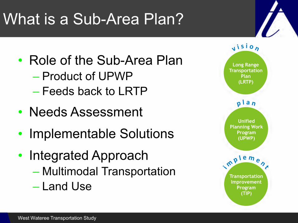
What is a Sub-Area Plan?
• Role of the Sub-Area Plan– Product of UPWP– Feeds back to LRTP
• Needs Assessment• Implementable Solutions• Integrated Approach
– Multimodal Transportation– Land Use
West Wateree Transportation Study

Study Area
West Wateree Transportation Study

Project Milestones
• Project Initiation• Establish Baseline• Planning Workshop• Analysis/Evaluation• Needs Assessment• Recommendations• Implementation Plan• Public Meeting• Final Study Report
Nov. 2015Dec. 2015-Mar. 2016
May 2016May 2016June 2016July 2016Aug. 2016Aug. 2016
Sept. 2016West Wateree Transportation Study

Project Approach
Public Participation
Baseline Review
Technical Analyses
Needs Assessment and Alternative Solutions
Recommendations/Phasing/Implementation
1
2
3
4
5
Vehicular, Transit, Bicycle and Pedestrian, Development Trends
West Wateree Transportation Study
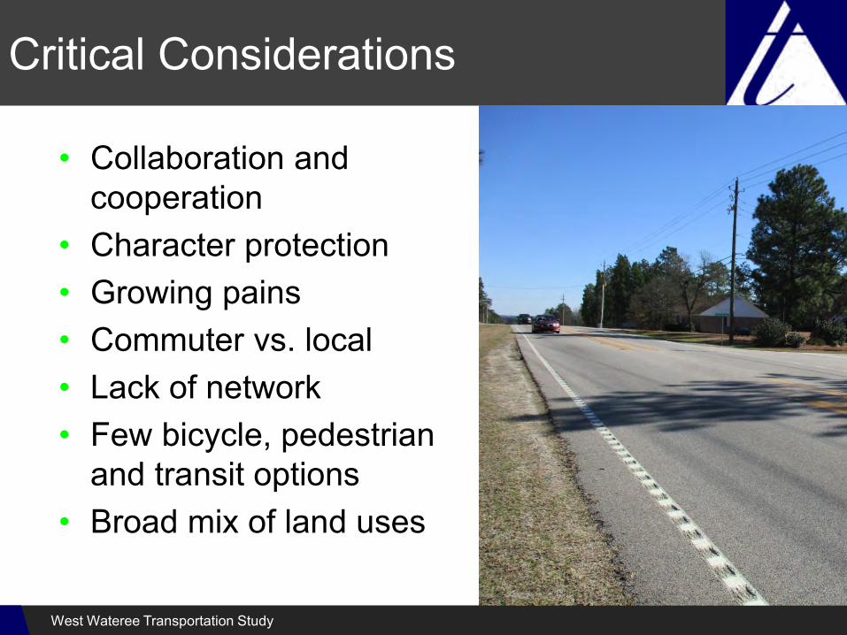
Critical Considerations
• Collaboration and cooperation
• Character protection• Growing pains• Commuter vs. local• Lack of network• Few bicycle, pedestrian
and transit options• Broad mix of land uses
West Wateree Transportation Study

One Size Will Not Fit All
• Varying constraints and characters require responsive solutions
• Sub-area subsets• Balanced solutions
– Technical analysis– Community guiding
principles– SCDOT support
West Wateree Transportation Study

Meaningful Public Participation
• Achieve informed consensus• Open, flexible process• Variety of tools
– Steering committee– Planning workshop– Open house– Website– WikiMap
West Wateree Transportation Study

Interactive Engagement
WikiMap
West Wateree Transportation Study
http://tinyurl.com/westwatereewikimap
West Wateree Transportation Study

Stopping Distance
West Wateree Transportation Study

Speed and Safety
West Wateree Transportation Study

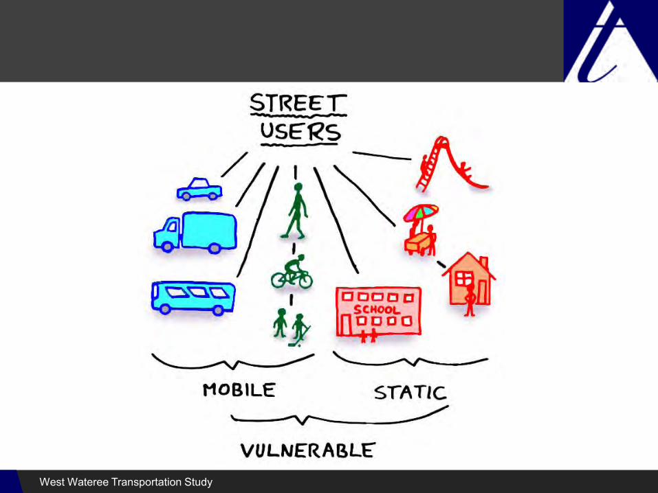
User Types
Source: U.S. Bicycling Participation Benchmarking Study
over 50%• Afraid of being hit
by a car
• More likely to ride if separated facilities were available
West Wateree Transportation Study
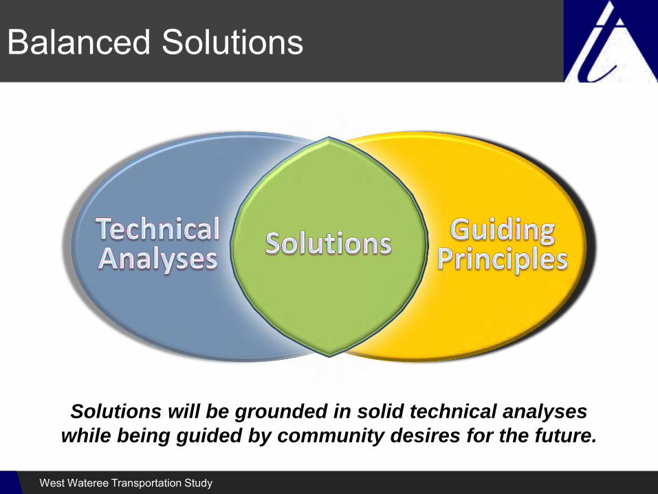
Solutions will be grounded in solid technical analyses
while being guided by community desires for the future.
Balanced Solutions
West Wateree Transportation Study

Great Street Approach
• People as priority– People who drive cars, walk,
bike, and live and work along/near the street
• Quality of design
• Quality of service for transportation
• Quality of life for residents and users
Make the trip as enjoyableas the destination
West Wateree Transportation Study
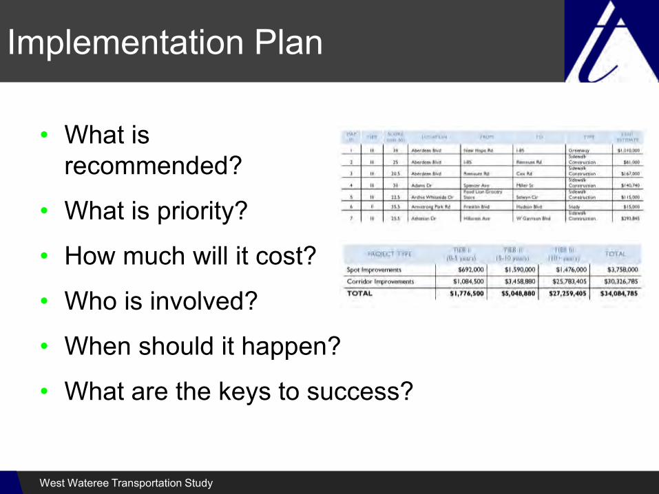
Implementation Plan
• What isrecommended?
• What is priority?
• How much will it cost?
• Who is involved?
• When should it happen?
• What are the keys to success?
West Wateree Transportation Study

Existing Conditions
West Wateree Transportation Study

Plans Review
• Long Range Transportation Plans• Transportation Improvement Programs• Elgin/Richland Northeast Sub-Area Plan• Bicycle and Pedestrian Plans• Commuter Rail Study/Alternative Analysis• Land Use Plans/TOD Report• Comprehensive Plans• Land Development Regulations
West Wateree Transportation Study

Zoning
West Wateree Transportation Study

Future Land Use
West Wateree Transportation Study

Elgin/Richland Northeast Sub-Area Plan
West Wateree Transportation Study

Main Street
West Wateree Transportation Study

Urban ArterialMain Street
West Wateree Transportation Study
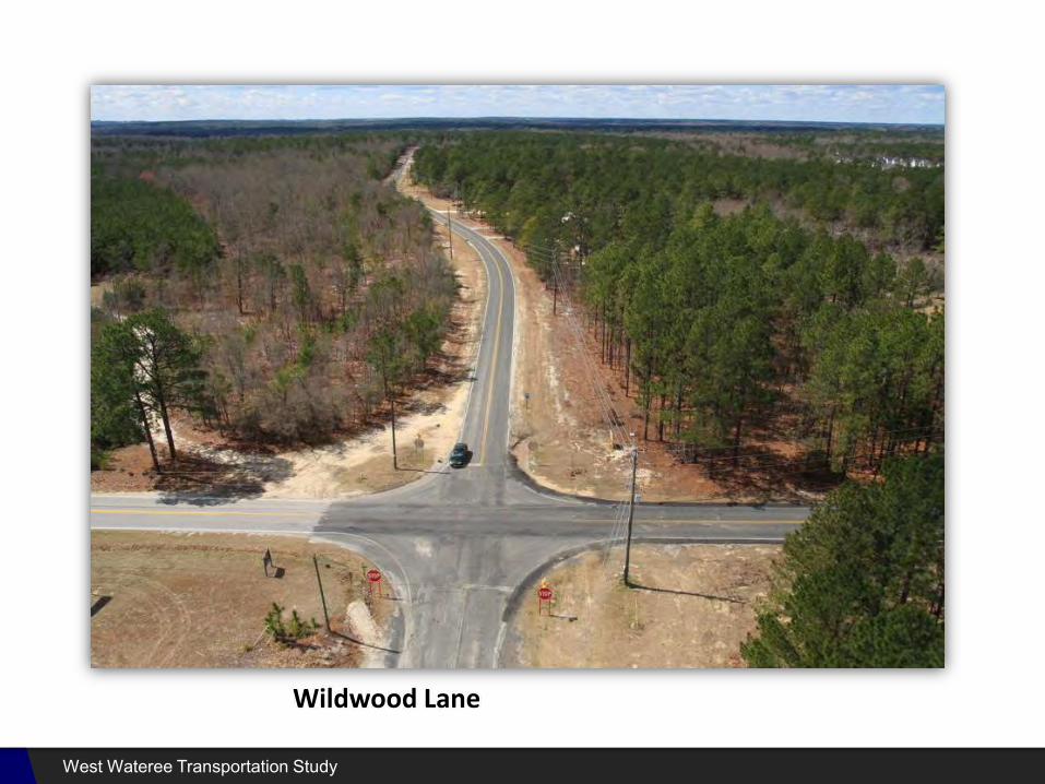
Wildwood Lane
West Wateree Transportation Study

Residential CollectorWildwood Lane
West Wateree Transportation Study

2009 Traffic Analysis
West Wateree Transportation Study
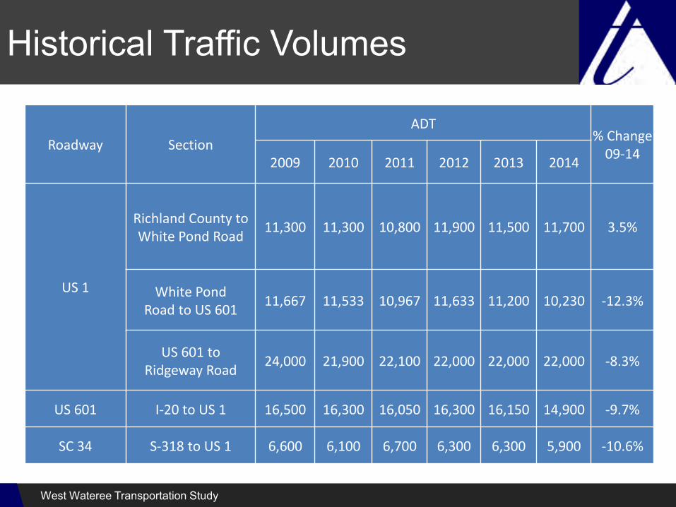
Historical Traffic Volumes
Roadway Section
ADT% Change
09‐142009 2010 2011 2012 2013 2014
US 1
Richland County to White Pond Road
11,300 11,300 10,800 11,900 11,500 11,700 3.5%
White PondRoad to US 601
11,667 11,533 10,967 11,633 11,200 10,230 ‐12.3%
US 601 toRidgeway Road
24,000 21,900 22,100 22,000 22,000 22,000 ‐8.3%
US 601 I‐20 to US 1 16,500 16,300 16,050 16,300 16,150 14,900 ‐9.7%
SC 34 S‐318 to US 1 6,600 6,100 6,700 6,300 6,300 5,900 ‐10.6%
West Wateree Transportation Study

Additional Intersections
West Wateree Transportation Study

LOS E and F
Intersection
HCM 2010Level of Service LOS (Delay)
ApproachExisting 2016
AM PM
US 1 at Magnolia Ln (S-36) / Business Dr SB Left F (531.4) F (58.4)
US 1 at US 601 NB Off Ramp NB Left F (391.6) F (133.8)
US 1 at Townlee Ln NB Left D (31.5) F (64.3)
US 601 at Standard Warehouse Rd (S-916)EB Left E (49.9) C (23.5)
WB Left F (61.2) D (25.3)
US 601 at Lachicotte Rd (S-133) WB Left E (49.3) F (69.6)
US 601 at Fredericksburg Dr (S-854) EB Left E (37.3) C (24.5)
US 601 at Whiting Way (S-993) EB Left F (165.9) F (78.0)
US 1 at Watts Hill Rd (S-757) SB Left B(11.6) E (39.9)
West Wateree Transportation Study

Crashes 2010-2014
104 Injuries
1 Fatality
93
77
105
55
104
434total crashes
rear-end collision #1 crash type
West Wateree Transportation Study