Embed Size (px)
Citation preview

Watershed Management
Strategy
2015-2025

ACKNOWLEDGEMENTS:A steering committee made up of nine staff members of the Ausable Bayfield Conservation Authority (ABCA) met regularly between 2013 and 2015 as stewards of this new Watershed Management Strategy (2015).
The steering committee members, at the time of publication, are:
Brian Horner, General Manager and Secretary-Treasurer Judith Parker, Corporate Services Coordinator Geoffrey Cade, Water and Planning Supervisor Tracey McPherson, GIS/IT Coordinator Aaron Clarke, Drinking Water Source Protection GIS Specialist Kari Jean, Aquatic Biologist Hope Brock, Healthy Watersheds Technician Ian Jean, Forestry and Land Stewardship Specialist Tim Cumming, Communications Specialist
The staff of the ABCA also contributed input at various stages of the document’s development. In-house subject experts also made particular contributions in their areas of expertise. These subject-area contributors included Mari Veliz, Healthy Watersheds Supervisor; Angela Van Niekerk, Wetlands Specialist; Alec Scott, Water and Planning Manager; Davin Heinbuck, Land and Water Technologist; Andrew Bicknell, Regulations Coordinator; Ross Wilson, Water and Stewardship Technologist; and Kate Monk, Manager of Stewardship, Land and Education.
Tom Prout, Past General Manager and Secretary-Treasurer of the ABCA, initiated the project to create a new Watershed Management Strategy (WMS). He worked closely with staff to develop a guiding document outlining the need, audience, and process to create the WMS. He took part in the first meetings of the staff steering committee and ensured the project was moving forward with momentum at the time of his retirement.
Elizabeth Snell, of Snell and Cecile Environmental Research, reviewed a draft of this document, in conjunction with review of some other Ausable Bayfield Conservation documents. She provided meaningful input and the new Watershed Management Strategy is an improved document thanks to her work and insights.
Cite as: Ausable Bayfield Conservation. 2015. Watershed Management Strategy. Ausable Bayfield Conservation Authority. Exeter, Ontario. 3 pp.
Photo by Joyce Callcott - Honourable Mention in Conservation Ontario Photo Contest 2011.

Table of Contents
Section One: The PATH Forward
1.0 Purpose Statement
2.0 Introduction – Moving Forward and Map of ABCA Watershed
3.0 The PATH
3.1 Watershed Management Strategy Goals and Objectives
3.2 Navigating the PATH
3.2.1 Engage People
3.2.2 Create Awareness and Take Action
3.2.3 Reduce Threats
3.2.4 Enhance Health/Resilience
4.0 Recommended Actions along the PATH
4.1 General Recommendations
4.2 Corporate Services Recommendations
4.3 Conservation Education Recommendations
4.4 Drinking Water Source Protection Recommendations
4.5 Environmental Monitoring Recommendations
4.6 Flood Plain Management Recommendations
4.7 Planning and Regulations Recommendations
4.8 Private Land Stewardship Recommendations
4.9 Property Management Recommendations
Section Two: The PATH Travelled (Watersheds, History, Context, Challenges, and Accomplishments)
5.0 Ausable Bayfield Conservation Watersheds
5.1 Watershed Descriptions – Major Watersheds
5.1.1 Ausable River Watershed
5.1.2 Old Ausable Channel
5.1.3 Parkhill Creek
5.1.4 Mud Creek
5.1.5 Bayfield River Watershed
5.1.6 Lakeshore Watersheds
6.0 Changing Landscapes – Historic Context to Current Context to Future Path
6.1 Where We Have Come from
6.1.1 Watershed Origins
6.1.2 History
6.2 Where We Are Today
6.2.1 The Social and Economic Climate
6.2.2 Watershed Challenges
6.2.3 Ausable Bayfield Conservation: Key Accomplishments
7.0 Bibliography
8.0 Appendices
8.1 Appendix 1 – Chart of Documents

2
Photos in the Watershed Management Strategy are by Daniel Holm (The Word Image
Studio) and Ausable Bayfield Conservation staff, unless otherwise noted.
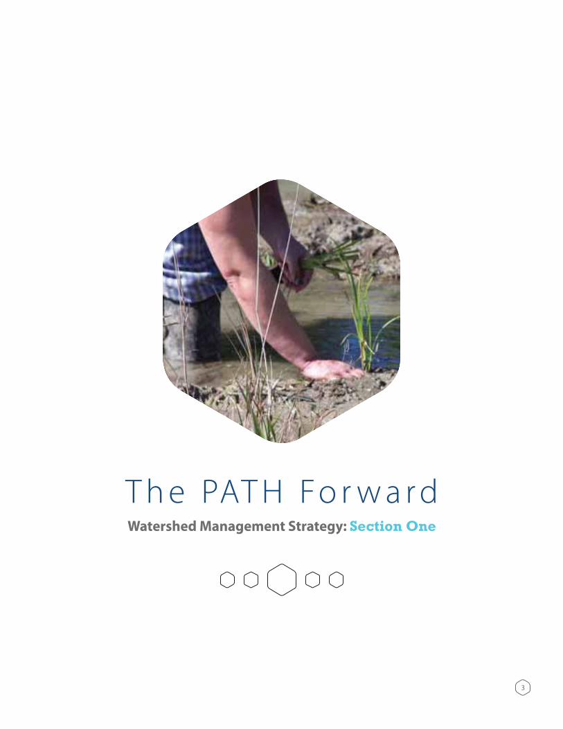
T h e PAT H Fo r w a r dWatershed Management Strategy: Section One
3

1.0 Purpose Statement The Watershed Management Strategy provides direction for the board and staff of Ausable Bayfield Conservation in implementing The Path Forward: Your Community Conservation Strategy for Ausable Bayfield Watersheds (2012).
2.0 IntroductionThe Ausable River Conservation Authority was formed in 1946. It was Ontario’s first conservation authority. It became Ausable Bayfield Conservation Authority, or ABCA, in 1972.
Representatives of the watershed community developed a Conservation Strategy in 1993. Later, the 1995 Watershed Management Strategy assembled staff input to target the Conservation Strategy’s issues, in 36 subwatersheds, as a guide to staff implementation.
Years later, changes both within and beyond the watersheds necessitated updates to the Conservation Strategy and the Watershed Management Strategy. By 2012, 34 people from the watershed community had taken part to develop The Path Forward: Your Community Conservation Strategy for Ausable Bayfield Watersheds. The Watershed Management Strategy (WMS) created in 2015 builds on this document, bringing forward relevant material from the 1995 WMS. Staff members provided input on WMS direction during meetings between 2013 and 2015. A staff steering committee met regularly to determine direction, develop the document, and incorporate input from staff and directors. An external consultant with environmental writing and strategic planning expertise reviewed the document and her comments were considered in revisions to this document. The Board of Directors of ABCA approved the new Watershed Management Strategy on May 21, 2015.
The new Watershed Management Strategy will help ensure we are moving forward together, with a clear direction and understanding of what we need to do. For maximum flexibility, specific actions are left to staff expertise in the context of specific situations and detailed information. Although intended mainly for Ausable Bayfield Conservation Authority staff, the WMS will also provide valuable information and strategies to partners.
The Conservation Strategy built a mission, vision, and goal for Ausable Bayfield Conservation:
Mission: Protect, improve, conserve and restore the watershed in partnership with the community.
Vision: Healthy watersheds where our needs and the needs of the natural environment are in balance.
Goal: Working with you, to create awareness and take action to improve watersheds for healthier communities and healthier people.
4
Mission: Protect, improve, conserve and
restore the watershed in partnership
with the community.
Vision: Healthy watersheds where
our needs and the needs of the natural
environment are in balance.
Goal: Working with you, to create
awareness and take action to improve
watersheds for healthier communities
and healthier people.
Watershed Management Strategy – Ausable Bayfield Conservation { Photo of owl courtesy of Paul Armstrong }

Historically, Ausable Bayfield Conservation has adapted to its changing environment. To continue as a leader, the conservation authority recognizes it needs to continue to adapt.
The following are some of the actions the local agency will need to undertake in the future:
involved in the studies, the better their understanding of environmental information becomes. It is important for the community to have this information to help guide better management.
Continue to develop and improve the Watershed Information System Kisters (WISKI) data management system to improve forecasting of flooding events, provide continuity for storage of historic data, and provide a means to publicly share watershed monitoring data.
Provide local, solid, practical knowledge and assistance to the community, including landowners and organizations, to enable them to be good stewards of soil, water, and natural heritage.
in sensitive areas.
balance recreation needs and the needs of the natural environment and showcase stewardship practices.
extensions to connect youth with nature and protect, improve, conserve and restore the watershed.
Continue to monitor hazard processes and respond to new challenges such as the impacts of climate change.
5
Watershed Community Concept:The community team that developed The Path Forward conservation strategy
created a circle diagram of how the conservation authority and the community can work together to build healthy watersheds. This concept can help to guide the
Watershed Management Strategy (Figure 1).
Figure 1. Conservation Strategy concept of how to create healthier watersheds.

Figure 2. Map of Ausable Bayfield Conservation Authority (ABCA) jurisdiction.
6 Watershed Management Strategy – Ausable Bayfield Conservation

3.0 The PATHThe community’s Conservation Strategy is called The Path Forward. To move along the PATH (Partnerships, Awareness and Action, Reducing Threats, Health) forward, to where the community has asked Ausable Bayfield Conservation to go, the conservation authority’s direction and actions will need to aspire to the WMS goals derived from the Conservation Strategy with accompanying objectives:
3.1 Watershed Management Strategy Goals and ObjectivesThe goal of the Conservation Strategy, from the community’s document, is phrased this way: “We want to work with you to create awareness and take action to improve watersheds for healthier communities and healthier people.”
The WMS will implement this statement using the following Watershed Management Strategy Goals:
1. To preserve, protect, enhance and restore the ecological function of the Ausable Bayfield watersheds.
2. To contribute to community health, safety, and sustainability.
3. To build partnerships, awareness, and engagement at all levels.
Four objectives of the Watershed Management Strategy represent the PATH needed to move forward to reach the ultimate goal of a healthy watershed where our needs and the needs of the natural environment are in balance (Figure 3). These objectives are to:
1. Engage People: Build community partnerships and engagement at all levels.
2. Create Awareness and Take Action: Employ effective education, research, monitoring and evaluation to contribute to community health, safety and sustainability.
3. Reduce Threats: Protect life and property by reducing threats.
4. Enhance Health/Resilience: Preserve, protect, enhance, the ecological integrity of the Ausable Bayfield watersheds.
Figure 3. Following the PATH can inform the progress of implementing the Conservation Strategy.
7 Watershed Management Strategy – Ausable Bayfield Conservation
Healthy
Watersheds
The PATHP
Engaging People,Building Partnerships
ACreating
Awarenessand Taking Action
TReducing, Mitigating, Managing
Threats
HCreating
EcosystemHealth

3.2 Navigating the PATHSociety is changing and the business of Ausable Bayfield Conservation continues to evolve. The ways staff members carry out the recommendations of this Watershed Management Strategy need to evolve as well.
Each individual leg of the PATH or objective has guiding principles or philosophies that will help set the course for recommended actions. As society and the world around us changes our actions may have to change but the principles remain the same.
3.2.1 Engage People
To engage people, we need to include principles such as:
3.2.2 Create Awareness and Take Action
Key principles of awareness include:
3.2.3 Reduce Threats
To reduce threats we are guided by the principles:
3.2.4 Enhance Health/Resilience
Principles include:
8

4.0 Recommended Actions along the PATHRecommended actions for Ausable Bayfield Conservation as a whole, or groups within the watershed, fulfill the PATH objectives (Partnerships, Awareness, Threat Reduction, Health). A recommendation that applies to more than one PATH objective is listed with the most applicable one but may apply to several. All recommendations are subject to financial and human resource constraints.
4.1 General RecommendationsAusable Bayfield Conservation should:
1. Build and maintain partnerships with landowners, community groups, municipalities and agencies for
that have an overlapping objective or objectives with WMS.
2. Raise awareness of the Ausable Bayfield Conservation programs and vision by:
a) Encouraging preparation and use of subwatershed and community watershed plans, explaining issues as they relate to residents.
b) Reviewing policies and programs of other levels of government which affect Ausable Bayfield Conservation watershed health, and informing them of any concerns.
3. Support programs such as Carbon Footprints to Forests as a means to counterbalance the threats caused by emission of carbon dioxide and other greenhouse gases and adapt to, and mitigate, climate change and to build watershed resiliency to deal with weather variability.
4. Implement the WMS process by:
or program activities.
improvement of the watershed.
c) Setting an evaluation component and review schedule at project inception and applying to all programs and the WMS, with reviews including target progress and new issues and
program adjustments. WMS is to be reviewed every 10 years.
d) Sharing resources and information among staff, including full use of the GIS as a tool to manage and analyse data.
9 Watershed Management Strategy – Ausable Bayfield Conservation

4.2 Corporate Services RecommendationsAusable Bayfield Conservation should:
5. Raise awareness of conservation measures by maintaining a Green Team to reduce waste and energy use in Ausable Bayfield Conservation Authority facilities and practices.
6. Implement the WMS process by:
a) Creating and regularly updating a Digital Information Management and Technology Strategy that includes: working with agencies to develop mapping and data standards suitable for current and future analyses; maintaining an Internal Mapping Site (IMS) that gives all staff access to GIS information; participating in programs and partnerships that allow for IT/GIS software and hardware infrastructure cost savings.
b) Maintaining an updated communications plan for Ausable Bayfield Conservation Authority.
c) Encouraging staff to stay current in science and technology through training and professional development.
d) Maintaining and expanding Ausable Bayfield Conservation catalogue of reference material including but not limited to reports, digital data, and books.
e) Promoting and supporting programs and projects of the Ausable Bayfield Conservation Foundation and Huron Tract Land Trust Conservancy.
4.3 Conservation Education RecommendationsAusable Bayfield Conservation should:
7. Seek partnerships to subsidize the cost of the Ausable Bayfield Conservation education program for local schools.
8. Create awareness by:
b) Promoting the highly effective overnight conservation education program at Camp Sylvan to local schools.
Conservation staff, through as many Ausable Bayfield Conservation projects and activities as possible.
through effective program delivery, presentations and special events.
10

4.4 Drinking Water Source Protection RecommendationsAusable Bayfield Conservation should:
9. Partner with municipalities to reduce threats to drinking water sources through efforts including stewardship best practices and effective risk management.
10. Increase awareness of methods to protect drinking water sources by:
a) Widely publicizing household hazardous waste days and opportunities to safely and properly dispose of waste in support of the protection of sources of drinking water.
b) Providing education and outreach in support of actions that reduce risk to sources of drinking water.
4.5 Environmental Monitoring RecommendationsAusable Bayfield Conservation should:
11. Encourage citizen and other partner participation in monitoring watershed resources, including water, soil,
12. Improve awareness with regular Watershed Report Cards and other evaluation tools.
13. Contribute to evaluation of threats to watershed health by:
a)
watershed monitoring.
runoff entering the sinkholes.
e) Being aware of gravel extraction and impacts on watershed ecology and, when appropriate, providing advisory comments to reviewing agencies.
14. Improve watershed health by:
a) Creating and implementing a guideline document for monitoring of the physical changes to the Lake Huron shoreline. Methods will include aerial photography, water levels changes, and physical surveys.
b) Develop an approach that determines where subwatershed plans are best initiated (for example, areas of protection and areas of enhancement.)
c) Regularly review and update the inventory of locally Environmentally Significant Areas (ESAs).
11 Watershed Management Strategy – Ausable Bayfield Conservation

4.6 Flood Plain Management RecommendationsAusable Bayfield Conservation should:
15. Partner with municipalities and agencies to alleviate flood and drought threats by:
a) Maintaining, advancing, and promoting an effective flood forecasting system to protect people from flood hazards.
b) Monitoring and maintaining Ausable Bayfield Conservation Authority flood and erosion control structures that protect existing development from flooding and erosion.
flood forecasting and warning, the Ontario Drought Program, and other water management programs.
d) Encouraging municipalities to maintain appropriate Emergency Contingency Plans dealing with floods.
implement appropriate measures to protect new development.
f ) Participating in the Ontario Drought Program and working with the Low Water Response Team and other agencies, such as Ontario Ministry of Natural Resources and Forestry (OMNRF) and Ontario Ministry of the Environment and Climate Change (MOECC), to address concerns of low base flow.
12 Watershed Management Strategy – Ausable Bayfield Conservation

4.7 Planning and Regulations RecommendationsAusable Bayfield Conservation should:
16. Improve awareness
17. Alleviate threats from hazard lands by:
a) Continuing to make use of regulations to discourage development in natural hazard areas.
b) Encouraging proper management of urban and rural stormwater runoff.
c) Working with municipalities and watershed partners to encourage the identification and protection of natural hazard areas in such documents as official plans and zoning bylaws.
d) Maintaining GIS layers of all hazards to help inform the watershed community of areas that are regulated under the Conservation Authorities Act.
e) Identifying areas of significant erosion and flooding to provide technical assistance to protecting development from them, through the Planning and Regulations Programs.
f ) Regularly reviewing and updating policies, procedures and technical guidelines for: natural heritage, hazard lands and stormwater management to keep current with state of the science and the needs of a changing landscape and climate.
18. Enhance the health of the watershed by:
a) Land use planning, zoning changes, regulations policy, and comments: promoting establishment of permanently vegetated riparian buffers, using natural species, along riparian zones.
b) Regularly reviewing and updating the shoreline recession rates and the Shoreline Management Plan to insure that its implementation policies address any changes in provincial or authority policy or emerging land use trends.
c) Identifying target areas where municipal drainage projects could benefit from alternative drain
d) Protecting and enhancing natural channels and associated riparian features as the primary objective of riverine management. In altered or managed channels such as municipal drains, opportunities to enhance the natural channel features and adjacent land use should be explored.
e) Increasing and formalizing the use of subwatershed planning concepts as a means to implement land use planning.
13

4.8 Private Land Stewardship RecommendationsAusable Bayfield Conservation should:
19. Encourage citizen and partner participation by:
a) Evaluating the current model of education and voluntary stewardship and exploring new tools and collaborations that expand conservation opportunities.
b) Supporting counties, municipalities and agencies in development, delivery, and review of forest conservation bylaws.
to encourage use of best management practices.
d) Cooperating with landowners to improve and protect watershed resources by encouraging financial incentive programs; providing education; offering technical assistance; and helping landowners to find out about and obtain financial incentives for their stewardship projects and best management practices.
e)
f ) With partners, exploring new tools to augment voluntary stewardship and outreach to help increase conservation ethic and land stewardship opportunities.
20. Raise awareness of how to alleviate threats to the watershed ecosystem by:
a) Encouraging and evaluating effectiveness of best management practices that promote the slow release of stormwater to watercourses. Watershed management should consider options of avoiding, controlling, trapping stormwater runoff and treating water, sediment and associated nutrients.
b) Encouraging proper livestock waste management and restricted livestock access to streams.
c) Educating agencies and agricultural producers about environmentally sound nutrient and manure management and best management practices and to continue to assist in implementation.
d) Providing information to landowners about proper septic system maintenance; encouraging repair or replacement of faulty septic systems; and supporting the work of municipalities and public health units to educate landowners, conduct septic system inspections and enforce applicable legislation.
21. Enhance the health of the watershed by:
a) Assisting farmers to maintain healthy, resilient soils that can sustain ongoing agricultural production while minimizing nutrient and topsoil losses to surface waters, groundwater, or air.
b) Encouraging establishment of permanent vegetative cover through cover crops and naturalization and/or active restoration of fragile lands, slopes, marginal lands, and other sites of ecological value, with diverse native species.
c) Promoting planting and maintenance of vegetative buffers along watercourses, wetlands, and
d) Encouraging windbreak, roadside, and hedgerow plantings throughout the watershed, using several vegetation species and forms.
14 Watershed Management Strategy – Ausable Bayfield Conservation

4.9 Property Management RecommendationsAusable Bayfield Conservation should:
22. Engage people by providing opportunities for outdoor recreation.
23. Raise awareness
conserve natural heritage values while providing for income.
hydrology, and associated native plant and animal communities.
24. Alleviate threats to the watershed ecosystem by being aware of invasive plant species on Ausable Bayfield Conservation Authority properties and controlling the species as much as possible.
25. Enhance health of the watershed ecosystem by:
a) Conducting regular inventories of species at risk on Ausable Bayfield Conservation Authority properties and using available stewardship incentives and technical advice to protect, conserve and enhance their habitat.
maintaining conservation lands.
c) Considering the role and possible need of natural disturbances (e.g., fire, flood, windthrows) in natural ecosystem maintenance.
d) Reviewing Master Plans of Ausable Bayfield Conservation Authority properties to ensure they are compatible with the Watershed Management Strategy.
15 Watershed Management Strategy – Ausable Bayfield Conservation

16Watershed Management Strategy
graphic design by Valery Baker

T h e PAT H Tr a v e l l e d Watershed Management Strategy: Section Two
(Watersheds, History, Context, Challenges, and Accomplishments)
17
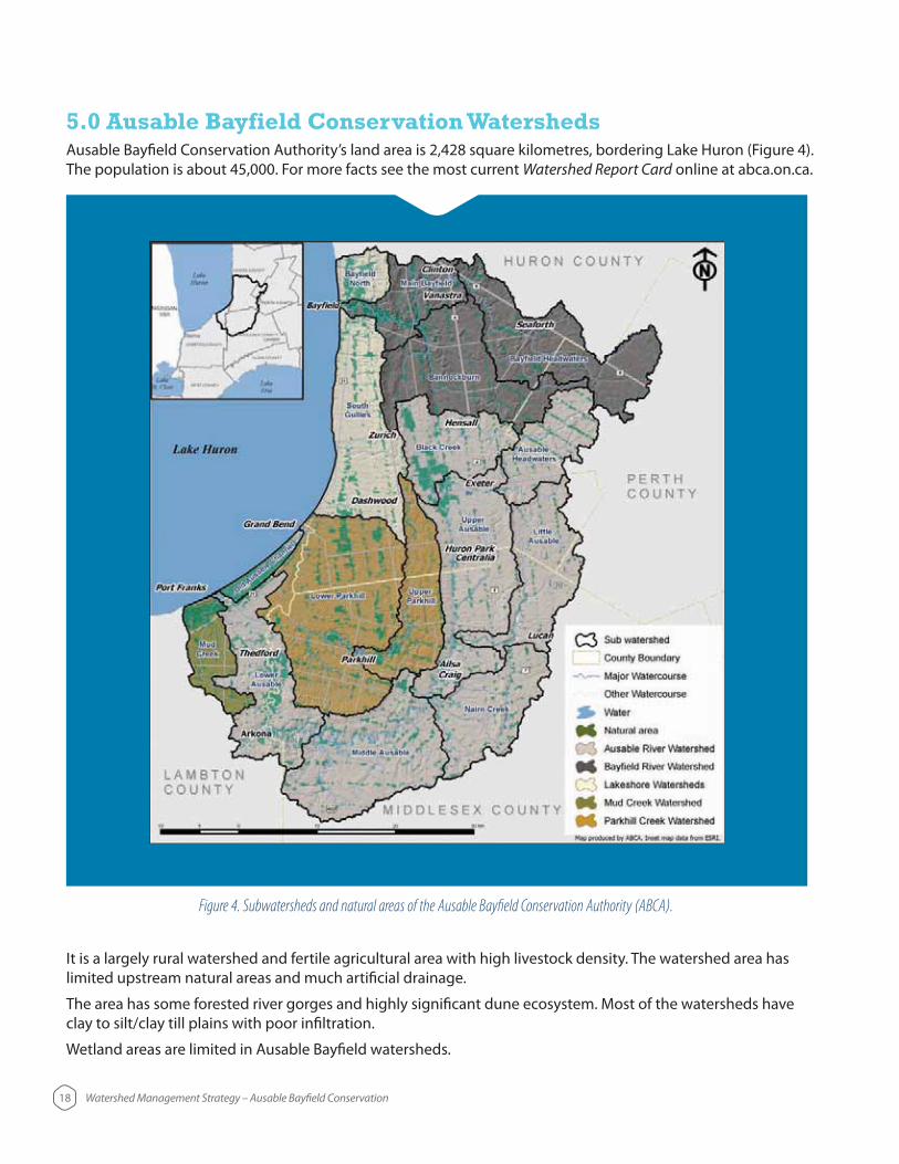
Figure 4. Subwatersheds and natural areas of the Ausable Bayfield Conservation Authority (ABCA).
18 Watershed Management Strategy – Ausable Bayfield Conservation
5.0 Ausable Bayfield Conservation Watersheds
The population is about 45,000. For more facts see the most current Watershed Report Card online at abca.on.ca.
It is a largely rural watershed and fertile agricultural area with high livestock density. The watershed area has limited upstream natural areas and much artificial drainage.
The area has some forested river gorges and highly significant dune ecosystem. Most of the watersheds have clay to silt/clay till plains with poor infiltration.
Wetland areas are limited in Ausable Bayfield watersheds.

5.1 Watershed Descriptions – Major WatershedsThe following outlines cover only major features. For detailed information about the watersheds, please see the most recent Ausable Bayfield Watershed Report Card.
5.1.1 Ausable River Watershed
The Ausable River starts near Staffa and flows lakeward until blocked by the Wyoming Moraine west of Exeter. There it turns southward along the moraine to Ailsa Craig where it manages to cut across the moraine in a wide arc westward to enter Lake Huron at Port Franks.
The Ausable River Watershed includes the Ausable River, Mud Creek, and Old Ausable Channel (Dunes) watersheds.
Hay Swamp is the only major remaining natural wetland filtration area in the Ausable River Watershed.
Runoff can collect bacteria and nutrients from nearby fields and properties.
The forest in the Ausable Gorge helps prevent erosion.
The fragile dune network of the Old Ausable Channel, beyond Highway 21, contains much of the last Old Savanna woodland in North America.
Creek and Nairn Creek.
its size in Canada. At least 26 species of freshwater mussels and 85 species of fish have been documented1. Some of these species are rare and have been assessed federally and provincially as Endangered, Threatened, or Special
The Ausable River Watershed does not have as much wildlife as it did prior to more intensive use of land. The
19 Watershed Management Strategy – Ausable Bayfield Conservation1 Fisheries and Oceans Canada. 2014. Action Plan for the Ausable River in Canada: An Ecosystem Approach [Draft]. Species at Risk Act Action Plan Series. Fisheries and Oceans Canada, Ottawa.
Ausable River Mud Creek Old Ausable Channel
20 Watershed Management Strategy – Ausable Bayfield Conservation
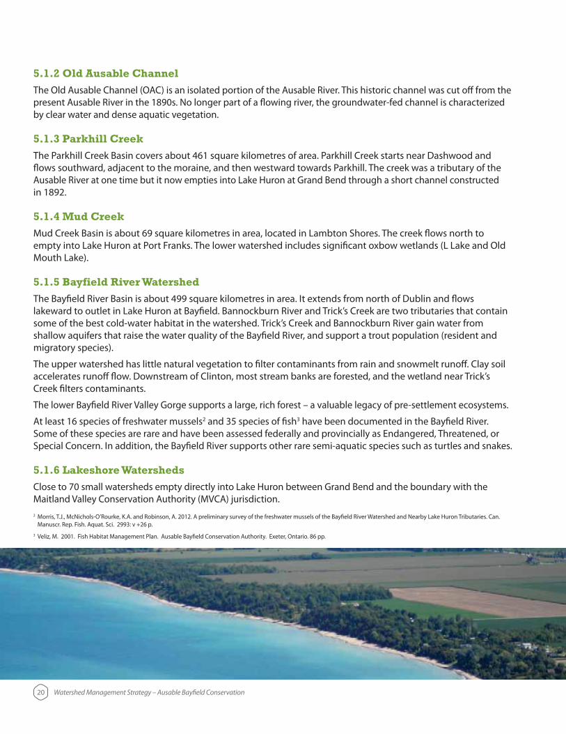
5.1.2 Old Ausable Channel
The Old Ausable Channel (OAC) is an isolated portion of the Ausable River. This historic channel was cut off from the
5.1.3 Parkhill Creek
flows southward, adjacent to the moraine, and then westward towards Parkhill. The creek was a tributary of the Ausable River at one time but it now empties into Lake Huron at Grand Bend through a short channel constructed in 1892.
5.1.4 Mud Creek
empty into Lake Huron at Port Franks. The lower watershed includes significant oxbow wetlands (L Lake and Old Mouth Lake).
5.1.5 Bayfield River Watershed
lakeward to outlet in Lake Huron at Bayfield. Bannockburn River and Trick’s Creek are two tributaries that contain
migratory species).
The upper watershed has little natural vegetation to filter contaminants from rain and snowmelt runoff. Clay soil accelerates runoff flow. Downstream of Clinton, most stream banks are forested, and the wetland near Trick’s Creek filters contaminants.
At least 16 species of freshwater mussels2 and 35 species of fish3 have been documented in the Bayfield River. Some of these species are rare and have been assessed federally and provincially as Endangered, Threatened, or
5.1.6 Lakeshore Watersheds
Close to 70 small watersheds empty directly into Lake Huron between Grand Bend and the boundary with the Maitland Valley Conservation Authority (MVCA) jurisdiction.2
3 Veliz, M. 2001. Fish Habitat Management Plan. Ausable Bayfield Conservation Authority. Exeter, Ontario. 86 pp.

21 Watershed Management Strategy – Ausable Bayfield Conservation
6.0 Changing Landscapes – Historic Context to Current Context to Future Path
flow on those who step into the same rivers.” Nothing stays the same except change.
Physical landscapes change. Economic, social, political, historical, technological, and scientific landscapes change as well.
A strategy, while helping to direct change, must also be flexible to adapt to the inevitable changes.
6.1 Where we have come from
6.1.1 Watershed Origins
Forest cover and natural area rapidly declined after 1850 as settlers cleared woodlands for agriculture and roads, using timber for fuel wood, fencing and building materials.
By the early 1900s, forest cover in the Ausable River watershed had shrunk to below 10 per cent of the area.4
Prior to European settlement, the Ausable River flowed north to Grand Bend where it turned abruptly (Grand
Franks. Issues of flooding prompted excavation of the Ausable River Cut between 1873 and 1875, to allow drainage and settlement of wet land in this area. The Cut permitted the Ausable River to flow directly to the lake, leaving only Parkhill Creek contributing to the original river bed of the lower portion of the Ausable River. In 1892, a second channel at Grand Bend diverted Parkhill Creek flow straight to the lake, severing it from the channel through the dunes.5 See maps on page 22.
4 Luinstra, B., Snell, E., Steele, R., Walker, M. and Veliz, M. 2008. Watershed Characterization. Ausable Bayfield Maitland Valley Source Protection Region. Exeter. 99 pp.
5 Richardson, A.H. 1949. Ausable Valley Conservation Report 1949. Ontario Department of Planning and Development, Conservation Branch. Toronto. 73 pp.

Figure 5. Ausable River flow path alterations in the late 1800s. (a) Original Ausable River path before 19th century alterations; (b) Cut 1: 1873 to 1875 cut diversion of Ausable River; (c) Cut 2: 1892 second cut diversion of Ausable River; (d) Configuration of the Ausable River, Parkhill Creek,
and Old Ausable Channel in the 20th century.
During the 20th century, there was a slight increase of forest area in some of the more marginal lands.
War II, farms gradually became more mechanized, larger and less diverse. Cattle number grew and feed lots replaced pastures. Pastured woodlots are now rare but left a legacy of impoverished ground flora in many forest areas.
22 Watershed Management Strategy – Ausable Bayfield Conservation
(a) (b)
(c) (d)

23 Watershed Management Strategy – Ausable Bayfield Conservation
Air photographs (Figure 6) and land use statistics (Figure 7) illustrate some of agriculture’s evolving landscape.
Figure 6. Air photos of the same location within the Ausable Bayfield Conservation Authority watershed in 1955 and 2010.
Figure 7. Percentage land use in the Ausable Watershed in 1949 and 2010.
permanent soil cover
a single field
and beans
Notes: Changes in field sizes and cropping typical in the watershed area shown has rolling topography
1955 2010
36.7% 50.3%
1.5%
11.5%
4.4% 72.7%
9.1%
13.8%
Cultivated Land
Pastured
Wooded
Non-agricultural
2010 Land Use in the Ausable Watershed1949 Land Use in the Ausable Watershed
24 Watershed Management Strategy – Ausable Bayfield Conservation
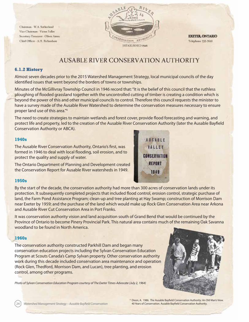
6.1.2 History
Almost seven decades prior to the 2015 Watershed Management Strategy, local municipal councils of the day identified issues that went beyond the borders of towns or townships.
Minutes of the McGillivray Township Council in 1946 record that: “It is the belief of this council that the ruthless ploughing of flooded grassland together with the uncontrolled cutting of timber is creating a condition which is
have a survey made of the Ausable River Watershed to determine the conservation measures necessary to ensure proper land use of this area.”6
The need to create strategies to maintain wetlands and forest cover, provide flood forecasting and warning, and protect life and property, led to the creation of the Ausable River Conservation Authority (later the Ausable Bayfield Conservation Authority or ABCA).
1940s
The Ausable River Conservation Authority, Ontario’s first, was formed in 1946 to deal with local flooding, soil erosion, and to
The Ontario Department of Planning and Development created the Conservation Report for Ausable River watersheds in 1949.
1950s
By the start of the decade, the conservation authority had more than 300 acres of conservation lands under its
near Exeter by 1959; and the purchase of the land which would make up Rock Glen Conservation Area near Arkona and Ausable River Cut Conservation Area in Port Franks.
Province of Ontario to become Pinery Provincial Park. This natural area contains much of the remaining Oak Savanna woodland to be found in North America.
1960s
The conservation authority constructed Parkhill Dam and began many conservation education projects including the Sylvan Conservation Education Program at Scouts Canada’s Camp Sylvan property. Other conservation authority work during this decade included conservation area maintenance and operation (Rock Glen, Thedford, Morrison Dam, and Lucan), tree planting, and erosion control, among other programs.
6 Dixon, A. 1986. The Ausable Bayfield Conservation Authority: An Old Man’s View. 40 Years of Conservation. Ausable Bayfield Conservation Authority.
Photo of Sylvan Conservation Education Program courtesy of The Exeter Times-Advocate (July 2, 1964)

1970s
The conservation authority continued to secure land to ensure the ecological benefits of
properties. The local agency also completed projects to control flooding and erosion.
The Bayfield River Watershed’s first report was created in 1971. The Bayfield Watershed was added to the local organization’s area in 1972 and the agency became the Ausable Bayfield Conservation Authority or ABCA.
The Ausable Bayfield Conservation Foundation was created in 1974.
In 1974 the Ausable Bayfield Conservation Authority started its Private Land Tree Planting Program, then called the Farm Tree Replacement Program.
The ABCA supplied trees for windbreaks. In 1978, 40,000 trees were planted on private land and 120,000 trees planted on conservation authority lands.
Bannockburn Wildlife Area (now Bannockburn Conservation Area) was opened to the public. The conservation authority added washrooms, gatehouse, picnic pavilion, and playground to Rock Glen Conservation Area.
A number of erosion control projects were completed in the Grand Bend area.
25 Watershed Management Strategy – Ausable Bayfield Conservation

26 Watershed Management Strategy – Ausable Bayfield Conservation
1980s
More erosion control projects were completed in Clinton, Port Franks, Grand Bend and Nairn.
Ausable Bayfield Conservation Authority employed its
professional engineer in 1982.
The new administration centre at Morrison Dam Conservation Area was constructed in 1983.
The Arkona Lions Museum and Information Centre was constructed in 1985 and officially opened in 1986.
New Conservation Area Master Plans and Ausable Bayfield Conservation Authority Watershed Plan were created. ABCA’s Fill, Construction and Alteration to Waterways Regulation (Ontario Regulation 544/84) was enacted. The conservation authority had a $1 million annual budget for the first time. The province was the major funding source.
Research also documented the distance that pollutants could travel in the watershed.
Work during those years included the Seaforth Flood Plain Management Study; a flood plain administrative study in Port Franks; a Dublin flood line delineation study; a Trick’s Creek trout habitat and stream rehabilitation project; a Zurich Drain flood plain delineation and stormwater management study; a farm waste management study; Thedford dune grass plantings; several erosion control projects; and more.
New foot bridges were built at Bannockburn Wildlife Area and Morrison Dam Conservation Area. Ausable Bayfield Conservation Authority operated seasonal group camping, hiking trails, fishing, and canoeing at Parkhill Conservation Area.
A new gatehouse and docking facilities were added to the Port Franks Conservation Area.
The private land tree planting program continued to grow reaching levels of 500,000 trees
landowners for trees removed during the development of the high voltage transmission line between the Bruce Nuclear Generating Station and south London.
In 1989, the conservation authority restructured the Board of Directors numbers from 35 to 16.
The 1980s saw increased use of personal computers for office tasks.
and telephone connections to monitor stream gauges.

1990s
Ausable Bayfield Conservation Authority leased the campground at Parkhill Conservation Area to the private sector.
Port Franks Conservation Area was sold to the Municipality of Lambton Shores.
Between 1992 and 1993, Ausable Bayfield Conservation Authority engaged the public in creation of a Conservation Strategy to guide the local agency into the future.
detailed 36 subwatersheds based on stream order and features. The document outlined the stresses and action plans for each of those areas.
The 1990s decade saw the start of Geographic Information Systems (GIS) technology use by conservation authorities with the Watershed Management Strategy being the first major use of GIS by Ausable Bayfield Conservation Authority.
In 1996, elimination of provincial representation on the board reduced the Board of Directors numbers from 16 to 14.
The Lake Huron Shoreline Management Plan was approved.
few years.
27 Watershed Management Strategy – Ausable Bayfield Conservation

28 Watershed Management Strategy – Ausable Bayfield Conservation
2000s
Many municipalities in Ontario were amalgamated in 2000. Following this restructuring, the number of directors on the ABCA Board of Directors declined from 14 to 9.
In 2001, the Board of Directors approved a new logo for the conservation authority: building blocks portraying water, plant life, and sunlight – foundation elements for survival. The organization was publicly branded as ‘Ausable Bayfield Conservation.’ The motto, or tag line, ‘Building Better Environmental Conscience’ was adopted.
The conservation authority also launched its first website in 2002. The Ausable River Recovery Team was established in 2002.
Ausable Bayfield Conservation celebrated the planting of its 5 millionth tree on May 5, 2002. Tree planting levels through the decade ranged mostly between 50,000 and 70,000 trees
expanded in 2003.
The Regulation of Development, Interference with Wetlands and Alterations to Shorelines and Watercourses (Ontario Regulation 147/06, under Ontario Regulation 97/04) replaced the Ausable Bayfield Conservation Authority’s Fill, Construction and Alteration to Waterways Regulation which had been the governing set of regulations for roughly 20 years. The conservation authority’s revised regulation was part of the Red Tape Reduction Act and is designed to protect public safety from natural hazards through the issuance of permits for works close to lakes, rivers, streams, wetlands, or sinkholes.
Ausable Bayfield Conservation undertook sinkhole studies in the former townships of Hibbert and Tuckersmith between 2004 and 2006. With the creation of the Ontario Clean Water Act, 2006, Ausable Bayfield Conservation Authority assumed new responsibilities as lead source protection authority and the drinking water source protection planning project was launched.
Ausable Bayfield Conservation released its first Watershed Report Card in 2006. Staff supported local watershed plan preparation and implementation in local watershed communities including the Old Ausable Channel, Bayfield North, and Main Bayfield watersheds.
The first decade of the 21st century saw increased use of Internet, the
email, and provincial and federal programs to support GIS initiatives.
The CA Maps (camaps.ca) mapping project was created in partnership with the Ontario Ministry of Natural Resources (now Ontario Ministry of Natural Resources and Forestry) and five other conservation authorities. The internal Intranet Mapping Site (IMS) was also
Partnerships between the Province of Ontario, municipalities, conservation authorities, and the
year intervals. Financial incentives that had been cut in the 1990s were once again offered for
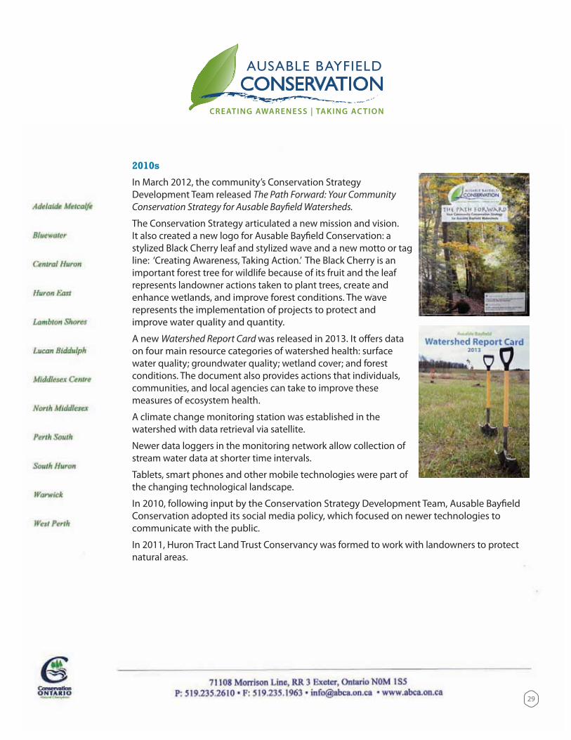
2010s
In March 2012, the community’s Conservation Strategy Development Team released The Path Forward: Your Community Conservation Strategy for Ausable Bayfield Watersheds.
The Conservation Strategy articulated a new mission and vision. It also created a new logo for Ausable Bayfield Conservation: a stylized Black Cherry leaf and stylized wave and a new motto or tag line: ‘Creating Awareness, Taking Action.’ The Black Cherry is an important forest tree for wildlife because of its fruit and the leaf represents landowner actions taken to plant trees, create and enhance wetlands, and improve forest conditions. The wave represents the implementation of projects to protect and
A new Watershed Report Card was released in 2013. It offers data on four main resource categories of watershed health: surface
conditions. The document also provides actions that individuals, communities, and local agencies can take to improve these measures of ecosystem health.
A climate change monitoring station was established in the watershed with data retrieval via satellite.
Newer data loggers in the monitoring network allow collection of stream water data at shorter time intervals.
Tablets, smart phones and other mobile technologies were part of the changing technological landscape.
In 2010, following input by the Conservation Strategy Development Team, Ausable Bayfield Conservation adopted its social media policy, which focused on newer technologies to communicate with the public.
In 2011, Huron Tract Land Trust Conservancy was formed to work with landowners to protect natural areas.
29
6.2 Where we are today?
6.2.1 The Social and Economic Climate
The Ausable Bayfield Conservation Authority has a long history of successfully working alongside groups with varied interests. The ABCA shall continue to partner with multiple community groups and levels of government. As the conservation authority moves forward with these partnerships, key issues and opportunities are emerging which will need to be considered. They include:
tourism and permanent residential development.
fluctuations in lake levels, impacts to ecosystem health, invasive species.
spending has pushed for tighter budgets and higher returns on investment.
6.2.2 Watershed Challenges
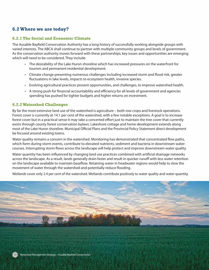
By far the most extensive land use of the watershed is agriculture – both row crops and livestock operations. Forest cover is currently at 14.1 per cent of the watershed, with a few notable exceptions. A goal is to increase forest cover but in a practical sense it may take a concerted effort just to maintain the tree cover that currently exists through county forest conservation bylaws. Lakeshore cottage and home development extends along most of the Lake Huron shoreline. Municipal Official Plans and the Provincial Policy Statement direct development be focused around existing towns.
which form during storm events, contribute to elevated nutrients, sediment and bacteria in downstream water
on the landscape available to maintain baseflow. Retaining water in headwater regions would help to slow the movement of water through the watershed and potentially reduce flooding.
30 Watershed Management Strategy – Ausable Bayfield Conservation

31
Living Things:
High biodiversity in parts of the watershed – Pinery/Lower Ausable area and Lower Bayfield/Trick’s Creek.
Ausable Bayfield Watershed Report Card document said forest conditionsremained limited in the watershed with most receiving a D grade.
according to the 2013 Watershed Report Card.
habitat conditions at a rate beyond that of many communities and species to adapt.
e.g., Emerald Ash Borer; Phragmites australis – European Common Reed) and harming
Water:
Watershed Report Card.
homes by the water, increase the number and size of septic systems along the lake as well as
wells in Zurich, Brucefield, Seaforth, Clinton; and other municipal wells north of Bayfield. Other residents have Lake Huron as their drinking source (raw lake water drawn from the intake at Port Blake, near Grand Bend, is treated at the Lake Huron Primary Water Supply System and then piped to consumers inside and outside of the watershed.)
on streams.
Soil:
the need for more farm land, has led to more intensive use of local land.
management of nutrients.
sediment, bacteria, and chemicals out of creeks, rivers, and the lake.
through artificial tile drainage networks.
to degradation.
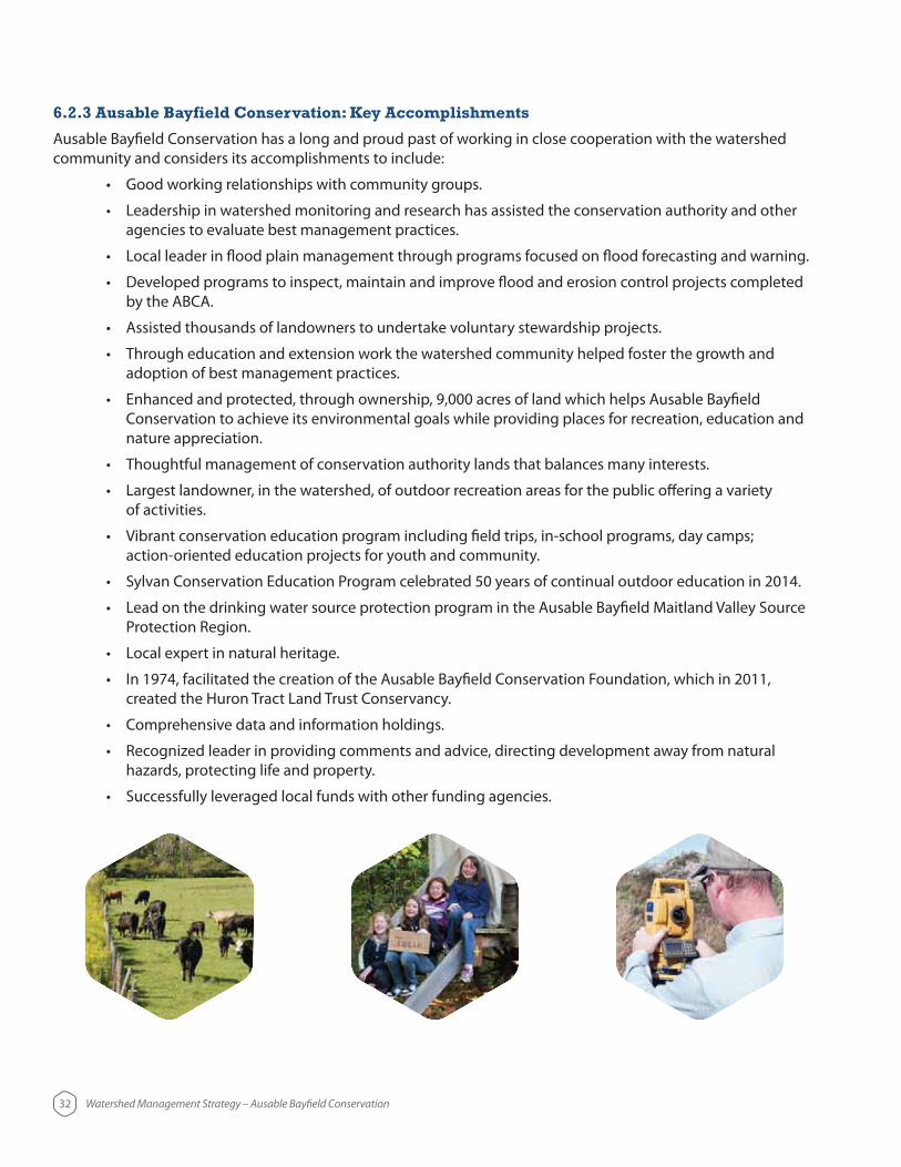
6.2.3 Ausable Bayfield Conservation: Key Accomplishments
Ausable Bayfield Conservation has a long and proud past of working in close cooperation with the watershed community and considers its accomplishments to include:
agencies to evaluate best management practices.
by the ABCA.
adoption of best management practices.
Conservation to achieve its environmental goals while providing places for recreation, education and nature appreciation.
of activities.
Protection Region.
created the Huron Tract Land Trust Conservancy.
hazards, protecting life and property.
32 Watershed Management Strategy – Ausable Bayfield Conservation

33 Watershed Management Strategy – Ausable Bayfield Conservation
7.0 BibliographyDixon, A. 1986. The Ausable Bayfield Conservation Authority: An Old Man’s View. 40 Years of Conservation. Ausable Bayfield Conservation Authority.
Fisheries and Oceans Canada. 2014. Action Plan for the Ausable River in Canada: An Ecosystem Approach [Draft]. Species at Risk Act Action Plan Series. Fisheries and Oceans Canada, Ottawa.
Luinstra, B., Snell, E., Steele, R., Walker, M. and Veliz, M. 2008. Watershed Characterization. Ausable Bayfield Maitland Valley Source Protection Region. Exeter. 99 pp.
Richardson, A.H. 1949. Ausable Valley Conservation Report 1949. Ontario Department of Planning and Development, Conservation Branch. Toronto. 73 pp.
Veliz, M. 2001. Fish Habitat Management Plan. Ausable Bayfield Conservation Authority. Exeter, Ontario. 86 pp.
8.0 Appendices
8.1 Appendix 1 – Chart of Documents
Figure 8. Some of the major documents produced by Ausable Bayfield Conservation Authority (ABCA) and guiding the work of the ABCA. Please see 11 X 17 pull-out copy of this chart, attached with this document.