Embed Size (px)
Citation preview

Walking andBiking in
Shelby County______
A project ofLeadership Shelby County
Class of 2004

TABLE OF CONTENTS
Map of Shelby County . . . . . . . . . . . . . . . . . . . . . . . . . . . . . . 2-3
Introduction . . . . . . . . . . . . . . . . . . . . . . . . . . . . . . . . . . . . . . . 5
What we have: walking and biking in Shelby County
North Shelby (Hoover to Pelham, Inverness to Greystone) . . . . . 9
Alabaster, Helena . . . . . . . . . . . . . . . . . . . . . . . . . . . . . . . . . . 13
Chelsea, Westover . . . . . . . . . . . . . . . . . . . . . . . . . . . . . . . . . . 14
East Shelby (Leeds, Vincent, Sterrett, Harpersville) . . . . . . . . . . 15
South Shelby (Montevallo, Calera, Columbiana, Wilsonville) . . . . 17
What’s coming: walk/bike projects in discussion . . . . . . . 21
What we need: proposals for future projects
General recommendations . . . . . . . . . . . . . . . . . . . . . . . . . . . . 23
Recommendations for specific projects . . . . . . . . . . . . . . . . . . . 27
Acknowledgements . . . . . . . . . . . . . . . . . . . . . . . . . . . . . . . . . 35
~1~

SHELBY COUNTY
A. Oak Mt. State Park
B. Spain Park walk/biketrail
C. Inverness walk/biketrail
D. Highway 119,Heardmont area
E. Highway 119 bike lane- west
F. Highway 119 bike lane- east
G. Lake Purdy walk/bikelane
H. Alabaster -Montevallo bike trail
I. Helena, Alabastersidewalks
J. Cahaba Riverwalk/bike trail
K. Highway 11 bikecorridor
L. Highway 47 bike route
M. Highway 55 bike route
N. Dunavant ValleyGreenway
O. Dunavant, Double OakMountain link
P. Highway 25 bike route
Q. Historic Columbianawalking trail
R. Montevallo toAmerican Village bikeroute
S. Shelby Iron Works toBeeswax Creek Park
T. Heart of Dixie RailroadGreenway
PROPOSALS FOR IMPROVEMENTS

~3~
1. Heardmont Park2. Oak Mt. State Park3. Cahaba Lily Nature Trail4. Cahaba River Wildlife
Management Area5. Chelsea Recreational Park6. Mt Laurel7. Highway 258. Highway 559. Orr Park10. Univ. of Montevallo11. George Roy Park12. Downtown Columbiana13. Beeswax Creek Park
BEST WALKING/BIKING

INTRODUCTION:
Shelby County is a great place. We know this,because we – the authors of this report – are Shelby
County residents. Shelby County’s extraordinary growthand rising property values are testament to the county’swonderful array of resources, from its quality schools,housing stock and health care, to its business
opportunities, restaurants, entertainment venues and recreationalfacilities.
Ironically, Shelby County’s popularity and growth are also itsgreatest challenges. As more people seek the lifestyle that ShelbyCounty affords, county leaders must find ways to protect andimprove on the attractive features that have drawn people here inthe first place.
Many Shelby County residents will agree that the mostpressing problems the county faces are traffic and suburbansprawl. Like many suburban counties, Shelby’s growth has beenfueled by the automobile, and many of its communities weredesigned with the automobile in mind. As a result, there are veryfew places in Shelby County where residents can walk or bikesafely to work, to school or to the grocery store. This problem –that we must use our cars to get almost everywhere – onlycompounds the county’s traffic mess.
Unfortunately, traffic-clogged roads are more than anannoyance, they are a serious health issue. While air quality in theBirmingham metro area has improved in recent decades, ShelbyCounty continues to suffer from a summer ozone problem that putsvulnerable children and the elderly at risk. What’s more, thesedentary lifestyle, of which driving is a part, is a major contributorto our health problems. Poor diet and physical inactivity have ledto a disturbing increase in obesity, which is now second only tosmoking as the nation’s top preventable killer.
As Shelby County residents, we want to improve the healthand quality of life of our communities. We want our neighborhoodsto become more connected, and more family friendly. And webelieve one way to do this is to get us out of our cars.
We aren’t the only ones who believe in making our home abetter place for walking and bicycling. Across the county, and thisregion, there is growing enthusiasm about creating walkable
~5~

communities. A recent series ofworkshops on this issue,sponsored by the RegionalPlanning Commission of GreaterBirmingham, drew hundreds ofinterested citizens, developers,professional planners andgovernment officials. The recentlycompleted Shelby CountyComprehensive Plan speaks atlength about this issue, includingthe need for tougher zoning rulesthat require new residential andcommercial developments toincorporate sidewalks.Meanwhile, communities areembracing the idea of building greenways, such as the successfulproject recently completed in Homewood along Shades Creek. A similarproject along Five Mile Creek in Jefferson County is moving beyond theplanning stages, while discussions are ongoing about a project alongthe Cahaba River in Helena.
As our contribution to this burgeoning movement, we present thisguide to walking and biking in Shelby County. In this pamphlet we’vetried to compile an accurate inventory of walking and biking facilities inthe county. But we’ve also gone further. In the concluding section youwill find proposals on how to make Shelby County a more invitingplace for walkers and bicyclists. In addition, we make specificrecommendations on where to construct new walking and bikingroutes.
In creating this pamphlet, our Leadership Shelby project teamtraveled across the county, documenting existing places to walk andride and identifying practical locations for new facilities. We consultedwith local planning experts, state and municipal officials, andneighborhood leaders. And we held our own discussions in order torefine our recommendations.
This guidebook does not discuss specific funding methods for newwalking and biking trails. Suffice it to say that money is available froma variety of sources, including government agencies and privatefoundations. In many cases, a community interested in building awalk/bike trail can receive matching dollars that are triple or quadruple
~6~

its financial commitment to the project. It is also well-documented thatwalk/bike paths can help boost property values and, subsequently, taxrevenues. In other words, these projects are a terrific value for ourcommunities, let alone their recreational and health benefits.
We hope this document, in a small way, helps advance efforts tomake Shelby County more attractive for walkers and bicyclists. And wehope it encourages county leaders to speed up efforts to build morewalk/bike paths – projects we believe will not only benefit those wholive here, but can help the county boost tourism, draw new businessesand improve the quality of residential and commercial developments.
Thanks to everyone who provided input, advice and encouragementduring this project. Special thanks to designer Laura Borgman, toAlabama Power, to Alagasco, and to the Shelby County HistoricalSociety which provided the resources for printing this publication andfor producing the accompanying video. Thanks also to Shelby BaptistMedical Center, which provided meeting space for the project team, toBirmingham Color Graphics, to Means Advertising, ABC 33/40,Impressive Promotions, and to the Shelby County Economic &Industrial Authority. Finally, we want to thank Leadership ShelbyCounty. Through this wonderful program, we’ve learned so much moreabout our community, and had a chance to put forth our own ideas formaking Shelby County an even better place to live, work and raise ourfamilies.
Jody BrewerEleanor Davis
Susan McBrayerCindy Nicholson
Michael Reid Bobby Joe Seales
Michael SznajdermanRhonda Toler
May 12, 2004
~7~

WHAT WE HAVE:WALKING/BIKING INSHELBY COUNTY:
All over Shelby County, you’ll find people who love to walk or ride bicycles. For several generations,
Oak Mountain State Park has been the county’s Meccafor walkers and bikers. And in recent years Shelby County hasmade progress in building more public facilities for walking andbiking. Nevertheless, the lack of sidewalks and bicycle lanes inmany areas of the county makes it very difficult for residents towalk or ride safely from their neighborhood to another subdivision,or from their neighborhood to the supermarket, the library or thelocal school.
Here is a listing of existing places in the county, divided bygeographic location, where residents and visitors can walk or bikewith relative safety. We’ve given the best places a number; youcan refer to the map on pages 2-3 for their location:
North Shelby (Hoover to Pelham,Inverness to Greystone)
The most densely populated part of the county, North Shelby
has only a few locations designed specifically for safe walking or
biking. In Hoover, preferred walking, hiking and biking facilities
are located solely in the Jefferson County portion of the city. Those
near the Shelby line include Moss Rock Preserve, the walking
path in Aldridge Gardens and the walking path around Howard
Lake on Municipal Drive. There are many subdivisions across
North Shelby that provide relatively quiet streets for walking or
cycling, but few have sidewalks. The two standout locations for
walking, biking or hiking in North Shelby are Heardmont Park
and Oak Mountain State Park.
Heardmont ParkLocated on Highway 119 in North Shelby County, Heardmont
Park features a paved walking trail as well as a quarter-milerunning track used by Oak Mountain High School. The track isopen to the public when not in use by school teams. The paved
~9~
1

walking trail provides two routes,marked by yellow and blue arrowspainted on the path. Each route is about1 mile. Many of the markers are faded,but there are plans to repaint them. TheHeardmont Park trail, while not veryscenic, is very kid- and senior-friendly. Itpasses by ball fields, tennis courts and avery popular playground. It’s a greatplace for a casual stroll while your youngchildren ride along on bicycles ortricycles.
For more information, contact countypark representatives at (205) 991-2015.
Oak Mountain State ParkOak Mountain State Park is located on the ridges and valleys of Double
Oak Mountain, in the city of Pelham. There are two entrances to the 9,940-acre park, one off Highway 119 (east of Heardmont Park) and the mainentrance on State Park Road in Pelham. There is a $2 per person entrancecharge. The park contains more than a dozen walking and biking trailstotaling 47 miles. The trails are of varying length and difficulty. For moreinformation call (205) 620-2520. Here are some of the key attractions:
• Treetop Nature Trail - After entering the park, follow the mainroad, John Findlay Drive, for about 2 miles. Turn right on the firstpaved road, Terrace Drive, and travel about 1 mile. Treetop NatureTrail is on your left with parking on the right. The 1/3 mileboardwalk winds through trees offering views of wild birds living inlarge, naturally furnished cages. The birds, now healthy thoughphysically impaired, were brought to the Wildlife RehabilitationCenter because of previous injury and would not be able to survivein the wild. The boardwalk connects to Eagle Trail, which continuesup the hill to the Wildlife Rehabilitation Center. The boardwalkportion of this trail is easy walking and wheelchair accessible. Theremainder of the hike does have some steep, rough parts and mightbe considered a moderate rather than easy walk. Total distance isabout 1 mile one way. There is parking at the Wildlife Center andthe trail could be done in reverse, avoiding a steep climb. There issomething on this trail for most all ages and abilities.
~10~
2

• BMX Track – A new BMX track is now open, replacing the well-worn track used by thousands of children and teens for years. Thenew track is nestled among trees and is chock full of steep dirt hills,twists and turns. The track is periodically the site of BMX races.Great for kids and adults. Helmets are required; gloves and pads arestrongly recommended.
• Bike and Hike Loop - This is a loop that includes about five and a halfmiles of hiking and eight and a half miles of biking. This route allowsyou to make a 14 mile loopcombining the Yellow Trail with theRed Trail. It is moderate level forhiking and difficult for biking. This isa trail for mountain bikes, not streetbikes. Be sure to have a bike helmet.After entering the park, follow JohnFindlay Drive for 2 miles and turnright on Terrace drive. Drive up thehill past the site of the old BMX trackand park in the lot on the corner ofTerrace Drive and Day Use Road.There are bike racks there. Be sure tochain your bike securely beforedriving back to John Findlay Drive.Turn Right on John Findlay andfollow it for about three and a half miles to the North Trail Head whereyou will start your hike. From the North Trail Head walk about 100 feetand turn right at a sign that says “Maggie’s Glen 1.3 miles”. This willput you on the Yellow Trail, which you will follow until you reach yourbike. This is a pretty hike most anytime of year and will lead you overrolling hills of wooded terrain. You will skirt the north edge of TranquilityLake till you come to the dam built by Civilian Conservation Corps in thelate 1930s. You will see old cabins as well as the cabins in use today.The Yellow Trail intersects several other trails so be sure to follow theyellow blaze on trees and it will lead you back to the bike rack whereyou can start the bike ride up the mountain and back to the North TrailHead. After retrieving your bike start out going the wrong way on theone way road that circles the picnic area. The beginning of the Red Trailis immediately on your left. This is a single file narrow track that windsbeside and back and forth across Peavine Falls Road. It is a long, steep
~11~

climb that eventually takes you to the northern most part of Double OakRidge and onto a wide dirt road. This is still the Red Trail and it is, asthey say, all down hill from here. The ride is now along a wide trail thatgoes through pretty forested areas. There are streams that cross the trailin concrete culverts. This is the easier part of the bike ride, and you cango rather fast down to your car at the North Trail Head. You are sharingthis part of the trail with hikers, so be aware.
• The Blue Trail - This trail stretches from the North Trail Head toPeavine Falls and is a little over 8 miles long. Most of the hikewould be considered moderate level, but there are a couple ofdifficult steep climbs. Starting at the North Trail Head, the Blue Trailwill be on the left soon afar you begin your hike. You immediatelybegin a steep climb through a hardwood forest. The trail will levelsomewhat with up and down segments where you continue to gainelevation. It eventually turns into a meandering walk on or near theridge top with junctures that lead to other trails, if you should wantto loop back to your starting point. This is an interesting hike withsome good views and great boulders for a picnic spot.
More detailed Oak Mountain trail information, and a printable map,is available at www.bump.org, the Web site of the Birmingham UrbanMountain Pedalers. BUMP also hosts bike races periodically at the park.
Other places to walk, North Shelby: • Walking paths around lakes in Meadowbrook Corporate Park, off
U.S. 280 between Meadowbrook Road and Highway 119. • A new sidewalk stretches from the new Publix shopping center on
U.S. 280 along Doug Baker Boulevard to Highway 119.Unfortunately, the sidewalk does not connect directly to anyresidential neighborhoods.
• Highland Lakes - There are 6 miles of walking trails connectingcommunity parks in this private, gated development off U.S. 280.
• Brook Highland subdivision - Some neighborhoods off BrookHighland Drive have sidewalks.
• Pelham City Park Complex - Entrance at U.S. 31 and from BeardenRoad. Walking track - approximately 1/2 mile.
• Fun Go Holler – Enter from County Road 52 behind the tenniscenter and from County Road 35 at the County Services Building.Walking track - approximately 1/4 mile.
~12~

• Mallard Pointe Neighborhood Park - Entrance from County Road 72.Walking track - approximately 1/4 mile.
Alabaster, HelenaThis is one of the fastest growing areas of Shelby County, with a
need for more safe places to walk, bike and hike. Like the North
Shelby area, there are only limited facilities available at this time:
Alabaster
Buck Creek ParkLocated on Sixth Avenue S.W., this park has an inviting playground
and picnic areas as well as a 1/4 mile walking track. The track is onflat terrain and is well lighted for night walking. No pets or bikes areallowed on the track.
Abby Wooley ParkLocated in the Simmsville Community off of Highway 11, this park
has a playground area and a 1/4 mile walking track. The track is onflat terrain.
Other walking facilities in Alabaster include a 1/4 mile track onHighway 12 at Fire Station No. 2. There is also a 1/4 mile track atMeadow View Elementary School, 2800 Smokey Road.
Helena
Cahaba Lily Park Nature TrailThe park can be accessed from County Road
52 in Helena near Helena Intermediate School.This is a one and a half mile easy walk on awide gravel path. The trail is lit at intervals for anight walk. It is not on the Cahaba River anddoes not have Cahaba Lilies in the park.
Cahaba River WildlifeManagement Area
Follow County Road 261 to the junction ofC.R. 261, 52, 91 and 17 in Helena. C.R. 261turns into C.R. 91 at this point, so you shouldcontinue straight at that point for 2.6 miles to
~13~
3
4

where the pavement ends and gravel begins. Soon you will see a signfor the Cahaba River Wildlife Management Area. The road splits andyou should go left. The dirt road dead-ends in about 8 miles at acondemned bridge.
Logging and mining still go on in this area, so on weekdays youcould be sharing your recreation area with other people’s workplace.This area is hunted from September through April of each year.
This trail is a little over 5 miles. It includes a variety of forest types,including mixed hardwoods and pine, clear-cut land and secondarygrowth. There’s also an abundance of wildflowers. The trail will takeyou to the Cahaba River. It is a moderately difficult hike with littlechange in elevation.
More detailed trail information is available for the Cahaba RiverWildlife Management Area at www.bump.org, the Web site of theBirmingham Urban Mountain Pedalers.
Joe Tucker ParkThis park behind Helena City Hall has a 1/2 mile path around a
small lake. There is also a playground. The park is the site of severalevents throughout the year.
Old Town HelenaA small commercial district in Old Town Helena contains sidewalks,
as does the new, “smart growth” residential development behind thedistrict. Two small parks, one within the residential development, andone across Highway 17, where the town amphitheatre is located, offeraccess to Buck Creek, but very limited walking.
Chelsea, WestoverThe Chelsea area has witnessed explosive
growth during the past decade, and is expected
to continue to grow at a fast pace over the next
20 years. Very few housing developments in
Chelsea contain sidewalks, and many of the
city’s roads are two lanes with limited shoulders.
Although the traffic isn’t as congested as in some
areas of Shelby County, biking and walking along
the community’s winding roadways can pose a
hazard. In Chelsea there is clearly a need for
more safe locations to walk and ride. One place
~14~

near Chelsea which
offers a safe and
interesting place to
walk or bicycle is the
Town of Mt Laurel.
The town is a model
for the rest of the
county for what a
“walkable
community” truly means.
Chelsea Recreational ParkThis recently opened city-county facility provides a beautiful setting
for walking/biking. A path through open and wooded areas includesflat and hilly terrain. The course is well lighted for evening strolls. Thepark also has a playground, a pavilion for family gatherings andrestrooms. The park, off Highway 39, is easily accessible from U.S 280and Highway 47.
Mt LaurelThis relatively new, but growing community, is built with walkers
and bicycles in mind. Sidewalks run throughout the development, fromresidential areas to the expanding commercial district and eventually tothe new Mt Laurel Elementary School. You can park your car here andtake a pleasant walk or bike ride through town.
Highway 41This roadway from the Town of Mt Laurel east toward Highway 25
offers a pleasant rolling roadway for more experienced bicyclists. Infact, a short stretch of the road east of Mt Laurel already has a pavedshoulder that is ideal for biking. Traffic diminishes east of Mt Laurel,although bicyclists must stay alert. As the road approaches Highway25, the number of blind curves increases. A long-term plan calls for agreenway along this route.
East Shelby (Leeds, Vincent, Sterrett,Harpersville)
This area contains some of the county’s most scenic landscapes,
and some of its best open-road biking. The Twin Pines Resort and
Conference Center near Sterrett offers a superior walking trail, but it is
~15~
5
6

open only to guests of the facility. The
public is invited to visit the historic
Saunders Family Covered Bridge at
Twin Pines.
Highway 25A favorite route for area weekend
bikers is to take Highway 25 southfrom Leeds through the DunavantValley and across Dunavant Mountaininto Vandiver, Sterrett, past the oldvillage of Calcis and on to Vincent.The route passes a historical markerand offers broad views alongDunavant Mountain. The route is steep in spots, but automobile trafficis relatively light. Be sure to stop at Miller’s Cheese Store on Highway467, run by the family that used to have a dairy in this area.
In Vincent, Highway 25 and U.S. 231 are joined for a stretch,which means more traffic. Bikers can continue to Harpersville, site ofMorgan Creek Winery and Baker’s Farm, where a fall festival takesplace each October.
From Harpersville, bikers can continue south on 25 towardWilsonville. The road travels near the Coosa River and past someaging, historic homes. Here the terrain is relatively flat, but bikers muststay alert for speeding traffic.
Highway 55This road from Sterrett to Highway 25, west of Wilsonville, offers
superior open-road bicycling. The road winds past farms and homesand is relatively flat its entire length. You can also continue onHighway 25 into Columbiana.
HarpersvilleJ.W. Donahoo Municipal Park has a small black-topped walking
track (not quite 1\4 mile), along with tennis courts, a picnic area,children play area and softball fields. Turn right off Highway 79 Southat the sign for Coosa Valley Academy. Turn onto Park Street.
Also near Harpersvile is The Meadows, a privately owned golfcourse on Plantation Drive, off U.S. 280. The course is open to walkersafter 3 p.m. For more information, call (205) 672-7529.
~16~
7
8

VincentVincent Municipal Park is located on Highway 25/U.S. 231. The
park features a 1/4 mile paved track, children’s play area, tennis courts,softball fields and picnic area.
South Shelby (Montevallo, Calera,Columbiana, Wilsonville)
South Shelby County also is developing rapidly, but in many areas still
maintains its scenic and rural character. For bikers, specific stretches of
south county roadways, such as Highway 119 near American Village and
Highway 42 near the Shelby Iron Works offer pleasant views of the
countryside. Here’s the best of walking and biking in South Shelby:
Montevallo
Orr ParkOrr Park/Tingle Woods is a beautiful 40 acre park near the
downtown area of Montevallo with a stream, small waterfall and aquiet atmosphere. It is the home of Tingle Woods, which featuresdelightful carvings in the cedars by Tim Tingle, a local artist. There are33 “Tingles,” mostof which can beseen from thewalk/bike trail. Thetrail isapproximately oneand a half mileswith a pavedsurface. The terrainis slightly hilly. Thetrail circles thechildren’s play areaand the softballfields. Great for children and seniors.
Stephens ParkStephens Park is located on Highway 10 just outside of Montevallo.
The paved walk/bike trail circles the softball fields. The 3/4 mile trail ison flat terrain.
~17~
9

University ofMontevallo
There areseveral walkingtours on thecampus thatindividuals maytake independently.Brochures withdirections andpoints of interestmay be obtainedfrom the LymanHouse at the cornerof Oak and Middlestreets. The firstthree tours areknown as the “RedBrick Tours.”
• “Great Caesar’s Ghost” – A 1/2 mile walk highlights “Hauntingsand things that go bump in the night.”
• “Through These Portals” – A 1.8 mile walk highlighting thecolumns and structural ornaments of the University.
• “A Walk Through Time” – This 2 mile walk highlights the historicstructures of the university.
Guide to Campus Trees Thirty trees have been designated by black markers with the
common and scientific names of each tree. Tour directions are availableat the Lyman House. A frequent assignment for local schoolchildren isto collect a leaf from each tree.
City/University Historic Walking TourThis tour is approximately 3 miles and includes historic sites on the
campus as well as historic sites in town and in Orr Park. A guided touris offered regularly, normally on Saturdays. Or you can take a self-guided tour. For more information, call (205) 665-1519.
~18~
10

Montevallo bike races, ridesThere are two annual bike races that begin and end in Montevallo.
The Shelby County Stage Race is timed, with distances ranging from 30 to 75 miles and cash prizes for the winners. The BirminghamBicycle Club’sAnnual CenturyRide featuresdistances from 20 to 200 miles.There are alsocasual ridesalmost everySaturday, startingin town. For more information,call UniversityCycle at (205) 665-0302.
The American VillageThis impressive civic education center is becoming one of the
region’s most popular attractions. Stroll the Constitution Green amongreplicas of historical colonial structures, including Washington Hall,patterned after Mount Vernon. American Village is also home to the
Pettus Randall MiniatureMuseum of AmericanHistory, a collection ofdioramas that bring tolife significant events inAmerican history.Admission is $7.50 foradults, $7 for seniorsand $6 for students.During special events,admission is usually $5 per person. For moreinformation and hours,call (205) 665-3535.
~19~

Calera
George Roy ParkThis recently constructed facility is on Second Avenue, 1 mile west of
U.S. 31. It features a 1/2 mile walk/bike trail that circles the park. The pavedtrail is on flat terrain. The park also has a playground and picnic area.
Oliver ParkOliver Park is located on Highway 25. There is a 1/4 mile track
around the football field for walking or running. Adjacent to the footballfield is a large picnic and play area.
ColumbianaThe city of Columbiana is finishing up a redevelopment project that
includes new sidewalks in the city center. Visitors can now stroll alongMain Street to the old Shelby County Courthouse, circa 1854, which nowhouses the Shelby County Museum and Archives. A short walk from thecourthouse is the Karl C. Harrison Museum of George Washington, whichhouses one of the largest private collections of George and MarthaWashington memorabilia outside of Mount Vernon. For more informationabout the Shelby County Museum, call (205) 669-3912. For moreinformation about the Karl C. Harrison Museum, call (205) 669-8767.
A 1/4 mile walking track is located at Elvin Hill Elementary School,201 Washington St. It is available for community use after school.
Wilsonville
Beeswax Creek ParkAdjacent to Lay Lake on Highway 145, this county park
encompasses nearly 100 acres and features a walking trail, boat launchfacilities and picnic pavilions.
A 1/8 mile walking track is located beside Wilsonville ElementarySchool. Bikes are not allowed.
~20~
11
12
13

WHAT’S COMING:WALK/BIKE PROJECTSIN DISCUSSION:
Municipal and county officials are beginning torecognize the need to expand walking and biking
opportunities in the county. So are some developers,who realize that making their projects friendly to pedestrians alsomake them more attractive to homebuyers, shoppers and retailers.An encouraging sign can be found in some of the projects that willbe coming to fruition in the next few years. And yet, as thisrelatively short list indicates, much more can be done. Here is thelineup of Shelby County walk/bike projects that are either underdiscussion or have funding already secured for their construction:
North Shelby (Hoover to Pelham,Inverness to Greystone)
The City of Hoover plans to construct sidewalks alongValleydale Road from Caldwell Mill Road to U.S. 280. Rights-of-way for the project are expected to be purchased in 2004 withconstruction in 2005. The city should be commended for thisambitious project.
Sidewalks also are expected to be constructed by the City ofHoover from the back entrance of Greystone to Highway 119, eastof U.S. 280. Construction is expected to take place in the 2005-2006 time frame.
The City of Hoover also plans to build a 3,100-foot walkingtrail from the Hoover Metropolitan Stadium to the Cahaba River.
Alabaster, Helena The City of Alabaster plans to construct a sports complex on
Highway 119 that will include a track. The track will circle foursports fields and will accommodate walkers and bikers. Thecomplex will be well lit and built on flat terrain.
The City of Helena has secured at least partial funding toconstruct a walking and biking trail, starting at Old Town Helenaand stretching ultimately to the Cahaba River along Buck Creek.Construction of the first phase is expected to start this year, with a
~21~

second phase constructed in 2005 and a third phase in 2006. The trailwould ultimately extend nearly 5 miles.
The greenway will be a multi-use trail for bikes and pedestrians. Alarge part of the trail will be along the old Tocoa rail line with a 10-12foot wide asphalt path, occasional seating, some bridges and signs. Thesection along Buck Creek will run from Amphitheater Park in Old Townto the Civil War era coke ovens near the Cahaba River, connecting tothe new sports complex. A second section will branch off and run pastHighway 52 to Beaver Creek, ending near the Helena IntermediateSchool. City leaders deserve praise for this project.
Also under discussion is a proposal in the Helena Comprehensive Planthat calls for the creation of pedestrian-friendly “Village Centers” in severalHelena locations. These Village Centers would be connected via sidewalksto nearby residential neighborhoods. The Village Market Center would belocated at County Roads 58 and 95. The Riverwoods Village Center wouldbe located on County Road 52 across from Cahaba Lily Park, HelenaIntermediate School and the Old Cahaba subdivision. Although theseproposals are in the Comprehensive Plan, there is no specific timetable forconstruction, nor are they guaranteed to ever be built.
East Shelby (Leeds, Vincent, Sterrett,Harpersville)
The community of Vandiver has applied for a grant to construct apark and walking track next to the fire station on Highway 43 North.
South Shelby (Montevallo, Calera,Columbiana, Wilsonville)
Montevallo park link – There is an ad hoccommittee in place to locate and plan a trailsystem that would ultimately connectStephens and Orr parks to University ofMontevallo lake. The proposed route followsthe creek system in town. The interim routepresently follows city streets. The committeeis working to secure the rights-of-waybetween the two parks.
The City of Columbiana is in the processof constructing a sports complex on McDowRoad that will include a walk/bike trail. Thetrail will circle the sports fields.
~22~

WHAT WE NEED:PROPOSALS FORFUTURE PROJECTS
As noted several times in this guidebook, growing population, traffic problems and suburban sprawl
are all challenges facing Shelby County. The newShelby County Comprehensive Plan speaks at length of the need toplan better for growth while creating more walkable, bikablecommunities in the county. Here are some specificrecommendations for public planners, private developers and thepublic to consider. These recommendations and proposals wereselected by our team because they would provide real, tangiblebenefits to Shelby residents; because they are realistic; and becausewe believe there would be opportunities to secure matchinggovernment dollars to fund them.
General Recommendations:
1. Create the “Shelby Trails”program, a nonprofit,volunteer, countywideadvisory panel thatwould encouragewalking and bikingand recommendadditions and improvementsto walk/bike facilities.Responsibilities of Shelby Trailscould include: publishing walk/bikeguides; working with the county and the state to install signageon walk/bike routes; presenting awards for residential andcommercial developments that are walker- and biker-friendly;and partnering with walking and biking clubs to hold periodicevents that promote walking and biking in the county. TheShelby Trails organization should seek input from residents,public officials, walking and biking enthusiast organizationsand bicycle shops in crafting its mission and its
~23~
recommendations. The Shelby County Commission could providelimited seed money for the group; the organization could also seekpublic and corporate contributions.
2. Work closely with the Regional Planning Commission of GreaterBirmingham to ensure Shelby County is well-represented in theregional walking and biking plan and considered for bothgovernment and private funding for walk/bike trails.
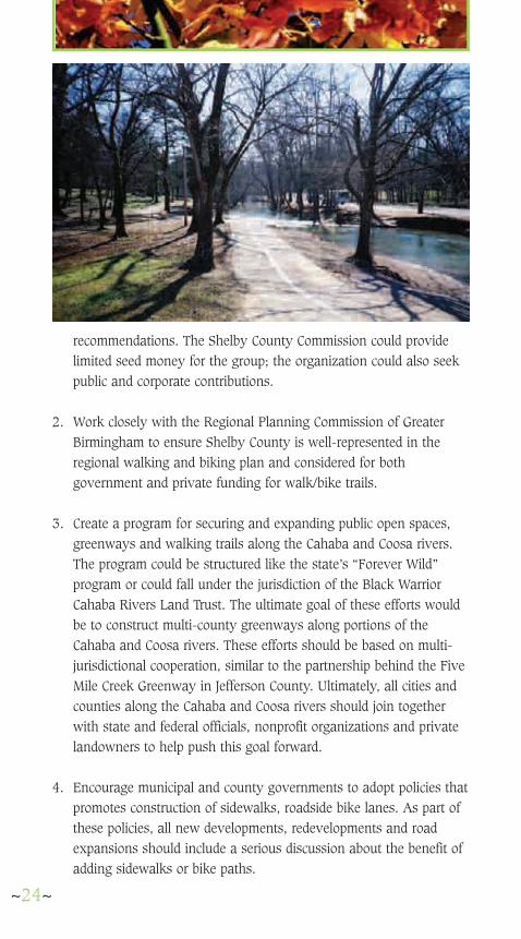
3. Create a program for securing and expanding public open spaces,greenways and walking trails along the Cahaba and Coosa rivers.The program could be structured like the state’s “Forever Wild”program or could fall under the jurisdiction of the Black WarriorCahaba Rivers Land Trust. The ultimate goal of these efforts wouldbe to construct multi-county greenways along portions of theCahaba and Coosa rivers. These efforts should be based on multi-jurisdictional cooperation, similar to the partnership behind the FiveMile Creek Greenway in Jefferson County. Ultimately, all cities andcounties along the Cahaba and Coosa rivers should join togetherwith state and federal officials, nonprofit organizations and privatelandowners to help push this goal forward.
4. Encourage municipal and county governments to adopt policies thatpromotes construction of sidewalks, roadside bike lanes. As part ofthese policies, all new developments, redevelopments and roadexpansions should include a serious discussion about the benefit ofadding sidewalks or bike paths.
~24~

5. Encourage the Shelby County Board of Education to build sidewalksat all new school construction projects. Encourage the school board,the Shelby County Commission and local municipalities to find waysto make existing schools more pedestrian friendly, includingconstructing sidewalks or paths that make it easier for students wholive close to the schools to walk or ride their bicycles from home.Work with Shelby and Hoover schools to promote the healthbenefits of walking and biking.
6. As with the Heardmont Park walk/bike trail project, encouragecounty officials to identify other walk/bike projects that would beeligible for funding through the Alabama Department of Economicand Community Affairs (ADECA). Submit at least one countywalk/bike project a year to ADECA for funding.
7. Encourage the state Department of Transportation (DOT) to considerthe benefits and feasibility of including sidewalks and/or bike laneswith all road improvement projects. Urge DOT to work with otherstate agencies, municipal and county governments to secure federalmatching grants for such projects.
~25~

SPECIFIC PROPOSALSFOR WALKING/BIKINGIMPROVEMENTS: See map on pages 2-3 for locations.
North Shelby (Hoover to Pelham,Inverness to Greystone):
Oak Mountain State Park Park officials should extend the bike lanes on the main park
road all the way to the fishing center, completing a roadway bikepath that would run the length of the park. State and countyofficials should consider the possibility of adding a bike lane alongthe entrance road to the park from Highway 119. Some day, ifpossible, a bike lane should be built along Highway 119 andHighway 11 and connected to the Oak Mountain bike lane system.
Spain Park walk/bike trail Originally part of the design plans for the Spain Park High
School and Recreation Complex property, the future of thisproposal is unclear at the present time. The City of Hoover alreadyintends to construct sidewalks along Valleydale Road past SpainPark. The city should also plan and secure funding for a walkingand biking trail in the open space surrounding the old pond southof the high school. The trail could connect to the Valleydalesidewalk, providing pedestrian and bike access to communitiesalong Valleydale Road. At this time, there are no sidewalksrunning through the Spain Park complex. Many area residents arealready walking or jogging along the shoulder of the Spain Parkroad system, posing a safety problem for the runners and formotorists. In the interim the roadways within the complex shouldbe marked as part of the Shelby Trails system.
Inverness walk/bike trail There has been ongoing discussion among members of the
Inverness Master Homeowners Association about constructing awalk/bike trail along Inverness Parkway. With plans already in
~27~
A
B
C

place to build sidewalks along east Valleydale Road, this projectrepresents a natural extension of that project and should beencouraged. The Inverness walk/bike trail would provide a multi-mile,safe walking and riding route from the Caldwell Mill Road commercialdistrict down Valleydale Road, through Inverness and on to theInverness entrance at U.S. 280. It would also provide pedestrian andbicyclist access from several North Shelby neighborhoods to theInverness corporate park. In addition, it would provide biking andwalking access from the Spain Park recreation complex to the City ofHoover’s pocket park off Inverness Parkway.
Walk/bike paths on Highway 119 linkingHeardmont Park, the North Shelby Library and OakMountain Elementary and Middle Schools
Planners should find a way to provide a pedestrian and bicyclistpath linking these three public complexes, which exist within a quarter-mile of each other. There have been discussions in the past about apath behind Oak Mountain Elementary and Middle Schools to the park.If this is not feasible, a sidewalk along Highway 119 is recommended.Crossing 119 to the library does pose a hazard. If a sidewalk isconstructed here, county officials should consider a pedestrian crossingwith a stoplight and a button that pedestrians can use to make the lightchange. An alternative would be a pedestrian overpass. Federal fundingshould be available for this project.
Shoulder bike lane on Highway 119 from Pelhamto U.S. 280
Despite resistance from residents in Indian Springs, and from statehighway officials, this idea should be given serious consideration. Plans
~28~
D
E

are already developed for three-laning Highway 119 from the BrokenBow neighborhood to U.S. 280. A shoulder bike lane should beseriously discussed as part of this project. Matching money would berequired from Shelby County. Although Indian Springs residents haveessentially rejected sidewalks and bike paths through their town as partof their proposed comprehensive plan, that decision is counter-intuitivefrom their stated goal of maintaining the rural and open-space characterof the village. When Highway 119 is widened through Indian Village toCaldwell Mill Road, a shoulder bike lane should be given very seriousconsideration. The bike lane, if ever built, should be extended toHeardmont Park, and up Caldwell Mill Road to Oak MountainIntermediate and High Schools. Eventually, a sidewalk should beextended from the schools to the Caldwell Mill commercial district andValleydale Road.
Shoulder bike lane on Highway 119 from U.S. 280to Leeds
Highway 119 east of U.S. 280 past Lake Purdy and on to Leeds inJefferson County would also be a strong candidate for a shoulder bikelane at the time the highway is improved and widened. The road,actually a historic stagecoach route between Ashville and Montevallo,already offers a relatively wide utility right-of-way along the ShelbyCounty portions east of U.S. 280. In the Jefferson County portion,however, there is very little shoulder available at this time for bikeriders, although they are seen regularly along this route. State highwayofficials, along with Shelby and Jeffersoncounties, should work together on exploringthis project.
Lake Purdy walk/bike trail The Birmingham Water Works owns
substantial property surrounding LakePurdy. Already some recreationalopportunities are available on the easternside of Lake Purdy in the way of fishingand boating. The Birmingham Water Worksshould give serious consideration todeveloping a greenway with walk/bikepaths on the west side of Lake Purdy. Thisis especially important as land along
~29~
F
G

Highway 119 east of U.S. 280 and along the Grants Mill Road corridorface development pressures.
Helena, Alabaster
Alabaster to Montevallo bike trail Consider construction of a shoulder bike trail to connect Alabaster
and Montevallo. The trail, possibly following Highways 17 and 22 andportions of 119, would connect both communities to the AmericanVillage and would encourage more visitation to that site. A first stepwould be to mark the route as part of the Shelby Trails, although safetyissues for bikers along this route would have to be considered.
Helena, Alabaster sidewalks Consider construction of sidewalks to connect schools to residential
areas. Specifically, consider construction of sidewalks to connectThompson Intermediate, Middle and High Schools. There is a shortdistance among all three of these schools.
Cahaba River walk/bike trail As noted in our general recommendations, continue efforts to
extend greenways with walk/bike trails along the Cahaba River.Explore ways to tie together the Buck Creek Greenway and Tocoa rails-to-trails projects with the Cahaba River Wildlife Management Area.Officials in Shelby and Bibb counties should work with state and federalofficials to secure additional lands along the Cahaba River, ultimatelycreating a multicounty, regional greenway along this beautifulwaterway.
Chelsea, Westover
Highway 11 bike corridor, new Oak Mountain StatePark entrance
Explore thepossibility of creatinga shoulder bike lanein conjunction withthe widening ofHighway 11 from oldU.S. 280 to U.S. 31.
~30~
H
I
J
K

A first step could be to install Shelby Trails signage along Highway 11.Work with the state Department of Conservation and Natural Resourcesto create a new, passive, walk/bike path entrance into Oak MountainState Park from Highway 11 west of Chelsea.
Highway 47 bike route This roadway would be a strong candidate for signage as part
of the Shelby Trails system, providing a bike route from Chelsea toColumbiana. An alternative would be to use Highways 47, 39 and 69to connect the two cities. In the long run, consider building a shoulderbike path.
Highway 55 bike route This highway offers a relatively safe route from eastern sections of
the county to Columbiana. This road should be marked as part of theShelby Trails system, with additional markers from the intersection ofHighway 25 into Columbiana.
Dunavant Valley Greenway This proposal calls for an 11.4 mile walk/bike path along Highway
41, from U.S. 280 to Highway 25. The greenway would create a linearpark similar to Jemison Trail in Mountain Brook, and provide pedestrianlinks among the valley’s communities while preserving the scenicquality of the area. The proposed greenway consists of three phases.Phase I would begin at U.S. 280 at the Soccer Blast facility andcontinue to Mt Laurel. Phase II would extend the Greenway from MtLaurel to Lake Wehapa, including pocket parks along the way. Phase IIIwould continue the trail from Lake Wehapa to Highway 25. Alongmany sections of Highway 41, walkways can be constructed withminimal site work. Existing roadside setbacks by developers of ShoalCreek, Greystone and Mt Laurel have helped to maintain a park-like
~31~
L
M
N

setting along Dunavant Valley Road.However, there are portions of the roadwhere the right-of-way is inadequate. Thishas prompted the county to suggest acorridor study and traffic control plan forthe area. The idea is to keep traffic flowing,without traffic lights, and to incorporatepedestrian areas. A first step for thisproposal would be to mark sections alongthe main route as part of the Shelby Trailssystem, provided safety concerns areaddressed.
Dunavant Valley, Double OakMountain link
This is a long-term proposal, but as an extension of the Dunavant ValleyGreenway, consider connecting the greenway to Double Oak Mountainand Oak Mountain State Park via a walk/bike tunnel under U.S. 280 atThe Narrows development. With the addition of recommendedwalk/bike paths from the Fishing Center at Oak Mountain to 119 andHeardmont Park, and along Highway 11, bicyclists would ultimately beable to travel safely from the Meadowbrook/Heardmont areas of NorthShelby through the state park to Chelsea, Mt Laurel, Vandiver and evento Pelham.
East Shelby (Leeds, Vincent, Harpersville)
Highway 25 bike route Mark Highway 25 from Leeds through the Dunavant Valley and on
to Vincent as part of the Shelby Trails system. Consider the long-termpossibility of creating shoulder bike lanes in sections where traffic orblind curves would pose a hazard to cyclists.
South Shelby (Montevallo, Calera,Columbiana, Wilsonville)
Historic Columbiana walking trail Develop a historical walking trail, with accompanying brochure,
that would connect the Shelby County Museum and Archives, in the
~32~
O
P
Q

old county courthouse, with other sites of historic significance,including the Karl C. Harrrison Museum of George Washington.
Montevallo to American Village Mark Highway 119 from
American Village todowntown Montevallo as partof the Shelby Trails system.Consider the possibility ofultimately building a shoulderbike path along Highway 119,linking American Village todowntown Montevallo. Thisroute could ultimately link tothe proposed trail connectingStephens and Orr parks.
Bike link, Shelby IronWorks to BeeswaxCreek Park
Mark as part of the ShelbyTrails system Highways 145,47 and 42 between the park and the historic Shelby Iron Works. Themarkings could later be extended along these roads to Wilsonville andColumbiana and, finally, to Calera along the proposed Heart of DixieRailroad Greenway.
Heart of Dixie Railroad Greenway Construct a walk/bike path on the right-of-way adjacent to the
Heart of Dixie Railroad, from Calera to Shelby Iron Works. The right-of-way is already secured and is wide enough to add a path. Plans arealready in place to extend the rail line to Shelby Iron Works. Awalk/bike path would give visitors the option of walking or biking oneway and then riding back on the railroad. This project would alsoprovide additional riders for the railroad, helping sustain thiscommunity asset. We believe the railroad’s concerns about safety canbe adequately addressed in the greenway’s design.
~33~
R
S
T

Acknowledgements:
ABC 33/40
Alabama Power
Alagasco
BUMP (Birmingham Urban Mountain Pedalers)
Birmingham Color Graphics
Impressive Promotions
Leadership Shelby County
Means Advertising
Regional Planning Commission of GreaterBirmingham
Shelby Baptist Medical Center
Shelby Country Economic and Industrial Authority
Shelby County Historical Society
~35~