Embed Size (px)
Citation preview

32
Walk This WaySouth BankLondon Eye to the Imperial War Museum
Architecture + History at your feet

3
South Bank is an area of incredible history, architecture, culture and regeneration. Originally isolated and defined by the Thames, for centuries this riverside location developed in a very different way from the affluent north bank. A marshy expanse of slum housing and country estates; a rural haven of green fields and pleasure gardens; a dynamic hub of industry and manufacturing; a nucleus of nineteenth-century theatre and entertainment venues; a host to the largest railway terminus in the country; and a byword for post-war cultural restoration. South Bank is now home to great national centres for art and culture, a vibrant and growing community and some of London’s finest achievements in architecture, such as the National Theatre and London Eye. Throughout its history, South Bank has endured fire, flood, slum clearance, railway demolition, devastating bombing, and the ebb and flow of investment and industry. Consequently, the area is peppered with unique examples of architecture and hidden mementoes from the past that are waiting to be explored. Walk This Way will guide you through this journey of discovery, into the heart and the history of South Bank.
Your walking guide to South BankAt a comfortable pace, the Walk This Way South Bank route will take around 1.5 hours although it is recommended that you allow more time to stop and sightsee at various points along the route (map pages 16–17).
Acknowledgements The Walk This Way – South Bank guide was first published in 2003 by South Bank Employers’ Group, a partnership of the major organisations in South Bank, Waterloo and Blackfriars, with a 25-year track record of regeneration projects that have helped transform a bleak and hostile area into one of the most exciting destinations in the UK.
This new, expanded edition has been made possible thanks to funding from South Bank BID (Business Improvement District), which was set up in 2014 by South Bank Employers’ Group. South Bank BID is dedicated to providing a strong voice for local businesses and additional resources to make South Bank a safer, cleaner and more vibrant destination, for the benefit of visitors, employees, and residents.
For further information about Walk This Way or South Bank, please visit southbanklondon.com
South Bank Employers’ Group /South Bank BID Elizabeth House, 39 York Road, London SE1 7NQ T: 020 7202 6900 E: [email protected]
Project Manager: Claudio Giambrone, South Bank Marketing Group/ South Bank BID Photography: Unless otherwise specified, all photographs © Peter Durant/peterdurant.com Graphic design: Micheline Mannion/michelinemannion.co.uk Map design: ML Design/mldesign.co.uk Text & Research: Lindsey & Peter Berthoud/Huw Morgan Route Planning: Peter Berthoud/peterberthoud.co.uk Oral History: Rosalind Haber
© 2016 4th Edition, August 2016

5
IndustryIt was in the eighteenth century that industry also began to develop in the area: some needed the Marsh’s fresh water supply (for brewing or cloth bleaching); others exploited the cheap land and river access to move or store their bulk goods (limestone, scrap iron and wood). Improved access from the new Westminster and Blackfriars bridges, combined with the need for large amounts of industrial labour led to a population explosion in the once-quiet village as thousands flocked to the South Bank to work on the coal wharves, timber yards, potteries, dye works, lime kilns, blacking factories and printing houses. The growth of industry was one of the key components in Lambeth’s transformation from a rural haven into a centre of industry, the other was the railway.
The RailwayFrom its arrival in 1848 the Railway has dominated the area, dividing it from the river with a bastion of brickwork and isolating the waterfront. With powers of compulsory purchase, the railway company was free to demolish anything to increase its railway lines and terminus (one such casualty in 1900 was the insalubrious ‘Whore-terloo’
4
South Bank Influences
The MarshThe Anglo-Saxon origin of Lambeth, ‘Lambhythe’, implies that a muddy harbour or marsh had been present from the earliest days of London. As the city grew, the Marsh, a prime location but difficult to develop, remained largely untouched, a green oasis of agriculture and public gardens where urbanites could find refreshment in a rural surrounding.
TheatreIn the eighteenth and nineteenth centuries, the area of Lambeth urbanised and the entertainment world burgeoned. Away from the rigid theatrical duopoly of the north bank, the cheap land of Lambeth enabled individual impresarios to build and develop their own performance venues, creating all-year, all-weather venues. Taverns converted to music halls and fringe ‘Penny Gaffs’ were ubiquitous. Without artistic restrictions or censorship (unlike the North bank), the theatres of the Marsh were quite permissive and, before modern film and radio put the theatres out of business, many were closed down for being ‘disorderly houses’.
Hoare’s Map of London c.1810

7
neighbourhood). The vast number of steam trains running from the Station (as many as 700 a day by the end of the nineteenth century) polluted the local air, already choked by two centuries of industry, with thick smog.
The Festival of BritainIronically, it was the Second World War, which had done so much damage to the area, that was responsible for much of its regeneration. Intending to create a ‘tonic’ for the war-scarred nation, the South Bank was chosen as the site for the Festival of Britain. The bombed-out Riverside was cleared and built upon, becoming the site, in 1951, of a national celebration. The Royal Festival Hall remained as a permanent legacy, to be followed in subsequent decades by other arts venues, such as the Hayward Gallery and Royal National Theatre, adding a new chapter to the history of the South Bank.
CommunityBomb damage, commercial development and the decline of traditional industries took their toll on the post-war population of South Bank and by the 1970’s, the residential population had fallen from 50,000 to just 4,000. A proposed skyscraper development in 1977 threatened to seal the river off from the interior completely, prompting the protests of the Coin Street Community Action Group. By 1984 this group proved successful and formed a not-for-profit company to redevelop and regenerate the area. Since then, derelict buildings have been demolished, new parks and riverside walkways have been opened up and affordable housing has been built, reversing the population decline, as well as introducing workshops, public art and festivals to the area.
6
© Il
lustr
ated
Lond
on N
ews L
td/M
ary E
vans

9
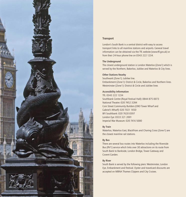
Westminster Bridge Thomas Page 1862 For centuries before the construction of Westminster Bridge, the monopoly of Thames crossings was held by the London ferrymen. Battling against these powerful established interests, the campaigners for a new bridge were finally permitted to raise funds for the bridge through a public lottery, a fact which only increased the derision from those who opposed the ‘Bridge of Fools’. In 1739, the first foundations of the new bridge were laid, beginning an eleven-year project beset by European warfare, ferrymen sabotage, the death of the bridge’s sponsor, a small earthquake and the Thames freezing over. The bridge was further consolidated in 1853 on a seven-arch structure of wrought-iron, decorated with Gothic detailing by Charles Barry, architect of Parliament. Setting a precedent, soon followed by other bridges, Westminster was the bridge that opened up the South Bank. Towards the Southern end of Westminster Bridge, you will notice the imposing Park Plaza Westminster Bridge, designed by BUJ architects and Uri Blumenthal architects. The hotel was built on the site of the County Hall Island Block, an annex of London County Hall (see below), that was demolished in 2006.
The South Bank Lion W F Woodington 1837
Westminster BridgeThis thirteen-ton Lion is one of the last-known products to be made of Coade Stone, a hard-wearing material produced by a mother-and-daughter factory on the South Bank. Founded in 1769, Eleanor Coade’s stone ornaments were a major feature on the buildings of Georgian London. The Lion was commissioned for the South Bank’s Red Lion Brewery where, painted red, it stood on the roof for over a century. When the bomb-damaged Brewery was demolished in 1951 to build the Royal Festival Hall, the Lion was spared at the behest of George VI and moved to its present location in 1966.
Walk down steps and follow the Riverside Walkway noting
2
8
1
2
1

3
11
responsibility for their management passed to a local charity, the Jubilee Gardens Trust. The Queen inaugurated the new Jubilee Gardens in October 2012. At the same time a new public toilet was opened, nicknamed the Jubiloo. Its boat-like structure recalls a Roman galley that was excavated close by in 1911. The roof of the structure gathers rainwater to help flush the toilets.
Continue along Riverside Walkway going underneath
Golden Jubilee Bridges Lifschutz Davidson Sandilands 2002
Sandwiching the Hungerford railway bridge are the twin Golden Jubilee footbridges, completed in 2002, the Queen’s Golden Jubilee year. The original Hungerford Bridge was built by Isambard Kingdom Brunel as a suspension footbridge in 1845. Hungerford Bridge (named after the market on the north bank) was bought in 1859 to extend a railway line to the new Charing Cross station. Much of the original bridge was recycled and used in Bristol’s Clifton Bridge. The Golden Jubilee footbridges are the busiest in London, and between them their 300m long decks carry an estimated 8.5 million pedestrians a year.
Continue along Riverside walkway and on your right is
Southbank Centre complex Royal Festival Hall Robert Matthew 1951
Built on the site of the Red Lion Brewery, Royal Festival Hall is the only permanent legacy of the 1951 Festival of Britain. Designed in a Modernist style with glazed screens and Portland Stone facings, with a green roof of weather-exposed copper, it is the first post-war building to receive a Grade 1 listing. Inside, the auditorium is built high on the upper floors, insulated from the sound of the nearby railway, while beneath are placed galleries, restaurants, shops, cafés and performance areas. In 1965 a redevelopment scheme was completed that now defines much of the outward
10
County Hall Ralph Knott 1911–1933
Home to the capital’s local government the London County Council (LCC) and later its successor the Greater London Council (GLC) until the GLC’s abolition in 1986, the Main Building is a six-storey, symmetrical construction, faced with Portland Stone, in the ‘Edwardian baroque’ style. It took twenty-five years to complete, with North, South and Island Blocks added thereafter (the last in 1974). County Hall now houses attractions including The London Dungeon, Shrek’s Adventure, SEA LIFE London Aquarium and two hotels, the five-star Marriott County Hall and Premier Inn County Hall.
Coca-Cola London Eye Marks Barfield 2000
Designed as a huge, latticed bicycle wheel structure, the London Eye is cantilevered and uses enormous ‘A’ frame legs supported by giant foundations and is tied back by more cables anchored underneath Jubilee Gardens. Built in less than 16 months, the London Eye is an international structure, involving the teamwork of various European engineers, co-ordinated by British designers Marks Barfield Architects. The sections of this 2,100-tonne construction were transported down the Thames and raised a massive 135 metres high, and the structure breaks many technology, design and size records. From inside the glass observation capsules, views of up to 25 miles over the city and beyond can be seen.
Jubilee Gardens & Jubiloo West 8 & Mark Power 2012
During the Festival of Britain in 1951 this area was home to the Dome of Discovery and Skylon, the 300ft cigar-shaped vertical monument that is remembered nearby with a flagpole and plaque laid into the ground. After the Festival these temporary structures were removed and the land was used as a car park until 1977, when the area was transformed into a park for the Queen’s Silver Jubilee. In 2011–12, for the Queen’s Diamond Jubilee, the gardens were completely re-landscaped with new flower beds, pathways and seating, 97 trees and a new playground, and
54 6 7
6
7
4
5
3
Sara
h By
rne

13
stays in this unique micro-hotel. It is currently in hibernation while Queen Elizabeth Hall is refurbished. Continue along the Riverside Walkway underneath
Waterloo Bridge Giles Gilbert 1937–45
Designed as the Strand Bridge, the granite construction was bought by the government, re-named ‘Waterloo Bridge’ after the recent victory and opened in 1817. Falling into neglect, by 1923 the bridge was deemed beyond repair and closed permanently. Work eventually began on a replacement in 1939, immediately delayed by the outbreak of War, though work continued throughout, mostly with female labour, hence its nickname, the Ladies’ Bridge. The new bridge was even built with demolition chambers, in case of enemy invasion, though it was nearly demolished in a more direct fashion, being damaged by enemy action several times. Labour shortage and V2 rockets notwithstanding, the current construction of reinforced concrete was opened in 1945.
Turn right and note on your right
BFI Southbank / National Film Theatre (NFT) LCC 1956–1958
The NFT owes it origins to the 1951 Festival of Britain and the ‘Télekinema’, a purpose-built cinema designed to celebrate British film-making and technology. Never intended to be a permanent exhibition, the Télekinema’s popularity led to the National Film Theatre opening in 1957, tucked underneath Waterloo Bridge’s Southern arches. Initially containing only one cinema, the Theatre was given a second in 1970 and became one of the world’s leading cinematheques, organising the London Film Festival. In 2007 the NFT was relaunched as BFI Southbank in much enlarged premises. Today there are three cinemas and studio space as well as the Mediatheque, a world-class television and film archive, spanning everything from early documentaries to modern soap operas and comedy
12
appearance: the Portland Stone exterior was re-cased; the river frontage was pushed thirty yards forward, and a new riverside entrance was created. In 2007 a major renovation project upgraded the facilities, qualities, and capabilities of the Concert Hall, as well as restoring many of the original features of the ‘People’s Place’.
Queen Elizabeth Hall & Purcell Room LCC/GLC 1963–8
These concert halls were built alongside Royal Festival Hall in 1967 to host classical, jazz and avant-garde music and dance performances. Both venues are closed for refurbishment, along with Hayward Gallery to the rear, until 2018.
SkatespaceThe area beneath the Queen Elizabeth Hall foyer is known as the birthplace of British skateboarding and is the oldest recognised, and still existing, skateboarding space in the world. The Skatespace is popular with skaters, BMXers, graffiti artists, photographers, and spectators.
Queen Elizabeth Hall Roof GardenCreated in 2011 as part of Southbank Centre’s celebrations of the Festival of Britain’s 60th anniversary, this garden atop Queen Elizabeth Hall is a welcome green retreat during the spring and summer months with its wildflowers, fruit trees, allotment boxes, scented flowers, woodland garden, and cafe. The garden was built and is maintained by Grounded EcoTherapy – a group of volunteers who have experienced homelessness, mental health and addiction problems.
A Room for London David Kohn Architects & Fiona Banner 2012
This boat-like structure perched on the roof of the building is a one-bedroom installation with unbeatable views of the River Thames. Throughout 2012, artists of all disciplines were invited to use it as their studio and reflect on London’s place in the world during its Olympic year. Up until the end of 2015 members of the public were able to book one-night
119 12 13
12
13
8
9
10
11
Indi
a Ro
per-E
vans

15
land awaiting permanent development and recycled building materials. The Green Room won New London Architecture’s Best Temporary Building award in 2015.
Rambert Allies & Morrison 2013
A purpose-built home for the Rambert contemporary dance company. It contains five dance studios along with treatment and training rooms, offices and the company’s archive. Opened officially by the Queen in 2014 in the same year it won a RIBA national award as one of the best new buildings of the year. Built on land owned by Coin Street Community Builders, Rambert is charged a peppercorn rent of one pair of ballet shoes a year, in exchange for a contemporary dance engagement programme for the local community.
Upper Ground From the Middle Ages, artificial banks and causeways were constructed in Lambeth and Southwark to allow crossings of the flooded lowlands and to hold back the Thames. The most important of these causeways were Bankside, The Broad Wall and The Narrow Wall. Once the river had been successfully pushed back, the causeways became roads, and The Narrow Wall remained, changing its name to Upper Ground Street in 1787.
Turn left along Upper Ground and note on your left
London Television Centre C H Elsom and Partners 1970–72
Originally built for London Weekend Television, this complex is now home to ITV’s headquarters, production base and main studios. Shows such as Good Morning Britain, Lorraine, This Morning, Loose Women and Ant & Dec’s Saturday Night Takeaway are all filmed here.
Princes Wharf, 58 Upper Ground ITV also occupy the former riverside warehouse, Princes Wharf, and this mock Tudor building known as ‘The Younger’s
16 19
14
programmes. It is free to log on to a viewing station and watch any of the films and programmes in the archive.
On your left
National Theatre Denys Lasdun & Partners 1961–76
In 1976, after more than a century of planning and fourteen years in the Old Vic, the National Theatre company moved into the three theatres of their new building: Lyttelton, Olivier, and Cottesloe (now renamed Dorfman). Lasdun’s Brutalist design of reinforced concrete and horizontal lines, with a skyline augmented by the massive Olivier and Lyttelton fly-towers, has become a landmark of the South Bank.
NT Future Haworth Tompkins 2015
In 2015 the major development programme NT Future was completed. On the riverfront, this saw the redevelopment and renaming of the Cottesloe as the new Dorfman Theatre, as well as a remodelled foyer, new café and bars, a new bookshop and the creation of the Clore Learning Centre. At the rear of site the Max Rayne Centre is a striking new block built to house all the National Theatre’s production departments. Linked to the new Dorfman Theatre by the Sherling High-Level Walkway, from this and other viewing galleries visitors can now observe the hitherto behind-the-scenes work of prop-makers, scenery designers and other workshops. Clad in aluminium fins and crumpled steel mesh the building was “designed to complement rather than replicate” the austere concrete of Lasdun’s National Theatre. The NT Future project won a RIBA National Award in 2015.
At Upper Ground look across the road at
The Green Room Benjamin Marks 2014
A neighbourhood restaurant, bar and garden created by social enterprise Coin Street Community Builders in collaboration with the National Theatre. The restaurant uses
14 17
17
18
19
20
14
15
16
Iain
Tuck
ett
Phili
p Vi
le

17
Walking Route
1 Westminster Bridge2 South Bank Lion3 County Hall4 London Eye5 Jubilee Gardens & Jubiloo
6 Golden Jubilee Bridges7 Royal Festival Hall8 Queen Elizabeth Hall9 Skatespace
10 Roof Garden11 Room for London12 Waterloo Bridge13 BFI Southbank & National Film Theatre (NFT)14 National Theatre15 NT Future16 The Green Room17 Rambert Dance Studios18 Upper Ground19 London Television Centre20 Princes Wharf, 58 Upper Ground21 Gabriel’s Wharf22 Ernie’s Beach23 Bernie Spain Gardens24 Oxo Tower Wharf25 Sea Containers House26 Doggett’s Coat & Badge27 Blackfriars Bridge28 Blackfriars Station Bridge 29 Mad Hatter Hotel 30 London Nautical School31 Aquinas Street32 Coin Street Neighbourhood Centre33 Royal Waterloo Hospital for women & children34 BFI London IMAX35 Waterloo Station36 St John’s Church & South Bank Mosaics37 Roupell Street & Whittlesey Street 38 Windmill Walk39 National Theatre Studio40 The Old Vic Theatre41 Waterloo Millennium Green42 The Crane by Waterloo Station43 Lower Marsh44 Leake Street Tunnel45 House of Vans46 Crown & Cushion Pub47 London Necropolis Station (former)48 The Perspective Building49 Wellington Mills50 Morley College51 Imperial War Museum.
16
6
5
7
8
20
23
25
26
28
29
30
31
27
24
22
32
33
34
36
37
38
39
40
41
42
44
45
43
46
47
48
49
50
51
35
1 2
3
4
18
19
9
16
17
10
11
13
12
14
15
21
Ufford Str
eet
Upper
Ground
Belve
dere
Roa
d Yo
rk Ro
ad
Lambeth Palace Ro
ad
Archbishop’sPark
Carli
sle La
ne
Hercule
s Roa
d
Cosser Street
Lambeth Road
Westminster Bridge Road
Mor
ley St
reet
Bayli
s Roa
d
BlackfriarsRoad
Cornwall Road
Kennington Road
Brook Drive
Lambeth Road St George’s Road
Waterloo Road
The Cut
Webber
Street
Lower Marsh
Waterloo Road
Coral St
Short Street
Wooton Street
Waterloo Station
JubileeGardens
ImperialWar Museum
St Georges
Circus
Gray St
Ch
aplin
Close
Greet St Roupell St Whittlesey Street Theed Street
Exton St
Ten ison Way
Concert Hall App
Waterloo Bridge
Mepham St
Stamford
Street
Hatfields
Paris Garden Meymott Street
Blackfriars Road Colombo S
t
Barge Ho St
Rennie Street
Blackfriars Bridge
Cornwall Road
Westminster Bridge
LondonEye
Addington Street
Royal Street
Victoria Embankment Vic
toria
Emba
nkmen
t
Lancaster Place
Strand
RIVER THAMES
RIVE
R TH
AMES
Golden Jubilee Bridges
Waterloo East
Embankment
Southwark
Coin St
LambethPalace
Gardens
Cons St
Aquinas St
Broadwall
Frazier Street
Lambeth North
Upper Ground
Upper Ground
Walking routePierToiletsToilets with disabled accessBaby changing facilities
RailUndergroundRestaurants CafesShopping
WaterlooMillennium Pier
Festival Pier
Embankment Pier
Savoy Pier
Map reproduced from Ordnance Survey Landplan 1:5000 mapping with permission of the Controller of Her Majesty’s Stationery Office © Crown copyright; Licence Number 398179

19
Oxo Tower Wharf Lifschutz Davidson Sandilands 1996 (refurbishment)
Originally a power station for the Post Office, the Wharf was acquired in the 1920s by the Liebig Extract of Meat Company, makers of the OXO beef cube. They built great cranes on the riverside frontage to haul meat from Thames barges directly into their factory. In the 1930s, the company added the Art Deco tower to advertise their most famous product. Designed to circumvent strict laws about exterior advertising, the letters that spelt out ‘OXO’ were in fact glass windows. With the closure of the docks, industry faded and by the 1970s the wharf was derelict. When a developer proposed to demolish it to build a hotel and offices, the local community formed an action group and rallied in protest. The social enterprise Coin Street Community Builders was formed by local residents to regenerate the area. After their success at Gabriel’s Wharf they tackled the more ambitious refurbishment of Oxo Tower Wharf, giving it 78 co-operative flats, design-led shopping, galleries as well as restaurants, cafes and bars. In 1997 Oxo Tower Wharf won Building of the Year Award for Urban Regeneration.Behind the OXO Tower is Bargehouse, part of the same development but left as an untouched, raw, industrial space used for exhibitions and events.
Continue east along the Riverside Walkway past
Sea Containers House Warren Platner 1978/BDG 2014
(refurbishment)
Sea Containers House, named after the global shipping company who were its major tenants for several decades, is a vast complex of offices facing the river that had fallen into disuse. It has now been fully renovated and houses international brands such as Ogilvy and Puma. The building is also home to the Mondrian London hotel, whose interiors were designed by British designer Tom Dixon and inspired by a transatlantic 1920s liner, in honour of the building’s rich maritime history.
24 25
18
Building’ as it was built as the London offices of Younger’s Brewery. They predominantly house a studio with set and prop storage.
Turn left into
Gabriel’s Wharf Coin Street Community Builders 1988
Originally owned by timber merchants the Gabriel family, it was Coin Street Community Builders who created the Gabriel’s Wharf we see today. In 1988 old garages with glazed fronts placed side by side created ideal temporary workshop spaces for designer-makers. You’ll find a colourful mix of independent shops, cafes and restaurants. The long-term plan is to provide a care home on this site.
Rejoin Riverside Walkway and note in front of you
Ernie’s BeachNamed after local resident John Hearn MBE (known as Ernie) to recognise his work in gaining recognition of the Thames as a London amenity and, in particular, the importance of the foreshore. You can read more about Ernie on the plaque on the Thames wall.
Continue east along Riverside Walkway and into
Bernie Spain Gardens & Palm Housing Co-operative Lifschutz Davidson Sandilands (1994) for Coin Street Community Builders
The Gardens, named after local resident and health and housing campaigner Bernadette Spain, were once the site of the Eldorado Ice Cream Company. This green oasis with pub-lic seating spans Upper Ground from the Riverside Walkway to Stamford Street and is owned and managed by Coin Street Community Builders. The award-winning Palm Housing Co-operative (on Broadwall) overlooks the east of the gardens.
Note on your left
2221 2323
25
24
21
22
23

21
Mad Hatter Hotel On this site, in the days of rural Lambeth, there were once fields where beaver-skins were prepared to be manufactured into fine hats. Millinery continued with the construction of a hat factory in the Victorian era on the corner of Stamford Street. The factory is now a public house and hotel, The Mad Hatter. A nearby street is also named Hatfields.
Proceed west along Stamford Street
London Nautical SchoolOn your left you will pass a block of flats with a dramatic Neo-Classical portico with Greek columns for an entrance. This was once the entrance to a chapel, long demolished. Next you will come to The Nautical School which was founded in 1915 to educate naval cadets as a response to the Titanic disaster. The original Rotherhithe premises were destroyed in the Second World War and it occupied its present building in 1965. The boys-only school still operates with a unique nautical ethos.
Turn left into Duchy Street and right into
Aquinas StreetOriginating around 1819 as Thomas Street, the street was re-named in 1888 as Aquinas Street, after St Thomas Aquinas. The attractive paired cottages are part of the Duchy of Cornwall estate, as is Climsland House which bears the Duchy’s crest.
Turn right into Coin Street, left into Stamford Street and see
Coin Street Neighbourhood Centre Haworth Tompkins 2007
Designed to “provide local families with the best possible community facilities and services”, the centre also has conference space to hire and offices for Coin Street Community Builders’ staff. The use of colour throughout is
30 32
20
Doggett’s Coat & BadgeThis pub is named after a famous race. In 1715 Thomas Doggett offered the prize of a new coat and a large silver badge to the winner of a rowing race on the Thames. The race was open to “watermen” who offered a river taxi service at the time. Doggett bequeathed money to ensure the race could continue after his death. The race has been run annually ever since, making it one of the oldest sporting competitions in the world.
Proceed under
Blackfriars Bridge Joseph Cubitt 1869
The road bridge we see today replaced an earlier bridge of 1769, to reflect the significance of the tidal Thames. Each of the piers is decorated with sculptures of animals. On the Eastern side, nearest the sea, are seabirds and marine life, on the Western side facing upstream, are freshwater birds. There were once two rail bridges here. All that now remains of the London, Chatham and Dover Railway’s bridge are the red columns in the river and the brightly coloured cast-iron insignia of the company.
Blackfriars Station Bridge Will Alsop 2013
The existing Blackfriars rail bridge was comprehensively redesigned and renovated between 2009–12. It is now the only London station to have entrances on both the north and south banks of the Thames. The station was also roofed at the same time and solar panels on the roof now supply about 50% of the station’s energy requirements. The roof also harvests rainwater and features “sun pipes” to reduce the need for artificial lighting. Take stairs on right to Blackfriars Road. NB Wheelchair access route – at Blackfriars Station retrace steps back past Doggett’s Coat and Badge and take first left into Marigold Alley, left again into Upper Ground then cross the road and go down Rennie Street. Walk south on Blackfriars Road, cross road past no1 Blackfriars and turn right into Stamford Street
2727
31
32
30
29
27
28
26

23
Waterloo StationThe first Waterloo Station, built from 1848–85, was a confused collection of eighteen platforms spread over four stations. By 1900, it was decided to demolish the terminal and build a new station, a construction of red brick and Portland Stone, whose twenty-one platforms and grand booking hall were complete by 1922. The Station received fifty bomb hits during the War, but remained operational and was the terminus for the 1951 Festival of Britain. The Station’s main entrance is the listed ‘Victory Arch’, a First World War memorial, which includes various sculptures around its large fanlight. The former Eurostar terminal, Waterloo International, at platforms 20–24 is being brought back into use as part of a massive upgrade of the UK’s busiest mainline station. The re-introduction of disused platforms and tracks will increase station capacity and development of the lower levels where arrivals and departures once operated will further enhance station facilities.
Turn left onto Waterloo Road and note on your left
St. John’s ChurchBuilt in the early 1820’s, St John’s is known as one of the four ‘Waterloo Churches’ so named because they were built with funds provided by Parliament to celebrate British victory in the Napoleonic Wars. It was designed in Neo-Classical style, with Greek columns and portico, crowned with a tall thin steeple. In 1940, the church received a direct hit during a bombing raid, and though the crypt was strong enough to protect those who sheltered within, the interior of the church was gutted (one of the few surviving pieces was the eighteenth century Italian white marble font). In 1950, the Church was selected for inclusion in the 1951 Festival of Britain and the building was restored.
35 36
22
the result of the architects collaborating with artist Antoni Malinowski. Incorporated into the glass façade are “solar chimneys” to drive the natural ventilation system, just one of many design features that optimise the building’s environmental sustainability.
At the junction with Waterloo Road note on your right
Royal Waterloo Hospital For Children & WomenBeginning as a dispensary in the City, the Royal Universal Infirmary For Children moved to the South Bank in 1823, one of the first buildings on Waterloo Road. It was completely rebuilt in 1905 with red brick, terracotta dressings and a ceramic façade that bore the new name of the institution. The Hospital closed in 1936 and the Grade II listed building now houses university accommodation.
Straight ahead, note
BFI IMAX Brian Avery 1999
Out of Waterloo Road’s sunken ‘bullring’ roundabout rises the giant glass drum of the BFI IMAX, which is the home to the biggest cinema screen in the UK, featuring a 20m by 26m screen and a sound system of over 12,000 watts. This imposing cinema was originally designed by Bryan Avery and completed in 1999. The venue has won a number of prestigious awards at the time of opening, including a Design Council Millennium Product Award in 1999 and a Civic Trust Award in 2000. BFI IMAX is owned by the British Film Institute and since July 2012 it has been operated by ODEON Cinemas. Although the venue has an underground line just four metres below, it is totally sound and vibration proof, with the entire upper structure sitting on anti-vibration bearings. Film lovers travel from across Europe for the immer-sive experience of the latest blockbuster or classic re-release.
Beyond the BFI IMAX is Waterloo Station
33 3433
36
35
33
34

25
Where Windmill Walk crosses Roupell Street do look up at the rooflines. Continue along Windmill Walk, over Brad Street through railway arches beneath London Waterloo East station. Note Cons Street to your left (there is a link to The Old Vic). Continue to the Windmill Tavern. Cross the Cut, turn right and walk down to the
National Theatre Studio Lyons, Israel & Ellis 1957
Formerly the workshop for the Old Vic next door, it reopened in 1984 as the National Theatre Studio. The first purpose-built theatre workshop in the country, it was Grade II listed in 2005. Today it is home to the NT New Work Department, providing a space for theatrical experimentation and collaboration, and also the NT Archive’s collection, research room and screening facility. The Archive is open to everyone by appointment.
Cross Webber Street for
The Old Vic R Cabanel 1816 remodelled E Hoole 1880
Opened in 1816 as The Royal Coburg Theatre, it was soon renamed the Royal Victoria Hall ( the ‘Old Vic’) a bawdy and drunken music hall. For this reason, the social reformer Emma Cons (whom Cons street is named after) bought the theatre in 1880 and turned it into the Royal Victoria Coffee Hall, for sobriety and learning, putting on “Penny Lectures” and driving out corrupting influences like alcohol and ‘blood-and-guts’ Shakespeare. In 1912, Cons’ niece, Lilian Baylis, took control and re-established the theatre’s dramatic productions to great success. By 1962, The Old Vic was one of London’s premier venues and housed the fledgeling National Theatre until 1976. Kevin Spacey ran The Old Vic from 2003–2014 reinstating it as one of London’s leading producing houses. Now with Matthew Warchus at the fore, it continues to produce a varied programme of musicals, classics and new plays to great success.
Cross Waterloo Road walking towards
4039
24
Southbank Mosaics An open art studio in the crypt of St John’s where members of the local community can learn to produce mosaics which are then installed in public locations for everyone to enjoy. You can see many examples in the gardens of St John’s and you may already have spotted some of their work at the Southbank Centre. They have installed over 300 mosaics in London since their foundation in 2004.
Continue along Waterloo Road and take the first left into Exton Street and left again into Cornwall Road. Turn right into Whittlesey Street.
Roupell Street & Whittlesey StreetWhittlesey Street and neighbouring Theed and Roupell Streets were all developed in the 1820s by John Palmer Roupell, a gold refiner. He built them to rent out to local workers. Originally Theed Street was named John Street after himself, the west end of Whittlesey was named Richard Street after his son and the east end named Catherine Street after his wife.Together these streets form a remarkably intact collection of humble Georgian houses and the majority of them are now Grade II listed. Ian Nairn writing in his book Nairn’s London wrote of the area: “Here is true architectural purity … nothing but yellow London brick and unselfconscious self-respect. Whittlesey Street is … two storeys made into three with a blind attic window … Roupell Street answers with a wavy parapet … On one level there is no finer architectural effect in London”.
Walk up Whittlesey and turn right into
Windmill WalkWindmill Street took its name from Lambeth’s mills, once a key feature of its pre-industrial economy. A mill was even used to power the local Horn Brewery, whose Taphouse has today evolved into a pub, named The Windmill. The street, now pedestrianised, is now called Windmill Walk.
3736
40
39
37
36
38
even
tpho
togr
aphy
inlo
ndon
.co.u
k.

27
Leake Street TunnelThis is a 300m long graffiti tunnel under the country end of the platforms and tracks of Waterloo Station. The famous Banksy first used the tunnel for the Cans Festival in 2008 turning it into a giant exhibition space for some of the world’s top graffiti artists. The walls are covered with constantly changing street art and it is now an “authorised area” for graffiti artists.
House of VansHouse of Vans is the physical manifestation of the culture and creativity that have defined the Vans brand since 1966. It is situated in the atmospheric, subterranean spaces laid out over five previously disused train tunnels beneath Waterloo Station. Since its opening in 2015, House of Vans has offered a platform for local communities to experience art, live music, BMX and street culture, as well as hosting a free cinema and London’s first and only indoor skatepark.
Walk down Lower Marsh to the junction with Westminster Bridge Road and turn left, looking across the road at
Crown & Cushion PubIn 1615, ‘The Dunghill Cock’ tavern opened in Lambeth. By 1785, the name had changed to ‘The Crown And Cushion’ and a century later, the pub moved to its new premises, a three-storey Victorian building on the former site of the Flora Tea Gardens, another of pre-urban Lambeth’s open-air venues.
London Necropolis Station (former)From this building at 121 Westminster Bridge Road operated London’s only one-way train service. Founded in 1854 in re-sponse to the city-wide cholera epidemic, the Necropolis and its hearse-carriages took the dead of London (as many as fifty a day) to their final destination, Brookwood Cemetery in Surrey, the world’s largest at the time, it contained separate platforms for Anglican and Non-Conformist deceased, and
44 45 47
26
Waterloo Millennium GreenOpposite the Old Vic is Waterloo Millennium Green, a public park created by a community-led regeneration project. The park provides public green space in Waterloo for workers, residents and visitors, hearkening back to the days when Lambeth was dotted with leisure gardens and public areas, before the mass-urbanisation of the nineteenth century.
At the junction of Baylis Road and Spur Road look for
The Crane by Waterloo Station The Waterloo and City line is the capital’s shortest under-ground line, with just two stations. It is entirely underground and unconnected to any other line, so it poses unique problems when it comes to maintaining the carriages. This crane is periodically used to lift Underground trains out of the line and transport them for maintenance.
Bear right and walk down
Lower Marsh The name originated from Lambeth Marsh, the rural village that developed and urbanised in the eighteenth century. The road leading through the village was divided by the Waterloo Railway line in 1848 and renamed Upper Marsh and Lower Marsh, on either side of the tracks. Lower Marsh has been home to a street market since the mid-19th century and the local area and its shops have been designated a conservation area since 1984. Today, the Market is managed by We Are Waterloo Business Improvement District and runs Monday to Saturday. You can find a great variety of shops and cafes lining the busy street.
Half way down Lower Marsh watch for
4341
46
44
45
47
41
42
43
Chris
Lloy
d

29
taking place backstage at the theatre. Morley moved to its current site on Westminster Bridge Road in the 1920’s and now welcomes over 13,000 students every year. Look out for the portrait of Emma Cons among the 14 mosaics (made by Southbank Mosaics) of notable local women on the front and side of the building and come into the College to see its interesting collection of murals or visit one of the many fascinating exhibitions in the Morley Gallery.
Continue south down St George’s Road and cross Lambeth Road for Geraldine Mary Harmsworth Park and
IWM London (Imperial War Museum) This was the former home of Bethlem Royal Hospital.Founded in 1247 it was the first institution in the UK to specialise in the care of the mentally ill. By 1815 ‘Bedlam’ had moved to its new building in Lambeth. The hospital’s design, a giant portico with six Ionic columns, was flanked by two three-storey wings and augmented by a tall copper dome. After the hospital moved out in 1930, permission was obtained from London County Council to use it for Imperial War Museums but a lack of funds available for the conversion meant that the Museum did not open on the site until 7 July 1936. Founded in 1917, the Museum had been at Crystal Palace from 1920–1924 and the Imperial Institute, South Kensington from 1924–1935. With both large-scale hardware (including the two gargantuan naval guns before the entrance) and exhibitions on the social effects of war, the Museum now covers all conflicts in which British or Commonwealth forces had been involved since 1914 to present day. The museum underwent a major internal redesign and refurbishment and reopened in 2014 in time for the First World War Centenary commemorations.Where the great hospital wings once stood is now the expansive Geraldine Mary Harmsworth Park, named after the mother of Viscount Rothermere.
51 51
28
the station even had a licensed bar (with a sign that read ‘Spirits Served Here’). The first Necropolis was demolished in 1900 to allow for the expansion of Waterloo Station. This re- placement continued to function until after the Second World War and while the ground floor has been converted into a mezzanine, many of the building’s original features remain.
Cross Baylis Road and walk past Lambeth North Station. On your left is
The Perspective Building100 Westminster Bridge Road was the home of the Secret Intelligence Service (SIS) or MI6 between 1964 and 1994 when it relocated to its purpose-built riverside fortress at Vauxhall Cross. In a 1985 National Audit Office report this building, then called Century House, was described as “irredeemably insecure” as it was made largely of glass and had a petrol station at its base. The site was refurbished as residential and opened as The Perspective Building in 2001.
Cross Kennington Road and continue south on Westminster Bridge Road and note on your right
Wellington MillsThis housing co-operative has 140 maisonettes, built by the GLC, now privately-owned. Originating as an eighteenth-century female orphanage, part of the site was bought by J Oakey and Sons, who established a factory in 1873 (named Wellington Mills) to produce emery paper (sandpaper) and blacking (shoe polish).
Morley CollegeThis leading adult education centre came into being in 1889, inspired by the huge popularity of Emma Cons’ Penny Lectures at the Old Vic. The College was founded by Emma Cons with an endowment from philanthropist, Samuel Morley and began life as Morley Memorial College for Working Men and Women with classes and student meetings
5048
48
50
49
51
Guill
aum
e M
ercie
r
Transport
London’s South Bank is a central district with easy to access transport links to all mainline stations and airports. General travel information can be obtained via the TfL website (www.tfl.gov.uk) or from their 24-hour phone-line on 0343 222 1234.
The Underground The closest underground station is London Waterloo (Zone1) which is served by the Northern, Bakerloo, Jubilee and Waterloo & City lines.
Other Stations Nearby Southwark (Zone1): Jubilee line. Embankment (Zone1): District & Circle, Bakerloo and Northern lines. Westminster (Zone1): District & Circle and Jubilee lines
Accessibility Information TfL: 0343 222 1234 Southbank Centre (Royal Festival Hall): 0844 875 0073 National Theatre: 020 7452 3284 Coin Street Community Builders (OXO Tower Wharf and Gabriel’s Wharf): 020 7021 1650 BFI Southbank: 020 7620 0397 London Eye: 0333 321 2001 Imperial War Museum: 020 7416 5000
By Train Waterloo, Waterloo East, Blackfriars and Charing Cross (Zone1) are the closest mainline rail stations.
By Bus There are several bus routes into Waterloo including the Riverside Bus (RV1) service which links over 30 attractions on its route from South Bank to Bankside, London Bridge, Tower Gateway and Covent Garden.
By River South Bank is served by the following piers: Westminster, London Eye, Embankment and Festival. Oyster and travelcard discounts are accepted on MBNA Thames Clippers and City Cruises.