Embed Size (px)
Citation preview
pa
rkn
ote
s
For more information call the Parks Victoria Information Centre on 13 1963 or visit our website at www.parks.vic.gov.au
Enjoying the coast Swimming and surfing There are many popular beaches along this coast. However, visitors must be aware that strong currents, rips and steep sloping bottoms occur, making many of the beaches unsuitable for swimming.
The Inverloch surf beach and two Cape Paterson beaches are patrolled by lifesavers during the summer months.
Accommodation Caravan Parks are located at San Remo, Cape Paterson, Wonthaggi, Inverloch, Kilcunda and Powlett River. Advance bookings are required during the summer school holidays and Easter. Camping is not permitted within any of the parks or reserves. A range of other accommodation including cabins, motels, B&B’s and farm stays are available throughout the region.
Fishing and boating
Recreational line fishing is popular along the Bass Coast, both from the shore or by boat. The surf beaches at Kilcunda Cemetery, Tea Tree Car park and Williamsons Beach offer catches of whiting, pike, flathead, salmon, snapper and trevally. Rock fishing at Inverloch, Flat Rocks, Cape Paterson and Kilcunda offers snapper, salmon, ruff and leatherjacket. Rock fishing can be extremely dangerous, so please beware of big seas and the incoming tide.
Anderson Inlet is popular for boat fishing with anglers seeking black bream, yellow-eye mullet, salmon, estuary perch and silver trevally.
Boats allow the angler to explore offshore. Launching facilities are located at Inverloch, Cape Paterson and New Haven (near San Remo).
A recreational fishing licence is required to take fish (including bait and shellfish) in all Victorian marine, estuary and freshwaters. Licences are available from the Department of Primary Industries offices and most fishing stores, as is the Victorian Recreational Fishing Guide which specifies size and bag limits, and seasons for different fish.
Bass Coast Parks and Reserves
Visitor Guide From the majestic cliffs of the Anderson Peninsula near San Remo to Inverloch's sandy
beaches this coastal area offers a wealth of activities. Visitors frequent this area to enjoy surf
and rock fishing, surfing, significant cultural sites and many kilometres of scenic walking
tracks. Come and explore the diverse cultural and natural attractions of the Bass Coast. Location and access The Bass Coast is situated 130 kilometres south east of Melbourne via the South Gippsland and Bass Highways. Driving east from Anderson on the Bass Highway provides access to all the parks and reserves of the Bass Coast.
Remnants of history The Boonwurrung aboriginal people were custodians of this stretch of coast for thousands of years prior to white settlement. The Boakoolawal clan lived in the Kilcunda area south of the Bass River, and the Yowenjerre were west of the Tarwin River along what is now the Bunurong Marine & Coastal Park. Middens containing charcoal and shellfish mark the location of their campsites along the coast.
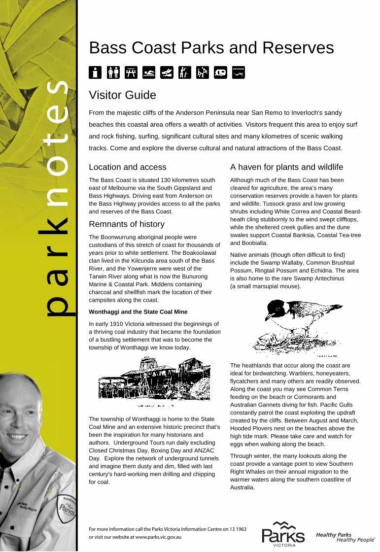
Wonthaggi and the State Coal Mine
In early 1910 Victoria witnessed the beginnings of a thriving coal industry that became the foundation of a bustling settlement that was to become the township of Wonthaggi we know today.
The township of Wonthaggi is home to the State Coal Mine and an extensive historic precinct that’s been the inspiration for many historians and authors. Underground Tours run daily excluding Closed Christmas Day, Boxing Day and ANZAC Day. Explore the network of underground tunnels and imagine them dusty and dim, filled with last century's hard-working men drilling and chipping for coal.
A haven for plants and wildlife Although much of the Bass Coast has been cleared for agriculture, the area’s many conservation reserves provide a haven for plants and wildlife. Tussock grass and low growing shrubs including White Correa and Coastal Beard-heath cling stubbornly to the wind swept clifftops, while the sheltered creek gullies and the dune swales support Coastal Banksia, Coastal Tea-tree and Boobialla.
Native animals (though often difficult to find) include the Swamp Wallaby, Common Brushtail Possum, Ringtail Possum and Echidna. The area is also home to the rare Swamp Antechinus (a small marsupial mouse).
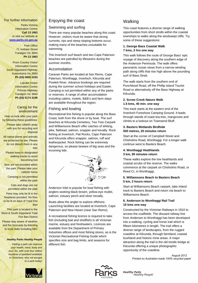
The heathlands that occur along the coast are ideal for birdwatching. Warblers, honeyeaters, flycatchers and many others are readily observed. Along the coast you may see Common Terns feeding on the beach or Cormorants and Australian Gannets diving for fish. Pacific Gulls constantly patrol the coast exploiting the updraft created by the cliffs. Between August and March, Hooded Plovers nest on the beaches above the high tide mark. Please take care and watch for eggs when walking along the beach.
Through winter, the many lookouts along the coast provide a vantage point to view Southern Right Whales on their annual migration to the warmer waters along the southern coastline of Australia.
For further information Parks Victoria
Information Centre Call 13 1963
or visit our website at www.parks.vic.gov.au
Park Office 71 Hotham Street
Traralgon Vic 3844 Ph 13 1963
Prom Country Visitor Information Centre
South Gippsland Highway Korumburra Vic 3950
Ph (03) 5655 2233
Latrobe Visitor Information Centre
Princes Highway Traralgon Vic 3844 Ph (03) 5174 3199
Caring for the environment
Help us look after your park by following these guidelines:
Please take rubbish away with you for recycling and
disposal
All native plants and animals are protected by law. Please
do not disturb them in any way
Please keep to designated walking tracks to avoid
becoming lost
Bins are not provided within the park. Please take your
rubbish home
Camping is not permitted within the park
Cats and dogs are not permitted within the park
Fires may only be lit in the fireplaces provided. No fires to be lit on days of Total Fire
Ban
This park is located in the West & South Gippsland Total
Fire Ban District
Please stay aware of weather and fire forecasts by listening
to local radio including ABC
Walking This coast features a diverse range of walking opportunities from short strolls within the coastal townships to walks along the windswept cliffs. Try some of these suggestions:
1. George Bass Coastal Walk 7 kms, 2 hrs one way This walk follows the route of George Bass’ epic voyage of discovery along the southern edge of the Anderson Peninsula. The walk offers panoramic ocean views from a narrow winding path along cliffs that rise high above the pounding surf of Bass Strait.
The walk starts from the southern end of Punchbowl Road, off the Phillip Island Tourist Road or alternatively off the Bass Highway at Kilcunda.
2. Screw Creek Nature Walk 1.5 kms, 40 min. one way This track starts at the eastern end of the Inverloch Foreshore Camping Ground. It leads through stands of coast tea-tree, mangroves and climbs to a lookout on Townsend Bluff.
3. Baxters Wetlands Birdhide 500 metres, 20 minutes return Start at the corner of Campbell Street and Chisholms Road, Wonthaggi. For a longer walk continue west to Baxters Beach.
4. Wonthaggi Heathlands 3 km, 90 minutes return These walks explore the low heathlands and coastal scrubs of the reserve. The walks commence at the carpark on Chisholms Road, or Reed Cr, in Wonthaggi.
5. Williamsons Beach to Baxters Beach 5 km, 2 hours return Start at Williamsons Beach carpark, take inland track to Baxters Beach and return via beach to Williamsons Beach.
6. Anderson to Wonthaggi Rail Trail 15 kms one way Constructed by the Victorian Railways in 1910 to access the coalfields. The disused railway line from Anderson to Wonthaggi has been developed into a walking, cycling and horse trail which is fifteen kilometres in length. The trail offers a diverse range of landscapes, from the rugged coastline at Kilcunda, through farmland, coastal bushland and historic mine areas. A major attraction along the trail is the old trestle bridge at Kilcunda offering a unique photographic opportunity of the coastline.
August 2012 Printed on Australian-made 100% recycled paper
pa
rkn
ote
s
For more information call the Parks Victoria Information Centre on 13 1963 or visit our website at www.parks.vic.gov.au
Healthy Parks Healthy People
Visiting a park can improve your health, mind, body and
soul. So, with over four million hectares of parkland available to Victorians, why not escape
to a park today!
Enjoying the coast Swimming and surfing There are many popular beaches along this coast. However, visitors must be aware that strong currents, rips and steep sloping bottoms occur, making many of the beaches unsuitable for swimming.
The Inverloch surf beach and two Cape Paterson beaches are patrolled by lifesavers during the summer months.
Accomodation Caravan Parks are located at San Remo, Cape Paterson, Wonthaggi, Inverloch, Kilcunda and Powlett River. Advance bookings are required during the summer school holidays and Easter. Camping is not permitted within any of the parks or reserves. A range of other accomodation including cabins, motels, B&B’s and farm stays are available throughout the region.
Fishing and boating
Recreational line fishing is popular along the Bass Coast, both from the shore or by boat. The surf beaches at Kilcunda Cemetery, Tea Tree Carpark and Williamsons Beach offer catches of whiting, pike, flathead, salmon, snapper and trevally. Rock fishing at Inverloch, Flat Rocks, Cape Paterson and Kilcunda offers snapper, salmon, ruff and leatherjacket. Rock fishing can be extremely dangerous, so please beware of big seas and the incoming tide.
Anderson Inlet is popular for boat fishing with anglers seeking black bream, yellow-eye mullet, salmon, estuary perch and silver trevally.
Boats allow the angler to explore offshore. Launching facilities are located at Inverloch, Cape Paterson and New Haven (near San Remo).
A recreational fishing licence is required to take fish (including bait and shellfish) in all Victorian marine, estuary and freshwaters. Licences are available from the Department of Primary Industries offices and most fishing stores, as is the Victorian Recreational Fishing Guide which specifies size and bag limits, and seasons for different fish.
Bass Coast Parks and Reserves
Visitor Guide From the majestic cliffs of the Anderson Peninsula near San Remo to Inverloch's sandy
beaches this coastal area offers a wealth of activities. Visitors frequent this area to enjoy surf
and rock fishing, surfing, significant cultural sites and many kilometres of scenic walking
tracks. Come and explore the diverse cultural and natural attractions of the Bass Coast. Location and access The Bass Coast is situated 130 kilometres south east of Melbourne via the South Gippsland and Bass Highways. Driving east from Anderson on the Bass Highway provides access to all the parks and reserves of the Bass Coast.
Remnants of history The Boonwurrung aboriginal people were custodians of this stretch of coast for thousands of years prior to white settlement. The Boakoolawal clan lived in the Kilcunda area south of the Bass River, and the Yowenjerre were west of the Tarwin River along what is now the Bunurong Marine & Coastal Park. Middens containing charcoal and shellfish mark the location of their campsites along the coast.
In 1797 George Bass set sail from Sydney in an 8.7 metre whale boat to explore the southern mainland coast. He discovered and named the first natural harbour and the strait that bares this name. The Anderson Peninsula was named after Samuel Anderson who migrated to Australia in 1830. After working with the Van Diemens Land Company in Tasmania, Samuel moved to the area establishing a grazing farm on the Bass River.
Industry and transport relied heavily on coal from New South Wales. When miners went on strike in 1909, the Victorian government commenced mining the Powlett River (later Wonthaggi) coalfields. A tent city sprang up in the bush and a railway line was quickly constructed from Nyora to transport the coal. Wonthaggi soon became the largest town in South Gippsland. Today it is the commerce centre of the district.
A haven for plants and wildlife Although much of the Bass Coast has been cleared for agriculture, the area’s many conservation reserves provide a haven for plants and wildlife. Tussock grass and low growing shrubs including White Correa and Coastal Beard-heath cling stubbornly to the wind swept clifftops, while the sheltered creek gullies and the dune swales support Coastal Banksia, Coastal Tea-tree and Boobialla.
Native animals (though often difficult to find) include the Swamp Wallaby, Common Brushtail Possum, Ringtail Possum and Echidna. The area is also home to the rare Swamp Antechinus (a small marsupial mouse).
The heathlands that occur along the coast are ideal for birdwatching. Warblers, honeyeaters, flycatchers and many others are readily observed. Along the coast you may see Common Terns feeding on the beach or Cormorants and Australian Gannets diving for fish. Pacific Gulls constantly patrol the coast exploiting the updraft created by the cliffs. Between August and March, Hooded Plovers nest on the beaches above the high tide mark. Please take care and watch for eggs when walking along the beach.
Through winter, the many lookouts along the coast provide a vantage point to view Southern Right Whales on their annual migration to the warmer waters along the southern coastline of Australia.
For further information Parks Victoria
Information Centre Call 13 1963
or visit our website at www.parks.vic.gov.au
Park Office 71 Hotham Street
Traralgon Vic 3844 Ph 13 1963
Prom Country Visitor Information Centre
South Gippsland Highway Korumburra Vic 3950
Ph (03) 5655 2233
Latrobe Visitor Information Centre
Princes Highway Traralgon Vic 3844 Ph (03) 5174 3199
Caring for the environment
Help us look after your park by following these guidelines:
Please take rubbish away with you for recycling and
disposal
All native plants and animals are protected by law. Please
do not disturb them in any way
Please keep to designated walking tracks to avoid
becoming lost
Bins are not provided within the park. Please take your
rubbish home
Camping is not permitted within the park
Cats and dogs are not permitted within the park
Fires may only be lit in the fireplaces provided. No fires to be lit on days of Total Fire
Ban
This park is located in the West & South Gippsland Total
Fire Ban District
Please stay aware of weather and fire forecasts by listening
to local radio including ABC
Walking This coast features a diverse range of walking opportunities from short strolls within the coastal townships to walks along the windswept cliffs. Try some of these suggestions:
1. George Bass Coastal Walk 7 kms, 2 hrs one way This walk follows the route of George Bass’ epic voyage of discovery along the southern edge of the Anderson Peninsula. The walk offers panoramic ocean views from a narrow winding path along cliffs that rise high above the pounding surf of Bass Strait.
The walk starts from the southern end of Punchbowl Road, off the Phillip Island Tourist Road or alternatively off the Bass Highway at Kilcunda.
2. Screw Creek Nature Walk 1.5 kms, 40 min. one way This track starts at the eastern end of the Inverloch Foreshore Camping Ground. It leads through stands of coast tea-tree, mangroves and climbs to a lookout on Townsend Bluff.
3. Baxters Wetlands Birdhide 500 metres, 20 minutes return Start at the corner of Campbell Street and Chisholms Road, Wonthaggi. For a longer walk continue west to Baxters Beach.
4. Wonthaggi Heathlands 3 km, 90 minutes return These walks explore the low heathlands and coastal scrubs of the reserve. The walks commence at the carpark on Chisholms Road, or Reed Cr, in Wonthaggi.
5. Williamsons Beach to Baxters Beach 5 km, 2 hours return Start at Williamsons Beach carpark, take inland track to Baxters Beach and return via beach to Williamsons Beach.
6. Anderson to Wonthaggi Rail Trail 15 kms one way Constructed by the Victorian Railways in 1910 to access the coalfields. The disused railway line from Anderson to Wonthaggi has been developed into a walking, cycling and horse trail which is fifteen kilometres in length. The trail offers a diverse range of landscapes, from the rugged coastline at Kilcunda, through farmland, coastal bushland and historic mine areas. A major attraction along the trail is the old trestle bridge at Kilcunda offering a unique photographic opportunity of the coastline.
August 2012 Printed on Australian-made 100% recycled paper
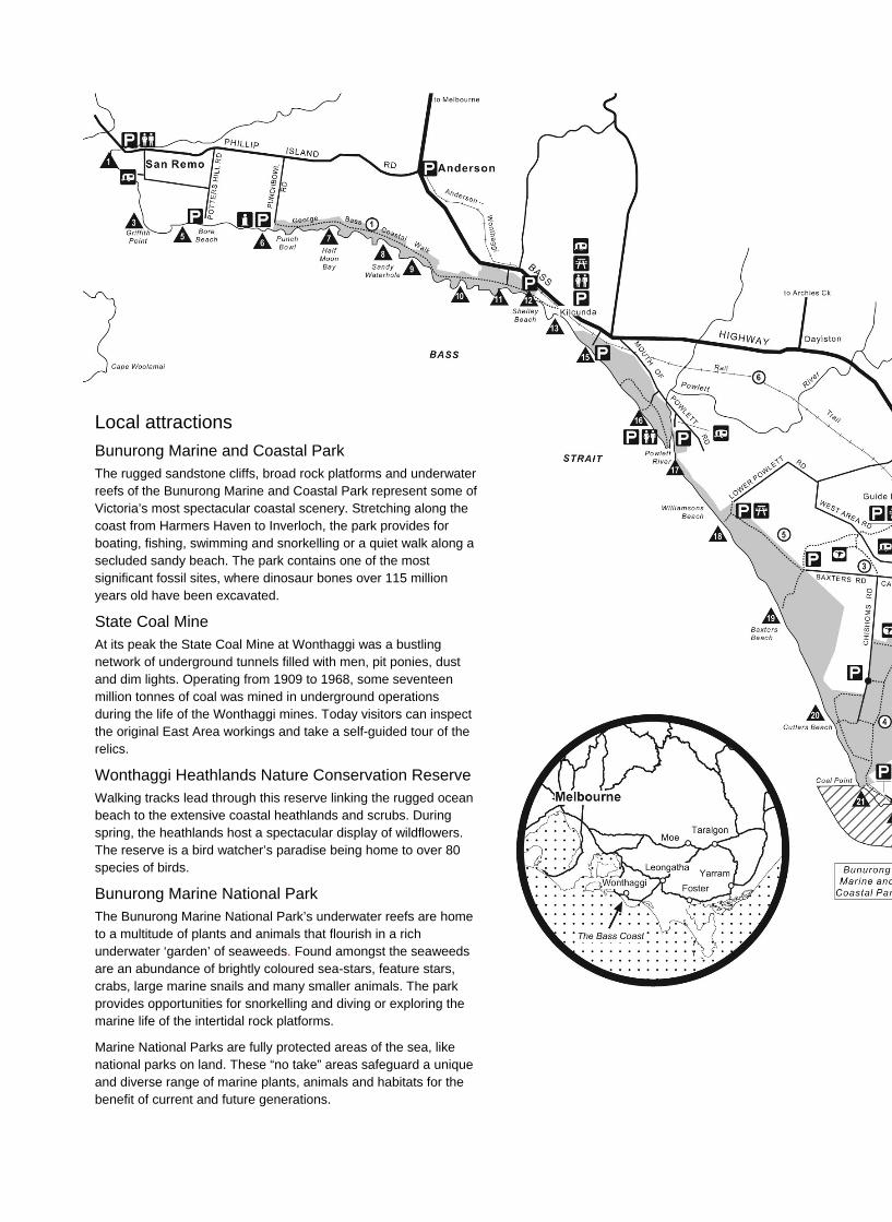
Local attractions
Bunurong Marine and Coastal Park The rugged sandstone cliffs, broad rock platforms and underwater reefs of the Bunurong Marine and Coastal Park represent some of Victoria’s most spectacular coastal scenery. Stretching along the coast from Harmers Haven to Inverloch, the park provides for boating, fishing, swimming and snorkelling or a quiet walk along a secluded sandy beach. The park contains one of the most significant fossil sites, where dinosaur bones over 115 million years old have been excavated.
State Coal Mine At its peak the State Coal Mine at Wonthaggi was a bustling network of underground tunnels filled with men, pit ponies, dust and dim lights. Operating from 1909 to 1968, some seventeen million tonnes of coal was mined in underground operations during the life of the Wonthaggi mines. Today visitors can inspect the original East Area workings and take a self-guided tour of the relics.
Wonthaggi Heathlands Nature Conservation Reserve Walking tracks lead through this reserve linking the rugged ocean beach to the extensive coastal heathlands and scrubs. During spring, the heathlands host a spectacular display of wildflowers. The reserve is a bird watcher’s paradise being home to over 80 species of birds.
Bunurong Marine National Park The Bunurong Marine National Park’s underwater reefs are home to a multitude of plants and animals that flourish in a rich underwater ‘garden’ of seaweeds. Found amongst the seaweeds are an abundance of brightly coloured sea-stars, feature stars, crabs, large marine snails and many smaller animals. The park provides opportunities for snorkelling and diving or exploring the marine life of the intertidal rock platforms.
Marine National Parks are fully protected areas of the sea, like national parks on land. These “no take” areas safeguard a unique and diverse range of marine plants, animals and habitats for the benefit of current and future generations.


![[DRAFT] Environmental Management Frameworkmetrotunnel.vic.gov.au/__data/assets/pdf_file/0003/76008/360... · [DRAFT] Environmental Management Framework ... required under this Incorporated](https://img.dokumen.tips/doc/110x75/5b1f4c2f7f8b9a443d8b47fa/draft-environmental-management-draft-environmental-management-framework.jpg)