Embed Size (px)
Citation preview

Terrestrial Vertebrate Fauna Survey Field Data Sheets Ecological Sciences, Queensland Herbarium
November 2014

Department of Science, Information Technology, Innovation and the Arts
Prepared by: Queensland Herbarium, Department of Science, Information Technology, Innovation and the Arts.
© The State of Queensland (Department of Science, Information Technology, Innovation and the Arts) 2012. Copyright inquiries should be addressed to <[email protected]> or the Department of Science, Information Technology, Innovation and the Arts, 41 George Street, Brisbane QLD 4000.
Disclaimer
This document has been prepared with all due diligence and care, based on the best available information at the time of publication. The department holds no responsibility for any errors or omissions within this document. Any decisions made by other parties based on this document are solely the responsibility of those parties. Information contained in this document is from a number of sources and, as such, does not necessarily represent government or departmental policy.
If you need to access this document in a language other than English, please call the Translating and Interpreting Service (TIS National) on 131 450 and ask them to telephone Library Services on +61 7 3224 8412.
This publication can be made available in an alternative format (e.g. large print or audiotape) on request for people with vision impairment; phone +61 7 3224 8412 or email <[email protected]>.
Citation
Eyre TJ, Ferguson DJ, Hourigan CL, Smith GC, Mathieson MT, Kelly, AL, Venz MF, Hogan, LD & Rowland, J. 2014. Terrestrial Vertebrate Fauna Survey Assessment Guidelines for Queensland: Field Data sheets. Department of Science, Information Technology, Innovation and the Arts, Queensland Government, Brisbane.
November 2014

Terrestrial Vertebrate Fauna Survey Guidelines for Queensland Version 1.2 September 2014
Page 3 of 5
Datasheets
Description and Purpose
All fauna survey or incidental sightings require certain minimum data (see table below) to be recorded. Depending on the project and its purpose, additional types of data will also be required.
Standardised data sheets containing the required data provide a convenient and effective way to ensure that the required data are recorded in a consistent manner. Information collected during surveys may have important historical ramifications and may be required for other applications in the future. Therefore the appropriate documentation and storage of key biological data is highly desirable.
It is recommended that datasheets should contain the following as a minimum: • Fields for recording all essential data (including about the environmental conditions at the time
of the survey) and specifying units if appropriate. • Code descriptions, if codes are used in data recording. • Extra space for recording notes that do not fit into specific categories. • Capability to track progress of data entry, verification and storage. It is also important to be able
to link the stored data back to the original, archived datasheet (see ‘office use only section’).
The datasheets attached have been developed by experienced zoologists and ecologists familiar with undertaking wildlife surveys. Some examples of particular datasheets have been used, fine-tuned and improved over a period of years or even decades. Others, particularly for newer technologies such as camera trapping or acoustic recording may require future refining. While designed by Queensland Government staff for use in their inventory, monitoring and research projects, we believe that that the datasheets may be useful for other practitioners. There is no requirement to use Queensland Government datasheets or return collected data to the Queensland Government (beyond permit requirements, such as ‘return of operations’ for scientific permits).
Minimum recommended data to be recorded for each survey site and/or sighting during the field survey.
Data required Reason
Location description
Detailed description including a regional and local context. This ensures that coordinate locations can be verified.
Location coordinates
Latitude and longitude in decimal degrees or map grid reference (zone, easting and northing). Preferably recorded using a GPS (Global Positioning System).
Location Datum This is the standard position or level that measurements are taken from (e.g. DSITIA standard is GDA94; others are AGD84, AGD66). This is especially important to record if coordinates are from maps older than 10 years.
Location precision
Accuracy of the coordinate location, recorded in metres. The distance of the sighting/record from the coordinates may also need to be factored in. Location precision should also reflect the area around the coordinates over which records were collected.

Department of Science, Information Technology, Innovation and the Arts
Date Including day, month and year of survey.
Observer Name/s
Name of the person/s responsible for the identification of the species.
Taxon Name Species identification to the most precise level that can be accurately and confidently identified. In most cases this would include a scientific name with genus and species (e.g. Macropus giganteus). Subspecies should be recorded if known. In other cases recording to 'species pair' level (e.g. Litoria jungguy/L. wilcoxii, L. serrata/L. myola) where a species can be separated only by genetic analysis, is appropriate, or at generic level (Genus spp.) if there is any doubt about identification to species or 'species pair' level. For birds, common names are acceptable if using a standard checklist (e.g. Birds Australia use Christidis and Boles, 2008).
Species code (optional)
A unique taxonomic coding system, such as the Census of Australian Vertebrate Species (see Department of the Environment website), to aid in rapid, accurate (spelling and taxonomy) entry of species data.
Number of Individuals
Presence of the species assumes a minimum of one individual, so record the lowest number that can be accurately counted or estimated.
Observation Type
Whether the animal(s) were seen, heard, identified from remains, etc.
Reliability Reliability of the sighting. Data should not be recorded when the identification of the species is uncertain unless a specimen or photo can be taken for later identification. Specimens lodged with public institutions attract the highest reliability. However, collection of specimens should occur only when the identification is uncertain.
Survey Effort Survey effort is especially important to record if using a standard or commonly used search method (e.g. area and/or time limited searches).
Time The time when the sighting occurred or when the search was performed (e.g. 1600 – 1630)
Assessment Unit
Relatively homogenous unit usually based on vegetation type (e.g. RE), used for sampling the survey area
Habitat Description
The habitat where a species was recorded can change with time and disturbance (seasonal changes as well as clearing, fire, drought, etc). An absolute minimum description should include the RE and broad condition state. If this is not possible, then a simple habitat description using a standard technique can help to verify vegetation mapping in some cases. The standard technique used should be reported (e.g. Tall closed Eucalyptus grandis forest - Walker and Hopkins 1998).
Prevailing survey conditions
Prevailing conditions refer to the climatic or an environmental variable that may influence the detection of fauna during surveys e.g. rainfall, wind, and flowering. These data can be standardised to allow analysis of the degree of influence.
Life History Age, sex, breeding or reproductive condition of the individual, if known, can value-add sighting records.
Comments Any extra information

Terrestrial Vertebrate Fauna Survey Guidelines for Queensland Version 1.2 September 2014
Page 5 of 5
List of Datasheets
• Site information – details of location, vegetation, site photos, disturbance and habitat characteristics. Should be used on sites where systematic fauna surveys are conducted without more detailed habitat assessment. If this datasheet is filled out there is no need to fill out the ‘Locality Info’ on the separate method datasheets.
• Diurnal bird surveys - for recording bird point and fixed area counts (Note: there is a specific waterbird and shorebird survey datasheet when targeting wetland environs).
• Herpetofauna searches - for recording reptile and amphibian searches (Note: there is a specific amphibian search datasheet if targeting frog habitat, such as a stream or pond).
• Elliott, pitfall, funnel, cage and turtle trapping – multiple trapping methods are usually employed on a site and can be recorded using this datasheet.
• Arboreal spotlight and nocturnal call playback – designed for ‘on site’ spotlighting and call playback. Vehicle spotlighting should use the ‘vehicle and foot road transects’ datasheet.
• Incidental records on survey sites – during all wildlife surveys some species on standard sites are only seen outside of generic surveys, these should be recorded here. This datasheet is also ideal for a species list at a particular point or area; and it can also be used to record data from targeted methods without a specific datasheet.
• Incidental fauna sightings – is designed to record fauna sightings made whilst moving throughout the project area. In particular, threatened and uncommon species, and those not recorded in association with a generic or targeted site should be recorded.
• Bat trapping – specifically for bat trapping methods including harp traps, mist nets and triplines.
• Camera trapping – specifically for camera trapping methods where camera settings and setup details are important.
• Acoustic recording – specifically for automatic sound recording systems, particularly when manually analysed.
• Hair tubes – specifically for hair tube results.
• Scat and sign searches – specifically designed for standard scat, track, and other trace searches. Signs detected during herpetofauna searches can be recorded on the ‘herpetofauna search’ datasheet.
• Vehicle and foot road transects – use when conducting spotlighting transects (by road or on foot) for arboreal species and road driving (or walking) for herpetofauna, when an accurate record of effort is required. Fauna detected commuting between sites should be recorded on the ‘incidental fauna sightings’ datasheet unless this commute is being conducted as a transect.
• Amphibian search – use when conducting targeted frog surveys in specific habitat (e.g. stream, pond, breeding habitat).
• Waterbird/shorebird survey – specifically for waterbirds and shorebirds where habitat attributes and breeding information is particularly important. Some species age (i.e. chick/young or adolescent/adult) can be difficult to differentiate; if this is the case then these columns can be grouped and clearly indicated.

BASIC SITE INFORMATION
LOCATION
VEGETATION
SITE INFORMATION
Plot Centre zone: easting: northing:
Datum: AGD84 GDA94 (WGS84) Location derivation:
Accuracy:
Altitude Altitude accuracy: Altitude derivation:
Locality description:
Reserve or Property Name:Tenure: Reserve number:
Map number:
Bioregion:
Subregion:Map name: Parish:
Habitat Description:
Broad veg group:Regional Ecosystem (mapped)
General Site comments:
LANDFORM
SOIL
GEOLOGY
SITE PHOTOS
Situation:* Pattern:*Element:*
Slope Position:* Slope Aspect:Slope Degree:
Depth:* Colour Texture:. / Munsell? (y/n):
Soil notes:
Source:
Photo No./s
North: South:
East: West:
Other photo numbers and notes:
(no need to fill this section out if revisiting an established site)
Current Site visit comments
m
Road: zone: easting: northing:
(GPS reference)
OTHER:
Regional Ecosystem (obs):
DATE: / /Surveynums:..........................................................................
Entered:............... Checked:............. Corrected:............
OFFICE USE ONLY
SITEID:PROJECT:
SITE ALIAS (field code):
OBSERVERS
Photo No./s
Geology unitCode: Map / Cutting / Core / Outcrop Notes:
Dominant/characteristic species
Layer^ Species Species Layer^ Species Layer^
^Layer: Emergent (E), T1, T2, T3, S1, S2, Ground (G)
(top soil)
m
Version 1.1 8/07/2013 Queensland Herbarium, Mt Coot-tha Rd, Toowong

BASIC SITE INFORMATION CONT......
Disturbance Type
Severity 0 - 3 (0=nil, 3= severe)
Date of last event
(range ok)
^Observation type: 1= visual estimate; 2 = records; 3 = informant
Wildfire
Logging
Grazing
Clearing
Other (specify):
DISTURBANCE:
Weeds
Erosion
Notes:
Prescribed Burn
Treatment
mean fire scar ht (m)
Storm
Code Description
AGPS Averaged GPS fix (5 min)
ARCGIS ArcView Map
DGPS
Differential / RTCM corrected
GPS
EST
Estimate from known
position
GPS00 GPS - type unspecified
GPS04 GPS - 4 station
GPS08 GPS - 6 to 8 station
GPS12
Multichannel GPS (12
station)
KNO
Known position, eg surveyed
point
MAP Map - scale unspecified
MP012 Map - 1:12 500 scale
MP025 Map - 1:25 000 scale
MP050 Map - 1:50 000 scale
MP100 Map - 1:100 000 scale
MP250 Map - 1:250 000 scale
SGPS GPS survey system
Location derivationLocation derivationLocation derivationLocation derivation
CODESLocation accuracyLocation accuracyLocation accuracyLocation accuracy
Code Description
A +/- 0.0 m
B +/- 0-10 m
C +/- 11-50m
D +/- 51-100m
E +/- 101-300m
F +/- 301-500m
G +/- 501-1000m
H +/- 1001-3000m
I >3000m
Code Description
ALT Altimeter
DEM Digital elevation model
EST Estimate from known height
GPS Global positioning system
KNO Known height
OTH Other
TOP Topographic map
Altitude derivationAltitude derivationAltitude derivationAltitude derivation
Code Description
A Not otherwise specified, flat gentle slopes; undulating terrain
B Alluvial plain or flat, alluvium, flood plain
U
Claypan, Playa or Salina(including inland lakes), Salt
Flat(inland).
V Tidal Flat (coastal), Salt Flat (coastal).
C Banks of lake, river, stream, watercourse, levees
D Gully, drainage line, ravine gorge, outwash
E Channel Bed, distributaries of inland streams
F Slope or Hill not specified
L
Cliff (steep rocky faces), rocky ledge, rocky outcrop, scarp,
crevice
N Coastal rocky headland
K Top, crest of mountain or ridge
Q Jump Up (Cuesta) and Mesa, Tableland, Plateau,
R Recent Coastal Dune (low dune less than about 15m) and
S Fossil Coastal Dune (High Dune greater than about 15m)
T Inland Dune.
W Swamp or Marsh.
X Fresh Water Aquatic.
Y Salt Water Aquatic.
Z Melon Holes, Gilgai, Depressions in Soil, Sink Holes.
Water
Streams, Lakes
Plains
Hills, Mountains, Tablelands
Dunes
SituationSituationSituationSituation
Code Description Code Description Code Description
HCR Hillcrest DUS Duneslope STF Supratidal flat
SUS Summit Surface BRK Breakaway FIL Fill-top
DUC Dunecrest CFS Cliff-foot slope REF Feef flat
TOR Tor SFS Scarp-foot Slope ALC Alcove
TUM Tumulus BEN Bench GUL Gully
DUN Dune BER Berm CIR Cirque
CON Cone PED Pediment DDE
Drainage
depression
MOU Mound FOO Footslope STC Stream channel
LEV Levee TAL Talus STB Stream bed
BAR Bar PLA Plain TDC Tidal creek
SCR Scroll RFL Rock flat EST Estuary
PST Prior stream RPL Rock platform SWP Swamp
FOR Foredune COS Cut-over surface SWL Swale
LUN Lunette SCD Scald TRE Trench
BRI Beach ridge FAN Fan LAK Lake
EMB Embankment VLF Valley flat PLY Playa
DAM Dam TEF Terrace flat DOL Doline
CLI Cliff CBE Channel bench OXB Ox-bow
SCA Scarp BKP Backplain LAG Lagoon
HSL Hillslope SRP Scroll plain BOU Blow-out
CUT Cut face FLD Flood-out MAA Maar
LDS Landslide TEP Terrace plain CRA Crater
BAN (Stream) Bank TDF Tidal flat PIT Pit
BEA Beach ITF Intertidal flat
ElementElementElementElement
Code Description
RM Rolling mountains
SM Steep mountains
VM Very steep mountains
PM Precipitous mountains
UH Undulating hills
RH Rolling hills
SH Steep hills
VH Very steep hills
PH Precipitous hills
UL Undulating low hills
RL Rolling low hills
SL Steep low hills
VL Very steep low hills
B Badlands
GR Gently undulating rises
UR Undulating rises
RR Rolling rises
SR Steep rises
LP Level plain
GP Gently undulating plain
UP Undulating plain
RP Rolling plain
PatternPatternPatternPattern
Code Description
C Crest
D Closed Depression
F Flat
G Gully
H Hillock
L Lower-Slope
M Mid-Slope
P Plateau
R Ridge
U Upper-Slope
V Open Depression
W Wetland
Slope PositionSlope PositionSlope PositionSlope Position
Code Description
D Deep
S Shallow
X Skeletal
Soil DepthSoil DepthSoil DepthSoil Depth
Obs type^(e.g. Info on prior events, treatment type, % of site impacted, clearing technique, weed species, erosion type)
Characteristic Abundance
(0-7)^
HABITAT CHARACTERISTICS - ABUNDANCE:
Hollows in trees & stags
Fallen logs (>10cm diam.)
Decorticating bark
Course litter (>2cm diam.)
Fine litter (<2cm diameter)
Bare ground
Grass
Soil cracks
Stones (20-60cm)
Boulders (61cm-2m)
Large boulders (>2m)
Rock crevices
Exfoliating rock
Notes:(Add others as required)
^Abundance Key:
0 = Nil
1 = Rare
2 = Rare to Occasional
3 = Occasional
4 = Occasional to common
5 = Commo
6 = Common to Abundant
7 = Abundant
Version 1.1 8/07/2013 Queensland Herbarium, Mt Coot-tha Rd, Toowong

BIRD POINT/AREA COUNT
Surveynums:..........................................................................
Entered:............... Checked:............. Corrected:............
OFFICE USE ONLY
SITEID:
SpeciesNo.
indivs CommentsSpecies
codeRecord type*
PROJECT:
SITE ALIAS (field code):
Offsite? (tick)
Search num
Microhab Code*
Datum: Location derivation:*
Accuracy:* Altitude Altitude accuracy: Altitude derivation:*
Locality description:
Reserve or Property Name:Tenure: Bioregion:
Habitat Description:
m
zone: easting: northing
Locality Info: (not required if site info datasheet already filled out)
Cloud Cover (8ths)
Temperature
Precipitation*
Wind Velocity*
Wind Direction
1 2 3 4 5
Date
Time (start - finish)
Method (see over)
Observer/s:
Search num: 6
Flower Abundance:
Effort (time x area)
*Codes on back of pageRecords Note: Offsite is anything outside of the 100 x 100m site
NONE LOW (<10% of canopy) MEDIUM (10-50% of canopy) HIGH (>50% of canopy)
Version 2.4 8/07/2013 Queensland Herbarium, Mt Coot-tha Rd, Toowong PAGE: Of:

Survey M etho ds Lo cat io n D erivat io n
Code Description Effort Code Description
SBAE Standard Early B ird Area Search (dawn to 2 hrs after) 5min, 100m x 100m (1ha) AGPS Averaged GPS fix (5 min)
SBAL Standard Late B ird Area Search (2-4hrs after dawn) 5min, 100m x 100m (1ha) ARCSIS ArcView M ap
SBAO Standard B ird Area Search - Other (ie: after 4hrs from dawn) 5min, 100m x 100m (1ha) EST Estimate from known position
SBA Bird Area Count specify time (min) and Area (ha) GPS GPS (12 plus channels)
BPC Bird Point Count specify time (min) for po int count M AP Position taken from map
SpeciesNo.
indivs CommentsSpecies
code
Record type
Offsite? (tick)
Search num
Microhab Code
R eco rd T ype
Code Description
CC Caught by hand
DR Remains (eg: skull, feathers)
DS Scats
DT Tracks
H Heard
S Seen
SH Seen and Heard
Lo cat io n accuracy
Code Description
B +/-0-10m
C +/-11-50m
D +/-51-100m (site)
E +/-101-300m
F +/-301-500m
G +/-501-1000m
H +/-1001-3000m
I >3000m
A lt itude D erivat io n
Code Description
ALT Altimeter
DEM Digital elevation model
EST Estimate from known height
GPS Global Positioning System
KNO Known height
TOP Topographic map
Code Description
0 Nil
1 Drizzle or light rain
2 M ed - heavy rain
3 light rain in past 24hrs
4
No rain now but med -
heavy rain in past 24hrs
5 past 24hrs
6 Fog/mist
7 Isolated showers
R ain
Code Description Code Description
0 Calm 2 M oderate, moves branches
1 Light, leaves rustle 3 Strong, impedes progress
Wind
Code Description Code Description
AC Flying above canopy SH In shrub (general)
T1 In tree (T1 layer) IG In grass
T2 In tree (T2 layer) GR On ground
T3 In tree (T3 layer) GB On BARE ground
IT In tree (general) OL On log
FL Flying within canopy FC In/on post/ stump
DT In dead tree (stag) IH In tree hollow
TK On trunk EW Edge of water
S1 In shrub (S1 layer) IW In water
S2 In shrub (S2 layer) RD On road
S3 In shrub (S3 layer)
M icro habitat
Version 2.4 8/07/2013 Queensland Herbarium, Mt Coot-tha Rd, Toowong PAGE: Of:

BIRD POINT/AREA COUNT - CONT.....
SpeciesNo.
indivs CommentsSpecies
code
Record type
Offsite? (tick)
Search num
Microhab Code
Record Type
code description
CC Caught by hand
CF Found dead
CP Predated
CR Roadkilled
DL Detected by presence of platelets
DN Nest
DP Pellets
DR Remains (eg: skull, feathers)
DT Tracks
H Heard
S Seen
SH Seen and Heard
Microhabitat
code description code description
AC Flying above canopy (overhead) IG In Grass
AF Aerial Feeding IH In tree Hollow
AR Adjacent to roost/nest IT In Tree
BC Below canopy LC Low er Canopy
CA Canopy LS Low shrub
CR Tree crow n MB On main branch
DT in Dead Tree (stag) MC Mid Canopy
FB Flying below canopy RD On road or track
FL Flying w ithin the canopy SH Shrub
GB On bare ground TH In tree w hich has hollow
GR On ground (not bare) UC Upper Canopy
HS High Shrub WT Walking track
SITE ALIAS (field code):
Version 2.4 8/07/2013 Queensland Herbarium, Mt Coot-tha Rd, Toowong PAGE: Of:

SPECIES No. indiv
Record Type*
Microhab Code*
CommentsSpecies code
METHOD/SEARCH
Cloud Cover (8ths)
Temperature
Precipitation*
Wind Velocity*
Wind Direction
Moon*
Night Light*
D1 D2 N1 N2
Date
Time (start - finish)
Method/effort*
Observer/s:
Search:
Early or Late?** Early Late Early Late
Quadrant** (shade in)
HERPETOFAUNA SEARCH
Surveynums:..........................................................................
Entered:............... Checked:............. Corrected:............
OFFICE USE ONLY
SITEID:
PROJECT:
SITE ALIAS (field code):
Datum: Location derivation:*
Accuracy:* Altitude Altitude accuracy: Altitude derivation:*
Locality description:
Reserve or Property Name:Tenure: Bioregion:
Habitat Description:
m
zone: easting: northing
Locality Info: (not required if site info datasheet already filled out)
*Codes on back of page
Records**Note: Early= morning search and late= afternoon search; Quadrant=which 50x50m area the search was conducted on
NA - on 100 x 100m site NA - on 100 x 100m site
Version 5.2 8/07/2013 Queensland Herbarium, Mt Coot-tha Rd, Toowong PAGE: Of:
N ight Light
Code Description
1 very dark - no moon and cloud
2 dark - 1/4 moon, or moon and heavy cloud
3 detail seen - moon and clear sky
4 bright - 1/2 moon and no cloud
SPECIES No. indiv
Record Type*
Microhab Code*
CommentsSpecies code
METHOD /SEARCH
Lo cat io n D erivat io n
Code Description Effort Code Description
SHD1 Standard Diurnal Herp Search - 1st on site 1 person 30min per 50x50m AGPS Averaged GPS fix (5 min)
SHD2 Standard Diurnal Herp Search - 2nd on site 1 person 30min per 50x50m ARCSIS ArcView M ap
SHN Standard Nocturnal Herp Search 1 person 30min per 100x100m EST Estimate from known position
HD Diurnal Herp Search (specify effort) specify time per area GPS GPS (12 plus channels)
NHN Nocturnal Herp Search (specify effort) specify time per area M AP Position taken from map
Survey M etho ds
Lo cat io n accuracy
Code Description
B +/-0-10m
C +/-11-50m
D +/-51-100m (site)
E +/-101-300m
F +/-301-500m
G +/-501-1000m
H +/-1001-3000m
I >3000m
Code Description
0 Nil
1 Drizzle or light rain
2 M ed - heavy rain
3 light rain in past 24hrs
4
No rain now but med -
heavy rain in past 24hrs
5 past 24hrs
6 Fog/mist
7 Isolated showers
R ain
Code Description
BU Detected by presence of burrow/s
CC Caught by hand
CF Found dead
DC Cast skin
DR Remains (eg: skull, feathers)
DS Scats
DT Tracks
H Heard
S Seen
R eco rd T ype
Code Description Code Description
CK Crevice in rock IW In water
CL Crevice in log OI On Litter
EW Edge of water OL On Log
FC in/on post or stump OR On rock
GB On bare ground RD On road or track
GR On ground (not bare) TK On Trunk
IB In Burrow UB Under Bark on tree
IG In Grass UL Under log/fallen wood/bark (natural)
IL In Litter UR Under Rock
IO Inside log UT Under iron, wood pile or o ther human debris
IS In So il
M icro habitat
Code Description
0 no moon
1 1/4 moon
2 1/2 moon
3 3/4 moon
4 full moon
5
moon present - use if
unsure o f phase
M o o n
Wind Velo city
Code Description
0 Calm
1 Light, leaves rustle
2 M oderate, moves branches
3 Strong, impedes progress
A lt itude D erivat io n
Code Description
ALT Altimeter
DEM Digital elevation model
EST Estimate from known height
GPS Global Positioning System
KNO Known height
TOP Topographic map
Version 5.2 8/07/2013 Queensland Herbarium, Mt Coot-tha Rd, Toowong PAGE: Of:

Methods and Effort:
Records
Trap Night Species Spp. code SexAge Comments
Elliott traps open for
Pitfall traps open for
Funnel traps open for
nights
nights
nights
m apart
m apart
m apart
Other:
Elliott traps (SET)
Pitfall traps (SPT):
Funnel traps (SFT)
Effort:
Cage traps open for nights m apartCage traps (SCT)
Trapping notes (eg: T- design, square, straight line):
Method (Repro condition, wt, sv, tail, etc)Num
TRAPPING DATA SHEET -
Surveynums:..........................................................................
Entered:............... Checked:............. Corrected:............
OFFICE USE ONLY
SITEID:
PROJECT:
SITE ALIAS (field code):
Locality Info: (not required if site info datasheet already filled out)
Datum: Location derivation:*
Accuracy:* Altitude Altitude accuracy: Altitude derivation:*
Locality description:
Reserve or Property Name:Tenure: Bioregion:
Habitat Description:
m
zone: easting: northing
Camera traps deployed for nightsCamera traps (RCT):
Cloud Cover (8ths)
Precipitation*
Wind Velocity*
Wind Direction
1 2 3 4 5
Date
Observer/s:
6
*Codes on back of page
Max Temp
Min Temp
TRAP NIGHT:
Moon*
Night Light*
Turtle traps open for nightsTurtle traps (STU):
Elliott, Pitfall, Funnel, Cage, Camera...
Date traps open: / / Date traps closed: / /
Version 5.2 8/07/2013 Queensland Herbarium, Mt Coot-tha Rd, Toowong PAGE: Of:

Trap Night Species Spp. code SexAge Comments Method (Repro condition, wt, sv, tail, etc)Num
N ight Light
Code Description
1 very dark - no moon and cloud
2 dark - 1/4 moon, o r moon and heavy cloud
3 detail seen - moon and clear sky
4 bright - 1/2 moon and no cloud
Lo cat io n D erivat io n
Code Description
AGPS Averaged GPS fix (5 min)
ARCSIS ArcView M ap
EST Estimate from known position
GPS GPS (12 plus channels)
M AP Position taken from map
Lo cat io n accuracy
Code Description
B +/-0-10m
C +/-11-50m
D +/-51-100m (site)
E +/-101-300m
F +/-301-500m
G +/-501-1000m
H +/-1001-3000m
I >3000m
R ain
Code Description
0 Nil
1 Drizzle o r light rain
2 M ed - heavy rain
3 light rain in past 24hrs
4
No rain now but med -
heavy rain in past 24hrs
5 past 24hrs
6 Fog/mist
7 Isolated showers
M o o n
Code Description
0 no moon
1 1/4 moon
2 1/2 moon
3 3/4 moon
4 full moon
5
moon present - use if
unsure o f phase
Wind Velo city
Code Description
0 Calm
1 Light, leaves rustle
2 M oderate, moves branches
3 Strong, impedes progress
A lt itude D erivat io n
Code Description
ALT Altimeter
DEM Digital elevation model
EST Estimate from known height
GPS Global Positioning System
KNO Known height
TOP Topographic map
Version 5.2 8/07/2013 Queensland Herbarium, Mt Coot-tha Rd, Toowong PAGE: Of:

Search num
# - Field is optional
No. Indivs
Record Type code
ARBOREAL SPOTLIGHT/NOCTURNAL CALL PLAYBACK
Microhab Code #
Tree Species OR tape
responding to # Comments #SpeciesSpecies
codeOn | Near | Off
On | Near | Off
onsite = within 100x100m, near = within 50m of site boundary, off = >50m of site boundary.
Cloud Cover (8ths)
Temperature
Precipitation*
Wind Velocity*
Wind Direction
Moon*
Night Light*
(2) 1st Spotlight (4) 2nd Spotlight(1) 1st Call playback (3) 2nd Call playback
Date
Time (start - finish)
Effort (time x area)
Observer/s:
Search:
Flower abundance
Calls played**
*Codes on back of page. **Use these codes for calls played and order: MF-marble frogmouth; PF-Papuan frogmouth; PO-powerful owl; RO-rufous owl; MO-masked owl; SO-sooty owl; BO-barking owl; GO-grass owl; YBG-yellow bellied glider; SG-sugar glider; SQG-squirrel glider
On | Near | Off
On | Near | Off
On | Near | Off
On | Near | Off
On | Near | Off
On | Near | Off
On | Near | Off
On | Near | Off
On | Near | Off
On | Near | Off
On | Near | Off
On | Near | Off
On | Near | Off
Surveynums:..........................................................................
Entered:............... Checked:............. Corrected:............
OFFICE USE ONLY
SITEID:
PROJECT:
SITE ALIAS (field code):
Datum: Location derivation:*
Accuracy:* Altitude Altitude accuracy: Altitude derivation:*
Locality description:
Reserve or Property Name:Tenure: Bioregion:
Habitat Description:
m
zone: easting: northing
Locality Info: (not required if site info datasheet already filled out)
NONE LOW (<10% of canopy) MEDIUM (10-50% of canopy) HIGH (>50% of canopy)
Veg density NONE (paddock) LOW (open forest) MEDIUM (wet sclero forest) HIGH (dense rainforest)
Version 2.2 8/07/2013 Queensland Herbarium, Mt Coot-tha Rd, Toowong PAGE: Of:

No. Indivs
Record Type code
Microhab Code #
Tree Species OR tape
responding to # Comments #SpeciesSpecies
codeOn | Near | Off
On | Near | Off
Search num
On | Near | Off
On | Near | Off
On | Near | Off
On | Near | Off
On | Near | Off
On | Near | Off
On | Near | Off
On | Near | Off
On | Near | Off
On | Near | Off
On | Near | Off
On | Near | Off
On | Near | Off
On | Near | Off
On | Near | Off
On | Near | Off
On | Near | Off
On | Near | Off
On | Near | Off
On | Near | Off
On | Near | Off
On | Near | Off
On | Near | Off
On | Near | Off
On | Near | Off
# - Field is optionalonsite = within 100x100m, near = within 50m of site boundary, off = >50m of site boundary.
N ight Light
Code Description
1 very dark - no moon and cloud
2 dark - 1/4 moon, o r moon and heavy cloud
3 detail seen - moon and clear sky
4 bright - 1/2 moon and no cloud
Lo cat io n D erivat io n
Code Description
AGPS Averaged GPS fix (5 min)
ARCSIS ArcView M ap
EST Estimate from known position
GPS GPS (12 plus channels)
M AP Position taken from map
Lo cat io n accuracy
Code Description
B +/-0-10m
C +/-11-50m
D +/-51-100m (site)
E +/-101-300m
F +/-301-500m
G +/-501-1000m
H +/-1001-3000m
I >3000m
R ain
Code Description
0 Nil
1 Drizzle o r light rain
2 M ed - heavy rain
3 light rain in past 24hrs
4
No rain now but med -
heavy rain in past 24hrs
5 past 24hrs
6 Fog/mist
7 Isolated showers
M o o n
Code Description
0 no moon
1 1/4 moon
2 1/2 moon
3 3/4 moon
4 full moon
5
moon present - use if
unsure o f phase
Wind Velo city
Code Description
0 Calm
1 Light, leaves rustle
2 M oderate, moves branches
3 Strong, impedes progress
A lt itude D erivat io n
Code Description
ALT Altimeter
DEM Digital elevation model
EST Estimate from known height
GPS Global Positioning System
KNO Known height
TOP Topographic map
M icro habitat
Code Description
DT In dead tree (stag)
IH In tree hollow
IT In tree
OL On log
OR On rock
TK On trunk
R eco rd T ype
Code Description
CC Caught by hand
DR Remains (eg: skull, feathers)
DS Scats
DT Tracks
H Heard
S Seen
SH Seen and Heard
Version 2.2 8/07/2013 Queensland Herbarium, Mt Coot-tha Rd, Toowong PAGE: Of:

Incidental Records at Generic or Target Survey Sites
Method (if not incidental records for a generic or targetted survey site - describe the method and effort)
SPECIES No. indivs
Record Type*
On / Off / Near
OTHER INFORMATION
sex, wt, length, reproductive cond., microhabitat
Species code
Surveynums:..........................................................................
Entered:............... Checked:............. Corrected:............
OFFICE USE ONLY
SITEID:PROJECT:
SITE ALIAS (field code):
Datum: Location derivation:*
Accuracy:* Altitude Altitude accuracy: Altitude derivation:*
Locality description:
Reserve or Property Name:Tenure: Bioregion:
Habitat Description:
m
zone: easting: northing
Locality Info: (not required if site info datasheet already filled out)
OBSERVERS
DATES // // -
onsite = within 100x100m, near = within 50m of site boundary, off = >50m of site boundary.
Version 5.2 8/07/2013 Queensland Herbarium, Mt Coot-tha Rd, Toowong PAGE: Of:

SPECIES No. indivs
Record Type
On / Off / Near
OTHER INFORMATION
Sex, Wt, Length, Reproductive cond. Microhab
Species code
Code Description
AGPS Averaged GPS fix (5 min)
ARCSIS ArcView M ap
EST Estimate from known position
GPS GPS (12 plus channels)
M AP Position taken from map
Lo cat io n D erivat io nCode Description
B +/-0-10m
C +/-11-50m
D +/-51-100m (site)
E +/-101-300m
F +/-301-500m
G +/-501-1000m
H +/-1001-3000m
I >3000m
Lo cat io n accuracy
Code Description
ALT Altimeter
DEM Digital elevation model
EST Estimate from known height
GPS Global Positioning System
KNO Known height
TOP Topographic map
A lt itude D erivat io n
Code Description
BU Detected by presence of burrow/s
CC Caught by hand
CF Found dead
DC Cast skin
DR Remains (eg: skull, feathers)
DS Scats
DT Tracks
H Heard
S Seen
R eco rd T ype
Version 5.2 8/07/2013 Queensland Herbarium, Mt Coot-tha Rd, Toowong PAGE: Of:

INCIDENTAL FAUNA SIGHTINGS
Entered:............... Checked:............. Corrected:............
OFFICE USE ONLY
Refnum:
General Area:
Date EastingZoneSpecies Number Observer/s Other Info/Comments
Locality, Tenure and Habitat:
Datum NorthingRec Type
GPS
Error
Trip Dates:
Siteid
Locality, Tenure and Habitat:
Locality, Tenure and Habitat:
Locality, Tenure and Habitat:
Locality, Tenure and Habitat:
Locality, Tenure and Habitat:
Locality, Tenure and Habitat:
Locality, Tenure and Habitat:
Locality, Tenure and Habitat:
Locality, Tenure and Habitat:
Site Alias
Version 2.2 8/07/2013 Queensland Herbarium, Mt Coot-tha Rd, Toowong PAGE: Of:

Locality, Tenure and Habitat:
Locality, Tenure and Habitat:
Locality, Tenure and Habitat:
Locality, Tenure and Habitat:
Locality, Tenure and Habitat:
Locality, Tenure and Habitat:
Locality, Tenure and Habitat:
Locality, Tenure and Habitat:
Locality, Tenure and Habitat:
Locality, Tenure and Habitat:
Incidental Record Type Codes
BU
C
CC
CF
CP
CR
D
DC
DF
DL
DN
DP
DR
DS
DT
H
SSH
Detected by presence of burrow/s
Captured/Caught
Caught by hand
Found Dead
Predated
Roadkilled
Detected by other means
Cast Skin
Presence of Feeding Marks
Presence of Platelets
Nest
Pellets
Remains (skull, feathers etc)
Scats
Tracks
Heard
Seen
SH Seen and Heard
Date EastingZoneSpecies Number Observer/s Other Info/Comments
Datum NorthingRec Type
GPS
Error
Siteid
Site Alias
Version 2.2 8/07/2013 Queensland Herbarium, Mt Coot-tha Rd, Toowong PAGE: Of:

BAT TRAPPING DATA SHEET - GENERAL
EFFORT
Start Date Finish Date:/ // /
Tripline Hours Mist Net Hours and Length (m)
TRAP PLACEMENT CODE
RECORDS:
Date Species code
Species SexNo. indivs
Weight(g) #F. arm (mm)#
Reprod Cond * #
* see codes on reverse, # optional
Age
Use a separate Sheet for each trap/ net/ dam
Tibia (mm)#
-BB Beside buildin
-CD Over creek - dry bed
-CF Over creek - flowing
-PC Pool in creek - not flowing
-DA Farm/fire dam
-FM In front of mineshaft
-IM In mineshaft//tunnel
-PO Pond
-RD On road or trac
-UI Under Bridge
-AR Adjacent to roost/nestTick ONE (the most correct) OR specify in "other"
Other (specify)
Start time Finish time:If less than full night, specify:
mini harptrap
double harptrap
Harp trap nights.
single harptrap
Surveynums:..........................................................................
Entered:............... Checked:............. Corrected:............
OFFICE USE ONLY
SITEID:PROJECT:
SITE ALIAS (field code):
Locality Info: (not required if site info datasheet already filled out)
Cloud Cover (8ths)
Precipitation*
Wind Velocity*
Wind Direction
1 2 3 4 5
Date
Observer/s:
6
Max Temp
Min Temp
TRAP NIGHT:
Moon*
Night Light*
specify if more:
Number of string banks on harp trap: 2 3 4 5
Datum: Location derivation:*
Accuracy:* Altitude Altitude accuracy: Altitude derivation:*
Locality description:
Reserve or Property Name:Tenure: Bioregion:
Habitat Description:
m
zone: easting: northing
Comments #
Version 4.1 8/07/2013 Queensland Herbarium, Mt Coot-tha Rd, Toowong PAGE: Of:

BAT TRAPPING DATA SHEET - GENERALUse separate Sheet for each trap/ net/ dam
Page 2
WIND VELOCITY
0 = Calm
1 = light, leaves rustle
2 = moderate, moves branches
3 = strong, impedes progress
PRECIPITATION0 = nil
2 = med - heavy rain
3 = No rain during survey period but drizzle or light rain in previous 24 hrs
4 = No rain during survey period but med to heavy rain in previous 24 hrs
1 =drizzle or light rain
MOON
0 = No Moon or moon not up
1 = up to 1/4 Moon
2 = up to 1/2 moon
3 = up to 3/4 moon
4 = up to full moon
5 = moon present (use if unsure of phase)
NIGHTLIGHT
1 = V. dark - 0 moon or heavy cloud
2 = Dark < 1/4 moon or heavy cloud
3 = Detail seen <1/2 moon 0 Cloud
4 = Bright >1/2 moon + no cloud
Date Species code
Species SexNo. indivs
Weight (g)#F. arm (mm)#
Reprod Cond * #
Age Tibia (mm)#
5 = No rain during survey period but rain in previous 24 hrs
6 = Fog/mist
7 = Isolated Showers
AGE
J = Juvenile - still weaning, wing joints with large & obvious cartilaginous bands
S = Subadult - wing joint has smooth outline; cartilaginous band & blood vessels very distinct
A = Adult - wing joints knobbly; cartilaginous gap not visible
(From Parnaby 1992/Churchhill 2008)
REPRODUCTIVE CONDITION
Male
S1 = Testes not enlarged
S3 = Testes enlarged & epididymis distended
S4 = Testes regressed & epididymis distended
Females
TU = Teats undeveloped - sub-adult or nulliparous
PG = Pregnant
LA = Lactating
PL = Post-lactating
TR = Teats regressed
S2 = Testes enlarged
(from Churchill 2008)
(from Churchill 2008)
LOCATION DERIVATION
AGPS = Averaged GPS fix (5 min)
ARCGIS = ArcView Map
EST = Estimate from known position
GPS = GPS (12 plus channels)
MAP = Position taken from map
LOCATION ACCURACY
B = +/-0-10m
C = +/-11-50m
D = +/-51-100m (site)
E = +/-101-300m
F = +/-301-500m
G = +/-501-1000m
H = +/-1001-3000m
I = >3000m
ALTITUDE DERIVATION
ALT = Altimeter
DEM = Digital elevation model
EST = Estimate from known height
GPS = Global Positioning System
KNO = Known height
TOP = Topographic Ma
Comments #
Version 4.1 8/07/2013 Queensland Herbarium, Mt Coot-tha Rd, Toowong PAGE: Of:

CAMERA TRAPPING DATA SHEET
Event*
SPECIES No. of events/indivs*
OTHER INFORMATION/COMMENTSSpecies code
Surveynums:..........................................................................
Entered:............... Checked:............. Corrected:............
OFFICE USE ONLY
SITEID:PROJECT:
SITE ALIAS (field code):
Datum: Location derivation:
Accuracy: Altitude Altitude accuracy: Altitude derivation:
Locality description:
Reserve or Property Name:Tenure: Bioregion:
Habitat Description:
m
zone: easting: northing
Locality Info: (not required if site info datasheet already filled out)
OBSERVER/S:
DATE: / /
Reliability of ID^
Records ^Def = Definite; Prob = Probable; Poss = Possible
Def / Prob / Poss
Def / Prob / Poss
Def / Prob / Poss
Def / Prob / Poss
Def / Prob / Poss
Def / Prob / Poss
Def / Prob / Poss
Def / Prob / Poss
Def / Prob / Poss
Def / Prob / Poss
Def / Prob / Poss
Def / Prob / Poss
Def / Prob / Poss
Def / Prob / Poss
Def / Prob / Poss
Def / Prob / Poss
Def / Prob / Poss
Def / Prob / Poss
Def / Prob / Poss
Def / Prob / Poss
Def / Prob / Poss
Def / Prob / Poss
Def / Prob / Poss
Def / Prob / Poss
Def / Prob / Poss
Def / Prob / Poss
Def / Prob / Poss
/ /-
Trigger Date/Time
CAMERA SETTINGS: Brand/Model: Cam # or code: Mode: Photo / Video
Pic/video size/resolution: Pics per trigger/Video length: Interval btwn pics:
Sensor level: Time period active: Bait type & setup:
Comments on setup:
Cam functioning on removal?: problem: Bait still ok?:
*Define an 'event' if individuals can't be recognised (e.g. inactivity for >5min period is a "new" event)
(define gap in visitation to be regarded as a new event):
Version 1.1 8/07/2013 Queensland Herbarium, Mt Coot-tha Rd, Toowong PAGE: Of:

SPECIES No. of events/indivs*
OTHER INFORMATION/COMMENTSSpecies code
Reliability of ID^
Records ^Def = Definite; Prob = Probable; Poss = Possible
Def / Prob / Poss
Def / Prob / Poss
Def / Prob / Poss
Def / Prob / Poss
Def / Prob / Poss
Def / Prob / Poss
Def / Prob / Poss
Def / Prob / Poss
Def / Prob / Poss
Def / Prob / Poss
Def / Prob / Poss
Def / Prob / Poss
Def / Prob / Poss
Def / Prob / Poss
Def / Prob / Poss
Def / Prob / Poss
Def / Prob / Poss
Def / Prob / Poss
Def / Prob / Poss
Def / Prob / Poss
Def / Prob / Poss
Def / Prob / Poss
Def / Prob / Poss
Def / Prob / Poss
Def / Prob / Poss
Def / Prob / Poss
Trigger Date/Time
*Define an 'event' if individuals can't be recognised (e.g. inactivity for >5min period is a "new" event)
Def / Prob / Poss
Def / Prob / Poss
Def / Prob / Poss
Def / Prob / Poss
Def / Prob / Poss
Def / Prob / Poss
Def / Prob / Poss
Def / Prob / Poss
Def / Prob / Poss
Def / Prob / Poss
Def / Prob / Poss
Def / Prob / Poss
Def / Prob / Poss
Def / Prob / Poss
Def / Prob / Poss
Def / Prob / Poss
Def / Prob / Poss
Def / Prob / Poss
Def / Prob / Poss
Def / Prob / Poss
Version 1.1 8/07/2013 Queensland Herbarium, Mt Coot-tha Rd, Toowong PAGE: Of:

ACOUSTIC RECORDING (NON-BAT) DATA SHEET
Event*^
SPECIES No. of events/indivs*
OTHER INFORMATION/COMMENTS (e.g.
any background noise)
Species code
Surveynums:..........................................................................
Entered:............... Checked:............. Corrected:............
OFFICE USE ONLY
SITEID:PROJECT:
SITE ALIAS (field code):
Datum: Location derivation:
Accuracy: Altitude Altitude accuracy: Altitude derivation:
Locality description:
Reserve or Property Name:Tenure: Bioregion:
Habitat Description:
m
zone: easting: northing
Locality Info: (not required if site info datasheet already filled out)
OBSERVER/S:
DATE: / /
Records ^Optional
/ /-
Period /Date
RECORDER SETTINGS: Recorder Model: Unit # or code:
Mode: Recording / Call playback and recording
Start - Finish Time/s: Recording duration/s:
Sample rate (hz): Channels:
Comments on program/setup/schedule:
Unit functioning on removal?: problem:
*Define an 'event' (e.g. no calls detected for >5min period is a "new" event)
(define gap in recording to be regarded as a new event):
Time of call^^
Stereo (0 + 1) / Mono-L (0) / Mono-R (1)
Air Temperature^
Min MaxTemp
Source of ID**
Target species Target species (e.g. automation software): (call playback only):
**Source of ID codes: 1 = Programmatically (automation software) identified, 2 = Programmatically identified + verified, 3 = Aurally identified (human ear).
^^Can also be a range (e.g. 1800-1810)
Version 1.1 7/05/2014 Queensland Herbarium, Mt Coot-tha Rd, Toowong PAGE: Of:

SPECIES No. of events/indivs*
Species code
Records
Period /Date
**Source of ID codes: 1 = Programmatically (automation software) identified, 2 = Programmatically identified + verified, 3 = Aurally identified (human ear).
^Optional*Define an 'event' (e.g. no calls detected for >5min period is a "new" event) ^^Can also be a range (e.g. 1800-1810)
OTHER INFORMATION/COMMENTS (e.g.
any background noise)
Time of call^^
Air Temperature^
Min MaxTemp
Source of ID**
Version 1.1 7/05/2014 Queensland Herbarium, Mt Coot-tha Rd, Toowong PAGE: Of:
HAIR TUBE DATA SHEET
Effort: (describe the number of hair tubes, distance/area sampled and the number of nights)
SPECIES Tube No.
OTHER INFORMATION/COMMENTSSpecies code
Surveynum:.................
Entered:............... Checked:............. Corrected:............
OFFICE USE ONLY
SITEID:PROJECT:
SITE ALIAS (field code):
Datum: Location derivation:
Accuracy: Altitude Altitude accuracy: Altitude derivation:
Locality description:
Reserve or Property Name:Tenure: Bioregion:
Habitat Description:
m
zone: easting: northing
Locality Info: (not required if site info datasheet already filled out)
OBSERVERS
DATES / /
Reliability of ID^
Records
/ /-
^Def = Definite; Prob = Probable; Poss = Possible
Def / Prob / Poss
Def / Prob / Poss
Def / Prob / Poss
Def / Prob / Poss
Def / Prob / Poss
Def / Prob / Poss
Def / Prob / Poss
Def / Prob / Poss
Def / Prob / Poss
Def / Prob / Poss
Def / Prob / Poss
Def / Prob / Poss
Def / Prob / Poss
Def / Prob / Poss
Def / Prob / Poss
Def / Prob / Poss
Def / Prob / Poss
Def / Prob / Poss
Def / Prob / Poss
Def / Prob / Poss
Def / Prob / Poss
Def / Prob / Poss
Def / Prob / Poss
Def / Prob / Poss
Def / Prob / Poss
Def / Prob / Poss
Def / Prob / Poss
Def / Prob / Poss
Def / Prob / Poss
Def / Prob / Poss
Version 2.2 8/07/2013 Queensland Herbarium, Mt Coot-tha Rd, Toowong PAGE: Of:

SCAT AND SIGN SEARCH DATA SHEET
Effort: (describe the time and area searched for scats and signs)
SPECIES No. Record Type*
OTHER INFORMATION/COMMENTSSpecies code
Surveynums:..........................................................................
Entered:............... Checked:............. Corrected:............
OFFICE USE ONLY
SITEID:PROJECT:
SITE ALIAS (field code):
Datum: Location derivation:
Accuracy: Altitude Altitude accuracy: Altitude derivation:
Locality description:
Reserve or Property Name:Tenure: Bioregion:
Habitat Description:
m
zone: easting: northing
Locality Info: (not required if site info datasheet already filled out)
OBSERVERS
DATE: / /
Reliability of ID^
Records
*Record Type:
BU = Burrow
CF = Found dead
CP = Predated
D = Detected by other meansDC = Cast skin
DL = Presence of platelets
DN = Nest
DP = Pellets
DR = Dead remains (skull, feathers)
DS = Scats DT = Tracks
(e.g. from predator scat)
DF = Feeding or other marks
DH = Hair (inc from hair tube)
^Def = Definite; Prob = Probable; Poss = Possible
Def / Prob / Poss
Def / Prob / Poss
Def / Prob / Poss
Def / Prob / Poss
Def / Prob / Poss
Def / Prob / Poss
Def / Prob / Poss
Def / Prob / Poss
Def / Prob / Poss
Def / Prob / Poss
Def / Prob / Poss
Def / Prob / Poss
Def / Prob / Poss
Def / Prob / Poss
Def / Prob / Poss
Def / Prob / Poss
Def / Prob / Poss
Def / Prob / Poss
Def / Prob / Poss
Def / Prob / Poss
Def / Prob / Poss
Def / Prob / Poss
Def / Prob / Poss
Def / Prob / Poss
Def / Prob / Poss
Def / Prob / Poss
Def / Prob / Poss
Def / Prob / Poss
Version 2.1 8/07/2013 Queensland Herbarium, Mt Coot-tha Rd, Toowong PAGE: Of:

SPECIES No.Record Type*
Sighting AMGTime
(24 hrs)
OTHER INFORMATION/COMMENTS
(e.g. Sex, Weight, Size, Habitat)
1
2
3
4
5
6
7
8
9
10
11
12
(tick box in corner if GPS used)
VEHICLE / FOOT ROAD TRANSECT DATA SHEET
DATE / /
Road conditions: (describe road type, surface condition, traffic etc in relation to ease of seeing animals)
Surveynums:..........................................................................
Entered:............... Checked:............. Corrected:............
OFFICE USE ONLY
SITEID:PROJECT:
SITE ALIAS (field code):
Transect Information:
Location Datum: Location derivation:*
Transect location description:
Bioregion:
STARTING POINT:
Accuracy:*zone: easting: northingFINISH POINT:
OBSERVERS
Accuracy:*zone: easting: northing
Distance travelled: Average speed:
RECORDS: * see codes on reverse
13
14
15
Activity: Road Herps / Arboreal Spotlight / Both / Other (describe below)
Time (24hr) Temp. Wind Velocity* Wind Direction Cloud (8ths)
Survey Start:
Precipitation*
Survey Finish:
Moon* Night Light*
Version 2.1 8/07/2013 Queensland Herbarium, Mt Coot-tha Rd, Toowong PAGE: Of:

SPECIES No.Record Type*
Sighting AMGTime
(24 hrs)
OTHER INFORMATION/COMMENTS
(e.g. Sex, Weight, Size, Habitat)
16
17
18
19
20
21
22
23
24
25
26
27
(tick box in corner if GPS used)
28
29
30
RECORDS Continued...
WIND VELOCITY
0 = Calm
1 = light, leaves rustle
2 = moderate, moves branches
3 = strong, impedes progress
PRECIPITATION
0 = nil
2 = med - heavy rain
3 = No rain during survey period but drizzle or light rain in previous 24 hrs
4 = No rain during survey period but med to heavy rain in previous 24 hrs
1 =drizzle or light rain
MOON
0 = No Moon or moon not up
1 = up to 1/4 Moon
2 = up to 1/2 moon
3 = up to 3/4 moon
4 = up to full moon
5 = moon present (use if unsure of phase)
NIGHT LIGHT
1 = V. dark - 0 moon or heavy cloud
2 = Dark < 1/4 moon or heavy cloud
3 = Detail seen <1/2 moon 0 Cloud
4 = Bright >1/2 moon + no cloud
5 = No rain during survey period but rain in previous 24 hrs
6 = Fog/mist
7 = Isolated Showers
LOCATION DERIVATION
AGPS = Averaged GPS fix (5 min)
ARCGIS = ArcView Map
EST = Estimate from known position
GPS = GPS (12 plus channels)
MAP = Position taken from map
LOCATION ACCURACY
B = +/-0-10m
C = +/-11-50m
D = +/-51-100m (site)
E = +/-101-300m
F = +/-301-500m
G = +/-501-1000m
H = +/-1001-3000m
I = >3000m
ALTITUDE DERIVATION
ALT = Altimeter
DEM = Digital elevation model
EST = Estimate from known height
GPS = Global Positioning System
KNO = Known height
TOP = Topographic Ma
31
32
33
34
35
RECORD TYPE
S = Seen
H = Heard
CC = Caught / handled
CR = Road kill
DT = Tracks
DS = Scats
DF = Feed marks
Version 2.1 8/07/2013 Queensland Herbarium, Mt Coot-tha Rd, Toowong PAGE: Of:

SPECIES No. indiv
Record Type*
Microhab Code*^
Comments (e.g. SV, TL, HW, HL, weight, vial ID's etc)^
Species code
SEARCH #
Cloud Cover (8ths)
Air Temperature (D / W)
Precipitation*
Wind Velocity*
Wind Direction
Moon*
Night Light*
1 2 3 4
Date
Time (start - finish)
Effort (area or dist per time)
Observer/s:
Search:
Water temperature
Water depth (cm)
AMPHIBIAN SEARCH
Surveynums:..........................................................................
Entered:............... Checked:............. Corrected:............
OFFICE USE ONLY
SITEID:
PROJECT:
SITE ALIAS (field code):
Datum: Location derivation:*
Accuracy:* Altitude Altitude accuracy: Altitude derivation:*
Locality description:
Reserve or Property Name:Tenure: Bioregion:
Habitat Description:
m
zone: easting: northing
Locality Info: (not required if site info datasheet already filled out)
*Codes on back of pageRecords
Habitat Conditions (e.g. stream flow, water quality, fire, pig or stock damage, weeds etc):
Age / Sex*^
Reprod Cond*^
^Optional
Other search notes (incl factors affecting detectability):
DIST^
Relative humidity (%)
DIST = point along transect frog located (can also be a range e.g. 25-50m).
Transect length (m): Transect direction: Upstream / Downstream
Version 1.1 17/09/2013 Queensland Herbarium, Mt Coot-tha Rd, Toowong PAGE: Of:

N ight Light
Code Description
1 very dark - no moon and cloud
2 dark - 1/4 moon, o r moon and heavy cloud
3 detail seen - moon and clear sky
4 bright - 1/2 moon and no cloud
SPECIES No. indiv
Record Type*
Microhab Code*^
Species code
Lo cat io n D erivat io n
Code Description
AGPS Averaged GPS fix (5 min)
ARCSIS ArcView M ap
EST
Estimate from known
position
GPS GPS (12 plus channels)
M AP Position taken from map
Lo cat io n accuracy
Code Description
B +/-0-10m
C +/-11-50m
D +/-51-100m (site)
E +/-101-300m
F +/-301-500m
G +/-501-1000m
H +/-1001-3000m
I >3000m
R ain
Code Description
0 Nil
1 Drizzle o r light rain
2 M ed - heavy rain
3 light rain in past 24hrs
4
No rain now but med -
heavy rain in past 24hrs
5 past 24hrs
6 Fog/mist
7 Isolated showers
R eco rd T ype
Code Description
H Heard
S Seen
CC Caught by hand
CF Found dead
DR Remains (eg: skull, feathers)
CR Roadkill
Code Description Code Description
CK Crevice in rock IW In water
CL Crevice in log IS In Soil
EW Edge o f water OI On Litter
FC in/on post or stump OL On Log
GB On bare ground OR On rock
GR On ground (no t bare) RD On road o r track
IB In Burrow AV In Aquatic Vegetation
IG In Grass IH In tree hollow
IL In Litter IR In Reeds
IT In Tree
M icro habita t
M o o n
Code Description
0 no moon
1 1/4 moon
2 1/2 moon
3 3/4 moon
4 full moon
5
moon present - use if
unsure o f phase
Wind Velo city
Code Description
0 Calm
1 Light, leaves rustle
2 M oderate, moves branches
3 Strong, impedes progress
A lt itude D erivat io n
Code Description
ALT Altimeter
DEM Digital elevation model
EST Estimate from known height
GPS Global Positioning System
KNO Known height
TOP Topographic map
DIST = point along transect frog located (can also be a range e.g. 25-50m).
R epro duct ive C o ndit io n
Code Description
GR Gravid
BE Eggs/egg mass
BM In amplexus
N0 Nuptial pads inconspicuous
N1Nuptial pads obvious but not
fully developedN2 Nuptial pads fully developed
Code Description Code Description
UK Unknown AM Adult male
AA Adult (sex unknown) FF Female (age unknown)
SA Sub-adult (sex unknown) JF Juvenile female
JJ Juvenile (sex unknown) SF Sub-adult female
FP Tadpole AF Adult female
M M M ale (age unknown) EG Egg
JM Juvenile male HA M etamorph
SM Sub-adult male
A ge/ Sex
Age / Sex*^
Reprod Cond*^
Comments (e.g. SV, TL, HW, HL, weight, vial ID's etc)^
SEARCH #
DIST^
Version 1.1 17/09/2013 Queensland Herbarium, Mt Coot-tha Rd, Toowong PAGE: Of:

WATERBIRD/SHOREBIRD SURVEY
Surveynums:..........................................................................
Entered:............... Checked:............. Corrected:............
OFFICE USE ONLY SITE ID/WIC ID:
PROJECT:
SITE ALIAS (field code):
Datum: Location derivation:*
Accuracy:* Altitude Altitude accuracy: Altitude derivation:*
Locality description:
Reserve or Property Name:Tenure: Bioregion:
Habitat Description (incl if waterbody is fresh/saline, if applicable)
m
zone: easting: northing
Locality Info: (not required if site info datasheet already filled out)
Cloud Cover (8ths)
Temperature
Precipitation*
Wind Velocity*
Wind Direction
Date
Time (start - finish)
Observer/s:
Tide (if applicable)
Survey type: land -- boat -- air
*Codes on back of pageRecords
L -- half -- H -- half -- L
Site Visit comments (incl water levels/extent/depth and disturbance info):
Site map/sketch
Breeding species Nests Chicks Young Adolescents Adults
Common name Bonded pair/unoccupied
active nest/nest w ith
adult/egg present (no
visible chicks/young)
On or off nest, naked or
dow ny.
On or off nest, pin
feathers present on
head/body, not fully
feathered.
Fully feathered, plumage
other than adult
Total number observed.
Enter "P" for present
w here a species w as
seen but not counted.
Count Count
Continued over page
Non-breeding species Non-breeding species
% site perimeter seen
% site interior seen
0-25 26-50 51-75 76-100
0-25 26-50 51-75 76-100
Count accuracy: Accurate Fair Estimate
Include details of wetland, showing area surveyed, significant habitat and other features (e.g. breeding areas)
Comment:
Comment:
Comment:
Comment:
Comment:
Comment:
Comment:
Comment:
Version 2.1 19/11/2014 Queensland Herbarium, Mt Coot-tha Rd, Toowong PAGE: Of:
Lo cat io n D erivat io n
Code Description
AGPS Averaged GPS fix (5 min)
ARCSIS ArcView M ap
EST Estimate from known position
GPS GPS (12 plus channels)
M AP Position taken from map
Lo cat io n accuracy
Code Description
B +/-0-10m
C +/-11-50m
D +/-51-100m (site)
E +/-101-300m
F +/-301-500m
G +/-501-1000m
H +/-1001-3000m
I >3000m
A lt itude D erivat io n
Code Description
ALT Altimeter
DEM Digital elevation model
EST Estimate from known height
GPS Global Positioning System
KNO Known height
TOP Topographic map
Code Description
0 Nil
1 Drizzle or light rain
2 M ed - heavy rain
3 or light rain in past
4
No rain now but med -
heavy rain in past 24hrs
5 past 24hrs
6 Fog/mist
7 Isolated showers
R ain
Code Description
0 Calm
1 Light, leaves rustle
2 M oderate, moves branches
3 Strong, impedes progress
Wind
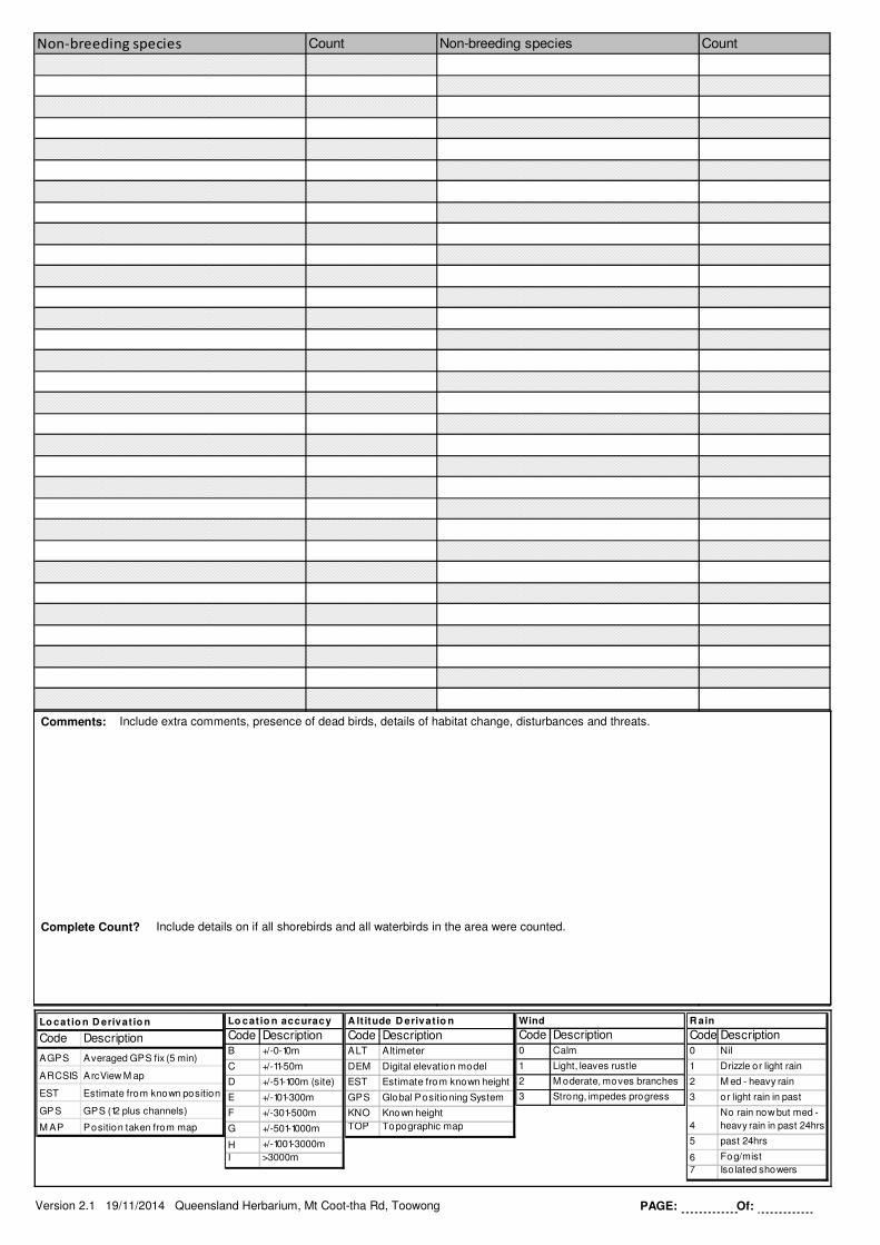
Count CountNon-breeding species Non-breeding species
Comments: Include extra comments, presence of dead birds, details of habitat change, disturbances and threats.
Complete Count? Include details on if all shorebirds and all waterbirds in the area were counted.
Version 2.1 19/11/2014 Queensland Herbarium, Mt Coot-tha Rd, Toowong PAGE: Of: