Embed Size (px)
Citation preview
V A N U A T UPage 139
1. COUNTRY INTRODUCTION
Description:
The Vanuatu archipelago consists of over 80 islands, 69 of which are inhabited, comprising of volcanic and raised limestone geologies. The population for 2009 was 234,023, with 76% of the population living in rural areas, being occupied in mainly subsistence and small holder farming, the remaining 24% of the population living in the two main urban areas of Port Vila on Efate and Luganville on Santo 19% and 5% respectively. (Vanuatu National Statistics Office).
Economy:
The economy is based primarily on small-scale agriculture that provides a living for 65% of the population. Fishing, offshore financial services and tourism are the other mainstays of the economy. Significant mineral deposits are known to exist, especially on the island of Santo.
Water Availability:
All of the larger islands have significant surface water resources and groundwater development potential where it is thought groundwater will play a significant role in the perennial nature of
many of the streams. Some smaller islands such as Mataso & Buninga in the Shepherd’s Group, all of the Torres Group, and small islands off Malekula and Santo have neither significant ground nor surface water, relying on rainwater harvesting. During times of national disaster such as cyclones the National Disaster Management Office has provided a desalination plant to these islands as a temporary measure. Bottled water is increasingly used in Port Vila and other urban areas.
Island Vulnerability:
Vanuatu is situated on the “Ring of Fire” and is in the centre of the South Pacific’s “Cyclone Alley”. It is vulnerable to natural disasters such as tsunamis, earthquakes, volcanic eruptions, and cyclones and is considered to be one of the most disaster prone countries in the South Pacific. Vanuatu’s population is generally concentrated along the coastal rim which plays a vital role in the subsistence and commercial life of Vanuatu. Increased human activity in this coastal environment especially on Efate is placing greater pressure on sensitive areas such as beaches, coral reefs and mangroves especially for tourist and resort development.
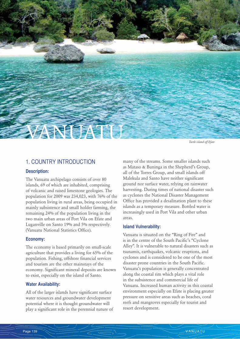
VANUATUTurtle island off Efate
C A T A L O G U E O F R I V E R S F O R P A C I F I C I S L A N D S Page 140
Power generation:
Electricity is produced by a privately operated hydropower plant on Santo and by diesel generation on Efate primarily for Port Vila. There has been a recent interest in renewable energy especially wind energy. There is significant potential on most of the larger islands for mini and micro hydroelectric systems but limited load demand.
Health:
Scabies, skin diseases and malaria are three of the most common health issues in Vanuatu and are associated with poor quality or insufficient water. Inappropriate and uncontrolled onsite wastewater disposal from livestock, especially pig pens, and humans are also major concerns for health. Poor sanitation is of particular concern for high-density areas where an outbreak of communicable water borne disease can quickly spread and affect a large number of people. Communicable diseases account for a large proportion of illness and death in Vanuatu. The tourism industry is also compromised by poor sanitation facilities. The Vanuatu Island Bungalow Association (VIBA) is participating in the Eco-Sanitation Program in an attempt to introduce more hygienic and more acceptable sanitation to remote tourist locations. Community awareness programs are assisting with improvement of the situation.
Environment and Tourism:
There are seventeen nature reserves in Vanuatu that cover a range of habitats including coastal areas, inland areas, forests and waterways. Despite a biodiversity study undertaken by the Environment Unit there is still a lack of knowledge on habitats and endangered species. Outside the system of reserves, no formal sectoral linkages are currently known for planning and management of coastal development or the impacts of land based activities on waterways and coastal ecosystems. Eco-tourism is being promoted as a means to protect the environment. Tourism and property development for foreign buyers is a major and growing source of income for the country especially on the island of Efate.
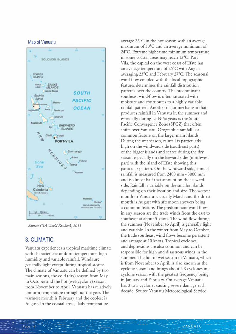
2. GEOGRAPHIC Known in Condominium days as “New Hebrides”, this island group was rechristened “Vanuatu”, on July 30th, 1980, the day it achieved political independence from France and the United Kingdom and became a Republic, with an elected Parliament and a Council of Chiefs to mark its ties with custom and tradition. The dual colonial influence enhanced the country’s cultural diversity and provided the basis for economic development and tourism opportunities. The country is made up of some 80 islands in the shape of a “Y” on a north-westerly slant. Most of the islands that make up the archipelago range from atolls to a young chain of mountainous and volcanic islands, rising high out of the sea with the highest peak located on Santo Island, the largest island in the chain, at about 1800 meters above mean sea level. The northernmost islands, the Torres group, are located about 900 km from Aneityum at the southern tip with the whole group covering a land mass of 12,189 km2 and an ocean area of 450,000 km2. Being located right on the Pacific Rim of Fire, on the subduction zone of two tectonic plates, Vanuatu is frequently subject to earthquakes. The seismic monitoring stations register tremors almost continuously, but only the major ones can be felt on land. There are several permanently active volcanoes on the islands of Tanna, Ambrym and Lopevi. Vanuatu also offers a variety of pools and lakes (such as Lake Manaro on Ambae) which is an old crater surrounded by rainforest. There is growing evidence that people migrating from Asia towards the South Pacific came through the islands of Melanesia in the Pacific migration with Vanuatu being a central point for these migratory movements.
V A N U A T UPage 141
3. CLIMATICVanuatu experiences a tropical maritime climate with characteristic uniform temperature, high humidity and variable rainfall. Winds are generally light except during tropical storms. The climate of Vanuatu can be defined by two main seasons, the cold (dry) season from May to October and the hot (wet/cyclone) season from November to April. Vanuatu has relatively uniform temperature throughout the year. The warmest month is February and the coolest is August. In the coastal areas, daily temperature
average 26°C in the hot season with an average maximum of 30°C and an average minimum of 24°C. Extreme night-time minimum temperature in some coastal areas may reach 13°C. Port Vila, the capital on the west coast of Efate has an average temperature of 25°C with August averaging 23°C and February 27°C. The seasonal wind flow coupled with the local topographic features determines the rainfall distribution patterns over the country. The predominant southeast wind-flow is often saturated with moisture and contributes to a highly variable rainfall pattern. Another major mechanism that produces rainfall in Vanuatu in the summer and especially during La Niña years is the South Pacific Convergence Zone (SPCZ) that often shifts over Vanuatu. Orographic rainfall is a common feature on the larger main islands. During the wet season, rainfall is particularly high on the windward side (southeast parts) of the bigger islands and scarce during the dry season especially on the leeward sides (northwest part) with the island of Efate showing this particular pattern. On the windward side, annual rainfall is measured from 2400 mm - 3000 mm and is almost half that amount on the leeward side. Rainfall is variable on the smaller islands depending on their location and size. The wettest month in Vanuatu is usually March and the driest month is August with afternoon showers being a common feature. The predominant wind flows in any season are the trade winds from the east to southeast at about 5 knots. The wind flow during the summer (November to April) is generally light and variable. In the winter from May to October, the trade southeast wind flows become persistent and average at 10 knots. Tropical cyclones and depressions are also common and can be responsible for high and disastrous winds in the summer. The hot or wet season in Vanuatu, which is from November to April, is also known as the cyclone season and brings about 2-3 cyclones in a cyclone season with the greatest frequency being in January and February. On average Vanuatu has 3 to 5 cyclones causing severe damage each decade. Source Vanuatu Meteorological Service
Map of Vanuatu
Source: CIA World Factbook, 2011

C A T A L O G U E O F R I V E R S F O R P A C I F I C I S L A N D S Page 142
Map of Efate Catchments
Source: SOPAC 2010
Source: SOPAC 2010
Map of Espiritu Santo Catchments
V A N U A T UPage 143
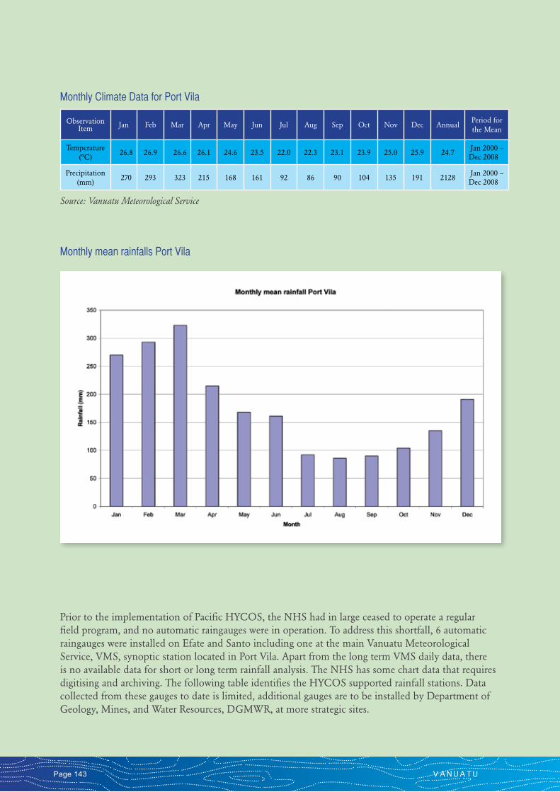
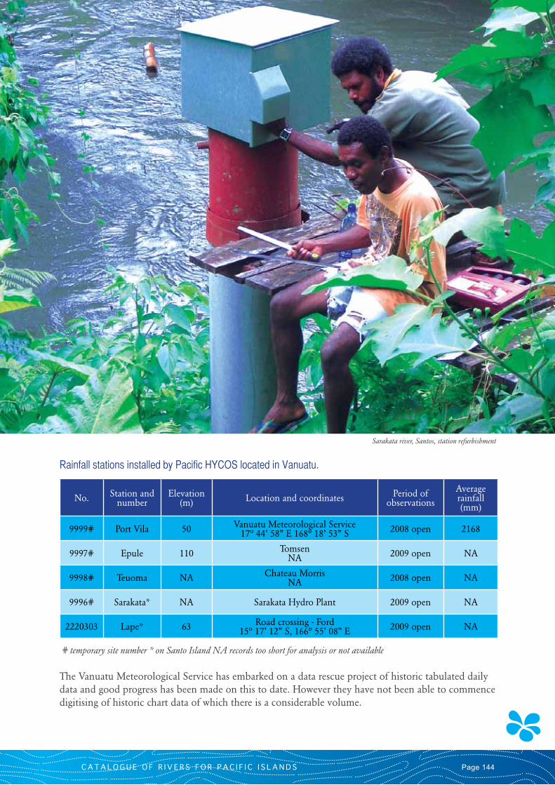
Prior to the implementation of Pacific HYCOS, the NHS had in large ceased to operate a regular field program, and no automatic raingauges were in operation. To address this shortfall, 6 automatic raingauges were installed on Efate and Santo including one at the main Vanuatu Meteorological Service, VMS, synoptic station located in Port Vila. Apart from the long term VMS daily data, there is no available data for short or long term rainfall analysis. The NHS has some chart data that requires digitising and archiving. The following table identifies the HYCOS supported rainfall stations. Data collected from these gauges to date is limited, additional gauges are to be installed by Department of Geology, Mines, and Water Resources, DGMWR, at more strategic sites.
Observation Item Jan Feb Mar Apr May Jun Jul Aug Sep Oct Nov Dec Annual
Period for the Mean
Temperature (ºC)
26.8 26.9 26.6 26.1 24.6 23.5 22.0 22.3 23.1 23.9 25.0 25.9 24.7 Jan 2000 – Dec 2008
Precipitation (mm)
270 293 323 215 168 161 92 86 90 104 135 191 2128 Jan 2000 – Dec 2008
Monthly Climate Data for Port Vila
Source: Vanuatu Meteorological Service
Monthly mean rainfalls Port Vila
C A T A L O G U E O F R I V E R S F O R P A C I F I C I S L A N D S Page 144
# temporary site number * on Santo Island NA records too short for analysis or not available
The Vanuatu Meteorological Service has embarked on a data rescue project of historic tabulated daily data and good progress has been made on this to date. However they have not been able to commence digitising of historic chart data of which there is a considerable volume.
No. Station and number
Elevation (m) Location and coordinates Period of
observations
Average rainfall (mm)
9999# Port Vila 50 Vanuatu Meteorological Service 17º 44’ 58” E 168º 18’ 53” S 2008 open 2168
9997# Epule 110 Tomsen NA 2009 open NA
9998# Teuoma NA Chateau Morris NA 2008 open NA
9996# Sarakata* NA Sarakata Hydro Plant 2009 open NA
2220303 Lape* 63 Road crossing - Ford 15º 17’ 12” S, 166º 55’ 08” E 2009 open NA
Rainfall stations installed by Pacific HYCOS located in Vanuatu.
Sarakata river, Santos, station refurbishment

V A N U A T UPage 145
4. WATER RESOURCES
4.1 General Description
The water resources in Vanuatu are as diverse as the island group itself. They vary from the shallow freshwater lenses on the low islands, to mixed surface water streams and groundwater on the medium sized islands such as Efate to the comparative water abundance within large river systems on the larger islands such as Santo. In general terms of availability there would appear to be water in excess, however urbanisation is stressing local supplies. Droughts and issues over water quality can also compromise supply especially for available potable water. Both ground and surface water are used for domestic purposes. In urban areas the main water source is shallow aquifers whereas in rural areas various sources are used such as bores, wells, springs, rivers and rainwater catchments. Urban water supplies are provided by UNELCO (a private company) in Port Vila and Public Works in Luganville, Isangel and Lakatoro. In both Port Vila and Luganville aquifers are under increasing pressure from housing, agriculture and other developments including tourism resorts and land development. Outside of the areas of the reticulated supply, no formal assessment has been made on the available water resources. Information on surface and ground water resources in Vanuatu is lacking, data is very limited and there is only a modest improvement in monitoring and assessment programs.
Apart from the risks associated with water quality and potable supply, the urban areas around Port Vila and Luganville experience periodic flooding. Currently there is little available data to assist with flood estimates, infrastructure design, or from which to develop mitigation measures. Though less abundant on Efate, most of the larger islands have significant river systems and potential for viable hydro power, although the local load is limited to village supply with possible future mineral processing in Santo. Similarly the generally fertile soils, and available water suggests good potential for irrigated agriculture for food and commodity production,
although to date irrigation is limited to a village level. A national water resource database does exist within DGMWR, installed in the 1990’s however it contains limited and fragmented data.
4.2 Major Floods and Droughts
Flooding is common on low-lying flood plains near rivers such as those close to Port Vila and Luganville especially during tropical cyclones and during La Niña years. Prolonged rainfall during the wetter season often cause severe impacts to low lying villages, crops, road crossings, culverts, bridges and urban drainage infrastructure. Droughts in Vanuatu are related to the El Niño (ENSO – El Niño Southern Oscillation). The latest ENSO episodes, which resulted in dry conditions in Vanuatu, were in 1982/83, 1990/95 and the 1997/98. The worst observed drought year in Vanuatu was in 1993. However, during a normal year, drought effects can be experienced in rain-shadow areas such as the Port Vila water supply catchment. The absence of water resource data precludes any measurement or assessment of floods or droughts.
4.3 Socio-economic characteristics
Most Vanuatu Islanders (ni Van) live in rural communities based on traditional village and clan social structures and are dependent on subsistence agriculture supplemented by cash cropping, fishing and forest products. Use of water is based on traditional cultural use for fishing, food preparation, laundry and recreation, and in some cases limited irrigation. Most water use at the village level can be considered in-stream where any degradation of the resource from uses such as cattle farming, cropping or logging can have a detrimental effect on the community. Approximately 24 per cent of the population live in urban areas (Vanuatu National Statistics Office), with migration to cities and towns in the past decade or so contributing to urban unemployment and accompanying social problems. Contributing to this urbanisation is the poorly maintained infrastructure, including degraded reticulated water supply systems, in the rural towns. Port Vila draws its water from bores which are closely connected to the surface water
C A T A L O G U E O F R I V E R S F O R P A C I F I C I S L A N D S Page 146
stream. A significant issue precluding effective data collection programs being undertaken and development has been land ownership, where vandalism is common for any public or remote monitoring equipment deployed, or compensation claims required to ensure access and safeguard of stations.
5. HYDROLOGICAL INFORMATIONHydrological monitoring and assessment commenced in Vanuatu during the condominium days with some data being collected and archived on the ORSTOM HYDROM database system. Following independence in 1980 the new Department of Geology, Mines and Water Resources, DGMWR, was mandated to take the role of the NHS. Limited international assistance has been advanced to the NHS apart from a NZAID funded assistance program and training running from 1982 to 1996 when training and transfer of technology was given in surface water and groundwater hydrology, on short mobilisations. During this period only limited datasets were collected and sustainability of the program was an ongoing problem. On cessation of this assistance, the hydrology program waned to the point where no significant data was being collected.
Pacific HYCOS implemented in 2007 and has supplied considerable assistance to the hydrology unit of DGMWR, making considerable effort to renew the interest in hydrological data collection. A brief review of the data on the TIDEDA database installed by NZ National Institute for Water and Atmospheric Research, NIWA, shows the data to be of limited application with no long term datasets due to many gaps in the record, with sometimes up to 40 or 50% missing or corrupted data. Quality issues are highly apparent with few discharge measurements undertaken and where rating curves have not been established. Data was rescued from the ORSTOM HYDROM (French hydrological database system, and is no longer supported), this data also is of limited use. Donor support, technical assistance and training opportunities since the NIWA inputs have been extremely limited with subsequent difficulties in maintaining a field program to collect basic datasets.
5.1 Hydrological Stations
On commencement of Pacific HYCOS implementation, no hydrological stations were operating in Vanuatu, nor data collected and added to the database since the 2002. Lack of support at the institutional level including low value placed on the information, and poor resourcing with very limited operational budget,
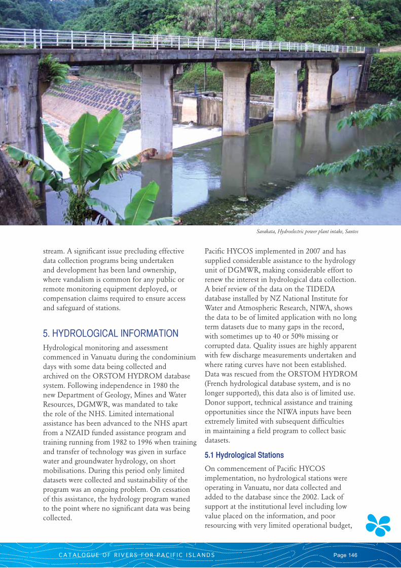
Sarakata, Hydroelectric power plant intake, Santos
V A N U A T UPage 147
rather than limited staff capacity, contributed to the situation where hydrological data was not routinely collected. The following number of hydro meteorological sites are listed on the Vanuatu TIDEDA database system;
• InstantaneousWaterlevelandflow,6(only 1 with rating curve)
• Instantaneouswaterlevelonly,18(bothgroundwater and surface water)
• Periodicdischargeonly,1
• Rainfall,19
The database includes some manually read groundwater level data of short duration. In 2010, HYCOS assisted in the deployment of several groundwater level loggers resulting in useful groundwater data being collected. The main island of Efate is compact with good access to all rivers and streams, though even here an operational hydrology program has been difficult to sustain.
5.2 Study Catchment Introduction
Pacific HYCOS in discussion with the NHS elected to support hydrological stations on Efate and Santo as the study catchments. The Sarakata catchment on Santo was selected as the primary demonstration catchment with important links
and support to other projects, including the Pacific IWRM GEF Project. On Efate, despite the close proximity of the Tagabe and La Colle stations to Port Vila these supported stations have been difficult to sustain by the NHS and no effective resource data has been collected to date.
5.2.1 General Description
The primary study catchment of the Sarakata rises on the southern end of Santo Island. The catchment is forested, except for the lower catchment where there are extensive clearings of pasture land for cattle grazing and village food production, this terrain is interspersed with some incised rugged gorges. Access to rivers on Santo depends on road conditions, for the Sarakata stations this is relatively good. In rural areas, the roads are at best bad and can be impassable in the wet season. Much of the Santo has no road access.
5.2.2 Measured Hydrological data
There is little quality hydrological information available for the Vanuatu. The NHS has made their best attempt to collect data from the Pacific HYCOS supported sites but little substantial data has been collected to date. The following table identify the sites and locations of Pacific HYCOS supported sites.
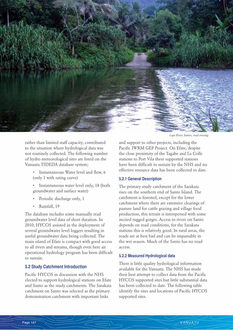
Lape River, Santos, road crossing
C A T A L O G U E O F R I V E R S F O R P A C I F I C I S L A N D S Page 148
WL = Waterlevel, Q = discharge flow, RF = Rainfall ? assumed to be open NA not available * denotes located on the island of Santo
No. Station and number Location Catchment Area
(km2)Observation
Period
Observation Items
(frequency)
1 Sarakata* 2220303
Above intake Site NA 1965 to 1996 WL, Q, RF
2 Lape* NA
Above for road crossing 15º 17’ 12” S, 166º 55’ 08” E 2009 open ? WL, Q, RF
3 Epule 5003901
Tomsen NA 2009 open ? WL, Q, RF
4 La Colle 5536101
Russet 17º 41’ 31” S, 168º 19’ 31” E 2009 open ? WL, Q
5 Tagabe NA
Pumping Station 17º 42’ 37” S, 168º 19’ 26” E 2009 open WL, Q
6 Adsone* 2250101
Patmarifu NA 1999-2002 WL, Q
Hydrological stations in Vanuatu supported by Pacific HYCOS
Catchment 1 – Sarakata upstream of Intake Site, Espiritu Santo
The Sarakata River flows adjacent to the main Santo town of Lugainville into the ocean. It experiences periodic flooding, has encroaching urban sprawl, hydro electric power generation, and agriculture development. Portable water supplies to Luganville are sourced from a shallow aquifer found in the lower Sarakata catchment. The Sakarata is a substantial river by Vanuatu terms and a hydrological station was installed upstream of the UNELCO power station with
NIWA assistance around 2000. There has been insubstantial data collected to date despite Pacific HYCOS support in re-commissioning the station in 2007. It is hoped that the NHS can better engage with data collection when their institutional position improves. The NHS have been unable to supply any additional data from this site to date, for inclusion in this publication.
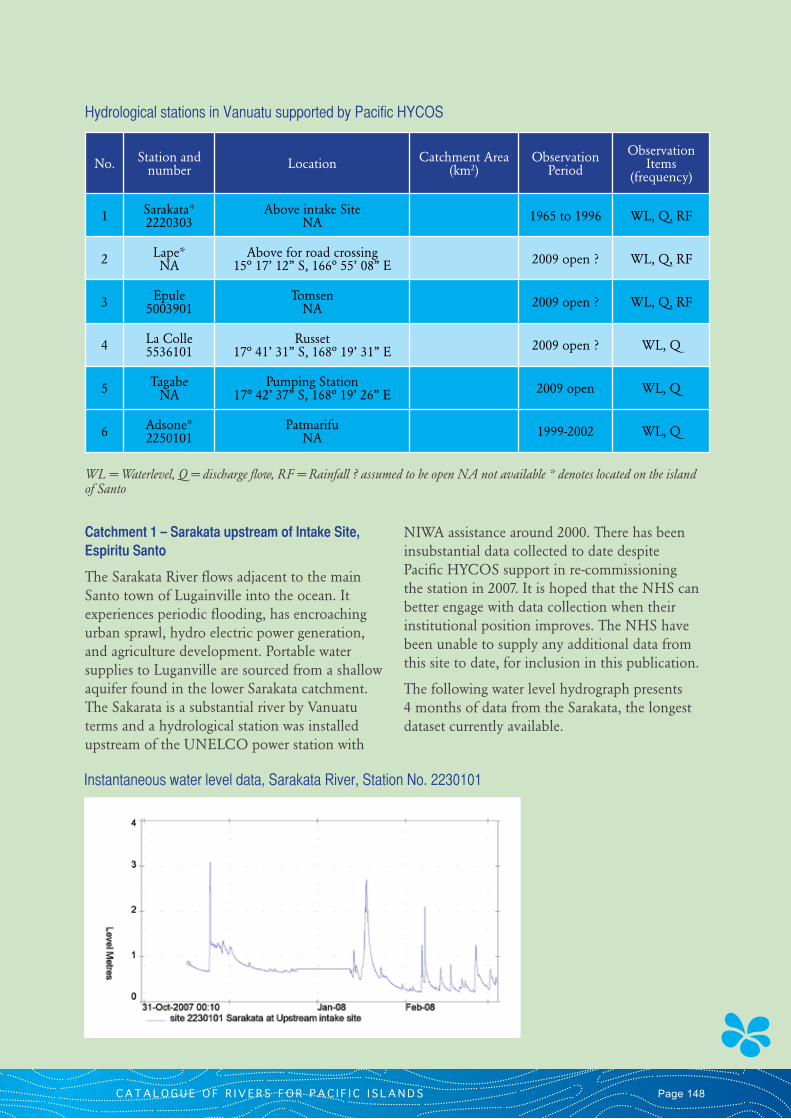
The following water level hydrograph presents 4 months of data from the Sarakata, the longest dataset currently available.
Instantaneous water level data, Sarakata River, Station No. 2230101
V A N U A T UPage 149
6. COMMENTIn general there is extremely limited usable hydrological data available for Vanuatu due to poor and fragmented records, very few discharge measurements being undertaken and essentially no substantial data collected within the last decade or two especially on the larger rivers, with great uncertainty in any rating curves which have been developed. This is despite Vanuatu commencing hydrological monitoring over 30 years ago. It is doubted that the data that is available is even useful for the basic calibration of catchment models and for identification of storm or drought sequences. A minimum of 10 years of consistent and continuous data is needed for hydrological statistics to be derived and a review of the data has shown this is lacking. The NHS and their staff have shown a fair level of commitment during Pacific HYCOS for the collection of hydrological data and it is hopeful that by 2015 some robust datasets may have been collected. These datasets will assist government and stakeholders alike to make a more informed assessment on the development and sustainability options of the nation’s water resources. In particular the need for data for energy production, disaster risk management and mitigation in regard to large floods and droughts. There are no professional hydrologists within the NHS who might be able to better advance the operational program, develop capacity and address the serious and ongoing issues recognised during the Pacific HYCOS implementation and the preparation of this publication. The hydrology program is driven from a largely technical base with only modest skill levels.
7. PHOTOGRAPHS
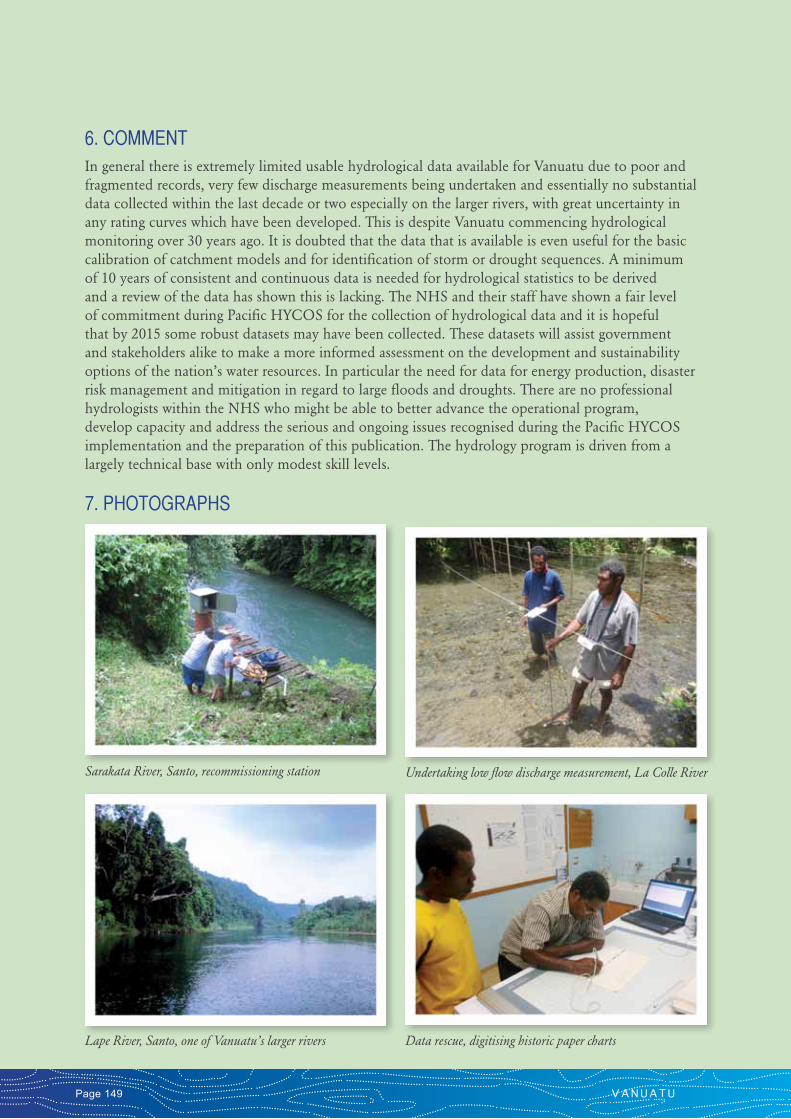
Sarakata River, Santo, recommissioning station
Lape River, Santo, one of Vanuatu’s larger rivers
Undertaking low flow discharge measurement, La Colle River
Data rescue, digitising historic paper charts
C A T A L O G U E O F R I V E R S F O R P A C I F I C I S L A N D S Page 150
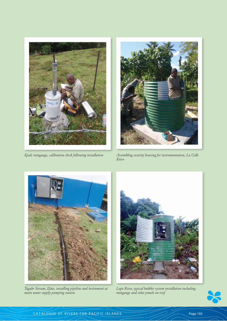
Epule raingauge, calibration check following installation Assembling security housing for instrumentation, La Colle River
Tagabe Stream, Efate, installing pipeline and instrument at main water supply pumping station
Lape River, typical bubbler system installation including raingauge and solar panels on roof