Embed Size (px)
Citation preview
USFS - Region 6 USFS - Region 6 Imagery ProgramImagery Program

USFS - Region 6 USFS - Region 6 Imagery ProgramImagery Program

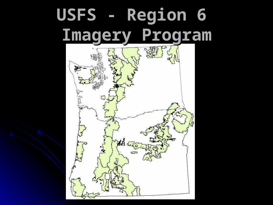
USFS - Region 6 USFS - Region 6 Imagery ProgramImagery Program
Landsat TM25+ scenes downloadedfrom MRLC Landsat Science collection
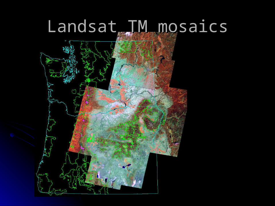
Landsat TM mosaicsLandsat TM mosaics

USFS - Region 6 USFS - Region 6 Imagery ProgramImagery Program
NAIPWashington – 2006Oregon – 2005
½ meter buy-up for entiretwo states
Used extensively by thefield and GIS staffs,and by the remotesensing staff (texture)

USFS - Region 6 USFS - Region 6 Imagery ProgramImagery Program
SPOT, IKONOS, QuickBird nothing purchased in 2008
Resource Photography no new acquisitions one set of reprints ordered (Siuslaw NF)
Photogrammetry no projects in 2008

Region 6 Region 6 Special Purpose Special Purpose
PhotographyPhotography

Region 6 SPPRegion 6 SPP 20082008
Prints DeliveredPrints Delivered 35243524
Prints ScannedPrints Scanned 33733373
Flight Line MilesFlight Line Miles 11881188
Average Scale Average Scale 1:69001:6900
Number of ProjectsNumber of Projects 7878

Region 6 SPPRegion 6 SPP
0
1000
2000
3000
4000
prints 1055 2346 3508 3524
scans 0 0 2048 3373
miles flown 407 842 1142 1182
2005 2006 2007 2008

Region 6 SPPRegion 6 SPPFY09
ProgramOf Work
Collecting project requests until Dec 1.FY09 budget of $125,000.

Region 6Region 6FY09 Program of WorkFY09 Program of Work
Four orthorectification projects:-Two on Olympic NF for assisting in timber planning-Two on Willamette NF for restoration planning
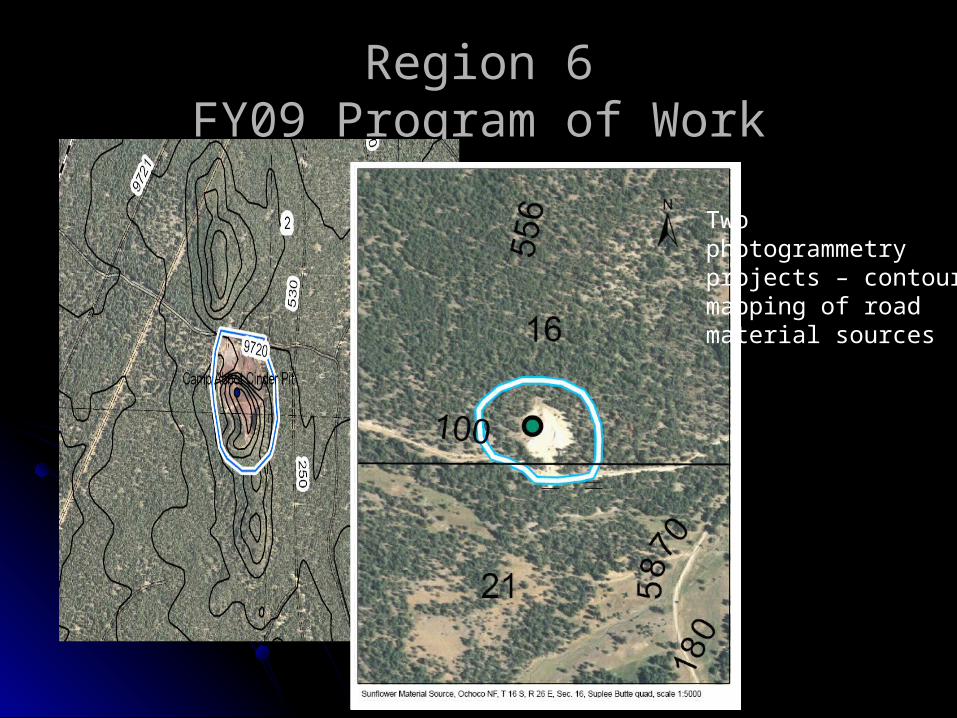
Region 6Region 6FY09 Program of WorkFY09 Program of Work
Two photogrammetry projects – contour mapping of road material sources

Region 6Region 6FY09 Program of WorkFY09 Program of Work
Major LiDAR acquisitionsIn Washington and Oregon
Puget Sound LidarConsortium Cyan – completedOregon Lidar Consortium Grey – planned Blue – contractedRegion 6 Red – completed
Three major acquisitions on NF lands totaling over 800 square miles.
Budgeted 19 person-weeksfor LiDAR processing of NFlands