Embed Size (px)
Citation preview
USDA and NOAA Partnerships:USDA and NOAA Partnerships:Data, Decision Making, and the Data, Decision Making, and the
Advent of NIDISAdvent of NIDIS
Presented to the Presented to the
NWS Eastern Region and Southern RegionNWS Eastern Region and Southern Region
2007 Climate Workshop2007 Climate Workshop
June 21, 2007June 21, 2007
Mark D. BrusbergMark D. Brusberg
USDA Office of the Chief EconomistUSDA Office of the Chief Economist
World Agricultural Outlook BoardWorld Agricultural Outlook Board
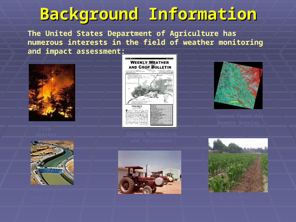
Background InformationBackground InformationThe United States Department of Agriculture has numerous interests in the field of weather monitoring and impact assessment:
Global Monitoring and Assessment
Ground Truth forRemote Sensing
Crop Insurance Programs
Western Water Supply Forecasting Research
Fire Weather

Chief MeteorologistJoint Agricultural Weather Facility
Remote Sensing Coordinator
Interagency Agricultural Projections Coordinator
OCE Chief Economist
Secretary/Deputy Secretary
USDA Situation and Outlook Organizational Structure
WAOB Chairperson
Grains OilseedsLivestock Fibers Specialty Crops
Interagency Commodity Estimates CommitteesChaired by WAOB Senior Analysts
OCE Organizational StructureOCE Organizational Structure
NOAA/USDA Joint Agricultural NOAA/USDA Joint Agricultural Weather Facility (JAWF)Weather Facility (JAWF)
Jointly operated by NOAA/NWS and USDA/OCE (Washington, D.C.)Jointly operated by NOAA/NWS and USDA/OCE (Washington, D.C.) USDA and NWS (CPC) meteorologists work together as a teamUSDA and NWS (CPC) meteorologists work together as a team
Mission: Keep the Nation’s growers, exporters, USDA commodity analysts, as Mission: Keep the Nation’s growers, exporters, USDA commodity analysts, as well as the Secretary and top staff informed of world-wide weather related well as the Secretary and top staff informed of world-wide weather related developments and their effects on crops and livestockdevelopments and their effects on crops and livestock Routinely collect global weather data and agricultural information to Routinely collect global weather data and agricultural information to
determine the impact of growing season weather conditions on crops and determine the impact of growing season weather conditions on crops and livestock production prospectslivestock production prospects
Directly advise the Office of the Chief Economist and the Secretary of Directly advise the Office of the Chief Economist and the Secretary of Agriculture on weather related agricultural developmentsAgriculture on weather related agricultural developments
Provide crop-weather assessments for WAOB’s monthly World Provide crop-weather assessments for WAOB’s monthly World Agricultural Supply and Demand Estimates (WASDE) lockup reportAgricultural Supply and Demand Estimates (WASDE) lockup report
Disseminate global weather data to other agencies within USDADisseminate global weather data to other agencies within USDA

Meteorological Surface Data
Metar (~ 5,000 stations) Frequency of reporting: 1 hour Wind speed Temperature Precipitation (U.S. only) Dew point
Synoptic (~ 7,000 stations) Frequency of reporting: 3 hours Wind speed Temperature Precipitation Dew point
Summarized by CPC from hourly data Maximum temperature Minimum temperature Total precipitation 3-Hourly observed weather
Hourly Daily

Agrometeorological Indices
Vapor Pressure Deficit Temperature Dew point
Potential Evapotranspiration Temperature Dew point Wind speed
Soil Moisture Precipitation PET
Growing Degree Days Temperature
Crop Stress Index Temperature VPD Wind speed

Daily Activities and Daily Activities and AssessmentsAssessments
Morning US Weather Briefing and Report Morning US Weather Briefing and Report (WAOB, NWS)(WAOB, NWS)
Afternoon Global Weather Briefing (NWS)Afternoon Global Weather Briefing (NWS)
Daily Highlights of Agricultural Daily Highlights of Agricultural
Developments (WAOB)Developments (WAOB)
Special Reports (WAOB)Special Reports (WAOB)

Weekly Activities and Weekly Activities and AssessmentsAssessments
Weekly Weather and Crop BulletinWeekly Weather and Crop Bulletin U.S. and foreign weather analyses and U.S. and foreign weather analyses and
tabular weather data (NWS)tabular weather data (NWS) U.S. Agricultural Summary (NASS)U.S. Agricultural Summary (NASS) National and International Weather and National and International Weather and
Crop Summaries (WAOB)Crop Summaries (WAOB)
USDA Secretary Briefing (WAOB, NWS)USDA Secretary Briefing (WAOB, NWS) Highlight relevant global crop-weather Highlight relevant global crop-weather
impacts for USDA top staffimpacts for USDA top staff
Drought MonitorDrought Monitor (NOAA, WAOB, NDMC) (NOAA, WAOB, NDMC)
Global Weather Briefing for USDA Global Weather Briefing for USDA analysts (NWS)analysts (NWS)
Media (WAOB, NWS)Media (WAOB, NWS)
Monthly Activities and Monthly Activities and AssessmentsAssessments
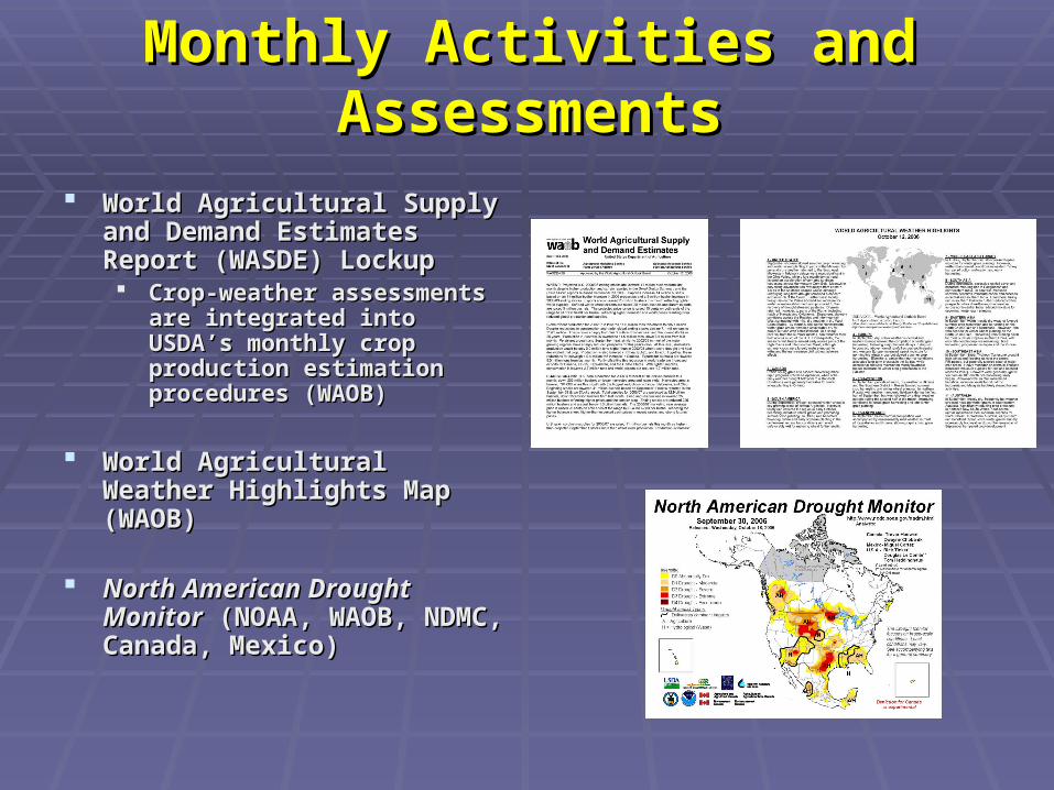
World Agricultural Supply and World Agricultural Supply and Demand Estimates Report Demand Estimates Report (WASDE) Lockup (WASDE) Lockup Crop-weather assessments are Crop-weather assessments are
integrated into USDA’s monthly integrated into USDA’s monthly crop production estimation crop production estimation procedures (WAOB)procedures (WAOB)
World Agricultural Weather World Agricultural Weather Highlights Map (WAOB)Highlights Map (WAOB)
North American Drought North American Drought MonitorMonitor (NOAA, WAOB, NDMC, (NOAA, WAOB, NDMC, Canada, Mexico)Canada, Mexico)

USDA Organization Chart
Joint Agricultural Weather Facility(Office of Chief Economist)
Other partnerships exist between USDA and NOAA!

Question:
How can NOAA more effectively coordinate weather and climate data requirements for both operations and policy decisions across a wide spectrum of disciplines?
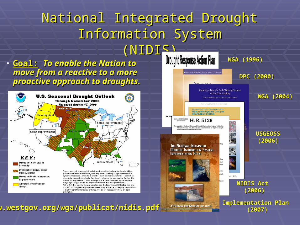
• Goal:Goal: To enable the Nation to move To enable the Nation to move from a reactive to a more proactive from a reactive to a more proactive approach to droughts.approach to droughts.
www.westgov.org/wga/publicat/nidis.pdfwww.westgov.org/wga/publicat/nidis.pdf
National Integrated Drought Information SystemNational Integrated Drought Information System(NIDIS)(NIDIS)
WGA (1996)WGA (1996)
DPC (2000)DPC (2000)
NIDIS ActNIDIS Act (2006)(2006)
USGEOSSUSGEOSS(2006)(2006)
WGA (2004)WGA (2004)
Implementation PlanImplementation Plan (2007)(2007)
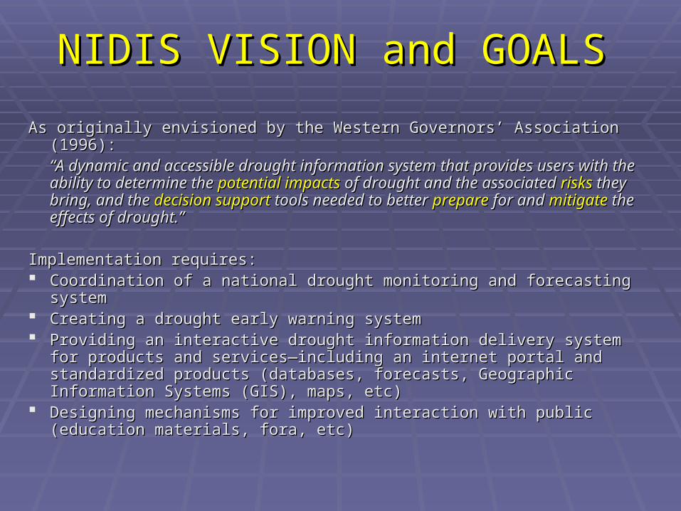
NIDIS VISION and GOALSNIDIS VISION and GOALS
As originally envisioned by the Western Governors’ Association (1996):As originally envisioned by the Western Governors’ Association (1996):““A dynamic and accessible drought information system that provides A dynamic and accessible drought information system that provides users with the ability to determine the users with the ability to determine the potential impactspotential impacts of drought and of drought and the associated the associated risksrisks they bring, and the they bring, and the decision supportdecision support tools needed to tools needed to better better prepareprepare for and for and mitigatemitigate the effects of drought.” the effects of drought.”
Implementation requires:Implementation requires: Coordination of a national drought monitoring and forecasting systemCoordination of a national drought monitoring and forecasting system Creating a drought early warning systemCreating a drought early warning system Providing an interactive drought information delivery system for products Providing an interactive drought information delivery system for products
and services—including an internet portal and standardized products and services—including an internet portal and standardized products (databases, forecasts, Geographic Information Systems (GIS), maps, (databases, forecasts, Geographic Information Systems (GIS), maps, etc)etc)
Designing mechanisms for improved interaction with public (education Designing mechanisms for improved interaction with public (education materials, fora, etc)materials, fora, etc)
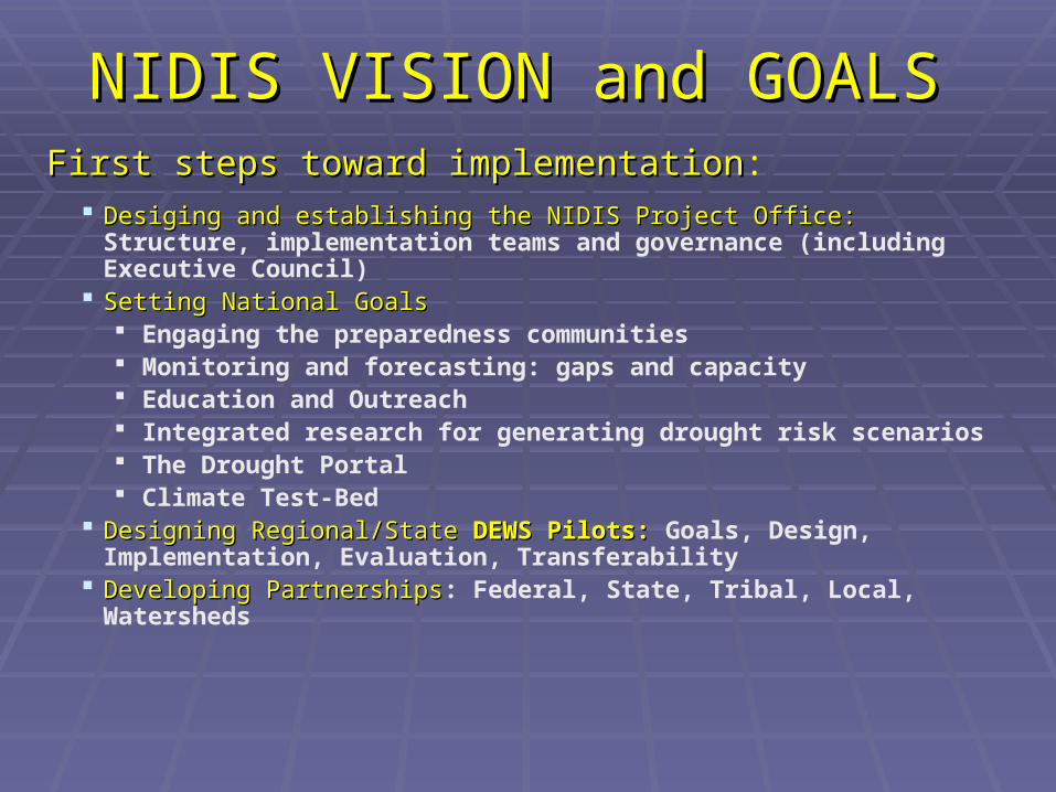
Desiging and establishing the NIDIS Project Office:Desiging and establishing the NIDIS Project Office: Structure, implementation teams and governance (including Executive Council)
Setting National GoalsSetting National Goals Engaging the preparedness communities Monitoring and forecasting: gaps and capacity Education and Outreach Integrated research for generating drought risk scenarios The Drought Portal Climate Test-Bed
Designing Regional/StateDesigning Regional/State DEWS Pilots: DEWS Pilots: Goals, Design, Implementation, Evaluation, Transferability
Developing PartnershipsDeveloping Partnerships: Federal, State, Tribal, Local, Watersheds
NIDIS VISION and GOALSNIDIS VISION and GOALSFirst steps toward implementationFirst steps toward implementation:

Interagency and Interstate NIDIS Team and Implementation PlanInteragency and Interstate NIDIS Team and Implementation Plan U.S. Drought PortalU.S. Drought Portal Presentations to various stakeholder and other communities by Project Presentations to various stakeholder and other communities by Project
Team members: Creating a drought response communityTeam members: Creating a drought response community Identify and review NOAA cross-line activities in support of NIDISIdentify and review NOAA cross-line activities in support of NIDIS Workshops to initiate pilot team and prototype design: Cross-agency Workshops to initiate pilot team and prototype design: Cross-agency
and cross-state coordinationand cross-state coordination. Note: All activities designated as “NIDIS . Note: All activities designated as “NIDIS pilots” must be approved by the NIDIS Teampilots” must be approved by the NIDIS Team
Focusing Climate Test-Bed activities in pilot locationsFocusing Climate Test-Bed activities in pilot locations USGS detail to the NIDIS Program office (others?)USGS detail to the NIDIS Program office (others?) Partnerships with California Department of Water Resources, Partnerships with California Department of Water Resources,
Western States Water Council (others) Western States Water Council (others) National Workshop: Status of Drought Early Warning in the U.S.National Workshop: Status of Drought Early Warning in the U.S. USGEOUSGEO
Steps Toward ImplementationSteps Toward Implementation

Governance Structure for NIDIS ImplementationNIDIS Executive Council
Co-chairs: Director, NOAA Climate Program Office (or designee) Director, National Drought Mitigation Center (or designee)
NIDIS Program Office(NPO Director)
•Coordinate NIDIS-relevant cross-NOAA•and Interagency drought-related activities
•Develop a national presence for NIDIS(e.g. formal links to National Governors Ass’n)
•Participate in GEOSS / IEOS
Public AwarenessAnd Education
IntegratedMonitoring and
Forecasting
InterdisciplinaryResearch andApplications
Engaging PreparednessCommunities
U.S.Drought Portal
NIDIS Program Implementation Team (NPIT)
Working-Level Partner RepresentativesCoordinate and develop evaluation criteria for all NIDIS activities including pilot project selection
Chair: NPO Director
National Integrated Drought Information System Drought Early Warning System Design, Pilots, and Implementation
NIDIS Technical Working GroupsFederal, Regional, State, Tribal and Local Partner Leads
Embedded in national and regional, and local NIDIS ActivitiesDevelop pilot implementation and transferability criteria
Co-Chairs selected by NPIT

Coming soon: www.drought.govComing soon: www.drought.gov
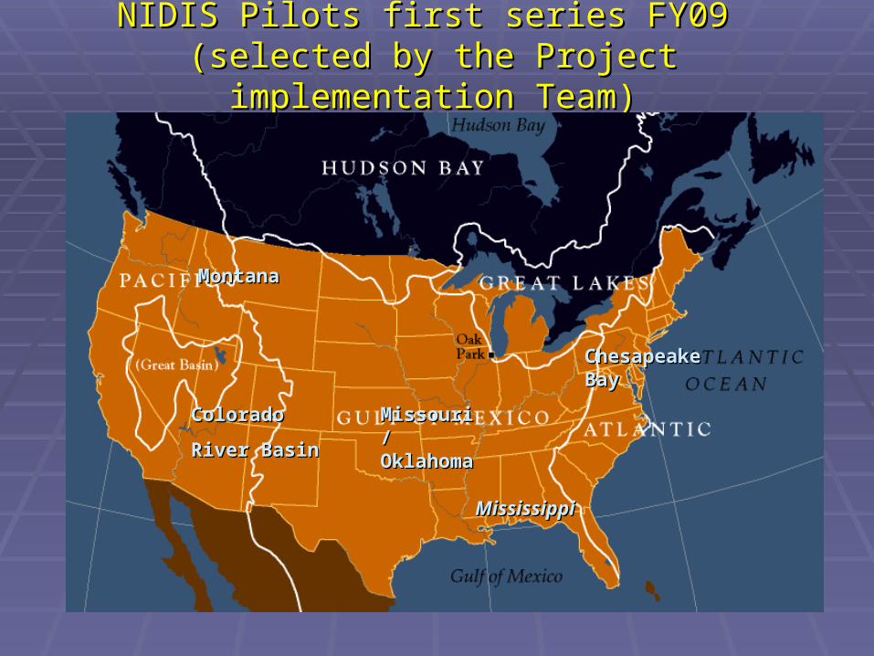
NIDIS Pilots first series FY09 NIDIS Pilots first series FY09 (selected by the Project implementation Team)(selected by the Project implementation Team)
Colorado Colorado
River BasinRiver Basin
Chesapeake Chesapeake Bay Bay
MontanaMontana
Missouri/Missouri/OklahomaOklahoma
MississippiMississippi

• Monitoring and forecastingMonitoring and forecasting National, regional and local levels gap analyses and product tailoring, benefits of additional (soil moisture, etc.) sensors. Real time data streams
• Risk assessmentRisk assessment Enable resource and other management authorities to generate risk and impact scenarios (e.g., indicators, triggers, risk analysis in particular settings for EWS)
• Raising Public awareness of drought risksRaising Public awareness of drought risks
Goal Areas for the PilotsGoal Areas for the Pilots
• Preparedness Preparedness Outline and inform actions required to reduce the loss and damage expected from an impending hazard event
• Communication Communication Delivery of timely information on impending events, potential risk scenarios and preparedness strategies
• Evaluation and feedbackEvaluation and feedback

Long-Term (>5 years)
Short–Term (1-3 years)
Begin Pilots:-Establish local partnerships
-Identify regional capabilities to address goal areas
- Identify activities to improve capabilities
Summary of Pilot Goals and TimelinesSummary of Pilot Goals and Timelines
Evaluate Pilots:-Effectiveness within region
-Understanding of local drought
-Ability to monitor, predict, and mitigate
Transition to non-Pilot areas
Initiate second series of Pilots
Transition to National Program
Delivery of National Products to Regional and Local Level
Continued Refinement
Mid–Term (3-5 years)

[email protected]@usda.gov
http://www.usda.gov/oce/weather/http://www.usda.gov/oce/weather/
Questions?Questions?
[email protected]@noaa.gov