Embed Size (px)
Citation preview
1
Usage of GIS Data (Overview/Crash Perspective)
Division of Traffic Engineering & Operations
MCDOT
Devang Dave, Traffic Engineer
2
Outline
Introduction Process Outcome Usage of the data Various programs What we can do better Questions/Answers
3
Introduction
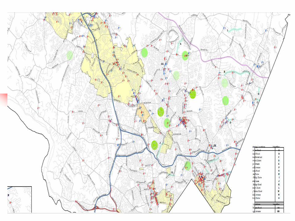
SHA & MCPD traffic crash data owner TE&O analyze GIS: Great Tool for Visualization /
Analysis
4
Process
Upload into GIS (address match) Intersection Particular address (i.e. parking lot) Heat Map / Density (based on crash
frequency)
5
6
Example
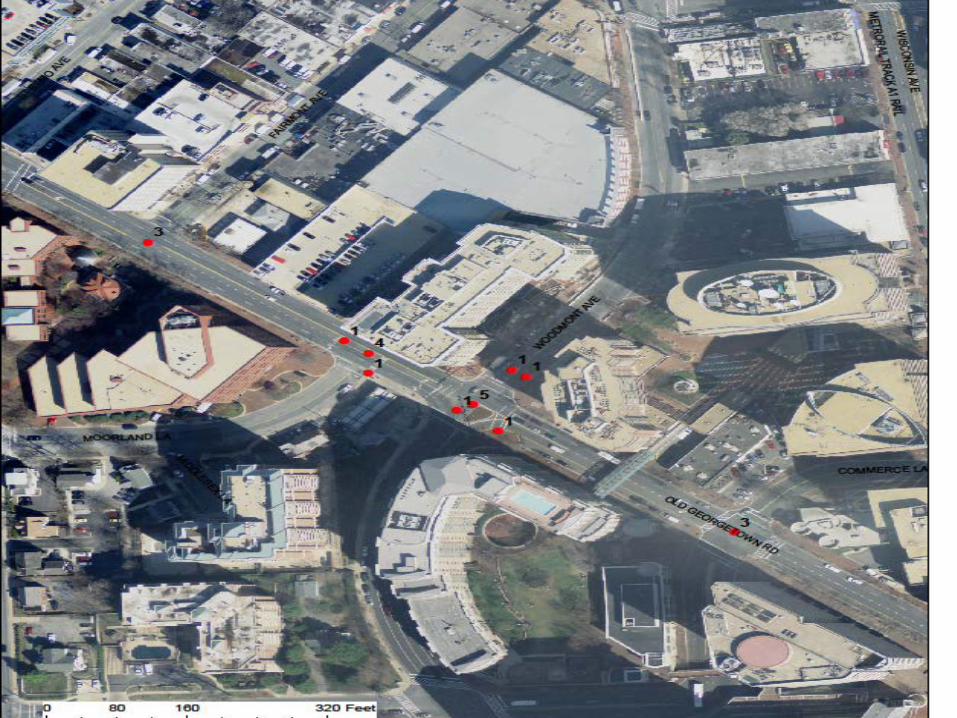
How to Geocode Parking Lot Crash Data Please see the handouts
7
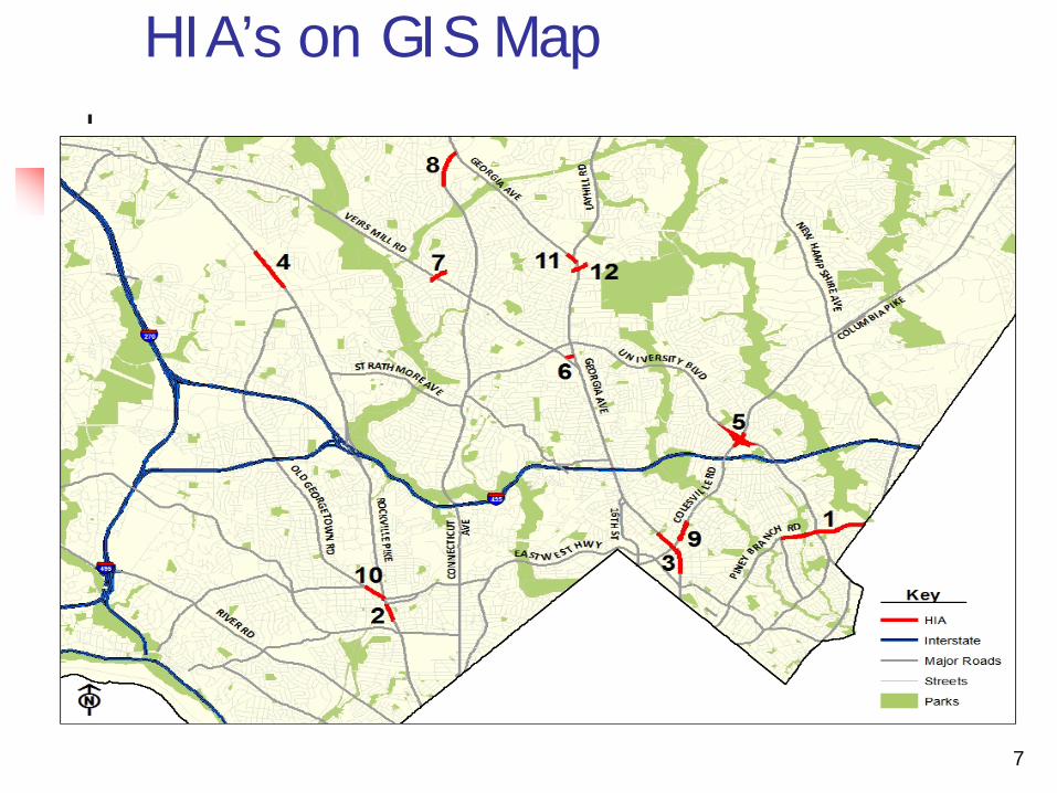
HIA’s on GIS Map
8
9
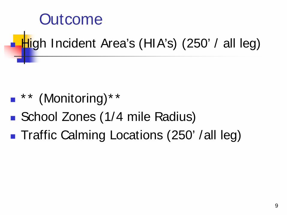
Outcome High Incident Area’s (HIA’s) (250’ / all leg)
** (Monitoring)** School Zones (1/4 mile Radius) Traffic Calming Locations (250’ /all leg)
10
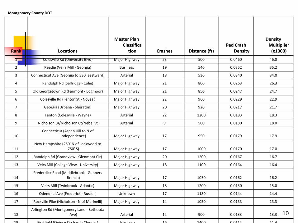
Montgomery County DOT
Rank Locations
Master Plan Classifica
tion Crashes Distance (ft) Ped Crash
Density
Density Multiplier
(x1000)
1 Colesville Rd (University Blvd) Major Highway 23 500 0.0460 46.0
2 Reedie (Veirs Mill - Georgia) Business 19 540 0.0352 35.2
3 Connecticut Ave (Georgia to 530' eastward) Arterial 18 530 0.0340 34.0
4 Randolph Rd (Selfridge - Colie) Major Highway 21 800 0.0263 26.3
5 Old Georgetown Rd (Fairmont - Edgmoor) Major Highway 21 850 0.0247 24.7
6 Colesville Rd (Fenton St - Noyes ) Major Highway 22 960 0.0229 22.9
7 Georgia (Urbana - Sheraton) Major Highway 20 920 0.0217 21.7
8 Fenton (Colesville - Wayne) Arterial 22 1200 0.0183 18.3
9 Nicholson La/Nicholson Ct/Nebel St Arterial 9 500 0.0180 18.0
10 Connecticut (Aspen Hill to N of
Independence) Major Highway 17 950 0.0179 17.9
11 New Hampshire (250' N of Lockwood to
750' S) Major Highway 17 1000 0.0170 17.0
12 Randolph Rd (Grandview - Glenmont Cir) Major Highway 20 1200 0.0167 16.7
13 Veirs Mill (College View - University) Major Highway 18 1100 0.0164 16.4
14 Frederdick Road (Middlebrook - Gunners
Branch) Major Highway 17 1050 0.0162 16.2
15 Veirs Mill (Twinbrook - Atlantic) Major Highway 18 1200 0.0150 15.0
16 Odendhal Ave (Frederick - Russell) Unknown 17 1180 0.0144 14.4
17 Rockville Pike (Nicholson - N of Marinelli) Major Highway 14 1050 0.0133 13.3
18 Arlington Rd (Montgomery Lane - Bethesda
Ave) Arterial 12 900 0.0133 13.3
19 Firstfield (Quince Orchard - Clopper) Unknown 16 1400 0 0114 11 4
11
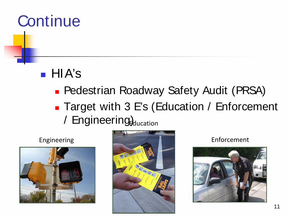
Continue
HIA’s Pedestrian Roadway Safety Audit (PRSA) Target with 3 E’s (Education / Enforcement
/ Engineering)
Engineering Enforcement
Education

12
School Zones (Monitoring)
Different Type of Grants Scope – Conduct proactive assessments of
traffic and pedestrian activities around schools focused on providing safe walking routes for children to school
13
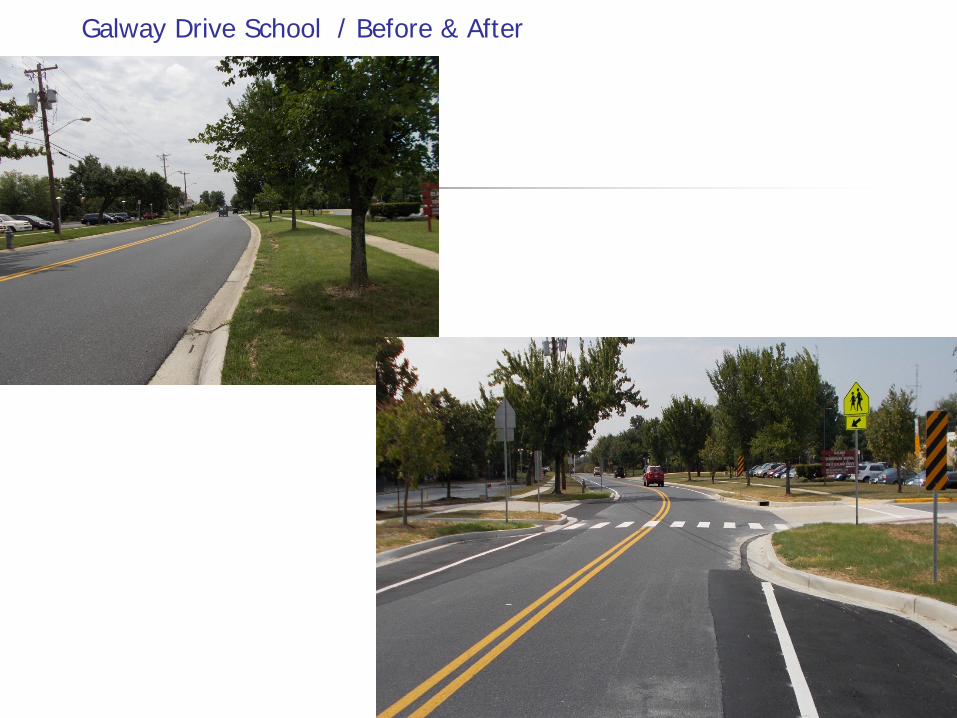
Galway Drive School / Before & After
14
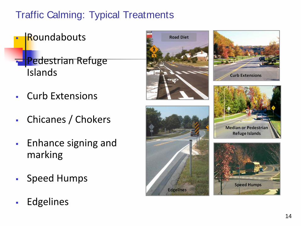
Roundabouts
Pedestrian Refuge Islands
Curb Extensions
Chicanes / Chokers
Enhance signing and marking
Speed Humps
Edgelines
Traffic Calming: Typical Treatments
15
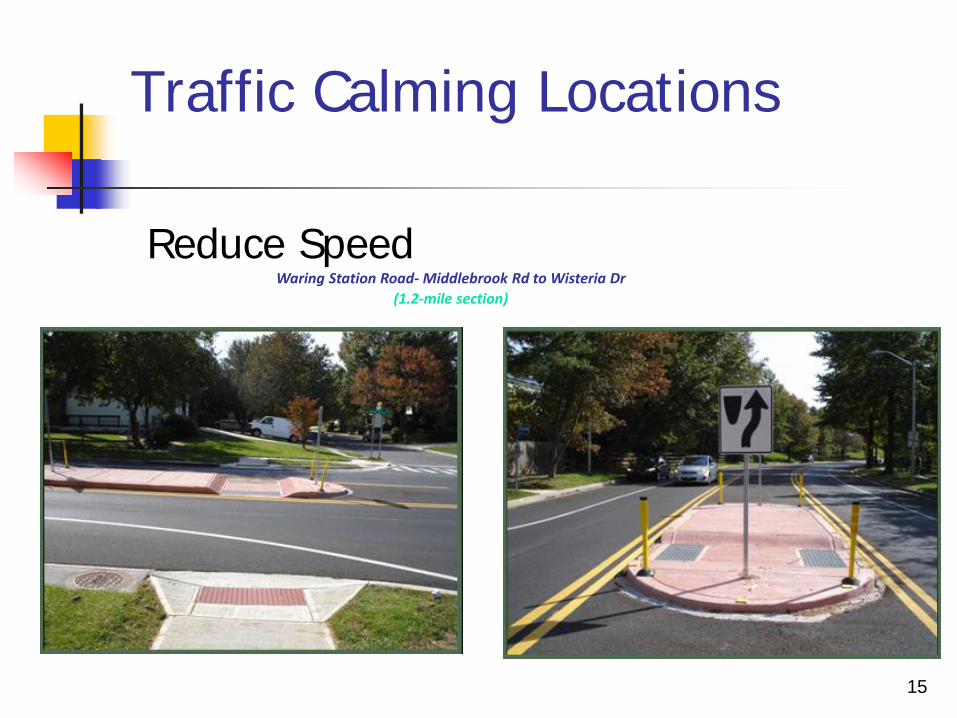
Traffic Calming Locations
Reduce Speed
Waring Station Road- Middlebrook Rd to Wisteria Dr (1.2-mile section)
16
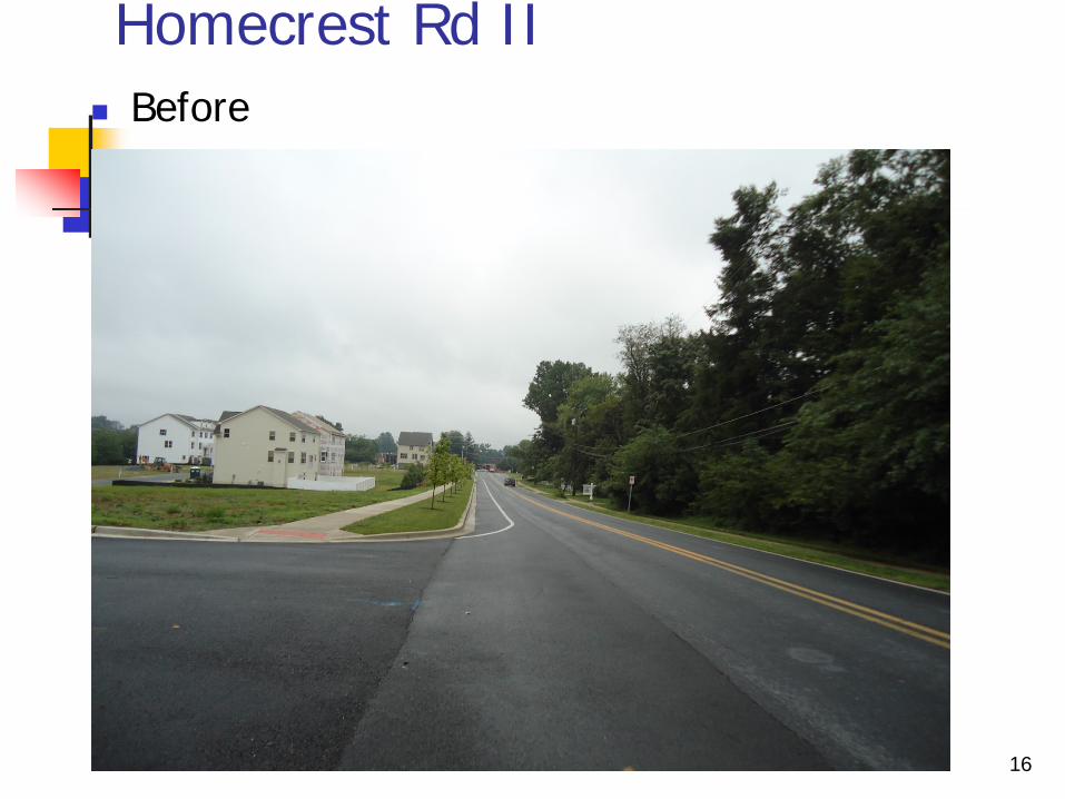
Homecrest Rd II Before
17
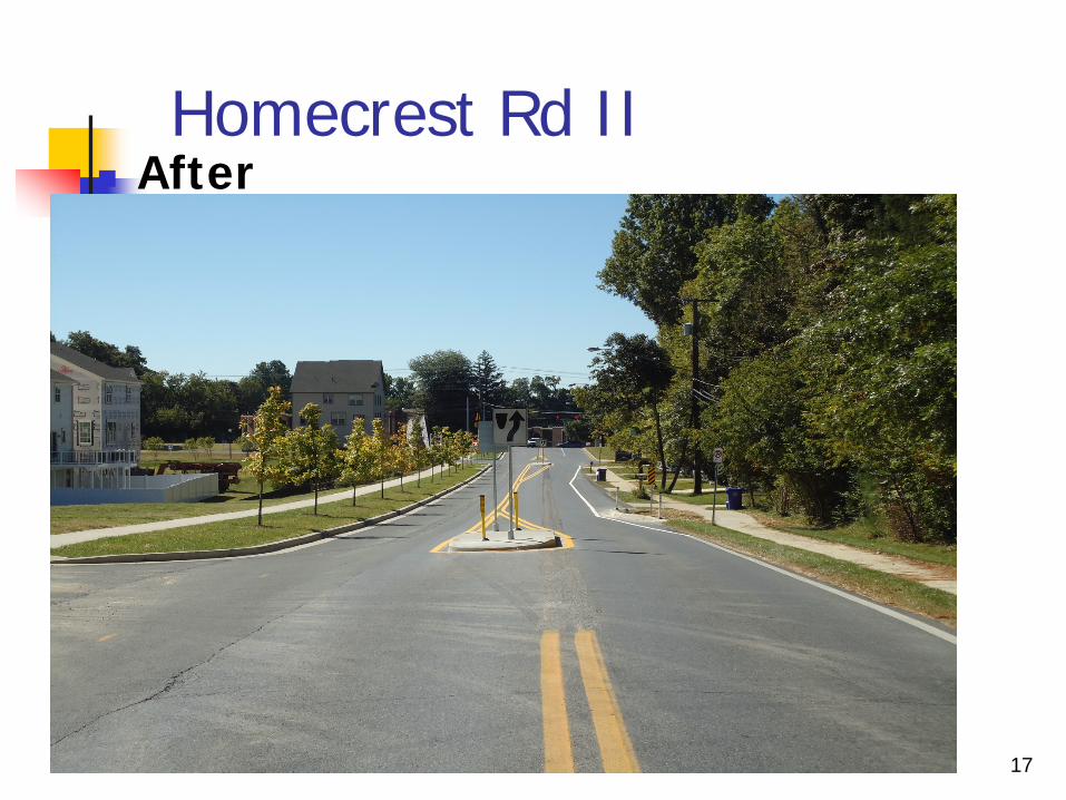
Homecrest Rd II After
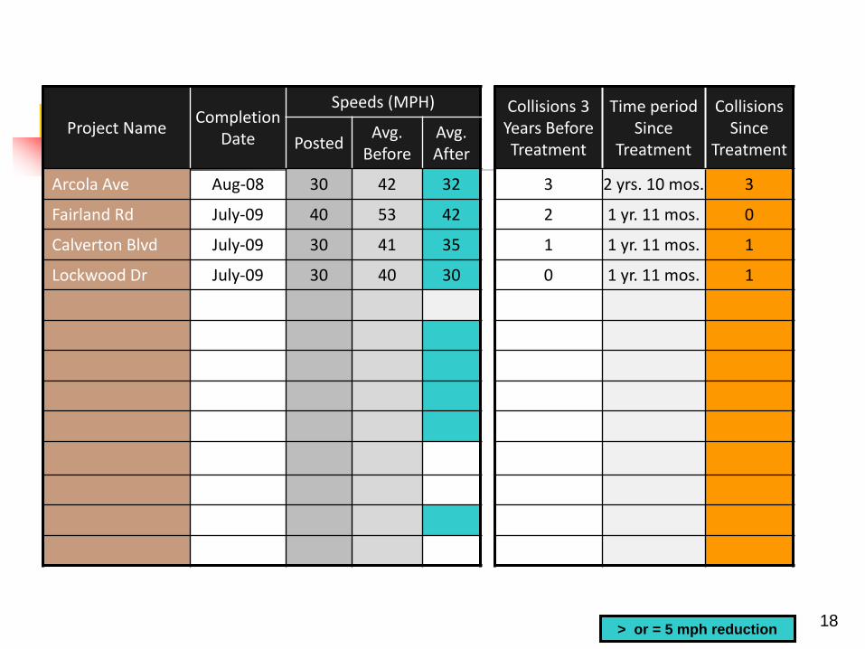
18
Project Name Completion Date
Speeds (MPH) Collisions 3 Years Before Treatment
Time period Since
Treatment
Collisions Since
Treatment Posted Avg. Before
Avg. After
Arcola Ave Aug-08 30 42 32 3 2 yrs. 10 mos. 3
Fairland Rd July-09 40 53 42 2 1 yr. 11 mos. 0
Calverton Blvd July-09 30 41 35 1 1 yr. 11 mos. 1
Lockwood Dr July-09 30 40 30 0 1 yr. 11 mos. 1
> or = 5 mph reduction
19
Partnership
MCDOT & MDSHA partnership in pedestrian road safety audits
MDSHA, PG County and MC DOT’s joint venture: to standardize an approach to addressing high pedestrian crash corridors/locations statewide (In development stage)
20
Challenges
Reliability of the Crash Data
21
What we can do better
Add Long and Lat data (x,y coordinates) Eliminate Boundary Issues Plots Accurate in the GIS map
Linear Referencing Dynamic Segmentation Better Training / Close interactions with
Different Agencies