Embed Size (px)
Citation preview

U.S. Integrated Ocean Observing System (IOOS)
Enabling decision making every day;
Fostering advances in science and technology
IOOS Program in FY2013
Support Regional Component
Strengthen National
Component
Advance DMAC
Regional POCsICOOS Act Reauthorization2013 Report to Congress CertificationOutcome MetricsOAInteragency PartnershipsCommunications
SOS Reference Implementation
National Glider Network
Modeling Plan
HFR
Animal Telemetry Network
BDP Reference Implementation Plan
EPA IOOS RA Beach Water Quality
National Water Quality Monitoring
The “catalog” v3.0
QARTOD
Non-Federal Asset Inventory
Post-Summit ActionsIOOS Advisory CommitteeGrants PlanningOut-year BudgetingIOOCUS GEO
2

IOOS Summit 2012: A New Vision for IOOS
• Summit report available online
• IOOC Meeting on 30 May was the first attempt to prioritize all summit recommendations.
• Implementation is happening now.
A New Decade for anIntegrated and SustainedOcean Observing System
SUMMIT 2012
November 13-16, 2012Hyatt Dulles | Herndon, VA
The Summit report is available here: http://www.iooc.us/2013/u-s-ioos-summit-report-now-available/
3

Funding – FY13 Overview
• Regional Observing Systems ($18.4M) and Surface Currents ($5M)
• FY13 Marine Sensor Innovation Project ($3.996M) Alliance for Coastal Technologies (ACT)
• Sensor Evaluation U.S. IOOS Coastal Ocean Modeling Testbed (COMT)
• Continuing efforts to advance research to operations Marine sensor and other advanced observing technologies
• Transition to Operations: Environmental Sample Processor
• Ocean Acidification: Support for West Coast Shellfish Industry
4

Sandy Supplemental Awards
• Restore, replace, repair, and enhance
the Regional Coastal Ocean
Observing Systems
• MARACOOS and NERACOOS
• Award imminent
• First time IOOS Regions have
received supplemental dollars
5
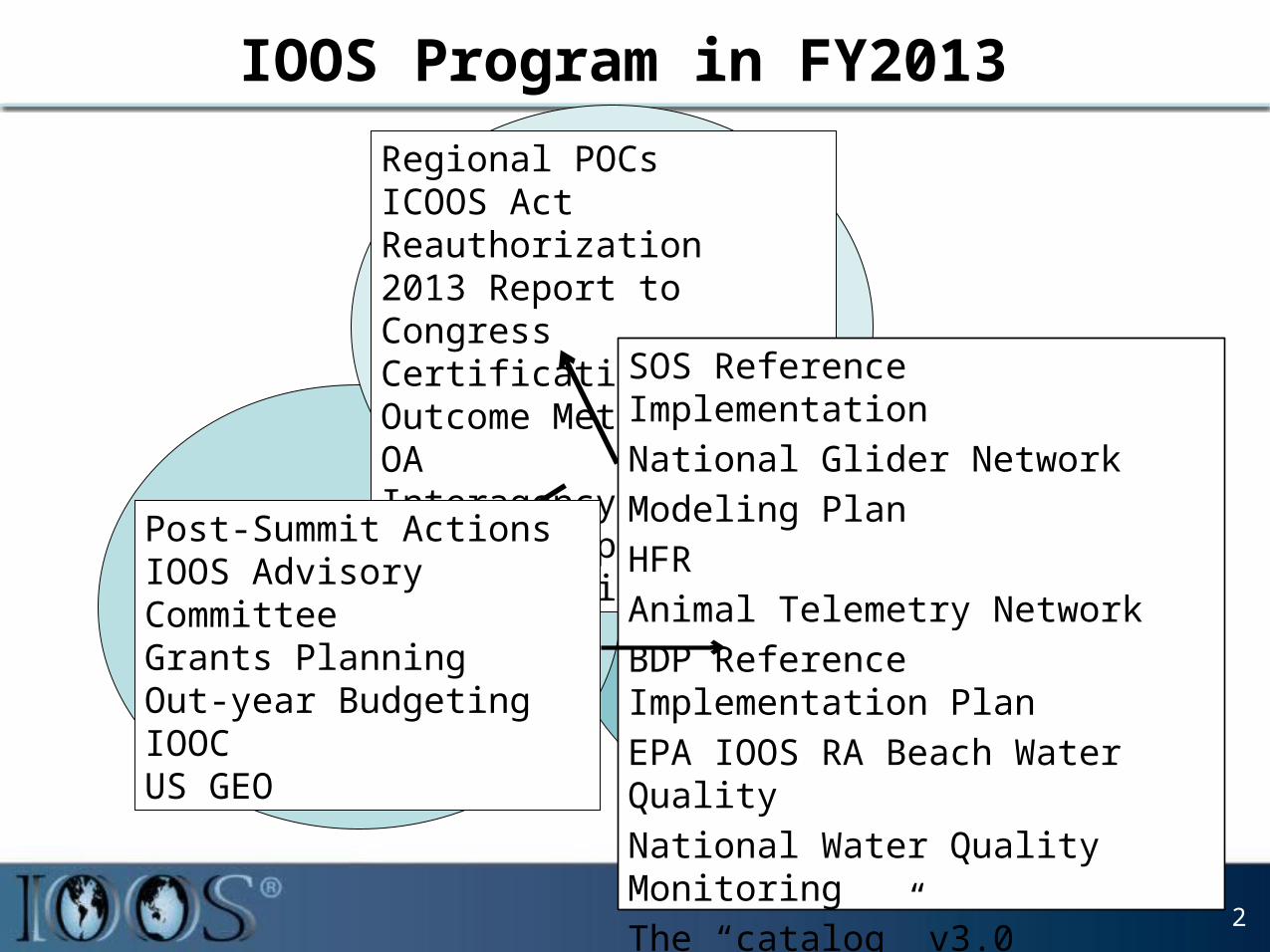
DMAC: on-going implementation
6
11 RA with Data Access Services; Functional and useful Catalog; Critical mass of client softwareMajor Activities:
• SOS reference implementation
• Centralized THREDDS data server
• Beta catalog (http://catalog.ioos.us)
• Client tools• Archive utilities• QA/QC software demo
Asset Inventory
FY2013FY2014

Gliderpalooza
• US IOOS effort• 15 gliders• 15 Partners:
– Ocean Tracking Network, Canada; – University of Maine; Woods Hole
Oceanographic Institution, University of Massachusetts, Rutgers University, University of Delaware, University of Maryland, College of William and Mary, North Carolina State University, University of Georgia
– Teledyne Webb Research Corporation
– New Jersey Department of Environmental Protection
– IOOS Northeast, Mid-Atlantic, Southeastern Regions
– NOAA, US Navy, NASA
• >25,000 profiles to date
7

National Glider Network
8
V2 Anticipated Soon
Where are Gliders deployed today!

Animal Telemetry Network (ATN)
9
• Focus on data management and building an ATN DAC• Reconciled Metadata Conventions for Animal Acoustic Telemetry • Info: https://code.google.com/p/ioostech/wiki/AnimalAcousticTelData• http://mmisw.org/orr/#http://mmisw.org/ont/ioos/animal_acoustic_telemetry• IOOS rep on Ocean Tracking Network Council
Image courtesy from John Kocik
Image courtesy from Josh Kohut

RA Collaboration on Buoys
NOAA, IOOS, and CariCOOS Announce NewData Buoy in the Caribbean – Sept. 2013
CariCOOS data buoy “E” was deployed on September 10, 2013 in Vieques Sound. This area is characterized by heavy recreational and commercial ferry use.
University of Maine built buoy Measures wave heights, wave direction, wind speed, wind direction, air
temperature, salinity, barometric pressure, and ocean currents
10
NERACOOS partner helped CariCOOS Refurbish Data Buoys in Record Time 3 buoys refurbished in record time with assistance from the University of Maine
Physical Oceanography Group - May 2013
Personnel from the University of Maine Physical Oceanography Group and CariCOOS refurbished all instruments and ground tackle and recertified the buoys for continued operation.
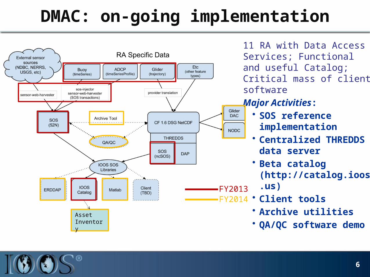
IOOS® High Frequency Radar
National Effort
• NWS• AWIPS Marine WFOs FY14• NCEP Data Tanks Q1 FY14
• NOS• Spill Response Ongoing
• DHS USCG• Search & Rescue Ongoing
International
• GEO• Data & Ops Standards• Data Sharing
11

CBIBS – A New Partnership
• Joint operation and maintenance of the Chesapeake Bay Interpretive Buoy System
• New funding in FY13 and beyond from the NOAA Chesapeake Bay Office
• Partnering on:– On-the-water operations– Research and development activities to
expand and enhance the system– Data quality assurance and control– Web services to improve CBIBS data
dissemination and integration into regional networks
12
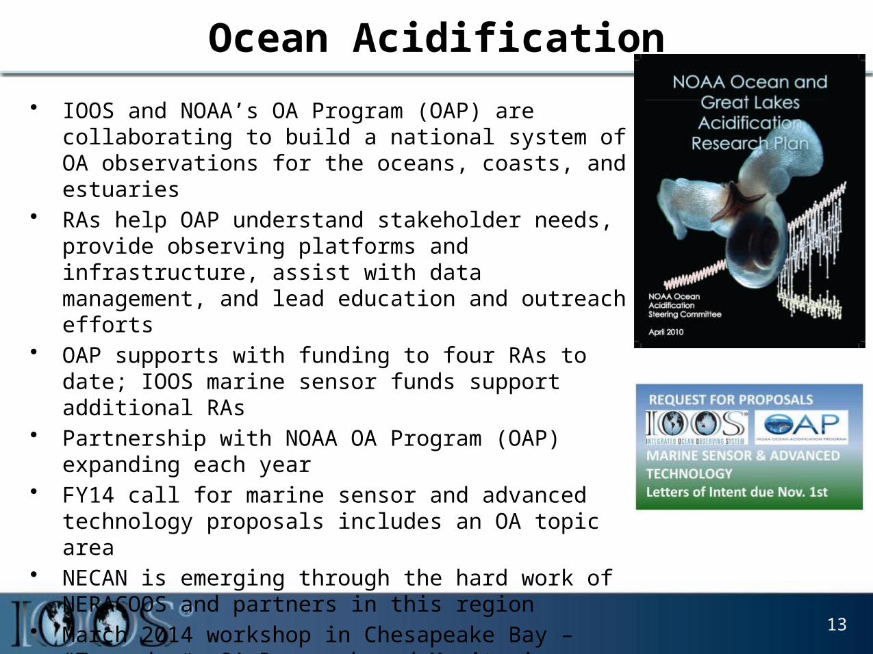
Ocean Acidification
• IOOS and NOAA’s OA Program (OAP) are collaborating to build a national system of OA observations for the oceans, coasts, and estuaries
• RAs help OAP understand stakeholder needs, provide observing platforms and infrastructure, assist with data management, and lead education and outreach efforts
• OAP supports with funding to four RAs to date; IOOS marine sensor funds support additional RAs
• Partnership with NOAA OA Program (OAP) expanding each year
• FY14 call for marine sensor and advanced technology proposals includes an OA topic area
• NECAN is emerging through the hard work of NERACOOS and partners in this region
• March 2014 workshop in Chesapeake Bay – “Towards an OA Research and Monitoring Strategy”
13

J-SCOPE is a FATE (Fisheries And The Environment) project, funded by NOAA and presented by NANOOS


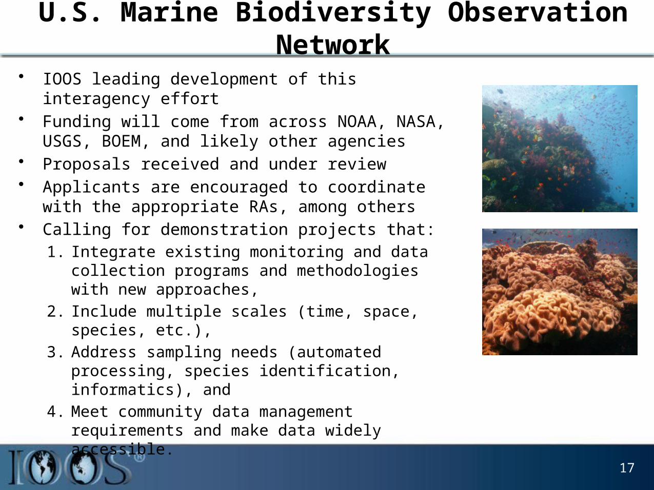
U.S. Marine Biodiversity Observation Network
• IOOS leading development of this interagency effort• Funding will come from across NOAA, NASA, USGS,
BOEM, and likely other agencies• Proposals received and under review• Applicants are encouraged to coordinate with the
appropriate RAs, among others• Calling for demonstration projects that:
1. Integrate existing monitoring and data collection programs and methodologies with new approaches,
2. Include multiple scales (time, space, species, etc.),
3. Address sampling needs (automated processing, species identification, informatics), and
4. Meet community data management requirements and make data widely accessible.
17

NOAA’s Ecological Forecasting Roadmap
• There is substantial customer demand for ecological forecast products
• NOAA lacks a coordinated approach to development and delivery of ecological forecast products and services
• NOAA can better use its observational and computational capabilities
• New Roadmap – NOAA-wide capability– Effective and efficient– Establish priorities and collaborations– Build-on existing infrastructure and
partnerships – Improve quality and delivery of products
and services
18

Sustainable Planning – So What?
Photo credit: WWF
Photo credit: Clemson University
Photo credit: Hightower report
Photo credit: PT SUMBER YALA SAMUDRA
Peruvian Anchovy
Fishmeal
Story credit: BNY Mellon

Industry Study Framework
Intermediate Users
End Users
Provider
Credit: Rayner – IOOS Summit 2012 – white paper
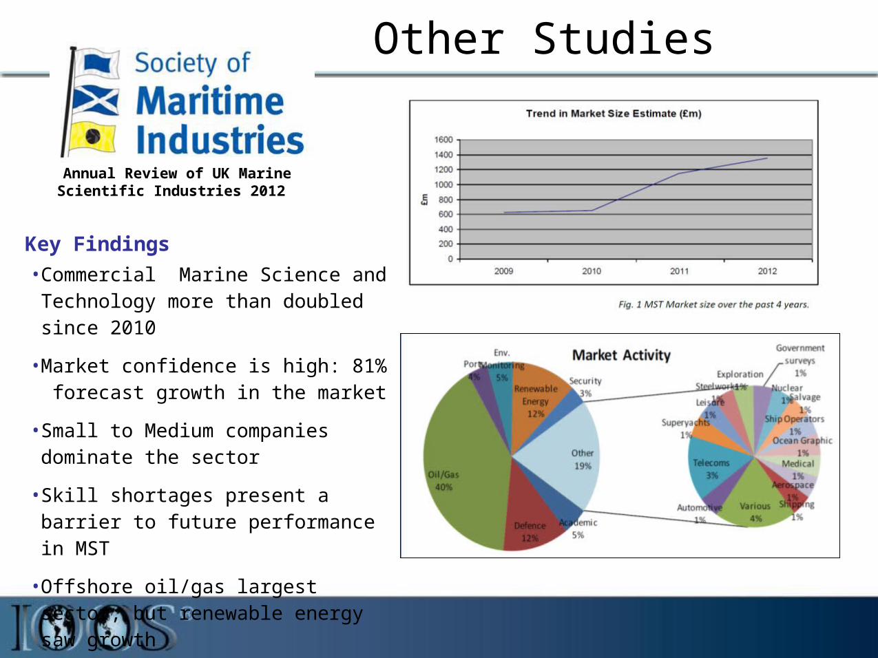
Other Studies
Key Findings
• Commercial Marine Science and Technology more than doubled since 2010
• Market confidence is high: 81% forecast growth in the market
• Small to Medium companies dominate the sector
• Skill shortages present a barrier to future performance in MST
• Offshore oil/gas largest sector; but renewable energy saw growth
Annual Review of UK Marine Scientific Industries 2012

San Diego StudyOverall Findings• Total employment: 46,000 jobs• Total Revenues: $14 billion (2011)
San Diego Blue Tech Findings• Highly differentiated industry – 14 sectors in
San Diego; 71 sub-sectors
• Prevalence of multi-use technologies from small, specialized firms
• Largely invisible in local markets / limited public & government awareness
• Little baseline economic data due to non-specific NAICS codes
• Highly export-oriented – typically 40-60 percent
• Markets exist in virtually every country around the world
• Growth in most sectors strongly outpaces world economic growth

Marine Technology and Services Industry Study
23
• Marine technology industry is an important partner and stakeholder
• First step toward assessing the economic impact of the marine ocean technology sector in the U.S.
• Collection and analysis of both qualitative (interviews) & quantitative data (survey). http://www.usworks.com/usioos/

CODAR• 1984: Barrick and staff leave
NOAA to form CODAR company to commercialize HF radar
• 1986: CODAR Ocean Sensors, Ltd. officially founded.
• 1983-88: first-generation CODARs; deployed North Sea offshore oil rigs.
• 1992: Second-generation CODARs
• 2002: 100th SeaSonde sold• 2009: Rapid overseas growth• Today: 98% IOOS network;
deployed in 30 countries• Broken sales records last 3 years
IOOS• 2002: CA Prop 40 & 50 - $21
million is designated for the “Coastal Ocean Circulation Monitoring Program” (COCMP)
• 2004: IOOS project based < 15 radars
• 2005-2006: Network emerges • 2008: Network reached 100• 2009: National Surface
Currents Plan V1• 2012: O&M dollars in budget• Today: > 130 Radars• Global through Group on Earth
Observations (GEO)
Growing Together

IOOS – Hot off the Presses!
25
Thank You
Please Visit the U.S. IOOS Websiteioos.noaa.gov
26