Embed Size (px)
Citation preview
U.S. Department of the InteriorU.S. Geological Survey
Ground-Water Monitoring in the Lake Michigan Basin
Lake Michigan Monitoring Coordinating Council
November 2005
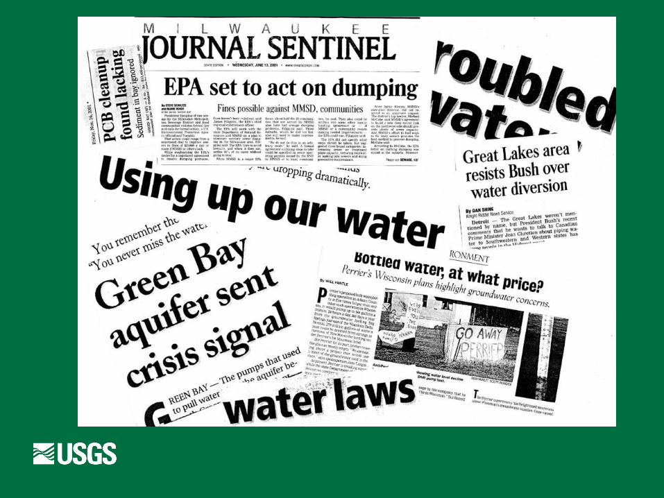

Reasons for GW Monitoring
Water Availability/Water Supply Conflict Resolution Drought Warning Diversion of Great Lakes Water by GW
Pumping

Water Use
Important to the Annex process
Integrate data from multiple sources to support statistical estimates of water use
Water Use estimates are important for gw monitoring
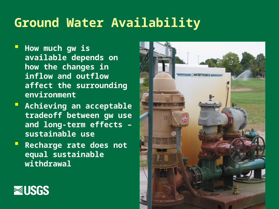
Ground Water Availability
How much gw is available depends on how the changes in inflow and outflow affect the surrounding environment
Achieving an acceptable tradeoff between gw use and long-term effects – sustainable use
Recharge rate does not equal sustainable withdrawal
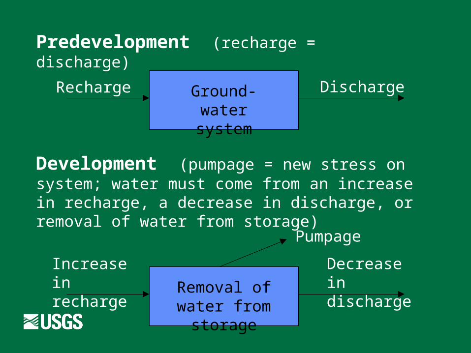
Ground-water
system
Recharge Discharge
Removal of water from
storage
Increase in recharge
Decrease in discharge
Pumpage
Predevelopment (recharge = discharge)
Development (pumpage = new stress on system; water must come from an increase in recharge, a decrease in discharge, or removal of water from storage)
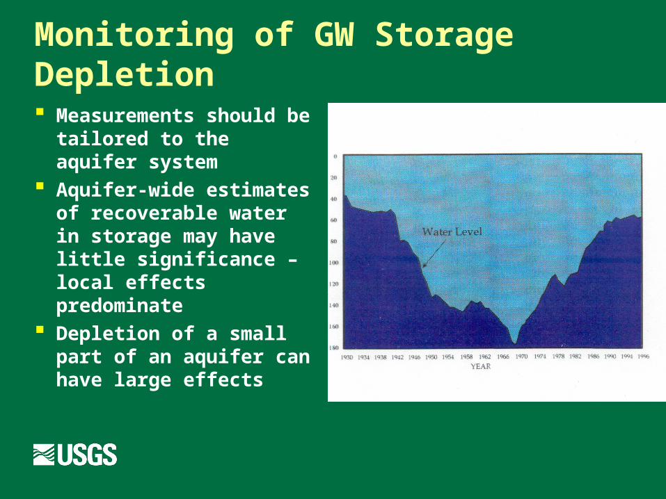
Monitoring of GW Storage Depletion
Measurements should be tailored to the aquifer system
Aquifer-wide estimates of recoverable water in storage may have little significance – local effects predominate
Depletion of a small part of an aquifer can have large effects
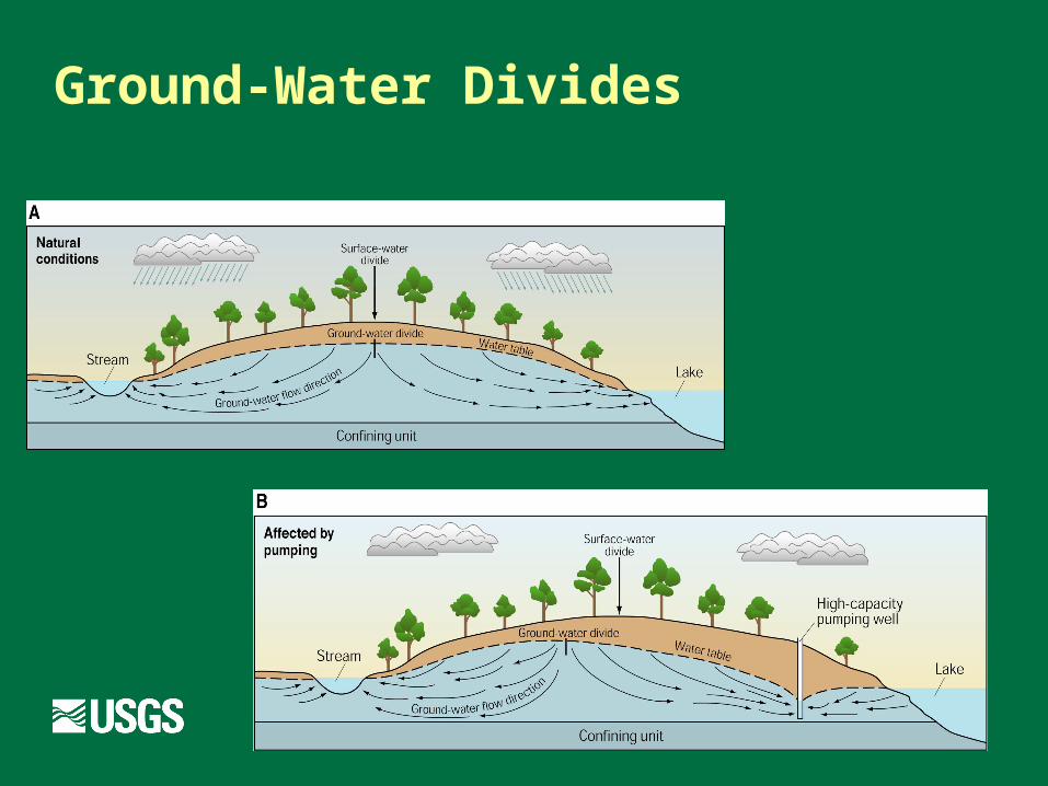
Ground-Water Divides
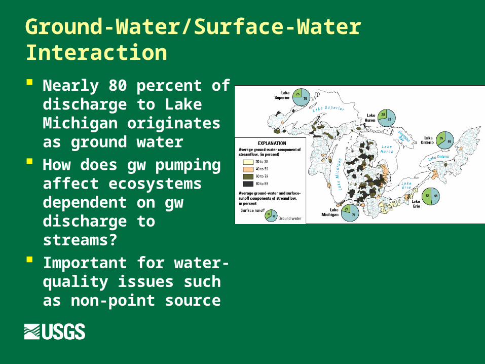
Ground-Water/Surface-Water Interaction
Nearly 80 percent of discharge to Lake Michigan originates as ground water
How does gw pumping affect ecosystems dependent on gw discharge to streams?
Important for water-quality issues such as non-point source
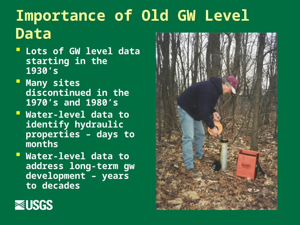
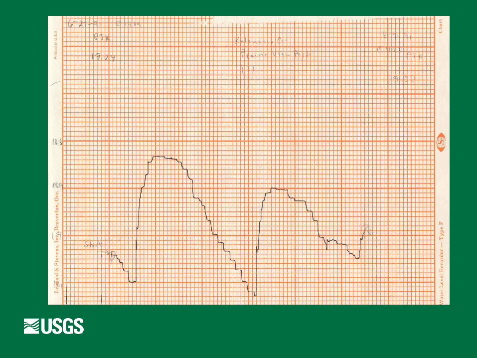
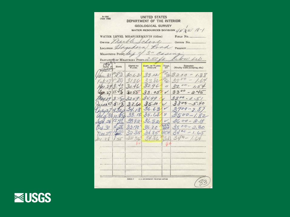
Importance of Old GW Level Data
Lots of GW level data starting in the 1930’s
Many sites discontinued in the 1970’s and 1980’s
Water-level data to identify hydraulic properties – days to months
Water-level data to address long-term gw development – years to decades

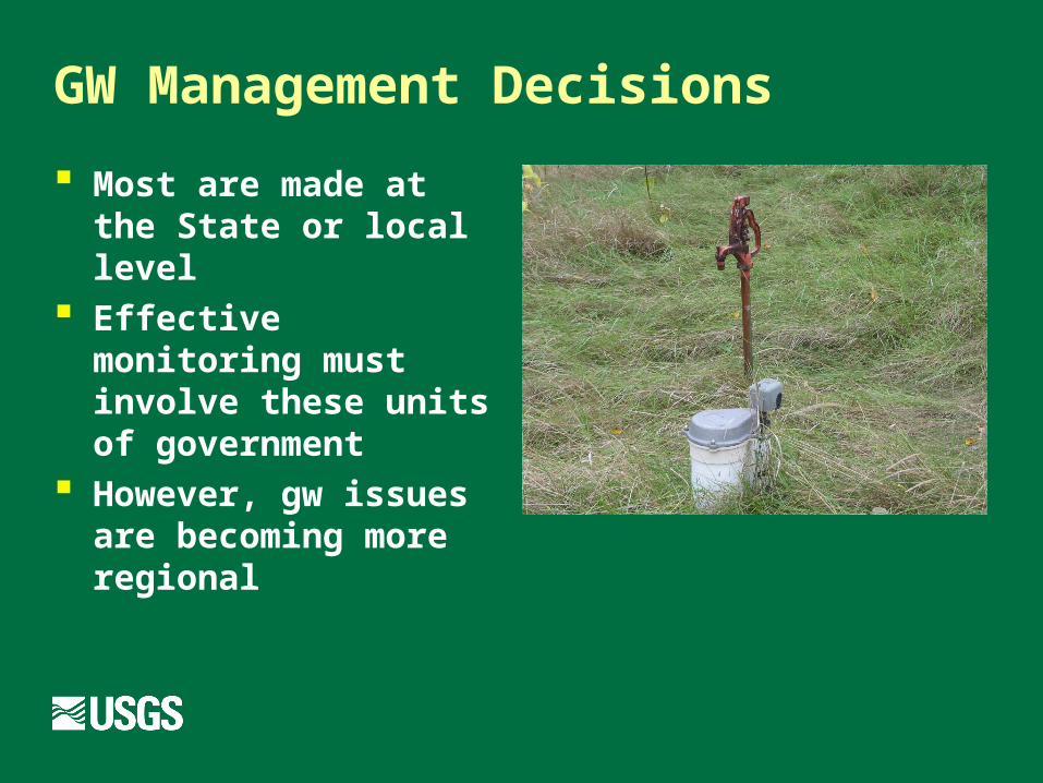
GW Management Decisions
Most are made at the State or local level
Effective monitoring must involve these units of government
However, gw issues are becoming more regional
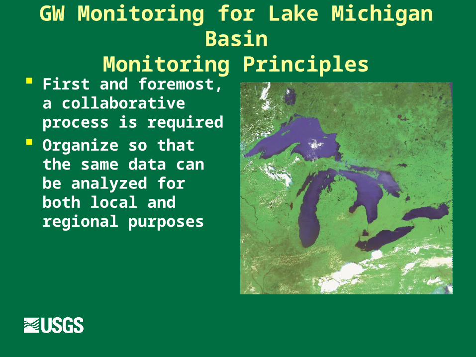
GW Monitoring for Lake Michigan BasinMonitoring Principles
First and foremost, a collaborative process is required
Organize so that the same data can be analyzed for both local and regional purposes

GW Monitoring for Lake Michigan BasinMonitoring Areas
Areas with large withdrawals
Areas not effected by withdrawals (for drought and climate studies)
Areas to be developed Areas with important
amounts of recharge
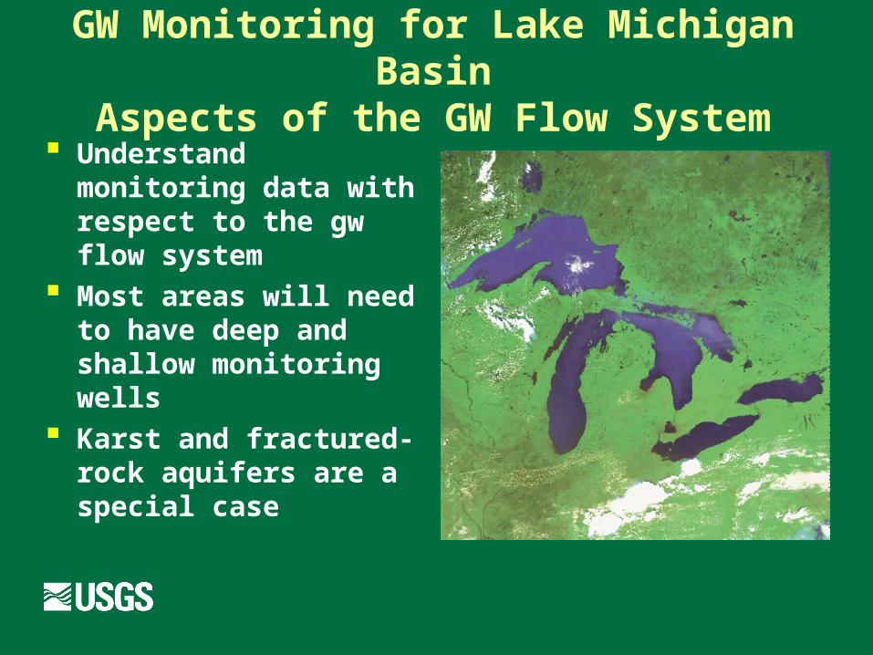
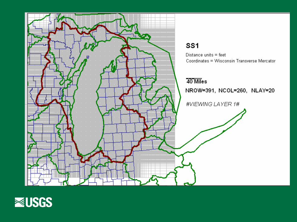
GW Monitoring for Lake Michigan BasinAspects of the GW Flow System
Understand monitoring data with respect to the gw flow system
Most areas will need to have deep and shallow monitoring wells
Karst and fractured-rock aquifers are a special case
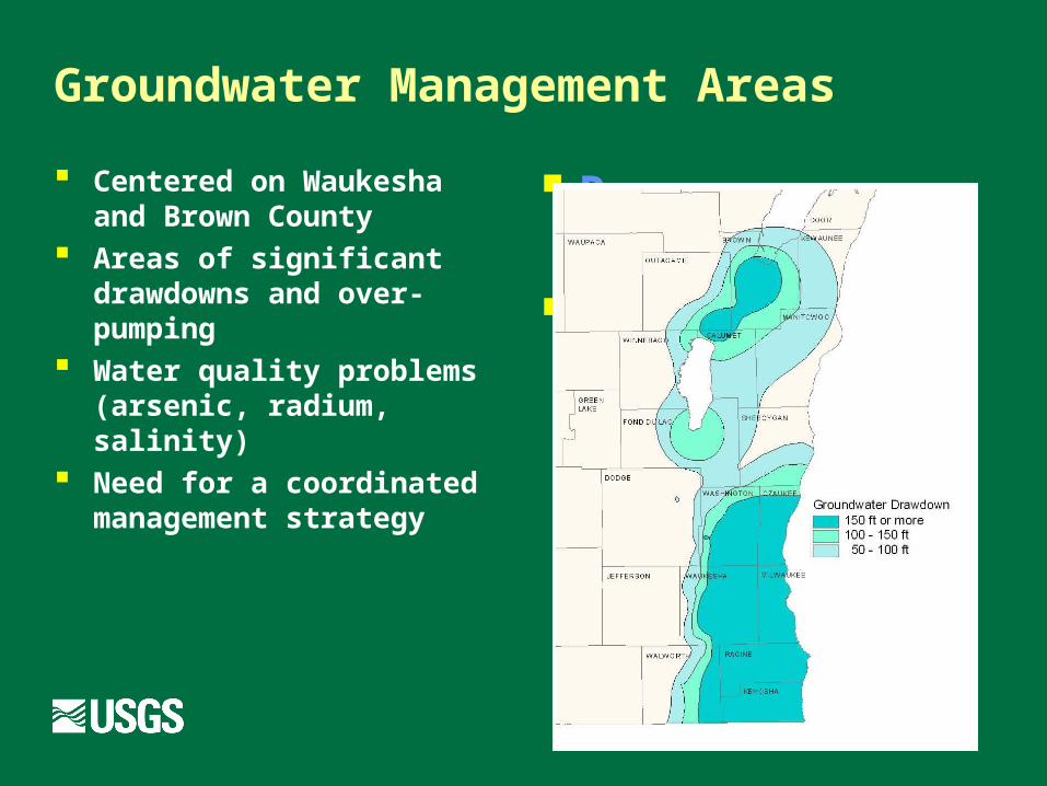
Groundwater Management Areas
Centered on Waukesha and Brown County
Areas of significant drawdowns and over-pumping
Water quality problems (arsenic, radium, salinity)
Need for a coordinated management strategy
Resource concern #1
Surface Water Impacts
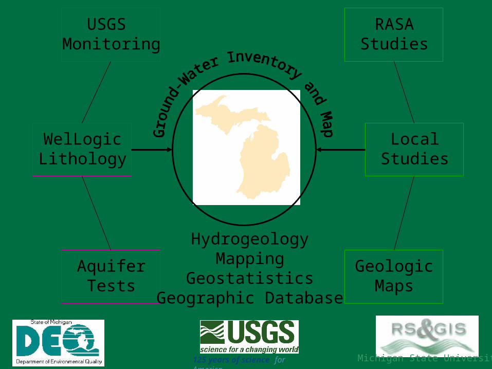
GeologicMaps
WelLogicLithology
AquiferTests
RASAStudies
LocalStudies
USGS Monitoring
HydrogeologyMapping
GeostatisticsGeographic Database
125 years of science for America
Michigan State University

Information Needed for GW Monitoring
Water Levels in Wells Deep Aquifers Intermediate-Depth Aquifers Shallow Aquifers
Baseflow Analysis
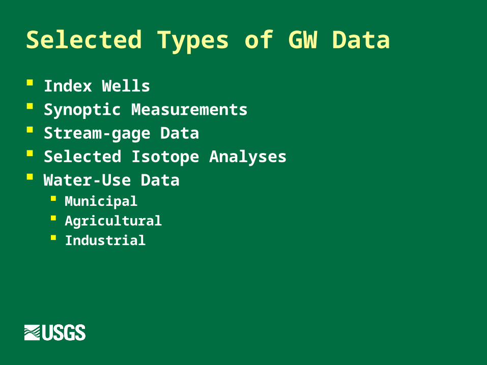
Selected Types of GW Data
Index Wells Synoptic Measurements Stream-gage Data Selected Isotope Analyses Water-Use Data
Municipal Agricultural Industrial
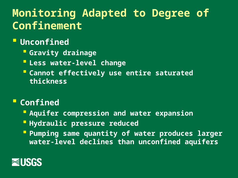
Monitoring Adapted to Degree of Confinement
Unconfined Gravity drainage Less water-level change Cannot effectively use entire saturated thickness
Confined Aquifer compression and water expansion Hydraulic pressure reduced Pumping same quantity of water produces larger
water-level declines than unconfined aquifers
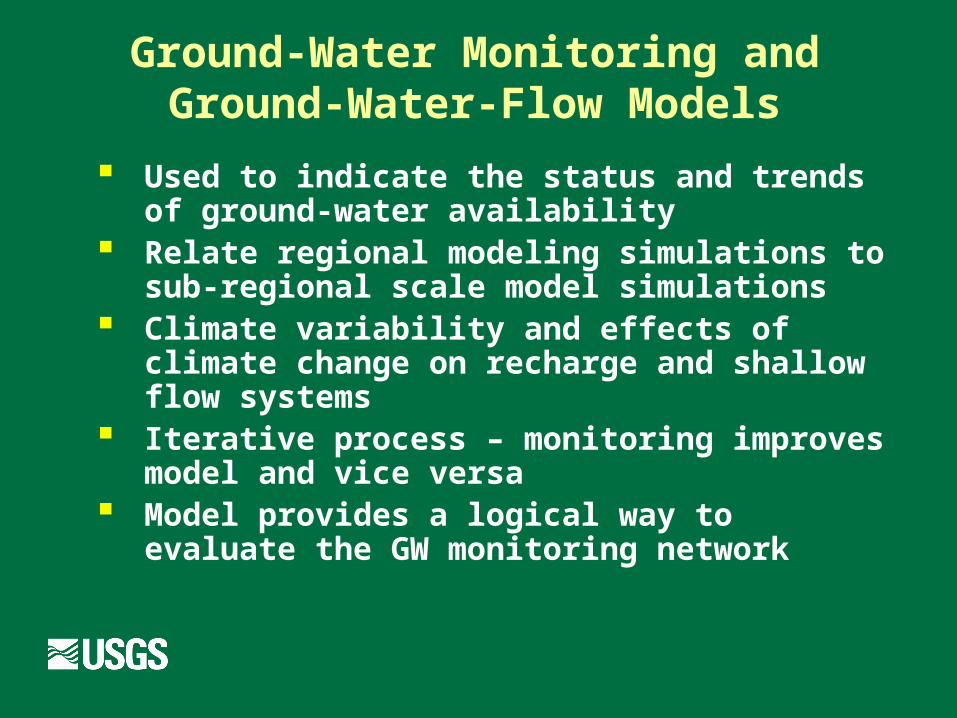
Ground-Water Monitoring andGround-Water-Flow Models
Used to indicate the status and trends of ground-water availability
Relate regional modeling simulations to sub-regional scale model simulations
Climate variability and effects of climate change on recharge and shallow flow systems
Iterative process – monitoring improves model and vice versa
Model provides a logical way to evaluate the GW monitoring network
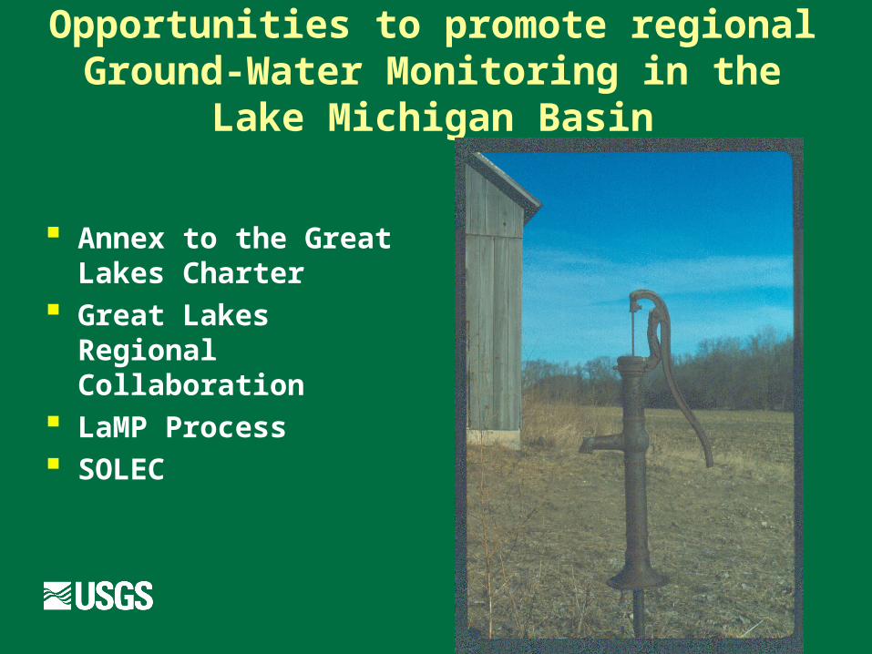
Opportunities to promote regional Ground-Water Monitoring in the Lake
Michigan Basin
Annex to the Great Lakes Charter
Great Lakes Regional Collaboration
LaMP Process SOLEC


![10....2. West to East - Lake Superior, Lake Michigan (Completely in USA), Lake Huron, Lake Erie, Lake Ontario [Chicago on Michigan Lake] 3. Rockies mountain -> Western part …](https://img.dokumen.tips/doc/110x75/609ccee351500b0ee9543957/10-2-west-to-east-lake-superior-lake-michigan-completely-in-usa-lake.jpg)


![Great Lakes. The Five Great Lakes Lake Michigan [ touches Michigan] Lake Michigan [ touches Michigan] Lake Erie [touches Michigan] Lake Erie [touches](https://img.dokumen.tips/doc/110x75/56649dca5503460f94ac1371/great-lakes-the-five-great-lakes-lake-michigan-touches-michigan-lake-michigan.jpg)