Embed Size (px)
Citation preview
8/8/2019 URISA News November. December 2009
http://slidepdf.com/reader/full/urisa-news-november-december-2009 1/12
NEWS
Issue 234 • November/December 2009
Geospatial Technology professionals,
whether in public or private sector, are
faced with many fascinating oppor-
tunities for gathering, disseminating,
and communicating information. This
means a constant search to optimize
the job. Recently, I ran across a news feed, indicating that USGS is testing a
method for gathering data via the ex-
tremely popular social media site Twit-
ter. Immediately, this was intriguing.
How are they presenting the intercon-
nectivity of GIS and Social Media? What
else is out there? What kinds of policies
or guidelines exist for social media in
the public sector? Social media comes
in many forms (blogs, mini-blogs, wikis,
RSS, podcasts, and other social-centric
forums or knowledge-bases) and it is all,
in some way, location based. (It is up
to us to harness the data). This article
includes a brief review of the fast grow-
ing social media (Web 2.0) phenomena
within the public service sector and
highlights some popular uses, including
Geographic Information Systems (GIS).
Social media is a flexible range
of applications with many options for
serving the public from a governmental
perspective. The Federal CIO Council
Public Service Social MediaKeri S. Shearer, GISP
states that “The use of social media
technologies…quickly becomes
a complex topic, with varying
interpretations and perspectives.
Researchers at the National Defense
University (NDU) define social media
as social software, applications thatinherently connect people and
information in spontaneous, interactive
ways”. If you are not very familiar with
the term social media, here are some
popular application examples for
reference: AddThis, Twitter, Facebook,
Google Earth, Zillow, Digg, Pageflakes,
Skype, Yelp, My Yahoo!, My Site, YouTube,
Second Life, Twine, BlogSpot, AIM, Gmail,
CityWatch, RSS, LinkedIn, Slide Share .
This in no way reflects the whole
width and breadth of the social media
options available to both private and
public entities. It shows the abundance
available to us. You may say to
yourself after reading this list, well that
sounds like everything that is on the
internet and my cell phone. There are
so many applications to choose from,
in-depth research is recommended
before beginning a plan of action.
A relevant point by Andy
Blumenthal, chief technology officer
The Association for GIS Professionals
IN THIS ISSUE
3 President’s Column
6 Addressing, 3-D, Suitesand Occupancies—GISNeeds to be in theForefront!
7 Book Review
8 GIS for the UtilityIndustry, Not JustMaps….
at the Bureau of Alcohol, Tobacco,
Firearms and Explosives delves into
how today, in both public and private
lives, the technologies available to us
for communication are in constant flux.
Can the government provide services
in the many ways our customers expectand the way our employees and other
organizations expect to interact? So, as
technology trends have headed toward
communicating via social media,
incorporating various applications
and devices to interact with the world
in their everyday lives, government
entities are going to be expected to
pass services in the same way (Nextgov.
com).
What some government entities
have begun to do is welcome social
media services with open arms and
others are investigating the risk of
using these platforms. It seems that
these types of data flow are completely
organic, driven by internal and external
forces to the government. A brief review
of public service social media, within
the United States, at the federal, state,
continued on page 4

8/8/2019 URISA News November. December 2009
http://slidepdf.com/reader/full/urisa-news-november-december-2009 2/12
Important URISADates to Remember
December 7–11, 2009URISA Leadership Academy
Seattle, WA
March 8–11, 201014th Annual GIS/CAMA Technologies
Conference
Little Rock, AR
August 16–18, 2010URISA/NENA Addressing Conference
Charlotte, NC
September 28–October 1, 201048th Annual URISA Conference &
Exposition
Orlando, FL
The Urban and Regional Information
Systems Association (URISA) is the
premier professional association for
those involved in improving our urban
and regional environments through the
effective use of information technology.
Professionals in planning, economic
development, information systems,
emergency services, natural resources,
public works, transportation, and other
departments within state and local
government have depended on URISA
for professional development and
educational needs since 1963. Through
its international, national and local
chapter operations, URISA serves nearly
8,000 professionals.
AboutPRESIDENT
Kathrine Cargo, GISP-Orleans ParishCommunication [email protected]
PRESIDENT-ELECT
Cy Smith, GISP-State of [email protected]
IMMEDIATE PAST-PRESIDENT
Hilary Perkins, GISP AICP-East-West GatewayCouncil of Governments, St. Louis, [email protected]
SECRETARY
Cynthia Braddock-Boulder County (CO) Assessor’s [email protected]
TREASURER
Greg Babinski, GISP-King County (WA) GISCenter [email protected]
Carl Anderson, GISP-Fulton County (GA)[email protected]
Clare Brown, GISP-Montgomery WatsonHarza, New Orleans, [email protected]
David DiBiase, GISP-Penn State [email protected]
Michael W Lovett, GISP-CDM Camp Dresser & McKee, Maitland, [email protected]
Sandra Majewski, GISP-Las Vegas MetroPolice [email protected]
Twyla McDermott, GISP-City of Charlotte (NC)[email protected]
Karen RM Stewart, GISP-ESRI Canada, Vancouver, [email protected]
URISA Headquarters 701 Lee Street, Suite 680
Des Plaines, IL 60016
Phone: 847-824-6300
Fax: 847-824-6363
[email protected]://www.urisa.org
Wendy Nelson
Executive Director
Article submissions, calendar items
and industry news should be sent to
2 November/December • URISA News

8/8/2019 URISA News November. December 2009
http://slidepdf.com/reader/full/urisa-news-november-december-2009 3/12
Kathrine Cargo
PSD’S COM
SA MattersBy Kathrine Cargo, URISA President 2009-2010
In a recent issue of the URISA Digest ,President-elect Cy Smith sent a reminder
to the membership to check out the
URISA website (http://www.urisa.org/an-
nual/keynote) for the Opening Keynote
Address delivered at the 2009 Annual
Conference in Anaheim. The speaker was
Dr. Barry Wellar, who, besides being a Past
President of URISA, has accomplishments
in the eld of GIS that are too numerous
to list here. His topic was “Core Informa-
tion Challenges and Opportunities, 2010-
2020: Building on Strengths,” in which
Dr. Wellar laid out four main areas whereURISA should consider focusing its ener-
gies and agendas over the next decade.
It was an excellent presentation, and
contained much food for thought not
only for the leaders in URISA, but for the
entire URISA membership in that we, as
GIS professionals, have the institutional
knowledge, experiences, and ability to
direct the future course of GIS activities.
By identifying four areas of focus, Dr.
Wellar challenged URISA to not only
maintain the past high standard of GIS
service to the industry and membership,but to continue to strive to be the go-to
association for geospatial research, ethics,
and best practices.
Compare/ContrastThe idea of challenging URISA to focus on
four areas intrigued me, and I wanted to
see how closely Dr. Wellar’s view of the
direction in which URISA should move
mirrored the initiatives in the URISA Stra-
tegic Plan. Given the space constraints
of this column, I have summarized Dr. Wellar’s Core Information points for the
purposes of comparison with the Strategic
Plan initiatives.
Point 1 - Strengthening nterdepen-
dent nfrastructures. Briey stated,
URISA has always been about how urban
and regional entities identify and use
information. As Dr. Wellar stated, “One
of the core information challenges and
opportunities for URISA in the coming
decade is to elaborate federal and state/
provincial government perspectives oninfrastructures, so that they are consis-
tent with urban and regional realities.”
Infrastructure can mean many things to
many people, and for the purposes of
his presentation, Dr. Wellar focused on
identifying interdependent infrastructures
via a matrix to assist in showing where
the greatest interdependencies exist, and
thus, where GIS could be used to produce
data with the maximum benet.
While the URISA Strategic Planning
Committee did not use a matrix to figure
out our interdependent “infrastructures”when identifying our initiatives, we did
consider those activities that would
produce the maximum benefit to the
membership and the Association. Whether
it is developing a new methodology
to identify and create new workshops,
or institutionalizing a professional
development track at the Annual
Conference, or the most interdependent
of all infrastructures, strengthening the
bonds between URISA and her chapters,
the Strategic Plan initiatives all support the
association’s objectives of engaging the
members in key issues, and building the
membership community.
Point 2 - Climate Change Mitigation
and Adjustment. As an example of
identifying information systems applica-
tions, Dr. Wellar suggests that climate
change is one area where there is still
much work to be done “linking inter-
dependent infrastructures and climatechange mitigation and adjustment at the
urban and regional level.” He contends
that while much has been written about
climate change, there is little quantitative
evidence to support mitigation efforts at
local and regional levels. Dr. Wellar feels
that this is an area where URISA, in col-
laboration with other associations, can
lead the way in providing analytical data
to support mitigation efforts.
URISA’s Strategic Plan also supports
collaborative efforts to achieve its
initiatives. Specifically, the StrategicPlan wants to work more closely with
Corporate and Business members to
develop educational offerings that provide
geospatial solutions to the membership.
Another educational initiative is to offer
URISA Workshops to regional and national
conferences of affiliated organizations in
order to better educate those outside of
URISA of the benefits of geospatial analysis.
The Strategic Plan is right in line with Dr.
Wellar’s ideas on promoting the knowledge
and benefits of GIS use to help address
issues for today and into the future.
Point 3 - Safety and Security. Accord-
ing to Dr. Wellar, homeland security and
public safety are interdependent infra-
structures which have gained signicant
attention over the last decade. The sheer
amount of complex information that is
generated keeping humans safe from real
and perceived threats is overwhelming to
those at all levels of government tasked
with protecting vulnerable populations.
But it is precisely the management of all
this generated information that is bogging
down the process of using the informa-
tion. Dr. Wellar pointed out that URISA
has a history of synthesizing information
created by a large variety of sources into
usable data, or as he says, the “data‐in-
formation‐knowledge transform process
that has characterized URISA discussions
since the 1960s.” He further opined that,
continued on page 6
November/December • URISA News 3

8/8/2019 URISA News November. December 2009
http://slidepdf.com/reader/full/urisa-news-november-december-2009 4/12
Social Media continued from page 1
and local government levels exposes
essential business drivers for using social
media internally or externally. At a high
level, many use this media for training,
announcements, communication,
entertainment, interaction, crowd
sourcing, data gathering, pictures, video,
text, marketing, networking, meetings,
analysis, trend spotting and visualization
(examples gathered from Gartner Hype
Report for 2009, CIO Council, and
Wikipedia).
At the federal level there is great
support for using social media to connect
with the public and gain feedback.
A memorandum for Transparency
and Open Government was signed,
this past January, by President Barack
Obama. This sparked opportunities for utilization of social media engagement
with the public. In response to this,
the CIO for the Federal Government
devised a plan for: open and transparent
government; lowering the cost of
government; cybersecurity; participatory
democracy; and innovation, as a way to
fundamentally “tap into the vast amounts
of knowledge … in communities across
the country” (CIO Council). USA.gov,
the U.S. government’s official web portal,
uses ShareThis allowing a share of over
150 different social media applications.The United States Geological Survey
(USGS) uses a full gamut of resources
to communicate, crowdsource and
educate. This may be a good way to
relay first hand information from the
ground during and immediately after
events from text, tweets, pictures and
video, giving experts an earlier disaster
assessment before hitting the ground.
They are testing the Earthquake Hazards
Program, “Did you feel it?” by mapping
the incidents texted in. The US Census
Bureau is launching the 2010 Census and for the first time will use social media to
gather information. This is a hope that
by interacting with the public in this way
they will retrieve more information and
be able to market to that target audience
that is hard to reach. Census data is the
foundation for much of the government’s
boundaries (i.e. congressional districts
as an example). The CDC (Center for
Disease Control) uses the same social
media outlets, including mobile, and web
TV. They have a blog on WebMD to aid
with communicating Flu information to
the public. NASA (National Aeronautics
and Space Administration) and NOAA
(National Oceanic and Atmospheric
Administration) use the ShareThis
application within their main web
portals. Plus, both of these organizationsare found within the 3-D virtual world
Second Life’s wiki for Real Life Government .
NASA has two in-land experiences
one sponsored by the Jet Propulsion
Laboratory offering exploration,
education, an interactive planetarium,
and a virtual CoLab experience. NOAA’s
3-D virtual world is another fantastic
experience in which they share history
and education of their program as well as
informational weather, globes, and other
maps.
A review of state web portals gives
a high level glimpse at which states
are utilizing social media as a public
service. Roughly 16% of states have
at least one social media outlet, 10%
have two, 4% have three, 40% have
three or more, and 30% could not be
found on the main portal. California,
Texas, Oklahoma, Arkansas, Michigan,
Delaware, Rhode Island, Maine and
Virginia are states which seem to
have a high presence of social media
options available quickly on their mainweb portal. The State of Missouri has
AddThis and also has a Second Life Real
Life Government wiki as well as a Second
Life 3-D site for information technology
recruiting. The State of Utah uses Blogs,
Mobile, Multimedia, wikis, Flickr, Photo
Networking, Twitter, Facebook, YouTube
and RSS to connect with the public. Utah
has guidelines and suggestions for using
these specific social media types (utahta.
wikispaces.net).
There are several exciting local
examples, with both large and smallpopulations. The City of Concord and
Mecklenburg County, both located in
the state of North Carolina, use simple
Blog, Facebook, Twitter , or Flickr ; The
City of Boston, Massachusetts and the
City of Pittsburgh, Pennsylvania use
similar outreaches, plus have iPhone
applications for citizens to connect
with the 311 call center. Boston has an
application called Citizen Connect and
Pittsburgh has iBurgh with which users
can take a picture, video or text in an
issue; Alameda County, California and
Jefferson City, Missouri have Second Life
3-D virtual world sites inland and on
Second Lifes’s Real Life Government wiki.
Alameda County uses this 3-D realm as
a virtual polling location. Jefferson City
has an inland site for their InformationTechnology Coalition.
Obviously, location is one of the
most important pieces of data for
government agencies, adding another
dimension of understanding to the social
media outlet. Of course, location is going
to answer the main question of “where?”
Where are my customers, citizens, service
boundaries? What are they thinking,
what are the trends? Who is reading my
blog, what is their location? Social media
used with GIS can give more information
and aid in visualization.
Currently applications exist,
built into the web as a widget, or for
download which take advantage of
geography. For instance: Google Earth
provides a rich geographic interface, tied
to videos, pictures, user added content,
and more; Zillow has data on 88 billion
homes (“every home has a story”); The
popular iPhone has 70 plus applications
for social media, many of which are
spatially enabled; GeoTwitter can be used
in OpenSource/Twitter mapping mashupsto see mini-blog info by location;
applications like ClustrMaps.com and
MapStats.net , help you understand who
is on your site, where they are located
in the world, and catalog what visitors
are looking at the most on your site;
and one last example is TrendsMap,
this shows mapping in real time, giving
potential crowdsourcing opportunities,
it reveals a topic’s geography, as it grows
in popularity and spreads from post to
post, climaxes and then begins to fade
(geoserver.isciences.com).For GIS the vast field of options
tied to gathering information via social
media is beginning to surface, as noted
by the USGS Earthquake Hazards
Program (TED). The question for the
GIS community will be how should this
be used in conjunction with GIS? We
can use these platforms for educating
the public and each other. We can
use it for communicating, displaying
4 November/December • URISA News

8/8/2019 URISA News November. December 2009
http://slidepdf.com/reader/full/urisa-news-november-december-2009 5/12
Introducing – The Adventures of Pam Sig, GISPBy Twyla McDermott, GISP and Michael Waltuch, GISP
event feedback in a quick manner, and
getting information from those whom
we support. There is a vast amount of
information currently on sites like YouTube
to help us. We can also advance by using
platforms like LinkedIn, Facebook , and
Twitte r to network, communicate and
stay connected and informed (many of us
are doing this today).Much discussion has centered on
policies, guidelines or procedures which
should be in place before utilizing social
media as a solution. The Information
Security and Identity Management
Committee (ISIMC), Network and
Infrastructure Security Subcommittee
(NISSC), and Web 2.0 Security Working
Group (W20SWG) released their CIO
Council, “Guidelines for Secure Use of
Social Media by Federal Departments
and Agencies” in September 2009.
The United States Federal Government
has decided to “embrace” these
technologies and approach them not
as an IT Management directive, but
rather as a “risk-based decision.” The
report is meant as a broad guideline for
all federal government agencies and
gives suggestions to their agencies for
designing a plan around social media.
They break this down into five controls--
policy, acquisition, training, network,
and host. The Federal CIO Council states
that the business case should be strongand well thought out for using social
media, and emphasizes that “security
concerns are multi-dimensional.” They
also list threats and risks associated with
this type of application used within
a government space (for instance—
information phishing, social engineering,
and attacks from web applications).
There are certainly potential pitfalls for
using social media from security, legal
concerns, constitutional infringements,
privacy and personnel costs. They
recommend establishment of roles andresponsibilities, a solid communication
plan, incident response protocol for
internal users, and a training plan for
employees, integrated into the business
plan as well. The General Services
Administration (GSA) “Social Media
Handbook” may give ideas on risks to
assess as well. For example, think about
how the site meets record retention and
management. Another good place to
begin research is Govsocialmedia.com, a
blog especially dedicated to governance
policies and best practices which centers
on public social media services. This
site currently houses a decent sample
of practices and guidelines from both
private and public sectors (govsocmed.
pbworks.com).
Many advantages exist for the useof social media, especially for internal
and external users. By giving people the
choice of what they want to be informed
about and at the same time, what
they would like to provide information
on, it opens up new opportunities for
data gathering, open and transparent
communication. This can be done by
subscription using an email address,
phone number or even location
information (address, zip code, latitude
and longitude) and filter per topic if
the service allows. These applications
are light, mobile, and generally easy
to use. The applications tend to be
non-intimidating, simple to learn, and
configurable by users with very little
knowledge of technology. So for these
reasons, as governments create service
around social media, the end users
tendency should be to adopt due to
familiarity and ease of use. Whether your organization is using
blogs, mini-blogs, wikis, RSS, podcasts,
virtual world, or other social-centric
forums, plan ahead, educate yourself on
the existing technologies and guidelines,
and think about how this information
may be used in the future, even for
mapping and analysis purposes.
A lengthy list of references may
be found at http://giscommunity101.
blogspot.com/2009/11/public-service-
social-media-reference.html
November/December • URISA News 5

8/8/2019 URISA News November. December 2009
http://slidepdf.com/reader/full/urisa-news-november-december-2009 6/12
My recent columns on the need for GISpeople to push their IT staff to better
capture, format and update address data
where ever it might occur in local gov-
ernment data systems seemed to strike a
responsive chord. A recent conversation
I had with one of the technical staff left
me amazed at how little progress we
have made. While the technical people
agreed to format all address data ele-
ments into a County standard, i.e 30
character street name eld, two digit
type, one character directional they said
it was “too much work” to provide a do-main table check of all valid street names
for other systems. A domain table of all
valid street names, types and directions
exists in GIS. If we can not propagate
the correct, valid street names to all oth-
er IT systems in government we have a
lot more work to do! Or perhaps its time
for the GIS people to become the CIOs
and really get on with local government
system integration?
You can just guess the interest (or
lack thereof) when I reminded the IT
staff that the occupancy identifier (fivecharacters) for the suite, apartment or
room numbers is also an integral part
of the address standard and should
be formatted, captured, shared and
displayed along with all other address
components. Well we have still got our
work cut out for us!
Did you see the word “shared” in
the above paragraph? Yes, we need to
have GIS/addressing staff take the lead
in capturing occupancy level address
data and to build the 3-D repository
of all suite, apartment and occupancy
numbers/identifiers for the entire
jurisdiction. (And we thought that
building the parcel base map was a lot
of work?) We need to work with the
municipal officials, the building codes
staff, emergency staff and E-911 interests
to get to this level of detail in our urban
data/GIS frameworks. Not only is this
level of detail necessary to capture, it will
Addressing, 3-D, Suites and Occupancies—GS eeds to be in the Forefront!F. Peirce Eichelberger, Collegeville, PA
open many new vistas and applicationpotentials to us--code enforcement,
finance, revenue generation and
geoauditing possibilities.
URISA has done some very fine
and significant work with its addressing
initiatives--proceedings papers, sessions,
workshops and specialty conferences,
etc. during the last fifteen years we need
to push even further. We shouldn’t be
happy until address standards and shared
address data are available throughout
a local government. All street names
should be formatted and spelled once
and available to all. Our GIS databasesshould allow for the capture and display
of all addressing data components and
occupancy level identifiers. Yes, even
3-D display and queries and we should
be realistically handling all subsurface
parking layers, pedestrian malls,
skywalks.
If you think I’m crazy email me,
if you think I’m “right on” email
me, I’d like to know what you think?
[email protected]. Thanks
for reading/listening.
President's Message continued from page 3
“URISA take the lead in making the case
that more emphasis on, and discourse
about how we create information is cen-
tral to better communications among the
diverse interests…”
The Strategic Planning Committee
also believes that URISA should be a
leader in how data is created and used.
In the Strategic Plan, the URISA Policy
and Advisory Committee (PAC), whosepurpose is to monitor and investigate
the unwieldy arena of standards and
policies that affect geospatial interests, is
forming a Membership Sub-Committee
to engage URISA members in helping to
identify issues for URISA attention. This
initiative, open to all URISA members, will
increase the number of eyes monitoring
geospatial activities and assist the PAC in
communicating to the Board of Directors
those policies and activities that may
affect the way information is created and
used.
Point 4 - GS as a Societal earning
ool. Dr. Wellar’s last point was to engage
society as a whole about the benets of
GIS and spatial analysis. While this idea is
not new, especially to URISA members,
Dr. Wellar feels that the time may nally
be right (given the public’s comfort with
GPS, Google, etc.), and that URISA should
position itself to be the lead association by
“designing workshops and other outreach
efforts that promote and serve the trans-
formation from casual public awareness to
committed, signicant civic engagement.”
Dr. Wellar completed his speech with a
challenge to URISA to “have a signicant
and lasting impact on achieving increased
societal regard for information, and in-
creased societal acceptance and adoption
of GIS systems, sciences, and services overthe next decade.”
While the Strategic Plan does not
specifically include initiatives that address
engaging the general population in the
value of GIS, URISA actively supports the
GISCorps and their efforts to provide
GIS solutions and volunteer services
worldwide. URISA is also working closely
with the Chapter Relations Committee on
their “Fill in the Map” initiative to support
the creation of new chapters throughout
North America, thus providing a venue for
geospatial professionals to interact.
All in all, I left Dr. Wellar’s
presentation feeling inspired and re-
energized about my work in GIS and
URISA’s role in that work. There’s always
more that we can do to advance GIS,
both individually and as a group, and
fortunately URISA exists to help us in our
efforts. Please check out his presentation
and let me know what you thought of Dr.
Wellar’s ideas for URISA’s future.
6 November/December • URISA News

8/8/2019 URISA News November. December 2009
http://slidepdf.com/reader/full/urisa-news-november-december-2009 7/12
BOOK VW
GIS For Decision Support and PublicPolicy MakingBy Christopher Thomas and Nancy Humenik-
Sappington, ESRI Press Redlands California
This book is great reference material
for many decision makers in the eld of
Geographic Information System. As Jack
Dangermond has said in his foreword for
the book “Geography and GIS can provide
enormous benets to an organization in-
cluding providing the right kind of support
to make accurate and informed decisions.”
The book consists of case studies from twenty seven dif ferent public
organizations across the United States. The
case studies elaborate the application of
GIS in these organizations.
The greatest impact of using GIS
technology is in increasing efficiency,
greater accuracy and productivity,
cost and time savings followed by
improvement in access to information.
The case studies in the book have
been categorized into seven categories
of decision making policies adopted by
management:n Decision support for budget and
finance: The City of Newark, New
Jersey and the City and County of
Denver have developed sustainable
financial planning with the
application of GIS.n Defending a decision/reaching a
compromise: Sometimes the best
public policies are made after
reaching a compromise between
involved groups. In Frederick County,
Maryland, GIS technology was usedin the planning process by the Board
of County Commissioners. This has
made it easier to convey the best
options to the citizens. This has
eased the controversies arising over
transforming farm communities into
dense urban areas. In Houston, GIS
was used to determine how to fix the
infrastructure of the city. It helped
the city in prioritizing repair work and
improvements to the waterlines.n Facilitating public participation in
decision making: Governments
encourage public participation in
decision making and in the interim
build better citizen–government
relationships. The Cleveland Division
of Water in Ohio encouraged
its citizens to perform their data
conversion task. In the process they
converted these citizens into GIS
professionals. The Philadelphia GIS
Services Group has two GIS web
applications that have put mappingand spatial analysis in the forefront for
every public policy decision.n Making decisions under pressure:
Decisions in this category are
made due to pressure from upper
management. Paucity of time restricts
input from public. In Miami, which is
prone to floods and hurricanes, GIS
plays a major role in flood mitigation
for the Office of Emergency
management. Similarly in Fort Bend
County Texas, GIS helped set up
better response from the office of Emergency Management. The OEM
at Fort Bend was revamped after
September 11, 2001 with the help of
GIS data and maps.n Decision support of allocating
resources: Geography based
resource management has offered
an advantage over traditional
methods in governments to allocate
resources. For example, crime hot
spots would be major factors in
determining the allocation of law
enforcement personnel. GIS helps to
determine the location for new fire
stations in Denver, Colorado thus
ensuring that the maximum travel
time does not exceed four minutes.
Likewise in Utah, GIS maps helped
the Department of Health determine
which areas needed resources for
funding free immunizations.n Making decisions on the fly: GIS can
be used for impromptu decisionssince the analysis can be available via
web services and online applications.
In Jacksonville, Florida live data is
presented to the manager with the
help of a series of GIS applications
and has quickened the process of
decision making. In Zanesville, Ohio
County Health Department use
GIS to manage their sewer system.
GIS has reduced many site visits for
the sanitarian. The need for printed
parcel maps from the auditor’s office
has become slowly redundant. Newsystems can be installed more quickly
since all initial data like lot size and
location of floodplains is available
through GIS.n Supporting Policies with GIS: GIS data
has become an asset in supporting
public policy and strategic planning
decisions. In New York State, GIS
has helped the Preservation League
of New York State identify houses
to secure income tax credit for
occupying historic residences. GIS
database, linked to data from theassessor’s office led to creation of
several maps. These maps prioritized
the homes which could be potential
recipients of the credit. In Sheridan
Wyoming, parking seemed to have
a negative impact on the vitality of
its historic districts. Large surface
parking seems to deaden downtowns
and so GIS was used to study the
traditional parking requirements for
the area and provide an alternative so
that the quality of the Sheridan main
street is maintained.
A reader could identify a comparable
organization as a case study. Contact
information is provided for each case
study and could be used to gather more
information. The exercises at the end of
each section could be worked out to get a
preliminary insight into the reader’s real-
time scenario.
Submitted by Chaula Jain, GISP, Mecklenburg County, NC
November/December • URISA News 7
8/8/2019 URISA News November. December 2009
http://slidepdf.com/reader/full/urisa-news-november-december-2009 8/12
GS for the tility ndustry, ot Just Maps….By: Dr. Comfort Manyame, GISP, Mid-South Synergy, Navasota, TX
GIS at some utility companies (water,gas, and electric) has, for a long time,
been synonymous with ‘maps’ or ‘map-
ping’. Whilst it is true that map prod-
ucts represent the most ‘visible’ of GIS
products, they do represent just a small
part of what the power of GIS can do.
The past few years have seen a para-
digm shift in the utility industry regard-
ing GIS and maps. As more people have
become more ‘geo-spatially’ aware,
thanks to free web services like Google
Earth and Virtual Earth, so much more
(in terms of visualization and analysiscapabilities) is being demanded from
GIS data and a GIS system. This has ne-
cessitated ‘smarter’ ways of collecting
data (accuracy, completeness), and the
subsequent storage and manipulation
of this expensive resource.
For data collection, imagine this
scenario: A utility company embarks
on its first GIS project to GPS its whole
system so they can make better use
of their GIS, but to save money and
work within a constrained budget, the
utility only captures GPS data for anglepoles or poles with equipment/devices
mounted on them. Furthermore, on the
poles captured, the utility decides not
to capture or record the pole height or
class information, let alone information
on joint use attachment companies on
the pole, just so they can save the t ime
spent on any given pole. At the end of
the exercise, whilst this utility may be
able to have a ‘skeleton’ of its system in
a GIS, that is all it is, a skeleton. But we
all know that unless there is some flesh
to it (by way of rich data or complete
set of attributes) there are serious
limitations to what such a basic set-up
can achieve for any organization. A
time will come when more data needs
to be collected, to suit the needs of an
ever changing or evolving clientele.
Will such a GIS be able to satisf y asset
management or the smart grid? I
don’t think so. Now imagine the cost
of having to go back in the field to fill in these data gaps, not taking into
account the red tape that needs to
be overcome to justify why the same
project needs to be done twice. I think
this scenario was not uncommon a few
years ago as ‘GIS’ was the buzz word,
pretty much like the ‘smart grid’ is now,
when just a few people understood
then, the full potential and power of
GIS until they had gone a few years into
a major project before they realized
that they had missed some important
prerequisite components of the systemand had to go back to the f ield again
for either field verification or data
collection.
There is no doubt that the advent
of AM/FM (Automated Mapping &
Facilities Management) saw a major
improvement in how utilities do
their business. This change helped
to provide the necessary foundation
for a transition from the traditional
paper maps, infrequent updates, and
little or no database maintenance
to very complex systems like webservices. For most utilities, the days
of manually drawing in plats or new
construction drawings into the map
are gone. The market is flooded with
a myriad of choices for automated
design software, making it possible
to automatically bring in As-Built
drawings into geodatabases just by
the click of a button. This has gone a
long way in keeping a utility’s spatialdata current and complete, mainly
by eliminating data redundancy and
double data entry. Such developments
have also led most people to realize
that GIS is all about data, good data.
As long as a utility’s data is stored in
an easily accessible database like SQL
or Oracle, just to mention a few, it
can be ‘fetched’ and used for a wide
range of analyses and visualization.
The important thing is for the data to
be in a database and to have a spatial
component to it or geometry so that itcan be drawn on a map.
The power of GIS extends beyond
visualization; it is a powerful planning
tool in the hands of decision makers.
Fortunately, some electric utilities
have already started taking the lead in
incorporating GIS into their planning
departments for the purpose of
providing data and information to
feed into construction work plans. For
some electric utilities, vegetation issues
represent one of the major causes for
outages. By using simple out of the boxGIS tools, it is possible to determine
areas within the utility’s service territory
where right of way (ROW) should be
cleared, all within reasonable accuracy.
Aerial photographs (DOQQ) can be
used to run a simple classification to
produce a vegetation map for the
service territory (land use data can
also be obtained for free from various
Have you checked out thenew online DiscussionForums on the SAwebsite yet?
8 November/December • URISA News
8/8/2019 URISA News November. December 2009
http://slidepdf.com/reader/full/urisa-news-november-december-2009 9/12
agencies). Armed with a vegetation
map for the territory, a utility has a
good idea of where in their territory to
expect higher costs for ROW clearance
and where costs can be minimized
because there is sparse vegetation or
the topography is flat and easy to work
around. Most ROW companies charge
a unit price per foot of ROW cleared,and may not always disclose how the
price is arrived at. If a utility has a good
idea of how vegetation is distributed in
the territory, they sure can negotiate a
better price or even prioritize clearing
based on where there is denser
vegetation.
GIS tools can help utilities in
scheduling reasonable feeder and pole
inspection cycles based on an overlay
of different data layers. For example,
a utility can analyze outage data in
GIS to have an idea of where on the
system the utility is experiencing the
most outages. Such information when
integrated with customer density can
form a strong basis for deriving feeder
inspections. Have more frequent
inspections where there are more
outages, based on historical outage
data; and/or where there are more
customers. Pole inspection cycles
can also easily be formulated using
GIS-based analysis. Pole decay or
deterioration is largely influenced byrainfall amount, temperature, and
length of time that the pole has been
in the field. If this information can be
overlaid on the system, a utility can
have a good idea of where to have
more frequent pole inspections or
where in the system to start with pole
inspection if no such measures already
exist.
The above examples are just a few
of the many analyses that can be done
in a GIS to help utilities operate more
efficiently and make more informeddecisions.
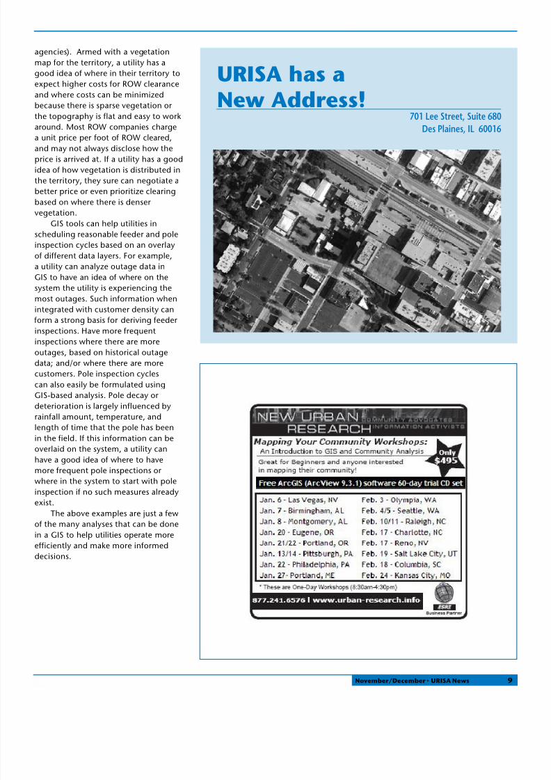
SA has aew Address!
701 Lee Street, Suite 680Des Plaines, IL 60016
November/December • URISA News 9

8/8/2019 URISA News November. December 2009
http://slidepdf.com/reader/full/urisa-news-november-december-2009 10/12
WCOM W SA MMBS
FDA AGCy MMBU.S. Census Bureau
COPOA MMBS
Platinum Corporate Member ESRI
Gold Corporate MembersCDMData Transfer Solutions, LLCMichael Baker Corporation
BC AssessmentManatronMerrick & CompanyOGInfo.com, LLC
PictometryPinnacle Mapping Technologies, Inc.Pixxures, Inc.The Sidwell Company
BSSS MMBS
Silver Business MembersInner Corridor Technologies/ Teach Me GISeGPS Solutions Inc
Colorado CustomWare, Inc. (CCI)Geotek MappingGeoWise LimitedGIS Innovations LTD.Kessler GIS
MGP, Inc.Munsys, Inc.North River Geographic Systems, Inc.Open Technology GroupOrion Technology Inc.Spatial Data ResearchSpatial Focus Inc.Tetra TechTyler Technologies Eagle Computer Division
VERTICES LLC Wellar Consulting
Robert L. Bethel, Florida Keys Aqueduct Authority,Key West, FL
Dr. Raymond Arthur Birchler Jr., Toms River, NJ,
Constance Carlson, King County, Oak Harbor, WA
Nicholas J Chamberlain Jr, Salisbury University,Salisbury, MD
Jason Clemis, GISP, Forsyth County, Cumming, GA
Diana María Contreras Mojica, Centre for Geoinformatics, A-5020 Salzburg, Austria
Rose Crawford, Long Beach, CA
Jared Cunningham, Elmira, ON, Canada
Kevin C Day, First American Title Insurance Company, Portland, OR
Laura Degroot, AICP, Town of Andover, Andover, MA
Rebecca Falterman, St John the Baptist ParishCouncil, Laplace, LA
Carl Figueiredo, Rutgers University, Highland Park, NJ
Elissa A Fjellman, GISP, Swinomish Indian Tribal Community, La Conner, WA
Christopher Todd Georgel, Surry, VA
Michael Green, Calvin Giordano & Associates, Fort Lauderdale, FL
Mary L. Johnson, Avencia Incorporated,Philadelphia, PA
Naomi Josafath, PMU-GLIS, Paramaribo, Zorg & Hoop, Suriname
Jennie Koenig, Town of Avon, Avon, CO
Amy Laurent, Public Health, Seattle & King County, Kirkland, WA
Nianwei Liu, GISP, City of Charlotte, Charlotte, NC
Ira Marcus, Skyline Software Systems Inc,Chantilly, VA
Maaza C Mekuria, Northeastern University,Somerville, MA
Dan Miller, GISP, State of Washington Military
Dept, Camp Murray, WAThomas R Mueller, GISP, California University of
Pennsylvania, California, PA
Don Nehmer, Milwaukee Metropolitan Sewerage District, Milwaukee, WI
Randi L Pickford, GISP, Amston, CT
Judy Cevelin Pizzo, Florida Department of Transportation, Orlando, FL
Nicolas Ramirez, Humboldt State University,Eureka, CA
Michael Reidy, Valley Center-Pauma, Valley Center, CA
Darrin A Smith, Critigen, Raleigh, NC
Calvin Tribby, University of New Mexico,Albuquerque, NM
George Wagner, Trapeze ITS, Cedar Rapids, IA
Dean Wallraff, Sierra Club Angeles Chapter, Los Angeles, CA
Normena Walton, Pixxures, Inc., Arvada, CO
Happy Holidays
f r o m t h e e n t i r e U R I S A S t a f f
10 November/December • URISA News

8/8/2019 URISA News November. December 2009
http://slidepdf.com/reader/full/urisa-news-november-december-2009 11/12
Call 1-888-288-1386 today to find out how youcan improve your fleet efficiency.
Visit www.esri.com/fleet.
Copyright © 2008 ESRI. All rights reserved. The ESRI globe logo, ESRI, ArcLogistics, ESRI—The GIS Company, @esri.com, and www.esri.com are trademarks, or registered trademarks, or service marks of ESRI in the
United States, the European Community, or certain other jurisdictions. Other companies and products mentioned herein may be trademarks of their respective trademark owners.
Cut Fleet Costs 15–30% and Improve Service with GIS
ESRI—e GIS Com pany ™
1-888-288-1386
www.esri.com/fleet
Use ESRI ArcLogistics™ to create vehicle routes and mobile
workforce schedules that consider time, cost, worker/vehicle
specialty, and actual street network drive-times.
ArcLogistics combines proven geographic information
system (GIS) technology with high-quality street data
to create a routing and scheduling solution that builds
optimized vehicle routes and provides turn-by-turn directions.
ArcLogistics is affordable, easy to implement, and requires
minimal training.
Create more efficient inspector territories with
balanced workloads.
Increase daily productivity while using fewer vehicles.
Use less fuel and reduce carbon emissions.
Quickly audit mileage and accurately monitor
work activity.
ESRI is the market leader in providing geographic information
system solutions to organizations around the world.
GIS Improves the Productivityand Efficiency of Your GovernmentFleet Operations
Create dispatcher summary reports, route overview maps, street-level
directions, route manifests, and more.
M a k e Y o
O r g a n i z a t i o n G r e

8/8/2019 URISA News November. December 2009
http://slidepdf.com/reader/full/urisa-news-november-december-2009 12/12
Urban & Regional Information Systems Association
701 Lee Street, Suite 680
Des Plaines, IL 60016
NON–PROFIT ORG.U.S. POSTAGE
PAIDURISA
Business Directory
Your business card advertisement can be seen here for $50 per issue.
Calendar!
MarkYour
November/December 2009
Easy RFP Distribution
Remember to email your technology-related
RFPs to [email protected] for FREE distribution to
URISA’s corporate and business members. Save
lots of time and effort. We have a list of contacts who are pleased to
receive your RFPs. Take advantage of this free service often!
Digital Orthophotography Digital Planimetric andTopographic Mapping
Aerial Photography LiDARGIS Services
Specializing in
photogrammetric and GIS
services since 1954
www.surdex.com
520 Spirit of St. Louis Blvd.
Chesterfield, MO 63005
tel 636-368-4400
URISA 2010
701 Lee Street, Suite 680Des Plaines, IL 60016Phone: (847) 824-6300Fax: (847) [email protected], www.urisa.org