Embed Size (px)
Citation preview

Bhutan’s Urbanization Strategy & Process
Geo Intelligence Asia 2016 2nd March 2016 Greater Noida, INDIA
Meghraj Adhikari Urban Specialist ([email protected]) Department of Human Settlements Ministry of Works and Human Settlements Thimphu: Bhutan

Bhutan’s National Urbanization Strategy & Process
1. Background/Introduction 2. Current status 3. Governance Structure 4. Bhutan’s National Urbanization Strategy 5. Bhutan’s Urban Planning Process 6. Urbanization and Culture 7. Survey & Mapping 8. New Challenges 9. Conclusion

1. Background/Introduction
• Modern development initiated in 1961
• Prior to 1961 predominantly rural settlements
• With development two settlements of Thimphu and Phuntsholing picked up
• Urbanization is not based on industrialization but administrative reforms & creation of service centres
• Rapid urbanization since 1981

2. Current Status
• GIS introduced since 2000 but its effective use is lacking • Cadastral information is collected but its dissemination
needs further improvement • Geodetic data collection is in progress but it takes long to
reach the desired level due to resource constraints. • The inventory of urban infrastructure is recognized • Two urban hubs are in planning stage that are designed to
absorb population moving towards economically active areas
• Spatial Planning Act and Standards are drafted to meet the legal challenges and to promote a technically sound planning methodology
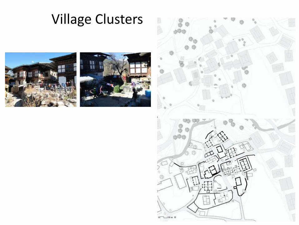
Village Clusters

3. Governance Structure
• Constitution provides for at least one district & satellite town in every district
• 4 towns declared in 2010 by Parliament for local government and mayors elected.
• Additional 16 districts & 20 satellite towns declared by Parliament in 2015
• New declaration to ensure a balanced development & avoid concentration of settlements in few areas
• Local governments have elected mayors supported by town council , technical and administrative set up

4. Bhutan National Urbanization Strategy
• Study conducted based on Housing & Population Census
2005 • Indicates rapid urbanization • Predicts urbanization to cross 70% by 2020 against earlier
estimation of 50% • Major shift of population from eastern region to capital
Thimphu and other economically active settlements • There are 63 settlements potential for urban development • Interventions initiated to promote balanced development-
regional hubs

Bhutan map and towns
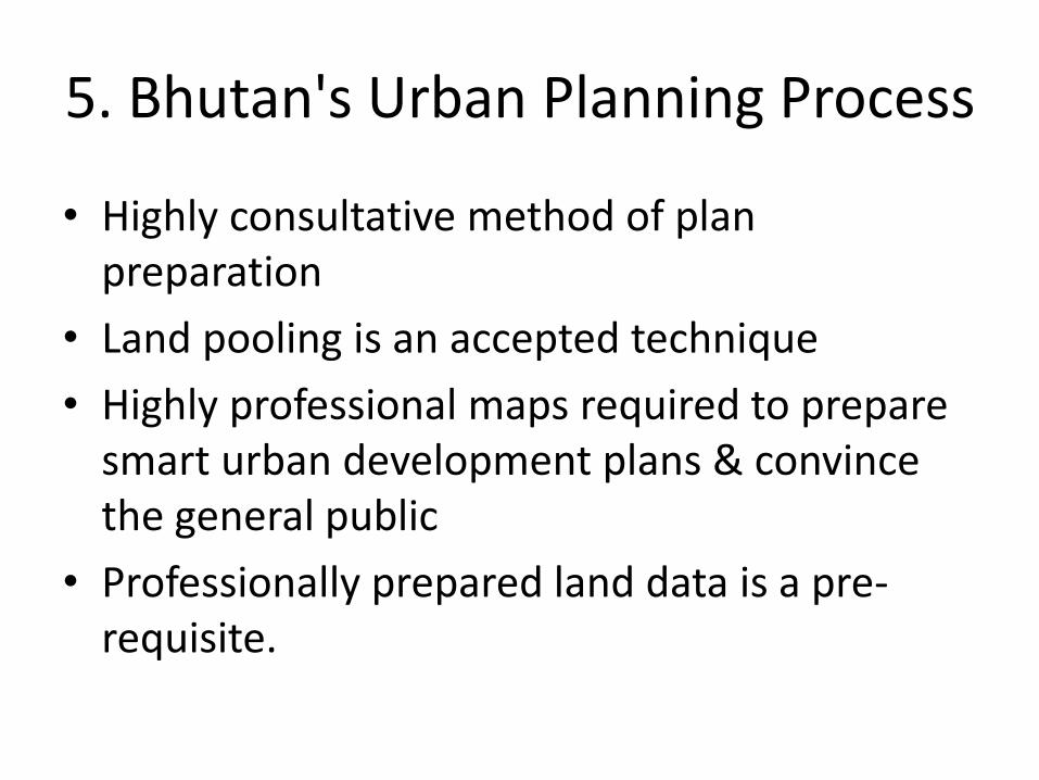
5. Bhutan's Urban Planning Process
• Highly consultative method of plan preparation
• Land pooling is an accepted technique
• Highly professional maps required to prepare smart urban development plans & convince the general public
• Professionally prepared land data is a pre-requisite.
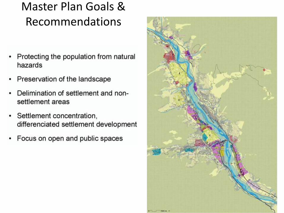
Master Plan Goals & Recommendations

Master Plan, Focus Areas

The Master Plan

Landscape Conservation and Risk Management of Natural Hazards
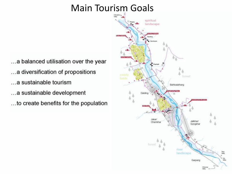
Main Tourism Goals
6. Urbanization & Culture
• Bhutan’s development philosophy is based on GNH
• Out of 4 pillars culture is very important from physical perspective
• All existing development is dependent on cultural landscape : Nodal points for urban growth are Dzongs, Agricultural areas, big hydropower projects, Modern institutional areas.
• Traditional architecture promotes culture and is made mandatory for aesthetics and uniqueness.

7. Survey & Mapping
• All declared towns to be mapped
• Delimitation plans prepared for election purpose but needs improvement
• Topographic maps are required to plan virgin areas and for urban renewal
• National land use plan needs to be developed
• Regional and valley development plans need priority to promote a regionally balanced development
• Structure and local area plans are urgently required to mobilize resources and enhance quality of life

8. New Challenges: Climate change & disaster risk
• Water sources are drying
• Rain is more erratic
• Risk of glacial lake outbursts
• Flash floods are common
• Land slides are frequently interrupting the surface transport thereby affecting the life of people
• Dry winters become fire risks particularly for forests

Traditional architecture & changing landscape

Streetscape with traditional & modern architecture
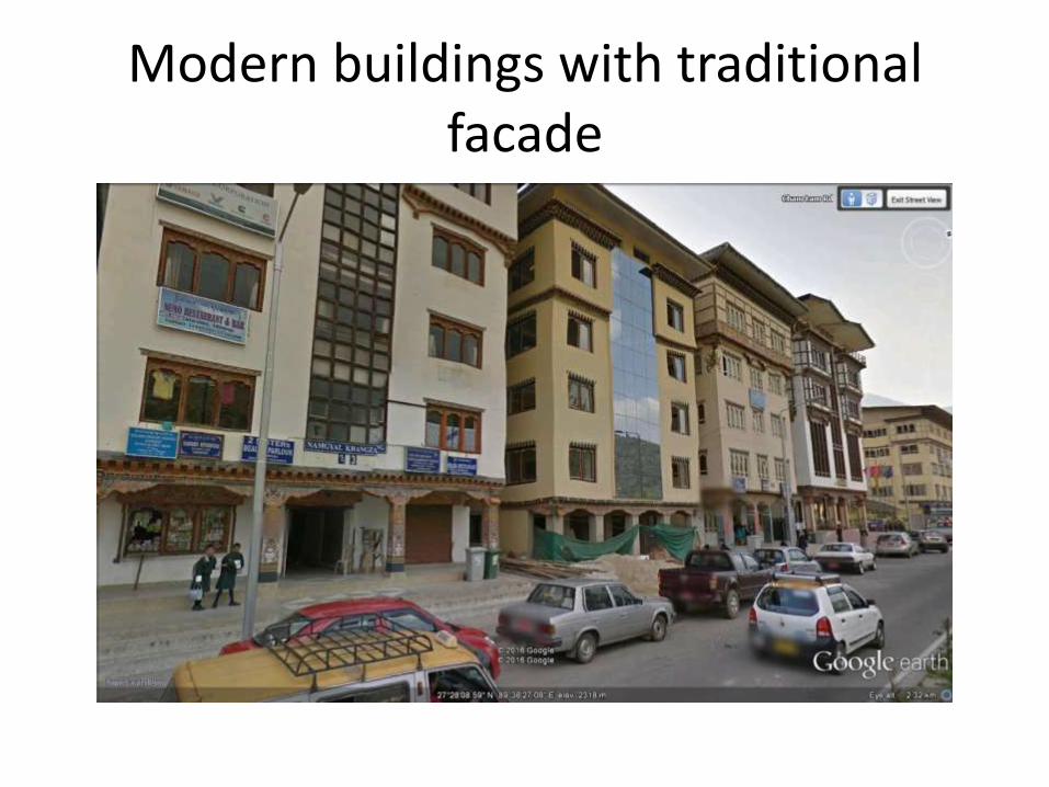
Modern buildings with traditional facade

New Urban form with Traditional architecture, open space & temple

9. Conclusions
• Prepare national land use plan
• Prepare regional plan
• Prepare Geo-hazardous maps
• Use satellite imageries for preparation of macro level plans
• Prepare water shed area maps for effective management
• Prepare thematic maps e.g. heritage sites, environmentally sensitve area maps etc.
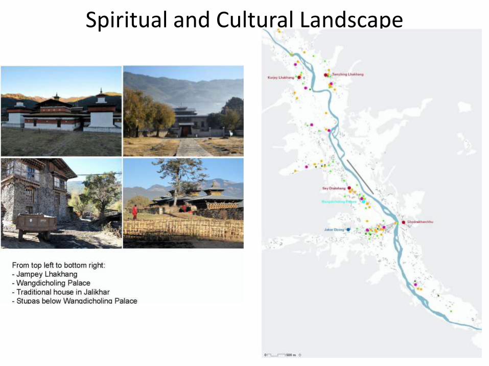
Spiritual and Cultural Landscape

Today’s Settlement Form

Future Form of Settlement

A highway settlement planned

All new constructions will be in traditional style
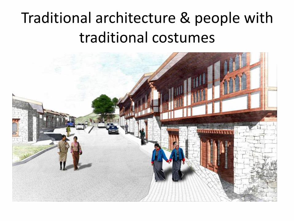
Traditional architecture & people with traditional costumes
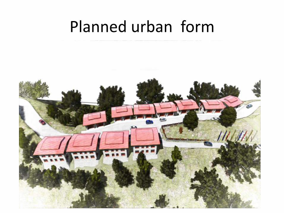
Planned urban form

Rear Façade of the housing

Conclusions…. (continued)
• All planning and implementation are dependent on maps
• Technology is improving very fast but accessibility is limited because of resource constraints
• Sometimes technology is available but capacity lacking e.g software, hardware and skills do not match

Tashi Delek


![Himalayan Kingdom Marathon Bhutan Information 2015[1].pdfHimalayan Kingdom Marathon Bhutan Bhutan Information 31st May, 2015 . Bhutan Bhutan, the land of the Thunder Dragon is mystical,](https://img.dokumen.tips/doc/110x75/5f11fd557037e051160106f9/himalayan-kingdom-marathon-bhutan-information-20151pdf-himalayan-kingdom-marathon.jpg)