Embed Size (px)
Citation preview

UNITED STATES ENVIRONMENTAL PROTECTION ww 7 9: 7 5 REGION VII
901 NORTH FIFTH STREET EN;'\l<F!i i*,:! , L :'>JTECTIOH
KANSAS CITY, KANSAS 66101 ,.,,,Y~icF(;lI3!4 YII AT'" ' REGIONAL HEAFiibiG CLERK
BEFORE THE ADMINISTRATOR
IN THE MATTER OF ) I . .
1 Z) = THF Grindstone Development, L.L.C. rn 5
) FINDINGS OF VIOLATIO&; - - I
) ORDER FOR C O M P L I A N ~ Kj ) ON CONSENT
,. -- and -- -< , ; - . .
1 ;: z-; > -.. I --. ,2 --.
Emery Sapp & Sons, Inc. ) Docket No. CWA -07-2007-Be2
) rJ4- r - m rn-0
Respondents ) 2 2 )
Z Proceedings under Section 309(a) of the Clean Water Act, 33 U.S.C. 8 1319(a) )
I. FINDINGS OF VIOLATION
Jurisdiction and Preliminary Statement
1. The FINDINGS OF VIOLATION are made and ORDER FOR
COMPLIANCE ON CONSENT ("Order on Consent") is issued pursuant to the authority
vested in the Administrator of the United States Environmental Protection Agency, by
Section 309(a) of the Clean Water Act ("CWA" or the "Act"), 33 U.S.C. $1319(a), as
delegated by the Administrator to the Regional Administrator, EPA Region VII, and
further delegated to the Director, Water, Wetlands and Pesticides Division, EPA Region
VII.
2. Respondent THF Grindstone Development L.L.C. is a limited liability
company, organized under the laws of Missouri for the purpose of, among other things,

fn the Matter oJTHP Cr~kdstone Deve/opmen/, L.L. C and Emery Sapp % Sons, fnc. Docket No. CCWA -07-2007-6'6'6'7
purchasing real property and engaging in activities related to commercial development of
real property. Respondent Emery Sapp & Sons, Inc. is a corporation organized under the
laws of Missouri, engaged in construction of commercial and residential projects.
3. The EPA has reason to believe that THF Grindstone Development, L.L.C. and
Emery Sapp & Sons, Inc. ("Respondents") violated Section 301 of the CWA, 33 U.S.C.
$ 13 1 1, through discharge of fill material into waters of the United States when
conducting activities at the Grindstone Plaza Construction Site, located in Section 30,
Township 48 North, Range 12 West, Boone County, Columbia, Missouri (the "Site").
Specifically, Respondents discharged dredged or fill material into navigable waters of the
United States without obtaining the necessary permits required by Section 404 of the
CWA, 33 U.S.C. $1344.
3. The EPA and Respondents, having determined that settlement of this matter is
in the best interest of all parties, come now and enter into this Order on Consent.
Statutorv and Regulatorv Framework
4. Section 301(a) of the CWA, 33 1J.S.C. $ 131 ](a), prohibits the discharge of
pollutants, by any person except in compliance with, inter alia, Section 404 of the CWA,
33 U.S.C. $ 1344.
5. Section 404 of the CWA, 33 U.S.C. $ 1344, provides that the discharge of
dredged or fill material into a "navigable water" of the United States, as these terms are
defined by Section 502 of the CWA, 33 U.S.C. $ 1362, occur in accordance with a permit
issued under that Section.

I n the Matter o/THP Grindstone DeveZopmenf, L.L. C and Emery Sapp & Sons, Inc. Docket No. CCWA -U%ZUU% DUD7
6. Section 404 of the CWA, 33 U.S.C. 5 1344, provides that the Secretary of the
Army, acting through the Chief of Engineers, may issue permits for the discharge of
dredged or fill material into navigable waters at specified disposal sites, after notice and
opportunity for public comment.
7 Section 502(12) of the CWA, 33 U.S.C. 5 1362(12), defines "discharge of a
pollutant" to include "any addition of any pollutant to navigable waters from any point
source."
8. Section 502(6) of the CWA, 33 U.S.C. S 1362(6), defines "pollutant" to
include, inter alia, dredged spoil, rock, sand and cellar dirt.
9. Section 502(7) of the CWA, 33 U.S.C. S 1362(7), defines "navigable waters" as
"...the waters of the United States, including the territorial seas."
10. Section 502(14) of the CWA, 33 U.S.C. 5 1362(14), defines "point source" as
". . .any discernible, confined and discrete conveyance.. .from which pollutants are or may
be discharged."
11. 40 C.F.R. 5 5 232.2 and 33 C.F.R. Part 328 define waters of the United States,
in part, as, "...lakes, rivers and streams, ... wetlands."
12. Section 502 of the CWA defines "person" to include an individual and a
corporation.
13. Except as provided in Section 404(f) of the CWA, Section 404 of the CWA
requires a person to obtain a permit from the United States Army Corps of Engineers
("Corps") prior to any discharge of dredged or fill material into the navigable waters of the
United States.
I n the Matter o/THC/P Cr~kdstone DeveZopmenf, L. L. 6: and Emery Sap & Sons, fnc. Docket No. CWA-07-2dd7-dOOI
Factual Background
14. At all times relevant to this action, Respondents were owners and/or
operators of the Site.
15. Between October 2005 and June 2006, Respondents, or ones acting on their
behalf, using a track hoe, discharged earthen fill and concrete into an unnamed tributary
to Hinkson Creek. Discharges were in the form of concrete footings approximately 18
inches wide and 18 inches tall inside three arched culverts and a concrete blanket
approximately 28 feet long and nine feet wide along the right descending bank of the
unnamed tributary between the upstream and middle arched culverts. The track hoe used
by Respondents or ones acting on their behalf, acted as a "point source" within the
meaning of Section 502(14) of the Act, 33 U.S.C. $ 1362(14).
16. The earthen fill and concrete that were discharged into the area described in
Paragraph 15 above between October 2005 and June 2006 are "pollutants" within the
meaning of Section 502(6) of the CWA, 33 U.S.C. $ 1362)(6).
17. The unnamed tributary to Hinkson Creek where earthen fill and concrete
were discharged, flows into Hinkson Creek, which flows into the Missouri River. The
Missouri River is a navigable water within the meaning of Section 502(7) of the CWA,
33 U.S.C. 5 1362(7) and a water of the United States as defined by 40 C.F.R. $ 232.2 and
33 C.F.R. $ 328.3.
18. The discharge of earthen fill and concrete into waters of the United States
constitutes the "discharge of pollutants" within the meaning of Section 502(12) of the
CWA, 33 U.S.C. $ 1362(12).

Zn the Mutter oJTHP Crcirdxtone DeveZopmen(, L. L. C; and Einery Supp & Sons, Znc. Docket No. CCWA-O%ZOO%OOOI
19. Respondents did not obtain a 404 permit prior to conducting the activities
described in Paragraph 15 above.
Findings of Violation
20. The facts stated in paragraphs 14 through 19 above are herein incorporated.
21. The use of a track hoe referenced in Paragraph 15 above indicates that
Respondents, or ones acting on their behalf, discharged pollutants into a water of the
United States by using earth-moving equipment without obtaining a Section 404 permit.
22. Respondents' failure to obtain a Section 404 permit prior to conducting
activities described in Paragraph 15 above is a violation of Section 301(a) of the CWA,
33 U.S.C. 5 1311(a).
B. ORDER FOR COMPLIANCE ON CONSENT
Specific Provisions
Based on the authority of Section 309(a) of the CWA, 33 U.S.C. 5 1319(a), Respondents
CONSENT and are hereby ORDERED as follows:
23. Respondents agree to complete Mitigation which is described in Appendix A,
attached hereto and incorporated herein, and consisting of i) the "Proposed Mitigation
Project for Stream Impacts at Grindstone Plaza THF-Grindstone Development L.L.C." by
Paul M. Mehrle, Ph.D., dated March 8,2007, and ii) letter by EPA dated February 13,
2007 from Audrey Asher to Frank Hackmann.
24. Respondents agree that it shall be in EPA's sole discretion to determine
whether Respondents have fully implemented Mitigation. In making this determination,
EPA will take into account Respondents' good-faith efforts as well as any factors beyond
Respondents' control.

fn the Matter of THP Crtirds/one Developmen/, 15.15. C and Emery S a p & Son4 f m Docket No. CCWA-O7-ZDD7-ODU7
25. Respondents agree that this Order on Consent shall not constitute a permit
under the CWA. Compliance with the terms of this Order on Consent shall not relieve
Respondents of their responsibility to obtain any required local, state, and/or Federal
permits.
26. Within 30 days of the Effective Date of this Order on Consent, Respondents
shall initiate steps to obtain a conservation easement, consistent with the Conservation
Easement section of Appendix A, and shall submit to EPA a letter describing the steps
taken. Respondents shall file the conservation easement with the Boone County Register
of Deeds and shall simultaneously provide a copy of the filed conservation easement to
EPA.
27. Within 45 days of the Effective Date of this Order on Consent, Respondents
shall submit to EPA a detailed design for the planting of trees, shrubs and grasses in the
riparian corridor that is described in Appendix A. Within 30 days of receipt of EPA's
comments on the detailed design, Respondents shall modify the design consistent with
EPA's comments and submit the modified design to EPA. Respondents shall implement
the EPA-approved design within- months of the Effective Date of this Order on
Consent.
28. Respondents shall arrange with the property owner of the riparian corridor
where the Mitigation Project will be implemented ("Property") for EPA, the Corps, and
their representatives to have access onto the Property in order to observe the Mitigation
Project.

Zn the Matter oJTHP Gr~hdstone De~eZopmenf, L.L 6: and Emery S a p & Son4 Znc. Docket No. CWA -07-ZUOFOUU7
29. Respondents shall submit annual reports to EPA, beginning on the first
anniversary of the Effective Date of this Order on Consent and continuing until EPA
notifies Respondents in writing that the Mitigation Project is complete. The annual
reports shall be consistent with the Mitigation Project Monitoring & Reporting section
of Appendix A, and shall outline the status of the project and corrective actions, if any,
that will be taken to maintain the original vegetation. If, at the conclusion of five years
from the first anniversary of the Effective Date, 80% success of restoration is not
achieved, Respondents shall implement revegetation efforts to achieve at least 80%
success rate.
30. Respondents agree that no changes shall be made to the Mitigation without
prior written approval from EPA.
3 1. Respondents shall submit the deliverables required by this Order on Consent
to EPA at the following address:
Delia Garcia, PhD., Compliance Officer Water, Wetlands, and Pesticides Division U. S. Environmental Protection Agency - Region VII 901 N. Fifth Street Kansas City, Kansas 66101
General Provisions
32. Respondents admit the jurisdictional allegations in this Order on Consent and
agree not to contest EPA's jurisdiction in this proceeding or any subsequent proceeding
to enforce the terms of the Order on Consent.
33. Respondents neither admit nor deny the factual allegations contained in this
Order on Consent.

Zn the Matter oSTHP Gr~irdstone DeveIopmennf, L.L. 6: and Emery Sapp % Sons, Znc. Docket No. CWA-@%ZDD7-DDD7
34. Nothing contained in the Order on Consent shall alter or otherwise affect
Respondents' obligations to comply with all applicable Federal, state, and local
environmental statutes and regulations and applicable permits.
35. Compliance with the terms of this Order on Consent shall not relieve
Respondents of liability for any violations of the CWA not addressed in this Order on
Consent or in the Consent Agreementwinal Order, Docket No. CWA-07-2007-0006. In
addition, nothing in this Order on Consent shall prohibit EPA from seeking additional
injunctive relief for matters not covered herein pursuant to Section 309 of the CWA, 33
U.S.C. 9 1319.
36. Nothing in this Order on Consent shall limit EPA's right to obtain access to
the area where the Mitigation was performed and to request additional information from
Respondents, pursuant to the authority of Section 308 of the CWA, 33 U.S.C. 3 1318 and
any other authority.
37. If any provision or authority of this Order on Consent, or the application of
this Order on Consent to Respondents, is held by Federal judicial authority to be invalid,
the application to Respondents of the remainder of this Order on Consent shall remain in
force and effect and shall not be affected by such a holding.
38. The signatories below certify that they are fully authorized to enter into the
terms and conditions of this Order on Consent.
39. The terms of this Order on Consent shall be effective and enforceable against
Respondents on the Effective Date, which is the date this Order on Consent is signed by
EPA.
I n the Mafter of THP Grindstone DeveIopmend L.L. 6: and Emery Sapp & Sun4 Znc. Docket No. C WA -0iT-2007-@DO7
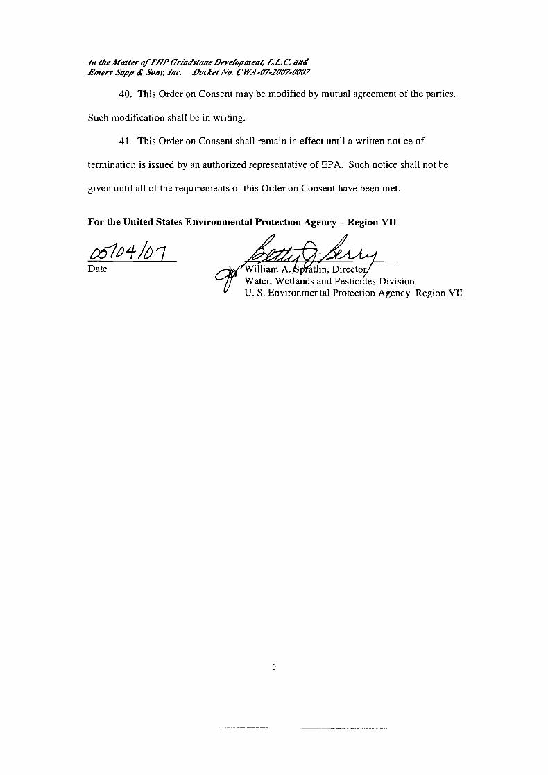
40. This Order on Consent may be modified by mutual agreement of the parties.
Such modification shall be in writing.
41. This Order on Consent shall remain in effect until a written notice of
termination is issued by an authorized representative of EPA. Such notice shall not be
given until all of the requirements of this Order on Consent have been met.
For the United States Environmental Protection Agency - Region VII
Date
U. S. Environmental Protection Agency Region VII

In the Matter ofTUP Cr~hdstone DeveZopmeni, L.L. tZ and Emery Sapp & Sons, Inc. Docket No. CCWA-O7-2OO%OOO7
4WQ- Date Audrey B. &er
8. & Senior Assistant Regional Counsel U. S. Environmental Protection Agency Region VII

Zn fhe Muffeer o/TI/P Grindsfone DeveZopmenf, L.L C and Emery Supp & Son4 Znc. Docket No. CWA-O7-2DD%ODD7
The undersigned representative of THF Grindstone Development, L.L C. certifies that he or she is authorized to enter into this Order For Compliance on Consent and to execute and legally bind THF Grindstone Development, L.L.C. to the terms and conditions of this Order For Compliance on Consent and meets the requirements for authorized signatory found in 40 C.F.R. 5 122.22.
For Respondent THF Grindstone Development, L.L. Fj Y 116 107 I
Date Michael H. Staenberg 2 127 Innerbelt Bus. Ctr. Dr. #200 I
I
St. Louis, MO 63 1 14
//I the Mnffer uJTHP Gr~hdsfone Deve/opmenf, L.L. C ::nu' Emery Supp Q JOHS, fnc. Lbckef No. CWA -07-2U07-6%9@7
The undersigned representative of Emery Sapp & Sons, Inc. certifies that he or she is authorized to enter into this Order For Compliance on Consent and to execute and legally bind Emery Sapp & Sons, Inc. to the terms and conditions of this Order For Compliance on Consent and meets the requirements for authorized signatory found in 40 C.F.R. p 122.22.
For Respondent Emery Sapp & Sons, Inc.:
Date

APPENDIX A

PROPOSED MITIGATION PROJECT FOR STREAM IMPACTS AT GRINDSTONE PLAZA
THF-GRINDSTONE DEVELOPMENT L.L.C.
Prepared by Paul M. Mehrle, Ph.D.
ENTRIX March 8,2007
During a site inspection by the Corps of Engineers (Corps) in March 2006, it was determined that 340 linear feet of an unnamed tributary of Hinkson Creek were impacted by activities associated with the construction of three arched culverts on Grindstone Plaza property. In a subsequent site visit by U.S. EPA Region VII in June 2006, it was estimated that 368 linear feet of stream were impacted. The U.S. EPA has indicated that in order to mitigate for the impact, 736 linear feet of stream with a 50-foot riparian corridor on each side of the stream must be included in the mitigation project. This mitigation requirement will be at a 2:l ratio to mitigate for the impacts to the 368 linear feet of stream impact. The Hinkson Creek watershed in Columbia, Missouri, is the focus of the proposed Mitigation Project by THF-Grindstone Development L.L.C.
This proposed Mitigation Project incorporates the recommendations provided by EPA in the letter dated February 13,2007, from Audrey Asher to Frank Hackrnann. In addition, the proposed Mitigation Project incorporates the recommendations of the Corps of Engineers and EPA provided in a conference call on March 1,2007, relative to the area and types of mitigation acceptable for the stream impacts at the Grindstone Plaza property.
The Hinkson Creek is approximately 17 miles long starting north of Columbia and converging with Perche Creek southwest of Columbia. Hinkson Creek receives runoff from approximately 60% of the City of Columbia. During the past decades, the Hinkson Creek has experienced increased flows due to agricultural and urban runoff in the watershed which has resulted in streambank erosion, increased sedimentation, and decreased water quality. Numerous restoration activities along Hinkson Creek have been implemented during the past several years to stabilize streambanks, improve riparian corridors, and enhance aquatic habitats. The following is a Mitigation Project consisting of riparian corridor restoration and enhancements that will provide additional positive benefits to the Hinkson Creek watershed in Columbia, MO.
Enhance Hinkson Creek Riparian Corridor Adjacent to Scott Boulevard City Park
In southwest Columbia, the City of Columbia has a major recreational park area located on Scott Boulevard. There are nature areas, walking trails, and recreational fields for public use. The Hinkson Creek is adjacent to the southern boundary of the park. The

watershed along this segment of Hinkson Creek has experienced significant growth in the past several years resulting in greater upstream runoff from residential and commercial developments. In the lower segments of Hinkson Creek near Scott Boulevard, there is considerable streambank erosion that has been occurring over the past decade. In addition, the Scott Boulevard City Park area adjacent to the Hinkson Creek has potential to experience impacts from streambank and riparian corridor instability which could result in future impacts to the recreational areas as well as to Hinkson Creek. The proposed restoration activities will provide enhancements and stability to the riparian corridor for this area of the Hinkson Creek watershed as well as to the City park recreational area. The proposed Mitigation Project will include riparian corridor restoration enhancements and will be implemented along 750 linear feet of the northern streambank of Hinkson Creek within the Scott Boulevard park area on property owned by the City of Columbia and managed by the City's Parks and Recreation Department. The area for the mitigation project within the City park site is depicted in Figure 1.
To stabilize and enhance the riparian corridor along the Hinkson Creek, native grasses, shrubs and trees will be planted within the riparian corridor area along approximately 750 linear feet on the northern side of Hinkson Creek. The riparian area is an irregularly shaped area along the northern streambank with the riparian area being approximately 100 feet wide along 650 linear feet of the stream and at the western edge of the corridor approximately 200 feet wide along 100 linear feet of stream. The riparian corridor area proposed for restoration enhancements is approximately two (2) acres. Figure 2 depicts the approximate area proposed for restoration enhancements. The EPA and Corps of Engineers typically expect protection and enhancement of 50 feet of riparian buffer on each side of stream as part of mitigation projects. The proposed Mitigation Project provides restoration enhancements to only the northern riparian corridor of this segment of Hinkson Creek. The riparian corridor on the south of Hinkson Creek contains dense mature hardwood trees along the majority of the targeted stream segment and is not in need of restoration enhancements compared to the riparian area to the north of Hinkson Creek. Focusing on the northern riparian area along this 750 linear feet segment of Hinkson Creek will provide more long term benefit to the Hinkson Creek and also protect future erosion of the City park recreation area.
The riparian corridor area is a relatively flat area that slopes north-to-south toward Hinkson Creek and is covered by various densities of grasses. The grasses are less dense at the western and eastern areas of the corridor area. There are mature hardwood trees near the top of the streambank along the Hinkson, and approximately 60 feet to the north of the streambank in the middle section of the corridor there are immature cottonwoods and hardwoods. The majority of the corridor has minimal trees and few shrubs. Figures 3,4, & 5 are photographs depicting the current vegetation in the riparian corridor. The majority of the proposed tree plantings will be in the open areas within the corridor, and the proposed shrub plantings will be spaced within the new tree plantings as well as within the existing trees. A goal of the restoration enhancements is to provide a biologically diverse riparian corridor along this segment of Hinkson Creek.
A combination of upland and transition zone trees native to Missouri will be planted within the riparian corridor. The more mature trees will be RPM trees (3-5 gallon size) planted on 8x20 spacing, and bare root treeslwhips will be planted on 4x6 spacing. The species of trees considered for planting are as follows:
Red Oak (Quercos rubra) White Oak (Quercus alba) Shagbark Hickory (Carya ovata) Eastern Redbud (Cercis Canadensis) Green Hawthorne (Crataegus viridis) Common Hackberry (Celtis occidentalis) River Birch (Betula nigra)
Bare-root shrubs will be planted within the new tree plantings as well as within the existing trees in the corridor. Shrubs will be planted on 6x12 spacing. The species of native Missouri shrubs considered for planting are as follows:
Sumac (Rhus aromatica) Witch Hazel (Hamamelis vernalis) Buttonbush (Cephalanthus occidentalis) Serviceberry (Amelanchier Canadensis) Golden Currant (Ribes aureum)
A native seed mix will be applied in areas throughout the riparian corridor. The seed mix will be applied at the rate of approximately 20 poundslacre depending on the area and the existing grass cover. The native seed mix will include the following (scientific names of native grass varieties will be provided in the final planting design):
Prairie Dropseed Virginia Ryegrass Paradoxa Fescue River Oats Switchgrass (Missouri native only) Yellow Coneflower
A detailed planting design for the trees, shrubs, and grasses will be presented to EPA for approval prior to implementation of the plantings. The detailed planting design will show existing vegetation, proposed placement of trees, species & sizes of trees, shrubs and grasses as well as details of the planting methods, soil amendments, fertilizers, and source of vegetative plantings. Every effort will be made to achieve a beneficial biological diversity within the riparian corridor that is similar to other areas of the Hinkson Creek watershed. Based on the availability and quality of the vegetative species available at the time of implementation, the planting design may change, but any changes will be submitted to EPA for review and approval prior to implementation.

Mitigation Project Monitoring & Reporting
The riparian corridor restoration will be monitored for five (5) years after implementation. A monitoring report to document the success of the restoration will be reported to the U.S. EPA annually. If 80% success of the restoration is not achieved over 5 years, revegetation efforts will be implemented so to achieve at least 80% success.
Each year a site survey of the planted acreage will be conducted to document vegetation success metrics. The following metrics will be used to gauge the success of this project:
Percent Cover (grasses & scrubs) Percent survival (tree species) Observation of invasive species Observation of naturally occurring (non-invasive) species Changes in biological diversity Possible factors affecting success
Upon completion of these observations, a report will be made detailing the findings and submitted to EPA. All observations made at the site will be documented both in notebooks and visually through photodocumentation. Consultation with EPA will be done as necessary. If 80% success in the vegetative plantings is not achieved, then re- vegetation efforts will take place during the appropriate seasons of the year. Dr. Paul Mehrle of ENTRIX will be the point of contact for the annual monitoring surveys and be responsible for implementing the annual monitoring activities.
Implementation Process
Every effort will be made to avoid impacts to the stream and riparian corridor during implementation of the project. Inadvertent adverse impacts to Hinkson Creek and the riparian corridor will be corrected to pre-implementation conditions. The work activities and access to Hinkson Creek will be coordinated with the City of Columbia Parks & Recreation Department who is responsible for maintaining and managing the City property adjacent to the Hinkson Creek. In addition, the proposed Mitigation Project will not overlap with the Mitigation Plan area described in the Compensatory Mitigation Plan for Centerstate Properties LLC approved by Corps of Engineers (Permit No. 200400082).
Implementation Schedule
The schedule for implementation will be based on several factors with one of the most important factors being the climate conditions most conducive to success of the vegetative plantings. Other factors that play into the implementation schedule are: 1. Obtaining approval of the Mitigation Plan by the U.S. EPA; 2. Obtaining the Conservation Easement from the City Council of Columbia; and 3. Availability of quality native vegetative species, as well as sufficient quantities, during the time of the year most conducive to planting. Every effort will be made to implement the Mitigation Project in

the most expeditious manner that will result in a successful restoration project. Assuming that the necessary approvals from EPA and the City are obtained, the Mitigation Project will be implemented in Spring 2007 unless climate conditions cause delays until Fall 2007.
Conservation Easement
In cooperation with the City of Columbia, a Conservation Easement will be obtained for the riparian corridor area included in the Mitigation Project. It is proposed that the Conservation Easement will contain the following restrictions which will require City Council approval:
The City shall not:
Conduct any tilling or planting of agricultural row crops or vegetables; Place any dredge or fill materials or any other materials classified under the Clean Water Act, P.L. 99500, as waste; Dump or store debrislitems such as tires, rocks, yard wastes, equipment, vehicles Pasture or graze domestic animals; Construct or place any buildings except otherwise approved by the U.S. Environmental Protection Agency; Alter the contour or hydrology except as otherwise approved by the U.S. Environmental Protection Agency; Sanction or allow the operation of all-terrain or off-road vehicles except as necessary to 1. maintain the property consistent with the approved Mitigation Project; 2. maintain the riparian corridor by the City of Columbia; 3. maintain any current or future utility easements; and 4. establish and maintain nature trails or nature observation areas. Construct roads for vehicles or other motorized machinery or equipment; Harvest vegetation and trees except for activities necessary to maintain an appropriate biological diversity consistent with the approved Mitigation Project and the management of the City of Columbia's nature areas.

Figure 1 . Area for proposed Mitigation Project within Scott Boulevard park site along the north streambank of Hinkson Creek. The Yellow line on the aerial photograph identifies the riparian area (approximately 750 linear feet) for proposed restoration enhancement activities.
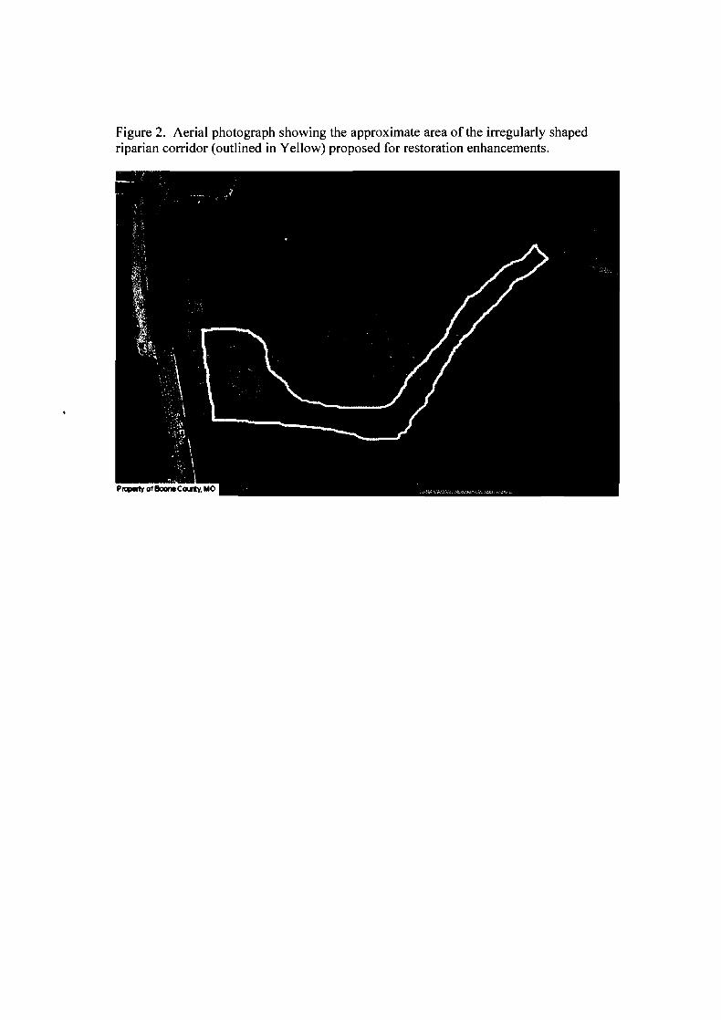
Figure 2. Aerial photograph showing the approximate area of the irregularly shaped riparian corridor (outlined in Yellow) proposed for restoration enhancements.

PROPOSED MITIGATION PROJECT FOR STREAM IMPACTS AT GRINDSTONE PLAZA
THF-GRINDSTONE DEVELOPMENT L.L.C.
Prepared by Paul M. Mehrle, Ph.D.
ENTRIX March 8,2007
During a site inspection by the Corps of Engineers (Corps) in March 2006, it was determined that 340 linear feet of an unnamed tributary of Hinkson Creek were impacted by activities associated with the construction of three arched culverts on Grindstone Plaza property. In a subsequent site visit by U.S. EPA Region VII in June 2006, it was estimated that 368 linear feet of stream were impacted. The U.S. EPA has indicated that in order to mitigate for the impact, 736 linear feet of stream with a 50-foot riparian corridor on each side of the stream must be included in the mitigation project. This mitigation requirement will be at a 2:l ratio to mitigate for the impacts to the 368 linear feet of stream impact. The Hinkson Creek watershed in Columbia, Missouri, is the focus of the proposed Mitigation Project by THF-Grindstone Development L.L.C.
This proposed Mitigation Project incorporates the recommendations provided by EPA in the letter dated February 13,2007, from Audrey Asher to Frank Hackrnann. In addition, the proposed Mitigation Project incorporates the recommendations of the Corps of Engineers and EPA provided in a conference call on March 1,2007, relative to the area and types of mitigation acceptable for the stream impacts at the Grindstone Plaza property.
The Hinkson Creek is approximately 17 miles long starting north of Columbia and converging with Perche Creek southwest of Columbia. Hinkson Creek receives runoff from approximately 60% of the City of Columbia. During the past decades, the Hinkson Creek has experienced increased flows due to agricultural and urban runoff in the watershed which has resulted in streambank erosion, increased sedimentation, and decreased water quality. Numerous restoration activities along Hinkson Creek have been implemented during the past several years to stabilize streambanks, improve riparian corridors, and enhance aquatic habitats. The following is a Mitigation Project consisting of riparian corridor restoration and enhancements that will provide additional positive benefits to the Hinkson Creek watershed in Columbia, MO.
Enhance Hinkson Creek Riparian Corridor Adjacent to Scott Boulevard City Park
In southwest Columbia, the City of Columbia has a major recreational park area located on Scott Boulevard. There are nature areas, walking trails, and recreational fields for public use. The Hinkson Creek is adjacent to the southern boundary of the park. The

watershed along this segment of Hinkson Creek has experienced significant growth in the past several years resulting in greater upstream runoff from residential and commercial developments. In the lower segments of Hinkson Creek near Scott Boulevard, there is considerable streambank erosion that has been occurring over the past decade. In addition, the Scott Boulevard City Park area adjacent to the Hinkson Creek has potential to experience impacts from streambank and riparian corridor instability which could result in future impacts to the recreational areas as well as to Hinkson Creek. The proposed restoration activities will provide enhancements and stability to the riparian corridor for this area of the Hinkson Creek watershed as well as to the City park recreational area. The proposed Mitigation Project will include riparian corridor restoration enhancements and will be implemented along 750 linear feet of the northern streambank of Hinkson Creek within the Scott Boulevard park area on property owned by the City of Columbia and managed by the City's Parks and Recreation Department. The area for the mitigation project within the City park site is depicted in Figure 1.
To stabilize and enhance the riparian corridor along the Hinkson Creek, native grasses, shrubs and trees will be planted within the riparian corridor area along approximately 750 linear feet on the northern side of Hinkson Creek. The riparian area is an irregularly shaped area along the northern streambank with the riparian area being approximately 100 feet wide along 650 linear feet of the stream and at the western edge of the corridor approximately 200 feet wide along 100 linear feet of stream. The riparian corridor area proposed for restoration enhancements is approximately two (2) acres. Figure 2 depicts the approximate area proposed for restoration enhancements. The EPA and Corps of Engineers typically expect protection and enhancement of 50 feet of riparian buffer on each side of stream as part of mitigation projects. The proposed Mitigation Project provides restoration enhancements to only the northern riparian corridor of this segment of Hinkson Creek. The riparian corridor on the south of Hinkson Creek contains dense mature hardwood trees along the majority of the targeted stream segment and is not in need of restoration enhancements compared to the riparian area to the north of Hinkson Creek. Focusing on the northern riparian area along this 750 linear feet segment of Hinkson Creek will provide more long term benefit to the Hinkson Creek and also protect future erosion of the City park recreation area.
The riparian corridor area is a relatively flat area that slopes north-to-south toward Hinkson Creek and is covered by various densities of grasses. The grasses are less dense at the western and eastern areas of the corridor area. There are mature hardwood trees near the top of the streambank along the Hinkson, and approximately 60 feet to the north of the streambank in the middle section of the corridor there are immature cottonwoods and hardwoods. The majority of the corridor has minimal trees and few shrubs. Figures 3,4, & 5 are photographs depicting the current vegetation in the riparian corridor. The majority of the proposed tree plantings will be in the open areas within the corridor, and the proposed shrub plantings will be spaced within the new tree plantings as well as within the existing trees. A goal of the restoration enhancements is to provide a biologically diverse riparian corridor along this segment of Hinkson Creek.

A combination of upland and transition zone trees native to Missouri will be planted within the riparian corridor. The more mature trees will be RPM trees (3-5 gallon size) planted on 8x20 spacing, and bare root treesfwhips will be planted on 4x6 spacing. The species of trees considered for planting are as follows:
Red Oak (Quercos rubra) White Oak (Quercus alba) Shagbark Hickory (Carya ovata) Eastern Redbud (Cercis Canadensis) Green Hawthorne (Crataegus viridis) Common Hackberry (Celtis occidentalis) River Birch (Betula nigra)
Bare-root shrubs will be planted within the new tree plantings as well as within the existing trees in the corridor. Shrubs will be planted on 6x12 spacing. The species of native Missouri shrubs considered for planting are as follows:
Sumac (Rhus aromatica) Witch Hazel (Hamamelis vernalis) Buttonbush (Cephalanthus occidentalis) Serviceberry (Amelanchier Canadensis) Golden Currant (Ribes aureum)
A native seed mix will be applied in areas throughout the riparian corridor. The seed mix will be applied at the rate of approximately 20 poundsfacre depending on the area and the existing grass cover. The native seed mix will include the following (scientific names of native grass varieties will be provided in the final planting design):
Prairie Dropseed Virginia Ryegrass Paradoxa Fescue River Oats Switchgrass (Missouri native only) Yellow Coneflower
A detailed planting design for the trees, shrubs, and grasses will be presented to EPA for approval prior to implementation of the plantings. The detailed planting design will show existing vegetation, proposed placement of trees, species & sizes of trees, shrubs and grasses as well as details of the planting methods, soil amendments, fertilizers, and source of vegetative plantings. Every effort will be made to achieve a beneficial biological diversity within the riparian corridor that is similar to other areas of the Hinkson Creek watershed. Based on the availability and quality of the vegetative species available at the time of implementation, the planting design may change, but any changes will be submitted to EPA for review and approval prior to implementation.
Mitigation Project Monitoring & Reporting
The riparian corridor restoration will be monitored for five (5) years after implementation. A monitoring report to document the success of the restoration will be reported to the U.S. EPA annually. If 80% success of the restoration is not achieved over 5 years, revegetation efforts will be implemented so to achieve at least 80% success.
Each year a site survey of the planted acreage will be conducted to document vegetation success metrics. The following metrics will be used to gauge the success of this project:
Percent Cover (grasses & scrubs) Percent survival (tree species) Observation of invasive species Observation of naturally occurring (non-invasive) species Changes in biological diversity Possible factors affecting success
Upon completion of these observations, a report will be made detailing the findings and submitted to EPA. All observations made at the site will be documented both in notebooks and visually through photodocumentation. Consultation with EPA will be done as necessary. If 80% success in the vegetative plantings is not achieved, then re- vegetation efforts will take place during the appropriate seasons of the year. Dr. Paul Mehrle of ENTRIX will be the point of contact for the annual monitoring surveys and be responsible for implementing the annual monitoring activities.
Implementation Process
Every effort will be made to avoid impacts to the stream and riparian corridor during implementation of the project. Inadvertent adverse impacts to Hinkson Creek and the riparian corridor will be corrected to pre-implementation conditions. The work activities and access to Hinkson Creek will be coordinated with the City of Columbia Parks & Recreation Department who is responsible for maintaining and managing the City property adjacent to the Hinkson Creek. In addition, the proposed Mitigation Project will not overlap with the Mitigation Plan area described in the Compensatory Mitigation Plan for Centerstate Properties LLC approved by Corps of Engineers (Permit No. 200400082).
Implementation Schedule
The schedule for implementation will be based on several factors with one of the most important factors being the climate conditions most conducive to success of the vegetative plantings. Other factors that play into the implementation schedule are: 1. Obtaining approval of the Mitigation Plan by the U.S. EPA; 2. Obtaining the Conservation Easement from the City Council of Columbia; and 3. Availability of quality native vegetative species, as well as sufficient quantities, during the time of the year most conducive to planting. Every effort will be made to implement the Mitigation Project in

the most expeditious manner that will result in a successful restoration project. Assuming that the necessary approvals from EPA and the City are obtained, the Mitigation Project will be implemented in Spring 2007 unless climate conditions cause delays until Fall 2007.
Conservation Easement
In cooperation with the City of Columbia, a Conservation Easement will be obtained for the riparian corridor area included in the Mitigation Project. It is proposed that the Conservation Easement will contain the following restrictions which will require City Council approval:
The City shall not:
Conduct any tilling or planting of agricultural row crops or vegetables; Place any dredge or fill materials or any other materials classified under the Clean Water Act, P.L. 99500, as waste; Dump or store debrislitems such as tires, rocks, yard wastes, equipment, vehicles Pasture or graze domestic animals; Construct or place any buildings except otherwise approved by the U.S. Environmental Protection Agency; Alter the contour or hydrology except as otherwise approved by the U.S. Environmental Protection Agency; Sanction or allow the operation of all-terrain or off-road vehicles except as necessary to I . maintain the property consistent with the approved Mitigation Project; 2. maintain the riparian corridor by the City of Columbia; 3. maintain any current or future utility easements; and 4. establish and maintain nature trails or nature observation areas. Construct roads for vehicles or other motorized machinery or equipment; Harvest vegetation and trees except for activities necessary to maintain an appropriate biological diversity consistent with the approved Mitigation Project and the management of the City of Columbia's nature areas.

Figure 1. Area for proposed Mitigation Project within Scott Boulevard park site along the north streambank of Hinkson Creek. The Yellow line on the aerial photograph identifies the riparian area (approximately 750 linear feet) for proposed restoration enhancement activities.

Figure 2. Aerial photograph showing the approximate area of the irregularly shaped riparian corridor (outlined in Yellow) proposed for restoration enhancements.

Figure 3. Photo of current riparian buffer facing west near Scott Blvd road. Hinkson Creek is on the left. This area is approx. 200 feet east from Scott Blvd.

Figure 4. Riparian buffer along north bank of Hinkson Creek facing east. Hinkson Creek is on the right. This area is approx. 400 feet east from Scott Blvd.

Figure 5. Riparian buffer along north bank of Hinkson Creek facing west. Hinkson Creek is on the left. This area is approx. 700 feet east of Scott Blvd.

IN THE MATTER OF THF Grindstone Development, L.L.C., Respondent Docket No. CWA-07-2007-0007
CERTIFICATE OF SERVICE
I certify that a true and correct copy of the foregoing Findings of ViolatiodOrder for Compliance on Consent was sent this day in the following manner to the addressees:
Copy hand delivered to Attorney for Complainant:
Audrey B. Asher Senior Assistant Regional Counsel Region VII United States Environmental Protection Agency 901 N. 5th Street Kansas City, Kansas 66 1 0 1
Copy by Certified Mail Return Receipt to:
Frank H. Hackmann, Esq. Sonnenschein Nath & Rosenthal LLP One Metropolitan Square, Suite 3000 St. Louis, Missouri 63 102-2741
Dated: 517 107
Kathy ~ o b i n s d Hearing Clerk, Region 7