Embed Size (px)
Citation preview
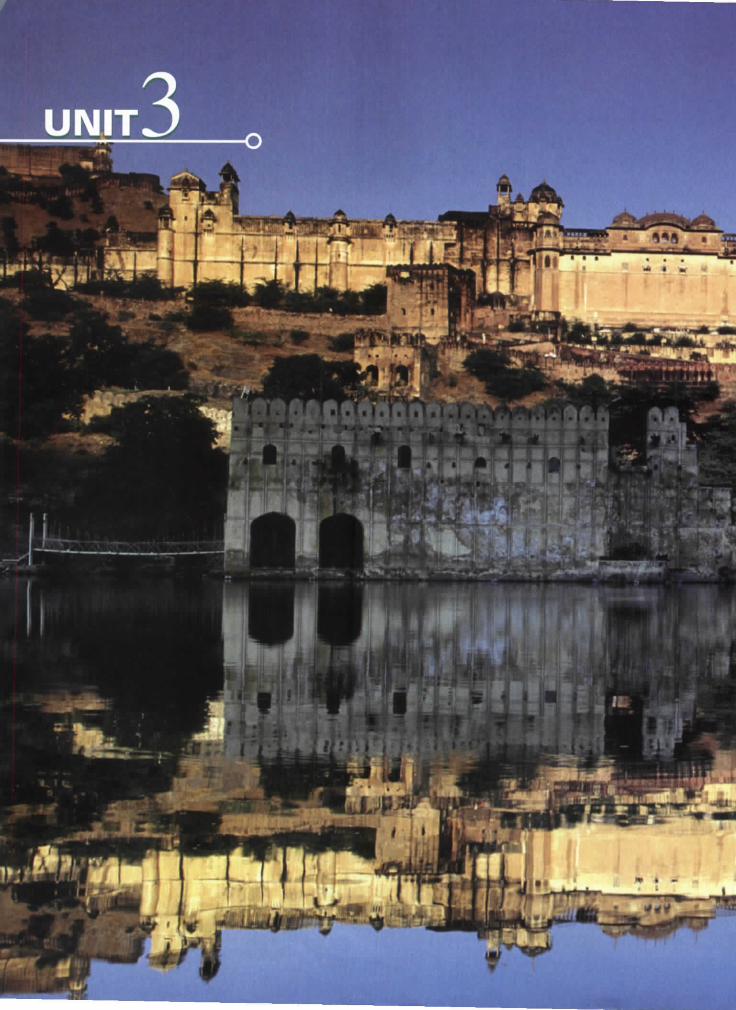
UNIT
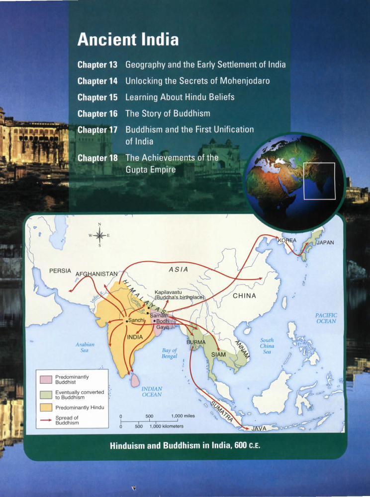
Ancient IndiaChapter 13 Geography and the Early Settlement of India
Chapter 14 Unlocking the Secrets of Mohenjodaro
Chapter 15 Learning About Hindu Beliefs
Chapter 16 The Story of Buddhism
Chapter 17 Buddhism and the First Unificationof India
Chapter 18 The AchievemGupta Empire
n Predominantly
n Eventually convertedto Buddhism
_j Predominantly Hindu
^ Spread ofBuddhism
500 1,000 kilometers
Hinduism and Buddhism in India, 600 C.E.
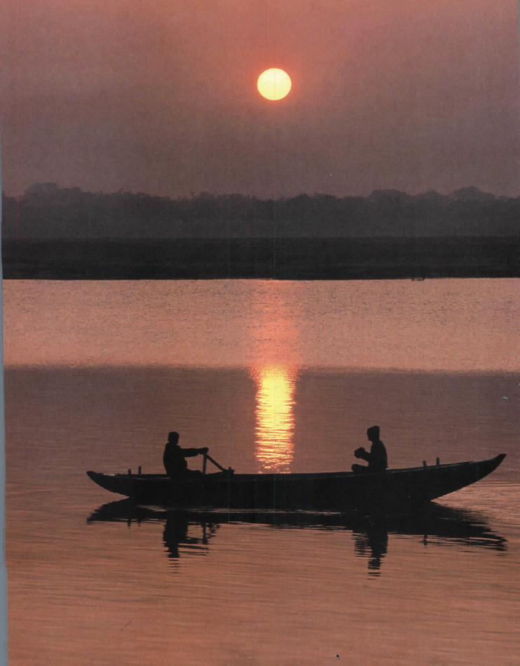

CHAPTER4 Boatmen glide along the Ganges River,
which flows across northern India.
Geography and theEarly Settlement of India13.1 Introduction
In Unit 2, you explored the world of the ancient Egyptians, the
Hebrews, and the people of Kush. In this unit, you will learn about the
civilization of ancient India.
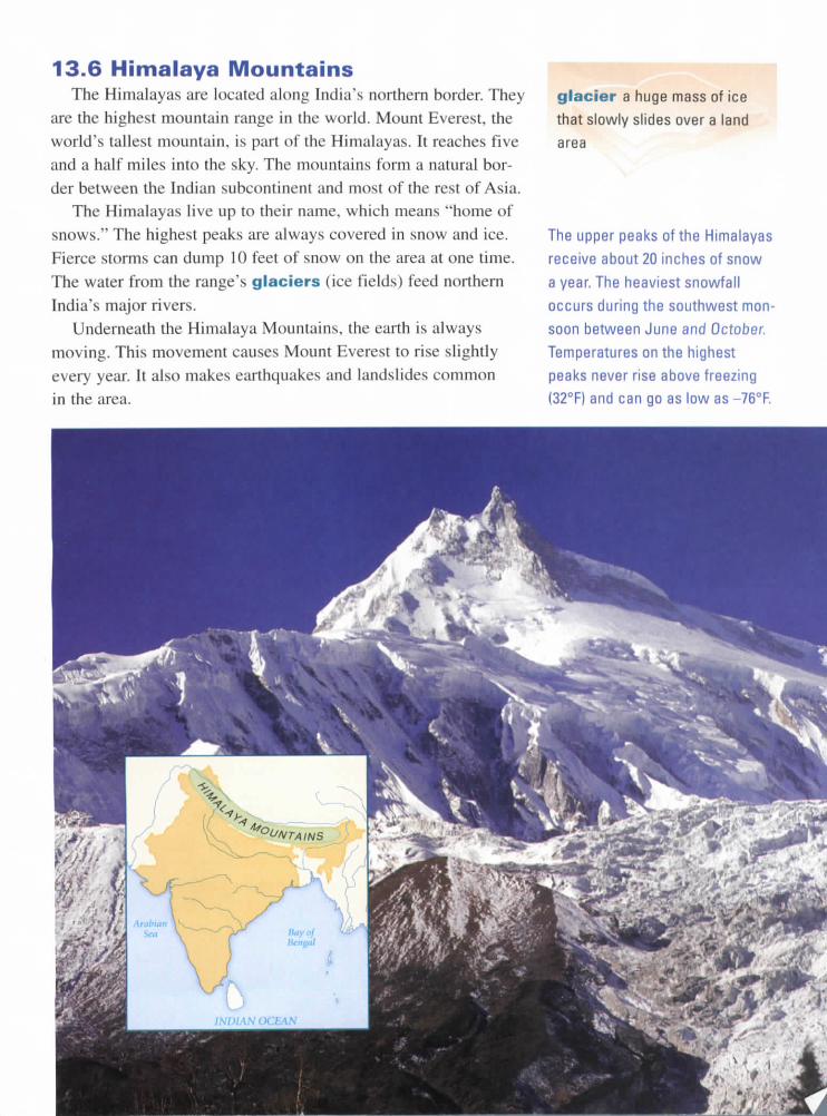
India is a subcontinent of Asia. If you look at a map of India, you
can see that it is attached to the continent of Asia, but surrounded orithree sides by water.
The first walled towns appeared on the Indian subcontinent in about2500 B.C.E. Over the next 2,000 years, a unique civilization developed
in India.
According to an ancient Indian story,
a river god and goddess once lived inthe snow-covered Himalayas, a mountain
range north of the valleys. One day, they
decided to race down the mountainsto the plains below. The goddess sped
straight down and won the race. But her
joy soon turned to worry. Where was theriver god?
The river god had slowed down to
admire the snowcapped mountains and therich brown earth in the valleys. In time, heflowed down to meet his beloved goddess.The two rivers became one, joined foreveron India's plains. The rivers made the land
good for farming.In this chapter, you will learn about
India's rivers and other physical fea-tures. You'll explore eight key features
and their effects on the settlement ofIndia.
Geography and the Early Settlement of India 123
monsoon a strong wind that
brings heavy rain to southern
Asia in the summer
A typical southern town along
the Brahmaputra River receives
between 70 and 150 inches of
rain a year. The heaviest rainfall
occurs during the southwest mon-
soon between June and October.
Temperatures along the river
range from 45°F to 85°F.
13.2 Brahmaputra RiverOur exploration of India begins with the Brahmaputra River.
This river starts high up in the Himalayas. From there, it winds
through snowcapped mountains and narrow canyons. The water
is clear and cold as it rushes over the sharp rocks.The river becomes slower and deeper as it moves into its val-
ley. Each summer, heavy monsoon rains add water to this part of
the river. A monsoon is a large wind that often brings lots of
rain. The heavy rains cause the river to overflow its banks. As itoverflows, the river leaves the rich minerals it has carried down
from the Himalayas in the earth of the valley.
Eventually, the river joins another river, the Ganges, on the
plains. Where the two rivers meet, the land is very fertile (goodfor farming).
124 Chapter 13
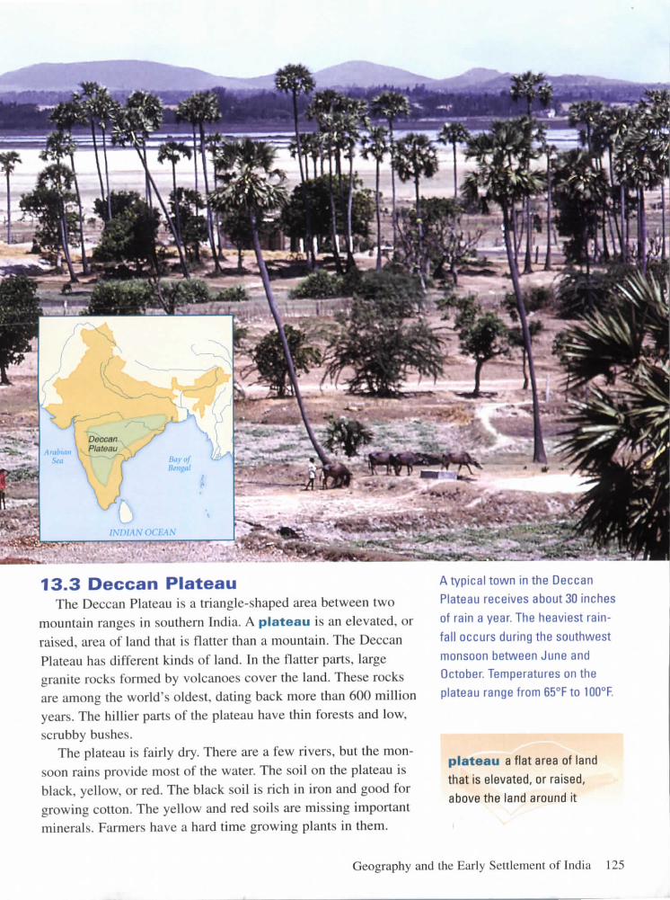
13.3 Deccan PlateauThe Deccan Plateau is a triangle-shaped area between two
mountain ranges in southern India. A plateau is an elevated, or
raised, area of land that is flatter than a mountain. The Deccan
Plateau has different kinds of land. In the flatter parts, largegranite rocks formed by volcanoes cover the land. These rocksare among the world's oldest, dating back more than 600 millionyears. The hillier parts of the plateau have thin forests and low,
scrubby bushes.The plateau is fairly dry. There are a few rivers, but the mon-
soon rains provide most of the water. The soil on the plateau is
black, yellow, or red. The black soil is rich in iron and good forgrowing cotton. The yellow and red soils are missing importantminerals. Farmers have a hard time growing plants in them.
A typical town in the Deccan
Plateau receives about 30 inches
of rain a year. The heaviest rain-
fall occurs during the southwest
monsoon between June and
October. Temperatures on the
plateau range from 65°F to !00°F.
plateau a flat area of land
that is elevated, or raised,
above the land around it
Geography and the Early Settlement of India 125
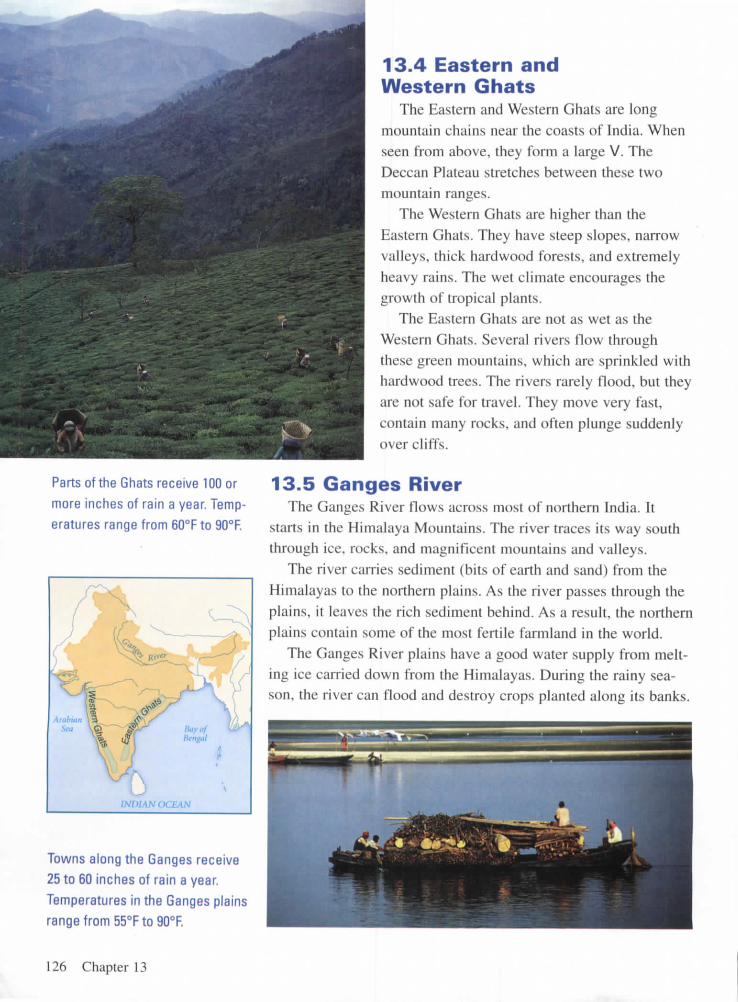
Parts of the Ghats receive 100 or
more inches of rain a year. Temp-
eratures range from 60°F to 90°F.
13.4 Eastern andWestern Ghats
The Eastern and Western Ghats are long
mountain chains near the coasts of India. When
seen from above, they form a large V. TheDeccan Plateau stretches between these two
mountain ranges.The Western Ghats are higher than the
Eastern Ghats. They have steep slopes, narrowvalleys, thick hardwood forests, and extremely
heavy rains. The wet climate encourages the
growth of tropical plants.The Eastern Ghats are not as wet as the
Western Ghats. Several rivers flow through
these green mountains, which are sprinkled withhardwood trees. The rivers rarely flood, but they
are not safe for travel. They move very fast,
contain many rocks, and often plunge suddenly
over cliffs.
13.5 Ganges RiverThe Ganges River flows across most of northern India. It
starts in the Himalaya Mountains. The river traces its way souththrough ice, rocks, and magnificent mountains and valleys.
The river carries sediment (bits of earth and sand) from the
Himalayas to the northern plains. As the river passes through the
plains, it leaves the rich sediment behind. As a result, the northern
plains contain some of the most fertile farmland in the world.The Ganges River plains have a good water supply from melt-
ing ice carried down from the Himalayas. During the rainy sea-son, the river can flood and destroy crops planted along its banks.
Towns along the Ganges receive
25 to 60 inches of rain a year,
Temperatures in the Ganges plains
range from 55°F to 90°F.
126 Chapter 13
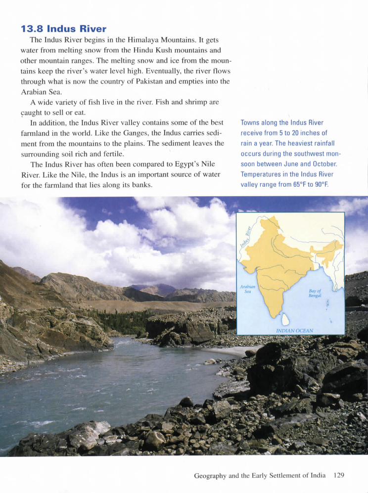
13.6 Himalaya MountainsThe Himalayas are located along India's northern border. They
are the highest mountain range in the world. Mount Everest, theworld's tallest mountain, is part of the Himalayas. It reaches fiveand a half miles into the sky. The mountains form a natural bor-der between the Indian subcontinent and most of the rest of Asia.
The Himalayas live up to their name, which means "home ofsnows." The highest peaks are always covered in snow and ice.Fierce storms can dump 10 feet of snow on the area at one time.
The water from the range's glaciers (ice fields) feed northernIndia's major rivers.
Underneath the Himalaya Mountains, the earth is always
moving. This movement causes Mount Everest to rise slightlyevery year. It also makes earthquakes and landslides common
in the area.
glacier a huge mass of ice
that slowly slides over a land
area
The upper peaks of the Himalayas
receive about 20 inches of snow
a year. The heaviest snowfall
occurs during the southwest mon-
soon between June and October.
Temperatures on the highest
peaks never rise above freezing
(32°F) and can go as low as -76°F.

iNWAN OCEAN
The Hindu Kush mountain range
receives about 15 inches of rain
and snow a year. Weather and
seasons vary greatly across the
range. Temperatures in the Hindu
Kush vary from about 25°F to 75°F.
13.7 Hindu Kush MountainsThe Hindu Kush mountains form a fierce barrier between
India and present-day Afghanistan. This mountain range is not
as tall as the Himalayas, but it is still one of the highest in the
world. Some of its peaks are almost 5 miles high. Many parts ofthe mountain range are unlivable. Snow and ice permanentlycover the steep slopes and peaks.
The Khyber Pass is a 28-mile-long gap between the moun-
tains. It connects central Asia to the Indian subcontinent. Forthousands of years, traders used the pass to enter the Indus Rivervalley. Invaders also used the pass, although many died in themountains' unforgiving landscape.
128 Chapter 13
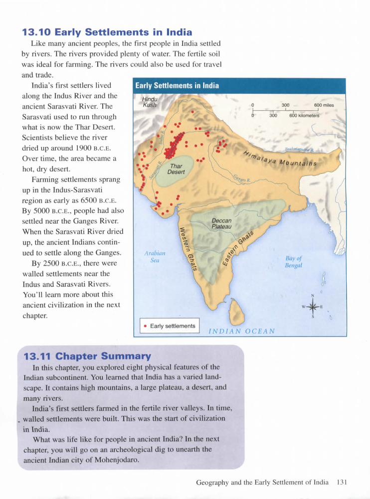
13.8 Indus RiverThe Indus River begins in the Himalaya Mountains. It gets
water from melting snow from the Hindu Kush mountains and
other mountain ranges. The melting snow and ice from the moun-
tains keep the river's water level high. Eventually, the river flows
through what is now the country of Pakistan and empties into the
Arabian Sea.A wide variety of fish live in the river. Fish and shrimp are
caught to sell or eat.In addition, the Indus River valley contains some of the best
farmland in the world. Like the Ganges, the Indus carries sedi-
ment from the mountains to the plains. The sediment leaves the
surrounding soil rich and fertile.The Indus River has often been compared to Egypt's Nile
River. Like the Nile, the Indus is an important source of water
for the farmland that lies along its banks.
Towns along the Indus River
receive from 5 to 20 inches of
rain a year The heaviest rainfall
occurs during the southwest mon-
soon between June and October.
Temperatures in the Indus River
valley range from 65°F to 90°F.
Geography and the Early Settlement of India 129

J+
The Thar Desert receives about
4 to 20 inches of rain a year.
The heaviest rainfall occurs
during the southwest monsoon
between June and October.
Temperatures in the desert
range from 45°F to 120°F.
13.9 Thar DesertThe massive Thar Desert in northern India is mostly sand and
stone. Huge, rolling sand dunes stretch for hundreds of miles.
The landscape is littered with rocks. There is very little plant lifeexcept for grass and low, hardy shrubs. Most of the time, the heat
is unbearable.Water is a precious resource in the desert. There is evidence
of dried-up riverbeds near the desert's borders, but there are no
rivers now. Rain is rare, although the monsoons occasionallybring a soothing storm. The dry conditions make dust stormscommon.
A variety of animals and birds make their home in the desert.There are more than 45 kinds of lizards and snakes. Gazelles lopeacross the sand. Birds include quail, ducks, and geese.
130 Chapter 13
Early Settlements in India
HinduKush
13.10 Early Settlements in IndiaLike many ancient peoples, the first people in India settled
by rivers. The rivers provided plenty of water. The fertile soilwas ideal for farming. The rivers could also be used for traveland trade.
India's first settlers livedalong the Indus River and theancient Sarasvati River. TheSarasvati used to run throughwhat is now the Thar Desert.Scientists believe the riverdried up around 1900 B.c.E.Over time, the area became ahot, dry desert.
Farming settlements sprangup in the Indus-Sarasvatiregion as early as 6500 B.C.E.By 5000 B.C.E., people had alsosettled near the Ganges River.When the Sarasvati River driedup, the ancient Indians contin-ued to settle along the Ganges.
By 2500 B.C.E., there werewalled settlements near theIndus and Sarasvati Rivers.You'll learn more about thisancient civilization in the nextchapter.
300 600 miles
300 600 kilometers
INDIAN OCEAN
13.11 Chapter SummaryIn this chapter, you explored eight physical features of the
Indian subcontinent. You learned that India has a varied land-scape. It contains high mountains, a large plateau, a desert, andmany rivers.
India's first settlers farmed in the fertile river valleys. In time,walled settlements were built. This was the start of civilizationin India.
What was life like for people in ancient India? In the nextchapter, you will go on an archeological dig to unearth theancient Indian city of Mohenjodaro.
Geography and the Early Settlement of India 131