Embed Size (px)
Citation preview
Underp
inning Transformational G
overnment
Case studies from
the 2010 NLPG
and NSG
Exemp
lar Aw
ards
To learn more about how the NLPG, the NSG and the national address gazetteer can benefi t your organisation, please contact:
NLPG and NSG Project TeamsIvybridge House1 Adam StreetLondon, WC2N 6DD
Telephone 020 7747 3500Email [email protected] [email protected] www.thensg.org.uk
GeoPlaceIvybridge House1 Adam StreetLondon, WC2N 6DD
Telephone 020 7747 3500www.geoplace.co.uk
© LGIH and Intelligent Addressing April 2011
IDT 1973 · Printed on paper from sustainable sources · Design: burnthebook.co.uk
Cert no. SA-COC-001654EW
everythinghappenssomewhereCase studies from the 2010 NLPG and NSG Exemplar Awards Demonstrating the importance of location to service delivery within the public sector
04 Foreword from GeoPlace
06 Foreword from Local Government Information House
08 Foreword from Intelligent Addressing
10 Improving service through better communication
West Oxfordshire District CouncilWinner – NLPG NSG Exemplar Award ‘Citizen’s Award‘ and ‘2010 Exemplar Award’
12 A single version of the truthLondon Borough of HackneyRunner Up – NLPG NSG Exemplar Award ‘Citizen Award’
14 Identifying play prioritiesCanterbury City CouncilHighly Commended – NLPG NSG Exemplar Award ‘Citizen Award’
16 A compelling business caseLondon Borough of HarrowWinner – NLPG NSG Exemplar Award ‘Financial Award’
18 All change on bin dayReigate and Banstead Borough CouncilRunner Up – NLPG NSG Exemplar Award ‘Financial Award’
20 Greening the boroughLondon Borough of HarrowWinner – NLPG NSG Exemplar Award ‘Green Award’
22 Promoting self serviceAshfield District CouncilRunner Up – NLPG NSG Exemplar Award ‘Green Award’
Index
Two
ASD – Additional Street Data
Provides additional attribution about a street, including details of ownership, reinstatement category, and special designations
BLPU – Basic Land & Property Unit
A real world object recorded within a gazetteer
BS7666
For BS 7666 (2000) Parts 1 and 2 and BS7666 (2006) Parts 0, 1 and 2 British Standard used in the compilation of all LLPGs and the NLPG
COU – Change Only Update
File of gazetteer update records supplied from a LLPG
GIS – Geographic Information System
Used to display digital imagery or mapping
IDeA – Improvement and Development Agency
The IDeA works for local government improvement so councils can serve people and places better. It is owned by the Local Government Association and belongs to local government
LGIH – Local Government Information House Ltd
LGIH works with local government to develop national geographical and spatial information infrastructure projects and is responsible for the MSA
IA – Intelligent Addressing Ltd
Service Provider responsible for the management of the NLPG and NSG Hubs
INSPIRE Directive
A European directive establishing an infrastructure for spatial information in Europe, to support Community environmental policies, and policies or activities which may have an impact on the environment.
LLPG – Local Land and Property Gazetteer
A Local Land and Property Gazetteer is the address index maintained by local authorities
LLPG Custodian
Nominated officer responsible for the maintenance of the Local Land and Property Gazetteer. This person will also be the point of contact for all addressing matters within and external to the authority responsible for the gazetteer
LPI – Land and Property Identifier
A unique and meaningful identifier used to locate an object within the gazetteer, for example an address
LSG Custodian
Nominated officer responsible for the maintenance of the Local Street Gazetteer. This person is also the point of contact for all street gazetteer matters within and external to the authority responsible for the gazetteer
LSG – Local Street Gazetteer
Street Gazetteer created by the highways function within a unitary or county council for the purposes of identifying street works on highways
MSA – Mapping Services Agreement
Contract under which all of local government procures address and mapping services
NAG – National address gazetteer
The national address gazetteer will bring together address information from local authorities and Ordnance Survey to create a ‘national address gazetteer database’, providing one definitive source of accurate publicly-owned spatial address data for the whole of the public sector.
NLPG – National Land and Property Gazetteer
The National Land and Property Gazetteer (NLPG) is the definitive, national address list that provides unique identification of land and property and conforms to BS7666. It is updated on a continual basis by each local authority in England and Wales
NSG – National Street Gazetteer
The NSG is an unambiguous referencing system which identifies any length of highway and additional street data in England and Wales through the compilation of local street data direct from the Highway Authorities
PSMA – Public Sector Mapping Agreement
The PSMA is run by Communities and Local Government (CLG) and aims to join up government through the sharing of location data between all its members: local government, emergency services, central government and health
SNN – Street Naming and Numbering
District or Unitary Authority Local government function responsible for the approval of all street names and property numbering schemes within that administrative area
TMA – Traffic Management Act
Act to make provision for, and in connection with: the designation of traffic officers and their duties; to make provision in relation to the management of road networks; to make new provision for regulating the carrying out of works and other activities in the street; to amend Part 3 of the New Roads and Street Works Act 1991 and Parts 9 and 14 of the Highways Act 1980; to make new provision in relation to the civil enforcement of traffic contraventions; to amend section 55 of the Road Traffic Regulation Act 1984; and for connected purposes
USRN – Unique Street Reference Number
Unique identifier assigned to each street within a LSG
UPRN – Unique Property Reference Number
Unique identifier assigned to each BLPU within a LLPG
Glossary – a useful guide to NLPG and NSG terminology
Fifty one
24 The golden threadCambridgeshire Fire and Rescue ServiceWinner – NLPG NSG Exemplar Award ‘Integration Award’
26 Monitoring the changing face of the high street
Chorley CouncilRunner Up – NLPG NSG Exemplar Award ‘Integration Award’
28 Boundary changes – putting the gazetteer to work
Huntingdonshire District CouncilHighly Commended – NLPG NSG Exemplar Award ‘Integration Award’
30 Getting it right first timeFenland District CouncilBest Practice – NLPG NSG Exemplar Award ‘Integration Award’
32 Address intelligence by proxyLondon Borough of HarrowWinner – NLPG NSG Exemplar Award ‘Technology Award’
34 The right tools for the jobIsle of Anglesey County CouncilRunner Up – NLPG NSG Exemplar Award ‘Technology Award’
36 Smart IT deliversNorthumberland County CouncilHighly Commended – NLPG NSG Exemplar Award ‘Technology Award‘
38 Honouring the heroes of war
Plymouth City CouncilWinner – NLPG NSG Exemplar Award ‘Naming Award’
40 Preserving a seafaring pastCanterbury City CouncilHighly Commended – NLPG NSG Exemplar Award ‘Naming Award’
42 Honouring the birthplace of Captain Myles Standish
Chorley Borough Council Highly commended – NLPG NSG Exemplar Award ‘Naming Award’
44 Most ImprovedNLPG Winner – Bolton Metropolitan Borough Council
NSG Winner – Stockton-on-Tees Borough Council
46 NLPG Best in Region Awards
48 NSG Best in Region
50 Glossary – a useful guide to NLPG and NSG terminology

Four
GeoPlace brings together local government’s address and streets gazetteers; the National Land and Property Gazetteer (NLPG) and the National Street Gazetteer (NSG), with all of Ordnance Survey’s spatial addressing products.
From 1 April 2011 a centrally funded initiative led by DCLG, the Public Sector Mapping Agreement (PSMA), will help to join up government through the sharing of location data between all its members; local government, emergency services, central government and health. All these organisations will have access to the same products on the same licensing terms, providing a licensing framework that enables more collaborative working with all delivery partners and enabling greater data sharing.
An essential aspect of the PSMA is the development and maintenance of the national address gazetteer. The PSMA will deliver free at point of use, products derived from the national address gazetteer, alongside Ordnance Survey mapping data.
Every local authority that has a street naming and numbering function has created and maintains a Local Land and Property Gazetteer (LLPG). Equally every local highway authority that has a street works function has created and maintains a Local Street Gazetteer (LSG). The regular capture and maintenance of street and address change intelligence in these local gazetteers, the existing LLPG and LSG maintenance and update processes will be at the centre of the national address gazetteer.
The NLPG and NSG provide the foundation of the national address gazetteer database, together with data from Ordnance Survey and Royal Mail. The work that LLPG and LSG custodians have done over the past eleven years demonstrates the continuing fundamental role that local authorities have in creating and maintaining definitive national gazetteers of addresses and street data.
This new agreement has gained very senior level support and interest. It has the total support of both the Local Government Association and Ordnance Survey boards. The work that LLPG and LSG custodians do should be recognised as an integral, vitally important corporate function that underpins the development of the national address gazetteer, as it will be the sole source of addressing for the whole of the public sector under the PSMA.
The case studies in this booklet demonstrate the importance of addressing to the core business of local government and how it underpins front line service delivery. As the new Managing Director of GeoPlace, I am really looking forward to working with local government to develop and deliver the national address gazetteer, for the benefit of service delivery across the whole of the public sector.
Richard MasonManaging DirectorGeoPlace
On 3 December 2010, Eric Pickles MP, the Secretary of State for the Department of Communities and Local Government (DCLG), announced the formation of a single national address gazetteer to provide one definitive source of accurate publicly-owned spatial address data for the whole of the public sector. To deliver this, the Local Government Group and Ordnance Survey entered into a joint venture partnership, ‘GeoPlace’.
Foreword from GeoPlace
Five

Six
The 2010 Award winners demonstrate how gazetteer custodians, authority liaison officers and street naming and numbering officers make a significant improvement to the way that local authority services are delivered to the public.
Better quality addressing has a substantial economic and practical value and a very considerable importance. Local authorities deliver over 700 different services including; adult care, children’s services, leisure, environment, waste and disposal, transport services, regulatory, planning services and street related services. Good quality addressing, with a precise location, makes a substantial difference to the efficiency with which these services are delivered and has a material impact upon the value or cost of the services provided.
In this year of the National Census, LLPG custodians have played an integral role in the initiative by the Office of National Statistics to create an address register for the 2011 census to ensure that all sections of the population are covered by the census. Census population statistics have a direct bearing on the government support local authorities receive to fund public services. Their accuracy depends on getting the highest possible response rate in all local authority areas and community groups; this necessitates an accurate address register.
2011 also sees a step change in the way that addressing information is collected and used in the national interest. The introduction of the Public Sector Mapping Agreement (PSMA) and the formation of a joint venture between the Local Government Group and Ordnance Survey to deliver a national address gazetteer, consisting of address and street data from local authorities, together with addressing information from Ordnance Survey will result in the most comprehensive spatial addressing database we have every seen in England and Wales. For the first time, the entire public sector can use local government’s national datasets to achieve efficiencies in service delivery and joint working.
Together with some colleagues from Local Government Information House, I will be moving over to GeoPlace, to continue the engagement work that we have done with local authorities over the past 12 years in the creation, maintenance and support of the national gazetteers.
I look forward to continuing to work closely with local authority colleagues across England and Wales to develop the national address gazetteer.
Steven BrandwoodProgramme ManagerLocal Government Information House
It gives me great pleasure to present the winners of the 2010 National Land and Property Gazetteer (NLPG) and National Street Gazetteer (NSG) Awards.
Foreword from Local Government Information House
Seven

Eight
In 1999 it set out to improve radically the management of address and street change intelligence with the development of the National Land & Property Gazetteer (NLPG) and the National Street Gazetteer (NSG).
History shows that innovation has a high risk of failure. However, thanks to the efforts of all those involved, the two Gazetteers have been a resounding success. They broke new ground: not only in terms of how they improved address and street data currency and completeness, but also because they conformed to a specific standard (BS7666), and required all local authorities to work together for their benefits to be secured at national level.
The following pages describe some remarkable examples of how the Gazetteers are now helping local authorities, and the emergency services, to achieve better service delivery, cut costs, and potentially save lives. On behalf of all at Intelligent Addressing, I would like to congratulate the worthy winners and runners-up of this year’s Awards. The examples add further weight to the case studies of winners in previous years.
It is now clear that the value of the Gazetteers is properly recognised within central government and that in future they will provide the bedrock for the national address gazetteer initiative, which Eric Pickles MP, Secretary of State for Communities and Local Government, announced in December 2010.
Continued maintenance of the Gazetteers by local government has thus become even more important. The opportunity to improve information management and the coherence and quality of service delivery can now be extended right across the public sector through the Public Sector Mapping Agreement.
Intelligent Addressing first became involved at the inception of the Gazetteers and my colleagues and I have been an integral part of their development and ongoing maintenance for over a decade. We look with great satisfaction at what has been achieved.
I am personally also delighted that my colleagues will in future be part of GeoPlace, the new joint venture between the Local Government Group and Ordnance Survey that has now acquired Intelligent Addressing and take forward the development of the national address gazetteer. Their very considerable knowledge and professionalism will remain central to the project under the leadership of Richard Mason.
Richard will be taking over my responsibilities as Managing Director of Intelligent Addressing and Tony Black, our Operations Director, and myself will not be joining GeoPlace. Accordingly, we would like to take this opportunity jointly and publicly to thank all of our colleagues at Intelligent Addressing, the Local Government Group and all local government gazetteer custodians more widely – and especially the Regional Chairs – for their dedication, support, good humour and hard work over many years.
I have been told it is unusual for the public and private sectors to work quite so harmoniously together over such a long period of time but I believe this was possible because we shared a common challenge and a common vision.
For eleven years we have met that challenge together and today we can see how the benefits anticipated by the original vision have been achieved in reality, thanks to our joint endeavours. The gazetteers have been described as the UK’s most successful e-Government project. Whether this is true or not, they are viewed as outstanding exemplars by other countries who want to initiate similar solutions.
There is much work still to be done and the consolidation of effort will present many opportunities. Tony and I wish GeoPlace and the national address gazetteer all continuing success in future.
Michael Nicholson Managing Director Intelligent Addressing
Local government has long recognised the central importance of accurate and complete address and street data forthe effective and efficient delivery of its services.
Foreword from Intelligent Addressing
Nine

Adult care services
Children and families services
Community safety and emergencies
Consumer affairs
Council property
Crematoria and cemeteries
Democracy
Economic development
Education and skills
Environmental protection •
Finance •
Health and safety
Housing
Human resources
Information and communication technology •
Information management •
Legal services
Leisure and culture
Management •
Planning and building control
Procurement •
Registration and coroners
Risk management and insurance
Transport and infrastructure
Waste management •
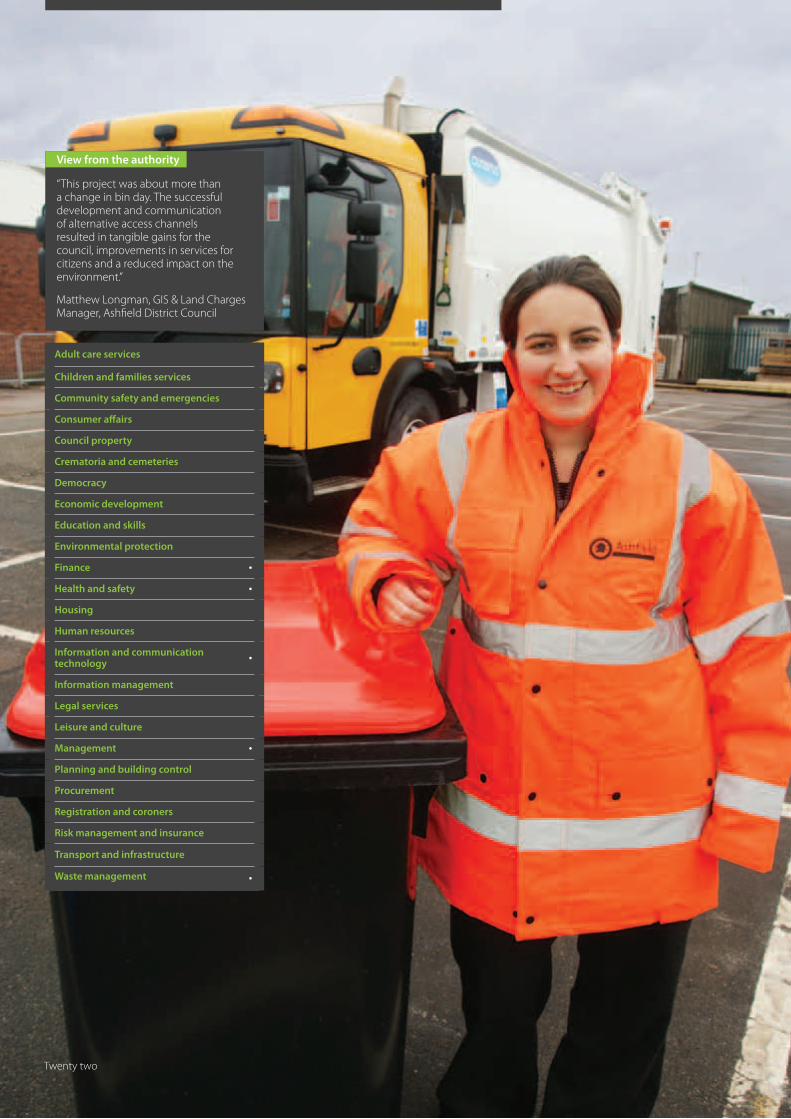
View from the authority
“This has been a cross-service project involving West Oxfordshire’s IT, Communications, Customer Services and Environmental Services departments working closely together to deliver new and vastly improved waste and recycling services. The LLPG’s UPRN has underpinned all our efforts, enabling us to tailor communications to individual customer requirements, link to the CRM in our call centre and with forms on our website. The result is better citizen engagement, more accurate service provision and smoother operational working.”
Sarah Turner, Business Solutions Manager, West Oxfordshire District Council
Ten
Improving service through better communication
The expiry of an existing contract for Waste and Recycling enabled West Oxfordshire District Council’s Environmental Services team to undertake a complete review of its service provision in this area.
West Oxfordshire District Council
WinnerNLPG NSG Exemplar Award ‘Citizen’s Award‘ and winner of the 2010 Exemplar AwardBest example of a project which delivers services to citizens underpinned by the NLPG/LLPG or the NSG/LSG
LLPG is now used for council mailings, improving citizen engagement
The property information held within the LLPG facilitated accurate customer segmentation
Customer survey for garden waste services has improved property information, particularly in flats
Channel shift to the web has accounted for over 40% of the sign up to the new services
Reduced costs – customers are keen to self-serve and use the web, the least cost channel
Repeat complaints and missed collections are now apparent and have initiated site visits to prevent re-occurrence
Commercial properties have been removed from the residential service and the number of assisted collections reduced, bringing cashable savings
Clear communications and citizen engagement will lead to improved recycling rates and reduced cost for the council.
The council regained ownership of its data, matched it to its Local Land and Property Gazetteer (LLPG), and integrated it with its new Customer Relationship Management (CRM) system. This, together with a data capture and improvement exercise, not only enabled the council to ensure an accurate and competitive tender process but also to achieve very high levels of citizen take-up for the new services.
West Oxfordshire’s IT, Communications, Customer Services and Environmental Services departments have been working closely for over a year in preparation for the introduction of fortnightly collections of household refuse and free garden waste, alongside weekly collections of recycling and food waste.
A significant part of this exercise focused on data improvement. Old CRM data and data from the existing waste and recycling contractor were matched to the LLPG and are now held within a new CRM system linked to the relevant UPRN to access the customer’s address, property type and state. This has resulted in a central database of customer waste preferences and requirements which remains dynamically linked to the LLPG. During this exercise, LLPG property information was important in identifying commercial properties which would not be included in the new provision, and flats and other properties, such as churches, with special collection requirements.
With the data updated, the council could now use its CRM to produce targeted, personalised and relevant mailings to all of its 46,000 residential addresses to enable full engagement with citizens. The initial mailing was segmented into over 20 different letter types.
Outcomes The mailings provided citizens with two ways to sign up for new services: by phone and by the web. Postal returns were considered too expensive. Even without this channel, the take-up has been impressive with more than 30,000 out of a possible 46,000 signing up for the new garden waste recycling service.
Over 12,000 citizens chose to use the online forms on the council website to sign up for the new services on offer, representing a considerable shift to the most cost effective channel. SOCITM suggests that each web transaction costs 1p compared to a phone transaction cost of £1.36, resulting in considerable savings for the council. In addition, the decision not to use the postal channel has saved the council at least £70,000 in terms of extra print, post and data capture costs. There has not been one single complaint about the lack of a paper form to return, vindication for the decision to stick to two channels.
Another benefit of the mailing process was the additional property state intelligence gained from returned mail. Royal Mail non-delivery comments were investigated and the LLPG state code updated to ensure the waste contractor does not collect from properties that are vacant, under construction or up for demolition. This also ensures that they are always using the most efficient routes.
The success of the take-up of the new services will result in further savings for the council as the increased amount of waste being recycled will significantly reduce the tonnage going into landfill, which is currently costing councils across Britain £48 per tonne.
Citizen returns and data matching also revealed some anomalies. Owners of properties that, in the past, had been deemed unsuitable for wheelie bins, for reasons such as inadequate access, had applied for and were using wheelie bins for garden refuse collection. This enabled the council to provide these properties with bins for normal biweekly waste collection instead of the more costly weekly black sack service.
Citizens phoning to report missed bin collections or other problems with their waste and recycling are now accurately identified by the new system, enabling the call centre to initiate an appropriate response. Reporting via web forms on the council website go directly to the contractor.
Key benefits
Eleven
View from the authority
“Every council is challenged by the sheer diversity of services it has to deliver. These then need to be accessible to every last person and business in the borough. By creating master datasets that underpin all back office systems, such as the LLPG and the citizen index, Hackney has been able to build up a customer centric architecture where systems are integrated. These integrated systems enable the council to deliver excellent services because they are based on data that are up-to-date and accurate.”
Steve McArthur, Master Data Technical Manager, London Borough of Hackney
Adult care services
Children and families services
Community safety and emergencies
Consumer affairs
Council property
Crematoria and cemeteries
Democracy
Economic development
Education and skills •
Environmental protection
Finance
Health and safety
Housing •
Human resources
Information and communication technology
•
Information management •
Legal services
Leisure and culture
Management •
Planning and building control
Procurement
Registration and coroners
Risk management and insurance
Transport and infrastructure
Waste management
Twelve
A single version of the truth
The London Borough of Hackney (LBH) has embarked upon an ambitious project to improve service delivery to its citizens.
London Borough of Hackney
Runner UpNLPG NSG Exemplar Award ‘Citizen Award’
LLPG underpins all service delivery systems
Realisation of cost savings of £35,000 per annum
One Call Centre now acts as the citizen’s single point of contact
‘Citizen index’ linked to the LLPG provides a customer centric approach to service delivery
Address accuracy directly contributes to shorter call times in the Call Centre
Infrastructure will support new ‘My Hackney’ web portal, enabling citizens to self-serve
LLPG access for partnership organisations enables further data sharing and efficiency
Improved customer experience and satisfaction
The project aims to build a ‘single version of the truth’ or, in other words, a central repository of knowledge and data that provides the answer to two questions: firstly, ‘who does the council provide its services to?’ and, secondly, ‘where do they provide them?’
If a local authority wishes to have a better understanding of its customers, it first needs to understand where they live. This is why the foundation of service delivery to Hackney’s citizens is based upon its LLPG, whilst the overall emphasis remains citizen centric.
In this project, the LLPG has become the central address database for all the council’s service delivery systems. The process has taken a number of years to achieve, using the knowledge and experience of the different service teams to bring about a single database that serves everyone. Each system either holds a copy of the LLPG, which is updated daily, or looks up addresses dynamically using the LLPG web service.
LBH followed its LLPG integration with a staged implementation of the Hackney Service Centre and Call Centre, complete with a new CRM that uses the LLPG.
The third part of the project, to put the citizen at the heart of LBH service delivery, is the pioneering citizen index: ‘the who.’ The primary aim of the citizen index is to improve service delivery to citizens through a single point of contact regardless of the service area. By intelligently merging data from different council sources, including Revenue and Benefits, CRM, Housing, Parking and the LLPG, the citizen index provides a new, single view of the borough’s citizens that can be accessed and searched council wide. Additions and edits to this information are made in seconds and are immediately available to all council departments and systems, including the Call Centre where it is firmly embedded in the CRM.
Every system used by the council is now populated with the Unique Property Reference Number from the LLPG so each citizen reference is associated with an address and precise geographic location.
Outcomes This innovative customer centric approach to the application architecture means that LBH is able to tailor the delivery of its services to suit its customers, rather than be restricted by the council’s own internal organisation and data locked up in multiple systems.
Moving from multiple call centres spread over different departments to one introduces further savings and operational efficiency. A 30% reduction in call times, due in large part to address accuracy, delivers additional savings of £35,000 per annum, based on SOCITM cost estimates of £4 per call.
The LLPG has been used as the integration model for multiple system data exchange throughout the council. This has culminated in the innovative ‘My Hackney’ web portal project. This will allow citizens to manage their business with the council in an authenticated manner. For citizens used to services such as online banking, this is not only convenient but often the preferred method of contact with the authority. It also has the added benefit of relieving pressure on the Call Centre, introducing further efficiencies and savings.
Elsewhere, partnership organisations such as the Learning Trust (education) and Hackney Homes (housing) are also benefiting from the use of the LLPG. It enables these organisations to share address related data seamlessly and benefit from not having to maintain their own address database.
This project has changed the way the citizens of Hackney interact with their local authority. Systems underpinned by the LLPG enable customer centric service delivery, and more reliable data make service delivery simpler and smoother, improving both customer experience and satisfaction.
Key benefits
Thirteen
View from the authority
“This project has, and will continue to have, a positive impact on local communities and the citizens within them. It is an excellent example of how the LLPG and GIS can assist in local government projects to benefit both the public and the council, providing both benefits and savings. Without the LLPG and GIS, this would have been an impossible task, extremely time consuming with inaccurate and incomplete results.”
Stella Loftus, GIS/LLPG Custodian, Canterbury City Council
Adult care services
Children and families services •
Community safety and emergencies •
Consumer affairs
Council property •
Crematoria and cemeteries
Democracy
Economic development
Education and skills
Environmental protection
Finance
Health and safety
Housing
Human resources
Information and communication technology
•
Information management •
Legal services
Leisure and culture •
Management •
Planning and building control
Procurement
Registration and coroners
Risk management and insurance
Transport and infrastructure
Waste management
Fourteen
Study carried out entirely in-house, saving on any outside consultancy
Identified local need as part of the council’s own Play Strategy
Delivers on national play strategy targets
Has led to a more focused approach to capital funding
Improvements have already been made to six existing play areas
Use of LLPG has included direct mail to keep citizens informed
Support for community groups and Parish Councils in bids for external funding
Focus on Play Areas is helping to keep young people safe and out of trouble
Canterbury City Council
Highly CommendedNLPG NSG Exemplar Award ‘Citizen Award’
The Play Strategy review was carried out under the council’s existing Play Strategy and looked at three distinct types of play:
• Fixed play – play facilities, such as equipped play areas, skate parks and ball courts
• Organised or adult-led play – supervised play activities, such as play schemes, children’s clubs and youth clubs
• Casual or child-led play – play activities that children and young people create and do on their own, without supervision.
The Play England national guidelines look at age groups, proximity and the type of play required as follows:
• LAP (Local Area for Play) Age 0-5 – 400 metres or within 5 minutes travel time
• LEAP (Local Equipped Area for Play) Age 0-12 – 400 metres or within 5 minutes travel
• NEAP (Neighbourhood Equipped Area for Play) Age 0-18 – 1000 Metres or within a 20 minute travel time.
Using these guidelines, household information provided by the LLPG and the already mapped location of existing Fixed Play Areas, it was relatively simple to determine the number and percentage of addresses both with and without access to fixed play areas. This was carried out for each council ward.
The council identified five Gaps in Provision (GIP), where a ward had little or no fixed play facilities. These were put to the top of a priority list. The remainder of the play areas were assessed against five specific criteria and prioritised accordingly. The criteria were:
• Play value
• Disability access
• Risk – using ROSPA risk assessments of each play area
• Child poverty – using Child Poverty Index
• Level of community interest in improving or establishing a play area
Outcomes On the priority list many had equal rank and therefore had equal priority.
Using the criteria, a recently refurbished play area will move down to the bottom of the priority list which will be reviewed every two years. To date, six play areas have already been refurbished.
The use of national guidelines means that improved play areas will be delivered with exciting, challenging equipment, appropriate to specific age ranges. This will include inclusive play equipment for children and young people (both able bodied and disabled), along with other enhancements such as signage and seating.
The GIP and the priority list have also been communicated to planners and developers to enable the council to address the shortage through the planning process. Specifically, this will focus on Section 106 agreements that compensate the local community for any impact caused by a development. The money raised would be targeted specifically at Play Area provision.
Canterbury City Council carried out a Play Strategy review for young people living in Canterbury, Herne Bay and Whitstable. It used national guidelines, GIS technology and its Local Land and Property Gazetteer to find gaps in its provision, identify priorities and secure external funding.
Identifying play priorities
Key benefits
Fifteen
View from the authority
“The council’s Waste and Recycling service is used as a benchmark by other local authorities and we are particularly proud of the savings that are already being made. Of course, all the systems put in place to deliver these changes are underpinned by our LLPG, which provides the links between the Waste Management System, the CRM and the ‘My Harrow’ web portal. As well as projected savings of over £3.2m over 10 years, we are seeing improvements in recycling rates and a reduction in the number of waste related calls received by our call centre: in other words, improvements all round.”
Jonathan Milbourn, Head of Access Harrow, London Borough of Harrow
Adult care services
Children and families services
Community safety and emergencies
Consumer affairs
Council property
Crematoria and cemeteries
Democracy
Economic development •
Education and skills
Environmental protection •
Finance •
Health and safety
Housing
Human resources
Information and communication technology
•
Information management •
Legal services
Leisure and culture
Management •
Planning and building control
Procurement
Registration and coroners
Risk management and insurance
Transport and infrastructure
Waste management •
Sixteen

LLPG underpins the project which will deliver £3.2m savings over 10 years
Reduced the amount of waste going to landfill by 18.8%
Recycling rate raised by 3% overall
Much improved Waste and Recycling service for citizens
Joined up response to citizen waste enquiries and improved call centre complaint handling
Considerable channel shift as citizens choose to self-serve via the web
Efficiencies and savings achieved through LLPG integration
Council now rated as high performing and benchmarked as a leader in waste and recycling
In addition to this Exemplar Award the Harrow Waste and Recycling system has received three national IT awards:
Professional Planning Forum
Guardian Newspaper
National eGov awards
London Borough of Harrow
WinnerNLPG NSG Exemplar Award ‘Financial Award’
Best example of saving money using the NLPG/LLPG or the NSG/LSG
A compelling business caseLarge capital spend requires a compelling business case and in Waste Management the drive to increase recycling and to reduce the amount of waste sent to landfill provides just that. At the London Borough of Harrow a comprehensive project that deals with the overhaul of every aspect of its waste and recycling provision is already promising £3.2m of savings over the next decade.
Over £2.6m of that figure is due to an 18.8% reduction in land fill that the project is already delivering. This headline figure is impressive and is made even more so by a recycling rate for household waste of 44%.
The systems introduced to bring about these changes are entirely underpinned by the council’s LLPG. The Waste Management system, with its mobile wireless extension in vehicle cabs, is linked to the call centre CRM. Both receive updates from the LLPG every 24 hours. Web forms on the ‘MyHarrow’ web portal are also linked to the CRM and the Waste Management system and are facilitated by the LLPG. This seamless integration has many benefits, not only to the citizen but also in terms of cashable savings and efficiencies.
Outcomes The Waste Management system handles three bin types for each property: recycled waste, general waste and organic waste, each linked to a Unique Property Reference Number (UPRN). Route optimisation has made the rounds more efficient, leading to a 15% fuel reduction valued at £11,000 in the first year alone. In a fast growing borough like Harrow, with a number of new developments, the accuracy of the LLPG will be vital in maintaining and increasing these levels of service efficiency.
The mobile wireless part of the system has introduced other efficiencies too, especially in recording and responding to non-collection, which is now a simple one click affair on the in-cab touch screen device. This has completely eliminated the need for paper forms used to record non-collection in the past. The system refreshes every three minutes so that staff in the customer contact centre can see the reason for non-collection, such as ‘bin contamination’, and then inform anyone who calls in to complain. Very often it is possible for a missed collection to be rectified during the call if crews are still in the vicinity. Previously, staff would have had to sift through the paper forms and then phone the customer back.
Citizens can also report non-collection and other waste and recycling problems via the borough’s web site. Use of the web is growing, with transactions via this channel making up nearly 60% of the total as the people of Harrow choose to self-serve, thus delivering further efficiencies.
In the Access Harrow call centre, there has already been a noticeable change, with overall call volumes down by 3%, those associated with the environment down by 7%, and those specifically to do with missed bins down by 25%. These amount to over 200 fewer calls per week, with 95% of remaining calls being resolved at first contact. Furthermore, the number of outbound follow-up calls has been slashed by 95%. Call duration has also been cut by 45 seconds on each average 248 second call. Costs, too, have been reduced significantly from £2.23 per enquiry in 2006/7 to £0.82 in 2009/10.
In areas where there are a significant number of non-collections, the council has initiated an outreach programme. Council officers visit the area, knock on doors and explain the principles behind the waste and recycling collection, helping people to understand how and why the system works in the way it does. Informed customers will then help to contribute towards the success of the scheme and further cost savings.
A Chartered Institute of Public Finance and Accounting study has reported that Harrow’s waste and recycling service was high performing in this area. The borough has also been the recipient of three national IT awards, leading it to be benchmarked by other local authorities as a leader in this area.
Key benefits
Seventeen
View from the authority
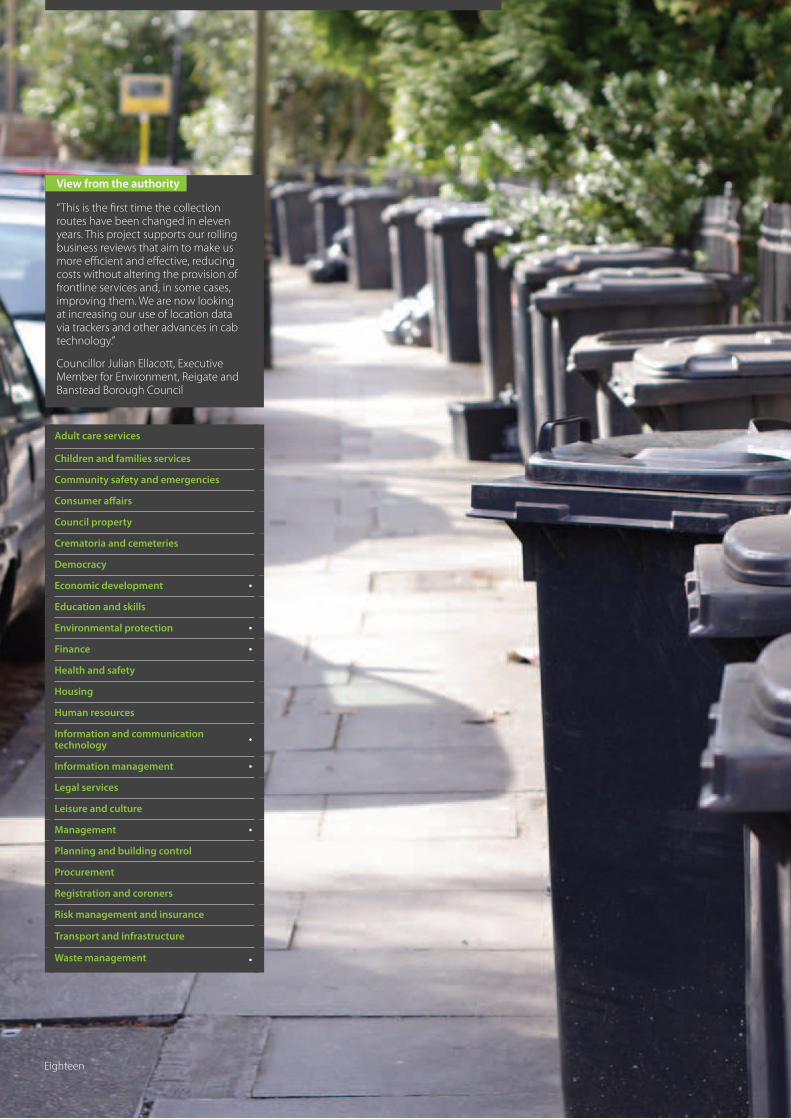
“This is the first time the collection routes have been changed in eleven years. This project supports our rolling business reviews that aim to make us more efficient and effective, reducing costs without altering the provision of frontline services and, in some cases, improving them. We are now looking at increasing our use of location data via trackers and other advances in cab technology.”
Councillor Julian Ellacott, Executive Member for Environment, Reigate and Banstead Borough Council
Adult care services
Children and families services
Community safety and emergencies
Consumer affairs
Council property
Crematoria and cemeteries
Democracy
Economic development •
Education and skills
Environmental protection •
Finance •
Health and safety
Housing
Human resources
Information and communication technology
•
Information management •
Legal services
Leisure and culture
Management •
Planning and building control
Procurement
Registration and coroners
Risk management and insurance
Transport and infrastructure
Waste management •
Eighteen
A saving of £137,000 per annum against a projected year on year growth in costs and a one off capital expense saving of £135,000
A more reliable and robust service for citizens with fewer missed bins, an integrated garden waste service and back up, in case of breakdown, from neighbouring crews
A reduction in the environmental impact of the service through reduced vehicle movements has been coupled with a projected increase in recycling rates
A facility for online registration and payment for additional services such as the relaunched garden waste service and future initiatives
Reigate and Banstead Borough Council
Runner UpNLPG NSG Exemplar Award ‘Financial Award’
The objective was to create a more logical and systematic collection programme with equity in the number of properties on each route.
It was hoped that reorganisation of the service would, in turn, achieve a reduction in costs, an improvement in service, and provide a strong foundation to support the introduction of future schemes and initiatives, such as the doorstep collection of plastics and food waste.
Outcomes By extracting all properties classified as residential from the council’s Local Land and Property Gazetteer, and overlaying them with the existing collection days, the council was able to understand the growing challenge it faced. Using route optimisation software, new collection rounds were generated, providing a balance between the workload of each vehicle and crew whilst introducing ‘same day same area’ working patterns.
As a result of this exercise, approximately 80% of households were allocated a new collection day, and letters advising residents of changes to the service were generated using LLPG extracted addresses. All household bins: refuse, recycling and garden waste (if applicable) are now collected on the same day. Due to the revised working patterns, backup from neighbouring crews can provide support in the case of a truck breakdown or other disruptions to the service.
The revised collection rounds enabled the council to reduce both manpower through natural wastage, without the need for any redundancies, and also the resources required to provide the service. This has produced revenue savings of £137,000 per annum in staff costs, eliminated the requirement to purchase an additional vehicle at a cost of £135,000, and removed the additional costs associated with the extra round. Reductions in mileage and, therefore, fuel consumption from the optimised routes have resulted in lower carbon emissions to support the council’s commitment to reducing its carbon footprint by 10% in 2010.
The council has also used the restructuring of waste collection services to build on the success of its garden waste scheme. An online registration form, linked to the LLPG, allows residents to sign up for the scheme on the council’s website, automatically validating their address and even making payment online if they choose. The new rounds have also laid the foundation for an increase in recycling, projected to grow to 65% over five years, with a long term reduction in costs estimated at 57% over three years.
On-going efficiencies and improvements in service are being supported by an in-house developed ‘Round Admin Tool’ that is linked to the gazetteer, and can automatically pick up new properties requiring collections, properties that no longer need the service and new customers of the garden waste service.
Against a backdrop of rising costs, due to an increasing number of households and a need to make significant savings Reigate and Banstead Borough Council undertook a comprehensive review of its waste and recycling service.
All change on bin day
Key benefits
Nineteen
View from the authority
“Through this project, which relies heavily on the LLPG, we will hit the 50% target for recycling of household waste in 2011. We have reduced the amount of waste going to landfill by 18.8%, and achieved a 15% reduction in the fuel consumed by our waste and recycling fleet, with a consequent reduction in CO
2 emissions. Together with the
improvements we have made to our internal systems, and through educating and encouraging citizens to recycle and dispose of their waste properly, Harrow has taken significant strides to improving its ‘Green’ credentials.”
Matt Pennells, GIS Officer, London Borough of Harrow
Adult care services
Children and families services
Community safety and emergencies
Consumer affairs
Council property
Crematoria and cemeteries
Democracy
Economic development •
Education and skills
Environmental protection •
Finance •
Health and safety
Housing
Human resources
Information and communication technology
•
Information management •
Legal services
Leisure and culture
Management •
Planning and building control
Procurement
Registration and coroners
Risk management and insurance
Transport and infrastructure
Waste management •
Twenty
Recycling rate for household waste is on target to reach 50% by 2011
Reduced the amount of waste going to landfill by 18.8%
Route optimisation minimises travelling distance and number of vehicles required
15% reduction in fuel with consequent reduction in CO
2 emissions
Reduced costs and improved efficiency of the customer contact centre
Improved customer satisfaction with the waste and recycling service
Overall savings of £3.2m over ten years
London Borough of Harrow
WinnerNLPG NSG Exemplar Award ‘Green Award’ Best example of where a service using the NLPG/LLPG or the NSG/LSG has either reduced environmental impact or increased greener outcomes
Greening the borough
The London Borough of Harrow has overhauled its waste and recycling provision not only saving money but also dramatically improving its green credentials. The new services are all underpinned by the Council’s high quality LLPG.
At the heart of Harrow’s Waste and recycling provision is a new Waste Management system complete with dynamically linked mobile wireless touch screen terminals in all 35 vehicle cabs. This system is also linked in real time to Harrow’s call centre CRM. Both these key systems receive an LLPG refresh every 24 hours. The Waste Management system is also linked to a route optimisation module that uses the LLPG to calculate the most efficient routes for each of the collection services. LLPG integration extends to the borough’s online location based web portal, ‘My Harrow’, which, in turn, is linked back to the Waste Management system for bin collection scheduling.
Outcomes Citizens in Harrow now benefit from three different bin types: recycled waste, general waste and organic waste. Engagement has been very successful and recycling has already exceeded the expectations laid out in the business case, resulting in an 18.8% reduction in landfill, delivering a first year saving of £195k.
Parent UPRNs have been created within the LLPG for multiple occupancy buildings, such as flats, which have communal bin facilities. This has enabled the LLPG to be used for route optimisation to create more efficient collection rounds. As new properties get built or existing properties get converted to flats, the LLPG is updated and routes are automatically re-calculated. This has resulted in a 15% fuel reduction valued at £11,000 in the first year alone, with consequent reductions in CO2
emissions. In a fast growing borough like Harrow, with a number of new developments, the accuracy of the LLPG will be vital in maintaining these levels of service efficiency and in reducing the council’s carbon footprint.
Harrow’s waste and recycling project has also delivered efficiencies elsewhere, thanks to systems integration enabled by the LLPG. In the customer contact centre, operatives now have full visibility of the waste management system via CRM integration. This enables them to see the real time status of the collections and to explain the reason to anyone who calls in to report a missed collection. Previously, staff would have had to wait for and sift through forms filled out by the returning crews before phoning the customer back. Citizens can also report non-collection and other waste and recycling problems via the borough’s web site.
Systems integration enabled by the LLPG on this project has had a significant impact both on the call centre and on the level of traffic going through the ‘My Harrow’ web portal. There has been a massive drop in complaints due to the availability of real time information; call duration has dropped and follow-up calls reduced to a trickle. The switch to the web channel has led to 200 fewer waste related calls per week.
The council intends to use the information it gets back from the system to target areas where there are high levels of non-collection, due to contamination and a lack of understanding of the recycling process. By educating and encouraging more citizens to recycle and dispose of their waste properly, the council hopes to further improve its recycling rates and make Harrow a greener place.
Key benefits
Twenty one
View from the authority
“This project was about more than a change in bin day. The successful development and communication of alternative access channels resulted in tangible gains for the council, improvements in services for citizens and a reduced impact on the environment.”
Matthew Longman, GIS & Land Charges Manager, Ashfield District Council
Adult care services
Children and families services
Community safety and emergencies
Consumer affairs
Council property
Crematoria and cemeteries
Democracy
Economic development
Education and skills
Environmental protection
Finance •
Health and safety •
Housing
Human resources
Information and communication technology
•
Information management
Legal services
Leisure and culture
Management •
Planning and building control
Procurement
Registration and coroners
Risk management and insurance
Transport and infrastructure
Waste management •
Twenty two
A more efficient refuse collection service resulting in reduced costs and reduced emissions inline with Ashfield District Council’s corporate objectives
An effective communication strategy to inform citizens of new routes and changes to the collection schedule
Development of an online property look up service providing self-service access to up to date service information
Promotion of alternative channels of communication resulting in reduced costs, gains in efficiency and improved service for citizens with minimal environmental impact
Provision of easy to access information online promoting recycling and reducing waste sent to landfill
“This project was about more than a change in bin day. The successful development and communication of alternative access channels resulted in tangible gains for the council, improvements in services for citizens and a reduced impact on the environment.”
Matthew Longman, GIS & Land Charges Manager, Ashfield District Council
Ashfield District Council
Runner UpNLPG NSG Exemplar Award ‘Green Award’
Having identified the revised routes, they were mapped and new collection calendars produced. The first line of communication was an initial mail shot to affected residents but the council recognised that this information would also need to be made available across different access channels. The development and communication of these channels was also viewed as an opportunity to publicise the range of additional information available to citizens on the council’s website.
Outcomes Ashfield District Council had already developed an online property finder: ‘Streetlevel.’ Underpinned by the National Land and Property Gazetteer (NLPG), this tool allowed visitors to the council’s website to search by street and then identify a property. Once a property is selected, information contained within the NLPG is displayed and a spatial query, using the geographical location of the chosen address, allows for the display of data from a variety of map layers. Having mapped the revised refuse collection routes and matched them to the NLPG, the integration of this data to the online service was relatively straightforward.
The original communication to affected households encouraged citizens with questions, queries or complaints about the revised service to visit the council’s website if possible, rather than calling customer services. The statistics provided during the month following the ‘Big Bin Change’ showed a ten-fold increase in Streetlevel queries. Customer service records also indicated that citizens were finding the information they needed using the self-access service, and these results were replicated during the two week period over Christmas when seasonal changes to the
service were implemented. Engaging with customers online and providing a mechanism for feedback has also generated a quick and easy way to communicate address change intelligence, further improving the accuracy and currency of the gazetteer.
The customer facing the online property finder is also replicated on Ashfield Council’s Intranet, providing Customer Service operators with accurate property records and up to the minute service information.
The introduction of new collection routes fulfilled the council’s aim, resulting in reduced costs and a reduced environmental impact through lower emissions. The development and promotion of the council’s online property look-up service also achieved tangible gains in efficiency and reduced costs, with customers self-accessing live service information rather than contacting the council by telephone or face-to-face at council offices. Recycling was promoted through the inclusion of information on waste collection calendars, allowing residents to check which materials could be placed in their recycling bin if they had misplaced the printed calendar. This has helped reduce residual household waste sent to landfill and increase the percentage of household waste sent for recycling.
The design of the web based system makes it easily reproducible, thereby offering a cost effective solution for disseminating information from other areas of the authority. Streetlevel applications have now been extended into a broad range of service delivery areas with solutions for Planning Applications, ‘find my Councillor’, local partners and agents and neighbourhood charters.
In order to achieve a reduction in costs and emissions, Ashfield District Council implemented a revised refuse collection programme with new routes. The changes to the service impacted on approximately 30,000 properties, all of which required communication about the change to the day or week their waste would be collected.
Promoting self service
Key benefits
View from the authority
Twenty three
View from the authority
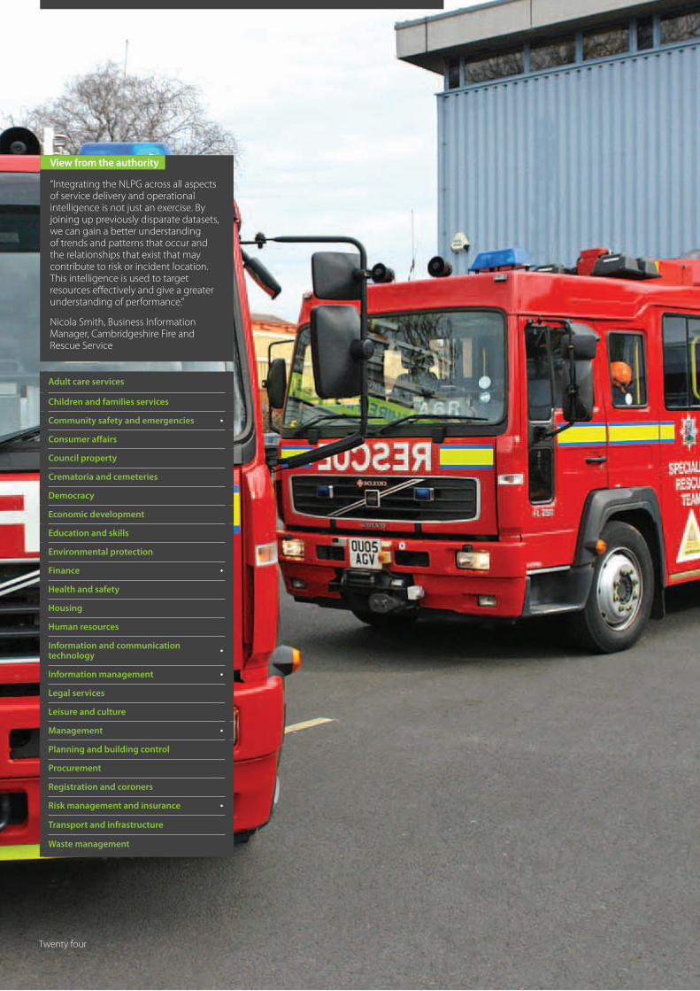
“Integrating the NLPG across all aspects of service delivery and operational intelligence is not just an exercise. By joining up previously disparate datasets, we can gain a better understanding of trends and patterns that occur and the relationships that exist that may contribute to risk or incident location. This intelligence is used to target resources effectively and give a greater understanding of performance.”
Nicola Smith, Business Information Manager, Cambridgeshire Fire and Rescue Service
Adult care services
Children and families services
Community safety and emergencies •
Consumer affairs
Council property
Crematoria and cemeteries
Democracy
Economic development
Education and skills
Environmental protection
Finance •
Health and safety
Housing
Human resources
Information and communication technology
•
Information management •
Legal services
Leisure and culture
Management •
Planning and building control
Procurement
Registration and coroners
Risk management and insurance •
Transport and infrastructure
Waste management
Twenty four

A fully integrated gazetteer supporting decision making at all levels and joining up potentially disparate data throughout the organisation
External information resources can be and are being appended to provide additional intelligence for risk analysis, resource management and safety campaigns
Evidence of both cashable and non cashable savings with a reduction in staff hours required to maintain the gazetteer - an 80% drop in address queries and a streamlining of processes
Development of best practice and strong working relationships with Local Authorities and other Emergency Service organisations with shared resources and knowledge transfer
Cambridgeshire Fire and Rescue Service
WinnerNLPG NSG Exemplar Award ‘Integration Award’
Best example of where the NLPG/LLPG or the NSG/LSG is linked to other council services or to local partnership
In order to achieve corporate wide integration of the NLPG, CFRS adopted a data management approach that aimed to apply a UPRN to every single piece of Service related information. Underpinning this policy is the ‘Golden Thread’ principle; a belief that the UPRN can be used to join up all operational data across the Service facilitating informed decision making and improving both access to and quality of intelligence.
Not only has CFRS integrated the UPRN, where possible, across all departments, it has taken the use of the NLPG to the next level developing strong relationships and robust working practices with Local Authority Custodians, demonstrating best practice to other Emergency Service organisations and developing and delivering a hosted gazetteer management service to a neighbouring Fire and Rescue Service.
Outcomes The Golden Thread, or application of a UPRN to all Service related information, has been achieved in the following departments and internal service delivery areas: Performance, Home Fire Safety, Commercial Building Site Assessment, Water, C.A.D. and Demographic Profiles.
This has resulted in both cashable and non-cashable savings, including: a reduction in annual data licensing costs; a saving of one hundred plus staff days per annum; a reduction in day-to-day queries, freeing up both operational and support resources; and an improvement in frontline service delivery and decision making.
Due to software incompatibility, the NLPG has yet to be fully integrated within the CFRS Control Room. However, the service has developed a workaround to match incidents, as they are reported, using the Incident Recording System developed by the Department of Communities and Local Government (DCLG), and address matching tools from their GIS supplier.
Above and beyond the work done to integrate the NLPG internally, CFRS has worked closely with local authority data custodians to enhance their understanding of how the data are used by the emergency services, and provide feedback on the quality and coverage of the data. CFRS has also shared its experience and expertise, providing advice and anecdotal evidence to other Fire and Rescue Services and Cambridgeshire Police. CFRS has again taken this a step further and has recently embarked on a ground-breaking project to host and provide a managed gazetteer service to a neighbouring Fire and Rescue Service. This has resulted in a further reduction in costs and, even in the early stages, a marked improvement in efficiency, evidenced in shared resources and knowledge transfer.
Cambridgeshire Fire and Rescue Service (CFRS) was an early adopter of the NLPG and has since pioneered its use within the Emergency Services sector, developing best practice and demonstrating an ongoing commitment to its development and wider adoption.
The golden thread
Key benefits
Twenty five

View from the authority
“This project shows the true value of the NLPG, taking it beyond its role as a simple address repository and turning it into a valuable resource that can be used to link property intelligence across an organisation.”
Colin Halliday, LLPG and GIS Officer, Chorley Council
Adult care services
Children and families services
Community safety and emergencies
Consumer affairs
Council property
Crematoria and cemeteries
Democracy
Economic development •
Education and skills
Environmental protection
Finance •
Health and safety
Housing
Human resources
Information and communication technology
•
Information management •
Legal services
Leisure and culture
Management •
Planning and building control
Procurement
Registration and coroners
Risk management and insurance
Transport and infrastructure
Waste management
Twenty six
An increase in revenue
100% match rate between VOA data and LLPG enabling improvements in both the quality and consistency of address data across the council
Intelligence to aid informed decision making in support of Chorley Council’s corporate strategy to ‘Create a thriving town centre’
Generation of regular statistical reports to monitor town centre vacancies and support a proactive campaign to target new tenants
Development of a web application to facilitate access to commercial premise data that can be deployed across other service areas within the council
Chorley Council
Runner UpNLPG NSG Exemplar Award ‘Integration Award’
Following an exercise to match data from the Valuation Office Agency (VOA) with council held Non Domestic Rates (NDR) records, Chorley Council realised that commercial premises data held in the LLPG could be utilised by other teams within the council, specifically the Town Centre Management team.
The initial stage of the project was to improve the match rate between VOA data and the LLPG, from an initial 66% of an estimated 3,000 properties to 100%. There was also a requirement to improve the quality of address data in support of the ‘One Chorley, One Address, One Boundary’ policy. Phase two of the project aimed to exploit the link, established in phase one, between the two databases, providing the Town Centre Management team with additional intelligence on property occupancy, type of vacancies and space available.
Outcomes Phase one of the project was successfully completed, with Chorley Council achieving a 100% match rate between the VOA data and their LLPG. This, in turn, has resulted in consistent address records used not only by the NDR team but also within the council’s Customer Relationship Management (CRM) solution and, via a search facility on Chorley’s Intranet service, by other departments and service delivery areas. The project has also improved the quality and currency of commercial premise data held within the LLPG, helping to cement its position as a corporate resource for address related information within the council.
Linking the NDR database with the LLPG, through the use of the Unique Property Reference Number (UPRN), enabled the second stage of the project to provide the Town Centre Management team with commercial property data. The Town Centre Management team can now access specific fields contained within the NDR database using a specially developed web application. Details such as the business name of the property, type of property and property state are being used to monitor vacancies within the town centre and proactively target potential tenants, based on the type of properties that are vacant and the available floor space. The Team has also improved the accuracy of information available to interested tenants. Changes in the profile of the town centre can also be tracked over time.
Savings and gains in efficiency have also been achieved as a direct result of this project. A number of properties not on the NDR database, and therefore not paying rates, have been identified, and the day-to-day administration of the NDR database has been greatly reduced. Prior to the data integration, it could take the Town Centre Management team weeks to collate the statistical information they required; in fact the council was quoted £5,000 for the creation of a bespoke solution offering the same service as that provided by the LLPG which is effectively free of charge.
As the current economic climate continues to bite, one of the most visible impacts is the changing face of many high streets and town centres. Traditional and well known high street brands are disappearing to be replaced with coffee bars, nail salons, value shops or, as is becoming increasingly common, with nothing at all.
Monitoring the changing face of the high street
Key benefits
Twenty seven
View from the authority
“We believe in making our LLPG work for the authority to ensure it provides a good return on the substantial investment of the last few years. Our LLPG is now used by over 40 systems within the authority and it certainly facilitated the management and communication of the boundary changes when they came into effect. This project not only engaged with internal users of the gazetteer but also external users, such as the County Council and the Fire and Rescue Service. It certainly enhanced the value and profile of the LLPG within the authority.”
David Lloyd, Local Land & Property Gazetteer Manager, Huntingdonshire District Council
Adult care services
Children and families services
Community safety and emergencies
Consumer affairs
Council property
Crematoria and cemeteries
Democracy •
Economic development
Education and skills
Environmental protection
Finance •
Health and safety
Housing
Human resources
Information and communication technology
•
Information management •
Legal services •
Leisure and culture
Management •
Planning and building control
Procurement
Registration and coroners
Risk management and insurance
Transport and infrastructure
Waste management
Twenty eight
Boundary changes – putting the gazetteer to work
Administrative and electoral boundaries change infrequently but are under constant review in order to ensure that they are an up-to-date reflection of real life communities with appropriate electoral representation.
100% LLPG linking with service delivery systems meant a single project with delivery Council-wide providing a significant financial saving
Process facilitated by inclusion of Parish and Ward codes and cross references with Council Tax and Electoral Registration in the LLPG
Project was carried out accurately, on time and with no operational disruption
Project did not affect the consistently high level of data accuracy and integrity
Changes communicated effectively to all parishes within the county, the County Council and the Fire & Rescue Service
Process enhanced the value and profile of the LLPG within the authority
Huntingdonshire District Council
Highly CommendedNLPG NSG Exemplar Award‘Integration Award’
Within Huntingdonshire District Council, the LLPG team has been involved in a comprehensive review which dated back to 2006. However, the statutory instrument, ‘The Huntingdonshire (Parishes) Order 2009’, was issued in July of that year, leaving the Council only seven months to prepare for the changes which would come into effect in April 2010. 27 out of 84 parishes were affected, 3 were abolished, 4 new parishes were created and the remainder saw changes to their boundaries. The changes also affected 8 out of the 29 electoral wards. These changes affected more than 6,000 properties.
Huntingdonshire District Council (HDC) has a high quality LLPG that is dynamically linked to over 40 of its service delivery systems, making it central to this project to assimilate and communicate the boundary changes. The first and most crucial requirement was to identify, for Council Tax, the number of properties that would change parish. This would then enable the Parish Councils to calculate the budget for their precept, the local component of Council Tax. This information had to be delivered several months prior to the changeover date.
The Huntingdonshire LLPG holds Parish and Ward codes as well as Council Tax and Electoral Registration cross references. These are not compulsory but, in this case, proved to be vital to the process upon which the council embarked. HDC’s LLPG team used the new electronic boundary maps supplied by Ordnance Survey to view the intersections between the old and the new boundaries in their Geographical Information System. Because every property within the LLPG is referenced to a parish and to Council Tax, they were then able to perform a process to identify the affected properties. Once the properties had been identified, the information was supplied electronically to Parish Councils as spread sheets, along with maps in PDF format. The exercise was repeated immediately before Council Tax billing commenced in March 2010, to ensure accuracy.
A similar analysis was undertaken for Electoral Registration, to identify properties where both the ward and the parish had changed.
A similar analysis was undertaken for Electoral Registration to identify properties where both the ward and the parish had changed.
Outcomes Having analysed the data in advance of the changeover, it was possible to prepare for the switch to the live system. On 31 March 2010, the Parish and Ward layers were updated in the LLPG, parish names were changed, old parishes deleted and new parishes added. All properties affected were attached to their new parishes and wards, all of which was completed in time for the updated LLPG to be available across the council by the April deadline and the start of the new financial year.
The data has been shared with Cambridgeshire County Council, which is the highways authority, to ensure accurate changes to the National Street Gazetteer and to highlight shifts in population between parish and ward. The changes have also been shared with the Cambridgeshire Fire & Rescue Service.
The public were kept informed through the council’s own magazine, local newspapers and through the annual Council Tax communication.
This project is a good example of why a local authority should fully embrace the LLPG across all of its service delivery systems. As Huntingdonshire has a fully integrated LLPG, the boundary changes could be tackled once by the team responsible for addressing and then used across the authority and beyond. It has been estimated that the council saved a minimum of £35K additional expenditure because no other departments had to get involved. The transition was smooth and caused no operational issues, further enhancing the value and profile of the LLPG within the authority.
Key benefits
Twenty nine
View from the authority
“The aim of this project was to get official addresses into circulation as early as possible, ensuring consistency and improving accuracy while reducing unnecessary administration. By achieving this, we have gained a better working relationship with the VO, reduced staff workloads and improved customer service.”
Wendy Cooley, LLPG Custodian, Fenland District Council
Adult care services
Children and families services
Community safety and emergencies
Consumer affairs
Council property
Crematoria and cemeteries
Democracy
Economic development
Education and skills
Environmental protection
Finance •
Health and safety
Housing
Human resources •
Information and communication technology
•
Information management •
Legal services
Leisure and culture
Management •
Planning and building control
Procurement
Registration and coroners
Risk management and insurance
Transport and infrastructure
Waste management
Thirty

A streamlined efficient work process resulting in the use of NLPG compliant addresses by both the Council NDR Team and VO
Efficiency savings for both the Council and VO achieved through a reduction in administration with associated cashable savings
Improved customer service with bills issued promptly, to the official address with fewer resulting queries
A strong working partnership built on mutual understanding with a potential roll-out of the process to other Valuation Offices and authorities
“The aim of this project was to get official addresses into circulation as early as possible; ensuring consistency and improving accuracy while reducing unnecessary administration. By achieving this we have gained a better working relationship with the VO, reduced staff workloads and improved customer service.”
Wendy Cooley, LLPG Custodian, Fenland District Council
Fenland District Council
Best PracticeNLPG NSG Exemplar Award‘Integration Award’
The use of ‘unofficial’ addresses by the council’s Revenue Team had historically caused confusion for customers and duplication of effort for council staff resulting in unnecessary communications and even site visits. Having identified a possible source of unofficial records as the ‘temporary’ addresses allocated by the Valuation Office when undertaking site visits to rate commercial properties the LLPG Team devised a new working process to prevent this happening.
Outcomes The Valuation Office (VO) is an executive agency of HM Revenue and Customs with responsibility for compiling and maintaining lists of the rateable values of 1.6 million commercial properties in England and 100,000 in Wales. It also compiles and maintains the lists of Council Tax bands for around 21.7 million domestic properties in England and 1.3 million in Wales.
Having identified a property requiring valuation - following a merge or split, for example - Fenland Council’s Non Domestic Rates (NDR) Team would historically send notification to the local VO. The VO would visit the site and record their information against a temporary ‘unofficial’ address. This report was sent to the council where the NDR Team would attempt to match it against the LLPG. On occasion, due to the ambiguity of the ‘address’ used by the VO, additional site visits to the property may have been required to clarify the location, or a VO allocated address may have found its way into Fenland’s NDR system.
Based on work already undertaken by Fenland Council to comply with the Valuebill project, a new set of working practices was devised and introduced. Valuebill was a project to establish the electronic exchange of information between local authority billing agencies, the VO and the NLPG aimed at improving valuation services for citizens and businesses. It provided benefits to all aspects of customer-facing work for which accurate property information is crucial.
When notifying the VO of a property requiring valuation, the NDR Team provided the official address and UPRN. If the VO had knowledge of a property merge or split, they requested this candidate information from the council before scheduling a site visit or, if already on site, they contacted the council to obtain the information prior to completing and submitting their report.
This simple yet effective process based on open communication has led to several key benefits for all parties involved, including the property owner or occupier. By using official NLPG compliant addresses, together with UPRN from the outset, staff at both the council and the VO are experiencing reduced workloads as a result of getting it right first time; the council is generating less correspondence in order to clarify addresses and the customer receives the correct bill at the correct address.
Fenland District Council is a small authority based in rural Cambridgeshire. Without specific funding it has consistently devised and implemented innovative ways of maintaining and integrating the National Land and Property Gazetteer internally while working with partner organisations.
Getting it right first time
Key benefits
View from the authority
Thirty one
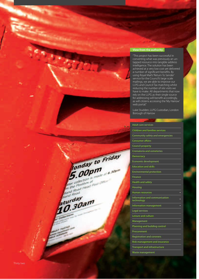
View from the authority
“This project has been successful in converting what was previously an un-tapped resource into tangible address intelligence. The solution has been achieved at a very low cost yet delivered a number of significant benefits. By using Royal Mail’s ‘Return To Sender’ service for the Council’s large scale mailings, we are able to improve our LLPG and Council Tax matching whilst reducing the number of site visits we have to make. All departments that now rely on the LLPG as their single source for addressing will benefit accordingly, as will citizens accessing the ‘My Harrow’ web portal.”
Luke Studden, LLPG Custodian, London Borough of Harrow
Adult care services
Children and families services
Community safety and emergencies
Consumer affairs
Council property
Crematoria and cemeteries
Democracy
Economic development
Education and skills
Environmental protection
Finance
Health and safety
Housing
Human resources •
Information and communication technology
•
Information management •
Legal services
Leisure and culture
Management •
Planning and building control
Procurement
Registration and coroners
Risk management and insurance
Transport and infrastructure
Waste management
Thirty two

Simple cost effective way of dealing with direct mail returns
Improved address change intelligence
Provides a snap shot of LLPG quality and accuracy
Reduction in officer site visits
Process picks up the conversion of single properties into flats both legal and illegal with resulting improvements in Council Tax returns
Confidence for other council applications in the completeness and currency of the LLPG
14 different service areas that use the LLPG in their systems will benefit from the improved quality of the gazetteer
Citizens benefit because the UPRN underpins Your Nearest searches on the MyHarrow online portal www.harrow.gov.uk/myharrow
London Borough of Harrow
WinnerNLPG NSG Exemplar Award‘Technology Award’
Best example of an innovative application of technology using the NLPG/LLPG or the NSG/LSG
Not surprisingly, the communications department had the most comprehensive list but also had boxes of mail that had been returned to the council via Royal Mail’s ‘Return to Sender’ (RTS) service. The LLPG custodian took the boxes away and started to do an analysis but soon decided that querying the LLPG manually for each returned item was a poor use of time.
The custodian did, however, realise that these items of returned mail were a good source of address intelligence because they came as a result of a postman visiting each address; in other words, a site visit by proxy. The returned items also came back with a label attached by the postman, marked up with the reason for the return. If the process for recording the reason for the returns and comparing them with the LLPG could be streamlined, there would be considerable benefits to the council.
Firstly, the mail returns would provide a valuable source of intelligence to update and improve the LLPG. It would also, in many cases, cut down the need for costly site visits or the need to initiate a further investigation. A return, for example marked as ‘No such address’, might be a perfectly valid address in the LLPG; however, the property itself might, in the interim, have been converted illegally into flats without recourse to planning permission. The return would trigger further investigation and, in due course, result in a gazetteer update.
The solution to the time consuming problem of data entry and record comparison turned out to be simple and inexpensive and makes efficient use of officer time. In the pilot for this project, the mailing list was matched to the LLPG. Using a barcode font already owned by the council, a barcode label was created in tandem with the normal address label and attached to each item sent out by the council.
The custodian created a simple Visual Basic application to handle the returns. This takes an export from the LLPG including the UPRN. The application is connected to an inexpensive barcode scanner which is used to scan the barcode on each item of returned mail. The scanned barcode UPRN is then used as the look-up for the property address. The reason for the return is populated using hotkeys relating to the various return types, streamlining data entry. The process takes a few seconds for each item of returned mail. Once the returns have been entered, a query list for further investigation can be exported.
Outcomes In the initial pilot there were 14,383 addresses in the mailing of the council’s ‘Vitality’ magazine. From this mailing, there were only 38 returns, just 0.26% of the total, a significant indication of the quality of the gazetteer. Further investigation revealed that 24 of these were occupier related so did not reflect on the LLPG. Seven were marked ‘No such address’ where demolition was underway and these were used to update the LLPG. The remaining seven were marked as ‘Inaccessible’ or ‘Incomplete address’. The returns were checked and not found to be at fault. Investigation of these therefore generated a confidence statistic of the LLPG at 99.1%.
This barcode solution was accomplished at very low cost. An integration project would have been far more costly and this solution will work very well for many of the systems and service areas within the council that generate the largest mailings. The project has shown that the LLPG can become the council’s de facto mailing list, and provide a very good reason for continuing to pay for the ‘return to sender service’.
The use of mailings to verify addresses has meant a significant reduction in the amount of site visits formerly required to check address queries, and has even raised the possibility of using the Royal Mail to answer specific queries in the future.
In 2009 the London Borough of Harrow’s LLPG Custodian decided to carry out an audit of all its departmental mailing lists with a view to improving address intelligence.
Address intelligence by proxy
Key benefits
Thirty three
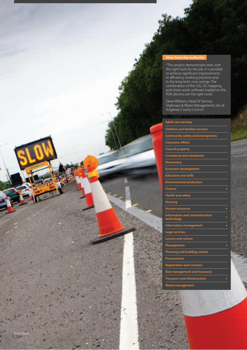
View from the authority
“This project demonstrates that, with the right tools for the job, it is possible to achieve significant improvements in efficiency, working practices and, in the long term, cost savings. The combination of the LSG, OS mapping and street works software loaded on the PDA devices are the right tools.”
Dewi Williams, Head Of Service, Highways & Waste Management, Isle of Anglesey County Council
Adult care services
Children and families services
Community safety and emergencies
Consumer affairs
Council property
Crematoria and cemeteries
Democracy
Economic development
Education and skills
Environmental protection
Finance •
Health and safety
Housing
Human resources •
Information and communication technology
•
Information management •
Legal services
Leisure and culture
Management •
Planning and building control
Procurement
Registration and coroners
Risk management and insurance
Transport and infrastructure •
Waste management
Thirty four
The right tools for the job
The New Roads and Street Works Act 1991 (NRSWA), the Transport Act 2000 and the Traffic Management Act 2004 (TMA), supported by additional regulations and codes of practice, provide a legislative framework for street works, works for road purposes and major highway works.
Local highways authorities may carry out a series of inspections to ensure that statutory undertakers working on the highway fulfil their duties to cooperate with authorities and other undertakers in the interests of safety, to minimise disruption to road users and to protect the street structure and the integrity of any apparatus in the street.
In order to improve productivity of their street works inspectors, the Isle of Anglesey County Council armed the team with personal digital assistant (PDA) computers. The devices were loaded with the Local Street Gazetteer (LSG), exported layers from the council’s Ordnance Survey MasterMap, specially developed mobile street works software, and an integrated mapping module to display the geographically referenced data.
Outcomes Prior to the introduction of the mobile devices, the preparation required for inspections was time consuming, resource intensive and generated large volumes of paper based reports. On average, each inspector would spend three hours a day preparing maps and report sheets for scheduled inspections and entering results from both scheduled and ad-hoc inspections into the centralised street works software.
The introduction of the PDA devices has virtually eliminated this administrative process. The devices are connected to the centralised street works management software at the start of each shift, and the daily schedule of planned inspections is automatically loaded onto the unit, together with any updates to the gazetteer or mapping. Inspection locations can be identified through the combined use of the geographically referenced data and results are recorded against a unique LSG defined position.
On completion of the schedule, the inspection results are automatically reloaded onto the central server, linked to existing data and records by the LSG location, for the generation of additional inspections, internal works orders or external correspondence.
This re-engineered workflow based around the use of existing yet technologically advanced hardware, software and data has resulted in significant benefits for both the Highways Department and the council as a whole. Observations recorded in the field are referenced to the LSG, which is used in the centralised street works management software and other areas of the council. As a result, it is more accurate and easily integrated; the processes of preparing for, undertaking and reporting from inspections are streamlined; and inspectors can, therefore, spend more time in the field inspecting the highway.
Isle of Anglesey County Council
Runner UpNLPG NSG Exemplar Award‘Technology Award’
Reduced administration, resulting in a saving of an estimated 1,560 staff hours per annum
Efficiency gains demonstrated by an increase from 30% to 100% of Category C* inspections, resulting in fewer defects requiring repair by the council
Improved working practices enabled by technology, allowing for flexible working, job sharing and cover for leave and sickness
Demonstration of best practice and a working example of the benefits of using the gazetteer with projects to integrate the data being initiated by Social Services and Land Charges
(*Category C inspections are those carried out on utility works prior to the utility’s guarantee expiring. Defects found during the guarantee period are charged to the relevant utility company where as remedying defects reported after this time is the responsibility of the Highway Authority.)
Key benefits
Thirty five
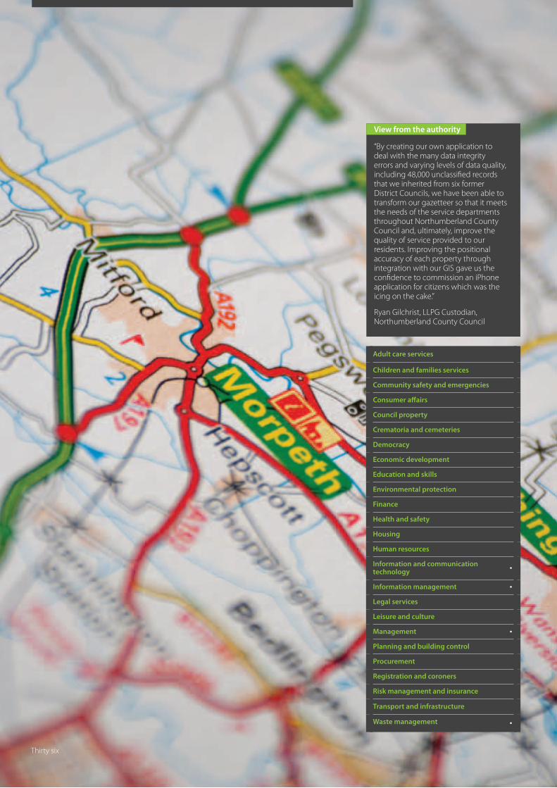
View from the authority
“By creating our own application to deal with the many data integrity errors and varying levels of data quality, including 48,000 unclassified records that we inherited from six former District Councils, we have been able to transform our gazetteer so that it meets the needs of the service departments throughout Northumberland County Council and, ultimately, improve the quality of service provided to our residents. Improving the positional accuracy of each property through integration with our GIS gave us the confidence to commission an iPhone application for citizens which was the icing on the cake.”
Ryan Gilchrist, LLPG Custodian, Northumberland County Council
Adult care services
Children and families services
Community safety and emergencies
Consumer affairs
Council property
Crematoria and cemeteries
Democracy
Economic development
Education and skills
Environmental protection
Finance
Health and safety
Housing
Human resources
Information and communication technology
•
Information management •
Legal services
Leisure and culture
Management •
Planning and building control
Procurement
Registration and coroners
Risk management and insurance
Transport and infrastructure
Waste management •
Thirty six
Facilitated the merger of six gazetteers into one unified gazetteer
Huge savings and efficiencies in the day-to-day management of the LLPG
Quality of the data in the LLPG is now very good
There are savings and efficiencies in departments which no longer have to maintain separate address databases
Very little need for site visits either during or after gazetteer unification
LLPG underpins free and fully featured iPhone application
Has laid the foundation for much wider systems integration
Northumberland County Council
Highly CommendedNLPG NSG Exemplar Award‘Technology Award’
This meant that it could not advance any plans to integrate its new single gazetteer with other systems until it was significantly improved.
The size of the problem, 40,000 unclassified records, many duplicate addresses and poor positional accuracy, led the NCC IT department to build a bespoke software solution. This was made easier by the fact that two of the former councils already shared IT, gazetteer and geographical information system (GIS) expertise, and had successfully integrated their LLPGs with many of their own council service systems. It was this team that led the new council’s LLPG improvement project.
The first step was to bring all the gazetteers, regardless of data quality, up to the national BS7666 standard by working closely with the National NLPG Custodian. Part of this process entailed the writing of simple scripts to unify cross references from the six different gazetteers. NCC then took a single export from the NLPG to form the new unitary gazetteer. Based on the earlier cross reference work, and the realisation that there was no easy way to tackle the problem of unclassified records, the next step was the creation of a new single, software application that would enable any and all of the scripts to be run at the click of a button.
One feature of this application is the ability to pull data from the new unified gazetteer so that they could be viewed selectively on a map in the council’s GIS. Each property classification was given an associated icon, making it easy to spot and select those that were unclassified. By looking at adjacent properties, such as terraced housing, it was possible to write simple scripts to batch classify the unclassified records. The same process was used for positional accuracy, using the map to precisely position individual properties, many of which appeared stacked on top of each other, a throwback to the time when the records were originally created as part of the planning process. Refreshing the GIS in each case updates the records in the gazetteer.
The application can also perform other health checks and analysis of the gazetteer to produce detailed reports to enable the team to correct numerous error types, such as poor cross referencing with the Electoral Roll, Council Tax and Non-Domestic Rates. The application also deals with day-to-day tasks and the process workflow, including the handling of ‘Change Only Updates’ to the NLPG hub.
Outcomes Progress in improving the NCC gazetteer, thanks to this application, has been swift. In the first year, the 40,000 unclassified records were reduced to zero. Council Tax matching improved from 95% to 99.63% and Non-Domestic Rates matching from 61% to 83%. More importantly, the improved confidence in the gazetteer has led to its roll-out as the single source of addressing for Planning and Building Control. The gazetteer is also used by Environmental Health, Trading Standards and Highways and further departmental integration are planned.
The LLPG is also being used as the basis for the route optimisation and management of the council’s waste and recycling routes. This will shortly be linked to the council’s website so that citizens can type in their address to find out the time and date of their next collection.
Another benefit of populating all the BLPU classifications with meaningful descriptions is that it enabled the council to commission its own ‘Northumberland’ iPhone application. The application uses the phone’s built-in Global Positioning System (GPS), Google Maps and the LLPG’s BLPU classifications to locate anything and everything from a Sure Start Children’s Centre to a Registry Office.
The LLPG system provides all the functionality to maintain and improve the data, carry out health checks, visualise data in a GIS and facilitate the roll-out to other service systems and departments.
The efficiencies and savings that derive from using a single source of addressing within a local authority rely on a high quality gazetteer. When Northumberland County Council (NCC) became a new unitary authority it inherited six Local Land and Property Gazetteers of varying quality.
Smart IT delivers
Key benefits
Thirty seven

View from the authority
“Through liaison with local residents and other interested parties, Plymouth City Council has used the development of high profile brownfield sites to celebrate and honour heroes and heroines of the two World Wars. The names chosen provide reference to the former use of the sites, their residents and the price they paid during times of conflict. It is hoped that the chosen names will prompt reflection and provide a fitting tribute for future generations.”
Jane Hirons, Senior Property and Terrier Officer, Plymouth City Council
Adult care services
Children and families services
Community safety and emergencies
Consumer affairs
Council property
Crematoria and cemeteries
Democracy
Economic development
Education and skills
Environmental protection
Finance
Health and safety
Housing
Human resources
Information and communication technology
•
Information management •
Legal services
Leisure and culture •
Management •
Planning and building control •
Procurement
Registration and coroners
Risk management and insurance
Transport and infrastructure
Waste management
Thirty eight
Plymouth City Council has provided a lasting tribute celebrating and commemorating the lives and deaths of just some of the city’s heroes and heroines of WWI and WWII
Communication with individuals, resident’s forums, historical groups and other interested parties ensured selected names were appropriate, applicable and respectful
The promotion of chosen names via local press generated a wide interest in and support of the Council’s process and decisions
Inclusion of new streets within the LLPG / LSG ensures council department and third party contractors have access to the most up-to-date information to support decision making and service delivery
Plymouth City Council
WinnerNLPG NSG Exemplar Award‘Naming Award’
Most innovative example of street naming which is relevant to local history and geographical context
Plymouth’s history dates back to the Bronze Age and the settlement grew rapidly, acting as an important trading post for the Roman Empire. In 1620, the Pilgrim Fathers departed from Plymouth for the New World and, throughout the Industrial Revolution, Plymouth grew, developing as a major shipping port while the neighbouring town of Devonport became an important Royal Naval shipbuilding and dockyard town. The conurbation of Plymouth encompasses the Three Towns of Plymouth, Stonehouse and Devonport. During WWI, it was the port of entry for many troops from around the empire and developed as a facility for the manufacture of munitions. Devonport was also an important base for escort vehicles and repair, and flying boats from Mount Batten.
RAF Mount Batten was a Royal Air Force station and base for flying boats that defended the south west coast of England. The station also became a base for high speed air sea rescue launches and employed Aircraftman Shaw, otherwise known as T. E. Lawrence or Lawrence of Arabia.
In WWII, Plymouth was an important embarkation point for US troops for the D-Day landing and the city was heavily bombed by the Luftwaffe in a series of 59 raids known as the Plymouth Blitz. One extreme period of action occurred shortly after a visit from HRH King George VI and Queen Elizabeth on March 20th 1941. In total, more than 12,000 devices were dropped and some of the worst casualties occurred at the City Hospital Maternity Ward which received a direct hit. Nineteen children died in the Maternity Ward that night together with six nurses.
The opportunity to recognise one of Plymouth’s most famous residents and to pay tribute to some of its fallen arose as a result of developments on the former sites of RAF Mount Batten and the City Hospital – latterly known as Freedom Fields.
Outcomes The approved names of streets at the former sites of RAF Mount Batten and the City Hospital, and their original references are as follows:
• Lawrence Road – T.E. Lawrence (Lawrence of Arabia) was based at the former RAF station
• Shaw Road – Shaw was a nom de guerre of Lawrence
• Cunliffe Avenue – Professor Cunliffe, an archaeologist, made a study and wrote a book about Mt Batten
• Durwent Avenue – Durwent was the name of a boat built at Mount Batten
• Catalina Villas – Catalina a type of ‘flying boat’ serving with 119 Squadron based at RAF Mt Batten
• Monica Walk – probationary nurse Monica White aged 17 years
• Lydia Way – nurse Lydia Rebecca Walters aged 16 years
• Emily Gardens – nurse Emily Helen Kelly aged 37 years
• Olivia Court – nurse Olivia May Willing aged 19 years.
Street naming offers councils the opportunity to engage with the local community and provide recognition and remembrance of a local feature, historic event or personality. Plymouth City Council takes this responsibility very seriously.
Honouring the heroes of war
Key benefits
Thirty nine

View from the authority
“Street naming and numbering is an important activity and it helps if new road and street names have some local resonance, as this acts to bind the old and the new together. Involving local people, who are interested in improving the amenity and utility value of the town, whilst preserving its character and heritage, can only lead to a positive outcome.”
Jan Uden, Street Naming and Numbering Officer, Canterbury City Council
Adult care services
Children and families services
Community safety and emergencies
Consumer affairs
Council property
Crematoria and cemeteries
Democracy
Economic development
Education and skills
Environmental protection
Finance
Health and safety
Housing
Human resources
Information and communication technology
•
Information management •
Legal services
Leisure and culture •
Management •
Planning and building control •
Procurement
Registration and coroners
Risk management and insurance
Transport and infrastructure
Waste management
Forty
Canterbury City Council
Highly CommendedNLPG NSG Exemplar Award‘Naming Award’
Since the new development of 300 houses is close to the sea, it seemed appropriate to link the new street names to some aspect of local maritime history. The council consulted the local ‘Whitstable Society’ to provide the link between the new development and a piece of the town’s historic past.
Whitstable is famous for its oysters and hosts an annual Oyster Festival to this day. During the 19th Century the town supported a large fleet of over 150 ‘Yawls’, the locally built cutter rigged fishing ‘smaks’ that worked the oyster beds in the bay. The yawls were unique, designed for the shallow estuary waters and built in the local shipyard.
The fleet plied a steady trade with London but, by the 1920s, it had diminished in size and the industry was in decline. Thankfully, much of Whitstable’s oyster history has been recorded and there is even a website which lists both the yawls and their owners. It was to this list that the street naming and numbering officers turned, with each new road being named after one of these sturdy, long serving vessels.
One of the Whitstable yawls, ‘Favourite’, has survived and it is now preserved and located between two houses on ‘Island Wall’, just a few yards from the sea. It is a monument to Whitstable’s maritime heritage close to its original working home. Meanwhile, close by in Mariners View, its namesake, Favourite Road, along with Ibis Close, Speedwell Road, Major Close, Trilby Way, Emelina Way, The Oaks, Royal Native Way, Portlight Place, Thistle Drive and Tradewinds, act as constant reminders of Whitstable’s oyster heritage.
Street naming and numbering officers at Canterbury City Council turned to local history for inspiration when naming the streets of the new Mariners View development in the thriving seaside town of Whitstable on the North Kent Coast.
Preserving a seafaring past
Forty one

View from the authority
“Myles Standish has an historical importance that exceeds local, regional or even national significance. He is already honoured and respected in his adopted home, Duxbury, Massachusetts, and so the opportunity to remember him in his probable place of birth seemed a fitting tribute.”
Adult care services
Children and families services
Community safety and emergencies
Consumer affairs
Council property
Crematoria and cemeteries
Democracy
Economic development
Education and skills
Environmental protection
Finance
Health and safety
Housing
Human resources
Information and communication technology
•
Information management •
Legal services
Leisure and culture •
Management •
Planning and building control •
Procurement
Registration and coroners
Risk management and insurance
Transport and infrastructure
Waste management
Forty two
Effective traffic relief for Chorley town centre and completion of the southern and western town bypass
Suitable, viable public transport route and alternative access for residents and emergency service vehicles
Remembrance of an international, historically significant former resident of the Borough
Chorley Borough Council
Highly CommendedNLPG NSG Exemplar Award‘Naming Award’
In accordance with national guidelines, names of new roads should, where possible, reflect the history or geography of a site or area; they should not be duplicated within the administrative area; not be difficult to pronounce or spell; not be construed as advertising or have the potential to cause offence; and not be named after a living person.
The Eaves Green Link Road was a major scheme to facilitate the flow of traffic across the southern area of Chorley, re-routing traffic away from the congested town centre. Connecting Bolton Road in the east and the Eaves Green area of Chorley at Lower Burgh Way to the west, the road passes through an area of Chorley called Duxbury. Following a suggestion from a local historian, it was decided to honour an historically important former resident of the area. The road was named Myles Standish Way to reflect his long standing family ties with the area.
Outcomes The link road was constructed along the original boundary between the Manors of Duxbury and Chorley, falling, in the main, on the Duxbury side on land once owned by the Standish family. The Standish family lived in Chorley from 1300 to 1623 (although probably originated from the nearby township of Standish) and built the Elizabethan Hall, thought to be the birthplace of Myles Standish, probably the most famous member of the family, in the centre of the manor circa 1600.
Myles Standish was an English Military Officer hired by the Pilgrim Fathers as Military Advisor for the Plymouth Colony. A passenger on the Mayflower on arrival in the ‘New World’, he
played a leading role in the administration and defence of the settlement from its inception. In 1621, Standish was elected as first commander, a position he was re-elected to for the rest of his life; he also served as an agent of the Plymouth Colony in England, as assistant governor and as treasurer. He was one of the first settlers and founders of the town of Duxbury, Massachusetts.
Several towns and military installations have been named after Standish and monuments have been built in his memory. These include the Myles Standish Monument in Duxbury, the second tallest to an individual in USA, surpassed only by the Washington Monument, and a smaller monument at the alleged site of the Captain’s grave.
Streets within a new development in the area of the link road are also named along the same theme and include Pilgrim Drive, after the name commonly applied to the early settlers of the Plymouth Colony, and Mayflower Gardens, named after the ship that transported the Pilgrims to Massachusetts. Allerton Close, Bradford Avenue, Chilton Mews, Minter Close, Sampson Close and Winslow Place were all named after passengers on the original Mayflower during its trans-Atlantic voyage in 1620.
Although no conclusive evidence has been found to definitively link Myles Standish to Duxbury Manor and, therefore, Chorley, local baptism records at Chorley Parish Church indicate this was possible, and the man himself provided further support by naming his parcel of land ‘Duxbury’ when the communal farm in the ‘New World’ was dissolved.
The naming and numbering of streets and buildings within Chorley, Lancashire is a Statutory Function of Chorley Borough Council. The council is the only organisation with the authority to allocate new or amended names and numbers and has strict guidelines for the selection of accurate, appropriate and respectful names.
Honouring the birthplace of Captain Myles Standish
Key benefits
Forty three

Forty four
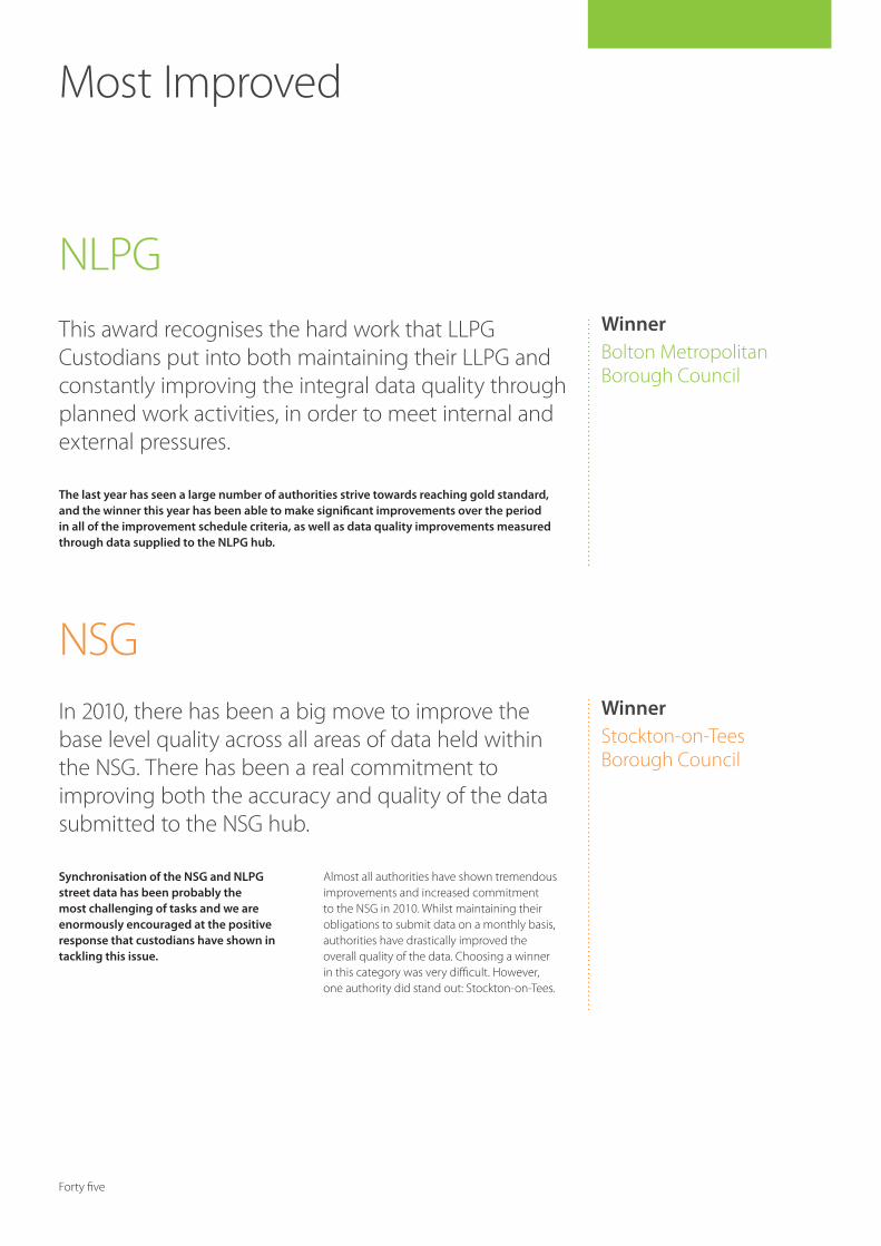
WinnerBolton Metropolitan Borough Council
Most Improved
The last year has seen a large number of authorities strive towards reaching gold standard, and the winner this year has been able to make significant improvements over the period in all of the improvement schedule criteria, as well as data quality improvements measured through data supplied to the NLPG hub.
This award recognises the hard work that LLPG Custodians put into both maintaining their LLPG and constantly improving the integral data quality through planned work activities, in order to meet internal and external pressures.
WinnerStockton-on-Tees Borough Council
Synchronisation of the NSG and NLPG street data has been probably the most challenging of tasks and we are enormously encouraged at the positive response that custodians have shown in tackling this issue.
Almost all authorities have shown tremendous improvements and increased commitment to the NSG in 2010. Whilst maintaining their obligations to submit data on a monthly basis, authorities have drastically improved the overall quality of the data. Choosing a winner in this category was very difficult. However, one authority did stand out: Stockton-on-Tees.
In 2010, there has been a big move to improve the base level quality across all areas of data held within the NSG. There has been a real commitment to improving both the accuracy and quality of the data submitted to the NSG hub.
NLPG
NSG
Forty five

Forty six
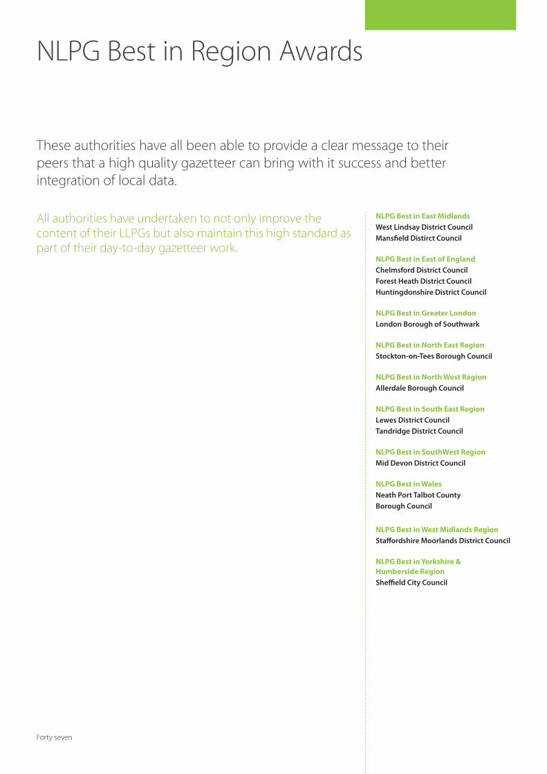
NLPG Best in Region Awards
These authorities have all been able to provide a clear message to their peers that a high quality gazetteer can bring with it success and better integration of local data.
NLPG Best in East MidlandsWest Lindsay District CouncilMansfield Distirct Council
NLPG Best in East of EnglandChelmsford District CouncilForest Heath District CouncilHuntingdonshire District Council
NLPG Best in Greater LondonLondon Borough of Southwark
NLPG Best in North East RegionStockton-on-Tees Borough Council
NLPG Best in North West RegionAllerdale Borough Council
NLPG Best in South East RegionLewes District CouncilTandridge District Council
NLPG Best in SouthWest RegionMid Devon District Council
NLPG Best in WalesNeath Port Talbot County Borough Council
NLPG Best in West Midlands RegionStaffordshire Moorlands District Council
NLPG Best in Yorkshire & Humberside RegionSheffield City Council
All authorities have undertaken to not only improve the content of their LLPGs but also maintain this high standard as part of their day-to-day gazetteer work.
Forty seven

Forty eight
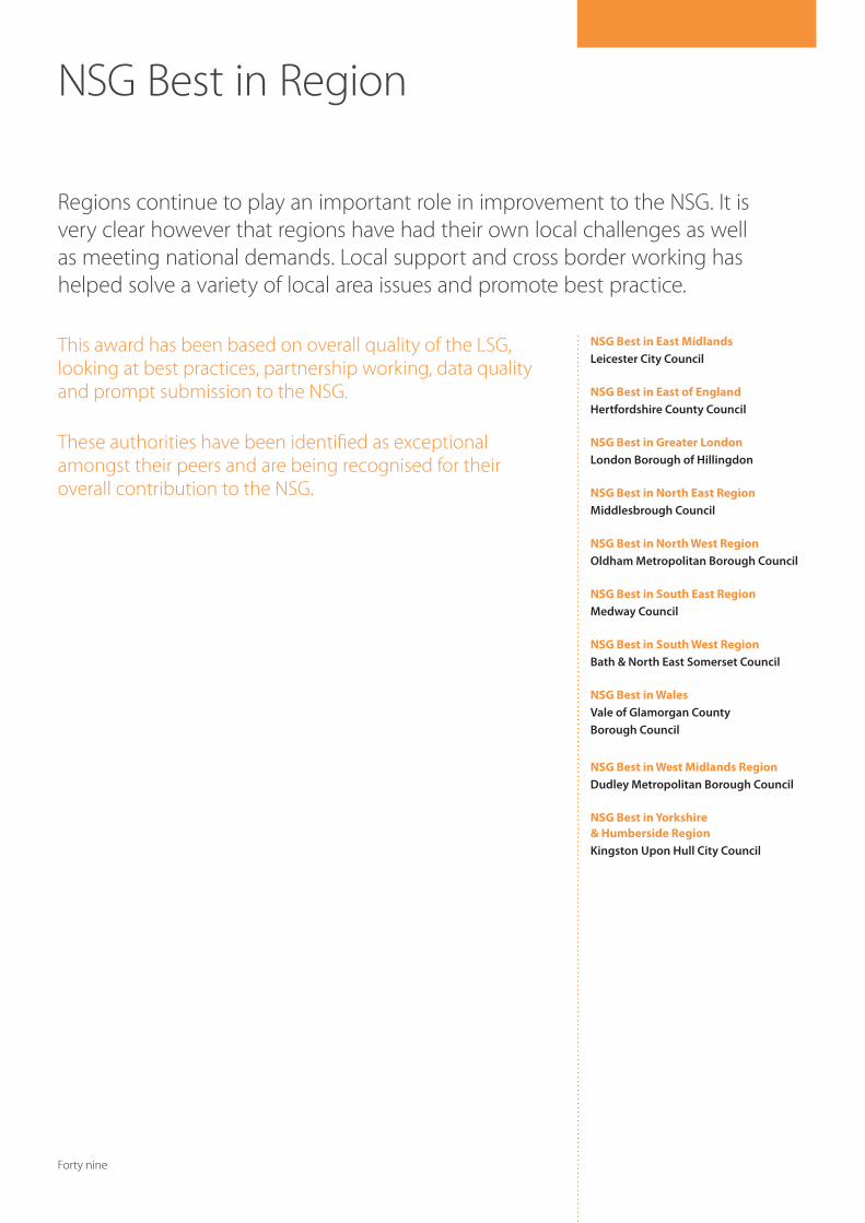
This award has been based on overall quality of the LSG, looking at best practices, partnership working, data quality and prompt submission to the NSG. These authorities have been identified as exceptional amongst their peers and are being recognised for their overall contribution to the NSG.
NSG Best in East MidlandsLeicester City Council
NSG Best in East of EnglandHertfordshire County Council
NSG Best in Greater LondonLondon Borough of Hillingdon
NSG Best in North East RegionMiddlesbrough Council
NSG Best in North West RegionOldham Metropolitan Borough Council
NSG Best in South East RegionMedway Council
NSG Best in South West RegionBath & North East Somerset Council
NSG Best in WalesVale of Glamorgan County Borough Council
NSG Best in West Midlands RegionDudley Metropolitan Borough Council
NSG Best in Yorkshire & Humberside RegionKingston Upon Hull City Council
Regions continue to play an important role in improvement to the NSG. It is very clear however that regions have had their own local challenges as well as meeting national demands. Local support and cross border working has helped solve a variety of local area issues and promote best practice.
NSG Best in Region
Forty nine

Fifty
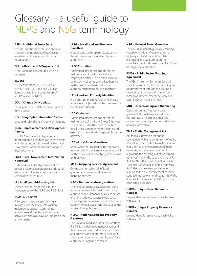
04 Foreword from GeoPlace
06 Foreword from Local Government Information House
08 Foreword from Intelligent Addressing
10 Improving service through better communication
West Oxfordshire District CouncilWinner – NLPG NSG Exemplar Award ‘Citizen’s Award‘ and ‘2010 Exemplar Award’
12 A single version of the truthLondon Borough of HackneyRunner Up – NLPG NSG Exemplar Award ‘Citizen Award’
14 Identifying play prioritiesCanterbury City CouncilHighly Commended – NLPG NSG Exemplar Award ‘Citizen Award’
16 A compelling business caseLondon Borough of HarrowWinner – NLPG NSG Exemplar Award ‘Financial Award’
18 All change on bin dayReigate and Banstead Borough CouncilRunner Up – NLPG NSG Exemplar Award ‘Financial Award’
20 Greening the boroughLondon Borough of HarrowWinner – NLPG NSG Exemplar Award ‘Green Award’
22 Promoting self serviceAshfield District CouncilRunner Up – NLPG NSG Exemplar Award ‘Green Award’
Index
Two
ASD – Additional Street Data
Provides additional attribution about a street, including details of ownership, reinstatement category, and special designations
BLPU – Basic Land & Property Unit
A real world object recorded within a gazetteer
BS7666
For BS 7666 (2000) Parts 1 and 2 and BS7666 (2006) Parts 0, 1 and 2 British Standard used in the compilation of all LLPGs and the NLPG
COU – Change Only Update
File of gazetteer update records supplied from a LLPG
GIS – Geographic Information System
Used to display digital imagery or mapping
IDeA – Improvement and Development Agency
The IDeA works for local government improvement so councils can serve people and places better. It is owned by the Local Government Association and belongs to local government
LGIH – Local Government Information House Ltd
LGIH works with local government to develop national geographical and spatial information infrastructure projects and is responsible for the MSA
IA – Intelligent Addressing Ltd
Service Provider responsible for the management of the NLPG and NSG Hubs
INSPIRE Directive
A European directive establishing an infrastructure for spatial information in Europe, to support Community environmental policies, and policies or activities which may have an impact on the environment.
LLPG – Local Land and Property Gazetteer
A Local Land and Property Gazetteer is the address index maintained by local authorities
LLPG Custodian
Nominated officer responsible for the maintenance of the Local Land and Property Gazetteer. This person will also be the point of contact for all addressing matters within and external to the authority responsible for the gazetteer
LPI – Land and Property Identifier
A unique and meaningful identifier used to locate an object within the gazetteer, for example an address
LSG Custodian
Nominated officer responsible for the maintenance of the Local Street Gazetteer. This person is also the point of contact for all street gazetteer matters within and external to the authority responsible for the gazetteer
LSG – Local Street Gazetteer
Street Gazetteer created by the highways function within a unitary or county council for the purposes of identifying street works on highways
MSA – Mapping Services Agreement
Contract under which all of local government procures address and mapping services
NAG – National address gazetteer
The national address gazetteer will bring together address information from local authorities and Ordnance Survey to create a ‘national address gazetteer database’, providing one definitive source of accurate publicly-owned spatial address data for the whole of the public sector.
NLPG – National Land and Property Gazetteer
The National Land and Property Gazetteer (NLPG) is the definitive, national address list that provides unique identification of land and property and conforms to BS7666. It is updated on a continual basis by each local authority in England and Wales
NSG – National Street Gazetteer
The NSG is an unambiguous referencing system which identifies any length of highway and additional street data in England and Wales through the compilation of local street data direct from the Highway Authorities
PSMA – Public Sector Mapping Agreement
The PSMA is run by Communities and Local Government (CLG) and aims to join up government through the sharing of location data between all its members: local government, emergency services, central government and health
SNN – Street Naming and Numbering
District or Unitary Authority Local government function responsible for the approval of all street names and property numbering schemes within that administrative area
TMA – Traffic Management Act
Act to make provision for, and in connection with: the designation of traffic officers and their duties; to make provision in relation to the management of road networks; to make new provision for regulating the carrying out of works and other activities in the street; to amend Part 3 of the New Roads and Street Works Act 1991 and Parts 9 and 14 of the Highways Act 1980; to make new provision in relation to the civil enforcement of traffic contraventions; to amend section 55 of the Road Traffic Regulation Act 1984; and for connected purposes
USRN – Unique Street Reference Number
Unique identifier assigned to each street within a LSG
UPRN – Unique Property Reference Number
Unique identifier assigned to each BLPU within a LLPG
Glossary – a useful guide to NLPG and NSG terminology
Fifty one
Underp
inning Transformational G
overnment
Case studies from
the 2010 NLPG
and NSG
Exemp
lar Aw
ards
To learn more about how the NLPG, the NSG and the national address gazetteer can benefi t your organisation, please contact:
NLPG and NSG Project TeamsIvybridge House1 Adam StreetLondon, WC2N 6DD
Telephone 020 7747 3500Email [email protected] [email protected] www.thensg.org.uk
GeoPlaceIvybridge House1 Adam StreetLondon, WC2N 6DD
Telephone 020 7747 3500www.geoplace.co.uk
© LGIH and Intelligent Addressing April 2011
IDT 1973 · Printed on paper from sustainable sources · Design: burnthebook.co.uk
Cert no. SA-COC-001654EW
everythinghappenssomewhereCase studies from the 2010 NLPG and NSG Exemplar Awards Demonstrating the importance of location to service delivery within the public sector