Embed Size (px)
Citation preview
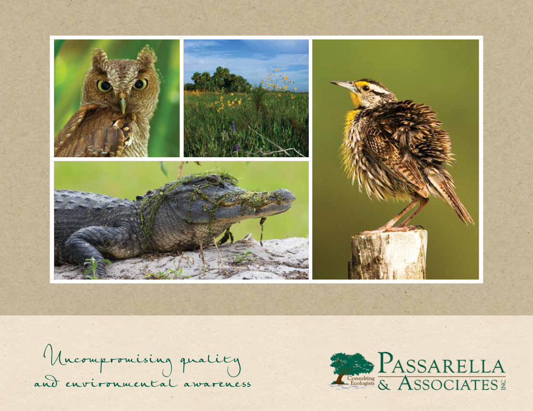
Uncompromising quality and environmental awareness

Our Reputation for environmental expertise
is based on our skillful application of science
and sound ecological principles as well as a
thorough understanding of permitting and agency
requirements and regulations.
Our Professional Approach ensures
that each project meets client expectations while
finding a sustainable balance with the natural
environment. We use the latest technology and
resources to ensure the accuracy and quality of
our data – and your project.
Our Clientele is wide-ranging and includes
landowners, civil engineers, land surveyors,
planners, land-use attorneys, realtors, residential
and commercial developers, agricultural operations,
as well as local, state, and federal agencies.
Clients depend on our knowledge, expertise,
and our remarkable working relationships to
navigate environmental regulations, no matter the
complexity of the project.

Achieving a sustainable balanceFounded in 1996, Passarella & Associates is a full-service ecological and environmental consulting firm that has built its reputation on the
skillful application of science and sound ecological principles.
Established to assist clients in achieving a sustainable balance between development and our unique environmental resources, Passarella &
Associates is backed by a staff of professional ecologists and environmental scientists with extensive knowledge of navigating environmental
regulations on regional, state, and federal levels. We are exceptionally qualified to guide a project – no matter how large or small – from
inception to completion in a thorough and timely manner.
Our experienced staff works closely with each client, as a team, to ensure that the design, permitting and implementation of every project is
of the highest level of quality, on time and at a reasonable cost, always while complementing the natural environment.

assarella & Associates
utilizes the latest
technology and
resources ensuring the accuracy
and quality of data. The dedicated
team of ecologists, biologists,
environmental consultants,
GIS analysts, and support staff
members have developed a
thorough understanding of
permitting, agency requirements
and regulations, as well as an
appreciation of the intricacies
and nuances of our environment.
Passarella & Associates expertly
creates the perfect balance of
progress and nature.

» WETLAND JURISDICTIONAL DETERMINATIONS
Wetland mapping, flagging, and assessments
Wetland jurisdictional determinations/delineations determine the
presence and physical limits of wetlands and surface waters. Our
ecologists routinely conduct wetland mapping and flagging on
sites utilizing criteria defined by federal and state rules. Wetland
assessments are necessary when a project results in unavoidable
wetland impacts. Our staff is trained to conduct these assessments
using methodologies approved by the permitting agencies.
» WETLAND PERMITTING
Federal, state, and local government permitting
Our team of environmental professionals is experienced in
providing the expertise needed to guide a project through
the federal and state permitting processes and obtain the
necessary entitlements for a project. We are knowledgeable
of local government wetland ordinances that may apply to a
project. We have the knowledge, experience, and excellent
working relationships that are required to expedite the
permitting process through the various federal, state, and
local government agencies.
Scope of servicesThe firm’s scope of professional services is all-inclusive, allowing our clients to tailor services to meet their project needs. Many clients choose
to take full advantage of our expertise and extensive field work experience, enlisting us to oversee all environmental aspects of a project –
guiding it through initial planning, permit submittals, agency negotiations, permit issuance, and construction implementation, as well as permit
compliance and follow-up monitoring.
» WETLAND MITIGATION DESIGN AND MONITORING
Wetland mitigation design, mitigation construction coordination,
mitigation assessments, and mitigation monitoring
The design of a wetland mitigation project is catered to individual
project needs. We have demonstrated our extensive experience in
wetland mitigation design through the successful completion of a
variety of projects with different goals and objectives while finding
a balance with the natural environment. We measure the ecological
success of mitigation areas through wetland mitigation monitoring
and performance standards established in the permitting process.
» WETLAND MITIGATION BANKS
We have experience in designing, permitting, managing, and
monitoring successful wetland mitigation banks. Aspects of
wetland mitigation bank design we can assist with include site
searches, mitigation planning, potential credit generation under
different scenarios, and preliminary restoration, management,
and monitoring cost estimates. We have a Qualified Mitigation
Supervisor on staff to oversee all facets of mitigation bank site
implementation, management, and monitoring, as well as
corrective actions, if necessary.

» PROTECTED SPECIES ASSESSMENTS
Habitat mapping, protected species surveying,
and habitat analysis
Our team of trained and experienced ecologists regularly
perform habitat mapping and conduct protected species
surveys on project sites as part of preliminary site
assessments and permitting requirements. Protected species
assessments/surveys are often required to determine the
presence or absence of plant and animal species protected
by federal, state, and local laws. Our ecologists are highly
experienced in utilizing habitat analysis to determine the
amount of mitigation a development project may be required
to provide as compensation for impacts to protected species,
or the amount of habitat credit that could be generated by the
land if proposed as a habitat conservation bank.
» PROTECTED SPECIES PERMITTING
Federally threatened and endangered species permitting,
state protected species permitting, and local government
protected species ordinances
The protection of plant and animal species by federal, state,
and local regulatory agencies involves specific and complex
laws that govern the protection and management of these
species. Our firm stays up-to-date on the latest regulations
regarding protected species, their habitats, and the
associated permitting requirements.
» PROTECTED SPECIES RELOCATIONS AND HABITAT MANAGEMENT
Protected species monitoring, relocations, and habitat
management plans
Relocation of protected species, habitat management plans,
and/or monitoring of protected species on a project site may
be required by the permitting agencies if it is determined that
a project has the potential to affect one or more threatened
or endangered species. The relocation of protected species
involves the determination of a suitable relocation site or an
appropriate mitigation bank. Our team can assist in planning
for on-site preservation, as well as preparation of habitat
management plans that may be needed.
» HABITAT CONSERVATION BANKS
Habitat conservation banks are permanently protected lands
with high natural resource value. These lands are conserved
and permanently managed for species that are endangered,
threatened, or are otherwise species-at-risk. Conservation
banks function to offset adverse impacts to these species
that occurred elsewhere, sometimes referred to as off-site
mitigation. Our firm assisted in permitting the first conservation
bank in the State of Florida for the Florida panther. We
continuously work with land owners and mitigation bank
managers to identify potential habitat conservation projects
throughout the Southeast.


» GEOGRAPHIC INFORMATION SYSTEMS (GIS)
GIS is a computer-based method that allows the collection, modeling, analysis, and displaying of geographic data. It is a perfect combination
of database management with the capabilities of a mapping system. Many different types of data can be integrated into GIS and represented
as a spatial layer. When these layers are drawn on top of one another, undetected spatial trends and relationships emerge. This allows us to
gain insight about relevant characteristics of a location.
GIS is being used in urban planning and management for zoning, economic development, and land acquisition; by businesses for
demographic analysis, market analysis, and site selections; in real estate to analyze neighborhood land prices, traffic analyses, aerial
photography, and to see the location of schools, retail businesses, cultural attractions, or other resources in relation to the location of
potential home and/or commercial sales; by developers with location or subject-specific maps to help with marketing to the public or
presentations to government and/or regulatory agencies; and by CDDs, HOAs, and/or property management companies for community asset
management and creating and maintaining data files. At Passarella & Associates, we use GIS in nearly every service we provide.
Using a set of integrated geoproccessing tools, wizards, and scripts, our highly-skilled GIS analysts can perform spatial analysis to understand
patterns and relationships among locations and features with geographic data. Some of these capabilities include map production (linking
a database to a map), calculations of areas (distances, routes, and lengths), integration of aerials and LiDAR data, and performing spatial
queries (identifying single-family homes within flood zones).

Geospatial Analysis
Geospatial analysis is the process of analyzing data in relation to its
location. Our analysts are trained to interpret geographic patterns
and relationships among locations and features with spatial data.
Examples of geospatial services include:
• Data Layer Analysis (parcels, land cover, zoning, preserves, community assets, etc.)
• Database Design & Management
• Wetland Mapping
• GIS Data Modeling & Python Scripting
• Address & Geocoding
Custom Mapping
Our team of analysts have years of experience creating maps for
display or presentation. This includes aerial photography maps,
subject-specific maps, and location maps. We can create a wide-
variety of custom sized maps featuring your exact data needs.
GIS Data Collection and Production
Every analysis requires data. Our analysts have created and
compiled data for many organizations both in the public and private
sectors. We collect spatial data utilizing GPS devices and from aerial-
photo interpretation; examples of which include tree inventories,
municipal infrastructure features (roads, street signs, light poles,
utilities), and business locations.

Database Design and Conversion
Data conversion is a very important and technical process. Our GIS team will work
with you to develop a geodatabase design that will suit your organization’s specific
needs. Our process can convert data from hard copy paper maps, AutoCAD drawings,
property records, aerial photographs, GPS data, and more.
Online GIS Web Applications
Using ESRI technologies, our staff can create an online GIS web map that meets your
business’s needs. Web maps can be designed for client-only access or for public
viewing. This gives your users 24/7 access to your maps and data online. Web map
solutions are user friendly, mobile ready, include map tools, and can be customized
specifically to your organization.

The majority of the images in this brochure were captured and copyrighted by Senior Ecologist and Nature Photographer William R. Cox. For copies, please call (239) 789-8945, or visit www.williamrcoxphotography.com
FLORIDAFort Myers
13620 Metropolis Avenue, Suite 200Fort Myers, FL 33912
Tel: (239) 274-0067 | Fax: (239) 274-0069
Sarasota 401 North Cattlemen Road, Suite 102
Sarasota, FL 34232
Tel: (941) 343-0701 | Fax: (239) 274-0069
SOUTH CAROLINA363 Wando Place Drive, Suite 200
Mount Pleasant, SC 29464
Tel: (843) 971-8520 | Fax: (843) 971-8522
Charleston
Sarasota
Fort Myers
Georgia
South Carolina
Florida

www.passarella.net