Embed Size (px)
Citation preview

UCLSNewsletterThe
Volume 4 Issue 22 September 2017
Do you know what this person is do-ing and is what he is doing a surveying function? Be the first to identify where it is and you become eligible for a free lunch at your next UCLS Chapter meet-ing. Answers may be emailed to Susan at [email protected]. The earliest date and time of response will determine the winner. In this issue: Are monument locations always inaccurate? We share the loca-tions and history of 11 monuments that
may be in the wrong place. We congratulate a student and a teacher from Clearfield High School, who won the prestigious NSPS Trig-Star competition. A UCLS member shares a humorous surveying experience and a new newspaper article highlights the daily hazards of land surveying. Is visiting a monument that designates the location of three entities part of your bucket list? Read about a 63-year old man from Massachusetts who has made it a hobby. Review the international right of way association flyer and consider attending one of their monthly chapter meetings. Additionally, we have included the latest infor-mation for the multi-state annual survey conference in Law Vegas. As we know, the average surveyor is on the upper side of 50. Therefore, enjoy the lighter side of life by reminiscing about what things used to be like.
The UCLS Newsletteris published monthly by the
Utah Council of Land SurveyorsPO Box 1032
Salt Lake City, UT 84110
Phone/Fax:801-964-6192
Website:www.ucls.org
NDEX TO PAGES:Page 2......Officers & CommitteesPage 3-5...Inaccurate Geographic MarkersPage 6......Local Trig-Star WinnerPage 7......Survey of a Dairy FarmPage 8......Dastardly DeedPage 9......Western Regional ConferencePage 10.....IRWA Chapter MeetingPage 11.....Monument HobbysitPage 12.....Tree OwnershipPage 13.....On the Lighter Side
“I’m a mentor to anybody who’s interested.”-Clint Eastwood
What is it?
We invite you to share charismatic photos of yourself and/or a coworker, panoramic images of Utah’s scenic wonders, or pictures of survey related tools and equipment. Additionally, we need interesting and unique descriptions or survey related stories to share with our membership. Remember, if you do not participate you have no right to complain. Please let us know your thoughts, recommendations, suggestions, or complaints.
The UCLS Newsletter is published monthly by the Utah Council of Land Surveyors (UCLS), as a service to the Land Surveying profession of the state of Utah. The publication is provided to UCLS members and similar organizations on a complimentary basis. The Newsletter is not copyright protected, therefore articles, except where specifically copy right noted, may be reprinted with proper credit given. Articles appearing in the Newsletter publication do not necessarily reflect the viewpoint or endorsement of UCLS, its officers, Board of Directors, or the editor.Contributions are encouraged. Articles, Advertisements, Pictures, and Comments may be submitted to UCLS at [email protected] or [email protected]
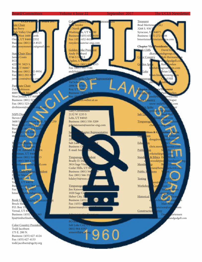
Board/Committees Volume 4 Issue 22 September 2017 The UCLS Newsletter
UCLS Executive Board 2017State ChairDan PerryUtah Valley University1300 West 1600 NorthOrem, UT 84604-2332Business: (801) [email protected]
State Chair ElectJames CoutsECI4229 W. 5825 S.Roy, UT 84067Business: (801) 292-9954Fax: (801) [email protected]
Past State ChairDale Robinson8889 South Mountain Vista Dr.West Jordan, UT 84081Business: (801) 523-0100Fax: (801) [email protected]
NSPS DirectorSteven Dale3600 S. Constitution Blvd., Room 250West Valley City, UT 84119Business: (801) 963-3218Fax: (801) [email protected]
West Fed RepresentativeMichael W. Nadeau (SL)5226 W. Ashland Rose Dr.Herriman, UT 84065Business: (801) 569-1315Fax: (801) [email protected]
Book Cliffs Chapter PresidentHarold Marshall85 S. 200 E.Vernal, UT 84078Business: (435) 789-1017Fax: (435) [email protected]
Book Cliffs Chapter RepresentativeBrock SlaughP.O. Box 1580Vernal, UT 84078Business: (435) [email protected]
Color Country PresidentTodd Jacobsen175 E. 200 N.Business: (435) 627-4124Fax: (435) [email protected]
Color Country Chapter RepresentativeRick Snyder11 North 300 WestWashington, UT 84780Business: (435) 652-8450Fax: (435) [email protected]
Golden Spike PresidentAndy Hubbard5746 S 1475 EOgden, UT 84403Business: (801) 394-4515Fax: (801) [email protected]
Golden Spike Chapter RepresentativeVal Schultz2096 W. 5750 S.Roy, UT 84067Business: (801) 399-8018Fax: (801) [email protected]
Salt Lake Chapter PresidentGary Christensen2132 W 1235 SLehi, UT 84043Business: (801) [email protected]
Salt Lake Chapter RepresentativeBrian Mitchell2001 S. State St. Suite N1500Salt Lake City, UT 84114Business: (385) 468-8243E-mail: [email protected]
Timpanogos PresidentBradly D. Daley3814 Sage Vista LaneCedar Hills, UT 84062Business: (801) 566-5599Fax: (801) [email protected]
Timpanogos Chapter RepresentativeJim Kaiserman1020 Sage CircleHeber City, UT 84032Business: (435) 657-3222Fax: (435) [email protected]
Administrative SecretarySusan MerrillPO Box 1032Salt Lake City, UT 84110(801) [email protected]
TreasurerBrad Mortensen (SL)3268 S. 930 W.Syracuse, UT 84075Business: (385) [email protected]
Chapter Vice Presidents:Book Cliffs David Kay [email protected] Country Bob Hermandson [email protected] Spike Ken Hawkes [email protected] Lake Brian Linam [email protected] Chad Hill [email protected]
Chapter Secretary/TreasurerBook Cliffs Paul Hawkes [email protected] Country Mike Draper [email protected] Spike Travis Gower [email protected] Lake Shad Hall [email protected] Chad Poulsen [email protected]
Committees & Committee ChairsLegislation Doug Kinsman [email protected] Chris Moore [email protected] Steve Keisel [email protected] & Ethics Evan Wood [email protected] Brian Linam [email protected] Relations Vacant
Testing Darryl Fenn [email protected] & Convention Todd Jacobsen [email protected] Charles Heaton [email protected] Matt Peterson [email protected] Survey David Mortensen [email protected]

11 Geographic Markers That Are Totally Inaccurateby: Kavya Ram Mohan
There’s something exciting about being at a special geographic spot, like the exact center of a continent or a point along an imaginary line like the equator. Throughout the globe, monuments and signs are installed to define these geographically significant locations. Only surprisingly often, these markers are actually in the wrong spot. In some cases, the identifying plaque or signpost was simply placed at some convenient spot close to the actual point. In other cases, these cartographic frauds show just how hard it is to accurately measure the globe. The constant shift and movement of the land, along with administrative changes like labeling new regions or redrawing borders can send calculations tumbling. At the same time, our methods of measurement have evolved through the years, calculating slightly different spots with each technological advancement. In the 20th century, many geographic center points were determined using the center-of-gravity method: The region was mapped out on a piece of cardboard, which was then cut in the shape of the outline and placed on the head of a pin to see at what point it balances perfectly. With the advent of satellite-aided and computerized mapping systems, more sophisticated methods have emerged to zero in on these centers. The result is an increasingly precise way to chart the globe. But in the process, some previous geographic markers are rendered inaccurate. Here are 11 geographic monuments that stand tall and proud, but are not at quite the right location.
Geographic Center of South America - Cuiaba, Brazil Back in 1909, legendary Brazilian explorer Candido Rondon calculated the center of South American continent - the spot with an equal area of landmass lying to both the north and south, and east and west. He determined it was in the then-remote and sparsely populated region of Cuiaba. A modest marker and later a tall striking monument marked the spot. Later, after satellite imaging came along, a different location 28 miles away was identified as the true center. But the original obelisk still stands tall.
Europos Park - Joneikiskes, Lithuania In the early 1990s the people of Lithuania got very excited when calculations identified a spot outside of the capital city, Vilnius, as the dead center of Europe. A big sculpture park dubbed Europos Park was erected at the spot. But French scien-tists who had proposed the spot for the center in the first place sent news that they accidentally missed the exact target by 8 miles (14 kilometers). The correct center, which is still contested, is now marked with a square and a small museum.
The Equator Monument - North Pontianak, Indonesia Standing a mere two miles north from the city of Pontianak in a monument con-structed to represent the otherwise conceptual equator. The spot was first marked simply with an arrow on a pole in 1928 by a Dutch geographer when he visited Borneo. The first monument, originally consisting of four wooden pillars surround-ing the pole, was rebuilt 10 years later and turned into a permanent monument. A globe was added to cap off the work, as well as a guard to keep it safe. But due to constant global shift, the monument no longer lies on the exact line of the equator. In 2005, the true equatorial line was recorded a short distance south of the monument and, according to GPS readings, the line continues to move south.
Middle of the world - San Antonio de Pichincha, Ecuador In 1936, geographer Luis Tufino sponsored a 32-foot monument at the equator to commemorate the 200th anniversary of the French Geodesic Mission which charted the division of the hemispheres and measured the shape of the Earth. A larger monument of the same design was built on the site in 1979. The main attraction, however, is the painted line on the pavement that marks Latitude 0o 0’ 0”, where all visitors take a photo straddling both hemispheres. Sadly, the painted line and the location of the monument are misplaced. The original calculations by Tufino to establish the equator have been proved incorrect by more accurate modern technology and the actual line runs about 780 feet (240 meters) north of the monument. What’s more, the French Geodesic Mission it com-memorates did not actually visit this site on its survey expedition.
Page 3 Volume 4 Issue 22 The UCLS NewsletterSeptember 2017
11 Geographic Markers That Are Totally Inaccurate continued...
45 X 90 Geographical Marker - Athens, Wisconsin Stuck halfway between the geographical poles, the equator, the Prime Meridian, and the 180th meridian, the point that is exactly at 45 degrees latitude, 90 degrees longitude is the center of the northern half of the western hemisphere. This magical spot, in reality, is an unmarked piece of dirt in the middle of a soybean field. The marker commemorating “45 X 90” is some 1,063 feet away from the actual spot, and is a lot more glamorous, where gift coins are given out to visitors indicated you are a member of the 45 x 90 club.
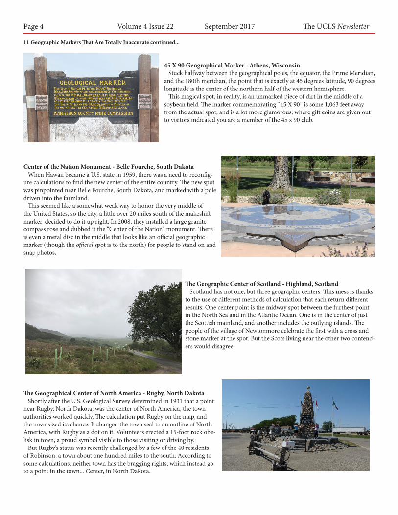
Center of the Nation Monument - Belle Fourche, South Dakota When Hawaii became a U.S. state in 1959, there was a need to reconfig-ure calculations to find the new center of the entire country. The new spot was pinpointed near Belle Fourche, South Dakota, and marked with a pole driven into the farmland. This seemed like a somewhat weak way to honor the very middle of the United States, so the city, a little over 20 miles south of the makeshift marker, decided to do it up right. In 2008, they installed a large granite compass rose and dubbed it the “Center of the Nation” monument. There is even a metal disc in the middle that looks like an official geographic marker (though the official spot is to the north) for people to stand on and snap photos.
The Geographic Center of Scotland - Highland, Scotland Scotland has not one, but three geographic centers. This mess is thanks to the use of different methods of calculation that each return different results. One center point is the midway spot between the furthest point in the North Sea and in the Atlantic Ocean. One is in the center of just the Scottish mainland, and another includes the outlying islands. The people of the village of Newtonmore celebrate the first with a cross and stone marker at the spot. But the Scots living near the other two contend-ers would disagree.
The Geographical Center of North America - Rugby, North Dakota Shortly after the U.S. Geological Survey determined in 1931 that a point near Rugby, North Dakota, was the center of North America, the town authorities worked quickly. The calculation put Rugby on the map, and the town sized its chance. It changed the town seal to an outline of North America, with Rugby as a dot on it. Volunteers erected a 15-foot rock obe-lisk in town, a proud symbol visible to those visiting or driving by. But Rugby’s status was recently challenged by a few of the 40 residents of Robinson, a town about one hundred miles to the south. According to some calculations, neither town has the bragging rights, which instead go to a point in the town... Center, in North Dakota.
Page 4 Volume 4 Issue 22 The UCLS NewsletterSeptember 2017

11 Geographic Markers That Are Totally Inaccurate continued...
Geographic Center of the Contiguous United States - Lebanon, Kansas The geographic center of the contiguous United States is marked at a point about two miles northwest of Lebanon, Kansas. A small stone pyramid des-ignates the spot measured by a survey performed in 1918. A picnic table and cozy chapel are nearby. Couples can be married at the chapel and a Bible and guest book allow visitors to reflect and mark their attendance to the middle of America. The problem is, the actual center determined by the 1918 survey is located on a private farm less than a mile away. And in second plot twist, a new location was later determined in Agra, Kansas, nearly 28 miles away.
The Oldest 45th Parallel Marker in the U.S. - Perry, Maine The 45th parallel wraps around the globe marking the halfway point between the equator and the North Pole. In the late 1880s, the United States Coast and Geodetic Survey crew were working their way northward trying to mark it, along the coast of Maine to the St. Croix River. Topographers noticed a house in Perry that just hap-pened to fall nearly on top of the 45th parallel, missing it by the tiniest fraction of a degree (only a few tenths of a second). The cartographers placed a brass pin next to the house to mark the spot where line crosses the main road. A few years later, the citizens of Perry decided to erect a more permanent marker, which still stands today. But the stone actually sits just a bit south of actual 45th, missing it by about 140 feet. But that took much more modern equip-ment to determine. The early survey crew was awfully close.
Mule Pass - Bisbee, Arizona When the road over Mule pass was built in 1913 and 1914, it was done by prison labor. The stubby concrete obelisk that marks the pass was placed here partly to pro-claim that fact, as well as memorialize the triumph of pavement over nature. But for some reason the marker added another claim: that Mule Pass was right on top of the Continental Divide, the invisible line separating the watersheds of the Atlantic and Pacific Oceans. That line, however, lies about 120 miles to the east, along a low rise in New Mexico.
The Real Greenwich Prime Meridian - London, England Tourists lining up for a picture at the Greenwich Observatory Monument can save some time and go for a walk just a few hundred feet to the east in Greenwich park for a picture at the real Greenwich Prime Meridian. With the introduction of satellite based GPS navigation, the position of the Greenwich Meridian that dates back to 1851 was called into question. What modern instruments pointed out was that, due to inaccuracies in the instruments used at the time the merid-ian line was established, it ended up to 102 meters (334 feet) west of its actual position.
Page 5 Volume 4 Issue 22 The UCLS NewsletterSeptember 2017

National Tri-Star Committee Selects Winners of theRichard E. Lomax National Tri-Star and Teaching
Excellence Awards The National Society of Professional Surveyors (NSPS) is please to announce the recipients of the 2017 Richard E. Lomax National Tri-Star Awards. The Trig-Star committee met on July 29,2017 to determine the three top high school students from the national examinations submitted by state winners. This year there were thirty-five state winners submitted. A past president of NSPS, Richard Lomax was the driving force behind the elevation of the local Trig-Star program to the national level. In October 1994, Board action named this high school trigo-nometry skill award in his honor. The Richard E. Lomax National Trig-Star Awards are as follows:First Place: Treyan Fitzwater, Clearfield High School, Clearfield, UtahSecond Place: Jathan Mentzer, Williamport High School, Williamsport, MarylandThird Place: Joseph Kovac, Macomb Math Science Technology Center, Warren, Michigan
The Richard E. Lomax National Teaching Excellence Awards are as follows:First Place: Ashley Martin, Clearfield High School, Clearfield, UtahSecond Place: Susan Kaltenbaugh, Williamsport High School, Williamsport, MarylandThird Place: Kincaid Dewey, Macomb Math Science Technology Center, Warren Michigan
The first place student receives $2,000, second place student receives $1,000, and third place student receives $500. The first place teacher receives $1,000, second place teacher receives $500, and third place teacher receives $250. The Trig-Star Policy states that “the National Student and Teacher Awards be given to the winning students at or before the next state professional land surveying organization conference of the student’s home state.” The following is a list of the remaining State Winners in the order of finish:Nolan Poczekay, Indiana; Caleb Noble, Montana; Drake Thomas, Alaska; Maxwell Jiang, Texas; Griffin Smith, South Dakota; Ashish Kalakunela, Nevada; Yiwei Lyu, Pennsylvania; Haoxiang Zhang, Connecticut; Jason D’Amico, Maine; Chatchanun, Suriyaammaranon, Wisconsin; Noah Paladino, New Jersey; Junhee Lee, Iowa; Eric J. Pabon Cancel, Puerto Rico; Saowapak Hanpadungkit, Washington; Grace Smith, New Hampshire; Sarah Jones, Oregon; Nicholas Cordero, Masschusetts; Jacob Ewy, Kansas; Saisupritha Talasu, Illinois; Naveen Makkar, Ohio; Briya Miller, Delaware; Dawson Stokes, Idaho; William Zhang, Alabama; Jennifer Aklilu, Colorado; Mya Stein-wehr, North Dakota; Ellie Laudenslayer, Kentucky; April Lyn Cintron, Georgia; Micah Link, Minnesota; Alex Tew, South Carolina; Makenna Parkinson, California; Grace Tanner, Wyoming; Cassy Deobler, Missouri.
The Richard E. Lomax National Trig-Star and Teaching Excellence Awards are a two of several annual NSPS awards. For more information about the NSPS awards and scholarship programs, please contact NSPS, 5119 Pegasus Court, Frederick, MD 21704, (240) 439-4615, e-mail: Trish Milburn at [email protected], or visit the NSPS web site at www.nsps.us.com.
Page 6 Volume 4 Issue 22 The UCLS NewsletterSeptember 2017
Employment OpportunityThe office of the Salt Lake County Surveyor isactively recruiting for the position of Chief of
Partyand an Assistant Field Operation Manager.
More information may be found on the Salt LakeCounty Human Resources website at
http://slco.org/human-resources/jobs/

NOTICESean Fernandez, Utah Automated Geographic Reference Center (AGRC), and Bill Stone, NOAA’s National Geodetic Survey (NGS), are pleased to announce the Sean is now serving as the NGS Geodetic Coordinator for Utah. In the voluntary role (in addition to his day-to-day AGRC responsibilities), Sean will assist Bill, the NGS Southwest Region (UT, AZ, NM) Geodetic Advisor, with various aspects of outreach and interface between Utah’s geospatial community and NGS. The volunteer State Geodetic Coordinator program augments the NGS Regional Geodetic Advisor program by providing a single point of contact within participating states to assist in supporting users of the National Spatial Reference System. For further information, including full contact information for Sean and Bill, see: https://geodesy.noaa.gov/ADVISORS/index.shtml. Feel free to contact direct questions to Sean ([email protected]) and/or Bill ([email protected]).
Page 7 Volume 4 Issue 22 The UCLS NewsletterSeptember 2017
Survey of a Dairy FarmLife Experiences by Kevin Bishop
Several years ago, our company was asked to do some survey work on a small family farm. I was sent to the project with the new guy. He was a young kid just out of high school. He was a good worker and I enjoyed his company, but he was still learning about the survey profession and I was going to show him a thing or two. It was January, and the small farm turned out to be an active dairy with all the sights, sounds, smells and ani-mals you would expect on a dairy. We parked the truck and met the land owner. He explained to us what his concerns were and what he was hoping to ac-complish with the survey. As soon as the owner left, the young kid “This whole place smells like S**T!” I began to laugh and responded something like “on a dairy, that is the smell of money, it’s called manure”. He commented that he didn’t care what I wanted to call it, he knew what it smelled like. We got the lay of the land and located a few property corners then decided it was lunch time. We flipped a coin to let fate decide who would make the run into town. He was to go into town and grab some burgers and drinks for lunch and I would stay and continue with the survey work. He had been gone about 40 minutes and I walked the back half of the property. I heard him honk the horn when he pulled up with lunch. I figured I would work my way back to the truck and locate the corrals, fencing and power poles, along with other structures, giving him time to eat, then we could switch. He could continue on with gathering data to complete the topography and survey and I could eat some lunch. On my way back, I came across a steel pole fence set in concrete. I walked the fence line and located each angle point in the concrete. After I took the last point, I stepped over the fence to walk the shortest distance back to the truck. I got about 3 steps away from the concrete and the ground beneath my feet gave way. I had walked onto a large pile of frozen manure. It may have been January, but it was nice sunny day, about 40oF. The snow was melt-ing and I was now covered in it. I made my way back to the truck and my co-worker could see there was a problem. He got out of the truck, try-ing to conceal his ear to ear smile. He said, “hey ma, you are covered in manure, or should I say gold.” I respond-ed, “It’s manure when it’s on the ground, when you are covered in it, it’s called S**T!”

Page 8 Volume 4 Issue 22 The UCLS NewsletterSeptember 2017
Arkansas man accused of firing shotgun toward land surveyorBy: Emma Pettit
An Arkansas man was arrested after he fired his shotgun to-ward a land surveyor who had stepped onto his property Tues-day afternoon, authorities said. A Pulaski County sheriff ’s deputy was sent shortly before 3:30 p.m. to 8011 Dorsey Road, where he spoke with a Vilonia man who was surveying the plot, according to a report. The 35-year-old told the deputy that as he was searching for a marker, he walked onto the neighboring property. A man, later identified as 38-year-old Chad Rowe of Cabot, stepped out from behind a tree and fired his shotgun in the sur-veyor’s direction, the report said. The round hit about 25 feet in front of him, the surveyor told authorities. Rowe then reportedly asked the 35-year-old what he was doing on his property. The man responded that he was doing on his property. The man responded that he was surveying the nearby plot, and Rowe gave a thumbs up and walked away, the report said. Several deputies approached Rowe, who seemed “very agitat-ed,” the report said. He was arrested and faces a charge of aggra-vated assault, a felony.
Rowe was being held Wednesday morning at the Pulaski County jail without bond.
Pop Questions posed by the NSPS Future of Surveying Forum
In its first (https://www.surveymonkey.com/r/LBZNXJZ) of a series of “Pop Questions” for Surveying Profes-sionals, the NSPS Future of Surveying Forum is seeking input intended to facilitate its work. Thank you in advance for your assistance. Please respond by Sept. 1. Check out the results after taking the survey for surveyors!
JUL 1 5 2003 E 1 aaB385 B 3332 P 1 72 RICHARDT. MAUGHAN, DAVIS CNTY RECORDER2003 JUL 15 8:43 AM FEE 10.00 DEP LHLREC'D FDR NICHOLAS L FAULKNER
QUIT CLAIM DEED
FOR VALUABLE CONSIDERATION, receipt of which is acknowledged, I. Nicholas L. Faulkner, QUIT CLAIM to: THE NICK FAULKNER FAMILY TRUST, dated the .;l, f-l"'day of May, 2003, Nicholas L Faulkner TRUSTEE, the following described real propedy in the County of Davis, State of Utah:
BEG 1039.75 FT E ALG THE CENTER LN OF A STR & 113 FT N OF TH SW COR OF SEC 21, T4N-RlW; SLM: & RUN THEW 78.7 FT; TH S 68'13" W 53.9 FT; THE S 60 FT TO THEN LN OF SD STR; TH W 107.46 FT ALG THEN LN OF SD STR TO THEE LN OF THE STATE HYW; TH N 28' ... ETC. CONTAINS .652 ACRES
-? PROPERTY ADDRESS: 16 NORTH MAIN STREET LAYTON
../-I.. Executed on the ,,J 11' day of May, 2003, at Ogden, Utah.
Nicholas L. Faulkner
STATE OF UTAH
COUNTY OF WEBER
} }SS. }
. .fl.. On this c2 r day of May, 2003, before me, the undersigned, a Notary Public in and for said State, personally appeared Nicholas L. Faulkner personally known to me (or proved to me on the basis of satisfactory evidence) to be the persons whose names are subscribed to the within instrument, and acknowledged to me that he executed it.
WITNESS my hand and official seal. <
Public in and for said State
�---------,�(ii'i�"'"- Notary Public
/�,i.,.,�..,_ RYAN E. CRANER fi' �(Ir,,;:;,:,· ?')i 3980 WASHINGTON BLVD. \<; �·
1. §/ OGDEN, UT84403
\_-s-_;..: -, • ,�;:.1 My Commission Expires
-. · .._.,.. · J OCTOBER io, 2004 �.,,•' SiATE: OF UTAH ...._ ____ _
Dastardly Deed

Western Regional Survey Conference
• 24 Hours Continuing Education • Workshops • Technical Sessions • CFedS Credits Available
• Exhibits & Vendor Demos
• Silent & Live Auction
February 21-24, 2018 Luxor Hotel & Casino, Las Vegas, NV
Mark Your Calendar!
WFPS, South E Street, Santa Rosa, CA 95404 (888) 994-3510
Conference Registration at: www.PLSeducation.org
Conference Sponsored by: APLS NALS UCLS WFPS
WFPS Conference 2018 AD FP.indd 2 8/22/17 4:03 PM
Page 9 Volume 4 Issue 22 The UCLS NewsletterSeptember 2017

Page 10 Volume 4 Issue 22 The UCLS NewsletterSeptember 2017
MEMBERSHIP MEETING
FOR SEPTEMBER 2017
Salt Lake City International Airport Park (See attached map)
Tuesday, Sept. 26th, 2017 11:30am – 1:00 pm
Food catered by Joe Morley’s $20.00/person (member/guest)
PLEASE RSVP BY MON, SEPT 25TH AT NOON
TOPIC: Chapter 38 Member Business – Presentation of Awards Lunch served from 11:30 am to 12:15 pm.
12:15 to 1 pm – Board busses to tour the secure side of the airport, seeing operations from the airplane’s (passengers) point of view. We will view progress on the current $1.8Billion airport terminal redevelopment project.
As always, feel free to invite guests! Hope to see you there and remember please try to
arrive on time to be finished with lunch when the buses arrive for our tour.
CHAPTER 38 STATE OF UTAH
MONTHLY MEETING and
LUNCHEON PROGRAM

Page 11 Volume 4 Issue 22 The UCLS NewsletterSeptember 2017
Hobby has travelers looking for spots where 3 states touchBy: Pat Eaton-robb
Thompson, Conn. (AP) - Brian Butler is a tripointer. The 63-year-old lives in Holliston, Massachusetts, about 20 miles from the Connecticut and Rhode Island borders. That’s were he picked up the unusual hobby of visiting spots where at least three states of three Canadian provinces meet. Butler says he was hiking near his home in the Douglas State Forest with a topographical map in 1998 when he decided to look for the point where the three southern New England states come together. He found it at the top of a rocky hill, in the middle of the forest, near an old railroad bed. It was marked by a 4-foot granits obelisk engraved with the abbreviations for Massachusetts, Connecticut and Rhode Island, and the date 1883. “As soon as you see that thing, you’re hooked,” he said. “You say, ‘Wow, I wonder if there are more of these things.” There are. Butler did some research and found 65 such spots where at least three state boarders intersect and another four in Canada, where provinces meet. Some are marked with monuments, other with survey markers, and some aren’t marked at all. There are 38 on land, and most are in remote areas. Butler estimates he and his brother, Gregg, have visited between 35 and 40 tripoints. There have been some adventures along the way - hiking, boating and sometimes flying into remote areas. They had to use metal rods to poke in the sand to find the marker for the Massachusetts - Vermont - New Hampshire tripoint, which was buried when a dam was built along the Connecticut River. They had to talk their way into a refinery, which sits on the intersection of New Jersey, Delaware and Pennsylvania. They took an inflatable kayak down the Mississippi to find several tripoints located on the water. The capstone of his adventures, Butler said, was a trip to Canada to find where Saskatchewan, Manitoba, the Northwest Territories and Nunavut meet. “You drive as far north as you can on pavement in Saskatchewan,” he said “Then you drive on a gravel road for 260 miles to an airport. Then you take a seaplane to a lake. Then you hike,” he said. “I don’t think we’re ever going to beat that one.” Butler documents the adventures on his website, the Corner Corner. Surprisingly, he has never been to the most famous multipoint on the list, the Four Corners monument where Arizona, Colorado, Utah and New Mexico come together. There is no one governmental body responsible for the upkeep of monuments, and some, like Four Corners, are in much better shape than others. Dan Webb, the chief border surveyor with the U.S. Bureau of Land Management in Utah, helped place granite monument on the Utah - Arizona - Nevada corner last fall with cooperation from all three states. It replaced a deteriorating sandstone monument that was erected in 1901. The spot is about 15 miles off Interstate 70 and hard to access, even with a four-wheel drive vehicle, he said. But there were flags in the ground and other indications that tourists had found the spot. “Just in the few-month period that we were working on this, we would have a group of ATVers come up almost every day to talk to us about it,” he said. “And they were there just to find that corner.”
In Thompson, Connecticut, town officials have worked for the last several years to improve access to the southern New England tripoint, where Connecti-cut, Rhode Island and Massachusetts meet. Visitors can now hike or ride a bicycle down the stone-dust covered Ariline Trail to a hiking trail created by the town that leads to the tripoint. “It used to be very hard to find,” said Charlie Obert, with the town of Thomp-son’s Trails Committee. “Now there is a very nice sign at the bottom of the hill pointing the way.”
See the editorial of the Tri-Monument replacement in POB at http://www.pobonline.com/articles/101038-guest-column-surveyors-aid-tri-state-remonumentation

The Tree That Owns ItselfAthens, GeorgiaFall: it’s all about trees. The year 2017: it’s all about not being able to decide whether the stress of contemporary life is a) inspiring you to find strength and self-possession you never knew you had, or b) encouraging constant, rushed deci-sions that will eventually undermine you to the point of collapse. In other words, it’s the perfect time to visit The Tree That Owns Itself, a stately white oak in Athens, Georgia. Is this tree constantly playing itself, Khaled-style, you ask - or has it simply gained the right to make autonomous de-cisions? Good news! It’s the second one. Legend has it that before an upstanding
Athenian named William H. Jackson died, sometime around 1832, he granted a tree on his land power over its own destiny “for all time.” “For and in consideration of the great love I bear this tree,” Jackson supposedly wrote, “I convey entire pos-session of itself and all land within eight feet of the tree on all sides.” That’s right: the tree in question does not merely own itself, it also owns land. This makes it far more accomplished than me, another good reason to pay my respects. Sadly, even proprietorship does not protect one from death, and the Tree That Owns Itself perished in a wind-storm in 1942. It was replaced by one of its own acorns, which has since grown into another healthy, sprawling, self-ruling oak, known as the Son of the Tree That Owns Itself. One last theme of Fall 2017: get in with the right people (or plants) and they’ll take care of you.
Surveyor Wedding
Page 12 Volume 4 Issue 22 The UCLS NewsletterSeptember 2017

Page 13 Volume 4 Issue 22 The UCLS NewsletterSeptember 2017
June - July Where is it ChallengeRebecca Fenn of the Iron County Engineering Department was the first to recognize the US Geological Survey Monument located on the front of the Wells Fargo building in Cedar City. Rebecca was followed by Corbin Van Nest who included a picture of the monument’s location.
On The Lighter SideAs a member of the gray beard society, we though you might enjoy this!• Black and White (Under age 45? You won’t understand.)
You could hardly see for all the snow, spread the rabbit ears as far as they go. ‘Good Night, David. Good Night, Chet.’
• My Mom used to cut chicken, chop eggs and spread mayo on the same cutting board with the same knife and no bleach, but we didn’t seem to get food poison-ing.
• My Mom used to defrost hamburg on the counter and I used to eat it raw sometimes, too.
• Our school sandwiches were wrapped in wax paper in a brown paper bag, not in ice pack coolers, but I can’t remember getting E. coli.
• Almost all of us would have rather gone swimming in the lake instead of a pristine pool (talk about boring), no beach closures then.
• The term cell phone would have conjured up a phone in a jail cell, and a pager was the school PA system.
• We all took gym, not PE...and risked permanent injury with a pair of high top Ked’s (only worn in gym) instead of having cross-training athletic shoes with air cushion soles and built in light reflectors. I can’t recall any inju-ries but they must have happened because they tell us how much safer we are now. Flunking gym was not an option... Even for stupid kids! I guess PE must be much harder than gym.
• Speaking of school, we all said prayers and sang the national anthem, and staying in detention after school caught all sorts of negative attention.
• We must have had horribly damaged psyches. What an archaic health system we had then. Remember school nurses? Ours wore a hat and everything.
• I thought that I was supposed to accomplish something before I was allowed to be proud of myself.
• I can’t recall how bored we were without computers, Play Station, Ninetendo, X-box, or 270 digital TV cable stations.
• Oh yeah... And where was the Benadryl and steriliza-tion kit when I got that bee sting? I could have been killed!
• We played ‘King of the hill’ on piles of gravel left on vacant construction sites, and when we got hurt, Mom pulled out the 48-cent bottle of Mercurochrome (kids liked it better because it didn’t sting like iodine did) and then we got our butt spanked. Now it’s a trip to the emergency room, followed by a 10-day doese of a $99 bottle of antibiotics, and then Mom calls the attorney to sue the contractor for leaving a horribly vicious pile of gravel where it was such a threat.
• We didn’t act up at the neighbor’s house either; because if we did we got our butt spanked there and then we got our butt spanked again when we got home.
• I re call Donny Reynolds from next door coming over and doing his tricks on the front stoop, just before he fell off. Little did his Mom know that she could have owned our house. Instead, she picked him up and swat-ted him for being such a jerk. It was a neighborhood run amuck.
• To top it off, not a single person I knew had ever been told that they were from a dysfunctional family. How could we possibly have known that? We needed to get into group therapy and anger management classes. We were obviously so duped by so many societal ills, that we didn’t even notice that the entire country wasn’t tak-ing Prozac!
• How did we ever survive?• LOVE TO ALL OF US WHO SHARED THIS ERA;
AND TO ALL WHO DIDN’T, SORRY FOR WHAT YOU MISSED. WE WOULDN’T TRADE IT FOR ANYTHING!
• Remember that life’s most simple pleasures are very often the best.