Embed Size (px)
Citation preview

Twillingate - New World Island Regional Profile
December 2008
Prepared by Jennifer Stuckless
and Nicole Renaud
for the
Rural-Urban Interaction in Newfoundland
and Labrador: Understanding and
Managing Functional Regions Project

Rural-Urban Interaction in Newfoundland and Labrador: Understanding and Managing Functional Regions
Pilot Region Profile: Twillingate – New World Island 1
Table of Contents
1. Twillingate – New World Island Regional Background 2
1.A. Location and local government 2
1.B. Individual communities overview 7
1.B.1 History of communities in the Twillingate - New World Island region 7
1.B.2 Comparison of Twillingate – New World Island Region communities 15
1.C. Regional well-being 17
Social, cultural and human health indicators 17
Economic indicators 22
Environmental indicators 23
Infrastructure 25
Resident views on community well-being 27
2. Future Directions 27
3. References 29
4. Appendix 30

Rural-Urban Interaction in Newfoundland and Labrador: Understanding and Managing Functional Regions
Pilot Region Profile: Twillingate – New World Island 2
1. Twillingate – New World Island Region Background
1.A. Location and Local Government
The Twillingate-New World Island (NWI) area is a part of the Kittiwake Economic
Development Corporation (or zone 14). Within zone 14, the communities of the Twillingate-NWI
area make-up subzone 5.
Municipalities and Local Service Districts within the Twillingate-NWI area include:
Bridgeport
Carter’s Cove
Chanceport
Cobb’s Arm
Cottlesville
Crow Head
Fairbank
Herring Neck
Hillgrade
Indian Cove
Merritt’s Harbour
Moreton’s Harbour
Newville
Parkview
Pike’s Arm
Purcell’s Harbour
Ragged Point
Summerford
Tizzard’s Harbour
Too Good Arm
Twillingate
Valley Pond
Virgin Arm

Rural-Urban Interaction in Newfoundland and Labrador: Understanding and Managing Functional Regions
Pilot Region Profile: Twillingate – New World Island 3
Fig 1. Twillingate – New World Island Pilot Region

Rural-Urban Interaction in Newfoundland and Labrador: Understanding and Managing Functional Regions
Pilot Region Profile: Twillingate – New World Island 4
The Twillingate-New World Island (NWI) area is a series of small islands located on the
Northeast coast of Newfoundland in Notre Dame Bay. Twillingate is made up of two islands- a
Fig 2. Project Pilot Regions

Rural-Urban Interaction in Newfoundland and Labrador: Understanding and Managing Functional Regions
Pilot Region Profile: Twillingate – New World Island 5
North and South island that are connected by a short causeway named Tickle Bridge. In total, the
two islands cover about 26.17 km2 (The Canadian Encyclopedia, 2008). Twillingate is linked to
the mainland of the province by the Walter B. Elliott causeway built in 1973. Prior to that,
residents used a ferry service to travel between Twillingate and the rest of Newfoundland.
Crow Head is located on the Northern tip of Twillingate’s north island. There are no
physical boundaries that separate Twillingate and Crow Head, except for a few hundred metres of
road. The community of Ragged Point is located on the edge of Twillingate, while Little Harbour
and the Local Service District of Purcell’s Harbour are located about 4km outside of Twillingate.
Twillingate and Crow Head also share many services such as snow clearing, garbage
collection, water supply, sewage, hospital, RCMP and fire services. RCMP and hospital services
are also shared with NWI.
NWI is made up of one island that is approximately 50km (NWI Accommodations and
Attractions). NWI is connected to the mainland of the province by the L.R. Curtis causeway.
The communities of Cottlesville and Summerford are located very close to one another
and are practically indistinguishable as they are separated by only a one-kilometre shared
watershed. Local Service Districts are scattered throughout NWI.
The communities located on NWI share many services. For example, Cottlesville and
Summerford share a water supply, while all of the communities on NWI share fire department
services. All communities on NWI, except for Summerford, share waste collection and disposal
as well. NWI also has its own health care clinic that is shared by all communities on NWI. They
also share RCMP and health care services with Twillingate.
The Twillingate-NWI area can be reached from Western Newfoundland by road by using
Route 340 at Lewisporte. From Eastern Newfoundland, Twillingate-NWI can be reached by road
using Route 330 and 331 via Gander or Route 320 at Gambo, all of which connect with Route
340 at Boyd’s Cove (The Town of Twillingate, 2006). There are no airports or airstrips located in
this area, but there is a helicopter landing pad located at Notre Dame Bay Memorial Health
Centre that is primarily used by the hospital and Canadian Coast Guard in case of emergencies.
The Twillingate-NWI area is also accessible by water, as fishing is the main industry and many
tourists visit the area using their private boats during the summer.
The nearest urban centres are Gander and Lewisporte. Gander (population: 10,000) is
approximately 100km and 89km south of Twillingate and NWI, respectively, while Lewisporte
(population: 4200) is approximately 85km and 67km southwest of Twillingate and NWI,
respectively (Community Accounts, 2008).
The Twillingate-NWI area is a part of the Kittiwake Economic Development Corporation
(or zone 14). Within the Kittiwake Economic Development Corporation, Twillingate and NWI
make up sub-zone 5.

Rural-Urban Interaction in Newfoundland and Labrador: Understanding and Managing Functional Regions
Pilot Region Profile: Twillingate – New World Island 6
Table 1. Twillingate – New World Island Area Communities
Community Population Community Type
Black Duck Cove Unincorporated Community
Bridgeport Local Service District
Carter’s Cove Local Service District
Chanceport Local Service District
Cobb’s Arm Local Service District
Cottlesville 275 Municipality
Crow Head Municipality
Durrell 760
Fairbank Local Service District
Green Cove
Hatchet Harbour
Herring Neck 930 Local Service District
Hillgrade Local Service District
Indian Cove Local Service District
Kettle Cove
Little Harbour Unincorporated Community
Merritt’s Harbour Local Service District
Moreton’s Harbour Local Service District
Newville Local Service District
Parkview Local Service District
Pike’s Arm
Purcell’s Harbour Local Service District
Ragged Point Unincorporated Community
Roger’s Cove
Salt Harbour
Shoal Cove
Summerford 965 Municipality
Tizzard’s Harbour Local Service District
Too Good Arm
Twillingate 2090 Municipality
Valley Pond 130 Local Service District
Virgin Arm
TOTAL
685
5835
Local Service District
(Source: Community Accounts, 2008)
1Parkview, Virgin Arm and Carter’s Cove have combined to form the Local Service District of Virgin Arm/Carter’s
Cove/Parkview. 2Hillgrade and Fairbank have combined to form the Local Service District of Fairbank/Hillgrade.
3The data for Twillingate includes Black Duck Cove, Crow Head, Kettle Cove and Purcell’s Harbour.
4The data for Virgin Arm also includes Chanceport.
5The data for Herring Neck includes Cobb’s Arm, Fairbank, Green Cove, Hatchet Harbour, Indian Cove, Merritt’s
Harbour, Newville, Pike’s Arm, Roger’s Cove, Salt Harbour and Shoal Cove. 6The community of Durrell is now included within the municipality of Twillingate.
Rural-Urban Interaction in Newfoundland and Labrador: Understanding and Managing Functional Regions
Pilot Region Profile: Twillingate – New World Island 7
1.B. Individual Communities Overview
1.B.1 History of Communities in the Twillingate – New World Island Region
Bridgeport
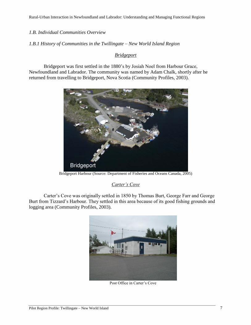
Bridgeport was first settled in the 1880’s by Josiah Noel from Harbour Grace,
Newfoundland and Labrador. The community was named by Adam Chalk, shortly after he
returned from travelling to Bridgeport, Nova Scotia (Community Profiles, 2003).
Bridgeport Harbour (Source: Department of Fisheries and Oceans Canada, 2005)
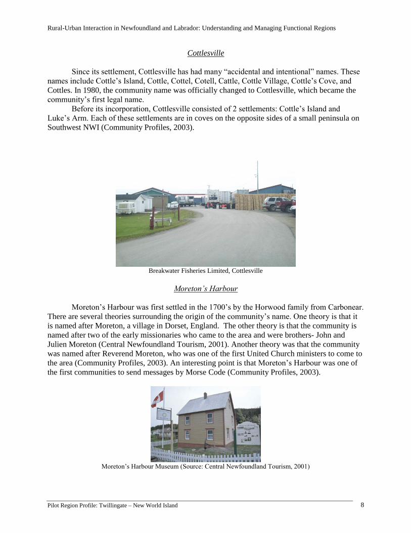
Carter’s Cove
Carter’s Cove was originally settled in 1850 by Thomas Burt, George Farr and George
Burt from Tizzard’s Harbour. They settled in this area because of its good fishing grounds and
logging area (Community Profiles, 2003).
Post Office in Carter’s Cove
Rural-Urban Interaction in Newfoundland and Labrador: Understanding and Managing Functional Regions
Pilot Region Profile: Twillingate – New World Island 8
Cottlesville
Since its settlement, Cottlesville has had many “accidental and intentional” names. These
names include Cottle’s Island, Cottle, Cottel, Cotell, Cattle, Cottle Village, Cottle’s Cove, and
Cottles. In 1980, the community name was officially changed to Cottlesville, which became the
community’s first legal name.
Before its incorporation, Cottlesville consisted of 2 settlements: Cottle’s Island and
Luke’s Arm. Each of these settlements are in coves on the opposite sides of a small peninsula on
Southwest NWI (Community Profiles, 2003).
Breakwater Fisheries Limited, Cottlesville
Moreton’s Harbour
Moreton’s Harbour was first settled in the 1700’s by the Horwood family from Carbonear.
There are several theories surrounding the origin of the community’s name. One theory is that it
is named after Moreton, a village in Dorset, England. The other theory is that the community is
named after two of the early missionaries who came to the area and were brothers- John and
Julien Moreton (Central Newfoundland Tourism, 2001). Another theory was that the community
was named after Reverend Moreton, who was one of the first United Church ministers to come to
the area (Community Profiles, 2003). An interesting point is that Moreton’s Harbour was one of
the first communities to send messages by Morse Code (Community Profiles, 2003).
Moreton’s Harbour Museum (Source: Central Newfoundland Tourism, 2001)

Rural-Urban Interaction in Newfoundland and Labrador: Understanding and Managing Functional Regions
Pilot Region Profile: Twillingate – New World Island 9
Parkview
Parkview, formerly known as Dark Hole, was first settled in 1970 by Stanley Burt.
Parkview was given its new name after a survey was taken of all the community residents. The
name Parkview was decided upon since the community had an excellent view of Dildo Run
Provincial Park (Community Profiles, 2003).
A privately-owned sawmill in Parkview.
Summerford
Summerford was first settled in 1892 by Mr. and Mrs. Thomas Wheeler. After being
originally called Farmer’s Arm, the name was changed to Summerford in 1912.
Years ago, the main industry in Summerford was schooner building. The schooners were
built and fitted for the cod fishery, and then sailed to Labrador and the French Shore by the men
who built them (Community Profiles, 2003).
Summerford Town Hall and Community Centre

Rural-Urban Interaction in Newfoundland and Labrador: Understanding and Managing Functional Regions
Pilot Region Profile: Twillingate – New World Island 10
Tizzard’s Harbour
The first settlers of Tizzard’s Harbour were Vincent and Rebecca Tizzard, who came from
England sometime between 1750 and 1800 (Community Profiles, 2003).
Tizzard’s Harbour United Church
Twillingate
About 100 years ago, Twillingate was a thriving community in Newfoundland as it was
one of the busiest trade and service centres for the Labrador and Northern shore fisheries. Now,
since its incorporation on September 30, 1965, the development of the former Newfoundland
railway, and the introduction of the cod moratorium in 1992, Twillingate has now re-invented
itself as “The Iceberg Capital of the World,” as icebergs, whales, and the rich culture and history
of Twillingate draw many visitors to the area each year.
Twillingate Harbour (Source: Department of Fisheries and Oceans Canada, 2005)

Rural-Urban Interaction in Newfoundland and Labrador: Understanding and Managing Functional Regions
Pilot Region Profile: Twillingate – New World Island 11
Twillingate is one of the few areas in Newfoundland and Labrador that can trace its
history back 3500 years to the inhabitiation of the Maritime Archiac Indians around 1500 B.C.
(The New Rural Economy Project, 2007). The existence of the Maritime Archaic Indians in
Twillingate was confirmed in 1967 when there was a major discovery of Maritime Archaic
artifacts in Back Harbour (Historica Canadiana, 2006).
The first European residents of Twillingate were a French fishing fleet between 1650 and
1690. The French first called the area “Toulinguet” because of its similarity to a group of islands
off of the coast of France (The New Rural Economy Project, 2007). Twillingate remained a
French fishing station until the Treaty of Utrecht in 1713 (The Canadian Encyclopedia, 2008). It
has also been thought that the French supposedly abandoned the area because of their fear of the
Beothuk people (Historica Canadiana, 2006).
The Beothuks were the native inhabits of the Twillingate area until the early-mid 1700s,
when the first English settlers arrived. These settlers consisted of four families- Moore, Smith,
Bath, Young, all of which are surnames that still exist in the area today (Historica Canadiana,
2006). The English settlers also anglicized the community name from “Toulinguet” to
“Twillingate” (The New Rural Economy Project, 2007).
By 1857, Twillingate had become of Newfoundland’s greatest fishing ports. At that time,
the community had about 400 fishing vessels, and 40 vessels were involved in the seal fishery.
The population was about 2300, and included the clergy, doctors, mechanics, fishermen and
merchants (Historica Canadiana, 2006).
Southside Twillingate, Date Unknown. (Source: www.twilliingate.net, 2008)
Even though the fishery was the main industry in Twillingate, there have been attempts to
diversify the economy. One such example is the Sleepy Cove (now located in Crow Head) copper
mine owned by the Great Northern Copper Company of North Dakota. After the mine opened in
1913, there were high hopes for its success, but after only a few loads of ore were shipped out,

Rural-Urban Interaction in Newfoundland and Labrador: Understanding and Managing Functional Regions
Pilot Region Profile: Twillingate – New World Island 12
the price of copper plummeted. The mine closed in 1917 (Historica Canadiana, 2006). Pieces of
equipment belonging to the mine can still be seen at Sea Breeze Park in Crow Head.
Shoal Tickle, Date Unknown. (Source: Adey, 2007)
Perhaps the most famous resident of Twillingate was Georgina Sterling, who was a world
renown opera singer. Georgina Sterling was born on April 3, 1867 to Dr. William Sterling,
Twillingate’s first doctor (Historica Canadiana, 2006; The New Rural Economy Project, 2007).
As a child she showed a lot of promise as a soprano opera singer, and seeing as there was no local
training available, she moved to Paris to study under Madame Marchesi. Georgina travelled
around the world and amazed people worldwide with her performance. She performed under the
stage name “Mme. Marie Toulinguet,” but it was singing ability that earned her the name
“Nightingale of the North.” Tragically, illness prematurely ended Georgina’s singing career. As a
result, she returned to Twillingate and died in relative obscurity in 1935. In 1964, the citizens of
Twillingate erected a headstone to mark her grave. It said “The Nightingale of the North sang
fairer than the larks of Italy. She entertained royalty by her voice, the poor by the kindness of her
heart. Erected by an admiring public, 1964” (The New Rural Economy Project, 2007).
Georgina Sterling. (Source: The Iceberg Shop, 2008)
Another pivotal point in Twillingate’s history was the building of the Notre Dame Bay
Memorial Hospital (NDBMH). After the end of World War I, Twillingate residents started a
Rural-Urban Interaction in Newfoundland and Labrador: Understanding and Managing Functional Regions
Pilot Region Profile: Twillingate – New World Island 13
movement to open their own hospital as a tribute to those who died in the war (Historica
Canadiana, 2006). After three years of construction, the hospital officially opened for patients on
October 1, 1924. However, part of the original hospital was destroyed by a fire in 1943. A new
hospital was opened in 1974, very close to the original hospital’s location (Historica Canadiana,
2006).
Fire at the Old Hospital, 1943. (Source: Adey, 2007)
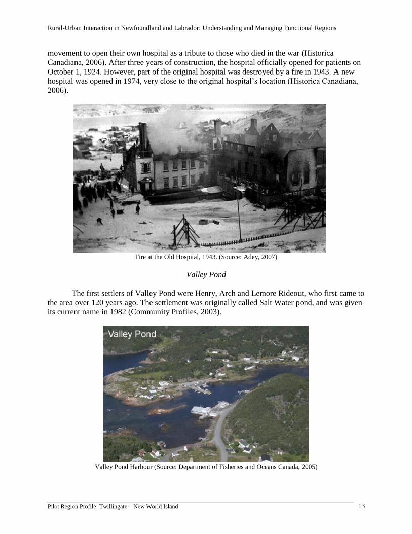
Valley Pond
The first settlers of Valley Pond were Henry, Arch and Lemore Rideout, who first came to
the area over 120 years ago. The settlement was originally called Salt Water pond, and was given
its current name in 1982 (Community Profiles, 2003).
Valley Pond Harbour (Source: Department of Fisheries and Oceans Canada, 2005)

Rural-Urban Interaction in Newfoundland and Labrador: Understanding and Managing Functional Regions
Pilot Region Profile: Twillingate – New World Island 14
Virgin Arm
Virgin Arm was first named by settlers who came to the area and were amazed by the vast
population of “virgin” Spruce trees (referring to the unharvested forest) that were located in the
area.
(Community Profiles, 2003).
Virgin Arm (Source: Glenn Rogers, 2008)

Rural-Urban Interaction in Newfoundland and Labrador: Understanding and Managing Functional Regions
Pilot Region Profile: Twillingate – New World Island 15
1.B.2 Comparison of Twillingate-NWI Region Communities
Fig 3. Community Populations
Source: Community Accounts, 2008. 1Data for Twillingate includes the communities of Black Duck Cove, Crow Head, Kettle Cove and Purcell’s
Harbour. 2Data for Virgin Arm includes the communities of Parkview, Chanceport and Carter’s Cove.
3Data for Herring Neck includes the communities of Cobb’s Arm, Fairbank, Green Cove, Hatchet Harbour, Indian
Cove, Merritt’s Harbour, Newville, Pike’s Arm, Roger’s Cove, Salt Harbour, Shoal Cove, Sunnyside and Toogood
Arm. 4The community of Durrell is included under the municipality of Twillingate.
All communities in the Twillingate-NWI region are experiencing a decline in population.
This decline is due to outmigration. Since the start of the cod moratorium, more residents have
been looking elsewhere for work. However, in recent years, while people are continuing to leave
the community to find employment, it seems to be individuals rather than families that are
leaving. For instance, many men are leaving to do seasonal or “shift” work in places such as
Alberta, while the women and children continue to live at home.
All of the communities are an important part of the region as many of the goods and
services regionally available are spread out amongst those communities. However, Twillingate
and Summerford seem to be the important service centres of the region. For example,
Summerford provides fire department services to all communities in NWI. Twillingate provides
the most shopping, accommodation and health services for the area.

Rural-Urban Interaction in Newfoundland and Labrador: Understanding and Managing Functional Regions
Pilot Region Profile: Twillingate – New World Island 16
The most important industry in the region is the fishery. There are three major fish
processors in the area- Breakwater Fish Processors in Bridgeport, Breakwater Fisheries in
Cottlesville and Notre Dame Seafoods in Twillingate. These businesses are a key part of the fish
industry in the area. Each processors employs residents from every community, not just their own
community, during the fishing season (depending on the species). As well, the processors tend to
buy their fish from local fishermen and in turn support their livelihood.
Another growing industry in the region is tourism, as thousands of tourists visit the area
during the summer months. Tourism benefits all communities in the area as tourist attractions
such as bed and breakfasts, restaurants, boat tours and museums are scattered throughout the
communities in the region. Tourism also provides many opportunities for local artists and
musicians to sell their products and gain wider popularity and recognition.
1.C. Regional Well-being
Table 2. Regional well-being indicators
Category Indicators Status
Social,
cultural and
human health
Demographics: ethnicity, population trends,
age
Education: facilities, levels of high-school and
post-secondary graduation
Health: mortality/life expectancy, fertility, self-
rated health
Social services
Culture: organizations, programs and events
Social capital: commitment to place, shared
sense of identity/history, social
conflict/cohesion, civil society, mutual aid
Population continues to
gradually decrease. Adequate
health services for the area.
Good education system,
despite declining enrolment.
Growing commitment to
preservation of culture and
history.
Economic
Employment by labour force
Employment rate
Median and total income
Gender participation
Trends in major sectors
Informal economic activity
Income has grown over the
past 20 years. Unemployment
is above the provincial rate.
The primary sector is the
number one employer. There
are 147 businesses, the highest
number in tourism.
Environmental
Waste management
Air and water pollution
Drinking water
Biodiversity/species health
Land and resource planning and management
Pollution is not a major
concern in the area, as much of
the natural wildlife is being
preserved. However, more
recycling programs are
needed.
Infrastructure
Roads
Docks and wharves
Information and communication
Water and sewer
Energy and heat
Road conditions are relatively
poor. Water and sewer,
information and
communication need to be
improved.

Rural-Urban Interaction in Newfoundland and Labrador: Understanding and Managing Functional Regions
Pilot Region Profile: Twillingate – New World Island 17
Social, Cultural and Human Health Indicators
Demographics
The Twillingate-NWI region is an area of about 5800 residents, mostly of Newfoundland
ancestry. Approximately 5.62% of the residents identify themselves as having aboriginal status,
while 3.44% of residents were born in a foreign country.
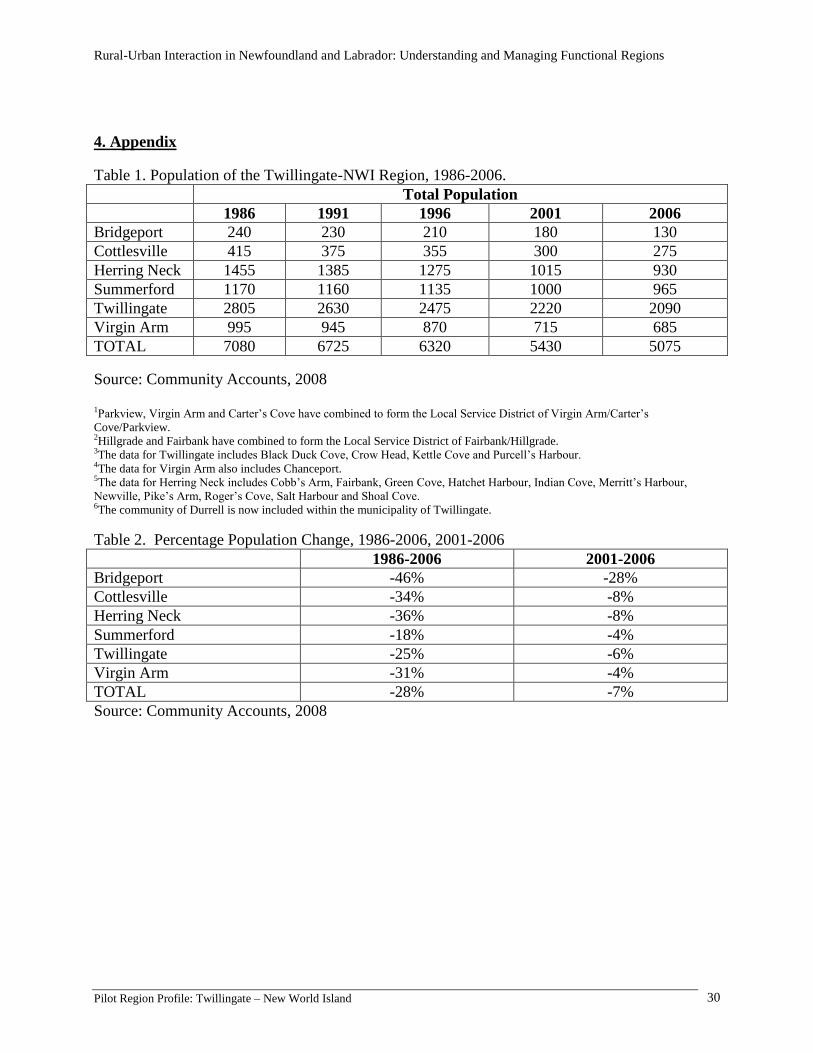
Since 1986, the population of the Twillingate-NWI area has been steadily declining (see
Appendix Table 1). While this is generally a concern to most residents in the area, there is a
growing concern about the lack of “young people” in the area, especially since the average age of
a person in the area is 47.8 years (Statistics Canada, 2008). Many residents feel that eventually
entire communities in the area will no longer exist since the population is aging, and as older
residents die, there will be no youth to replace them (see Appendix Graph 1).
The aging population is an important concern of local organizations and businesses.
Many businesses in the area have commented that it is difficult to find employees. For instance,
fish processors that require young people to unload fishing boats say that it is difficult to find
enough workers, especially during the busiest parts of the fishing season when there are many
boats that need their catch unloaded at the same time. Local non-government organizations on the
other hand, are experiencing similar problems. These organizations are finding it more and more
difficult to recruit new members. For example, the Loyal Orange Lodge (LOL) in Twillingate
once had over 400 members, now they only have 17 members. Most of the members have been
with the LOL for 50 years, with only 2 new members joining in the past three years. Since the
LOL is a volunteer organization, members are unable to carry out as many activities due to the
increasing age of their members, who range in age from approximately 50-95 years old. They fear
that since there are very few young people joining the organization and members continue to pass
away, that the LOL will be unable to work in the community for much longer.
Education
Currently, there are 3 schools in the Twillingate-NWI area: Twillingate Island
Elementary, J.M. Olds Collegiate and New World Island Academy. All 3 schools are under the
jurisdiction of the Nova Central School District.
Twillingate Island Elementary (TIE) is located in Twillingate, NL. It accommodates
students from kindergarden to grade 6 from all the communities on Twillingate Island. TIE was
originally built in the late 1940s as a four-room, all-grade school, and was operated by the United
Church Board of Education up to the end of the 1950s. It was one of many denominational
schools scattered throughout Twillingate Island. Prior to 1969, TIE served only those students
strictly from the town of Twillingate, while students from other communities on Twillingate
Island attended school in their own communities. In 1972, all the schools on Twillingate Island
became integrated and became a part of the Notre Dame Integrated School Board (Twillingate
Island Elementary website).
Rural-Urban Interaction in Newfoundland and Labrador: Understanding and Managing Functional Regions
Pilot Region Profile: Twillingate – New World Island 18
Twillingate Island Elementary
J.M. Olds Collegiate (JMOC) is a high school located in Twillingate, NL., that currently
serves students grades 7-12. JMOC was opened in September, 1960, and was first referred to as
the Regional High School. JMOC was formerly and unofficially called Twillingate Island Central
High School until it was officially renamed on March 22, 1980. It was named in honour of Dr.
J.M. Olds who practiced medicine in Twillingate for almost 50 years (J.M. Olds Collegiate
website).
J.M. Olds Collegiate
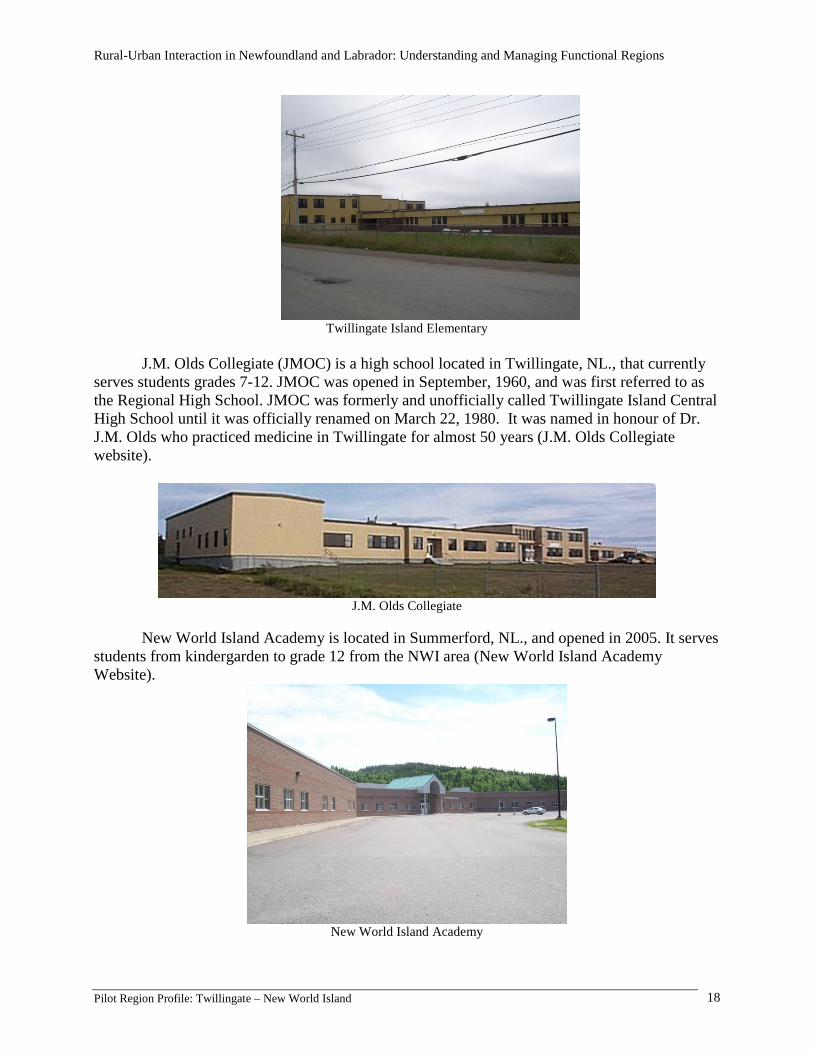
New World Island Academy is located in Summerford, NL., and opened in 2005. It serves
students from kindergarden to grade 12 from the NWI area (New World Island Academy
Website).
New World Island Academy

Rural-Urban Interaction in Newfoundland and Labrador: Understanding and Managing Functional Regions
Pilot Region Profile: Twillingate – New World Island 19
School enrolment in this area continues to gradually decrease due to smaller family sizes
and outmigration (see Appendix Graph 2 and Graph 3). Many residents of the area predict that as
school enrolment continues to decrease that eventually all schools on Twillingate and NWI will
be combined into one Kindergarden-Grade 12 school.
In the past, it was common for teenagers to leave school early in order to help out their
families or to begin working in the fishery. Today, most students stay in school to complete their
grade before beginning full-time work (See Appendix Table 5). Since there are no university or
colleges in the area, anyone wishing to pursue a higher education is forced to move out of the
area. The nearest university campuses are the Memorial University campuses in Corner Brook or
St. John’s. The nearest colleges are in Gander and Lewisporte.
Health
There are two health facilities in the Twillingate-NWI area. In Twillingate, the Notre
Dame Bay Memorial Health Centre serves all residents in the region. In the past, residents were
able to receive almost every type of medical treatment at this facility, including major surgeries,
as the health care centre was one of the few hospitals in Newfoundland at that time. Now, the
health care centre provides mainly outpatient care.
Notre Dame Bay Memorial Health Care Centre
In Summerford, the NWI Community Health Centre is a small clinic that provides basic medical
care to mainly NWI residents.
NWI Community Health Centre
Rural-Urban Interaction in Newfoundland and Labrador: Understanding and Managing Functional Regions
Pilot Region Profile: Twillingate – New World Island 20
Social Services
There are many different types of social services available to residents of the Twillingate-
NWI area. These include churches, fire department, RCMP, museums, art galleries, and
recreation facilities.
There are many churches located throughout the Twillingate-NWI for the following
denominations: Salvation Army, United Church, Pentecostal, Full Gospel, and Anglican. The
closest Roman Catholic Church is located in Boyd’s Cove, NL. All of these churches hold regular
Sunday Services, and most have active youth, men and women’s fellowship groups. Churches
that do not have an organized group for various reasons, such as low number of members in the
congregation, utilize the facilities of other churches or organize activities with other churches.
There are three volunteer fire departments in the area- Summerford and Tizzard’s Harbour
and Twillingate. The Twillingate Volunteer Fire Department serves all residents of Twillingate
Island. The Summerford Fire Department is made up of volunteers from Summerford, but the
department provides services to 17 communities on NWI, except Tizzard’s Harbour. Each
resident pays a fee to their respective community council which in turn is passed onto the Town
of Summerford ($15 per household). Tizzard’s formed its own fire department, but has an
agreement that the Summerford Volunteer Fire Department is available for back-up if needed.
There is one RCMP detachment in the Twillingate-NWI area which is located in
Twillingate. It serves all the communities in the Twillingate and NWI.
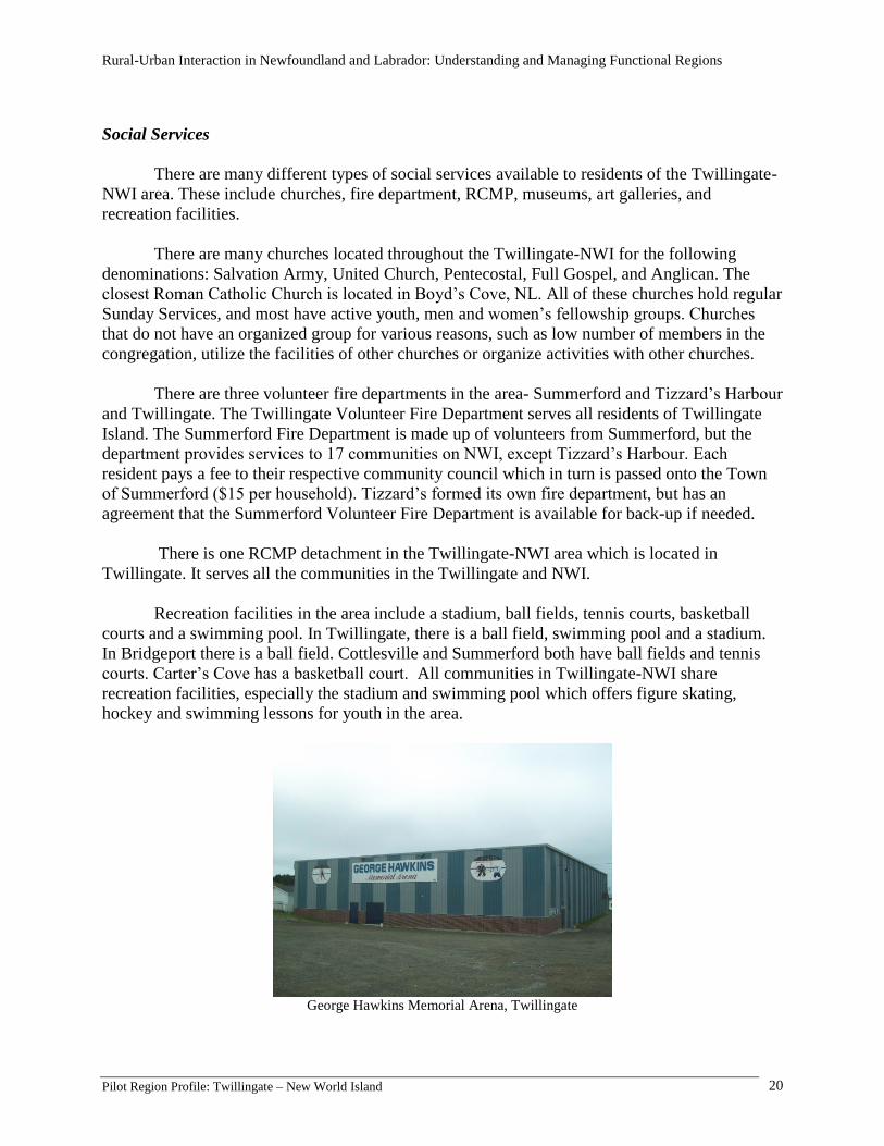
Recreation facilities in the area include a stadium, ball fields, tennis courts, basketball
courts and a swimming pool. In Twillingate, there is a ball field, swimming pool and a stadium.
In Bridgeport there is a ball field. Cottlesville and Summerford both have ball fields and tennis
courts. Carter’s Cove has a basketball court. All communities in Twillingate-NWI share
recreation facilities, especially the stadium and swimming pool which offers figure skating,
hockey and swimming lessons for youth in the area.
George Hawkins Memorial Arena, Twillingate
Rural-Urban Interaction in Newfoundland and Labrador: Understanding and Managing Functional Regions
Pilot Region Profile: Twillingate – New World Island 21
Culture
The preservation of Newfoundland culture and history is a very important part of life in
the Twillingate-NWI area. Since tourism is a growing industry in the region, many businesses,
entertainers and organizations are focused on showcasing Newfoundland’s rich culture.
Perhaps the two biggest cultural displays in the area are Cottlesville’s Festival By The
Bay held for two days in August, and the Twillingate-NWI Fish, Fun and Folk Festival held for
one week in July. Both of these festivals have meals, activities, entertainment and parades, all of
which contain some element of Newfoundland culture or history. Both of these events are well
attended not only by local residents but also visitors from around the world. There are also a
number of local artists, some of which have galleries that are listed among the businesses in he
appendix below.
Social Capital
There is a strong, positive sense of community in the Twillingate-NWI area, which is
evident by the large number and variety of community groups in the area (20 community
organizations and 14 based within and serving multiple communities in the Twillingate-New
World Island region). Each organization plays a vital role in improving some aspect of life in the
region.
Table 3. Non-government organizations
Category Group
Bus/Professional/Industry
Twillingate Harbour Authority
Harbour Authority of Bridgeport, Moreton’s Harbour and
Valley Pond
Herring Neck Harbour Authority
Women’s Organizations Women’s Institute
Breast Cancer Survivors Group
Service for Disabilities Community Living Committee
Twillingate Unpaid Caregivers Support Group
Emergency/Crisis Service
Twillingate Volunteer Fire Department
Summerford Volunteer Fire Department
Twillingate Red Cross
Health Services Community Advisory Committee (Primary Health)
Twillingate Hospital Auxiliary
Heritage/Preservation Twillingate Island Tourism Association
Fish, Fun & Folk Festival Committee
Family/Child Care/Youth YMCA Summerford Child Care Centre
Education/Training/Employment
Twillingate Public Library Board
NWI Island Academy School Advisory Committee
Twillingate Island Elementary School Council
J.M. Olds Collegiate School Council
Rural-Urban Interaction in Newfoundland and Labrador: Understanding and Managing Functional Regions
Pilot Region Profile: Twillingate – New World Island 22
Summerford Public Library Board
Service/Social Clubs
Twillingate Lions Club/Twillingate Leo Club
NWI Lions Club
Royal Canadian Legion Branch 21
Bridgeport and Area Kinsmen Club
Recreation/Sports
Twillingate Recreation Committee
Cottlesville Recreation Committee
Pike’s Arm Recreation Committee
Toogood Arm Recreation Committee
Religious Organizations/Churches Twillingate-NWI Ministerial Association
Social-Other
Loyal Orange Lodge
50+ Club
Twillingate Masonic
Economic Development Twillingate-NWI Development Association
All organizations in the area are facing similar challenges due to outmigration of young
people and the aging population. Many organizations are faced with the problem that since there
are less young people in the community, membership will continue to decrease. As well, many
organization representatives said that it is difficult to carry out activities in the community due to
the declining membership.
Another issue amongst community organizations is collaboration. Many organizations
feel that even though partnerships among groups in the same community are good, more
collaboration is needed between groups in different communities in order for the organizations
and communities to survive.
Economic Indicators
The main sources of employment in the Twillingate-NWI area are the fishery, tourism,
construction, and sales and services industries. Despite these major sources of employment, the
unemployment rate in this region is much higher than the provincial unemployment rate of 16.7%
(see Appendix Table 6).
Income for residents in the area has gradually increased over the past 15 years. The
average income has increased from about $12,000 in 1995 to $17,000 in 2005, or $13,872 in
1995 dollars1 (see Appendix Graph 4). The median family income has increased from about
$18,000 in 1990 to $30,000 in 2005, or $22,277 in 1990 dollars (see Appendix Graph 5).
Industry sectors based on worker type and occupation were looked at by first considering
Twillingate Island and New World Island separately, then in combination, in order to determine
the top 5 industries. This was done for 1996 and 2001 for comparative purposes, and to outline
potential short-term economic trends.
The top 5 industries in order for 1996 were identified as: primary (grouped as fishers,
loggers, and other), sales and service, construction and related, processing and manufacturing, 1 http://www.bankofcanada.ca/en/rates/inflation_calc.html

Rural-Urban Interaction in Newfoundland and Labrador: Understanding and Managing Functional Regions
Pilot Region Profile: Twillingate – New World Island 23
and office and related. The top 5 industries in order for 2001 were identified as: sales and
service, construction and related, primary, processing and manufacturing, and office and related.
The most significant change is the shift of the primary industry from first to third place (see
Appendix Tables A6.1, A6.2, A6.3).
The percentage of workers of the total workforce employed in the primary industry saw a
28% drop between 1996 and 2001, making it the industry with the greatest decrease out of the
total industries. Processing and manufacturing recorded the second greatest decrease with a 10%
decrease, sales and services came in third with a decrease of 5%, and office and related dropped
by 3%. Construction and related saw an increase by 12%. In total, the workforce saw a 6%
decrease in the 5 year period, going from 3,395 workers to 3,205 workers (ibid).
In 2000, 375 out of 1720 workers were employed in primary industries in New World
Island (agriculture, forestry, fishing, and hunting), representing 22% of the total workforce. In
the same year, Twillingate Island had 215 workers out of 1485 in primary industries, representing
14.5% of the total workforce. In total, there were 630 workers out of 3205 for the region of
Twillingate – NWI for a total of 20% of employment dedicated to the primary industry sector
(Appendix ). While a decline from 26% in 1995, primary sector employment remains significant,
particularly on New World Island.
When looking at the distribution of businesses in the region, the greatest number of
businesses by category fall under tourism/accommodation, with 40 of 147 listed businesses
(27%). The second highest category is professional/technical services (26), and the third is
financial, insurance, and real estate, with 11 businesses. Restaurant and wholesale and/or retail
other tie with 10 listed businesses, and the specialty retail stores category has 9 businesses.
Please note that those businesses not falling within any categories have been classified as “other”,
of which there are 15 (see Appendix - List of Businesses).
Environmental Indicators
Waste Management
Garbage disposal on Twillingate Island is carried out by the Town of Twillingate and
garbage is carried to a community dump in Durrell. In NWI, garbage is carried to a community
landfill located just outside of Summerford. The waste disposal service is organized on NWI by
the Waste Disposal Committee, which is responsible for garbage collection in all NWI
communities, except Summerford. The Town of Summerford manages garbage collection in its
town.
There is one recycling centre located in the area that collects only beverage containers
(Green Depot in Twillingate). From discussions with local residents, many people feel that more
recycling programs need to be developed in the area to include cardboard, paper and other types
of plastic.

Rural-Urban Interaction in Newfoundland and Labrador: Understanding and Managing Functional Regions
Pilot Region Profile: Twillingate – New World Island 24
Air and Water Pollution
The air quality of the Twillingate-NWI area is considered to be “relatively good” and has
an air quality value of 25 or less (exact air quality value for each community was unavailable).
The Air Quality Index is an indicator of air quality based on hourly measurements of 6 of the
most common air pollutants (sulfur dioxide (SO2), ground-level ozone (O3), nitrogen dioxide
(NO2), total reduced sulfur (TRS), carbon monoxide (CO), and fine particulate matter (PM2.5)).
(Environment Canada, 2008).
The quality of water surrounding the Twillingate-NWI area is relatively good. However,
water pollution is a concern. For example, the Twillingate Harbour Authority is concerned that
quality of water in Twillingate harbour is being destroyed by the town’s sewer system which
flows into the harbour, and by boats that sometimes dump their waste into the water rather than
properly disposing it. The Harbour Authority feels that these activities will eventually destroy the
local ecosystem. In the meantime, they feel that it will discourage people from docking their
boats in the area, especially tourists who visit the area by boat.
Drinking Water
Drinking water in the Twillingate-NWI area is relatively safe. There is a history of boil
advisories in the area’s municipalities (Department of Environment and Conservation, 2008). The
main concern with drinking water in the overall region seems to be its colour, but that is a
problem found throughout main areas of Newfoundland and Labrador.
It is rather difficult to obtain water quality data for this area as many residents, especially
those in local service districts, still use their own artesian wells or use local service district
watersheds which are not monitored regularly. The communities have mostly not been ranked in
the provincial Drinking Water Quality Index for Public Water Supplies due to boil advisories in
place or an inadequate number of Trihalomethane (THM) samples to compare to THM guidelines
(ibid).
The Town of Twillingate has its own town water supply that serves almost 100% of its
residents. The towns of Summerford and Cottlesville have a joint town water supply. Many of the
local service districts in this area do not have their own community water supply with the
exceptions of Herring Neck, Moreton’s Harbour, Purcell’s Harbour, and Fairbank/Hillgrade.
Biodiversity/Species Health
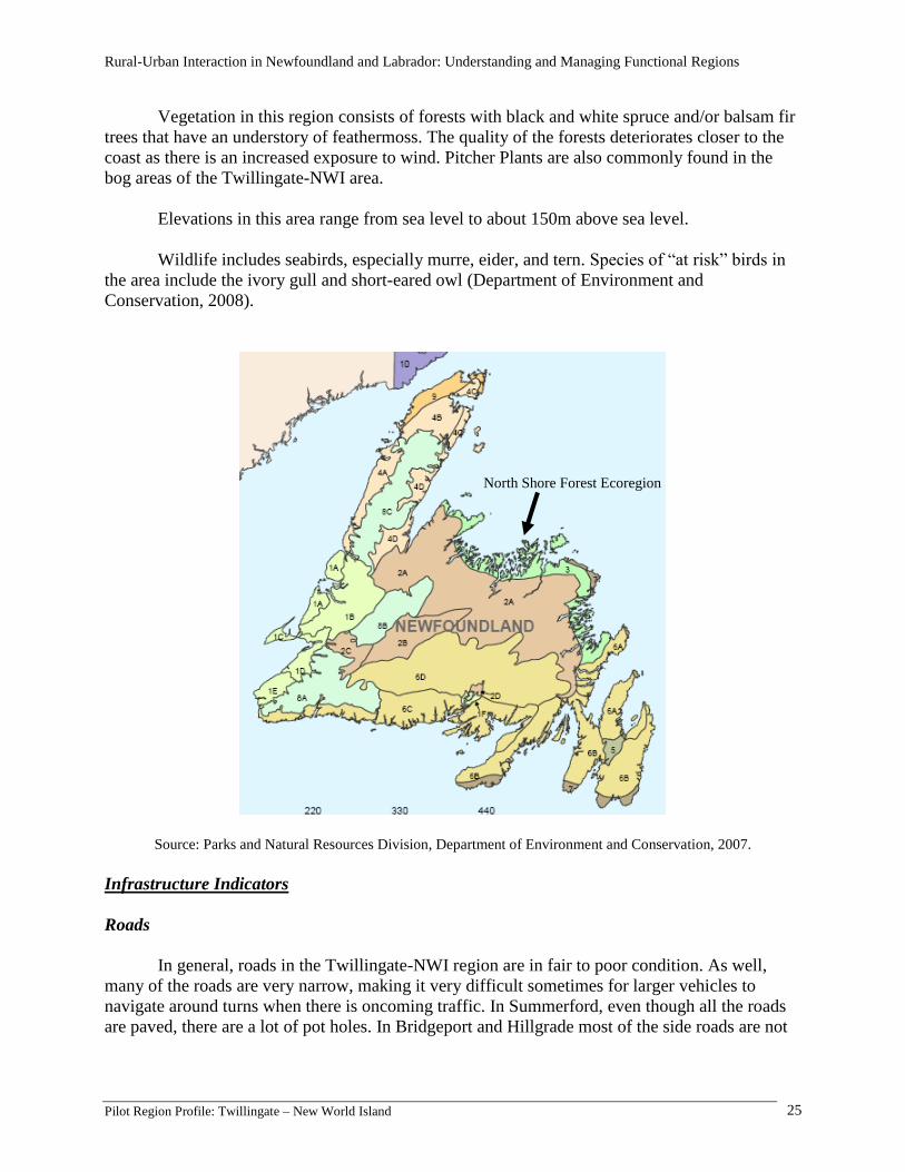
The Twillingate-NWI area is included in the Boreal Shield, which is one of Canada’s
many terrestrial ecozones. Within the Boreal Shield, the Twillingate-NWI area is a part of the
North Shore Forest Ecoregion, which spans along the North shore of Newfoundland from the
Northern Peninsula to Bonavista. The climate in this region includes short, cold winters and cool
summers. However, the summers in this area is the warmest among the provincial coastal region
and is the driest part of the island. The average summer temperature in this region is 12.5ºC and
the average winter temperature is -3.5ºC. Annual precipitation ranges from 900-1000mm.
Rural-Urban Interaction in Newfoundland and Labrador: Understanding and Managing Functional Regions
Pilot Region Profile: Twillingate – New World Island 25
Vegetation in this region consists of forests with black and white spruce and/or balsam fir
trees that have an understory of feathermoss. The quality of the forests deteriorates closer to the
coast as there is an increased exposure to wind. Pitcher Plants are also commonly found in the
bog areas of the Twillingate-NWI area.
Elevations in this area range from sea level to about 150m above sea level.
Wildlife includes seabirds, especially murre, eider, and tern. Species of “at risk” birds in
the area include the ivory gull and short-eared owl (Department of Environment and
Conservation, 2008).
Source: Parks and Natural Resources Division, Department of Environment and Conservation, 2007.
Infrastructure Indicators
Roads
In general, roads in the Twillingate-NWI region are in fair to poor condition. As well,
many of the roads are very narrow, making it very difficult sometimes for larger vehicles to
navigate around turns when there is oncoming traffic. In Summerford, even though all the roads
are paved, there are a lot of pot holes. In Bridgeport and Hillgrade most of the side roads are not
North Shore Forest Ecoregion

Rural-Urban Interaction in Newfoundland and Labrador: Understanding and Managing Functional Regions
Pilot Region Profile: Twillingate – New World Island 26
even paved. During the past few months, much of the pavement on the highway from Hillgrade
to Twillingate has been replaced, making the drive through this section of the region much better.
Docks and Wharves
Since fishing is one of the main industries in the Twillingate-NWI area, docks and
wharves are an important part of life. There are wharves and docks scattered throughout the area,
some residents have a personal wharf, whereas others use the larger wharves operated by the
Harbour Authorities and companies.
Harbour Authorities are local organizations that operate and manage harbours according
to the needs of the local area. Harbour Authorities provide services such as laundry facilities,
lounges, showers, ice and wharf space to local boats as well as boats from outside of the local
area. There are 3 Harbour Authorities in the region- Twillingate Harbour Authority, Herring Neck
Harbour Authority and Harbour Authority of Bridgeport, Moreton’s Harbour and Valley Pond.
The Twillingate Harbour Authority is responsible for 4 sites (wharves) in Twillingate, 2 of which
are owned by the Department of Fisheries and Oceans and 2 are owned by the Town of
Twillingate. The Herring Harbour Authority is responsible for 1 wharf in Herring Neck. The
Harbour Authority of Bridgeport, Moreton’s Harbour and Valley Pond is responsible for wharves
in 3 communities- Bridgeport, Moreton’s Harbour and Valley Pond.
Twillingate Harbour Authority
Information and Communications
Information and communication services have improved in the past few years. Most
communities have cell phone service and cable TV. However, some of the local service districts
and unincorporated communities such as Little Harbour and Purcell’s Harbour do not have cable
TV service.
In regards to internet services, many communities have wireless and cable internet. Many
residents hope that internet services will be upgraded to broadband in the near future.
There are also places such as the Twillingate Public Library and the Visitors Information
Centre in Newville which provide free wireless internet for local residents and tourists to use free

Rural-Urban Interaction in Newfoundland and Labrador: Understanding and Managing Functional Regions
Pilot Region Profile: Twillingate – New World Island 27
of charge. The Twillingate Public Library also has a CAP site which provides computers
available for use as well as computer classes throughout the year.
Water and Sewer
The Town of Twillingate has its own town water supply that serves almost 100% of its
residents. The towns of Summerford and Cottlesville have a joint town water supply. Many of the
local service districts in this area do not have their own community water supply with the
exceptions of Herring Neck, Moreton’s Harbour, Purcell’s Harbour, and Fairbank/Hillgrade.
Twillingate, Summerford, Cottlesville and Fairbank/Hillgrade have their own sewer
systems, which dispose of wastewater through outfalls to waterbodies. However, there are also
residents who still use their own septic tanks. For central NL, 76% of municipalities rely on
outfalls; 70% provincially. In central NL, 46% of municipalities have residences with private-
septic systems; 47% in the province as a whole.
Energy and Heat
Due to the cold, long winters experienced in the Twillingate-NWI region, many residents
depend upon wood and oil heat to keep their homes warm. Many residents still make trips into
the woods throughout the year to get wood for their homes.
Since this region receives a lot of wind throughout the year, there are a couple of
organizations in the year who are investigating the possibility of using wind mills to generate
electricity for the area.
Resident Views on Community Well-Being
Based on the data obtained from interviews with local business and organization
representatives, most community residents feel optimistic about the future of communities in the
area. Many residents feel that there is a great interest in their community and that residents will
not let their community “die.” They feel that their community will survive because the fishery
seems to be stable and the tourism industry is continuing to grow.
Residents who are not optimistic about the future of their community blame it on the lack
of young people in the community due to outmigration. Some people feel that their community
will eventually become a “vacation community” as “immigrants” continue to move in. In
addition, residents feel that since we are not connected to an urban area, this region will not
benefit from new oil developments in the province.
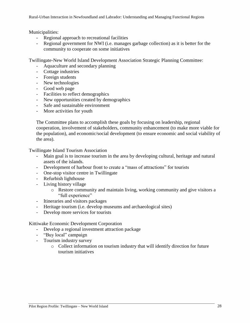
2. Future directions for the region
There are several groups in the Twillingate-NWI that strive to improve life in the area through the
use of strategic planning. The following groups have created and actively pursued strategic plan
goals for the area. They include:
Rural-Urban Interaction in Newfoundland and Labrador: Understanding and Managing Functional Regions
Pilot Region Profile: Twillingate – New World Island 28
Municipalities:
- Regional approach to recreational facilities
- Regional government for NWI (i.e. manages garbage collection) as it is better for the
community to cooperate on some initiatives
Twillingate-New World Island Development Association Strategic Planning Committee:
- Aquaculture and secondary planning
- Cottage industries
- Foreign students
- New technologies
- Good web page
- Facilities to reflect demographics
- New opportunities created by demographics
- Safe and sustainable environment
- More activities for youth
The Committee plans to accomplish these goals by focusing on leadership, regional
cooperation, involvement of stakeholders, community enhancement (to make more viable for
the population), and economic/social development (to ensure economic and social viability of
the area).
Twillingate Island Tourism Association
- Main goal is to increase tourism in the area by developing cultural, heritage and natural
assets of the islands.
- Development of harbour front to create a “mass of attractions” for tourists
- One-stop visitor centre in Twillingate
- Refurbish lighthouse
- Living history village
o Restore community and maintain living, working community and give visitors a
“full experience”
- Itineraries and visitors packages
- Heritage tourism (i.e. develop museums and archaeological sites)
- Develop more services for tourists
Kittiwake Economic Development Corporation
- Develop a regional investment attraction package
- “Buy local” campaign
- Tourism industry survey
o Collect information on tourism industry that will identify direction for future
tourism initiatives
Rural-Urban Interaction in Newfoundland and Labrador: Understanding and Managing Functional Regions
Pilot Region Profile: Twillingate – New World Island 29
3. References
Adey, T. (2007). Twillingate history exhibit. Retrieved August 21, 2008, from
http://www.twillingate.net/history/exhibit/
Central Newfoundland Tourism. (2001). Moreton’s Harbour. Retrieved August 21, 2008, from
http://www.centralnewfoundland.com/moretonsharbour.php3
Department of Fisheries and Oceans Canada. (2005). Harbours- National List. Retrieved August 21, 2008,
from http://www.dfo-mpo.gc.ca/sch/nat-harb_e.asp
Environment Canada. (2006). Air quality. Retrieved August 21, 2008, from
http://www.atl.ec.gc.ca/airquality/largemap_e.html
Government of Newfoundland and Labrador. (2008). Retrieved August 21, 2008, from
http://www.communityaccounts.ca/communityaccounts/onlinedata/getdata.asp
Historica Canadiana. (2006). Twillingate a brief history. Retrieved August 21, 2008, from
http://www.historica.ca/history_of_twillingate.php
J.M. Olds Collegiate. (2004). Dr. John McKee Olds. Retrieved August 21, 2008, from
http://www.k12.nf.ca/jmolds/school/jmoc.html
New World Island Academy. (2007). New World Island. Retrieved August 21, 2008, from
http://www.nwia.k12.nf.ca/overview.htm
Pitt, J.E.M., & Pitt, R.D. (2008). Twillingate. Retrieved August 21, 2008 from
http://www.thecanadianencyclopedia.com/index.cfm?PgNm=TCE&Params=A1ARTA0008182
Rogers, G. (n.d.) Favs: Virgin Arm. Retrieved August 21, 2008, from
http://www.grrphotography.com/Collections/VirginArm/index.htm
Sheldon, A. (2007). New World Island accommodations and attractions. Retrieved August 21, 2008, from
http://www.newworldisland.net/
The Iceberg Shop. (n.d.). The Iceberg Shop. Retrieved August 21, 2008, from
http://www.icebergtours.ca/icebergshop.htm
Town of Twillingate. (2006). Getting to Twillingate. Retrieved August 21, 2008, from
http://www.townoftwillingate.ca/Tourism_info.htm
Twillingate Island Elementary. (2004). Our school’s history. Retrieved August 21, 2008, from
http://www.k12.nf.ca/twillingate/history.html
Unknown. (2003). Community profiles. Retrieved August 21, 2008, from
http://www.k12.nf.ca/interisland/communities.htm
Department of Environment and Conservation (2008). Retrieved November 20, 2008, from
www.env.gov.nl.ca
Rural-Urban Interaction in Newfoundland and Labrador: Understanding and Managing Functional Regions
Pilot Region Profile: Twillingate – New World Island 30
4. Appendix
Table 1. Population of the Twillingate-NWI Region, 1986-2006.
Total Population
1986 1991 1996 2001 2006
Bridgeport 240 230 210 180 130
Cottlesville 415 375 355 300 275
Herring Neck 1455 1385 1275 1015 930
Summerford 1170 1160 1135 1000 965
Twillingate 2805 2630 2475 2220 2090
Virgin Arm 995 945 870 715 685
TOTAL 7080 6725 6320 5430 5075
Source: Community Accounts, 2008
1Parkview, Virgin Arm and Carter’s Cove have combined to form the Local Service District of Virgin Arm/Carter’s
Cove/Parkview. 2Hillgrade and Fairbank have combined to form the Local Service District of Fairbank/Hillgrade. 3The data for Twillingate includes Black Duck Cove, Crow Head, Kettle Cove and Purcell’s Harbour. 4The data for Virgin Arm also includes Chanceport. 5The data for Herring Neck includes Cobb’s Arm, Fairbank, Green Cove, Hatchet Harbour, Indian Cove, Merritt’s Harbour,
Newville, Pike’s Arm, Roger’s Cove, Salt Harbour and Shoal Cove. 6The community of Durrell is now included within the municipality of Twillingate.
Table 2. Percentage Population Change, 1986-2006, 2001-2006
1986-2006 2001-2006
Bridgeport -46% -28%
Cottlesville -34% -8%
Herring Neck -36% -8%
Summerford -18% -4%
Twillingate -25% -6%
Virgin Arm -31% -4%
TOTAL -28% -7%
Source: Community Accounts, 2008

Rural-Urban Interaction in Newfoundland and Labrador: Understanding and Managing Functional Regions
Pilot Region Profile: Twillingate – New World Island 31
Fig 1. Male and Female Population by Age Group for the Twillingate-NWI Region.
Source: Statistics Canada, 2006.
Table 3. Population Change by Sex 2001-2006
Twillingate
-New
World
Island
Male
s
(2001
)
Female
s
(2001)
Total
(2001
)
Male
s
(2006
)
Female
s
(2006)
Total
(2006
)
%
Chang
e
males
%
Chang
e
female
s
%
Chang
e
total
Total Age
Groups
3,415
3,340
6,760
3,155
3,125
6,280
-8%
-6%
-7%
Source: Community Accounts, 2008
Table 4. Population Distribution by Age (2006)
Age
Number
% of Total
Population
0-14
755
12%
15-64
1,900
69%
65+
1,170
19%
Source: Community Accounts, 2008

Rural-Urban Interaction in Newfoundland and Labrador: Understanding and Managing Functional Regions
Pilot Region Profile: Twillingate – New World Island 32
Fig 2. Total number of students in the Twillingate-NWI Region, 1998-2008.
Source: Community Accounts, 2008
Fig 3. Number students in the Twillingate-NWI area by Grade.

Rural-Urban Interaction in Newfoundland and Labrador: Understanding and Managing Functional Regions
Pilot Region Profile: Twillingate – New World Island 33
Table 5. Highest Level of Schooling of Twillingate-NWI Residents Highest Level of Schooling (%)
Without high
school diploma With
high
school
diploma
only
Trades or
non-
university
Some
university
Bachelor’s degree or
higher Bachelor’s
degree not
completed
Less
than
Grade
9
Grade
9-12
Bachelor’s
degree only
Above
Bachelor’s
degree
Bridgeport 24.1 24.1 20.7 17.2 10.3 .. .. 10.3
Cottlesville 25 50 7.7 15.4 .. .. .. ..
Durrell 25.2 30.1 11.2 27.3 6.3 1.4 .. 5.6
Herring Neck 34.1 28.3 13.9 16.8 7.5 .. .. 6.9
Moreton’s
Harbour 23.5 32.4 8.8 8.8 23.5 8.8 .. 17.6
Summerford 36.3 38 8.2 9.9 7 2.3 1.2 3.5
Twillingate 23.2 32.9 9.7 21.8 12.4 4.3 0.8 7.5
Valley Pond .. .. .. .. .. .. .. ..
Virgin Arm 35.2 35.2 14.8 9.8 4.9 1.6 .. 2.5
Source: Community Accounts, 2008 1Data for Twillingate includes the communities of Black Duck Cove, Crow Head, Kettle Cove and Purcell’s
Harbour. 2Data for Virgin Arm includes the communities of Parkview, Chanceport and Carter’s Cove.
3Data for Herring Neck includes communities of Cobb’s Arm, Fairbank, Green Cove, Hatchet Harbour, Indian Cove,
Merritt’s Harbour, Newville, Pike’s Arm, Roger’s Cove, Salt Harbour, Shoal Cove, Sunnyside and Toogood Arm. 4The community of Durrell is included under the municipality of Twillingate.
Table 6. Twillingate-NWI Labour Force Characteristics.
Labour Force (%)
In
Labour
Force
Employed Unemployed
Not in
Labour
Force
Employment
Rate
Unemployment
Rate
Black Duck
Cove 59 65.2 39.1 41 38.5 39.1
Bridgeport 52.4 70.2 29.8 47.6 36.8 29.8
Cottlesville 47.1 79.2 20.8 52.9 37.3 20.8
Crow Head 44.4 93.8 12.5 52.8 41.7 12.5
Summerford 49.4 66.3 34.9 50.6 32.7 34.9
Twillingate 55.3 76.4 23.6 44.7 42.3 23.6
Source: Statistics Canada 1This data is based on the population of each community that is 15 years old and older.
2The data for Black Duck Cove includes all the communities in Division 8, Subdivision I: Black Duck Cove, Kettle
Cove and Ragged Point. 3The data for Bridgeport includes all the communities in Division 8, Subdivision H: Bridgeport, Carter’s Cove,
Chanceport, Fairbank, Hillgrade, Indian Cove, Merritt’s Harbour, Moreton’s Harbour, Newville, Sunnyside, Salt
Harbour, Shoal Cove, Green Cove, Hatchet’s Harbour, Tizzard’s Harbour, Valley Pond and Virgin Arm. 4The data for Twillingate also includes the data for Durrell.

Rural-Urban Interaction in Newfoundland and Labrador: Understanding and Managing Functional Regions
Pilot Region Profile: Twillingate – New World Island 34
Fig 4. Average Income for Communities in the Twillingate-NWI Area.
Source: Community Accounts, 2008
1Data for Twillingate includes the communities of Black Duck Cove, Crow Head, Kettle Cove and Purcell’s
Harbour. 2Data for Virgin Arm includes the communities of Parkview, Chanceport and Carter’s Cove.
3Data for Herring Neck includes the communities of Cobb’s Arm, Fairbank, Green Cove, Hatchet Harbour, Indian
Cove, Merritt’s Harbour, Newville, Pike’s Arm, Roger’s Cove, Salt Harbour, Shoal Cove, Sunnyside and Toogood
Arm. 4The community of Durrell is included under the municipality of Twillingate.

Rural-Urban Interaction in Newfoundland and Labrador: Understanding and Managing Functional Regions
Pilot Region Profile: Twillingate – New World Island 35
Fig 5. Median Income for Communities in the Twillingate-NWI Area.
Source: Community Accounts, 2008 1Data for Twillingate includes the communities of Black Duck Cove, Crow Head, Kettle Cove and Purcell’s
Harbour. 2Data for Virgin Arm includes the communities of Parkview, Chanceport and Carter’s Cove.
3Data for Herring Neck includes the communities of Cobb’s Arm, Fairbank, Green Cove, Hatchet Harbour, Indian
Cove, Merritt’s Harbour, Newville, Pike’s Arm, Roger’s Cove, Salt Harbour, Shoal Cove, Sunnyside and Toogood
Arm. 4The community of Durrell is included under the municipality of Twillingate.

Rural-Urban Interaction in Newfoundland and Labrador: Understanding and Managing Functional Regions
Pilot Region Profile: Twillingate – New World Island 36
Table 6.1: Employment by Industry of Twillingate – NWI (Top 5 and Total)
1996 Employment by Industry (Top 5 and Total)
Detailed Industry Twillingate Island New World
Island
Twillingate - NWI
Primary (fishers,
loggers, other)
260 610 870 (26%)
Sales and service
425 415 840 (25%)
Construction and
related
335 350 685 (20%)
Processing &
Manufacturing
50 265 315 (9%)
Office and related
100 95 195 (6%)
Top 5 industries
total
1,170 1,735 2,905 (86%)
Total of all
industries
1,485 1,910 3,395
Source: Twillingate Island and New World Island, Employment and Working Conditions, Worker Type and
Occupation – Local Areas and Regions, Community Accounts, 2008
Table 6.2: Employment by Industry of Twillingate – NWI (Top 5 and Total)
2001 Employment by Industry (Top 5 and Total)
Detailed Industry Twillingate Island New World
Island
Twillingate - NWI
Sales and service 420 375 795 (25%)
Construction and
related
315 450 765 (24%)
Primary (fishers,
loggers, other)
210 420 630 (20%)
Processing &
manufacturing
75 210 285 (9%)
Office and related
130 60 190 (6%)
Top 5 industries
total
1,150 1,515 2,665 (83%)
Total of all
industries
1,485 1,720 3,205
Source: Twillingate Island and New World Island, Employment and Working Conditions, Worker Type and
Occupation – Local Areas and Regions, Community Accounts, 2008

Rural-Urban Interaction in Newfoundland and Labrador: Understanding and Managing Functional Regions
Pilot Region Profile: Twillingate – New World Island 37
Table 6.3: 1991-1996 Comparative Difference of Employment by Industry of Twillingate – NWI
(Top 5 and Total)
Employment by Industry - Comparative 1996-2001
Detailed Industry Twillingate – NWI
1996
Twillingate - NWI
2001
Comparative
Difference
Sales and service 840 795 -45 (-5%)
Construction and
related
685 765 +80 (+12%)
Primary (fishers,
loggers, other)
870 630 -240 (-28%)
Processing &
manufacturing
315 285 -30 (-10%)
Office and related
195 190 -5 (-3%)
Top 5 industries
total
2,905 2,665 -240 (-8%)
Total of all
industries
3,395 3,205 -190 (-6%)
Source: Twillingate Island and New World Island, Employment and Working Conditions, Worker Type and
Occupation – Local Areas and Regions, Community Accounts, 2008
Table 7. List of Businesses in Twillingate – New World Island Category Business
Major Supermarket (3) Twillingate Foodland
Farr’s Foodland
Twillingate Save Easy
Grocery Store (3) Herring Neck General Store
Canning Grocery
Stuckless’ Foodex
Convenience Store (6) King’s Vairety
C&R Variety
Barnes’ Store
Seaside Variety
Porter’s Convenience
Burt’s Variety Store
Restaurant (10) Dildo Run Snacks
Alvin’s Take-Out
The Coffee Cup and Pizza
Golden Restaurant
Dildo Run Snacks
R&J Restaurant
Harbourview Restaurant
Cozy Tea Room and Bakery (Restaurant & Bakery)

Rural-Urban Interaction in Newfoundland and Labrador: Understanding and Managing Functional Regions
Pilot Region Profile: Twillingate – New World Island 38
Mary Brown’s
FL Lobster Pool and Take-Out
Specialty Retail Store (9) AGA Variety (Liquor Store, Sporting Goods, Movie
Rental)
Islands Pizza and Tanning Salon
Isles Flowers
Twillingate Auto Supplies
J&J Fishmarket
Water Side Fish Market
The Paint Shop
Cohen’s (Furniture)
The Country Outport
Wholesale and/or retail other (10) Cloish’s Sales and Services Ltd.
Great Canadian Dollar Store
Sears Parcel Inquiry Office
Twillingate Pharmacy
New World Island pharmacy
Riff’s
Green Thmb Nursery
Notre Dame Agencies (Furniture and Hardware)
Gary’s Irving and Specialty Shop
AUK Island Enterprises
Agriculture and agrifoods (2) Cottlesville Farms
Ocean Fresh Mussels
Aquaculture
Fishery products (4) Breakwater Fisheries
Notre Dame Seafoods
Island Seafoods
Beothic Fish Processors
Food and/or beverage other than above (1) North 99 (Bar)
Wood products (2) Summerford Forest products
Cottlesville Lumber Company
Manufacturing (other) Sea Knife Kayaking (counted under tourism)
Life sciences Durrell Denture Clinic
Ocean technologies
Information/communications technology
Professional/technical services (26) Sally’s Salon
Watkins Ultramar
Twillingate Service Station Co Ltd.
Wade Anstey Beauty Salon
Notre Dame Compassionate Care (professional
home-care business)
Laite’s Small Engine Repairs
Isles Funeral Home
Rural-Urban Interaction in Newfoundland and Labrador: Understanding and Managing Functional Regions
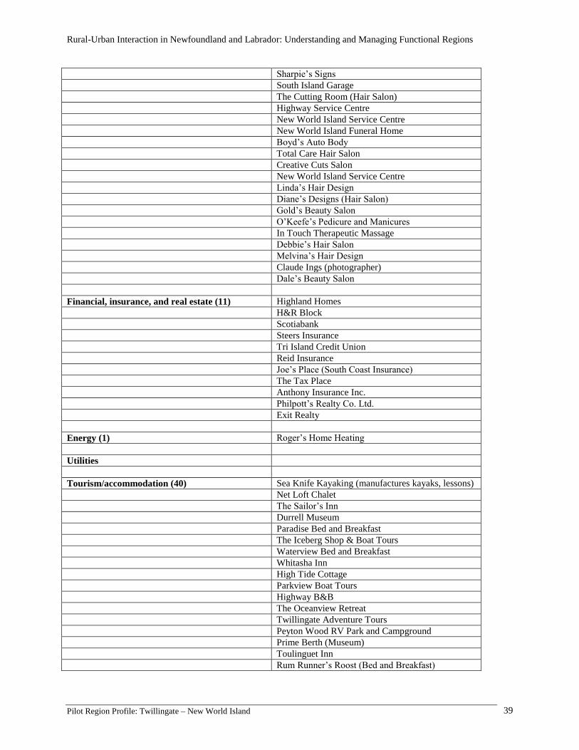
Pilot Region Profile: Twillingate – New World Island 39
Sharpie’s Signs
South Island Garage
The Cutting Room (Hair Salon)
Highway Service Centre
New World Island Service Centre
New World Island Funeral Home
Boyd’s Auto Body
Total Care Hair Salon
Creative Cuts Salon
New World Island Service Centre
Linda’s Hair Design
Diane’s Designs (Hair Salon)
Gold’s Beauty Salon
O’Keefe’s Pedicure and Manicures
In Touch Therapeutic Massage
Debbie’s Hair Salon
Melvina’s Hair Design
Claude Ings (photographer)
Dale’s Beauty Salon
Financial, insurance, and real estate (11) Highland Homes
H&R Block
Scotiabank
Steers Insurance
Tri Island Credit Union
Reid Insurance
Joe’s Place (South Coast Insurance)
The Tax Place
Anthony Insurance Inc.
Philpott’s Realty Co. Ltd.
Exit Realty
Energy (1) Roger’s Home Heating
Utilities
Tourism/accommodation (40) Sea Knife Kayaking (manufactures kayaks, lessons)
Net Loft Chalet
The Sailor’s Inn
Durrell Museum
Paradise Bed and Breakfast
The Iceberg Shop & Boat Tours
Waterview Bed and Breakfast
Whitasha Inn
High Tide Cottage
Parkview Boat Tours
Highway B&B
The Oceanview Retreat
Twillingate Adventure Tours
Peyton Wood RV Park and Campground
Prime Berth (Museum)
Toulinguet Inn
Rum Runner’s Roost (Bed and Breakfast)

Rural-Urban Interaction in Newfoundland and Labrador: Understanding and Managing Functional Regions
Pilot Region Profile: Twillingate – New World Island 40
Harbour Lights Inn
Old Found Land Inn
Robin’s Cove Guest House
Echoes of the Ocean Hospitality Home
All Around the Circle Dinner Theatre
Crewe’s Heritage Bed and Breakfast
Cricket Field Cottage
Anchor Inn Motel & Efficiency Units
Northern Lights Bed and Breakfast
Pike’s Arm Creations (Kayak, Camping, Fine Arts
and Crafts)
Twillingate Museum and Crafts
Josie’s Bed and Breakfast
Hillside Bed and Breakfast
North East Heritage Chuch Museum
Kelsie’s Inn
Iceberg Quest Boat Tours
Baabins by the Sea
Sea Fever Cottage
Moreton’s Harbour Museum
Sunset Bed and Breakfast
Serenity Cottage
Atlantic View Cabins
Captain’s Legacy
Construction (3) Gidge’s Construction
Whitewater Construction
Boyd’s Construction
Other (15) Lynch Art Gallery and Studio
Oakwood Enterprises Ltd.
Back Harbour Enterprises
Randy Hann (Artist and Studio)
A.R.K. Enterprises Inc.
Twillingate Marine Inc.
R&G Crafts
Town of Summerford
Canada Post
Fisherman’s Resource Centre
Sunset Manor (Seniors Home)
Double Decker Taxi
White’s Taxi
Driftwood Gallery and Fine Arts
Nova Central School District Bus Depot