Embed Size (px)
Citation preview
- 1 -
Copyright © 2011 Tata Consultancy Services Limited
Monday, September 12, 2016
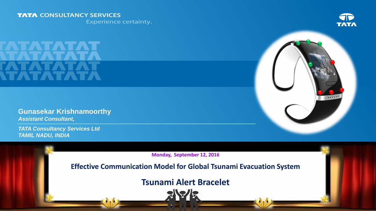
Effective Communication Model for Global Tsunami Evacuation System
Tsunami Alert Bracelet
Gunasekar Krishnamoorthy Assistant Consultant,
TATA Consultancy Services Ltd
TAMIL NADU, INDIA
- 2 - - 2 -
Agenda
Overview
Tsunami Device – Evacuation Algorithm
Tracing the mobility of Device
Enhancements
Tsunami Travel Time Prediction
Tsunami Alert for Registered Users
Proposed Solution
Feasibility Study – Let’s go Digital
Integrated Tsunami Warning Portal with Live Analysis
- 3 - - 3 -
Overview
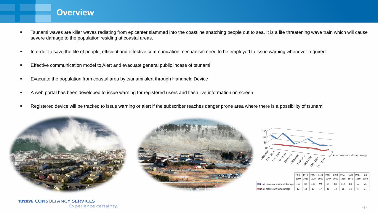
Tsunami waves are killer waves radiating from epicenter slammed into the coastline snatching people out to sea. It is a life threatening wave train which will cause
severe damage to the population residing at coastal areas.
In order to save the life of people, efficient and effective communication mechanism need to be employed to issue warning whenever required
Effective communication model to Alert and evacuate general public incase of tsunami
Evacuate the population from coastal area by tsunami alert through Handheld Device
A web portal has been developed to issue warning for registered users and flash live information on screen
Registered device will be tracked to issue warning or alert if the subscriber reaches danger prone area where there is a possibility of tsunami
1900-
1909
1910-
1919
1920-
1929
1930-
1939
1940-
1949
1950-
1959
1960-
1969
1970-
1979
1980-
1989
1990-
1999
No. of occurrence without damage
0
50
100
150
Tsunami impacts over decades
No. of occurrence without damage 107 82 137 99 54 80 112 83 67 76
No. of occurrence with damage 12 13 12 17 13 14 16 18 5 21
1900-
1909
1910-
1919
1920-
1929
1930-
1939
1940-
1949
1950-
1959
1960-
1969
1970-
1979
1980-
1989
1990-
1999
- 4 - - 4 -
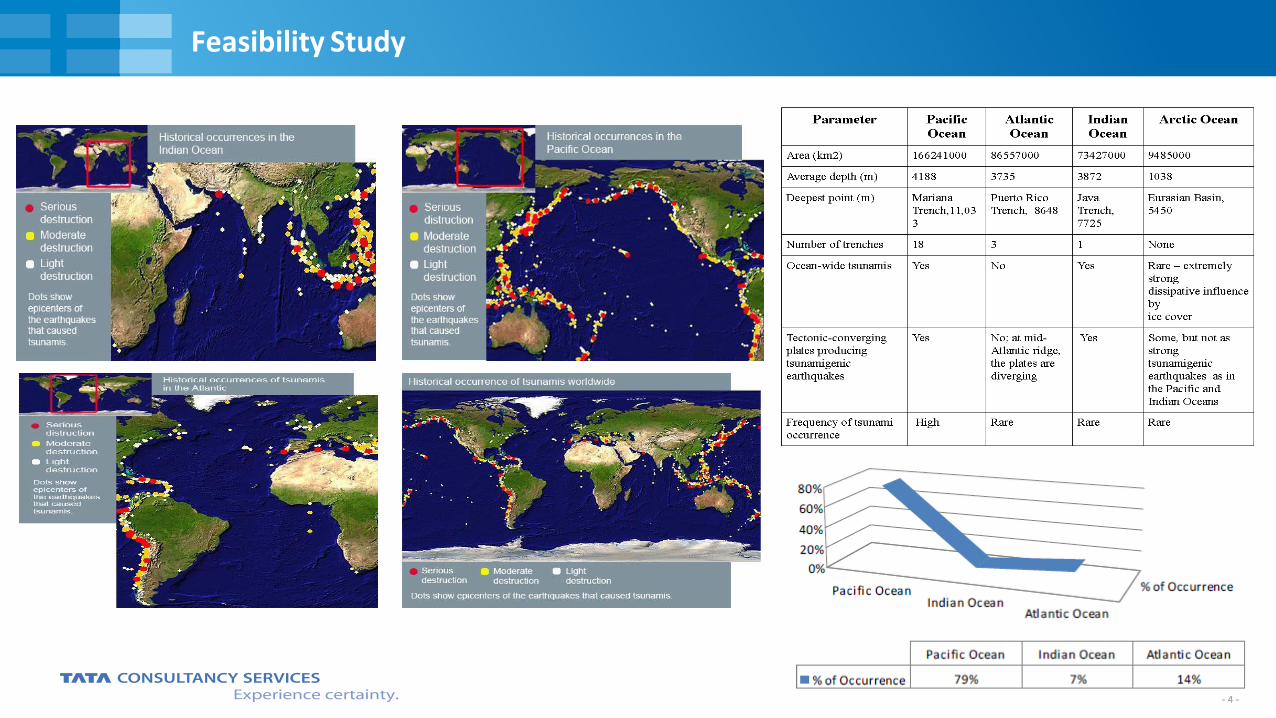
Feasibility Study
- 5 - - 5 -
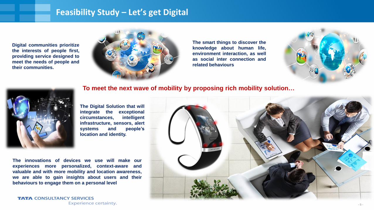
Feasibility Study – Let’s get Digital
The Digital Solution that will
integrate the exceptional
circumstances, intelligent
infrastructure, sensors, alert
systems and people’s
location and identity.
The smart things to discover the
knowledge about human life,
environment interaction, as well
as social inter connection and
related behaviours
Digital communities prioritize
the interests of people first,
providing service designed to
meet the needs of people and
their communities.
The innovations of devices we use will make our
experiences more personalized, context-aware and
valuable and with more mobility and location awareness,
we are able to gain insights about users and their
behaviours to engage them on a personal level
To meet the next wave of mobility by proposing rich mobility solution…
- 6 - - 6 -
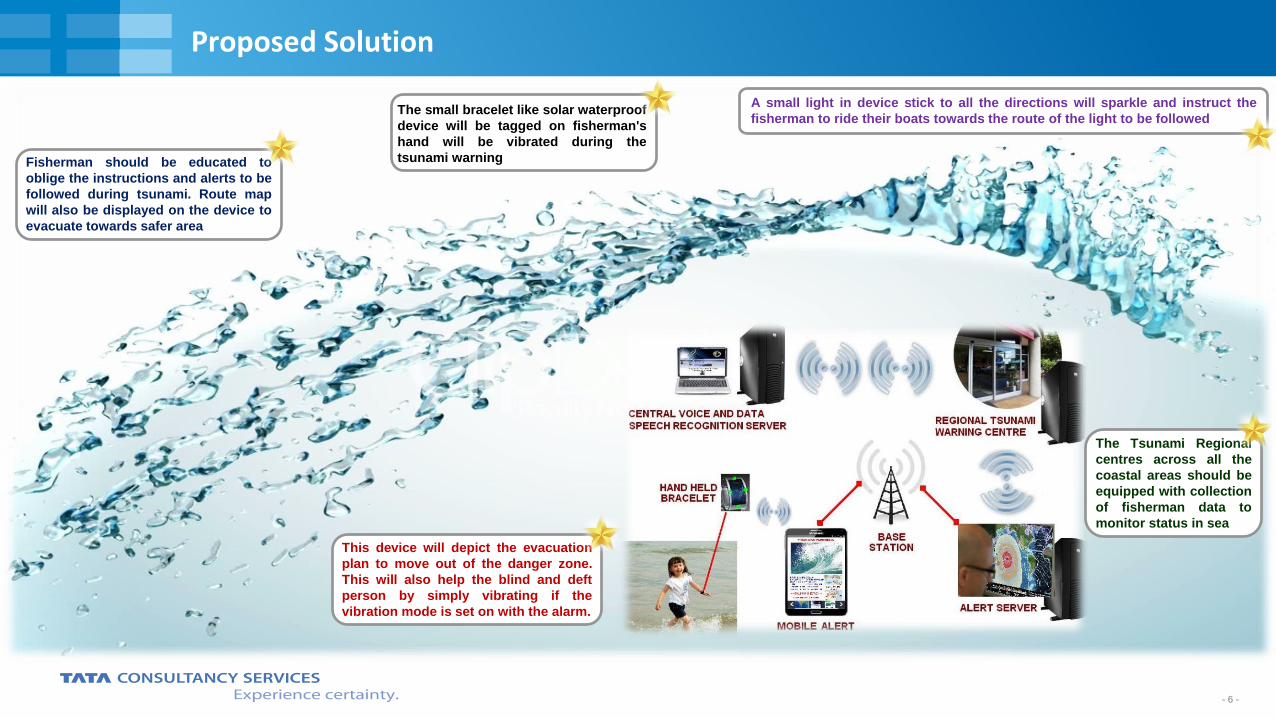
Proposed Solution
Fisherman should be educated to
oblige the instructions and alerts to be
followed during tsunami. Route map
will also be displayed on the device to
evacuate towards safer area
The small bracelet like solar waterproof
device will be tagged on fisherman's
hand will be vibrated during the
tsunami warning
A small light in device stick to all the directions will sparkle and instruct the
fisherman to ride their boats towards the route of the light to be followed
This device will depict the evacuation
plan to move out of the danger zone.
This will also help the blind and deft
person by simply vibrating if the
vibration mode is set on with the alarm.
The Tsunami Regional
centres across all the
coastal areas should be
equipped with collection
of fisherman data to
monitor status in sea
- 7 - - 7 -
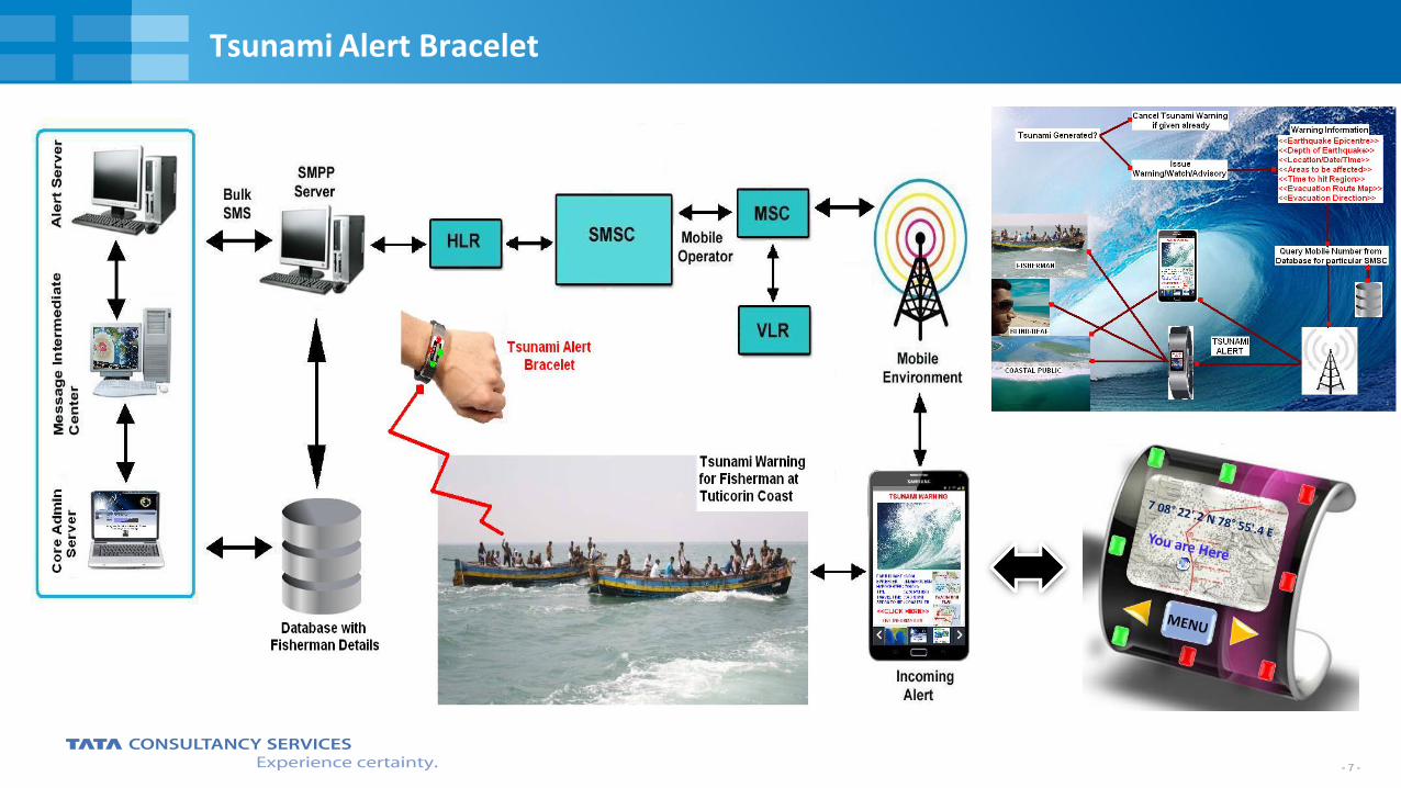
Tsunami Alert Bracelet
- 8 - - 8 -
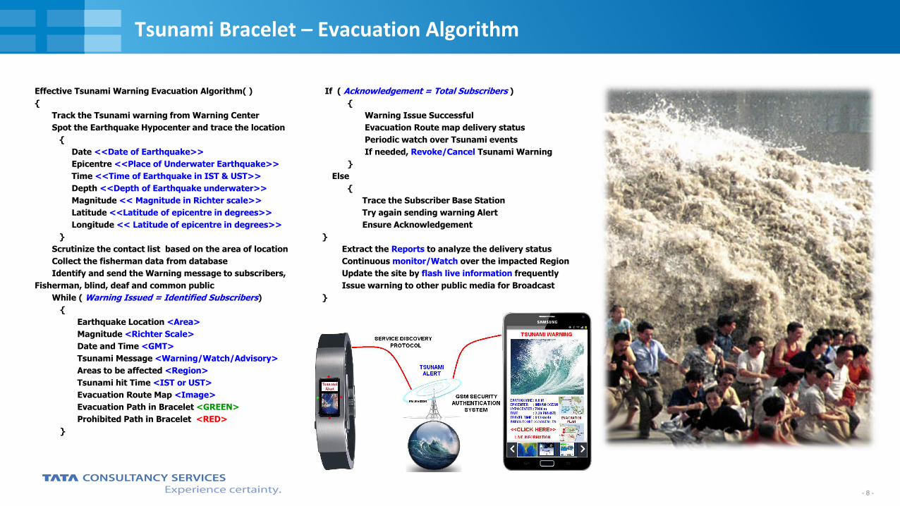
Tsunami Bracelet – Evacuation Algorithm
Effective Tsunami Warning Evacuation Algorithm( )
{
Track the Tsunami warning from Warning Center
Spot the Earthquake Hypocenter and trace the location
{
Date <<Date of Earthquake>>
Epicentre <<Place of Underwater Earthquake>>
Time <<Time of Earthquake in IST & UST>>
Depth <<Depth of Earthquake underwater>>
Magnitude << Magnitude in Richter scale>>
Latitude <<Latitude of epicentre in degrees>>
Longitude << Latitude of epicentre in degrees>>
}
Scrutinize the contact list based on the area of location
Collect the fisherman data from database
Identify and send the Warning message to subscribers,
Fisherman, blind, deaf and common public
While ( Warning Issued = Identified Subscribers)
{
Earthquake Location <Area>
Magnitude <Richter Scale>
Date and Time <GMT>
Tsunami Message <Warning/Watch/Advisory>
Areas to be affected <Region>
Tsunami hit Time <IST or UST>
Evacuation Route Map <Image>
Evacuation Path in Bracelet <GREEN>
Prohibited Path in Bracelet <RED>
}
If ( Acknowledgement = Total Subscribers )
{
Warning Issue Successful
Evacuation Route map delivery status
Periodic watch over Tsunami events
If needed, Revoke/Cancel Tsunami Warning
}
Else
{
Trace the Subscriber Base Station
Try again sending warning Alert
Ensure Acknowledgement
}
Extract the Reports to analyze the delivery status
Continuous monitor/Watch over the impacted Region
Update the site by flash live information frequently
Issue warning to other public media for Broadcast
}
- 9 - - 9 -
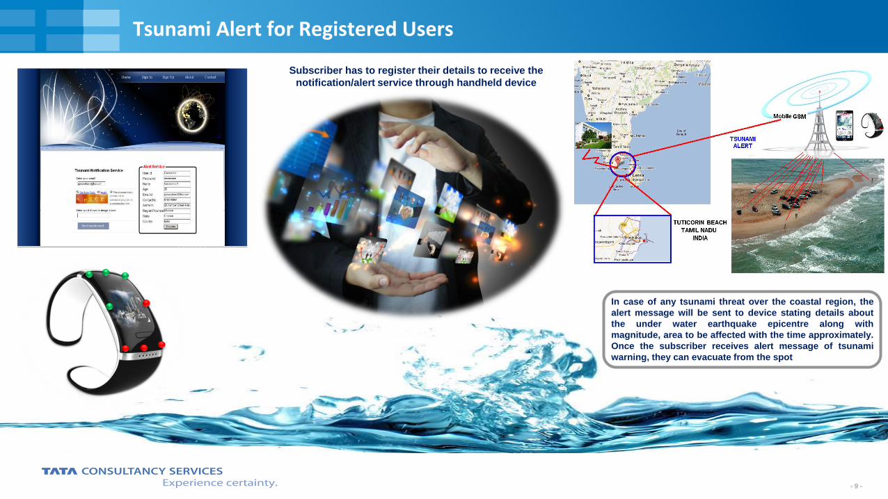
Tsunami Alert for Registered Users
Subscriber has to register their details to receive the
notification/alert service through handheld device
In case of any tsunami threat over the coastal region, the
alert message will be sent to device stating details about
the under water earthquake epicentre along with
magnitude, area to be affected with the time approximately.
Once the subscriber receives alert message of tsunami
warning, they can evacuate from the spot
- 10 - - 10 -
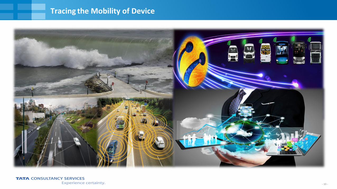
Tracing the Mobility of Device
- 11 - - 11 -
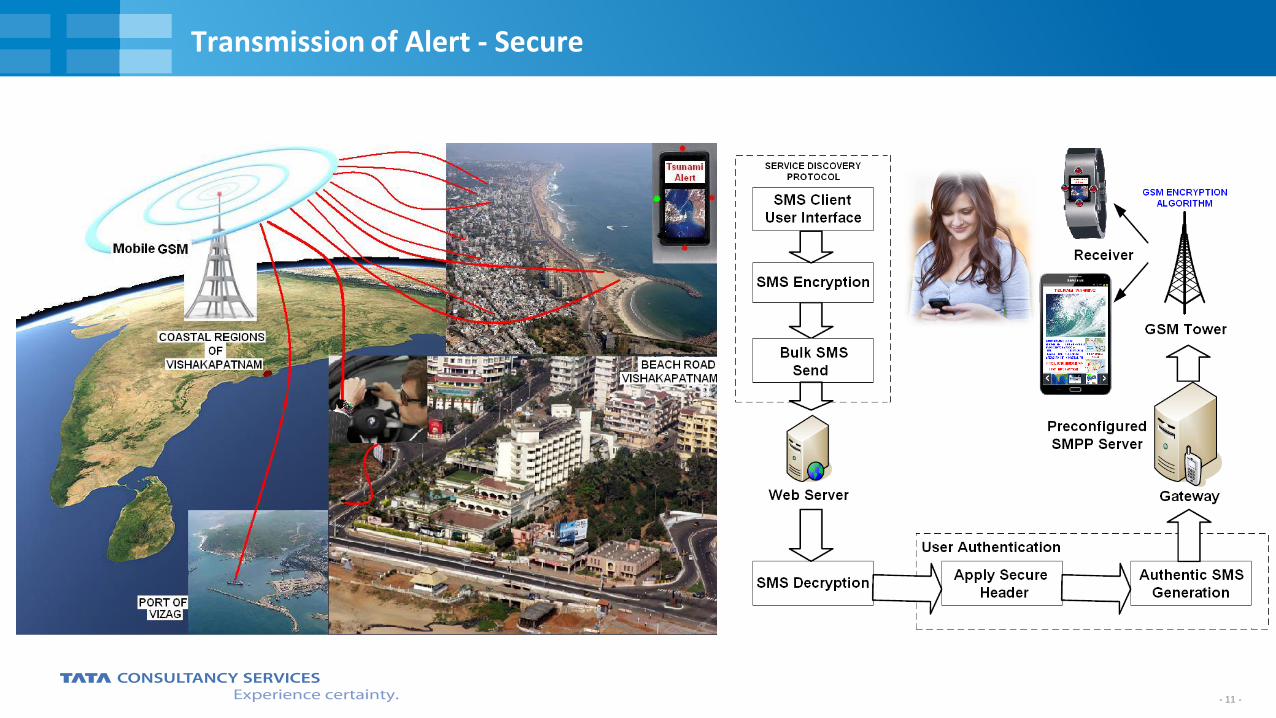
Transmission of Alert - Secure
- 12 - - 12 -
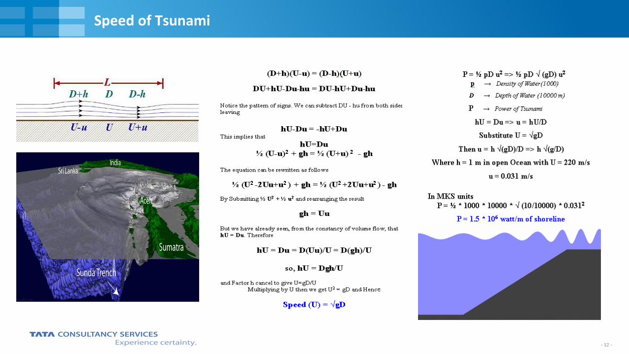
Speed of Tsunami
- 13 - - 13 -
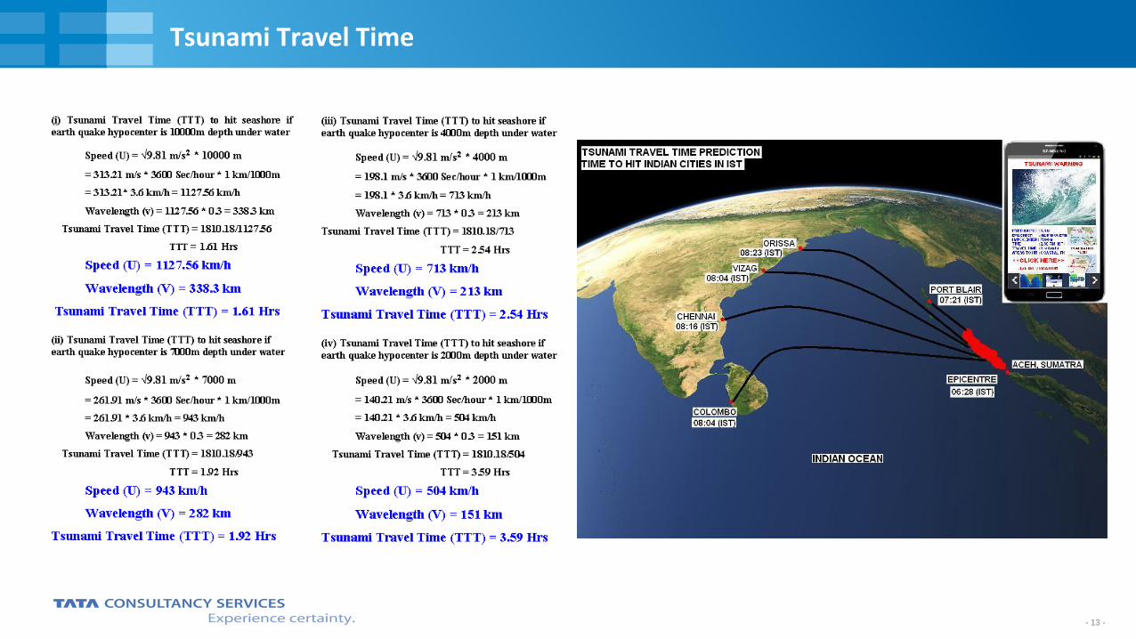
Tsunami Travel Time
- 14 - - 14 -
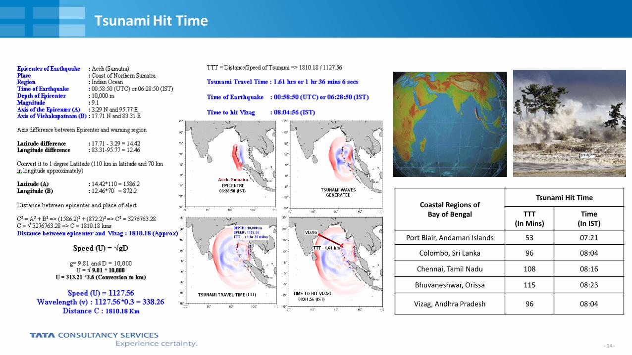
Tsunami Hit Time
Coastal Regions of Bay of Bengal
Tsunami Hit Time
TTT (In Mins)
Time (In IST)
Port Blair, Andaman Islands 53 07:21
Colombo, Sri Lanka 96 08:04
Chennai, Tamil Nadu 108 08:16
Bhuvaneshwar, Orissa 115 08:23
Vizag, Andhra Pradesh 96 08:04
- 15 - - 15 -
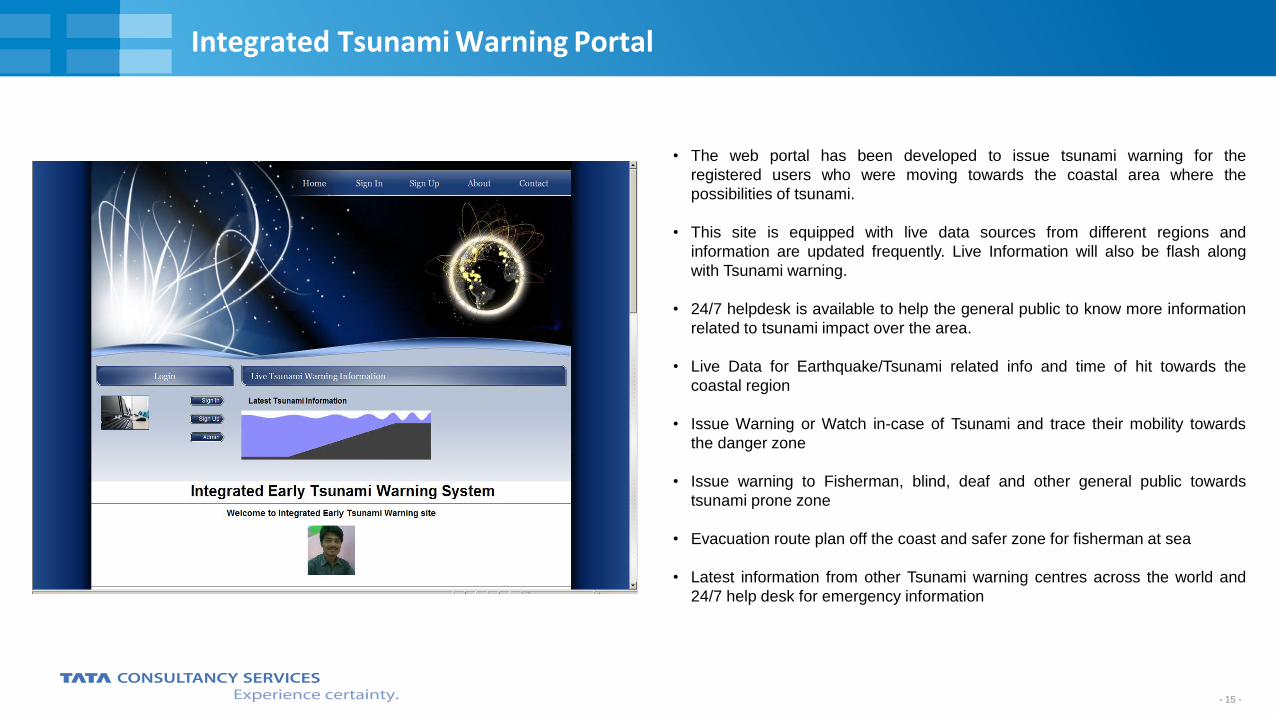
Integrated Tsunami Warning Portal
• The web portal has been developed to issue tsunami warning for the
registered users who were moving towards the coastal area where the
possibilities of tsunami.
• This site is equipped with live data sources from different regions and
information are updated frequently. Live Information will also be flash along
with Tsunami warning.
• 24/7 helpdesk is available to help the general public to know more information
related to tsunami impact over the area.
• Live Data for Earthquake/Tsunami related info and time of hit towards the
coastal region
• Issue Warning or Watch in-case of Tsunami and trace their mobility towards
the danger zone
• Issue warning to Fisherman, blind, deaf and other general public towards
tsunami prone zone
• Evacuation route plan off the coast and safer zone for fisherman at sea
• Latest information from other Tsunami warning centres across the world and
24/7 help desk for emergency information
- 16 - - 16 -
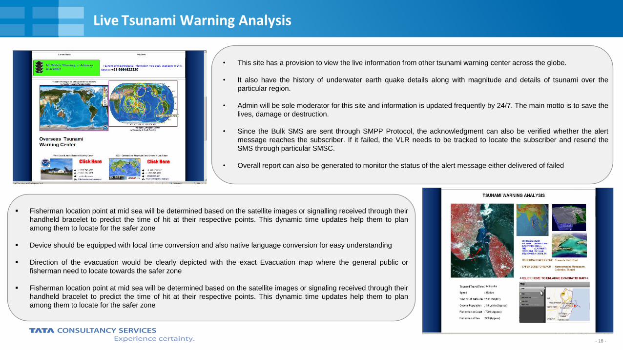
Live Tsunami Warning Analysis
• This site has a provision to view the live information from other tsunami warning center across the globe.
• It also have the history of underwater earth quake details along with magnitude and details of tsunami over the
particular region.
• Admin will be sole moderator for this site and information is updated frequently by 24/7. The main motto is to save the
lives, damage or destruction.
• Since the Bulk SMS are sent through SMPP Protocol, the acknowledgment can also be verified whether the alert
message reaches the subscriber. If it failed, the VLR needs to be tracked to locate the subscriber and resend the
SMS through particular SMSC.
• Overall report can also be generated to monitor the status of the alert message either delivered of failed
Fisherman location point at mid sea will be determined based on the satellite images or signalling received through their
handheld bracelet to predict the time of hit at their respective points. This dynamic time updates help them to plan
among them to locate for the safer zone
Device should be equipped with local time conversion and also native language conversion for easy understanding
Direction of the evacuation would be clearly depicted with the exact Evacuation map where the general public or
fisherman need to locate towards the safer zone
Fisherman location point at mid sea will be determined based on the satellite images or signaling received through their
handheld bracelet to predict the time of hit at their respective points. This dynamic time updates help them to plan
among them to locate for the safer zone
- 17 - - 17 -
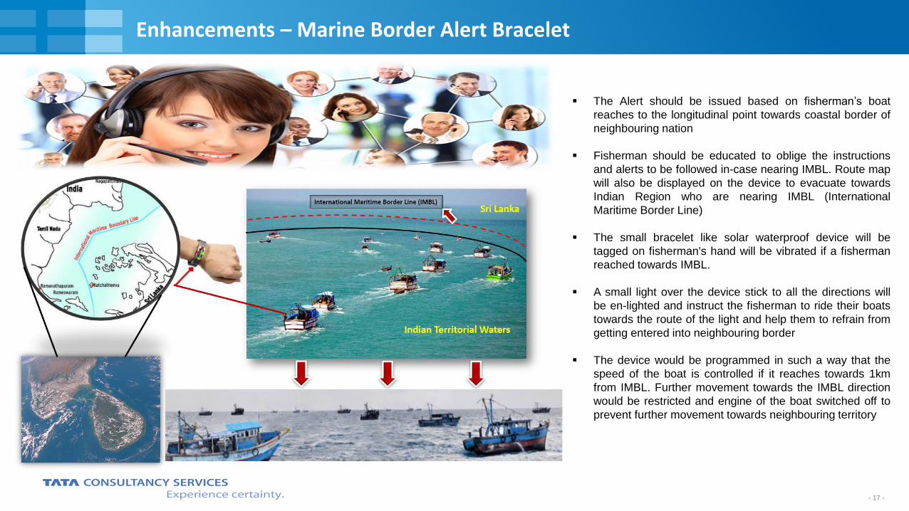
Enhancements – Marine Border Alert Bracelet
The Alert should be issued based on fisherman’s boat
reaches to the longitudinal point towards coastal border of
neighbouring nation
Fisherman should be educated to oblige the instructions
and alerts to be followed in-case nearing IMBL. Route map
will also be displayed on the device to evacuate towards
Indian Region who are nearing IMBL (International
Maritime Border Line)
The small bracelet like solar waterproof device will be
tagged on fisherman's hand will be vibrated if a fisherman
reached towards IMBL.
A small light over the device stick to all the directions will
be en-lighted and instruct the fisherman to ride their boats
towards the route of the light and help them to refrain from
getting entered into neighbouring border
The device would be programmed in such a way that the
speed of the boat is controlled if it reaches towards 1km
from IMBL. Further movement towards the IMBL direction
would be restricted and engine of the boat switched off to
prevent further movement towards neighbouring territory
- 18 -
Thank You

![SMPP+ for USSD services 1[1].13 - company.mts.ua_for_USSD_services_1_13_(2).pdf · SMPP+ means SMPP v3.4 protocol (document [1]) + additional features needed to implement a good and](https://img.dokumen.tips/doc/110x75/5dd0c3ced6be591ccb629591/smpp-for-ussd-services-1113-forussdservices1132pdf-smpp-means.jpg)