Embed Size (px)
Citation preview

Troubleshooting Performance Issues
with Enterprise GeodatabasesBen Lin, Nana Dei, Jim McAbee

Workshop Agenda
• Performance Troubleshooting (Then & Now)
• Real-World Examples and Troubleshooting
• Tips, Tricks and Guidance
• Tools
• Q&A Open Forum

Few questions to ask first…
• What is slow?
- 30 seconds may be ok for a batch database process, but not an OLTP transaction
• What is between the end user and the Enterprise Geodatabase?
- Understand infrastructure and processes, and at time of day
• What was the workflow and specific task being done and when?
- What was the end user, or system, doing when the issue was noticed

Troubleshooting Enterprise Geodatabase Performance
Issues
• ArcGIS Platform data management includes many solutions
- ArcGIS Data Store
- File Geodatabases
- Imagery
- Enterprise Geodatabases
- Other structures
• This session focuses on issues with Relational
Databases and Enterprise Geodatabases
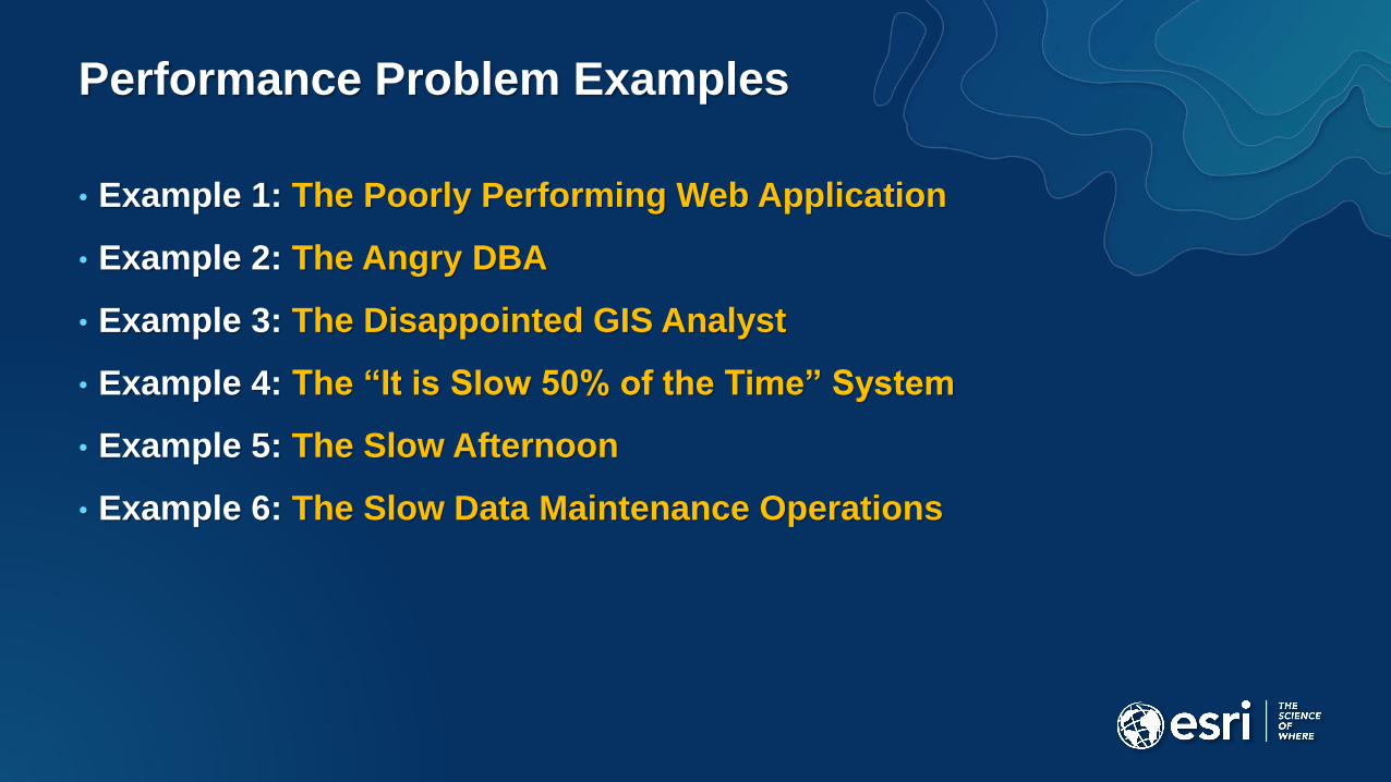
Performance Problem Examples
• Example 1: The Poorly Performing Web Application
• Example 2: The Angry DBA
• Example 3: The Disappointed GIS Analyst
• Example 4: The “It is Slow 50% of the Time” System
• Example 5: The Slow Afternoon
• Example 6: The Slow Data Maintenance Operations

Troubleshooting performance issues used to be simple
• Easier to find in the past…
• Geospatial information and use was
less pervasive in IT…
• Performance issues were more isolated…
• Fewer users…

Where are the performance issues now?
Now more components are
spread out over more deployment
environments and locations….
ArcGIS Online
Amazon (AWS)
On-PremiseAzure
Esri Managed
Cloud Services

Spatial Data Management is now Enterprise-Wide
• Geospatial information & use pervasive in Enterprise IT
• Business System Integration
• Users Enterprise-Wide
• All good, but making performance troubleshooting more difficult

Enterprise Geodatabase
ArcGIS Pro & Desktop

ArcGIS Servers
Enterprise Geodatabase
ArcGIS Pro & Desktop

ArcGIS Servers
Enterprise Geodatabase
ArcGIS Pro & Desktop

Portal & Enterprise Identity
ArcGIS Servers
Enterprise Geodatabase
ArcGIS Pro & Desktop

Business UsersArcGIS Online
Firewall & Filters
Web Servers & Load Balancers
Portal & Enterprise Identity
ArcGIS Servers
Enterprise Geodatabase
ArcGIS Pro & Desktop

Business Users
Enterprise Geodatabase
ArcGIS Pro & Desktop
?
?
?
Where the performance issues now?
• May be single or multiple
issues…
• May be a performance
issue or poor workflow…
• Where do you begin…?
• And what is urgency…?
?

Where to Start: Focus and Isolate
• Prioritize and isolate
• Check one issue at a time
• Check if it is the database
• Check component resources
• Check workflow, map, service configuration
• Check network design, security, latency
• Check business application/workflow
• Check relationships between issues?

Examples 1 & 2: The Poorly Performing Web App &
Angry DBA
• Occurred at same customer site…
Example 1: Poorly performing Web Application – Business Users
- How is application/service configured?
Example 2: Application Generating too much SQL (load) – the Angry DBA
- Which application and how is it configured?
• Few Questions…
- Are they the same problem?
- Where is the problem?
- Hint - database traces and sde intercepts may not be best first step…is it the database?

Examples 1 & 2: Resolution:
The Poorly Performing Web App & Angry DBA
• Poorly performing Web Application – Business Users
• Application Generating too much SQL (load) – DBA
• Process
- Review of Web Application, found
(75 layers using same feature class with definition queries)
- Isolated issue to an application issue NOT database
(overly complex map document)
- Check indexing on definition query fields or symbology
- Check scale-dependency on layers
- Read-only Publication Web App
(consider publication File Geodatabase)
Map
Configuration
Resources
& Service
Configuration
Indexes,
Statistics, &
Resources

Example 3: The Disappointed GIS Analyst
• Slow performance editing data – GIS Analyst
• Is it the same issues that were causing examples 1 & 2 issues? No
- Starting edit, creating feature, saving edit, snapping?
- ArcGIS Desktop / Pro (and Server) = “Thick” Client (heavy traffic)
- What is the total number of feature classes in feature dataset / map?
- How many rows in the state_lineages table?
- When was the last compress?
- Where is editor located, where is database located…
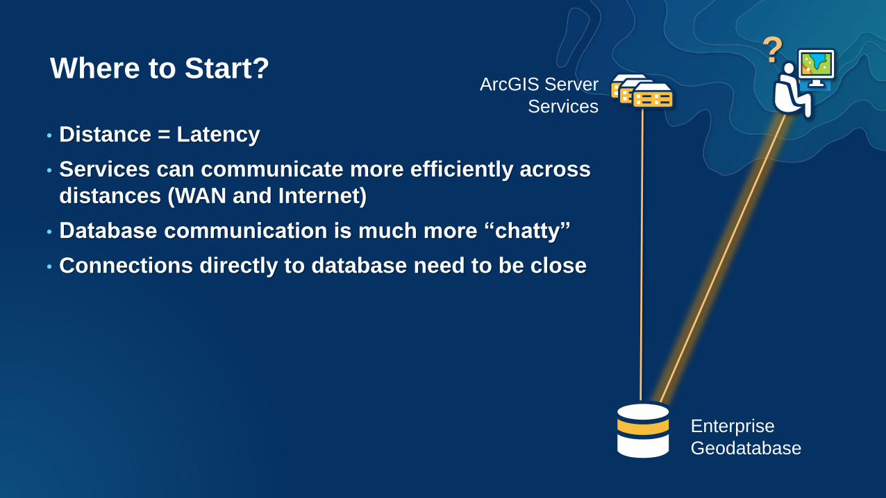
Where to Start?
Enterprise
Geodatabase
ArcGIS Server
Services
?
• Distance = Latency
• Services can communicate more efficiently across
distances (WAN and Internet)
• Database communication is much more “chatty”
• Connections directly to database need to be close

Component Location is Critical
ArcGIS Online
Portal for ArcGIS
Desktop ToolsComponents communicating via SQL or file-
based access must be as close as possible to
reduce effects of latency.
SQL and File access
Services-based communication best
for configuration prone to latency
Services

Example 3: Resolution -
The Disappointed GIS Analyst
• Ensure ArcGIS Server, Desktop and other direct
connections to database are close to database server.
• Provide Virtual Desktop (e.g. VMware Horizon, Citrix, MS
Terminal Services) - VDI
Enterprise Geodatabase
Remote
Desktops (VDI)

Example 4: The “It is Slow 50% of the Time” System
• Editors said performance was ok half the time
• What about time of day?
• Are maintenance practices being followed?
- Not as much in certain scenarios
- Or a cold backup done at night without shutting down
ArcGIS Server services or managing connections
Enterprise
Geodatabase
Citrix ArcGIS
Desktop Editing

Example 4: Resolution -
It is Slow 50% of the Time
• There were two data centers, but only one had the Enterprise Geodatabases
• Citrix based ArcGIS Desktops were deployed at both.
• 50% of time editor might get desktop at remote data center
Citrix ArcGIS Desktop
(Data Center 1)
Enterprise Geodatabase
(Data Center 1)
Citrix ArcGIS Desktop
(Data Center 2)
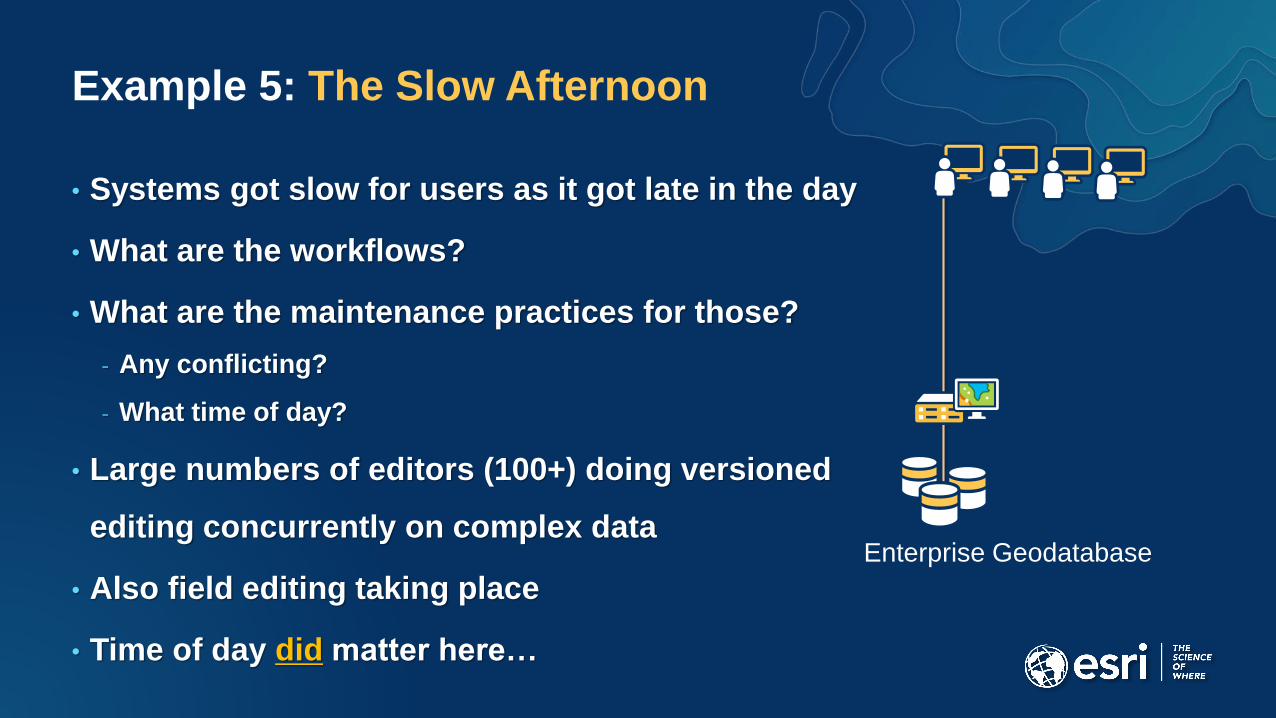
Example 5: The Slow Afternoon
• Systems got slow for users as it got late in the day
• What are the workflows?
• What are the maintenance practices for those?
- Any conflicting?
- What time of day?
• Large numbers of editors (100+) doing versioned
editing concurrently on complex data
• Also field editing taking place
• Time of day did matter here…
Enterprise Geodatabase
Example 5: Resolution - The Slow Afternoon
• Review of versioned editing management tables State_Lineages table
growing very rapidly due to various editing workflows (tens of thousands
of rows per hour).
• Geodatabase compress operations were being done nightly
• Editors and field crews did take a lunch break mid-day, allowing for a mid-
day compress to take place along with database statistics update.

Example 6: The Slow Data Maintenance Operations
• Geodatabase Administrator stated the Reconcile / Post / Compress
geoprocessing operations gets slower over time
• About 50,000 edits performed daily
• Isolate and review one operation – Reconcile
• What is the work performed?
• Set up batch script to run with no edits made
• Capture SDEIntercept
• Review log (1st run VS Nth run)
Enterprise Geodatabase

Example 6: Resolution –
The Slow Data Maintenance Operations
• Geoprocessing logging history in metadata
• Viewing the logging history
ArcCatalog 10.x: Customize > ArcMap Options window > Metadata tab
Select FGDC style
• ArcGIS 10.x (Default - ON) : ArcGIS PRO (Default – OFF)
• Scripting - arcpy.SetLogHistory(False)
• Resources : Delete history (as desired)
Clear GP History Add-in
How To: Automate the process of deleting geoprocessing history

Troubleshooting – Some Typical Scenarios
• Inefficient application configuration
- Overly complex map document, too many layers, complex symbology, etc..
• Inefficient database maintenance
- Geodatabase compress, statistics, index maintenance
- Compress_log – does it exist?
- State_lineages – 10’s of millions of rows?
• Inefficient architecture
- Large physical distance between Database and “thick” clients – Desktop and Server
• Resource Configuration Issue
• Security Configuration
- Is web sense or other web filtering present?

Troubleshooting - Tools
• ArcGIS PerfQAnalyzer and MxdPerfstat
• ArcGIS System Log Parser
• Esri System Monitor
• OS performance metrics and logs
• Database Specific
- SDEIntercept – communication between
ArcGIS and Database
- RDBMS Database Traces –
SQL and execution plans within database

Troubleshooting – Esri Support
• Review behavior on a test instance (if applicable)
• Isolate behavior
• Generate SDEIntercept / DBMS trace (single action)
• Open a Tech Support case
• A database backup might be requested
• More…

Please Take Our Survey on the Esri Events App!
Select the
session
you attended
Scroll down to
find the
survey
Complete Answers
and Select
“Submit”
Download the Esri
Events app and
find your event

Q & ANote: We will take as many questions as possible during this time, but
note that some questions may be better suited to post workshop
session discussion and follow up at Technical Support Island.
We will be available after the session for this.