Embed Size (px)
Citation preview

TREKS ON THE KATHMANDU VALLEY R I M


Alton C. Byers, Ill

Published by
S A H A Y O G I P R E S S Tripureshwar, Kathmandu Nepal Telephone : 11489
* \ --
Copyright : The Author
First Edition : 1982, March
Maps & Figures : Graphic Rachana
Drawings : Sribindu Bajracharya
Printed in Nepal a t S A H A Y O G I P R E S S Tripureshwar, Kathmandu Nepal Telephone : 11489

"I therfore resolved t o ascend the Sheopuri ...,,.. From this pos i t im ..... Northward, and not t h i r t y miles distant, the Himalayas reared their heaven piercing summits, peak succeeding peak and crag suceeding crag ...... The Dawalogiri, the highest mountain in the world, and 28,700 fee t above the level o f the sea, was as worthy a terminat ion of the chain at one end as i ts rival, Kinchin Jung, was a t the other ....,.. f f
Laurence Oliphant, JOURNEY TO KATHMANDU, 1852
"What? You're going to walk to Godavari? Why not take the bus? Its much faster."
A villager at Panauti, 1981


Sect ion
TABLE OF CONTENTS
Page
1. Introduction
Hil ls and Ridges of the Kathmandu Valley
Using the Guide
Equipment
II. Nagarjun
N1-- Queen's Forest gate to Nagarjun
N2-- lchangu to Nagarjun
N3-- Descending via Routes N1 and N2, the Nagarjun road, and the "Buddha Cave"
111. Kakani
K1-- Kakani to Balaju
K2-- Kakani to the Ahale Dara pass to Balaju
K3-- Kakani to the Ahale Dara pass to Sheopuri (possible alternative)
IV . Sheopuri
S1-- Budanilkantha to Sheopuri
S2-- Buddhist monastery to Sheopuri
S3-- S t i l l another ridge to Sheopuri
S4-- Sundarijal to Sheopuri via Chaubas
S4a- Sundarijal to Sheopuri via Okreni

V. Champadevi
C1-- Plkhel to Champadevl and Beyond
C2-- D ip i t i Bhanjyang to Thankot Bhanjyang t o Nagdhunga
VI. Pulchowki
PI - - Godavari to Pulchowki
P la - St. Xavier's School to Pulchowkl (possible alternative)
P2-- Behind and over Pulchowki
P3-- Pulchowki summits t o Panaoti or Godavari (possible alternative)
P4-- Panaot i to Godavarl (possible a1 ternatlve)
VII. Nagarkot
N1-- Nagarkot to Bhaktapur
N2-- Nagarkot to Changunarayan
N3-- Nagarkot t o Sundar i ja l
VIII. Brief Natural History of the Kathmandu Valley by R.L. Fleming, Jr.
IX. People of the Kathmandu Valley R lm by Donald A. Messerschmidt
X. Geology of the Kathmandu Valley by Elizabeth Andrews
Appendix A -- Recommended Reading

LlST OF FIGURES
IIgure 1. -Nagarjun, looking northwest f rom Kopundal
:lgure 2. -Ahale Dara, looking north f rom Kopundal
:lgure 3. -Sheopurl, looklng north f rom Kopundal
:igure 4. -Chandragiri, looking southwest from Kopundal
:igure 5. -Pulchowki, looking south f rom Kopundal
:igure 6. -Mountains seen from the Kathmandu Valley
LlST OF MAPS
Map 1. -Kathmandu Hil ls and Ridges
Map 2. -Kathmandu City Map
Map 3. -Nagarjun and Kakani Treks
Map 4. -Sheopurl Treks
Map 5. -Chandragiri Treks
Map 6. -Pulchowkl Treks
Map 7. -Nagarkot Treks


PREFACE
Treks on the Kathmandu Valley Rim is intended to be a basic juide to trekking on and about Kathmandu's more prominent hi l ls and -idges. It is a beginning, a f i rs t attempt to compile route descriptions ~f interest to Valley residents and to visitors with l imited time. It is soped that additional route descriptions, temple and historical place identi- fication, and interpretations of other natural and man-made phenomena ill be included in future editions.
Readers are invited to submit route descriptions of treks not cont- sined in the guide for future publication, for which due credit wi l l be aiven. A l l comments and suggestions wi l l be greatly appreciated-Contact the author at: Journeys Mountaineering and Trekking Service, P.O. Box 2034, Kathmandu, Nepal.

ACKNOWLEDGEMENTS
Bi l l and Lucy Dougall provided both the idea and inspiration for this guidebook, for which I would l ike to extend my warmest thanks. Bill also supplied the information for the Sheopuri treks. I would also like to thank Dr. William Leuschner, Dr. Don Messerschmidt, Dr. Robert Fleming and Elizabeth Andrews for their valuable suggestions and contri- but ions

To Elizabeth

MAP I - KATHMANDU HILLS 8 RIDGES
SCALE oL z 9 9 )rluurcns

TREKKING IN THE KATHMANDU VALLEY
1. Introduction
Unt i l about 25,000 years ago, the Kathmandu Valley was a large lake wi th a surface area of some 300 square ki lometers and a maximum depth of about 300 meters. The lake, known throughout the Buddhist text Swayambu Purana as Taodhanahrada ("Great Lake"), Ka l ihrada ("Black Water") or Nagavasahrada ("Lake Kingdom of the Nagas") was enclosed by a r i m of hi l ls, the highest over 2700 meters above sea level (Bajracharya, 1978).
These hi l ls f igure prominantly in both the Swayambu Purana and in the more recent history o f the valley. For example, legend states that the f i rs t of seven Buddhas t o visit the valley surveyed the lake from Nagarjun and predicted the creation of the holy h i l l of Swayambu (Map 1). Eight thousand years later, a second Buddha meditated on Chandragiri, t o be followed by a th i rd who made a pilgrimage to Nagarjun, Swayambu and Pulchowki. I t was this Buddha, who, while meditating on Pulchowki , predicted that the holy man Manjushri would arrive f rom China and drain the valley. Manjushri, in addition t o leaving his two wives on Pulchowki and Chandragiri, circumambulated the entire r i m before finding the lake's lowest point a t Chobar Gorge. Slashing the h i l l w i th his sword, Manjushri drained the lake, leaving a fert i le plain f i t for human habitation.
One of the remaining four Buddhas who visited the valley preached on the top of Sheopuri, which s t i l l is the location of a famous Indian saddhuls ashram. In 1748, Prithvi Narayan Shah, the uniter of present day Nepal, posted troops a t a l l of the valley's mountain passes t o t r y and starve the ruling Mallas into submission (Sanwal, 1965). Some of their forts may s t i l l be seen today. Many of the passes s t i l l serve as main links between the valley and other areas, and the hil ltops have been pilgrimage sites for valley inhabitants for thousands of years.
For the trekker, the Kathmandu Valley r i m offers a wealth of historical, ecological, cultural and aesthetic experiences comparable to the extended trekking routes in the more remote regions of Nepal. For example, large tracts of oak-rhododendron forest s t i l l exist on most of the ridges and mountain tops, of fer ing shelter for many of the valley's 400 bird species (Fleming, 1977). Some of the most beautiful views of the High Himalayas may be had f rom the summits or ridges of Sheopuri. Champadevi, Pulchowki or the town of Nagarkot. And t h e invitable
encounters with woodcutters, pi lgrims, porters, farmers and charcoal makers, Newars, Tamangs, Chhetris and Sherpas, of fer a fascinating glimpse of the cultural diversity so characterist ic to Nepal.

W i t h except ions, t he rou te descr ipt ions w i t h i n th is guide will enable you, l i ke Manjushr i , t o c i r cumambu la te t h e e n t i r e val ley rim. However, t h e t reks a re general ly b roken in to round- t r i p day hikes for the less ambi t ious. The t reks range f r o m t h e very easy, three hour h ikes t o t h e m o r e strenuous e igh t hour h ikes a long ra ther ill-defined t ra i l s . The routes described here are b y no means the only available t ra i l s . There are l i t e r a l l y thousands o f possible variat ions. Rather, th is guide is a t o o l t o begin t rekk ing in the val ley, and i t s use w i l l be enhanced b y your o w n c rea t i v i t y and sense o f adventure.
H i l l s and Ridges o f t h e Ka thmandu Va l l ey
The Kathmandu Va l ley is located i n the Mahabharat Lekh , a chain o f h i l l s reaching heights o f near ly 3,000 mete rs t h a t is para l le l t o and south o f t h e H i g h Himalayas. The Mahabhara t ac tua l l y "spl i ts" into t w o pa ra l l e l ranges a t t he western edge o f t h e Ka thmandu Va l ley and rejoins i n t o a single range a t t he o ther side. F r o m the val ley f loor , the r idgetops o f t he Mahabharat appear t o enc i r c le the val ley, forming d i s t i n c t summi ts wh ich may be divided i n t o nor thern , southern, eastern and western sect ions.
A good place t o see a l l o f t h e h i l l s is wh i le s tanding on the Bagmat i b r idge, en-route t o Patan near Kopundal. Look i n the d i rect ion the . wa te r is going. N o r t h is on the r i g h t (Kathmandu) r iver bank. To the n o r t h l ies Sheopuri (2732 m t h e second highest h i l l i n the va l ley 's r i m . The most d i r e c t approach t o the s u m m i t o f Sheopuri i s f r o m the t o w n o f Buddhani lkantha.
Look ing a t t h e s u m m i t o f Sheopuri, f o l l o w the skyl ine i n a westward d i rec t i on f i r s t down and then u p again along a "hump-backed" r idge. These ridges connect t h e Sheopuri s u m m i t and t h e t o w n o f Kakani (2073 m where the Kakani-Bala ju t reks begin. Ba la ju is also the s t a r t i n g po in t f o r the Nagar jun t r e k , the n e x t p rominen t (2096 m.) h i l l t o the no r thwes t near Swayambhu.
Continue fo l l ow ing the skyl ine i n a counter -c lockwise d i rec t ion . The long and d is t inc t ive Chandragir i r idge is located on the western r i m of the val ley ( t o the l e f t wh i le looking downst ream) . A number of c i r c u i t day t reks to Chandragir i ls various summi ts a re described here. However, most o f .... :ge ts skyl ine, f r o m Pikhel ( i n the south) to Nagdhunga ( t o t h e no r th ) , cou ld be wa lked i n one long day.
Pulchowki l ies due south. A t 2762 m., Pulchowki is t h e highest h i l l o n t h e val ley ls r i m . The s u m m i t may b e reached f r o m Godavari , and separate r idge and val ley t reks to and f r o m Panauti (due east f r o m Pulchowki) are also described. Treks o n t h e r idges between Chandragir i and Pulchowki a re n o t described here.

Nagarkot (1985 m.), on the eastern r im, is a good start ing point for several short treks as well as a two day t rek to Sheopuri. Nagarkot is famous fo r i t s mountain views, and there are several inexpensive lodges located there.
Using the Guide
A summary o f informat ion precedes each t rek description. This includes:
1. Time, o r the approximate number o f hours f rom the beginning o f the t rek to the summit o r destination,
2. - Bus, or location o f the bus stop and approximate fare to the t ra i l head,
3. Taxi, o r approximate tax i fare f rom various central locations (taking a tax i wi l l , w i t h e'xceptions, usually involve bargaining over the price. Always agree on a pr ice before entering the taxi . Going to Godavari, for example, means that the driver w i l l probably have to return empty, so that he w i l l understandably want to be paid for that. I f one taxi 's fare seems to exhorbitant, t r y another. Sometimes you can agree on twice the meter price), and
4. Trai l Description, o r a br ie f synopsis o f the trek including the terrain encountered, steepness, o f the t ra i l , availabi l i ty o f water and t ra i l condit ion (clear, brushy).
A mountain prof i le which outl ines the ridges as seen f rom the Kathmandu Val ley is provided for each trek. Dot ted lines approximately trace the trai ls as seen f rom this perspective. Sketch maps show each o f the routes described and, in some cases, other potent ia l treks. You might consider purchasing the beaut i fu l Kathmanau Valley Map (1:50,000, Nepal-Kartenwerk der Arbeitsgeneinschaft fur vergleichende, Munich, 1975; available a t Himalayan Booksellers, Bagh Bazaar), f rom which the sketch maps were drawn, as an aid t o navigation, a gauge of yourprogress, or as an eventual wall hanging. A compass is a highly recommended piece of equipment for any trekking.

The Nepal i language is, o f course, another nagivational tool. Seve- ra l phrase books, w r i t t en specifictally fo r trekkers, are available in most book stores. Of ten you can get by w i t h s imply saying the name of your destination, whereupon most vil lagers w i l l cheerful ly point you in the r ight direction. However, vou should general ly only accept answers that are coherent w i t h the rest o f your informat ion, since many of the ridge treks are no t major t rekk ing routes f o r Nepalis or Westerners. The ridge t r a i l may be heavily wooded and thus, t o the vil lagers, less desirable than a lower, more circuituous route. Or , the vil lagers may simply not know your destination, bu t w i l l nevertheless point t o where they think you should be going.
The t ra i ls described usually fo l low ridges, thus you simply get t o the ridge and fol low it (and the t ra i l ) t o the summit or other desti- nation. Of ten this w i l l be easy, such as the t rek f r om Pikhel t o Champa- devi, where the t r a i l is wide and wel l used. Sometimes it w i l l be hard, such as the same ridge f rom Thankot t o Nagdhunga, where th ick forests, spur ridges and criss-crossing or i l l -defined t ra i l s make going more d i f f i cu l t .
Hundreds of route variations exist whether ascending, descending or en-route t o a summit. The routes wi th in th is guide are only the ones which we happened t o have walked, and should no t be taken as absolutes. Regardless, the golden rules for ridge t rekk ing are (I) stay high and, as much as possible, on the ridge, (2) keep your landmarks (another summit , or the valley i tse l f , which is almost always i n sight) i n perspective, avoiding even the wide t ra i ls i f they s t r ike o f f i n the opposite direct ion, and (3) avoid "short cuts1' through the brush t o connect- ing trai ls, as the vegetation is deceptively th ick and o f t en t imes practical- l y inpenetrable.
La te September t o la te May is the best t i m e fo r trekking. The skies are generally clear. the davs cool. and excellent views of the High Himalaya may be enjoyed. The heavy rains, heat and leeches of the monsoon (June t o September) make trekking more d i f f i cu l t and less pleasurable for some, although many people enjoy th is t ime of year for i t s luxuriant vegetation and abundance of animal l i fe. A n umbrella, for sun and ra in protect ion, is popular i t em among trekkers during the monsoon.
Be sure t o maintain an adequate f lu id intake while trekking. A rule of thumb is t o drink two l i ters of water a day during any active exert ion, and four l i ters a day in hot weather. Remember t o add iodine t o any water you take f rom streams o r vil lage water spouts (see Equipment).


Common sense dictates that you should never travel alone, par- ticularly on the less-traveled t ra i ls through forested and remote areas. Medical emergencle-j and cr ime do happen, and i t is much safer (and usually more enjoyable) to keep your group t o a minimum of three people.
It might be a good idea to s tar t your t rekking w i th one of the easier hikes, such as Nagarjun or a direct route t o the summit of Sheo- puri. There is virtual ly no chance of gett ing confused or lost on these treks, and the views f rom the summits w i l l give you the perspective you wil l need t o thoroughly plan more ambitious routes, such as a Chandragiri ridge trek or a Sheopuri-Chaubas-Sundarijal c i r tu i t . For those interested in walking around the ent i re valley r im, note that this guide does not include two sections of the circui t . They are: (1) the region between Kakani and the northern end of the Chandragiri ridge, and (2) the region between the southern end of Chandragiri and the summit of Pulchowki. These are largely valley treks and so have not been included here.
Equipment
There is no need for special equipment besides a poncho (or umbre- lla), windbreaker, day pack, tennis shoes and water bott le, unless you decide to combine several day treks into an overnighter. Then you can rent tents, sleeping bags, and other equipment f rom the mountai- neering stores in Thamel (see Map 21, or be ou t f i t ted entirely (including guide, cook and porters) through one of the many trekking agencies. The lat ter option is rather expensive (about $24.OO/day/person), but may be worth i t t o those wi th l imited t ime.
rhododendron

A smal l f i rst-aid k i t should also be taken. A t least one member of your group should have a k i t which contains t he fo l lowing (a l l items are available in the drug stores on New Road):
1. Lugal ts lodine Solution (six drops per l i t e r fo r water purification; wai t 20 minutes before drinking)
2. Elast ic bandage ( f o r supporting sprains)
3. Bandaids ( 12)
4. Aspir in (20 tablets)
5. Sun screen
6. Moleskin o r s imi lar f e l t adheslve pads ( f o r b l ister prevention or t reatment)
7. But te r f l y closures ( fo r closing wounds; adhesire tape can be usad as a substitute)
8. Steri le gauge pads
9. Ant l -b io t ic o in tment
10. Adhesive tape
As w i th hiking anywhere in the world, the most ,common lmedical problems are bl isters, cuts, dehydration and sprains. ,B!l isters can be prevented by placing a b i t o f Moleskin or f e l t adhesive tape .an the reddened area o f the foot, or protected by layering the f e l t tape around the bl ister. Cuts, including leech bites, can become in fected and should be thoroughly cleaned and dressed. As was mentioned, drink lots of water in order t o prevent dehydration. Minor sprains can be relieved by using the elastic bandage. For serious accidents, where the victim is unable t o welk, remember that you w i l l rarely be more than an hour away f rom a village where porters can be hired t o carry the sick or injured person back to the nearest road. Don' t worry i f you don ' t speak Nepali; i n a real emergency your pantomine w i l l be an ef fect ive means of communication and you' l l f i , id the ,Nepali people t o be exceptionally helpful.

II. NAGARJUN (2096 m.)
NI Queen's Forest gate to Nagarjun (Jamachok)
Time: About 2 hours to the summit.
Bus: From Paknajol (Map 2, No. 8), Re. I/-. - Tempos, o r other three-wheeled, scooter-l ike vehicles seen o n the Kath- mandust reets may be taken instead o f a bus. They are parked o n the north side o f Rani Pokhari (Map 2, No. I) and leave for Balaju, the start ing point, every 15 minutes. Price is Re. I/-, o r Rs. 61- fo r the entire tempo. From Balaju, however, you ' l l have to walk through town for about a mi le to the entrance gate. The gate to the Queen's Forest is on the l e f t (west) side o f the road.
Taxi: About Rs. 251- f r o m the Thamel area to the entrance.
Trail: Wide, well-defined trai l . Fa i r ly steep at the beginning for about I hour. No water, p icnic sites o n the summit.
The prominent ridge to the north-west o f downtown Kathmandu is called Nagarjun, a popular pi lgrimage and picnic s i te for the c i t y ' s Hindus and Buddhists. The name of the actual summit is Jamachok. The ent i re ridge is a walled forest preserve, and 25 paisa admission is charge, unless you happen to be r id ing an elephant which is consi- derably more expensive (fees are posted on the sign board). The gate to the preserve opens a t 7:00 AM.
The t ra i l begins on the top o f a high bank on the r ight side o f the Nagarjun road (unpaved), just inside the entrance. The gatekeeper wi l l point it ou t to you. The t ra i l swings back and paral lels the road for a few yards before c l imbing into the forest. The f i r s t par t o f the t ra i l is rather steep, and can be very slippery i f wet. It is wide and easily fol lowed throughout the duration o f th is two hour trek. The t ra i l ends on a road just below the lookout tower which dominates the top. Cross the road and cl imbthe steps to the summit. Beside the tower, there is a Buddhist stupa, a rest house for pi lgrims, and picnic shelters
In the vicinity of the summit. The summit i tsel f is open and grass- covered, w i th several nice shade trees. There is a panoramic view o f Kathmandu Valley t o the southeast and the High Himalayas t o the north.

N2 Ichngu t o Nagarjun
Time: About 3 hours t o the summit.
Trail: Prominent land marks make navigation easy, but the trails an - sometimes obscure and steep. No water a f te r Ichangu.
An alternative t o the summit of Nagarjun is f rom the village o Ichangu.
Start a t Swayambu, walking northwest on the paved road whic, circles the hil l. Reach the Ring Road, cross, and continue on a motorabl d i r t road i n a norther ly direct ion towards Ichangu. A f te r about ten minut1 pass the l imestone gravel quarries on your le f t . Continue on the dir road t o a small saddle, then drop sl ightly t o the other side t o the tow of Ichangu.
A t Ichangu, a wide, level pa th forks to the right from the dir road near a cluster o f houses. Follow this path, which gradually steepm as it cl imbs through corn fields and scrub, This is a route used by WOO
cutters and pilgrims.
You wi l l reach the wall enclosing Queen's Forest a f ter about I li hours. There is a gate about 30 meters to the l e f t (west) f rom tC point where the t ra i l meets the wall. Pass through the gate, to a well defined t ra i l which climbs fa i r ly steeply through a beautiful pine form: Continue along this t ra i l for another 45 minutes unt i l you meet th Nagarjun road.
Turn l e f t and walk along the road for about 15 minutes. Take the f i rs t t ra i l leading up o f f the road to the r ight, toward another summl slightly higher than (2401 m.) and due west of Nagarjun (see figure 1) The t ra i l to this higher summit is not very well-traveled, but i t is eas\ t o keep the h i l l i n sight as the underbrush is low. Reach the summi' af ter about 112 hour. This i - i another grassy, open spot w i th excellen' views of Kathmandu, the H.gh Himalayas, and the lower summit 0.
Nagarjun t o the east.
The descent f rom this h i l l t o Nagarjun is an another ill-define t ra i l , but you w i l l have no trouble i f you keep the Buddhist stupe 0
Nagarjun's summit in sight. A f te r a 10 minute descent reach the Nagar jun road, arrd pick up the t ra i l on the other side. Reach the summl of Nagarjun af ter a five minute climb.

N3 Descending via Routes NI and N2, the Nagarjun road, and the "Buddha Cave1'
Obviously, one could return by reversing the ascent. Or, the Nagarjun road could be fol lowed to the Queen's Forest gate, or t o the flatlands where trai ls leading back t o Swayambu and Balaju could be located. The road, however, is long and circuituous, and between 2 and 3 hours of fast walking are required t o reach these areas.
A more interesting route is via a t ra i l which steeply descends f rom the summit on Nagarjunls east face and passes a large limestone cave (N. gupha). Walk down the embankment f rom the Buddhist stupa a t the summit of Nagarjun onto the gravel road as i f you were going t o the two green-roofed picnic structures below. Turn l e f t on the road before reaching the picnic area. Walking slowly down the road, look for a small t r a i l heading down h i l l on the r ight side of the road, south- east of the observation tower. I t ' s d i f f i cu l t t o f ind, and may require several passes, but it does exist and is the only t ra i l which descends from this vicinity. Once located, fol low the t ra i l down for about 10 minutes, through a grassy area. The t ra i l then drops steeply down the le f t (eastern) side o f the ridge, into a forest. About 45 minutes down, the t ra i l suddenly levels out br ie f ly , and the r ight fork leads to a limestone cave and a large (and in this quiet and remote sett ing, awesome) statue of the Buddha. Retrace your steps t o where the t ra i l f i r s t leveled out. The entire t rek f rom here winds through beautiful, thick forest unt i l you reach the Nagarjun gravel road a f te r another 45 minutes or so. Upon reaching the road, it is a 3.5 k m walk back t o the Queen's Forest entrance gate.
You can also return direct ly t o Balaju or Swayambu. I f either of these options are chosen, descend via the "Buddha Cave" t ra i l and walk along the road about I k m unt i l you reach a mi l i tary post which includes a small f i r ing range and bathing area. Walk past the f i r ing targets and through a doorway in the wall which encloses the Queen's Forest. A well-travelled t ra i l skirts the l e f t edge of the r ice paddies. Take this t ra i l , which af ter about five or ten minutes forks. The le f t fork leads t o Balaju, which can be reached in about 20 minutes. The right fork continues through the r ice paddies and marijuana fields t o a small Tamang village called Raniban, and f rom there t o Swayambu. I t takes about an hour f rom the mi l i tary post t o Swayambu.

JAMACHOK (2096m.1 BALAJU
(2104m)
w
- - - -- .
ICHANGU
Figure I- NAGARJUN, LOOKING NORTH WEST FROM KOPUNDOL

MAP 3- NAGARJUN and KAKANI TREKS
A Ridges Paved Road ----- Trails ----I River /Stream

Ill. KAKANI (2073 m.)
K I Kakrn l to RaImJu --. .
Tlms: About 3 1/2 t o 4 hourr -.a. -.
Bue: Catch tho bun qolng to Tr l rul l a t PrknrJol (Map 2, No. 8) . Frrc fol<akrnl l e rbout Rn. 31 . 7ha bus r lds takas botweon 1 I/? to 2 houn, Flrst bun lorvgr at 6:00 AM, wl th other bums Iervlng every hour untll 5 PM.
'TrxI: About FIB. I001 . Thn t r lp to the Kokrn l t l o t r l takes rbout l KG;. r a r e wl l l lnvolvrr aarna t)rrgrlnlrrq w l th tho tax1 dr lvr r .
T r r l l : Moatly cJownlrlll and f la t . lho, t ra l l la non~swtrr t ovrrgrown In - .-,
pu(acsn, but tlra ltrrrny land nlrrke n r ~ k a novlgatlon easy. Water rvrllrblc at Kakenl rnr l In rrgvsral nrnall a t ra~rr in In thr tnreat.
1 trllr l a an In la rmt lng trek ttrrougl~ om\k/rtroclncl~ndron rnd plne forostn wltlr L)aonutlfrll vlawrt a t t111, I<sttrnlnndu Valloy anti niountalna. Althaugll I1 can a ~ n l l y t)o clans In orlo timy ( In i : l ud l r~~ tlra bun rlda Crarrl I'nknalal t o Knkanl), I t le at1vlroul)l~ to tcpnrrd Itio nlgl l l Irr K iknril for ttio, nunrlrr rnd rnn~rnlnln vlewn In Ilrcl ~nn r l l l r i ~ . 'I llarn In n locigo a1 I<rkanl sorvlng Nnpn len~ nfyln taaci ( d d btwt, or rlcrr rrr t j I ~ r ? 1 1 1 pnnn), wltlr the, prlcn of cl tllrno c o t I oorii cluote(J I l l IltPI nn 1 , ! pnr n l ~ t i t . Clftan yOc1
cnn tarrMrrUa l o lrnvn n l r t w l tlr lvor rnernl you ewr ly In IIre ~i iorr i lng for I ltln i ~ p , nl ttlnrlt~lr t t ~ l n w I l l rrritlout~tmily Itrvr,Iv~ llin n(l(l lt lon o f a
t lp (N. haknhaerh) In tlln tlrrl.
I : I I I to l r lnu l l nt I a k r n l I I lnkan I 1 117 tn :' t \ ( ) r ~ l o Ljy t)tr?r I r j rnwc.11 tlrs 1 r ln r~ l l I lon(l/ l<rkrlnl f1nntl )trrictlan, I hour h y Lax1 ol r I o f I I I Itiln ( ~ r n c l l o r ~ , wlrluh I n ~ t t h * we look*tl, barJ a nlan polntlrig l o I<rrknrrl. I rorn ttrlrr polrrl fnllow 8 wln(llri(l, pnvntl rnnd for :3 hni. t o pr nrrrnll, lcrd I iolal ~ r r t l anottrer b~~l l t l lnq, llrn I l r I1 Inti Art~L)srrartlor In I j i~ngnlow. ,Irrnl I~n ro rn I tro I l r l t In11 n~lngnlow la r nlgn on ttia r lq l i l of the prvod road lndlcatlng the way t o thr Agrl- cu l tu r r l )-arm. fk ln rtirrkn Ihs baglnnlng at the trek. Follow tho motor- rh lo d l r t r o rd to the Agr l c r~ l tu r r l Farm, k e ~ p l n g l o the l o f t whon It torka. Thare In a A~TI~AII nctrool w i th r ewlng nat Imrn~d la to l y at tar th@ fork. C;ontlnua walklng an ttra ro rd t o tho Agr lcu l tur r l Farm nlgn wh@r@ tho road turna Into r tral l .

Follow tire trarll t t r r o t r ~ t ~ s t~mrvl ly c u t , ncrub oak r*glon. About ( / 3 lrour latmr reach r tt i lck orrh/rhotlot landro~~ l ~ r e a t mnd the t l ra t good llnwn of tho vallsy. Frorvr 17ere tlro t r o l l la nomawhat overgrown w l t h hnrry arnnllnr woodcuttarn' trmll,(r Imndlng o f f In a l l d l r rc t lonn. Several orgo l ra l la lssd down to ttrcr valley t o the Trlsul l Romtl, but r va ld ~ o l n g lown. I ~ ~ Q I ) to t t r r trlllnlde and contour around on any large t r o l l whlch Iernalno navcrrrl truntir ad feet helow the r l(1gatap.
No tc trow tho, r ldge l l r n t goon In a wslrterly d l rec t lon, then curvaa hrounrl In n ~ot r t t r s r l y dlrcrctlon t l r r l "polnta" toward Nagmrjun (am8 Map 3) rlrln l a Itre gnlrnrnl t l l rac t lo r~ that you ' l l want to go. T t ~ e t r r l l becornma ~ n l l claflnnd nanlrr mftar cronalng cr arrrall ntrmarn, about 113 hour f rom l t i t r oark/r lrodotlcsrr(irorr for ea t .
~ver1ttri11y, I t trail go88 r l o n u e r ldgetop wlttr h o r u t l f u l vlowa DI tlm valley. (:orit lrrtrn dawn tlra r ldqetop, whlr:li now goen In r aouttrmrly dlrcrc tlorr, orr A ntnnp r r r c l eroded t r r l l . Atjotrt 20 n l l r r u t ~ a I r t a r yiw1 w i l l pn3n Ilrrotr[)Ir a lrlrln fornet hnd, t~oyolrci I far ant, r n open ar w r w i t h fotrr nl t l nt t~psa (I l~rt l t l l r lal Moriurrrontrr) on Ilra r ldgetop and osvnrnl alate- t r )o l IIC)II:LCI.P. l o l l o w l l l n t r n l l i rnt l l v o t ~ tar \ 30e 11 l n r ~ u vl l lnua tiowrr In tlm vdllny nricl 10 yor~r le f t (arrnl). I l r ~ t r o l l fork3 Irare. You tako tlrlr l o l l fork clowr~ to t t r r vl l lnqe wtrero yutr can stop lor m r r r r t and tam. J I v l l l I fol low I r I ~ I I I I I : tlslcla ( y o t ~ e r r now In I t 1 0 f llrt Irrrldn ngnln). A l ~ t ~ t ~ t 70 rirlrrtrten tu I / ? trctur I ~ t c ~ r I orctr ttrn n*c.trritl ~ r r r r l l i v l l laya (~ l rnrmrr~t t r r r l l ) ant1 c n ~ ~ t l r ~ u o on ttro pattr towrr t la Bnlnltr. Ar~otlrnr I/;' Iroirr ontl yntr nr r I r r Fltalrrjt~ W ~ Q I (r @ tax1 n t rn t l r l l ow3 yorr lo eanll y qat 1)nc.k to K r r l l r r ~ r ~ n d t ~ .


K 2 Kakani t o the Ahale Dara Pass t o Balaju
Time: 5 hours
Trai l : Wi mostly f la prominent. a t Kakani is si tuated There are
de, wel l -marked t ra i l . Some c l imbing a t the beginning bu t it. Thick forests are o f t en encountered bu t landmarks are
Excel lent views o f the valley and High Himalaya. Water and in numerous villages along the t r a i l t o Balaju. This t rek almost ent i re ly along the r idgetop o f the Ahale Dara ( r idge).
numerous picnic spots along the route and a lmost uninterrupted views o f the High Himalaya.
Walk f r om Kakani t o the Agr icu l tura l F a r m as described above. Enter the gate, and looking in an eastern d i rec t ion note the prominent hi l l behind and above the various buildings. This h i l l is cal led Taresmar (2252 m.) and is your destination f o r the f i r s t leg o f the t rek .
Walk through the f a r m grounds, ascending on a well-defined and maintained t r a i l , t o the greenhouse. F r o m the greenhouse, continue walking up and toward the h i l l , and reach a school a f t e r about 20 minutes f rom the gate. The t r a i l goes behind the school and crosses a s t i l e over a barbed wi re fence. A f t e r crossing the s t i l e , stay on the middle path which winds up the r idge through a forested area. Reach the top of Taresmar a f t e r about 20 minutes f r o m the school.
Most o f the day's c l imb is now finished. Although you are now in th ick forests and brush, the t r a i l is generally easy t o stay on and rarely strays f r o m the r idge top. Your d i rec t ion o f t ravel is always to the east, which is easy t o maintain as the Kathmandu Val ley (which you can see throughout the durat ion o f the t rek ) is always lo your r ight or south.
A f t e r about 35 minutes reach the top of the second h i l l (2321 m.). From here you can see the summit of Sheopuri t o the east, or i n f ron t of you, which is another good landmark. Continue along the winding t r a i l , passing numerous open, grassy areas suitable f o r picnics. A f t e r about another hal f an hour reach a large, open area where the t r a i l begins t o descend steeply. Looking down into the valley before you,
note the wide, north-south t r a i l a t the bot tom. This is a heavily used route connecting the Likhu Khola valley t o the nor th w i t h the Kathmandu Valley t o the south, which w e ' l l ca l l the Ahale Dara pass. Descend and reach the t r a i l a f te r about 30 minutes. Turnr ight (south) and head back toward Balaju, descending for about 20 minutes before the t r a i l levels out for the remaining 2 112 hours back t o Balaju. The t r a i l forks in several places, but always bear t o the r ight .

K3 Kakar~l to the Ahale Dara Pass t o Sheopur~ (poss~ble alternat~ve) --- -
Time: Between 8 and 10 hours to Sh~opur i ' s summit. ---
'Traii: From the Ahale Dara Pass to the upper reaches of Sheopuri easy. The last two hours to Sheopuri's summit is rather (difficult, r you enter very thick forests w i th numerous side and woodcutters1 trail: A map and compass are essential for this last par t of the trek. h water f rom the Ahale Dara Pass to Sheopuri's summit.
I t is possible t o continue f rom the Ahale Dara Pass to the summ of Sheopuri wi thin one day. Bad weather and/or circumstances preventt our party f rom making the trek on several occasions. A number (
friends have completed the trek, however, so that based on their reporl a reasonable idea of what to expect may be presented here.
As described above, descend f rom the Kakani t ra i l t o the Aha Dara pass t ra i l . Turnleft (north), and walk up the t ra i l for about 2 minutes to the pass. During this t ime you' l l be able to see the ma Sheopuri ridge which strikes o f f to the east and up t o Sheopurils summr From the chautara (rest spot) a t the Ahale pass take any t ra i l w h i ~ leads o f f to the r ight (east) and tin tn tho r i d n ~
The Kakani to Sheopuri route is advocated here because of tb prominent landmarks in sight for most of the trek. This would appe; to faci l i tate orientation, as opposed to start ing the trek f rom the summ of Sheopuri where one is immediately engulfed in thick forests. Sever; people we've talked to began their t rek f rom the summit of Sheopur and nearly a l l were a t one t ime lost or confused. Better to stay r the open while cl imbing the ridge, and then before entering the fore$ take a bearing wi th your compass. Stay on the large trai ls whose direc, t ion is generally consistent wi th your compass bearing. You should react the main t ra i l as described in the Sheopuri section about 2 hours afte entering the forest, and either continue to the summit (about 45 minutes or descend to Buddhanilkantha.

IV. SHEOPURI (2732 m.)
SI Buddhanilkhantha t o Sheopuri
Time: 4 hours t o the summit.
Bus: Mini-buses leave f rom the northwest corner of Rani Pokhari on =tipath every hal f hour (Map 2, No. I ) , going d i rect ly t o Buddanil- kantha, the t rek 's start ing point. Price is Re. 1/25.
Taxi: About Rs. 401- using the meter.
Trail: Popular, well-defined trai l . Fa i r ly steep. Excellent views f rom the top, large camping area. Waterat Buddhanilkantha and near the summit.
Sheopuri, the second highest h i l l in the valley, is a popular day hike among Kathmandu residents. Many people camp overnight on the summit, a large, f l a t area, in order t o get the best mountain views a t sunrise.
Take the bus or tax i out t o Buddhanilkantha, stopping where the road makes a sharp l e f t turn just below the Buddhanilkantha village. A dir t road continues nor th through the village and past the reclining Vishnu statue f rom here. Follow this road, which has a creek running along the right side of it, through the village for about 10 minutes. Leave the road where it turns and crosses the creek on a bridge. Follow t h e ' t r a i l which continues along the l e f t (west) side of the creek.
Once the trair leaves the road, i t climbs gradually out o f town following along the creek's west side. Cross t o the r ight (east) o f the creek just below the large stone wall that encloses the national forest on Sheopuri ridge. There is a doorway in the wall, beyond which the t ra i l is moderately steep but well-defined. Shortly, an east-west t ra i l is crossed which runs along the side of the ridge t o the Tokha hospital. Keep going straight, don' t take the east-west trai l .

SHEOPURI (2732) OKHRENI PATI BHANJHANG
SUNDARI JAL
Figure 3- SHEOPURI, LOOKING NORTH FROM WPUNDOL

From: Schqeider, 1975 LEGEND
Ridges
MAP 4 - SHEOPURI TREKS --rr@ Trails - -- Paved Road - River/Stream A Peaks
Km. 0 I 2 3 Km.
i

The t ra i l becomes fa i r ly steep, wi th occasional gentle stretches. In places i t has been deeply eroded and becomes a foot deep cascade during a monsoon cloudburst. A f te r about an hour, +he t ra i l gradually enters a forest and becomes less steep as the ridge is approached. There are a couple of huts and a tea-house, where the t ra i l levels out at the top. Behind the huts another t ra i l leads o f f t o the l e f t (west) to Kakani but your t ra i l now bends around t o the r ight (east) for about 114 mile and then turns back t o the l e f t (north).
A t this point (about 2 hours af ter start ing), the main t ra i l drops down into the valley of the Likhu Khola, while the smaller t rai l to the top of Sheopuri separates to the r ight heading almost due east-This t ra i l t o Sheopuri begins fa i r ly level and then cl imbs steeply to the top of the summit ridge. The t ra i l is easy t o fol low af ter the turnoff , and runs along the ridge w i th a steep drop on either side. A large rock outcrop and the ruins of several stone buildings (an old Prithvi Narayan Shah fo r t ) are passed just below the top. This par t of the trek takes about another two hours.
S2 Buddhist monasterv t o Sheopuri
Time: 4 hours t o the summit, start ing f rom Buddhanilkantha.
Trai l : Well-defined trai l . Fainly steep. No water af ter the nonastery.
A popular alternate route to the summit of Sheopuri is via the Buddhist gompa, or monastery, a prominent land mark (due t o i ts prayer flags and white buildings) which can be seen f rom Buddhanilkantha and many other places in the valley. The t ime required to reach the summit is approximately four hours.

After arriving in Buddhanilkantha, walk through the village on the Jirt road heading north as described in the preceding trek. Follow the road, which becomes quite steep, al l the way to the gompa located above the road on a ridge extending south f rom Sheopurils summit.
Leave the road a t this point and make your way through the fields and buildings, staying generally along the le f t (west) side of the fields. About half way through the fields, a t ra i l leads along the side of the ridge into trees and brush. This t ra i l gradually ascends through the woods and, after about an hour of walking, comes to some abandoned (a t t ime of writting) terraced fields.
Continue across these fields in a northerly direction. The t ra i l is indistinct here, but reappears a t the far side of the fields and continues through the woods and brush. Avoid any trai ls which strike o f f to the right (east), staying on the ridge and maintaining a northerly direction. Several open, grassy areas appear to the lef t , and the t ra i l follows a series of distinct switchbacks which lead to the eastern part o f the summitls ridge. When this main ridge is reached, turn le f t (west) and walk about 30 meters through brush to the summit.
S3 S t i l l another ridae to Sheo~ur i
Time: About 4 hours to the summit, starting from Buddhanilkantha. - Trail: Somewhat steeper than Routes No. I and NO.'^. Obscure and over- - grown in places. No water after Buddhanilkantha.
Follow the d i r t road up the mountain side f rom Buddhanilkantha When you are perhaps half way up the highest visible point of the road (i.e., the buildings and flags of the monastery), look for a moderately visible t ra i l that branches o f f to the left . The t ra i l ascends along a promi- nent wooded ridge, between Routes No. 1 and No. 2, and eventually joins the main ridge running south f rom the summit. This t ra i l is fair ly steep and ascends in switchbacks up the ridge. In the woods a t the top of the

r idge, the r r a ~ l becomes level and curves north for about 100 yards bef joining a good t ra i l which comes in f rom the right. Follow the joi trai ls north ( lef t) , ascending slightly, arriving in the open terraced mentioned in Route No. 1. Follow the t ra i l f rom this point as descri i n Route No. 1.
t S4 Sundarijal to Sheopuri via Chaubas
Time: About 3 hours to Chaubas, and 3 hours along the ridge to Sheopuri.1 - 1
Bus: Buses leave for Sundarijal f rom the bus stop on the east side of t - Tundikhel parade grounds. Alternately, mini-buses f rom the west side
mini-bus to Sundarijal. Price is about Rs. 5/-. i Ratna Park leave every half hour for Boudha. From Boudha, catch anoth
I Taxi: Between Rs. 40/- and Rs. 100/- (without meter). - Trail: A l l trails are main routes and thus easy to locate and stay m y steep f rom Sundarijal to Chaubas, then a f la t ridge walk to She puri ts summit. Total t ime Sundarijal-Sheopuri-Buddhanilkantha: about to 8 hours. No water a f t e r Chaubas, 1
I I
The main t ra i l heads north through Sundarijal village, along-sid the large water pipeline. The t ra i l is very wide and paved with stone step! This is the beginning of the popular Helambu trek, which has been a ma1 trading route for centuries. Af ter about 112 hour of steep climbing rea( a tea shop with a large, old building above it. Descend from the tea s* t o a water reservoir below, where the t ra i l crosses the spillway.
Continue on this wide t ra t l , which switchbacks up a prominent ridg through the village of Mulkarka. Af ter several hours the ascent becom more gradual and you wil l pass a heavily eroded section. The trai l w begin a slight descent into the village of Chaubas.

F4a Sundarijal to Sheopuri via Okreni
lime: About 3 1/2 hours
rrail: Easy to moderate. Steep f rom Okreni to the main ridge top. - The summit ridge t r a i l to Sheopuri leaves the main Helambu t ra i l
ust below (south) o f Chaubas. Several branches o f the summit t ra i l a l l read west f rom Chaubas, bu t they soon merge into one trai l . Continue )long the summit t ra i l staying near the ridge top. A f te r about 40 minutes ) chaitya, o r small temple, is reached, w i th another large t ra i l crossing the ridge t ra i l a t r ight angles (north-south). Continue west along the summit trai l , ascending gradually. In a clearing about hal f an hour later this main t ra i l forks l e f t and r ight around a moderately steep hi l l . Both trails lead into the valleys on either side. Take the route d i rect ly up the hil l ahead. There is no clear indication o f a t ra i l , but once on top pf the h i l l a small path appears which follows the crest o f a broad ridge in a northwest direction. A small pond w i th a hut above it marks the hermitage o f a well-known Indian saddhu, o r holy man.
The t ra i l turns to the l e f t (south) o f the h i l l past the holy man's hut and continues along the south side o f the ridge. The t ra i l passes through woods and a pool o f water which is probably the best source o f drinking water in the area. Continue for about 15 minutes to the summit, contouring along the side o f the ridge and up switchbacks to the top.
This can be a continuation of the Nagarkot-Sheopuri trek ( the two day "r im trek1'; see Section VII) or a pleasant one day c i rcu i t f rom Sunda- rijal to Sheopuri.
I f start ing a t Sundarijal, walk up along the large pipe and arrive at the reservoir wi th the tea shop about 45 minutes later. Instead of crossing the bridge over the dam, continue around t o the l e f t of the reser- voir on a small trai l . About 10 minutes later cross a stream near a small cable car. Follow the well marked t ra i l upstream on the east side for about 112 hour, a part icularly beautiful forested stretch. The t ra i l takes a northeast direction and crosses the stream again about 20 minutes later. After about a 10 minutes cl imb you begin to leave the forested area and enter a cultivated zone-and the village of Chilaune. From here, continue climbing to the village of Okreni, actually a series of scattered villages near the ridgetop about 112 hour further.
From Okreni simply head along the most direct route t o the top of the ridge. There are many trai ls to choose from, but there's l i t t l e chance to gett ing lost i f you head up. Once on the ridge you'l l intersect a very large, well-marked t ra i l ; this is a main route t o Pati Bhanjyang on the Helambu trek, which you could reach by turning right. However, turn le f t on the t ra i l and follow i t through beautiful forests for about I hour, af ter which you'l l reach the f la t camping area a t the top of Sheo~ur i -

Figure 4- CHANDRAGIRI RIDGE TREKS, LOOKING SOUTHWEST FROM

CI Pikhel to Champadevi and Beyond
Time: About 2 112 hours t o Champadevi. - Bus: The bus leaves f rom southwest corner of Ratna Park ( ~ a p 2, No, 2). Fare to Pikhel: Rs. 51-.
Taxi: About Rs. loo/-, without meter. - Trail: Wide, well-defined trail. A "true" ridge walk. No water a f ter Pikhel .
The prominent ridge to the west of the Kathmandu valley is called Chandragiri, with Champadevi (2278 m) being a somewhat minor h i l l on the ridge. Champadevi, however, is a pilgrimage site, and important enough so that the entire ridge is often referred- to by that name.
There are a number of different routes to Champadevi's summit, a l l wide & fair ly heavily traveled, For example, one could start a t K i r t i - purl traveling to the base of the mountain chain on a wide d i r t road. The road turns into a t ra i l which switchbacks up the mountain to a saddle on Champadevits north face. Or, one could bus or taxi to Chobar Gorge, and then take a t ra i l which leads from that point up to a saddle on Champa- devi 's south-facing slope. These trails, however, are discussed as descents from Champadevi i n this book.
The Champadevi ridge t ra i l starts at Pikhel, the southern-most point of the chain, and ends a t Nagdhunga, the pass out of the valley on the Kathmandu-Pokhara road. The entire ridge could be walked in one very long day. However, it is broken into two treks here.
To begin, drive, bus or taxi to Pikhel (located a t the foot of the last ridge before the town of Dakshinkali) . Walk north up the ridge (called the Neupane Danda) through a young pine plantation. The ridgetop itself is badly eroded in places.

MAP 5 - CHANDRAGIRI TREKS ----- --=& Trails Paved Road
---=== River/ Stream A Peaks

After 112 hour you w i l l cross a barbed-wire fence. From here, the trail runs under some very ta l l pine trees in a park-like forest wi th no underbrush. I t continues t o cl imb, sl ightly east ( or r ight) of the ridge crest, and gradually becomes less steep.
A beaut i fu l f l a t area is reached w i th uninterrupted views of the High Himalayas about 45 minutes f rom Pikhel. The t ra i l turns l e f t here (northwest), w i th the vegetation changing to scrub which continues to the top of Champadevi .
From the pine forest area, the t ra i l skirts l e f t (south) of the f i r s t knoll on the chain (1981 m.), then drops into a small saddle before the final climb t o Champadevi. In the saddle, a well-maintained t ra i l drops northeast to rejoin the Dakshinkali road a t Tau Daha, a small lake south of the cement factory (cia, Map 5). Time f rom the forest to the saddle is about 30 minutes. F rom the saddle, fol low the ridge to the top o f Champadevi. The t ra i l becomes less dist inct here, but the ridge is f ree of underbrush and you can't get lost. Just fol low the crest, no mat te r how alluring the numerous wood cutt ing trai ls that contour o f f to the side seem to be.
On Champadevi's summit is a small white Buddhist stupa and a Hindu shrine, The views of the valley and the High Himalayas are magnificent.
Behind the Buddhist stupa (i-e., west o f ) are a number of Hindu artifacts in celebration o f Shiva and the remains of an old fo r t or building- To continue the Champadevi ridge t ra i l , pick up the t ra i l on this west- facing slope, fol lowing i t down t o the second saddle encountered. Climb up to Bhamesmar, the second knoll in the chain (2502 m.) a f ter another 45 minutes f rom Champadevi. From Bhamesmar, descend once again t o the third saddle, always staying on the ridge. There is a well-marked trail a t this saddle which, a t the base of the mountain, turns into the dirt road t o Ki r t ipur mentioned earlier (Clb, Map 5).
To reach the fourth saddle or pass, simply continue on the ridge in a northwestern direction. The t ra i l becomes less dist inct here and wi l l necessitate some bushwacking i f you lose i t even for a moment. However. You should reach the next major pass, called Dip i t i Bhanjyang or Deurali Bhanjyang, af ter another 45 minutes by keeping the valley in view to your right, and by staying as high as possible (C2, Figure 4 ) .
Dipi t i Bhanjyang is easily identif ied as the "junction1' of some elec- tric power lines and the old ropeway. There is a wide t ra i l here which descends back to Kisipir i on the Kathmandu-Pokhara highway. Unl* You've started very early in the morning, this might be a good place 40 stop and begin the descent back to Kathmandu. I f you're equipped to Spend the night, or have another 4 hours to walk to Nagdhunga, continue the trek as described f rom paragraph four in the following section.

C2 Dipt i Bhanjyang t o Thankot Bhanjyang to Nagdhunga I Time: About 6 1/2 hours. I Bus: Take the local bus to Kisipir i f rom the Bhim Sen tower bur rt i - near the Central Post Off ice (Map 2, No. 7). Fare is Rs. 3/-.
Taxi: From the Central Post Off ice to Kisipir i the fare should be abo~ =20/- with meter.
Trail: Di f f icu l t . Trails are generally overgrown, and numerous side ridg wi th heavily used trai ls can make this route confusing. A compass shou be taken. No water after Thankot Bhanjyang. I
This trek completes the Champadevi ridge walk f rom Pikhel to Na dhunga. A number of shorter variations are also described below.
Note the lldifficultll rating. There are many confusing side rid! and woodcutters' trai ls which diverge f rom the main ridge path (itsel obscure and rarely used). A compass should be taken to maintain a gene! northward bearing. i
The trek begins at the village of Kisipir i on the Pokhara-Kathman road. Catch the Pokhara bus a t Bhim Sen Tower near the post 0ffic1 and after about 15 minutes get o f f a t the small roadside village of Balm (Map 51, just before Kisipiri. Or, since it is such a short ride, take tax i but continue about 1/2 k m further up the road, past Bolmus, to t f i rs t large d i r t road to your lef t . Get o f f here, and walk up t o the la r i village of Kisipiri, past the pond and temple on through the village. 1 the edge of the village, the t ra i l forks. Take the l e f t hand fork an6 continue up the valley, keeping on a main t ra i l east and alongside a promla nent gulley which leads up t o the Dip i t i Bhanjyang. A t this point, the pass is in clear sight and can be distinguished by the electric lines and the old ropeway which cross at the top. Af ter a gradual cl imb on the !eft (east) side of the gulley for about 1/2 hour, begin the switchback climb up to the pass (1 1/2 hours).

A t the top of D ip i t i Bhanjyang there are numerous shrines and stupas, a tea house, several huts, and the ropeway/electr ic l ine junct ion previously mentioned. F r o m th is area, bear l e f t (nor th) and continue walking up a h i l l w i th a well-defined t ra i l . A f t e r about 5 minutes enter
l a scrub oak forest, and about another 5 minutes la te r the t r a i l forks. Take the r ight fork-- the l e f t w i l l take you down a western slope o f the main ridge and eventually t o Pokhara. The r i gh t fork contours around the first large h i l l no r th o r D i p i t i Bhanjyang, several hundred f e e t below the summit, through a th ick oak-rhododendron forest. A f t e r about 112 hour you wi l l reach Thankot Bhanjyang, a large, open pass w i t h several huts on the old cool ie path. F r o m here you can descend t o the vi l lage o f Thankot (45 minutes) on the Pokhara-Kathmandu road and ca t ch a bus or lorry t o Kathmandu (C2a, Map 5).
I f you wish t o continue along the r idgetop, head up the grassy slope in f ront (north) o f you. A f t e r several minutes the t r a i l becomes obscure, and you' l l probably have t o bushwack f o r a m inu te o r t w o before f ind ing the ridge t r a i l again. Remember t o keep your no r th bear ing and the Kathmandu valley in sight t o your r igh t (east) and you w i l l have no problems. The route we took went through some old, overgrown ruins, probably the remnants of Pr i th iv i Narayan Shah's f o r t near the Thankot pass. The trail was easily located f r o m these ruins, continuing through a very th ick and beaut i fu l oak-rhododendron forest , and always e i ther on the ridge o r within 50 meters o f the top.
The t r a i l w~dens and begins t o descend a f t e r about 112 hour (and depending on how long you bushwacked). This w i l l lead you back t o Than- kot in about 112 hour (C2b, Map 5). To complete the ridge walk, simply climb up t o the top of the last small h i l l in the Chandragiri chain, by way o f any small woodcutter t ra i ls or by pla in old bushwacking. Once on top there is a well-defined t r a i l which fo l lows the ridge down t o wi th in 112 mile east of the pass along the road. From here you can f lag down a bus, t ruck or f r iendly motor ist for the short-r ide back t o Kathmandu.

PANAUTI
GOMVARI b' .-
Figure 5- PULCHOWKI, LOOKING SOUTH FROM KOPUNDOL

VI. PULCHOWKI (2782 m.)
PI Godavari to Pulchowki
Time: 2 112 t o 3 112 hours to the summit.
Bus: Take the bus f rom the northeast corner of Ratna Park ( M ~ P 2, ~ 0 . 2 ) - to Lagankhel bus stop in Patan. Fare is Re. I/-. From Lagankhel, catch the bus to Godavari for approximately Rs. 31-. From Lagankhel the t r i p takes about I hour.
Taxi: From Ratna Park, the fare should be about Rs. 100/- without the meter. The t r i p takes about 25 minutes.
Trail: Steep but well-defined t ra i l f rom Godavari to the summit. No water af ter Godavari.
Both the drive to Godavari and the place i tsel f are beautiful. The Royal Botanical Gardens, the National Herbarium, St. Xavier's School and the Godavari Marble Quarry are located here. So are footpaths and a motorable road to the top of Kathmandu's highest peak, Phulchowki (2782 m.).
To reach Godavari, take the bus f rom Ratna Park to Lagankhel, a 15 minute ride, and transfer at Lagankhel onto the Godavari bus. A f te r about a olie hour ride get o f f a t the Godavari bus station which is actually a series of houses and a large tea shop on the right side of the road. Walk on the surfaced road toward the St. Xavier's School ( the direction the bus was heading) unt i l the road forks. Take the right fork ( the l e f t goes to the Botanical Gardens), and proceed for about 1 / 4 mile up unt i l you see a large temple on the le f t , part ia l ly hidden by trees. A path perpendicular to the d i r t road branches o f f here and goes to the temple, and this marks the beginning of the trek.

Walk through the temple's archway, past a pond on your left and eight fountains on your r ight, to the continuation o f the path on the other side. Begin a steep uphill walk through forests of Schima, laurel, holly and wild apple trees. A f te r about 112 hour the t ra i l parallels some high voltage wires on the le f t ; a f ter another 112 hour, the t ra i l intersects the gravel road for the f i r s t t ime.
The t ra i l crosses the road about six more t imes between here and almost the top of Fblchowki, because it takes a direct route whereas the gravel road switchbacks. A f te r about the s ix th crossing there is a small stone house. The t ra i l ends here, and you must fol low the road for about one more hour before reaching the summit.
A t the end o f the road is a compound containing buildings and a tower w i th several dish antennaes. Simply c l imb up the embankment t o your r ight and reach the summit and a number of tridents, bells and puja (worship) objects in celebration o f Shiva. The views f rom the top o f Pulchowki are among the best in the valley. Return to Godavari along the same t ra i l (about 1 112 hours down).
Pla St. Xavier's School t o Pulchowki
Time: 2 1/2 - 3 hours to the summit. - Trail : ,Mastly a gradual ascent along a ridge top. Wide, well-used trail. Beautiful forests.
In ~odavar i , ' take the r ight fork of the paved road as described in PI. Continue about 114 mi le up the road and take the f i rs t le f t turn onto a d i r t road. This turn is about 100 meters before the temple area, and is marked by a red and white-striped .sign pole. Di rect ly across from the sign pole, in March of 1982, is the gravel crushing machinzry of the Godavari Marble Quarry.
Cars may be parked in the sign pole area. Walk down the dirt road for about 100 meters and note the new red br ick buildings on You1 r ight. The road ends near these buildings wi th the t ra i l continuing immediately afterward.

The t r a i l is wide, well- traveled and fo l lows the crest o f the r idge immediately in f r on t (southeast) o f you. A f t e r a f a i r l y steep c l i m b reach the ridge and fo l low the t r a i l through beaut i fu l forests which continue throughout the durat ion o f th is trek--as opposed t o t r ek PI, there is l i t t l e human activi ty or presence except fo r the occasional woodcutter or char- coal maker.
I Af ter about 1 112 hours you t l l reach a grassy area where the t r a i l forks. The l e f t fork which continues around another hill would take you to Banepa. Take the r igh t fork , and note t ha t the summi t o f Pulchowki is directly in f r on t o f you. Cl imb steeply f o r about 20 minutes and reach the Pulchowki gravel road. As w i t h t r ek PI, fo l low this road f o r about I hour t o the summit , keeping an eye ou t f o r several short-cuts on the left which may save some t i m e between switchbacks.
I You can make a c i r cu i t by simply descending via t r ek PI. In reverse descend down the gravel road f r o m the summi t f o r about 25 minutes, keep2 ing your eyes t o the right. A t the last switchback you can see the gtessy area below you (now in a smal l valley f r o m th is perspective) and should be able t o f ind the t r a i l which descends steeply down the right bank of the gravel road.
P2 Behind and Over Pulchowki . .* Time: Between 6 and 8 hours t o the summit ; ,l: 1 I 2 hours beck down - to Godavari.
Bus: - Catch the bus a t the bus stop on the northeast corner of Tundi- khel, near the C i ty Hal l , t o Banepa (Map 2, No. 5). Fare is about Rs. 61- , and the t r i p takes 1 112 hours. F rom Banepa, ca tch the mini-bus to Panaoti. Bus fare is Rs. 1/50 and the trip takes 20 minutes.
Trail: The f i r s t 3-4 hours is an easy, beaut i fu l walk up a valley and along - a heavily used t ra i l . The c l imb up the backside of Pulchowki, however, is strenuows and almost complete bushwacking. No water a f t e r the c l imb begins. A compass is recommended.

This t rek is undoubtedly one o f the most beautiful in terms vegetation and remoteness even though most o f it is confined to a valle Be warned, however, that a f te r several beaut i fu l hours of walking throu thick, subtropical forests you' l l be faced w i th the prospect of a very ste bushwacking cl imb up the backside o f Pulchowki. Only the experienc
up the valley for a few hours and returning the same way to Panaoti.
1 woodsman in good physical condition should a t tempt this. A compass a map are also recommended. As an alternative, consider simply walki
A f te r gett ing o f f the bus a t Banepa, catch the mini-bus to ~anaot)' Walk through the b a ~ a a r t o the south side o f town where there is a t shop on the l e f t and a d i r t road leading o f f t o the west. Take this di road, and fol low it for about 20 minutes un t i l it turns into a wide tra~ Continue on the t ra i l and descend t o a small stream which you must cr on a log bridge. Follow the stream (running south) which, after abw f ive minutes, turns t o the west. This marks the beginning of the valle walk, and the t ra i l is wide and well-defined. 1
Follow the t ra i l which keeps t o the l e f t (south) side of the strear and goes through beaut i fu l agricultural land for about 1 1/2 hours. Tht it enters thick, subtopical forests, but always keeps within sight or hear14 distance of the stream. There are very few people i n this area beside the occasional woodcutter. Always take the fork which bears right parallels the streams a t any t ra i l junction which you happen to cow upon.
One and a half hours af ter entering the forest, the stream become quite small and, looking north, you w i l l see a large mountain which I!
Pulchowki. From this point Pulchowki is not very dist inct (you can't set
the tower or even the top). ~f you have the daylight and the ener1'1 you can t r y hiking t o the top, otherwise you should return t o Panaoti. I
If you decide on the top, simply begin cl imbing unt i l you are high enough to see the summit and the tower. Once the summit is in sight, I walk along any ridge or path which takes you in the most direct route t o the top. Don't be tempted by large paths which, a t f i rs t glance, appear to c irc le around the mountain. They w i l l dwindle to barely distin- guishable woodcutters' paths within I5 minutes, necessitating another two hours of bushwacking before actually reaching the road. Instead, set Your sights on the summit, and go for it. The steep, half-hour c l imb to the
top after sighting the tower IS nothing compared to hours of cross- countrj bushwacking seeking an "easier" route. These statements are unfortunate') based on personal experience.

I Once on the summit , s imply take the t r a i l back down t o Godavari s described in t rek No. VI.1. "Godavari t o Pulchowki." Remember t o tart t h ~ s trek early in the day so t ha t you can ca t ch the bus f r o m Godavar ack to Kathmandu.
f3 Fulchowki summit t o Panaoti or Godavari (possible a l ternat ive)
From the summit o f Pulchowki , a r idge s t r i k ing northeast may be followed down into the Rosi Khola val ley. Once in the val ley, one cou ld continue either east along the aos i Khola t o the vi l lage o f Panaoti , G r
w e s t back to Godavari.
P4 Panaoti t o Godavari (possible a l ternat ive)
This is a valley t rek which fo l lows the Rosi Khola upstream (west ) to Godavari. We have no other in format ion on th is t rek o ther than ( 1 ) it takes about six hours and (2 ) is very ho t in the la te spr ing and summer.
Albizzia mol l i s "S ir i s" tree


I VII. NAGARKOT
From Bhaktapur Bus Stop, across f rom Himalayan Book Sellers on kk Bazaar (Map 2, No. 3), to Bhaktepur, about I hour, Rs. 31-. From Bhektapur to Nagarkot, about I hour, Rs. 31-.
Taxl: About Rs. 2001-. -
Nagarkot, besides being famous for I ts mountain views, is also the stertlng point for a t least four treks ranging In duration f rom three hours to three days. The three day-treks take one either t o Banepa, Bhektapur or Chengunarayan, a l l o f which have bus transportation back t o Kathmandu The three day t rek, f rom Nagarkot t o Sheopuri (o f ten called the ItKathmandu ,Rim Trektt) ends In Buddhanl lkantha where there is also bus transportation.
NI Nagarkot to Bhaktapur
Time: 2 hours. - Trail: Wide, well-defined, a l l downhill. Water available throughout the - trek at villages.
'This short, easy, downhill trek to the outskirts of Bhaktapur, is a )ice w ~ y t o end an overnight stay at one of the several Nagarkot lodges. 'he t ra i l is easily located near the Nagarkot Lodge, heading east and lownhill f rom the restaurantlkitchen area. I t is wide and well used, cross- ng the paved road in several places l ike the Pulchowki t rai l .
The end of the trek is at the bot tom of the h i l l , about 5 minutes on the paved road to a small village wi th a t ra f f i c check post and bus stop. However, buses may be flagged on any section of the road. Catch the bus back to Bhaktapur (15 minutes, 50 palsa), and transfer a t Bhaktapur for the bus back to Kathmandu.

N2 Nagarkot t o Changunarayan
Time: 2 112 hours.
Tra i l : Most ly downhil l . Water available a t villages.
Look in a northeaster ly d i rec t ion f r o m the Nagarkot Lodge. You can see a h i l l .str iking in tha t d i rec t ion fo r several miles. A t the far end and near the bo t t om o f the h i l l you can see a large bui ld ing and compound, the temple o f Changunarayan. This is one o f the most beaut i fu l temples in the valley and is de f in i te l y wor th seeing.
Begin the t rek f r o m the same po in t as the Nagarkot t o Bhaktapur t rek . However, a f t e r about I hour ( o r ha l fway, whichever comes first) s t a r t looking t o your r igh t f o r a large t r a i l in the general direction of the temple. The t r a i l is easier t o f i nd than it sounds, as there i s only one ridge leading t o the temple. You can see the temple as you walk down f r o m Nagarkot and therefore you can see the r idge which runs to i t . Get on the t r a i l , which crosses the road once before heading up a steep, pine-covered hi l l . A f t e r c l imbing the h i l l the t r a i l becomes relatively f l a t . A f t e r about 2 112 hours you ' l l arr ive a t the Changunarayan village, and the temple just beyond.
A f t e r visi t ing the temple, walk back t o the vil lage and take any path t o your l e f t which leads down t o the Manohara River. Cross the river and proceed up t o the Sundarijal Road (gravel) , where you can catch a bus back t o the c i t y .
N3 Nagarkot t o Sundarijal
T ime: About 8 hours.
Tra i l : Somewhat d i f f i c u l t t o fo l low due t o the many criss-crossing trails; we had t o constantly ask direct ions. Water available in villages.

This is one version o f what is commonly called the "Kathmandu R i m Trek," a walk along the eastern r i m of the valley f rom Nagarkot t o Sheopuri The Nagarkot to Sundarijal t rek takes about two easy days; the t rek f rom Sundarijal to Sheopuri adds another day, and is described in t rek No. VI, 4.
Most people doing this t rek are ou t f i t ted by trekking agencies, which allows them t o camp in the oak-rhodendron forests or a t scenic overlooks. However, food and lodging may be obtained along the way, although your "lodge" w i l l probably be a b a ~ n , shack, or the outside of a tea shop.
From Nagarkot, near the mi l i ta ry camp, walk down the paved road for about 15 minutes unt i l you reach a large path leading o f f t o the l e f t and to a small h i l l t o the east. A t the top o f the h i l l is the Mahakal Temple, which you can see f rom the start ing point a t Nagarkot. Walk up the hi l l and reach the temple in about 15 minutes.
From Mahakal, fol low the t ra i l in a north-northeasterly direction down a ridge. A f te r about an hour pass the village of Ka t t i ke on your right, and then continue in a more northerly direct ion to Jorsim Pauwa, which you'l l reach in another hour. Another 112 hour brings you t o Bag- dhara where there are several nice tea shops. Continue along the t ra i l for 1/2 hour and reach Chowki Bhanjyang. From Chowki, continue nor th on the t ra i l t o Bhotechaur, passing through the village of Nangle and i ts blue-walled houses on the way. Chowki to Bhotechaur takes about I hour.
Bhotechaur is a good place to spend the night i f you've started somewhat late in the day f rom Nagarkot (and you' l l have l i t t l e choice but to do so i f you've travelled by bus). There are excellent views of the Himalayas and of Gosainkund in the morning, and Mr. Amar Bahadur Lama, who owns a small tea shop, can provide you w i th food and lodging for the night.
The next morning, retrace your steps back towards Chowki ( t o the tast) for about 10 minutes, to where the t ra i l forks a t a large Chautara. rake the uphill fork toward the village of Chule and a steep, I hour c l imb 0 the top of the ridge. A t the top of the ridge, the t ra i l splits in three jirections. You continue along the middle path, reaching Chule, a l i t t l e :luster of 3-4 houses, in about 15 minutes.

I LEGEND
MAP 7 - NAGARKOT TREKS
. Km. 1
/- Ridges ----0 Trails - Paved Rood - River/Stream
A Peaks A Temple 1
From here, the views of the valley are excellent and continue as such for the rest of the trek. The t ra i l continues through Chule and is now f la t , contouring along the upper parts of the Manichur Dara. A t a number of places the t ra i l w i l l fo rk , the l e f t t r a i l leading down ia to the valley. You continue to bear r ight in a nor th or northwest direct ion, towards Sheopuri (your pr imary landmark). About I hour beyond Chule you will reach the Manichur nursery, where medicinal plants are grown to be shipped and processed a t Thapathali in Kathmandu.
From Manichur, continue contouring on the main t ra i l , passing through beautiful meadows and forests. A f te r about an hour the t ra i l becomes less well-defined and is replaced by numerous paths through the scrubby vegetation, .most of which seem to lead down into the valley or in a westerly direction down the tops of ridges. You wi l l fol low these down slowly. Both Mulkarka and Sundarijal w i l l be in sight as you begin your descent. Stay on the ridge tops, walking in a westerly d 'rect ion towards Sheopuri and descending toward the Bagmati River and thL village of Mul- karka. Another hour brings you to Mulkarka, and f rom here take the main trail (the f i rs t part of the popular "Helambu Trek") down past the reservoir and along the pipeline to Sundarijal, about a 112 hour t r ip. Buses run on the hour back t o Kathmandu.
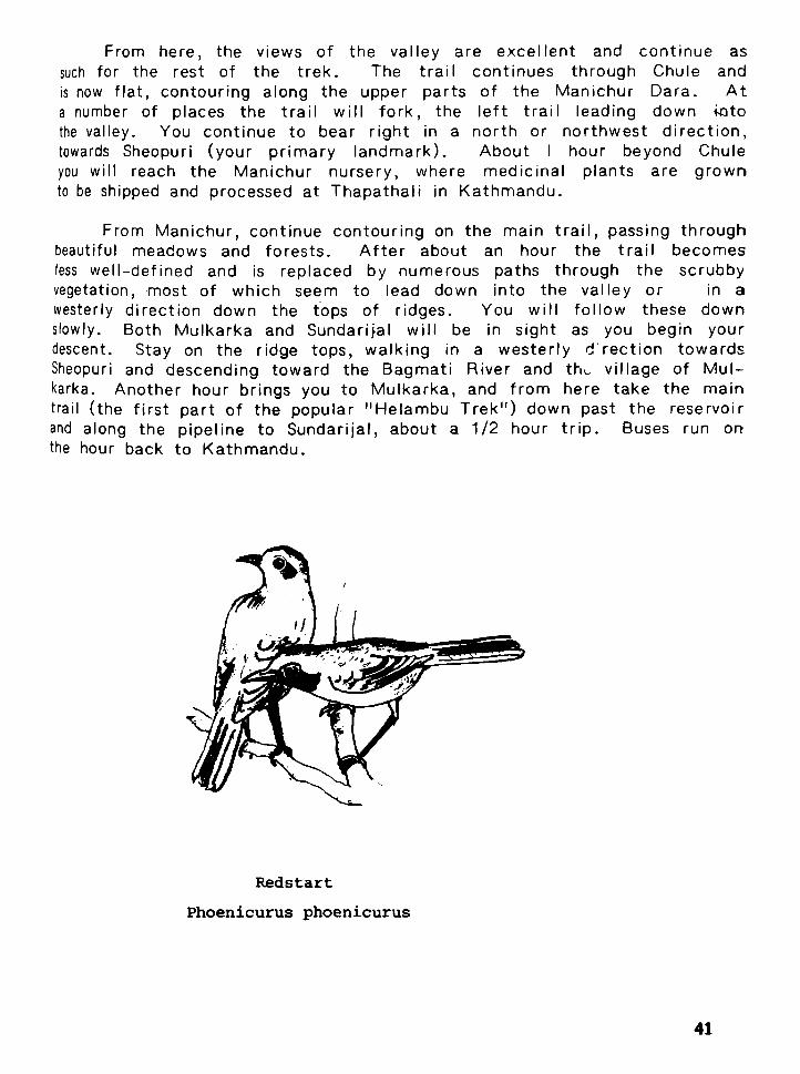
Redstart
Phoenicurus phoenicurus


VIII. BRIEF NATURAL HISTORY OF THE KATHMANDU V A L L E Y
R.L. Fleming, Jr.
The Kathmandu Valley is essentially a bowl w i th subtropical vegeta- tion rising f rom the valley f loor t o about 6,000' on the surrounding slopes and temperate hardwood forest (and scrub) continuing t o the top of the ridge line. As w i th many mountain areas, this f ine valley exhibits a fascina- ting variety of microl imates which in turn influence the vegetation and animal life.
The original forest ecosystems of the Kathmandu Valley have been severely af fected by human act iv i ty and while no par t of the Valley is free f rom human pressure, the oak forests clothing the upper portions of Shivpuri have not been extensively cut. Despite human presence, the natural history of Kathmandu remains remarkably diverse and exci t ing w i th over 400 species of birds, for example, recorded f rom the Valley and over 1,000 species of plants known here.
In an a t tempt to summarize the natural history of the Valley, one might divide the region into four dist inct parts: ( 1 ) the Valley f loor wi th towns, villages, cultivations, temple groves and stream beds, (2) cut-over scrub on dry south-facing slopes f rom about 5,000' to about 7,000f, (3) subtropical Schima-Castanopsis forest on north-facing slopes f rom 5,000' to 6,000' and (4) Quercus Oak - Rhododendron forest (or scrub) f rom about 7,000' up t o 9,000'.
The amount o f rainfal l , d irect ion o f slope exposure and slope (incl ine) are three of the most important natural features governing the distr ibution of plant growth in the Valley. Shivapuri a t about 120 inches a year is the wettest par t of the Valley wi th Pulchowki-Godavari second and the Valley f loor (a t about 60 inches a year) the driest.
Despite intense cult ivation and sett lement, the valley f loor is interest- ing f rom the natural history point of view. Stream beds, hedges, standing crops and temple groves a l l provide habitats fo r d i f ferent species. When considering birds, one immediately thinks of the Commort Myna, the House

Crow, the Barn Swallow and the Pied Wagtail as species found on the valley f loor and not of ten on surrounding slopes.
Even the scrub habitat provides shelter and ecological niches for certain species. The Spiny Babbler, fo r example, the only bird found only in Nepal, is more-or-less restr icted to scrub growth. This species is fa i r ly common in the Kathmandu Valley but is shy so that one may have to spend considerable t ime in scrub habitat in order t o see i t .
The Schima-Castanopsis forest w i t h many Lauraceae inclusions ranges to about 6,000 feet a t Godavari. This is possibly the largest region still covered by this forest type in the whole of Nepal. A t one t ime, this forest was l ikely very widespread in Nepal between 4,000' to 6,000' in the central and eastern portions of the country. But for centuries, now, humans have sett led a t these elevations and have virtual ly eliminated large stands of Schima-Castancpsis. Thus the Godavari area holds either the last or one of the last stands in the country and rates .very high on a natural heritage map of Nepal. Sadly, though, this unique forest is daily being decimated, l i teral ly hacked t o pieces before our very eyes. Already the sound of the axe has replaced the mellow whistle of the Common H i l l Partridge and unless the trend of destruction can be reversed, Nepal w i l l have lost one part of i ts original natural heritage.
" I
Above 7,000' one walks through mountain cloud forests. Oaks abound here along wi th Rhododendrons and a scattering of Lyonia, Michelia and Prunus. Moss clings to most trees, creating dark, b ~ l b o u s bumps on trunks and f r i l l y strands hanging f rom branches. Ferns choke the damp ravines (over a hundred species are known f rom the Valley).
This type of cloud forest is best seen on Shivapuri where the top triangular port ion is under cloud for a good many afternoons o f the Year- I t is in this type of forest that one looks for the special species of Hima- layas and the mountains of southwestern China. Thus, on a walk on Shiva- puri, one might see such b i rd as the Hoary Barwing, Black-capped Sibia, Stripethroated Yuhina, Bed-tailed Minla and White-browed Tit-Babbler. These birds belong to the large and diverse Babbler fami ly (~ ima l i i dae ) , a group especially well represented in the mountain forests of Nepal.
Mammals on Shivapuri include the Common Leopard, the Barking Deer, the Yellow-throated Marten and the Orange-bellied Squirrel. Hima- layan Black Bears did roam these woods some years ago but their con- tinued existence here needs confirmation.

A summer visit here reveals many wildf lowers ranging f rom Anemones Begonias, Wild Morning Glories (Porana), Smartweed (Polygonum) and
robilanthes. But leeches abound a t this season ( the summer monsoon), botaniying can be somewhat impeded.
But there are no leeches during the spring blooming season o f pal's national f lower, the Tree Rhododendron, R. arboreurn. These mson-bedecked trees o f fe r a f ine frame for view o f Langtang and other aks north o f Kathmandu. Both Shivapuri and Pulchowki o f fe r good stands rhododendrons, wi th white and pink forms o f arboreurn growing near
! tops o f the hills. Abundance and t im ing o f the blossoms varies con- erably f rom year to year but the th i rd week o f March is usually good between 7,000' to 8,000'.
Even f rom this br ie f summary one can see tha t the Kathmandu lley of fers a surprisingly r ich and diverse natural history, much o f which easily reached and easily seen. Wi th Nagarjun and Shivapuri now ful ly tected, we hope that coverage w i l l also be extended to Godavari-Pul- lwki so that three o f the most unique and beautiful areas o f the Valley y be enjoyed by generations to come.
Plaintive Cuckoo


IX. PEOPLE OF THE KATHMANDU VALLEY RIM
Donald A. Messerschmidt, Ph.D.
The Kathmandu Valley R im provides the trekker w i th an exce- lent opportunity to view and experience some o f Nepal's r ich ethnic liversity and cul tural heritage. From the f l a t valley f loor up through he rolling hi l ls to the ridge tops, the trekker passes the homes and ~bserves the livelihoods o f many d i f fe ren t groups o f people. This :hapter introduces you to the richness o f Kathmandu's surrounding ~cieties in order to make your t rek more meaningful and memor- ble.
There are several ways to distinguish among Nepal's many rthnic and caste groups. We wi l l begin here by di lneating them bgraphically. We wi l l add to that some aspects o f social structure !how the various peoples organize themselves) and mater ial cul ture jwhat tools they use, their house styles, and other forms o f rxpression).
The Valley Floor
The indigenous people o f Kathmandu Valley are called Newar. t is the r ich Newar religious a r t and architecture that you have ibserved in the historical older quarters o f the valley ci t ies o f Kath- nandu, Patan (or ~ a l i t p u r ) , and Bhaktapur (or Bhadgaon), as well s in such smaller towns as Ki r t ipur , Thimi, Banepa and Sankhu.
Many Newars are c i t y dwellers; their ancestors bui l t the r ich rban complexes o f the valley. Nowadays urban Newars pursue such Ccupations as shopkeepers, taxi-drivers and civi l servants in His lajesty's Government.
Almost any t r ip out o f the start o f a R im Trek takes the raveller past colorful (predominantly orange-ochre) Newar farm ouses and village clusters. Many are the homes o f the Jyapus, lewar farmers. Harisiddhi, a village on the road to Godavari and he Pulchowki treks, is a typical Jyapu community. Jyapu farmer :ulture adds a whole new dimension to the visitor 's appreciation ) f valley heritage. I t is though that these villagers are descendants 9 f the f i rs t valley dwellers, clans o f herdsmen and farmers who

periodlcal ly re-mud thelr houses and wash them anew with fresh/ color. Fal l festival t lme Is the tradl t lonal t lme to clean up the vlllaQe lanes and renew one's home to make It look fresh again I f your t rek takes you In the v lc ln l ty o f a slate quarry, you will not ice that thatch roofs glve way to sturdier slate roofs. Some-' t lmes a corrugated metal roof w l l l show up -- a sign o f wealth and prestlge In the vlllage; perhaps a ret l red Gurkha soldier lives there, o r a landlord, o r wealthy merchant. I
The hl l ls surrounding Kathmandu Valley are the home to many kinds o f people, lncludlng those o f the highest castes o f Brahmin; and Chhetrl, those o f the occupatlonal castes o f blacksmlth (Kaml),' cobbler (Sarkl), and ta l lor (Damal), and those o f the ethnlc ~roup o f Tamang. You may observe occupatlonal caste men such as black- smiths a t thelr ascribed occupatlons on house porches, In work areas adjacent to the house, or on the streets o f the occasional bazrar
1 town. Many o f the occupational caste people, however, are quite; poor and work as day laborers In the fields o f wealthelr people,, o r as long-dlstance porters (men, women, and young boys, allke),, carrylng goods to merchants In vlllages and bazaars far dlstant f rom the valley. I f you have engaged a porter for your trek, he or she; may well be f rom one o f the occupatlonal castes, o r f rom the Tamangi ethnlc group.
The predominant ethnlc group o f the h l l l reglons surrounding ' Kathmandu Valley Is Tamang. These sturdy people o f strong Mongo- lo id features speak a dialect unllke the Newarl o f the Newan,; o r the Nepal1 o f the caste groups. They are frequently encounteredi on the R i m Trek tral ls, particularly on Sheopurl rldge tralls. you: wi l l see them cut t ing wood o r fodder In the forests, or carryln9I heavy porter loads. Tarnang villages are nucleated, wl th thatch-' roofed houses. Tamangs are Buddhlsts, and thelr vlllages are easllY' Identif led by the presence o f long whlte pray-flags end an occasional wmba, a Buddhist shrine o r temple. The people themselves are o f ten distinguished by thelr dress, dark blue-violet sarls on the women, and rough woollen jackets wl th short sleeves and a khukrl kn i fe tucked Into the waistband on the men.
Some Tamangs are renowned as hunters (shlkarl); some others prect lce the ancient c r a f t o f paper-making f rom the bark o f the dephne, a ta l l bush. ' /ou may see paper making In the forest, o r men carrylng large lcads o f course Nepal1 paper to market. Other men may be seen wer,ving baskets o f spl i t bamboo. St i l l others)
Tamangs ana other castes as well, are o f ten encountered on the forest paths herding cows, buffalo, and goats. Such herdsmen @re known In Nepali as gothalos.

I f you happen upon a Tamang religious ceremony, o r a funeral, you w i l l see Tamang lamas performing the r i tual . A t o ther t imes, you may encounter a local f a i t h healer (a dhami or j h n k r i shaman). Falth healers o f v i r tual ly any caste o r ethnic group are exceptionally popular in rural Nepal, where there are few doctors o r health posts. They treat both physical as wel l as psychologicel disorders. They often wear colorful robes and headdresses, and carry one-sided drums as one o f the symbols o f thelr calling. Their incantations and other r i tua l expressions are very ancient, predetlng the great religious movements o f Hinduism and Tlbetan Buddhism.
Among other people you might encounter in the hi l ls o f the Rim Treks are Sherpas. Many of them come f rom the region o f Helambu, nor th o f the valley. They speak e Tibetan dialect and are sometimes indlstlnguishable f rom local Tamangs who dress simi- larly. Sherpas trek down to Kathmandu a l l through the year, carrying produce to and f rom market, or going back and fo r th for seasonal employment. You may encounter Sherpas on the t rek nor th o f Sundarijal over the Sheopuri ridge.
This is one o f several routes nor th toward the sacred lakes of Gosain Kunda on the way to Langtang Himal and the headwaters of the Trisul i Khole (river). Depending on the t ime o f year you are trekking, you may also encounter a variety o f Nepalese and Indian Hindus and Buddhists t rekking nor th toward Gosain Kunda on pllgrlmage. Annually, on the date o f the fu l l moon o f the Nepalese months o f Bhadau (mid-August to mid-~eptember ) and Chait (mld-March to mid-Apri l), hundreds o f pious pi lgr lms are found -on these trails. Some among them may be sadhw (holy men) and jogis (yogls), in quest o f enlightenment in the mountains end a t the shrines along the way. They can be recognlzed by their religlous forms o f dress (pale yellow o r orange robes, o r l i t t l e dress a t all), their bead necklaces, uncut halr, the tr lshul (a tr ident carrled by followers o f Lord Shiva), begging bowls, and the like.
Pilgrims, in fact , may be encountered on many o f the R i m Treks. Besldes Nepali and lndlan Hlndus, you may encounter Tlbetan Buddhist pilgrims, especially in the vicinity o f Pharping and Dakshln- kali southwest o f the valley on the Champadevi trek. The route

through Pharp~ng IS also part o f the ancient foot path leading to and f rom the valley via the south r im. I f you are trekking in this vicinity in February, around the t ime o f Shivaratri, watch for people going to the festival held in honor o f Lord Shiva in the month o f Magh (end o f January o r early February). Thousands o f devout Hindus stream into the valley by every means o f transportation -- many on foot and crowd the central Pashupatinath temple north- east o f Kathmandu ci ty. A t this t ime you w i l l be sure to see many Terai and Indian pilgrims.
In one sense, any one o f the R im Treks may be your own sort o f pilgrimage, to take in the cul tural , as well as the aesthetic, sense o f wonder so commonly encountered in the Nepalese hills.
Chautara

X. GEOLOGY OF THE KATHMANDU VALLEY
El i zabeth Andrews
Long before the b i r t h o f the Himalaya, lndia and China were separated by an ancient seaway. Driven by forces deep within the eerth, lndia moved slowly but relentlessly northward. For ty million years ,ago, the seaway began to close, culminat ing in the most spectacular collision o f continents the world has ever known. Sediments la id down in the ocean f loor over 500 mi l l ion years ago were forced upward into the highest mountain range on earth, the Himalaya. Great slices or sedimentary rock pi led on one another, and hot magma rose and cooled to fo rm granite.
Less than 200,000 years ago, when the up l i f t o f the main Himalayan chain had quieted, new disturbances suddenly appeared to the south. The range o f hi l ls known as the Mahabharat Lekh rose rapidly to heights o f over 2500 meters, damming the rivers that rushed southward down the Himalayan slopes. In the Kath- mandu Valley a huge lake formed, which remained for over 150,000 years. During the last ice age, erosion and earthquakes carved a course through the Mahabharat Lekh, and the Kathmandu lake drained ou t through this f inal range o f hi l ls to disappear onto the plains o f India.
Today the geology o f the Kathmandu Valley refects the story of i ts formation, and even the casual trekker can observe chapters of the valley's history preserved in i ts rocks. The valley lies in a large bowl-shaped depression in the Mahabharat Lekh, caused by a downward folding o f the rocks. The valley f loor is covered w i th ice-age lake deposits reaching thicknesses o f up to 300 meters. Most o f the lake deposits are si l ts and clays, but occasional gravels and sends collected where streams f rom the mountains entered the lake. Peat, l ignite and white clay a l l bear plant fossils and te l l o f a t ime when parts o f the lake were covered by swamps and marshlands. The l ignite is mined locally for br ick f i r ing, and the white clay is used to bleach vegetable o i l . The black clay o f Kal imat i is used as a fert i l izer. Natural gas is also found in small amounts, part icularly in the central pert o f the valley.

The valley r i m is formed by the ridges o f the Mahabharat Lekh. These ridges are made o f sediments la id down in the ancient seaway which separated India f r om China. The lowermost layer of the Kathmandu Valley r i m is found a t the base o f the Nagarkot ridge. These slates, sandstone, and si lky mica-r ich rocks were formed f rom the mudbanks and beaches o f the ancient seaway.
The base o f Pulchowki, Chandragiri and Nagarjun is made up o f so f t black slates and slaty limestones. These areoverlain by a massive l ight-colored rock known as the Chandragiri limestone, which is local ly mined for cement. The f ine lines and layering in th is l imestone are traces o f the ancient sea f loor. It forms the top o f Nagarjun and Chobar gorge.
Above this, topping the Chandragiri ridge and forming part o f Pulchowki, a sof t , violet-colored slate occurs. On the eastern slope o f Pulchowki th is slate contains fossils and occasional iron deposits. The uppermost rock layer o n the Pulchowki ridge is called the Godavari limestone. This is a coarse white rock w i t h abundant fossi Is.
Sheopuri and Kakani are made o u t o f gneisses. These are black and whi te banded rocks t ha t re f lec t the violence o f the continental coll ision. L ike the rest o f the rocks on the Kathmandu Valley r im, these gneisses were once ocean sediments, bu t have since been distorted and mangled beyond recognition.
These are black whi te banded rocks w i th a much more violent history than the surrounding rocks. They have been distorted and mangled by the tremendous forces o f the continental collision.

APPENDIX 'A
Recommended Readine
Anderson, Mary M., The Festivals of Nepal (London: George Allen & Umin , 1971).
Aran, Lydia, The Art of Nepal (Kathmandu: Sahayogi Prakashan, 1978).
Bajracharya, M.B., Mythological History of the Nepal Valley from Swayambhu Purana (Kathmandu: Avalok, 1978).
; h a , Dor Bahadur, People of Nepal (Kathmandu: Ra tna Pustak I Bhandar, 1974).
Il)etrnold, Geogrey, and Rubel, Mary, The Gods and Goddesses of Nepal (Kathmandu. Ra tna Pustak Bhandar, 1979).
Fleming, Robert L., Sr. Fleming, Rober t L., Jr., and Bangdel, Lain, Birds of Nepal (Kathmandu: Avalok, 1979).
Fleming, Robert L., Jr., The General Ecology, Flora, and F a w of Midland Nepal (Kathmandu: Tribhuvan University Press, 1978).
Fleming, Robert L., Jr., and Fleming, Linda F., Kathmandu Valley (Tokyo: Kodansha International, 1978).
His Majesty's Government, Flora of Nagarjun (Kathmandu: Depar tment of Medicinal Plants, 1973).
His Majesty's Government, Flora of ~ulchowki and Godavari (Kathman- du: Department of Medicinal Plants, 1969).
Sanwal, B.D., Nepal and the Esst India Company (Bombay: Asia Publishing House, 1965).

Sharma , Chandra K., Geology of Nepal (Kathmandu: Educational Enterpr ise , 1977).
Smi th , Colin, Commoner Butterflies of Nepal ( ~ a t h m a n d u : Natural History Museum, 1976).
S ta in ton , J.D.A., Forests of Nepal (London: John Murray, 1972).
a Newar Jyapu

GANESH HlMAL SHlSA PANGMA Ill IV I I I V
GANG CHENPO LONPO GANG
DOME BLANC DORJE LAKPA
FIGURE :- 6
MOUNTAINS SEEN FROM THE KATHMANDU VALLEY
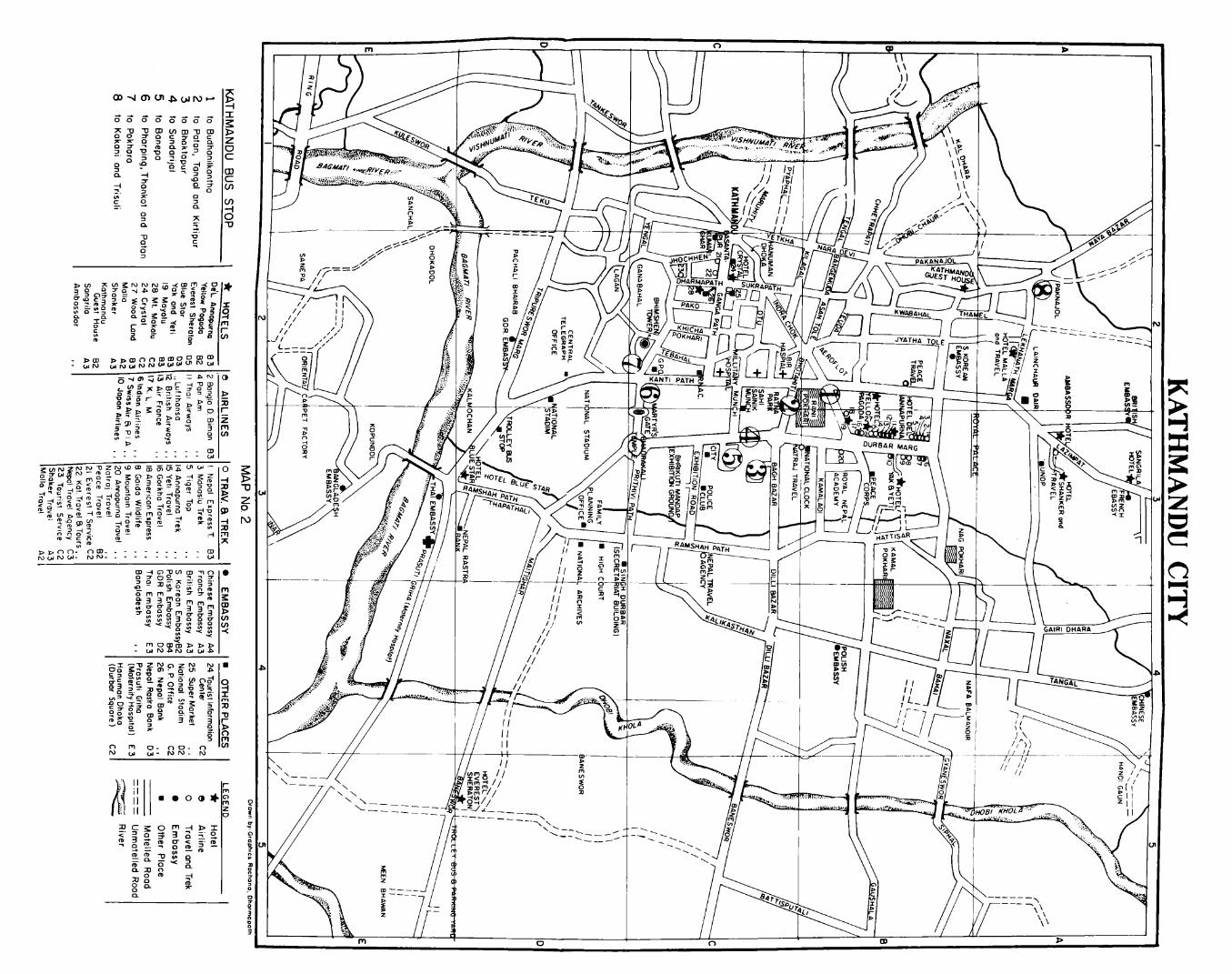
D D ~ O - o w - - - - - - - - . - N W N W - NN- - - - - - - - - .
m + o o v , m T o . 2 g g x ;. 2 z - g o , % : : o m m m n g 3 y $ r 7 z Z "EUm;w; 7 2 - 0 $
a : f 2 2 % : g ;Y:$ <
n m 0- 'W N W W - N N - 3