Embed Size (px)
Citation preview

Version: 1.0
1-12-2021
Transportation Impact Study Guidelines

Transportation Impact Study Guidelines
1 | P a g e
TABLE OF CONTENTS
Acknowledgement ................................................................................................................................. 4
Introduction ............................................................................................................................................ 4
3.1 General .......................................................................................................................................... 4
3.2 Multimodal Emphasis ..................................................................................................................... 4
3.3 Purpose ......................................................................................................................................... 4
3.4 Highway 400 .................................................................................................................................. 5
General Requirements ........................................................................................................................... 5
4.1 Need For Study .............................................................................................................................. 5
4.2 Traffic Brief .................................................................................................................................... 5
4.3 Study Timing .................................................................................................................................. 6
4.4 Funding Development Related Works – Minor Transportation Infrastructure ................................ 6
4.5 Funding Development Related Works – Major Transportation Infrastructure ................................ 6
TIS Analysis Requirements ................................................................................................................... 7
5.1 Elements of a Typical TIS .............................................................................................................. 7
5.2 Executive Summary ....................................................................................................................... 7
5.3 Description of the Development Proposal ...................................................................................... 8
5.4 Study Area ..................................................................................................................................... 8
5.5 Horizon Years ................................................................................................................................ 9
5.6 Analysis Time Periods ................................................................................................................. 10
Traffic Conditions ................................................................................................................................. 11
6.1 Existing Traffic ............................................................................................................................. 11
6.2 Background Traffic ....................................................................................................................... 11
6.3 Site Generated Traffic .................................................................................................................. 12
6.3.1. Trip Generation ......................................................................................................................... 12
6.3.2. Trip Distribution ......................................................................................................................... 12
6.3.3. Mode Split ................................................................................................................................. 12
6.3.4. Traffic Assignment .................................................................................................................... 12
6.4 Site Generated Traffic – Development Exceeding Forecasts ...................................................... 13
6.5 Summary of Traffic Conditions ..................................................................................................... 13

Transportation Impact Study Guidelines
2 | P a g e
Evaluation of Auto Mode Impacts ........................................................................................................ 13
7.1 General Provisions ...................................................................................................................... 13
7.2 Accepted Capacity Analysis Methodologies and Assumptions .................................................... 14
7.2.1. Intersection Capacity Analysis Methodologies .......................................................................... 15
7.2.2. Level of Service and Queuing Analysis on Select Arterial Corridors or Problem Intersection(s)15
7.2.3. Truck Percentages and Passenger Car Equivalents ................................................................. 15
7.2.4. Saturation Flow Rate ................................................................................................................. 16
7.2.5. Peak Hour Factor ...................................................................................................................... 16
7.2.6. Pedestrian Walking Speeds ...................................................................................................... 16
7.2.7. Cycle Length and Signal Phasing ............................................................................................. 16
7.2.8. Green Intervals ......................................................................................................................... 16
7.2.9. Intergreen Periods .................................................................................................................... 17
7.2.10. Left Turns on Intergreen .......................................................................................................... 17
7.2.11. Right Turns on Red ................................................................................................................. 17
7.2.12. Critical Gaps ........................................................................................................................... 17
7.2.13. HOV Lanes ............................................................................................................................. 17
Transit Infrastructure Assessment ....................................................................................................... 18
8.1 Existing Transit Infrastructure ...................................................................................................... 18
8.2 Assessment of Transit Infrastructure ........................................................................................... 18
Pedestrian Infrastructure Assessment ................................................................................................. 19
9.1 Existing Pedestrian Infrastructure ................................................................................................ 19
9.2 Assessment of Pedestrian Infrastructure ..................................................................................... 19
Cycling Infrastructure Assessment ...................................................................................................... 20
10.1 Existing Cycling Infrastructure ..................................................................................................... 20
10.2 Assessment of Cycling Infrastructure .......................................................................................... 20
Mitigative Measures ............................................................................................................................. 20
11.1 Identification of Required Road Network Modifications ................................................................ 20
11.2 Identification of Required Road Network Modifications – Traffic Signals ..................................... 21
11.2.1. Spacing ................................................................................................................................... 21
11.2.2. Analysis ................................................................................................................................... 21
11.3 Identification of Required Transit Infrastructure Modifications ..................................................... 21

Transportation Impact Study Guidelines
3 | P a g e
11.4 Identification of Required Pedestrian Infrastructure Modifications ............................................... 22
11.5 Identification of Required Cycling Infrastructure Modifications ..................................................... 22
Site Specific Considerations / Requirements ....................................................................................... 23
12.1 Site Plan ...................................................................................................................................... 23
12.2 Parking Study .............................................................................................................................. 23
12.3 Access Requirements (to City Road Network) ............................................................................. 23
12.3.1. General ................................................................................................................................... 23
12.3.2. Considerations ........................................................................................................................ 23
12.4 Sight Distance Evaluation ............................................................................................................ 24
12.5 Circulation .................................................................................................................................... 24
12.6 Drive-Throughs ............................................................................................................................ 25
Transportation Demand Management (TDM) Plan .............................................................................. 26
13.1 TDM Requirement Summary ....................................................................................................... 26
13.2 TDM Checklist ............................................................................................................................. 27
Conclusions and Recommendations ................................................................................................... 28
Documentation and Reporting ............................................................................................................. 28
Appendix A – Draft Terms of Reference ...................................................................................................... 29
Appendix B – Example Figures ................................................................................................................... 31
Appendix C – Example Tables .................................................................................................................... 34
Appendix D – Multimodal Trip Generation Survey ....................................................................................... 37
Appendix E – Parking Study Guidelines ...................................................................................................... 38
Transportation Impact Study Guidelines
4 | P a g e
ACKNOWLEDGEMENT
The City’s Transportation Impact Study Guidelines was prepared using content from the following existing guidelines:
City of Vaughan Transportation Impact Study Guidelines
York Region Transportation Mobility Plan Guidelines
City of Abbotsford Transportation Impact Assessment Terms of Reference
City of Brampton Traffic Impact and Parking Study Terms of Reference
City of Guelph Traffic Impact Study Guidelines
INTRODUCTION
3.1 GENERAL
As a single-tire municipality, the City of Barrie (referred herein as “the City”) has jurisdiction over the transportation system from arterial roads to local streets, cycling and walking infrastructure as well as providing transit service through Barrie Transit.
The City’s Official Plan and Transportation Master Plan (which includes a detailed Active Transportation and Transit Plan) provide a general outline of development patterns and long range planning of the City’s road, transit and active transportation network to support planned growth. As specifics of a development are known, it is necessary to examine its impacts on the transportation network. The onus is on the developer to conduct a Transportation Impact Study (TIS) to address the transportation-related issues of the development and obtain approval of the study.
The City’s TIS Guidelines have been compiled to outline the process and structure required to produce a comprehensive TIS for the City.
3.2 MULTIMODAL EMPHASIS
Urban development within North America was planned around the use of automobiles. This traditional transportation planning practice has resulted in traffic congestion and places tremendous pressures on existing transportation systems as communities continue to grow and become more urbanized. As construction, maintenance and property costs continue to rise rapidly, it is more difficult to build and maintain new transportation infrastructure to support growth.
Today, the City’s approach to transportation planning is guided through the City’s Official Plan and Transportation Master Plan; these guidance documents includes policies and identify the required infrastructure to encourage a multimodal approach to travel with a specific emphasis to encourage walking, cycling and the use of transit.
Development within the City must support non-automotive trips and include supporting infrastructure where appropriate. In this lens, the guideline is identified as a Transportation Impact Study Guideline (as opposed to a Traffic Impact Study) as it is broadly focused on all modes of travel.
The intent of the multimodal focus and requirement for assessment of transit, pedestrian and cycling mode infrastructure is to ensure development occurring within the City is in alignment with the City’s Official Plan and Transportation Master Plan active transportation policies and objectives.
3.3 PURPOSE
The main purpose of a TIS is to analyze the traffic generated by proposed developments. A TIS generally includes a description of the scope and intensity of the proposed development, a summary of the projected impacts and any required mitigation measures to ensure that the surrounding road network can safely accommodate the proposed development. A well-prepared transportation impact assessment helps the developer and City accomplish the following:
Quantitatively forecast the traffic impacts created by the proposed development based on accepted practices, not perceptions;
Determine improvements (all modes) needed to accommodate the proposed development;
Relate land use decisions with traffic conditions;
Transportation Impact Study Guidelines
5 | P a g e
Evaluate the number, location, and design of access points;
Update traffic data (projections);
Identify needed roadway improvements; and
Provide a basis for determining the developer’s responsibility for specific off-site improvements.
The following guideline is intended to assist developers and consultants in better understanding the City’s requirements and expectations regarding a TIS. A qualified transportation engineer that is licensed to practice in the province of Ontario (P.Eng.) is required to complete the TIS (including signing and sealing all supplied documents/reports produced).
3.4 HIGHWAY 400
Highway 400 is a critical north-south link for the movement of goods and services as well as serving the travelling public at large. Highway 400 is under the jurisdiction of the Ontario Ministry of Transportation (MTO). Proposed development within 300m of Highway 400 corridor or 395m of Highway 400 ramp terminal is located within MTO’s permit control area and must adhere to MTO Highway Corridor Management requirements. The City’s Planning Department circulates development applications upon receipt of a formal submission (which will include the TIS) to the MTO, but it is the proponent’s responsibility to understand MTO’s Highway Corridor Management requirements.
For further information, please contact the Central Region Highway Corridor Management Section.
GENERAL REQUIREMENTS
4.1 NEED FOR STUDY
There are several considerations in determining the need and level of detail for a transportation impact study. Block plans will generally require a planning analysis approach to assess demand and capacity on the adjacent transportation network. Subdivision and site plans usually necessitate a more detailed analysis of operational and design issues. Generally, a TIS is required when one or more of the following criteria are anticipated or present:
If the development will add 50 trips or more during the peak hour to the surrounding road network.
If in the opinion of the City, the site has the potential to generate five (5) percent increase in motor vehicle traffic volumes on the road network or on critical intersection turning movements, resulting in unacceptable or adverse operational and safety impacts.
The proposed site is located in an area of high roadway congestion or in proximity to a problem intersection.
The proposed site is not envisioned by local land use, transportation plans or requires a change or exception to a City planning or by-law policy, strategy or plan.
In all cases, the proponent is to submit a draft terms of reference for a TIS based on these guidelines and the application of best practices. The draft terms of reference will specifically outline the study area, assumptions, methodologies and any proposed deviation from the TIS guidelines with justification for consideration by the City. The City reserves the right to determine the need for and scope of a transportation impact study, the level of detail and the required components. In some instances, the proposal may lie within an area for which a transportation strategy or plan has been undertaken or prepared. In this case the City shall determine if certain elements of the TIS can be omitted.
The City reserves the right to require a peer review of a TIS at the sole cost of the applicant. This requirement should be expected for large developments and/or developments that are not in alignment with in-effect population and employment forecasts. The City will typically require the consultant whom prepared the Transportation Mater Plan to undertake the peer review.
4.2 TRAFFIC BRIEF
For developments that do not meet the criteria thresholds that would require the preparation of a TIS; a Traffic Brief will be required. A Traffic Brief is a reduced scope TIS and will generally focus on:
Traffic operations and geometrics of the proposed development site access

Transportation Impact Study Guidelines
6 | P a g e
Parking
Evaluating the need for corridor widening associated with intersection improvements by assessing background traffic growth for the in effect planning horizons
The proponent shall consult with the City to establish scope requirements for a Traffic Brief.
4.3 STUDY TIMING
Transportation needs are a major consideration for new or expanding development. In general, stages in the development process whereby transportation impact studies are appropriate are:
Secondary plans, Block Plans, or phases thereof
Amendments to the Official Plan
Zoning and rezoning applications
Draft plan of subdivision, condominium, or site plan.
A TIS will usually have a shelf life of no more than three years. Major changes within the study area may reduce the life of the document if they were not considered in the impact assessment or if major updates to the City’s Official Plan or Transportation Master Plan have occurred.
4.4 FUNDING DEVELOPMENT RELATED WORKS – MINOR TRANSPORTATION INFRASTRUCTURE
Transportation infrastructure required to provide access to the City’s road network and/or mitigate the impact of the development via localized improvements are the responsibility of the proponent (all costs and work to implement the required transportation infrastructure).
4.5 FUNDING DEVELOPMENT RELATED WORKS – MAJOR TRANSPORTATION INFRASTRUCTURE
Major transportation infrastructure, such as corridor widenings, required to mitigate the impact of the development, is funded in one or more of the following ways:
Where the work is identified in the development charge background study and the construction of the work (as identified in the City’s capital budget) coincides with the proposed schedule, the proponent will not be required to fund the work above the development charge levies or construct the work.
If the work is identified in the development charge background study, but the construction of the work (as identified in the City’s Business Plan) does not coincide with the proposed schedule, the proponent may be asked to “front-end” its cost and construct the work.
If the work is not identified in the development charge background study, the proponent will be expected to finance 100 percent of the cost of the work and construct the work.
The City will assess the need for transportation related infrastructure based on information provided in the TIS, as well as with technical warrants and sound judgment. Development specific improvements (i.e. auxiliary lanes for site access, signalized cross-rides, etc.) that are not included in the generic assumptions in the development charge background study will be the responsibility of the proponent.
As an alternative to implementing work identified in the development charge background study, interim improvements may be considered by the City if they adequately mitigate development related transportation impacts. The proponent will be expected to construct the interim improvements and fund 100 percent of the cost of the interim improvements as these improvements are typically not compatible with the work identified in the development charge background study and are considered “throw-away” (i.e. not eligible for development charge credits).

Transportation Impact Study Guidelines
7 | P a g e
TIS ANALYSIS REQUIREMENTS
5.1 ELEMENTS OF A TYPICAL TIS
Executive Summary
Describe the development proposal and the study area.
Establish a context for the TIS:
Horizon years
Time periods for analysis
Existing conditions (traffic and transit, pedestrian, cycling infrastructure)
Background conditions
Surrounding destinations (i.e. major trip generators/attractors such as school/park/community centre, shopping centres, etc.)
Estimate travel that will be generated by the development proposal:
Estimate basic travel demand by mode
Apply adjustments as appropriate
Estimate demand adjustments resulting from a proposed Travel Demand Management (TDM) plan
Evaluate transportation impacts of site-generated traffic demand:
Intersection level of service
Road operations
Transit, pedestrian and cycling infrastructure operations
Identify transportation system improvements (all modes) required to mitigate impacts of the proposed development:
Identify improvements
Evaluate effectiveness of mitigation
Identify outstanding issues
Functional plans and feasibility assessment
Address parking and access issues:
Suitability of proposed accesses onto the City’s road network
Suitability of parking and loading provisions
Accessibility for all modes
Pedestrian Circulation Plan
Sight Distance Analysis
Transportation Demand Management Plan
Conclusion and Recommendations
5.2 EXECUTIVE SUMMARY
An executive summary shall be provided that is a maximum of two (2) pages summarizing key findings and recommendations.
Transportation Impact Study Guidelines
8 | P a g e
5.3 DESCRIPTION OF THE DEVELOPMENT PROPOSAL
Components of a project that shall be described at the beginning of the transportation impact study report, if available, are:
Identification of the applicant
Site location with municipal address and map showing the site in area context
Existing land uses, “as-of-right” provisions in Official Plans, Official Plan Amendments, Zoning By-laws, etc.
Total building size and building locations
Floor space, including a summary of each type of use
Description of the type of land uses proposed, including the size of the individual land use components expressed in units related to transportation analysis (i.e. floor area, number of residential units, population, employment, number of parking spaces, etc.). Special attention should be paid to gross vs. net definitions.
A comparison of the in-effect population and employment forecasts for the parcel under consideration to what is being proposed. In instances where the development proposal is significantly out of alignment with in-effect Population and Employment Forecasts, the applicant will be required to undertake macro modelling using the City’s Master Plan consultant to assess whether recommendations within the current Transportation Master Plan are valid, if proposed capital projects must be accelerated or augmented, and ultimately, if any proposed improvements are realistic and feasible (widening recommendations on established corridors are generally not feasible).
Approximate hours of operation
Expected dates of completion and full occupancy of the ultimate development and of any interim phases, if known.
Planned phasing of the development with their associated land use statistics
Existing road and transit network, including nearby intersections and type of control
Opposite or adjacent site access driveways
Proposed vehicle access points and type and number of access(es) (full turns, right-in/right-out, turning movement restrictions, etc.)
Proposed pedestrian access
Nearby transit facilities or stops
Traffic calming measures
Proposed cycling and pedestrian facilities
Proposed parking supply and type of parking
Zoning Bylaw requirements for parking
Proposed number of parking supply
Zoning Bylaw requirements for loading zone (including solid waste handling)
Proposed number and type of loading areas
Heavy vehicle prohibitions and restrictions
It is required to provide a preliminary site plan of a suitable scale, for consideration in the evaluation of a TIS.
5.4 STUDY AREA
Definition of Study Area
Generally, the size of the study area will be a function of the size and nature of the development proposal and the existing and future operations of the surrounding road network. Typically, this will include areas that may be impacted when:

Transportation Impact Study Guidelines
9 | P a g e
All roadway or intersections where the vehicular traffic or transit usage increases by 5 percent
Volume/capacity (V/C) ratios for overall intersection operations, through movements or shared through/turning movements increased to 0.85 or greater
V/C ratios for exclusive turning movements increase to 0.90 or greater
Development proposals located on (or near or impacting) arterial road corridors with coordinated signal timing will require consultation with City staff to determine appropriate study area limits. Section 7 includes an outline of locations where corridor studies will be required.
The City reserves the right to establish the study area as may be deemed necessary. It is recommended to consult with City staff prior to initiating the study.
Description of Study Area
A description or illustration of the existing transportation system within the study area should be provided and should include, but not be limited to, the following:
1. Existing or approved land uses in the study area.
2. Municipal rights-of-way indicating number and configuration of travel lanes, road classification, posted speed, transit stops or bays and sidewalks.
3. Include map(s) to show the existing transportation system in the study area including the following details:
a. All adjacent roads including the road classifications, number of lanes and posted speeds
b. All adjacent and affected intersections and interchange ramp terminals including type of control, lane configurations, lane widths, and any turning or similar restrictions (medians and/or channelization)
c. If appropriate, on-street parking spaces, stopping restrictions, and parking meters in the vicinity of the development site and those which would affect the operation of key intersections being analyzed
d. Other traffic controls, restrictions on movements
e. Transit routes, stops and terminals
f. Adjacent and opposite driveways and other site accesses
g. Heavy vehicle prohibitions and restrictions
h. Other transportation facilities such as cycling infrastructure, sidewalks, trails and walkways, etc.
i. Pedestrian crossing facilities
j. Other features of interest
4. Planned roadway, transit and pedestrian projects which could impact on transportation operations within the study area.
5. Location of on-street parking, parking or stopping restrictions near the proposal, or those which would affect the operation of the study area roadways and intersections. The time periods for which the restrictions are in effect shall be provided.
6. Truck routes or heavy vehicle restrictions, by time of day or day of week, as applicable.
7. Transit facilities and routes which serve or will be expected to serve the development/ redevelopment proposal.
8. Identify if the proposed development falls within the jurisdiction of the Ministry of Transportation
9. Identify other developments under construction, approved or in the approval process within the study area, along with the type and size of development.
5.5 HORIZON YEARS
Typical horizon years for analysis include:

Transportation Impact Study Guidelines
10 | P a g e
Development Size Horizon Years
General Opening year
5 years after opening
10 years after opening
Multiphase development1 After each phase
5 years after last phase
10 years after last phase
1 - For large multiphase development, the initial traffic study shall analyze all phases of the development. The TIS should be updated as the development progresses and more accurate information becomes available. If separate TIS studies are conducted for future phases then the traffic generated by previous phases of the development shall not be added to background traffic but shall be considered as part of development traffic.
5.6 ANALYSIS TIME PERIODS
Time periods for analysis are critical for certain types of land use applications. The peak hours will be identified based on the “worst-case” combination of site-generated trips plus background traffic/transit volumes across the study area. Other peak hours, such as weekday noon hour, Saturday/Sunday afternoons or Friday evenings for retail/commercial uses, should be reviewed to see if they will result in a “worst-case” situation.
A noon time peak hour may have to be analyzed for developments containing food establishments, particularly fast-food outlets. If the proposed development generates a significant amount of truck traffic, the analysis periods and volumes should be specified and included in the analysis.
The following table summarizes typical requirement for time periods based on land use type. It is recommended that the analysis time periods be confirmed with City staff. For mixed-use developments, the predominant trip generation and “worst-case” combination should be reviewed for impact to the surrounding transportation system.
At minimum, the am and pm peak periods must be assessed. If the “worst-case” scenario does not occur during the am or pm peak period, then this period must also be assessed.
Typical Peak Periods for Analysis
Land Use Type Weekday AM Peak
Weekday PM Peak
Weekday Noon Peak
Weekend / Saturday
Site Specific
Retail, Commercial (e.g. shopping centre, restaurant, specialty store, supermarket)
Yes Yes No Yes No
Fast Food Restaurant Yes Yes Yes No Yes
Residential (e.g. single family, townhouse, condominium, apartments, senior homes Yes Yes No No No
Employment (e.g. business park, industrial park, office, warehouse) Yes Yes No No No
Institutional (e.g. school, church, banquet hall, entertainment centre, community centre)
Yes
Transportation Impact Study Guidelines
11 | P a g e
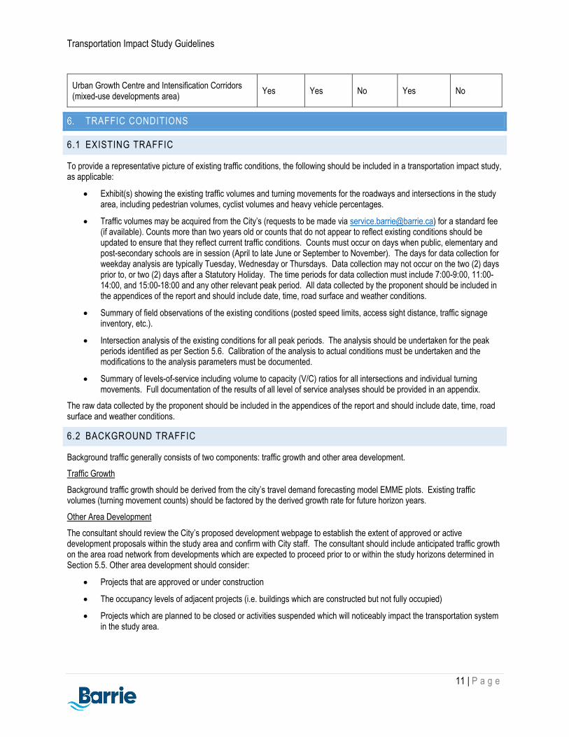
Urban Growth Centre and Intensification Corridors (mixed-use developments area)
Yes Yes No Yes No
TRAFFIC CONDITIONS
6.1 EXISTING TRAFFIC
To provide a representative picture of existing traffic conditions, the following should be included in a transportation impact study, as applicable:
Exhibit(s) showing the existing traffic volumes and turning movements for the roadways and intersections in the study area, including pedestrian volumes, cyclist volumes and heavy vehicle percentages.
Traffic volumes may be acquired from the City’s (requests to be made via [email protected]) for a standard fee (if available). Counts more than two years old or counts that do not appear to reflect existing conditions should be updated to ensure that they reflect current traffic conditions. Counts must occur on days when public, elementary and post-secondary schools are in session (April to late June or September to November). The days for data collection for weekday analysis are typically Tuesday, Wednesday or Thursdays. Data collection may not occur on the two (2) days prior to, or two (2) days after a Statutory Holiday. The time periods for data collection must include 7:00-9:00, 11:00-14:00, and 15:00-18:00 and any other relevant peak period. All data collected by the proponent should be included in the appendices of the report and should include date, time, road surface and weather conditions.
Summary of field observations of the existing conditions (posted speed limits, access sight distance, traffic signage inventory, etc.).
Intersection analysis of the existing conditions for all peak periods. The analysis should be undertaken for the peak periods identified as per Section 5.6. Calibration of the analysis to actual conditions must be undertaken and the modifications to the analysis parameters must be documented.
Summary of levels-of-service including volume to capacity (V/C) ratios for all intersections and individual turning movements. Full documentation of the results of all level of service analyses should be provided in an appendix.
The raw data collected by the proponent should be included in the appendices of the report and should include date, time, road surface and weather conditions.
6.2 BACKGROUND TRAFFIC
Background traffic generally consists of two components: traffic growth and other area development.
Traffic Growth
Background traffic growth should be derived from the city’s travel demand forecasting model EMME plots. Existing traffic volumes (turning movement counts) should be factored by the derived growth rate for future horizon years.
Other Area Development
The consultant should review the City’s proposed development webpage to establish the extent of approved or active development proposals within the study area and confirm with City staff. The consultant should include anticipated traffic growth on the area road network from developments which are expected to proceed prior to or within the study horizons determined in Section 5.5. Other area development should consider:
Projects that are approved or under construction
The occupancy levels of adjacent projects (i.e. buildings which are constructed but not fully occupied)
Projects which are planned to be closed or activities suspended which will noticeably impact the transportation system in the study area.

Transportation Impact Study Guidelines
12 | P a g e
6.3 SITE GENERATED TRAFFIC
6.3.1. Trip Generation
Trip generation rates shall be obtained from the ITE Trip Generation Manual (most recent edition). For instances where the R2 value is greater than 0.85, use the line equation to determine trip rates. For instances where the R2 value is less than 0.85, use both the line equation and average rate; utilize whichever generates the greatest trip rate.
Where appropriate it may be justified to reduce the base trip generation rates of the proposed development to account for:
1. Redundant Land Use: trips which are generated by existing land use actively and reflected in current traffic volumes and will be replaced by the proposed development. Unless otherwise accounted for, these trips normally subtracted from the trip generation estimates.
2. Pass-by trips: trips that represent intermediate stops on a trip already on the road network, i.e. a motorist stopping into a retail store on their way home from work. It should be recognized that pass-by trips must be accounted for in the turning movements into/out of the site.
3. Captive market effects/"Synergy": represents trips which are shared between two or more uses on the same site, i.e., a motorist visiting a retail store and a grocery store on the same site; and
4. Travel Demand Management (TDM) strategies: reductions in automobile travel to the site to account for travel to/from the site by public transit, walking and cycling. Please note that a robust TDM plan is required to use of the modal split targets established in the Transportation Master Plan. The modal split targets shall be extrapolated linearly. No additional trip reductions may be made beyond the modal split targets contained within the latest in effect Transportation Master Plan.
All trip generation assumptions and adjustments assumed in the calculation of "new" vehicle trips should be supported and documented. Sensitivity analysis should be undertaken where trip generation parameters have the potential to vary considerably and most probable values cannot be readily identified.
A table should be provided in the study report identifying the categories and quantities of land uses, with the corresponding trip generation rates or equations and the resulting number of trips. For large developments that will be phased in over time, the table should identify each significant phase separately.
6.3.2. Trip Distribution
Trip distribution assumptions should be supported by one or more of the followings:
1. Transportation Tomorrow Survey (TTS) data;
2. Origin-destination surveys;
3. Comprehensive travel surveys;
4. Existing / anticipated travel patterns;
5. Output from the city’s travel demand forecasting model (the proponent would be responsible for obtaining modelling output from the City’s Transportation Master Plan consultant and associated costs).
Engineering judgements should be used to determine the most applicable of the above methodologies for each particular application.
6.3.3. Mode Split
Travel surveys are the most reliable sources of modal splits. Transportation planning projections or goals should be considered, but they should not replace good engineering judgement and actual modal split data. The number of trips estimated with this assumption should be reflected in Section 6.3.1.
6.3.4. Traffic Assignment

Transportation Impact Study Guidelines
13 | P a g e
Traffic assignments should consider logic routings, available and projected roadway capacities, and travel time. Traffic assignments may be estimated using a transportation planning model or “hand assignment” based on knowledge of the proposed/future road network in the study area. The City has a travel demand forecasting model available and can provide assistance upon request (the proponent would be responsible for obtaining the required data from the City’s Transportation Master Plan consultant and pay associated costs).
The assumptions shall take into account projected “pass-by” trips, “diverted” trips and internal “Synergy” trips.
6.4 SITE GENERATED TRAFFIC – DEVELOPMENT EXCEEDING FORECASTS
In the case of a proposed development exceeding population and employment forecasts for the in-effect transportation master plan traffic area zone, the applicant must retain the City’s transportation master plan consultant to undertake macro modelling to assess network impacts associated with the proposed development, requirements for accelerated, augmented or new capital projects and feasibility of implementing any augmented or new capital projects in order to determine if the subject site can accommodate the additional unplanned density. As part of this work, the consultant will provide forecasted turning movement counts by creating an EMME sub-area model extracted from the City-wide model to forecast changes in travel patterns and future demands. This will allow the spatial extent of the impacts to be determined.
The applicant must directly retain the City’s transportation master plan consultant and pay for all costs associated with this work. When this work is triggered, the TIS must also undergo a peer review by the transportation master plan consultant at the applicants cost. All revisions and recommendations made by the transportation master plan consultant must be completed to their and the City’s satisfaction.
6.5 SUMMARY OF TRAFFIC CONDITIONS
A summary of the existing and future traffic demands should be provided in the form of exhibits which show traffic volumes for all intersections within the study area for:
Existing traffic
Future background traffic (existing plus background traffic)
Site generated traffic (if pass-by traffic has been assumed, an exhibit must be provided which summarizes the reassignment of pass-by traffic)
Future total traffic (future background traffic plus site generated traffic)
Summary exhibits must be provided for each analysis period and analysis horizon. In some cases, interim traffic conditions may need to be assessed to reflect phasing of developments, temporary site access arrangements or planned transportation system modifications. It is preferred that the exhibits be included in the body of the report where they are referenced, as opposed to an appendix, to aid in the review of the TIS.
EVALUATION OF AUTO MODE IMPACTS
7.1 GENERAL PROVISIONS
The level of detail required in the evaluation of a development proposal will depend on whether the proposal is a block plan, plan of subdivision or site plan. The following are steps which shall be undertaken to evaluate the impacts on the area transportation network:
Provision of a summary of computed level of service, delay and volume to capacity (V/C) ratios for individual movements and overall intersection operations and directly impacted roadway links, for all analysis periods and time horizons in the main body of the report. A separate queuing analysis shall be included for the 50th and 95th percentile queues and include existing storage lengths in the main body of the report. Full documentation of the results of all intersection performance measures should be provided in an appendix.
Identification of signalized intersections where:
- Levels of service (LOS) for overall intersection operations exceeds LOS D

Transportation Impact Study Guidelines
14 | P a g e
- V/C ratios for overall intersection operations, through movements, or shared through/turning movements increase to 0.85 or above
- V/C ratios for exclusive movements increase to 0.85 or above
- Where the 50th and 95th percentile queue length exceed available turning lane storage
- Queues for exclusive left and right turn lanes that are inaccessible due to the through lane queue length
Identification of unsignalized intersections where:
- LOS, based on average delay per vehicle, on individual movements exceed LOS E
- The estimated 95th percentile queue length for an individual movement exceeds the lesser of 5 vehicles or the available queue storage.
Identification of roadway links where:
- Peak hour traffic exceeds LOS D (V/C of 0.85) based on the following lane capacities
Classification / Lanes Lane Auto Capacity (vehicles per hour per lane)
Arterial (2,4,6 lanes) 750
Arterial (3,5,7 lanes) 850
Collector (2,4 lanes) 500
Collector (3,5 lanes) 550
Local 400
Identification of potential safety or operational issues associated with:
- Weaving and merging
- Corner clearances and sight distances
- Vehicle-pedestrian conflicts
- Access conflicts
- Traffic infiltration
- Pedestrian movements
- Cyclist movements
- Emergency vehicle response
- Heavy truck movement conflicts, etc.
Identification of transit priority measures where the generated traffic will negatively impact transit operations.
Provision of supplementary analysis to address additional operational or safety issues (i.e. vehicle queuing or blockage, merging, weaving, gap availability or acceptance, sight distance availability, travel time surveys, etc.).
7.2 ACCEPTED CAPACITY ANALYSIS METHODOLOGIES AND ASSUMPTIONS
The following sections provide analysis methodologies and assumptions accepted by the City. These assumptions represent base values and should be utilized in the absence of specific data. These assumptions should not be used in place of engineering judgement and common sense. The analysis assumptions must be documented in a section or appendix to the TIS. Any confirmation of agreement to analysis assumptions by the City should also be included.

Transportation Impact Study Guidelines
15 | P a g e
7.2.1. Intersection Capacity Analysis Methodologies
The City currently accepts intersection capacity analysis using Synchro/SimTraffic (version 10.0 or newer).
7.2.2. Level of Service and Queuing Analysis on Select Arterial Corridors or Problem Intersection(s)
The level of service and queuing analysis are to be based on micro-simulations using Sim-Traffic. The analysis is to be based on a minimum of five simulations comprising of a minimum one hour simulation runs plus a minimum seeding time for vehicles to travel through the entire network, or a minimum of 30-minute seeding time, whichever is the greater. The City does not deem the Synchro queuing analysis to be an accurate reflection of actual traffic performance, therefore, micro-simulations are required to aid in the elimination of errors due to issues missed within the Synchro analysis, such as intersection or lane spillback, forced lane changes, unbalanced lane use and possible other traffic idiosyncrasies which are not addressed within the macro reports.
Proposed development that impacts the City’s transportation network at the following locations can expect to be required to include this analysis:
Location Approximate Limits
Duckworth Street Bell Farm Road to Livingstone Street
St. Vincent Street Bell Farm Road to Cundles Road
Bayfield Street Grove Street to Hanmer Street
Anne Street Dunlop Street to Edgehill Drive
Dunlop Street Ferndale Drive to Anne Street
Essa Road Ardagh Road to Anne Street
Big Bay Point Road / Harvie Road Essa Road to Bayview Drive
Mapleview Drive Essa Road to Bayview Drive
Tiffin Street / Essa Road / Lakeshore Drive Intersections ~ 500m radius
Downtown Core (general area surrounding Dunlop Street from High Street to Mulcaster Street)
Simcoe Street – Bradford Street to Dunlop Street
Toronto Street – Simcoe Street to Dunlop Street
Bradford/High Street – Simcoe Street to Dunlop Street
Dunlop Street – High Street to Mulcaster Street
Bayfield Street – Simcoe Street to Sophia Street
Ross Street – Maple Avenue to Bayfield Street
Collier Street – Bayfield Street to Mulcaster Street
Minet’s Point Road Yonge Street to Lakeshore Drive
Yonge Street Garden Drive to Foster Drive
The above noted network locations use coordination signal timing plans and all micro-simulations shall utilize time of day patterns and established offsets (which are included within the signaling time plans as outlined in Section 7.2.7). The analysis shall also include a time space diagram to demonstrate appropriate green bands to demonstrate good corridor progression.
7.2.3. Truck Percentages and Passenger Car Equivalents

Transportation Impact Study Guidelines
16 | P a g e
Most analysis techniques, methodologies and computer applications require the utilization of a vehicle flow expressed in a homogeneous unit, or passenger car unit (pcu). Commercial and other heavy vehicles generally have different operating characteristics than passenger vehicles. The pcu for trucks can range from 1.2 to 6.0 due to variations in truck length, type and power-to-weight ratio. For planning purposes, an average of 2.0 pcu can be assumed for trucks, buses, and recreational vehicles. In situations where a high percentage of multi-unit or heavily loaded vehicles can be reasonably expected, the use of a higher pcu may be warranted.
The percentage of heavy vehicle traffic in a vehicle stream will vary by location and development. Actual truck percentages should be incorporated into the analysis of existing conditions. For future traffic scenarios, a minimum of 5 percent trucks and heavies shall be assumed on industrial roads and arterial roads connecting to an interchange during the peak analysis periods.
7.2.4. Saturation Flow Rate
The saturation flow rate is a measure of the rate which vehicles may enter a signalized intersection on a green phase under ideal conditions. The maximum base through saturation flow rate for City intersections is considered to be 1900 pcuphplg (passenger car units per hour per lane green). The TIS shall incorporate a base rate higher than this value only if justified through a documented saturation flow rate survey.
Base saturation flow rates may need to be reduced to reflect actual geometric, traffic or control conditions, and to account for heavy pedestrian volumes or multiple lanes. Field observations or surveys should be undertaken to determine appropriate assumptions under these circumstances. In the case of dual left turn lanes, the base saturation flow rate must be reduced, or a lane utilization factor used, to account for its lower capacity compared to two individual left turn lanes.
7.2.5. Peak Hour Factor
When the HCM methodology is used for the analysis of signalized or unsignalized intersections, a suitable peak hour factor (PHF) must be employed to account for the peak 15-minute traffic volume within the one-hour analysis period. Actual PHFs should be assumed for all existing intersection analyses. A PHF of 0.92 should be assumed for proposed or future intersections. Higher PHFs may be used if supported by documented field surveys.
7.2.6. Pedestrian Walking Speeds
Generally, a pedestrian walking speed of 1.0 m/s is accepted as design criteria for pedestrian crossing times. Pedestrian walking speed assumptions should consider such factors as school children and seniors utilizing the area intersections. Walking speeds may be reduced in these areas down to 0.9 m/s. Pedestrian crossing times must be accommodated in the intersection signal timing where it is reasonable to expect pedestrian movements at the intersection.
7.2.7. Cycle Length and Signal Phasing
Cycle lengths for the City’s signalized intersections vary from 60 seconds to 130 seconds. Cycle lengths in the order of 100 to 130 seconds are in effect at major intersections. Signal phasing and cycle length assumptions incorporated into the analysis of existing conditions must reflect actual timings. Signal timings are available from the City for a standard fee (requests are to be made via [email protected]):
Analysis of future conditions may utilize modified phasing to:
Minimize overall delay at the intersection
Minimize the degree of saturation for critical movements or major traffic flows
Implement queue management
Balance flow ratios
Better accommodate pedestrians.
Modifications to the cycle length and existing signal phasing employed by the City must be explicitly identified and justified. Typically, the City will accept cycle lengths in the range of 60 to 130 seconds. All revised (existing intersection) and proposed (future intersection) signal timings must be approved by the City. If the signal is part of a coordinated system, then the system cycle length must be used in the analysis.
Proposed signal timings at City intersections should not incorporate split phasing or extended/lagging fully protected phasing unless agreed upon, in advance, by the City.
7.2.8. Green Intervals

Transportation Impact Study Guidelines
17 | P a g e
Signal timings must satisfy motorist and pedestrian expectations, as both expect and require a reasonable length of green time. The expectation varies depending on the movements to be accommodated and local operating conditions. The table below outlines the minimum green times to be provided at City intersections.
Minimum Green Time
Signal Indication Min. Major Street Duration (sec)
Min. Minor Street Duration (sec)
Exceptional Min. Duration (s)
Green (steady green) 20 14 7 (minor street)
Left or Right Turn Advance (arrow) 7 7 5
Note: Minimum pedestrian crossing times must be accommodated where it is reasonable to expect pedestrian movements.
These minimum green times outlined above may need to be increased in areas where intersections accommodate significant volumes of multi-unit or heavily loaded commercial vehicles.
7.2.9. Intergreen Periods
At signalized intersections, intergreen (amber plus all-red) periods are based on several factors including operating speeds, approach grades, and local driving habits. The intergreen periods used in the analysis of existing conditions should reflect actual signal timings. For planning purposes, current intergreen periods should be utilized at existing intersections. In the case of future or proposed intersections, a minimum intergreen period of 6.0 seconds should be assumed.
7.2.10. Left Turns on Intergreen
The number of left turns on intergreen (“sneakers”) can vary considerably from one signalized intersection to the next. For design purposes, a maximum of 2.0 left turns on intergreen/cycle may be assumed at typical intersections, and 2.5 left turns on intergreen/cycle may be assumed at congested intersections. Note that in shared lanes with permissive left turns, the number of left turns on intergreen is assumed to be zero unless otherwise supported by documented surveys at the subject location(s).
7.2.11. Right Turns on Red
The number of right turns on red (RTOR) at signalized intersections is generally a function of conflicting vehicular and pedestrian volumes on the cross street. The RTOR volume is assumed to be zero in shared right turn lanes unless the right turn volumes are high enough to expect that the lane functions as an exclusive right turn lane. Channelized right turns that are not under signal control may be removed from the analysis. RTOR volumes assumed in the existing intersection analysis should reflect those observed in the field. Intersection analysis for future scenarios should include reasonable assumptions relating to RTOR volumes.
7.2.12. Critical Gaps
Used in unsignalized intersection analyses, a critical gap represents the time interval a motorist is willing to accept when proceeding across or turning into a higher-order traffic flow. Critical gap assumptions should reflect the most recent research provided in the Highway Capacity Manual. Deviations from these values must be justified. The City will consider alternative gap data based on representative documented field surveys.
7.2.13. HOV Lanes
Lane utilization for HOV lanes should not be more than 50% capacity of the adjacent general-purpose lanes (applies to future horizon assessments where HOV lanes have been identified in the City’s TMP that are within the development study area).

Transportation Impact Study Guidelines
18 | P a g e
TRANSIT INFRASTRUCTURE ASSESSMENT
Transit is an increasingly important mode choice as it supports intensification, provides transportation equity and contributes less greenhouse gas as compared to single occupancy vehicle trips. Transit stop locations as well as sufficient capacity is important to support this mode choice.
8.1 EXISTING TRANSIT INFRASTRUCTURE
To provide a representative picture of the existing transit infrastructure within the study area, the TIS should include, as applicable:
Exhibit(s) illustrating existing transit routes, stops/facility locations and walking routes (with distances) to access transit from the proposed development
For developments generating > 20 transit trips during the peak hour:
Transit vehicle headways or frequency for routes that service or may be anticipated to service the proposed development
Current ridership and residual capacity on each route, by bus and average peak passenger hour for applicable routes (data available from Barrie Transit)
8.2 ASSESSMENT OF TRANSIT INFRASTRUCTURE
In context of the proposed development, the TIS should include the following transit infrastructure assessment, as applicable:
Identification of situations, locations, time periods and corrective opportunities where:
- Transit service is not provided in the area and is required
- Transit stops are more than 200m from the site (walking distance)
- The provision of transit service or facilities are desired on site
- Transit service hours do not coincide with the times when transit will be required
- It would be beneficial to provide increase transit frequency or service requirements for peak arrival or departure times.
Identification of pedestrian/cycling connections required to access transit services
For developments generating >20 transit trips during the peak hour:
Identification of impacts on transit operations directly associated with the site generated traffic volumes or operations, and corrective measures
Evaluation of the site generated transit demands and impact on the peak point on the route and in the vicinity of the development
Identify when demand exceeds residual capacity of the existing transit service (in which case times of day, duration and days of week should be specified as applicable)
Estimates of expected service frequency and additional vehicle requirements to accommodate site demand

Transportation Impact Study Guidelines
19 | P a g e
PEDESTRIAN INFRASTRUCTURE ASSESSMENT
Walking can be a mode of choice for short trips such as going to transit stations, schools, running errands, and going to work. As pedestrians are more vulnerable than motorists, facilities and measures should be provided to separate pedestrians from vehicular traffic. Traffic control devices such as pedestrian signals, pedestrian only signals, zebra crosswalks, streetlight illumination, proper sidewalks and designated waiting areas can improve pedestrian safety.
Development Type External Public ROWs Internal Site Configuration New Public ROWs
Site Plan Assess public ROWs that abut the site1
Pedestrian circulation plan is required. Provide internal site infrastructure as per urban design guidelines / City standards where applicable.
NA
Plan of Condominium Assess public ROWs that abut the property subject to the draft plan of condominium proposal1
Pedestrian circulation plan is required. Provide internal site infrastructure as per urban design guidelines / City standards where applicable.
NA
Plan of Subdivision Assess public ROWs that abut the property subject to the draft plan of subdivision proposal1
NA
Pedestrian circulation plan is required. Pedestrian infrastructure to be constructed to City standards.
1 – scan for connectivity to the City’s existing pedestrian network is required; the proponent of the proposed development would be expected to eliminate gaps.
9.1 EXISTING PEDESTRIAN INFRASTRUCTURE
To provide a representative picture of existing pedestrian infrastructure external to the proposed development, the TIS should include an exhibit (and supplementary text if required) that illustrates:
Element Details Radius1
External network Sidewalks, trails, crosswalks, intersections 500m
Major trip generators/ attractors
Type / description 1000m
Transit Stops / facilities 500m
1- The evaluation should generally be focused on collector or arterial roads unless local roads provide relevant network connectivity for the proposed development.
9.2 ASSESSMENT OF PEDESTRIAN INFRASTRUCTURE
In context of the proposed development, the TIS should include the following pedestrian infrastructure assessment, as applicable:
Assessment of existing facilities and connectivity
Identify substandard designs, substandard operations, gaps and missing links on road segments and at intersections
Identification of pedestrian connections required to access the existing City road, transit, and/or trail network

Transportation Impact Study Guidelines
20 | P a g e
Pedestrian related infrastructure (streetlighting, crosswalks, etc.) not provided in the area and is required
Qualitative assessment of pedestrian experience based on:
‐ Potential impact of high left and right turn traffic volumes
‐ Traffic speeds
‐ Buffer between sidewalk and traffic lanes
‐ Potential impact of channelized right turn
‐ Availability/quality of pedestrian realm
CYCLING INFRASTRUCTURE ASSESSMENT
Cycling can be a mode of choice for short to medium distance trips. A bicycle is defined as a vehicle under the Ontario Highway Traffic Act and cyclists must abide by the rules of the road. However, cyclists are more vulnerable than motorists so safety measures should be provided as much as possible. Bicycle signals, dedicated or separated cycling facilities, shared facilities, cross-rides and other pavement markings can improve cycling safety.
An assessment of external cycling infrastructure is required for developments with ≥ 200m of frontage (and/or flankage) on a collector or arterial road. Note that internal cycling infrastructure is expected to be built to City standards and/or urban design guidelines and supplemented with staff direction where applicable. Applicants will be responsible to construct cycling infrastructure on external abutting roads if not provided (either a temporary or permanent solution dependant on the specific road and the City’s current capital plan) to logical termination points which may extend beyond the frontage of the proposed development. Any infrastructure not considered permanent will not be DC credit eligible.
10.1 EXISTING CYCLING INFRASTRUCTURE
To provide a representative picture of existing cycling infrastructure external to the proposed development, the TIS should include an exhibit (and supplementary text if required) that illustrates:
Element Details Radius1
External network Cycling infrastructure (type, dimensions, etc.)
1000m
1- The evaluation should generally be focused on collector or arterial roads unless local roads provide relevant network connectivity for the proposed development.
10.2 ASSESSMENT OF CYCLING INFRASTRUCTURE
In context of the proposed development, the TIS should include the following cycling infrastructure assessment, as applicable:
Assessment of existing facilities and connectivity
Identify substandard designs, substandard operations, gaps and missing links on road segments and at intersections
Identification of cycling connections required to access the existing City road, transit, and/or trail network
Potential impact of long right turn lanes, high left and right turn traffic volumes
MITIGATIVE MEASURES
The mitigation of traffic, transit, pedestrian and cycling related impacts arising from a development proposal should be considered in unison, as modifications to one inherently affect the operations of the other. The physical and operational mitigative measures recommended must address deficiencies identified through the completion of the tasks outlined in Sections 7, 8, 9 and 10 of this document.
11.1 IDENTIFICATION OF REQUIRED ROAD NETWORK MODIFICATIONS

Transportation Impact Study Guidelines
21 | P a g e
The analysis of the required physical and operational road network modifications identified in the TIS must include the following:
All intersections or individual movements identified as “problems” should be discussed in terms of contribution of the development proposal to the situation, possible remedial measures, a recommended solution and the effectiveness of the solution towards resolving the situation. In general, the objective should be to ensure that no new “problem” movements are created by the development and that “problem” movements which exist without the addition of site-generated traffic are not worsened by this addition.
All transportation systems improvements identified as necessary or desirable to serve the proposed development should be listed and the timing of their implementation should be identified.
All road improvements require functional plans indicating required pavement widenings, utility impacts and required right-of-way widenings with a construction cost estimate and commentary on implementation feasibility (e.g. is there a building, major utility, etc. in the required widening area).
A table should be prepared to show how the volume/capacity ratios and delay of the intersections and individual movements are affected by the recommended remedial measures.
All “problem” traffic movements or other traffic/transit impacts that cannot be successfully mitigated should be identified.
Where development proposals are of sufficient scale resulting in site trip generation requiring more extensive transportation network improvements (non-localized improvements such as corridor widening), the proponent shall consult with the City to develop an implementation plan in consideration of capital plan programming. Refer to Section 4.5 for information related to funding capital works required by a development proposal.
11.2 Identif ication of Required Road Network Modif ications – Traff ic Signals
11.2.1. Spacing
In general, the preferred traffic signal spacing is at least 400 metres. In the Urban Growth Centre, a minimum traffic signal spacing of 250 metres may be acceptable, however, it depends on the existing and future traffic operating conditions to ensure safety and effective corridor operation. Queuing and progression analysis will be required to demonstrate that any proposed new signal will not negatively impact progressive traffic flow. An assessment using ‘SimTraffic’ may be requested by the City.
11.2.2. Analysis
For each proposed traffic signal, a traffic signal warrant analysis is required. The proponent should view the warrants as guidelines and a decision-aid, not a legal requirement for the installation of a traffic signal. The satisfaction of warrants should not be the sole factor in determining the need to install a traffic signal. Rather, the primary justification for the installation of a traffic signal should be the intersection’s safety and operational improvement needs.
Should a traffic signal not meet warrant requirements, but is being proposed by the proponent, a detailed justification should be provided as to why a traffic signal should be permitted.
11.3 IDENTIFICATION OF REQUIRED TRANSIT INFRASTRUCTURE MODIFICATIONS
The physical and operational transit system and service modifications identified in the TIS must address the following:
The existing capacity of the transit service and facilities, to ensure it can accommodate the anticipated site generated transit demand.
Site generated traffic, to ensure it will not have an adverse impact on transit operations.
If required, that there is provision for:
- Transit service stop(s) to the area or the site (walking distance to transit shall be at minimum 90% within ≤500m and 50% within ≤200m and desirable 90% within ≤200m)
- Transit service to the area or to the site including potential transit routes
- An increase in transit frequency or hours of operation

Transportation Impact Study Guidelines
22 | P a g e
- Special event service
- High Occupancy Vehicle (HOV) lanes or transit priority
- Transit facilities such as terminals, bays or stops.
Analysis shall be provided to demonstrate that the proposed mitigative measures will address the impacts of the site generated transit demand. The proponent or consultant should consult with the City to confirm the feasibility of new or expanded transit services and facilities.
11.4 IDENTIFICATION OF REQUIRED PEDESTRIAN INFRASTRUCTURE MODIFICATIONS
The identified pedestrian infrastructure improvements identified in the TIS must address the following:
The existing deficiencies (substandard design, operations, gaps and missing links) in the pedestrian network to ensure it can accommodate the anticipated site generated pedestrian demand as well as general City standards for pedestrian infrastructure
Overarching objectives of the Official Plan and TMP to support the pedestrian mode including the provision of 2 – 2.0m sidewalks on arterial and collector roads and a single 1.5m sidewalk on local roads (with streetlighting and crosswalks per City standards; sidewalks may be interchangeably replaced with multi-use paths).
Provide a safe, convenient and accessible pedestrian network from street to building, trail to building, parking area to building, building to building, and neighboring properties (where appropriate) that is visible from the street and buildings, and clear from visual obstructions
Analysis shall be provided to demonstrate that the proposed mitigative measures will address the impacts of the site generated pedestrian infrastructure demand. The City’s urban design guidelines shall be referred to for internal site design guidance.
11.5 IDENTIFICATION OF REQUIRED CYCLING INFRASTRUCTURE MODIFICATIONS
The identified cycling infrastructure improvements identified in the TIS must address the following:
The existing deficiencies (substandard design, operations, gaps and missing links) in the cycling network to ensure it can accommodate the anticipated site generated cycling demand as well as general City standards for cycling infrastructure
Overarching objectives of the Official Plan and TMP to support the cycling mode including cycling infrastructure on arterial and collector roads per the TMP recommendations.
Provision of on-site cycling infrastructure for site plan and plan of condominium proposals including connectivity to external network and road system, secure cycling storage (secure indoor storage for multi-unit residential, employment), end-of-trip shower facilities (employment), exterior cycling racks, etc. (refer to Section 0 for Transportation Demand Management requirements).
Analysis shall be provided to demonstrate that the proposed mitigative measures will address the impacts of the site generated cycling infrastructure demand.

Transportation Impact Study Guidelines
23 | P a g e
SITE SPECIFIC CONSIDERATIONS / REQUIREMENTS
This section addresses site plan criteria, parking and access locations to develop a plan that will be harmonized with the surrounding developments and provide acceptable access and site circulation for pedestrians, cyclists, transit users, motorists and persons with disabilities.
12.1 SITE PLAN
The site plan should be completed in accordance with the in-effect Zoning By-Law and any applicable official plan requirements, policies and/or standards.
12.2 PARKING STUDY
Parking requirements should be in accordance with City’s Zoning By-law and should be consistent with the accepted analysis methodologies and assumptions utilized in the transportation impact study.
If a parking standard reduction is being proposed from the requirements set in the City Zoning By-Law, a detailed parking study is required. The City has adopted Vaughan’s Parking Study Guidelines to establish requirements and framework. This document has been included in Appendix F.
12.3 ACCESS REQUIREMENTS (TO CITY ROAD NETWORK)
12.3.1. General
All site access shall be designed in accordance with the Transportation Association of Canada (TAC) – Geometric Design Guide for Canadian Roads: Chapter 8 – Access and specifically follow the principles laid out in Section 8.3 – Access Management by Design Classification (or the relevant section in the most current TAC edition).
The number and location of access points must not negatively impact the flow of traffic along abutting roads. Generally, it is preferable to minimize the number of private site accesses to arterial roads to maintain the integrity of the arterial road network. Site access should generally be provided from the lowest order street where possible. Justifications for more than one access must be based on capacity of site traffic and not design preference.
12.3.2. Considerations
When determining the location of an access, consideration should be given to how the access will affect the surrounding road network, area residents and area businesses. Requirements and considerations with respect to accesses are:
Requirements:
All site access points should be evaluated in terms of capacity, corridor operation, safety, sight distance and adequacy of queue storage capacity along the corridor. This evaluation should be similar in scope to that for signalized and unsignalized intersections described previously.
Streets with 6 through lanes or planned for 6 through lanes:
‐ All proposed development located on arterial streets with 6 through lanes of traffic or is planned for 6 through lanes of traffic (refer to the City’s latest TMP) will generally be restricted to right-in/right-out only access and will be required to construct a porkchop island. The City may require the construction of a median island.
‐ All proposed development located on streets with 6 through lanes of traffic or is planned for 6 through lanes of traffic (refer to the City’s latest TMP) or greater and desire a full movement access generally must assemble sufficient property (or jointly develop with adjacent landowners) to facilitate desired signalized intersection spacing of 300m to 400m) or access an existing full movement/signalized intersection via mutual access agreement and completion of necessary site modifications.
Streets with 4 through lanes or planned for 4 through lanes:
‐ Although not as restrictive as compared to roads with 6 through lanes or planned for 6 through lanes, access onto streets with 4 through lanes or planned for 4 through lanes should be carefully planned in a similar manner.

Transportation Impact Study Guidelines
24 | P a g e
‐ All proposed development located on arterial streets with 4 through lanes of traffic or is planned for 4 through lanes of traffic (refer to the City’s latest TMP) or greater and within 125m of a signalized intersection will be restricted to right-in/right-out only access and will be required to construct a porkchop island. The City may require the construction of a median island.
‐ All proposed development requiring a signalized access/new intersection must locate the proposed access in consideration of desired signal spacing (300m to 400m) and include broad consideration for overall area development needs external to the subject site where applicable.
Considerations:
Minimizing the number of accesses on arterial and collector streets and providing justification for any additional access beyond the primary access based on capacity of site traffic and not design preference.
The possibility of consolidating or sharing access with adjacent developments; this is a common requirement on arterial streets (e.g. access maybe restricted to right-in/right-out only for the proposed development; if access to a full move access is desired by the proponent, they would be required to secure an easement from an adjacent property owner).
The possibility of restricting one or more site access to right in/right out only.
The potential for mutual interference with other adjacent or opposed access points, or with operations within municipal rights-of-way, on-street weaving problems, need for acceleration or deceleration lanes, pedestrian safety, etc..
Provision of aligning accesses with existing intersection and/or private driveways.
Provision of adequate sight lines and recommendation of any mitigation measures (i.e. parking prohibition, removal and/or relocation of shrubs, trees, signage, etc.).
Provision of adequate spacing from adjacent streets and driveway intersections. The City considers any road intersecting an arterial road or major collector a major intersection and TAC minimum corner clearances to accesses or public lanes at major intersections shall be followed for spacing from intersections.
Access points should be evaluated in terms of capacity, safety and adequacy of queue storage capacity. Access points should be free of all encumbrances and provide appropriate sight triangles/daylight triangles.
Provision of left turn and right turn lanes should be examined. Adequate spacing should be provided between access points to avoid potential turn lane overlaps. All design standards must be in conformance with those outlined in the TAC manual. Where turning lanes are warranted the length of storage and taper must be documented.
Commercial development access should be provided from the lowest order non-residential street where possible. Larger commercial developments may require direct access to an arterial road.
Multiple-family dwelling developments access should be provided from the lowest order street where possible with the exception of large multiple-family dwelling developments where access to a collector or arterial road is generally more appropriate (balancing the need to maintain the integrity of the arterial road network while discouraging additional or cut-through trips through existing residential areas).
Provision of an emergency access per building code requirements.
12.4 SIGHT DISTANCE EVALUATION
A review and analysis of the intersection sight distance availability for all proposed accesses or roads is required. The intersection sight distance requirements must be determined based on the most current TAC Geometric Design Guidelines for Canadian Roads. Available intersection sight distance should be taken from actual field measurements to ensure accurate conditions. Both approach and departure sight distances shall be reviewed. Scale drawings of the sightline analysis are required for review and comment.
12.5 CIRCULATION
On-site parking and circulation should be evaluated to demonstrate a high safety factor with respect to the possibility of queue spillback on to roads.
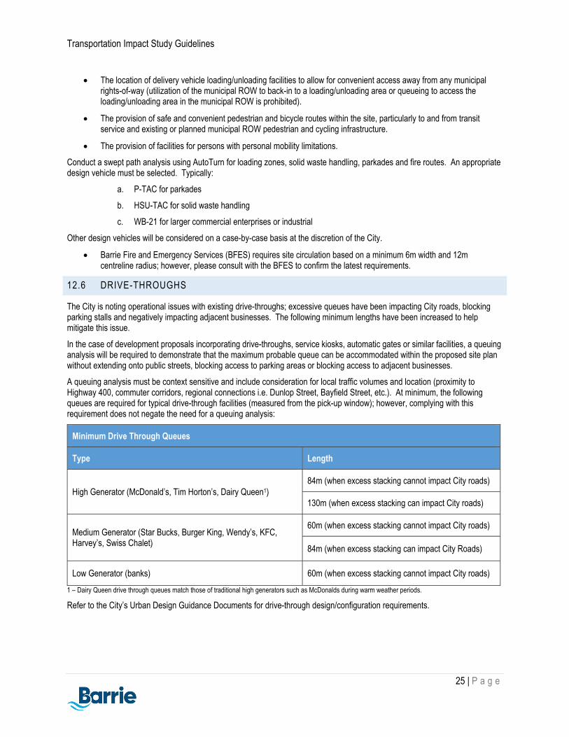
Transportation Impact Study Guidelines
25 | P a g e
The location of delivery vehicle loading/unloading facilities to allow for convenient access away from any municipal rights-of-way (utilization of the municipal ROW to back-in to a loading/unloading area or queueing to access the loading/unloading area in the municipal ROW is prohibited).
The provision of safe and convenient pedestrian and bicycle routes within the site, particularly to and from transit service and existing or planned municipal ROW pedestrian and cycling infrastructure.
The provision of facilities for persons with personal mobility limitations.
Conduct a swept path analysis using AutoTurn for loading zones, solid waste handling, parkades and fire routes. An appropriate design vehicle must be selected. Typically:
a. P-TAC for parkades
b. HSU-TAC for solid waste handling
c. WB-21 for larger commercial enterprises or industrial
Other design vehicles will be considered on a case-by-case basis at the discretion of the City.
Barrie Fire and Emergency Services (BFES) requires site circulation based on a minimum 6m width and 12m centreline radius; however, please consult with the BFES to confirm the latest requirements.
12.6 DRIVE-THROUGHS
The City is noting operational issues with existing drive-throughs; excessive queues have been impacting City roads, blocking parking stalls and negatively impacting adjacent businesses. The following minimum lengths have been increased to help mitigate this issue.
In the case of development proposals incorporating drive-throughs, service kiosks, automatic gates or similar facilities, a queuing analysis will be required to demonstrate that the maximum probable queue can be accommodated within the proposed site plan without extending onto public streets, blocking access to parking areas or blocking access to adjacent businesses.
A queuing analysis must be context sensitive and include consideration for local traffic volumes and location (proximity to Highway 400, commuter corridors, regional connections i.e. Dunlop Street, Bayfield Street, etc.). At minimum, the following queues are required for typical drive-through facilities (measured from the pick-up window); however, complying with this requirement does not negate the need for a queuing analysis:
Minimum Drive Through Queues
Type Length
High Generator (McDonald’s, Tim Horton’s, Dairy Queen1) 84m (when excess stacking cannot impact City roads)
130m (when excess stacking can impact City roads)
Medium Generator (Star Bucks, Burger King, Wendy’s, KFC, Harvey’s, Swiss Chalet)
60m (when excess stacking cannot impact City roads)
84m (when excess stacking can impact City Roads)
Low Generator (banks) 60m (when excess stacking cannot impact City roads)
1 – Dairy Queen drive through queues match those of traditional high generators such as McDonalds during warm weather periods.
Refer to the City’s Urban Design Guidance Documents for drive-through design/configuration requirements.

Transportation Impact Study Guidelines
26 | P a g e
TRANSPORTATION DEMAND MANAGEMENT (TDM) PLAN1
TDM Plans are required to encourage/enhance shifts to sustainable modes of transportation through ongoing action before and after occupation as well as aide in the City achieving modal targets contained in the Transportation Master Plan. The TDM Plan shall:
1. Be integrated with the TIS submitted to support the proposed development;
2. Identify design and/or programmatic means to reduce single occupancy vehicle use;
3. Identify the roles and responsibilities of the landowner with respect to each recommended program and its implementation; and
4. Identify the operational and financial roles and responsibilities of the landowner including, but not limited to, program development, implementation and ongoing management and operations of the travel demand management plan and/or program.
13.1 TDM REQUIREMENT SUMMARY
A TDM Plan is required if any of the following thresholds are met:
Criteria TDM Plan Threshold
Number of employees 75 or greater
Residential Units 50 or greater
Square Footage 2,000 sq.m
Parking Supply proposed parking reductions below requirements identified in the City’s zoning by-law
Trip Generation auto trip reductions by assigning a portion of trips to transit and active transportation (inline with transportation master plan modal split targets)
Based on the above requirements, a TDM Plan shall be included within or attached to the Transportation Impact Study (TIS). The TDM Plan shall identify TDM measures to support the modal split assumptions in the TIS, the following contents are recommended for the TDM Plan:
Targets – The TDM Plan should include the modal split assumptions / targets in the TIS. The future modal split assumptions for a proposed development should reflect transit and active transportation modal split targets as identified in the City’s TMP (using linear extrapolation for the study horizons under consideration).
TDM Measures – The TDM Plan should recommend a mix of hard and soft measures that support and link to the modal split assumptions for a development. The recommended measures should also include both ‘education, promotion and outreach’ measures, and ‘incentive/disincentive’ measures (as defined by Transport Canada). Note that hard measures are preferred.
Monitoring – As the City’s TDM efforts are relatively new; long-term monitoring requirements will be considered in the future.
Implementation plan – The TDM Plan should identify roles and responsibilities for all parties, including the landowner and TDM Coordinator (e.g. property owner, property management, employer representative). The TDM Plan should also summarize implementation of TDM measures, long term maintenance responsibilities, program of target dates, phasing of the development, and information about ongoing management of the TDM Plan.
1 Content sourced from York Region Transportation Mobility Plan Guidelines

Transportation Impact Study Guidelines
27 | P a g e
13.2 TDM CHECKLIST
The following checklist is intended to assist transportation professionals in developing a comprehensive TDM plan. TDM measures not contained within the checklist will be considered. Note that the City will provide recommendations if the proposed TDM plan is not in alignment with the scale of the proposed development.
TDM Measure Residential Non-Residential
Required Responsibility Required Responsibility
Transit incentives (i.e. transit passes)
Condos / residential apartments only
Applicant Yes Applicant
Information packages / communications / outreach (online resources, maps, schedules)
Yes City (informational website)
Yes City (informational website)
Pedestrian connections Yes Applicant Yes Applicant
Cycling connections Yes Applicant Yes Applicant
Ped/cycling connections to transit facilities
Yes Applicant Yes Applicant
Internal ped/cycling circulation
Yes Applicant Yes Applicant
Active transportation network/fine-grid network
Yes
Generally completed through the secondary planning process or plan of subdivision
Yes
Generally completed through the secondary planning process or plan of subdivision
Bicycle parking/shelter Condos / residential apartments only
Applicant Yes Applicant
Bicycle repair station Condos / residential apartments only
Applicant Yes Applicant
Bicycle parking Condos / residential apartments only
Applicant Yes Applicant
Benches/receptacles Yes Applicant Yes Applicant
Illumination of ped/cycling connections
Case-by-case Applicant Case-by-case Applicant
Carpool parking NA NA Yes Applicant
Shared parking between land uses
NA NA Yes Applicant
Parking reduction Where appropriate Applicant Where appropriate Applicant
Real time TV screen Condos / residential apartments only
Applicant Yes Applicant
Trip end facilities (i.e. showers)
NA NA Yes Applicant
Telecommute NA NA Yes Applicant

Transportation Impact Study Guidelines
28 | P a g e
CONCLUSIONS AND RECOMMENDATIONS
A summary of the key findings with respect to the transportation impact of the proposed development along with a summary of the recommended improvements shall be presented
DOCUMENTATION AND REPORTING
Two (2) copies of the final transportation impact study report and technical appendices should be provided to the City for review both in digital and hardcopy formats. Similar requirements are made for addendums and subsequent work submitted in support of the original TIS. Should changes to the original TIS be requested and these changes are deemed substantial by the City, then an updated TIS will be requested to replace the original.
The model and results of the ‘Synchro’ analysis along with the results of ‘SimTraffic’ analysis shall be supplemented as part of the TIS submission, both in digital and hardcopy format.
If the study area for the analysis includes transportation facilities located on the City’s periphery, then copies of the transportation impact study report should be submitted to these agencies for review where applicable (County of Simcoe, Town of Innisfil, Township of Springwater, Township of Oro-Medonte, Township of Essa). If the study area and/or development/redevelopment proposal is within the MTO permit control area, this triggers a separate review process with the MTO.
The TIS should consist of a main text document containing key maps, illustrations, summary tables and detailed analysis. A technical appendix included under another cover should be provided in the case were the analysis and other technical material is too substantial to provide in one document. Where possible, key maps, diagrams, graphs, tables and other exhibits should be placed adjacent to the relevant text as opposed to an appendix.
The TIS and all related information submitted to the City will be considered as public domain once accepted.

Transportation Impact Study Guidelines
29 | P a g e
APPENDIX A – DRAFT TERMS OF REFERENCE
Project Name:
Project Address:
1) Project description:
XXX Units – Residential Development
XXX Units – Single Family
XXX Units – Multi-Family
2) Population & Employment:
a) Provide commentary on the proposed development population and employment as compared to in-effect population and employment forecasts for the applicable traffic zone, prorated spatially and accounting for existing development. This information can be found in the EMME modelling appendix of the Transportation Master Plan.
3) Study area limits and list of intersection analysis:
Study area to include the following intersections:
a) List of intersections
b) ….
c) ….
4) Relevant background material
List of relevant background material to support the TIS.
a) Official Plan Road Classification and Widening Plan Schedules
b) Transportation Master Plan (active transportation, transit, future network improvements, future road widenings, macro modelling data)
c) ….
5) Turning Movement Counts and Signal Timing
List proposed data collection plan and required City data.
6) Design peak hour of analysis
List proposed peak periods for analysis as appropriate for the proposed development.
7) Horizon years of analysis
List proposed horizon years for analysis as appropriate for the proposed development and reflective of any proposed phasing.
8) Anticipated future developments within the study horizon that would effect the calculated growth rate derived from the Transportation EMME plots (e.g. intensity of development that far exceeds the official plan and/or land use utilized for the basis of population and employment forecasts used for macro modelling).
Consultant to review the City’s proposed developments web page and confirm with the City.

Transportation Impact Study Guidelines
30 | P a g e
9) Background Traffic volume growth rate
Confirm proposed growth rates for the peak period(s) analysis for the applicable horizons (generally using the City’s EMME plots from the Transportation Master Plan) and detail the growth rates similarly to the following example table.
Traffic Volume Growth Rate – PM Peak Period Analysis (EXAMPLE ONLY)
Growth rate (2016 to 2031 PM)
Annualized growth rate (2016 to 2031 PM)
Opening Day Opening Day + 5 years
Opening Day + 10 years
Street A - Eastbound 25% 1.6% 1.6% compounded annually to horizon year
1.6% compounded annually to horizon year
1.6% compounded annually to horizon year
Street B - Westbound 35% 2.2% 2.2% compounded annually to horizon year
2.2% compounded annually to horizon year
2.2% compounded annually to horizon year
10) Trip generation methodology
Use the latest Institute of Transportation Engineers (ITE) vehicle trip generation rates to estimate site traffic volumes as this represents the “worst case scenario” for the impact assessment.
11) Trip distribution and traffic assignment parameters
Propose distribution and traffic assignment parameters.
12) Traffic engineering methodology for analysis
Confirm software version, if SimTraffic analysis is required (if the proposed development is located within or potentially impacting the noted corridors requiring SimTraffic analysis as identified in Section 7.2.2.) and/or if macro modelling is required.
13) Transit, Pedestrian, Cycling Infrastructure Evaluation
Confirm limits and solicit any required information.
14) Pedestrian Circulation Plan
Propose plan limits and confirm applicability.
15) Transportation Demand Management Plan
Confirm if the proposed development meets thresholds requiring a transportation demand management plan.
16) Engineering standards
Use City standards (https://www.barrie.ca/City%20Hall/Planning-and-Development/Engineering-Resources/Pages/Engineering-Standards-Policies-Guidelines.aspx) and the Transportation Association of Canada Geometric Design Guidelines for Canadian Roads (latest edition).
17) Number of final report copies
City – 2 print, 1 – digital (including models)
Client – as required
18) Other matters
Outline additional site-specific issues or matters that will be addressed by the TIS as required.

Transportation Impact Study Guidelines
31 | P a g e
APPENDIX B – EXAMPLE FIGURES2
Example Study Area Figure
2 Content sourced from City of Abbotsford Transportation Impact Assessment Terms of Reference

Transportation Impact Study Guidelines
32 | P a g e
Example Lane Configuration Figure
Example of Base Traffic Figure

Transportation Impact Study Guidelines
33 | P a g e
Example of Trip Distribution Figure

Transportation Impact Study Guidelines
34 | P a g e
APPENDIX C – EXAMPLE TABLES
Example of Signalized Intersection Capacity Analysis Summary Table:
Left Thru Right Left Thru Right Left Thru Right Left Thru Right
Volumes
V/C
Delay
LOS
Existing Storage
50% Queue
95% Queue
Volumes
V/C
Delay
LOS
Existing Storage
50% Queue
95% Queue
Volumes
V/C
Delay
LOS
Existing Storage
50% Queue
95% Queue
Volumes
V/C
Delay
LOS
Existing Storage
50% Queue
95% Queue
Volumes
V/C
Delay
LOS
Existing Storage
50% Queue
95% Queue
Volumes
V/C
Delay
LOS
Existing Storage
50% Queue
95% Queue
Intersection approaching capacity (LOS D or E), approach demand near capacity (v/c 0.85 to 0.99), 95% queue length exceeds capacity of existing storage bay
Intersection equals or exceeds capacity (LOS F), approach demand equals or exceeds capacity (v/c >= 1), 50% queue length exceeds capacity of existing storage bay
Overall V/C
2025 Background +
Site
Street A (N/S) and Street B (E/W)
Overall Delay
2025 Background +
Site
Weekday AM
Weekday PM
2020 Base
2025 Background
Intersection Assessment Notes
2025 Background
IntersectionPeak
PeriodScenario
2020 Base
Eastbound Westbound Northbound Southbound Overall LOS
Performance Measure
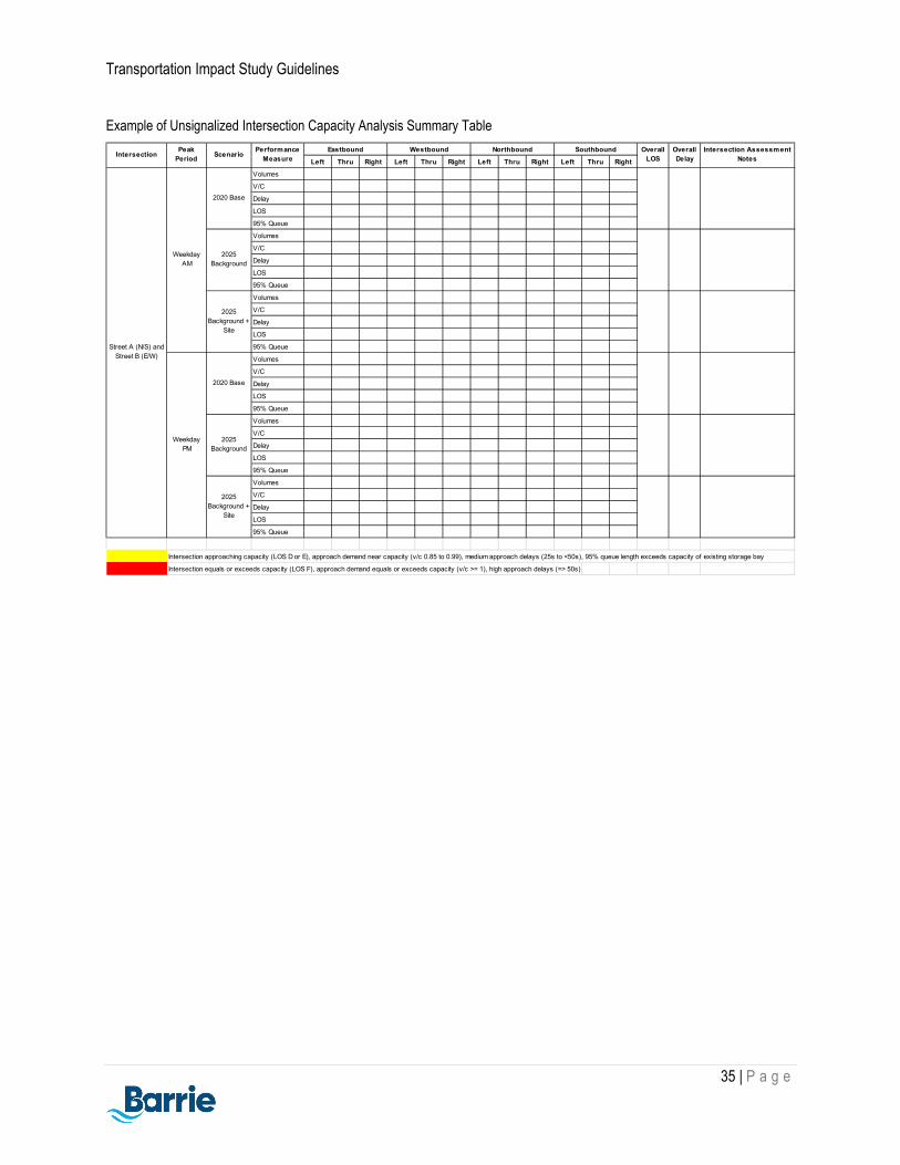
Transportation Impact Study Guidelines
35 | P a g e
Example of Unsignalized Intersection Capacity Analysis Summary Table
Left Thru Right Left Thru Right Left Thru Right Left Thru Right
Volumes
V/C
Delay
LOS
95% Queue
Volumes
V/C
Delay
LOS
95% Queue
Volumes
V/C
Delay
LOS
95% Queue
Volumes
V/C
Delay
LOS
95% Queue
Volumes
V/C
Delay
LOS
95% Queue
Volumes
V/C
Delay
LOS
95% Queue
Intersection approaching capacity (LOS D or E), approach demand near capacity (v/c 0.85 to 0.99), medium approach delays (25s to <50s), 95% queue length exceeds capacity of existing storage bay
Intersection equals or exceeds capacity (LOS F), approach demand equals or exceeds capacity (v/c >= 1), high approach delays (=> 50s)
2025 Background +
Site
Overall Delay
2025 Background +
Site
Weekday PM
2020 Base
2025 Background
Northbound Southbound Overall LOS
Intersection Assessment Notes
Street A (N/S) and Street B (E/W)
Weekday AM
2020 Base
2025 Background
IntersectionPeak
PeriodScenario
Performance Measure
Eastbound Westbound

Transportation Impact Study Guidelines
36 | P a g e
Example Trip Generation Table

Transportation Impact Study Guidelines
37 | P a g e
APPENDIX D – MULTIMODAL TRIP GENERATION SURVEY
Site walking and cycling trip generation can be estimated by using the following methodology or data source:
Transportation Tomorrow Survey (TTS) data (should be used carefully due to incompatible urban characteristics)
Proxy site surveys (must have similar built-forms and characteristics)
At this time, the City has many different types of land uses and developments located throughout different areas. For this reason, it is recommended that transportation specialists undertake surveys at proxy sites that have similar characteristics as the proposed development such as size, land use types, transit service frequency and road network. The surveys can collect information on different modes of transportation at the same time. For example, the following proxy site survey was conducted for a site’s multimodal trip generation:
Survey Period
Inbound Outbound
Tota
l Per
son
Trip
s
Car
s (%
)
Pass
enge
r (%
)
Tran
sit (
%)
Wal
k / C
ycle
(%)
Tota
l Per
son
Trip
s
Car
(%)
Pass
enge
r (%
)
Tran
sit (
%)
Wal
k / C
ycle
(%)
7:30-8:30 AM 55 50 10 10 30 200 55 10 10 25
4:30-5:30 PM 250 53 12 15 15 80 60 20 5 5

Transportation Impact Study Guidelines
38 | P a g e
APPENDIX E – PARKING STUDY GUIDELINES
The City has adopted the City of Vaughan’s Parking Study Guidelines. City of Barrie specific modifications are located within blue dashed boxes:
City of Barrie specific requirement / change……….

Transportation Impact Study Guidelines
39 | P a g e

Transportation Impact Study Guidelines
40 | P a g e

Transportation Impact Study Guidelines
41 | P a g e

Transportation Impact Study Guidelines
42 | P a g e

Transportation Impact Study Guidelines
43 | P a g e
A parking study is required when a parking reduction equal to or greater than 5% of the minimum parking requirements set out in the City’s Zoning By-law is proposed.
If the proposed reduction is less than 5% (to a maximum of 5 parking spaces) and is being proposed due to a in-situ technical/physical site constraint, a Letter of Justification may be accepted. Please refer to Section 3.6 of the parking study guidelines for general requirements.

Transportation Impact Study Guidelines
44 | P a g e
The parking study must be stamped and sealed by a Professional Engineer licensed to practice in the province of Ontario.

Transportation Impact Study Guidelines
45 | P a g e

Transportation Impact Study Guidelines
46 | P a g e
Proxy Site – An appropriate proxy site or sites should be selected and reviewed with the City prior to conducting survey(s). The City requires a minimum of three (3) proxy sites. This section of the Parking Study should summarize:

Transportation Impact Study Guidelines
47 | P a g e

Transportation Impact Study Guidelines
48 | P a g e
3.4.3 Cash-In-Lieu of Parking Space
In instances where the parking supply does not satisfy the projected demand, the City may consider cash-in-lieu for the difference in the number of parking stalls from what is required as identified in the parking study to what is being supplied. It should be noted that this is assessed on a case-by-case basis and is not to be used as a lower cost alternative to providing the required parking supply. Con’t….
The City will consider a comprehensive TDM Plan towards proposed parking reductions in consideration of a complete parking study. Proposed parking reductions in excess of projected demand would be subject to cash-in-lieu of parking space requirements.

Transportation Impact Study Guidelines
49 | P a g e
3.4.3 Cash-In-Lieu of Parking Space (continued)
The purpose of this provision is to provide a degree of flexibility when technical or physical constraints impacting the parking supply cannot be resolved feasibly. Note that this provision is not to be applied in instances of significant parking supply deficiencies, which may result in a development proposal being non feasible. The fees for cash-in-lieu are updated on an annual basis; the most up-to-date fees can be found under Fees By-Law at: https://www.barrie.ca/City%20Hall/ByLaws/Pages/byLaws.aspx.
Verify that the parking supply proposed is no greater than 5% from the minimum requirements (and no greater than 5 parking spaces).
The letter of justification shall include an explanation stating why the minimum parking requirements cannot be achieved. The letter of justification is to be prepared, signed and sealed by a Professional Engineer licensed to practice in the province of Ontario.

Transportation Impact Study Guidelines
50 | P a g e
Refer to Section 15 of the City of Barrie’s Transportation Impact Study Guidelines for submission requirements.