Embed Size (px)
Citation preview
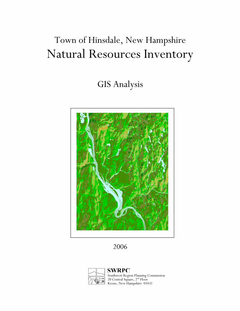
Town of Hinsdale, New Hampshire
Natural Resources Inventory
GIS Analysis
2006
SWRPCSouthwest Region Planning Commission 20 Central Square, 2nd Floor Keene, New Hampshire 03431
i
Town of Hinsdale, New Hampshire Natural Resources Inventory
GIS Analysis
Acknowledgments
The “Hinsdale Natural Resources Inventory, GIS Analysis” was prepared by Southwest Region Planning Commission with oversight from the Hinsdale Conservation Commission. This project was funded in part under the Southwest Region Planning Commission’s Regional Environmental Planning Program with support from the NH Department of Environmental Services.
Hinsdale Conservation Commission, 2005 - 2006
Bruce Bellville, Chairman
Carl Britt Ellen Edson
Barbara Fostyck Bill Roberts
Gordon Schofield and
Bob Johnson, Selectmen’s Representative
ii
Town of Hinsdale, New Hampshire Natural Resources Inventory
GIS Analysis
Table of Contents
Introduction . . . . . 1
Central New England Landscape. . 4
Geology . . . . . 6
Hydrology. . . . . . 8
Soil . . . . . . . 10
Landcover . . . . . . 12
Analysis . . . . . . 13
iii
Town of Hinsdale, New Hampshire Natural Resources Inventory
GIS Analysis
List of Maps
1. Bedrock Geology and Fractures
2. Water Resources with Watershed Boundaries
3. Elevation
4. Farmland Soils
5. Forest Soils
6. Construction Materials
7. Sensitive Soils
8. Sensitive Resources
9. Wildlife Habitat Landcover
10. Properties Shaded by Size and Structures
Appendices
Appendix 1- Descriptions of Natural Community Systems in Hinsdale Appendix 2- “Southwest Region Natural Resources Inventory, First Edition
(Fragmentation Analysis).” 2003. Southwest Region Planning Commission. (CD-ROM)
Appendix 3- “Wildlife Action Plan.” 2006. NH Fish & Game Department. (CD-
ROM) Appendix 4- Additional Resources and References

Town of Hinsdale, New Hampshire Natural Resources Inventory
GIS Analysis
Introduction 1
Introduction
This “Natural Resources Inventory, GIS Analysis” was prepared by the Hinsdale Conservation Commission for use by the local officials and citizens of Hinsdale. This analysis is intended as a foundation to be augmented and refined by future studies and local knowledge. The use of an NRI in community planning can help a community avoid or mitigate damaging impacts of human activity on natural features and natural resources. An NRI at minimum will identify resources found in the community and discuss the distribution of those resources. The NRI can also present quantitative and qualitative information about resources. All of this supports a larger purpose of creating a shared understanding among residents and officials of the community’s natural landscape and an appreciation for the intrinsic and social values of the community’s natural resources. The development and maintenance, periodic refinement and inclusion of NRI in the Master Plan can foster an ethic in municipal government of conservation, protection, stewardship of natural resources. In general, conservation goals will address two suites of issues: • Preserve Ecological Integrity / Avoid or Minimize Landscape Fragmentation - preserve the
parts of the mosaic of geology, topography, streams and ponds, plant and animal communities and preserve the natural processes such as hydrology, ecological succession, and biodiversity, in order to preserve the natural systems on which we depend for air , water, food, and fiber.
• Preserve Specific Places and Resources - rare or special plant communities and plant and
animal species; resources of economic value e.g. farmland soils, timber lands and water supplies; and aspects of Hinsdale’s natural and cultural heritage, such as scenic views and recreation opportunities ranging from strolling on country roads to hunting, fishing and rigorous backcountry experiences.
The development and use of this NRI is wholly consistent with the Town of Hinsdale’s current Master Plan, which was updated in 2002. A community survey conducted by the Planning Board as part of the a Master Plan update asked residents for their opinions of an array of issues related to community life, land use and development. Most survey respondents (89%) believed that the protection of undeveloped open space should be carefully planned and carried out in Hinsdale. More specifically, when asked what considerations should determine the location and rate of future development, from a choice of ten items “protecting drinking water supplies” and “conservation of habitat” were the second and fourth most frequent answers (“increasing tax revenue” was first, “controlling school spending” was third, and “protect/improve neighborhood character” was fifth).

Town of Hinsdale, New Hampshire Natural Resources Inventory
GIS Analysis
Introduction 2
Another public involvement exercise associated with the 2002 Master Plan update invited citizens to share photographs of places and things in Hinsdale to describe what they value about the community’s character. “Open Space” was frequently identified as a defining characteristic of Hinsdale to be preserved during that exercise. As a result of public opinion expressed in the survey and photo exercise, the Master Plan update specifically calls for the protection of open space and environmental quality in the Future Land Use Plan: “Future Land Use Policies” include “discourage development on environmentally sensitive and fragile lands, such as wetlands, steep slopes, and floodplains” and “provide for the preservation of Hinsdale’s agricultural, forest, wildlife, and water resources as vital to the town’s proper development.” The “Land Use” goal “to promote a balanced pattern of development for housing, agriculture, recreation, business, and industry” includes among other objectives: “2. ensure that development occurs at a rate consistent with the capability of the land to support it…” and “3. balance new development with protection of Hinsdale’s sensitive and significant resources.” The first of two goals under “Conservation and Preservation” follows: “balance new development with protection of the Town’s sensitive and significant natural, cultural and historic resources, while preserving the Town’s identity.” Three objectives were established to fulfill that goal: “1. Preserve and protect agricultural lands, environmentally sensitive lands, and historic structures to enhance the open space and retain the characteristics of the Town. “2. Establish conservation areas and open spaces throughout the town, where there is a community need to control further development. “3. Protect water resources throughout the Town. Above ground and underground water resources are now, and in the future will remain a vital asset worthy of protection from all forms of pollution.” The hallmarks of sustainable community development are public institutions that seek to learn, are willing to question convention, able to adapt to change, and able to create or capitalize on opportunities for positive change while protecting against loss. Undertaking studies like this NRI and applying the findings of the same to critical review of land use plans and regulations is a vital part of that. Approach This project is an analysis of the distribution of natural resources and physical landscape conditions as can be described from existing data in the Southwest Region Planning Commission Geographic Information System (GIS). GIS data sources used here are U.S. Department of Agriculture (USDA) Soil Survey of Cheshire County, U.S. Geologic Survey (USGS) Digital Line Graph hydrogaphy data, U.S. Fish & Wildlife Service (USFWS) National Wetlands Inventory (NWI), USGS Stratified Drift Aquifer data, NH Department of Environmental Services (NH

Town of Hinsdale, New Hampshire Natural Resources Inventory
GIS Analysis
Introduction 3
DES) water well and wellhead protection area data, NH Department of Transportation road data, NH GRANIT Digital Elevation Model data, and NH DES Non-Point Source pollution data. Original GIS data developed for this project are the locations of buildings within Hinsdale; the delineation of fields, gravel pits, recreation areas, etc. within Hinsdale; and the delineation of 17 watersheds and subwatersheds that convey water into, through and within Hinsdale. The analysis uses watersheds and town boundaries as organizing units to facilitate comparisons between parts of Town. Watersheds also provide a built-in monitoring system for environmental quality, being that water quality is the net product of all that water encounters in the course of the hydrologic cycle, water chemistry and aquatic plant and animal life provide readily assessable indicators for the environmental well-being of a stream’s or pond’s watershed. Results are presented in maps and a series of tables, which are organized by variable groupings: Water Resources, Sensitive Resources, Soil Resources, and Development Parameters and presented by watershed. This project includes a cursory description of land cover: perennial water, wetlands, forested and non-forested/non-wetlands (i.e. areas larger or more remote than typical landscaped yards associated with homes and commercial buildings that are maintained in a non-forested state for agriculture, recreation, excavation or residential use). New Hampshire’s 2006 Wildlife Action Plan provides descriptions and maps of habitats of concern- habitats that are themselves communities at risk or associated with plan and animal species at risk. GIS data depicting the distribution of significant wildlife habitat has made it possible to view these habitats for Hinsdale. An inventory of habitat types (natural community systems) in Hinsdale is included in this NRI. Appendix 1 includes descriptions of the natural community systems found in Hinsdale. The information presented in
this report is provided as a foundation for further study, refinement and enhancement with local knowledge and original research.

Town of Hinsdale, New Hampshire Natural Resources Inventory
GIS Analysis
Introduction 1
Introduction
This “Natural Resources Inventory, GIS Analysis” was prepared by the Hinsdale Conservation Commission for use by the local officials and citizens of Hinsdale. This analysis is intended as a foundation to be augmented and refined by future studies and local knowledge. The use of an NRI in community planning can help a community avoid or mitigate damaging impacts of human activity on natural features and natural resources. An NRI at minimum will identify resources found in the community and discuss the distribution of those resources. The NRI can also present quantitative and qualitative information about resources. All of this supports a larger purpose of creating a shared understanding among residents and officials of the community’s natural landscape and an appreciation for the intrinsic and social values of the community’s natural resources. The development and maintenance, periodic refinement and inclusion of NRI in the Master Plan can foster an ethic in municipal government of conservation, protection, stewardship of natural resources. In general, conservation goals will address two suites of issues: • Preserve Ecological Integrity / Avoid or Minimize Landscape Fragmentation - preserve the
parts of the mosaic of geology, topography, streams and ponds, plant and animal communities and preserve the natural processes such as hydrology, ecological succession, and biodiversity, in order to preserve the natural systems on which we depend for air , water, food, and fiber.
• Preserve Specific Places and Resources - rare or special plant communities and plant and
animal species; resources of economic value e.g. farmland soils, timber lands and water supplies; and aspects of Hinsdale’s natural and cultural heritage, such as scenic views and recreation opportunities ranging from strolling on country roads to hunting, fishing and rigorous backcountry experiences.
The development and use of this NRI is wholly consistent with the Town of Hinsdale’s current Master Plan, which was updated in 2002. A community survey conducted by the Planning Board as part of the a Master Plan update asked residents for their opinions of an array of issues related to community life, land use and development. Most survey respondents (89%) believed that the protection of undeveloped open space should be carefully planned and carried out in Hinsdale. More specifically, when asked what considerations should determine the location and rate of future development, from a choice of ten items “protecting drinking water supplies” and “conservation of habitat” were the second and fourth most frequent answers (“increasing tax revenue” was first, “controlling school spending” was third, and “protect/improve neighborhood character” was fifth).
Town of Hinsdale, New Hampshire Natural Resources Inventory
GIS Analysis
Introduction 2
Another public involvement exercise associated with the 2002 Master Plan update invited citizens to share photographs of places and things in Hinsdale to describe what they value about the community’s character. “Open Space” was frequently identified as a defining characteristic of Hinsdale to be preserved during that exercise. As a result of public opinion expressed in the survey and photo exercise, the Master Plan update specifically calls for the protection of open space and environmental quality in the Future Land Use Plan: “Future Land Use Policies” include “discourage development on environmentally sensitive and fragile lands, such as wetlands, steep slopes, and floodplains” and “provide for the preservation of Hinsdale’s agricultural, forest, wildlife, and water resources as vital to the town’s proper development.” The “Land Use” goal “to promote a balanced pattern of development for housing, agriculture, recreation, business, and industry” includes among other objectives: “2. ensure that development occurs at a rate consistent with the capability of the land to support it…” and “3. balance new development with protection of Hinsdale’s sensitive and significant resources.” The first of two goals under “Conservation and Preservation” follows: “balance new development with protection of the Town’s sensitive and significant natural, cultural and historic resources, while preserving the Town’s identity.” Three objectives were established to fulfill that goal: “1. Preserve and protect agricultural lands, environmentally sensitive lands, and historic structures to enhance the open space and retain the characteristics of the Town. “2. Establish conservation areas and open spaces throughout the town, where there is a community need to control further development. “3. Protect water resources throughout the Town. Above ground and underground water resources are now, and in the future will remain a vital asset worthy of protection from all forms of pollution.” The hallmarks of sustainable community development are public institutions that seek to learn, are willing to question convention, able to adapt to change, and able to create or capitalize on opportunities for positive change while protecting against loss. Undertaking studies like this NRI and applying the findings of the same to critical review of land use plans and regulations is a vital part of that. Approach This project is an analysis of the distribution of natural resources and physical landscape conditions as can be described from existing data in the Southwest Region Planning Commission Geographic Information System (GIS). GIS data sources used here are U.S. Department of Agriculture (USDA) Soil Survey of Cheshire County, U.S. Geologic Survey (USGS) Digital Line Graph hydrogaphy data, U.S. Fish & Wildlife Service (USFWS) National Wetlands Inventory (NWI), USGS Stratified Drift Aquifer data, NH Department of Environmental Services (NH
Town of Hinsdale, New Hampshire Natural Resources Inventory
GIS Analysis
Introduction 3
DES) water well and wellhead protection area data, NH Department of Transportation road data, NH GRANIT Digital Elevation Model data, and NH DES Non-Point Source pollution data. Original GIS data developed for this project are the locations of buildings within Hinsdale; the delineation of fields, gravel pits, recreation areas, etc. within Hinsdale; and the delineation of 17 watersheds and subwatersheds that convey water into, through and within Hinsdale. The analysis uses watersheds and town boundaries as organizing units to facilitate comparisons between parts of Town. Watersheds also provide a built-in monitoring system for environmental quality, being that water quality is the net product of all that water encounters in the course of the hydrologic cycle, water chemistry and aquatic plant and animal life provide readily assessable indicators for the environmental well-being of a stream’s or pond’s watershed. Results are presented in maps and a series of tables, which are organized by variable groupings: Water Resources, Sensitive Resources, Soil Resources, and Development Parameters and presented by watershed. This project includes a cursory description of land cover: perennial water, wetlands, forested and non-forested/non-wetlands (i.e. areas larger or more remote than typical landscaped yards associated with homes and commercial buildings that are maintained in a non-forested state for agriculture, recreation, excavation or residential use). New Hampshire’s 2006 Wildlife Action Plan provides descriptions and maps of habitats of concern- habitats that are themselves communities at risk or associated with plan and animal species at risk. GIS data depicting the distribution of significant wildlife habitat has made it possible to view these habitats for Hinsdale. An inventory of habitat types (natural community systems) in Hinsdale is included in this NRI. Appendix 1 includes descriptions of the natural community systems found in Hinsdale. The information presented in
this report is provided as a foundation for further study, refinement and enhancement with local knowledge and original research.

Town of Hinsdale, New Hampshire Natural Resources Inventory
GIS Analysis
New England Landscape 4
The Central New England Landscape
The rugged landscape of central New England is part of North America’s vast Appalachian Mountain range. The Appalachians today are the modest remnants of grand ancient mountains, widely thought to have arisen 250 million years ago from the collision of two plates of granite that since separated again and are now North America, northern Africa and southwestern Europe. The northern Appalachians were also subjected to several periods of glaciation – snow and ice accumulating in the north flowed in mass as far south as Massachusetts, Pennsylvania and Wisconsin, before melting away in a subsequently warming climates. The southward flow of the ice affected the landscape beneath it through both its erosive power which scoured the soil and life from the bed rock, and redeposited it when the ice melted. Some of that replaced material was simply laid down on the bedrock as the ice melted away from under it, and is known today as glacial till. Till is a mix of all manner of sizes and kinds of geologic particles: silt, sand, clay, stones, boulders…. Some of the material carried by the glaciers of redistributed by the water running out of the melting glaciers, and then deposited in stream channels, deltas and lake beds, and is known today as stratified drift. Stratified drift deposits tend to contain particles of a small range of sizes or the same size because they were sorted by the running water. The glaciers also affected the landscape (and animals, particularly aquatic life) by their incalculable weight which depressed the Earth’s curst and changed the direction of the flow of water for a period time. The last period of glaciation ended only 12,000 years ago. As the glacier retreated, much of Hinsdale was covered under Glacial Lake Hitchcock for 2-3,000 years. Deltas formed where fast-flowing streams entered the Lake. Course sand and gravel were quickly deposited as streams entered the calm lake environment. One of these deltas can be seen today at the mouth of the Ashuelot River, the largest tributary of the Connecticut River in New Hampshire. The flat, once lake-bottom, land at the banks of the Connecticut River provide fertile farmland today. The NH Natural Heritage Bureau1 classifies the “ecoregion” Vermont-New Hampshire Upland, with four subtypes. Of these, Hinsdale falls almost entirely into the subtype Northern Connecticut River Valley. The eastern border of Hinsdale falls on the Hillsboro Inland Hills and Plains subtype border. This classification arises from extensive research by the U.S. Forest Service. The map on the following page indicates that a rather indefinite boundary between these regions generally traverses Hinsdale along the Hinsdale/Winchester town line. The Natural Heritage Bureau describes the narrow Northern Connecticut River Valley as being “filled with glacial outwash and glacial lake deposits that abut lower slopes of adjacent hills comprised of glacial till. The processes of erosion and sedimentation over time have formed
1 Sperduto, D.D. and W.F. Nichols. 2004. Natural Communities of New Hampshire. The New Hampshire Natural Heritage Bureau and the Nature Conservancy.
Town of Hinsdale, New Hampshire Natural Resources Inventory
GIS Analysis
New England Landscape 5
distinctive river terraces in these glacial deposits. There is much metamorphic bedrock in this section that yields soils with relatively high nutrient status.” Located on the outer edge of Hinsdale, the Hillsboro Hills and Plains are “characterized by isolated hills and peaks of hard, resistant rock (mostly granite) commonly referred to as monadnocks. Numerous small lakes and narrow valley streams are scattered throughout the area. Drumlins are also distinctive glacial features. Soils are typically shallow and stony [and of a coarser texture with lower nutrient status]. … This is reflected in the composition and distribution of plant communities.” A description of habitats with associated natural communities and species expected to be found in Hinsdale is located in Appendix 1.

Town of Hinsdale, New Hampshire Natural Resources Inventory
GIS Analysis
6 Geology
Geology
Bedrock Geology, Surficial Geology, Geomorphology
Geology is the study of the mineral materials of which the earth is composed and the processes that create, re-shape and modify those materials. Geologic materials and processes are literally fundamental to our natural environment. The primary geologic processes that shape the Earth’s crust – plate tectonics (the continuous movement of continental plates), volcanism, earthquakes, glaciation, and erosion by wind and water, and freezing and thawing – have all had roles shaping the Connecticut River Valley of central New England. It is an interesting footnote of our natural history that the bedrock of most of New Hampshire, Maine and southeastern New England is actually distinct from the bedrock of New England west of the Connecticut River. Approximately 250 million years ago, the ancient land mass that is now Europe and African collided with North American. This collision was part a global “conglomeration” of continental plates into a single contiguous mass known as Pangaea. In the course of this collision, the former ocean floors that had separated the continents were compressed between the continents. In New England, that ocean flood became the shale and marble of the Connecticut Valley. The resulting layers of sedimentary rock (ocean floor) crushed between two plates of granite is known as a graben. Grabens are zones of constant seismic activity: central New England is an earthquake-prone region. It was also during this collision that the Appalachians rose to heights more like the Rocky Mountains and Himalayas. As tensions in the Earth’s crust changed, Pangaea disbanded principally into the original continents. During the break-up of Pangaea, it was not uncommon for edges of continental plates to break away from their parent plates and adhere to their neighboring plates. This is the case in New England: the bedrock of most of New Hampshire is remnant of the European-African plate, more specifically Portugal and Morocco. Bedrock geology also has a profound influence on the movement and quality of water above and below the surface. The mineralogy of bedrock directly influences water chemistry and in turn, aquatic ecology and human health. The shape of the land has an obvious influence on the direction and rate of water runoff, ponding and infiltration. However, the physical characteristics of bedrock and the effects of past and present tectonic forces likewise effect the movement of water through bedrock fractures or fracture zones. The bedrock of southern New Hampshire is riddled with criss-crossing fractures, some traversing thousands of feet, others many miles. The hydrologic characteristics of bedrock fractures and fracture zones are difficult to know without site-specific hydrogeologic study. Map 1: Bedrock Geology and Fractures shows Bedrock Geology and Fractures for the Town of Hinsdale.
Town of Hinsdale, New Hampshire Natural Resources Inventory
GIS Analysis
7 Geology
The NH Geologic Survey reports seven major geologic units, or kinds of rock, occurring in Hinsdale. Bedrock Geology New Hampshire Plutonic Suite (Late to Early Devonian) – includes synkinematic and postkinematic granitoids related to the Acadian orogeny. Ages range from 410 to 365 Ma. Igneous rock formed beneath the surface of the earth by consolidation of magma.
Dk2x Kinsman Granodiorite (Early Devonian) (Kinsman Quartz Monzonite of Billings, 1955)—Foliated granite, granodiorite, tonalite, and minor quartz diorite; large megacrysts of potassium feldspar characteristic; garnet locally abundant
Oo3B Trondhjemite—Contains biotite and hornblende. is a leucocratic (light-
colored) intrusive igneous rock. It is a tonalite variety with high albite and low anorthite and orthoclase content
Metasedimentary and Metavolcanic Rocks of the Central Maine Trough Metamorphosed sedimentary and volcanic rocks
Dl Littleton Formation, undivided (Lower Devonian; Siegenian)—Gray metapelite and metawacke and subordinate metavolcanic rocks; generally, but not everywhere, conformable with the underlying Fitch or Madrid Formations. Fossiliferous in western New Hampshire
Spr Perry Mountain and Rangeley Formations, undivided (Silurian) Sc Clough Quartzite (Lower Silurian; upper Llandoverian)—Orthoquartzite, quartz
metaconglomerate, muscovite schist, and minor polymictic metaconglomerate. Disconformable below the Fitch Formation and unconformable on Ordovician formations. Equivalent, in part, to member C of Rangeley Formation of Maine. Fossiliferous
Op Partridge Formation, undivided (Upper to Middle Ordovician)—Black, rusty-weathering sulfidic-graphitic slate or schist and sparse to abundant metagraywacke. Lies stratigraphically between upper and lower parts of the Ammonoosuc Volcanics
Oalx Bimodal volcanic rocks—Locally includes unmapped Oals (Oals Metasedimentary rocks)
Town of Hinsdale, New Hampshire Natural Resources Inventory
GIS Analysis
8 Hydrology
Hydrology
Watersheds, Surface Water, Ground Water Our water resources: perennial streams, ponds, lakes, wetlands, floodplains, and stratified drift aquifers, are some of our most sensitive natural resource areas - susceptible to loss due to small size, fragile conditions, poor prospects for regeneration once disturbed, vulnerability for water contamination, and areas with a high potential for special communities or species. We are familiar with the legacy of degraded water quality and aquatic habitats, the loss of riparian habitat, the diversion of rain water and snow melt from natural courses of meandering through low lands or recharging ground water. Just as the ubiquity of trees along country roads throughout our Region may belie the degradation of natural forested communities by the road and traffic, home building and recurrent timber harvest, so the abundance of water may perpetuate a false sense of security about the well-being of the aquatic in our landscape mosaic. Discussing water resources in terms of these discrete features – ponds, streams, aquifers – should not obscure the fact that these are not static, isolated resources, but parts of our hydrologic system – the ceaseless cycling of water through the atmosphere, soil and geologic formations, myriad organisms, and overland as surface water – and through our homes, businesses and industries. A watershed is a land area from which all the surface run-off drains at a single point. Watersheds can be any size, from a parking lot to half a continent. Watersheds are meaningful units for conservation planning because of the pervasive nature of water – it continuously moves through the natural and manmade environments and our water quality is the net product of everything it encounters - air, soil, pavement, forests – and in the event that a water quality problem is identified, the cause is probably within the same watershed. Watersheds for this project were delineated to identify all land area from which water flows into and through Hinsdale, hence the total land area of the watersheds considered here is greater than the total land area of the Hinsdale corporate limits. Map 2: Water Resources and Watershed Boundaries shows the watershed boundaries delineated along with other water resources discussed in this chapter. Map 3: Elevation shows topography used to assist in the delineation of watersheds. Hinsdale was divided into three distinct major watersheds: The Ashuelot River watershed, the Liscombe Brook watershed, and the Connecticut River Tributaries watershed. Remaining land that did not fall into these watersheds was placed in a category called “Leftovers.” The Town has been further subdivided in to 17 watersheds, some nested within others, to identify the land area from which water flowing in major streams and water bodies originates as rainfall, snow melt, or groundwater outbreak. This analysis addresses perennial lakes, ponds, impounded streams, and other perennial streams that are wide enough to appear as more than a single line in the Digital Line Graph GIS data from U.S. Geologic Survey (essentially the hydrography depicted on the USGS topographic maps) – the standard source for New Hampshire’s GRANIT GIS.

Town of Hinsdale, New Hampshire Natural Resources Inventory
GIS Analysis
9 Hydrology
Wetland data from the USGS was combined with data from the U.S. Fish & Wildlife Service National Wetlands Inventory (a 23-class system developed from aerial photography in the 1980’s) and from the USDA Soil Surveys (hydric soils) for this study. The USGS and USF&WS wetlands data may tend to under-represent the extent of identified wetlands and some forested wetlands may be overlooked all together. The hydric soils data, on the other hand, may over-represent the extent of wetlands due to a matter of resolution affecting all soils data – the boundaries of soil types in the soil survey are very accurate, but, there may be small patches within any mapped soil type that are different soils. Riparian Communities should be considered integral with our aquatic habitats and water resources. Floodplains are a special kind of riparian community, one dominated by recurring flooding. While floodplains are important as ecological communities, as part of the river ecology and for natural flood mitigation, the GIS floodplain data available for the Southwest Region today is not consistent with other water resources data, soils data or data used in the fragmentation analysis. Accordingly, floodplains are not part of this analysis. Aquifers are geologic formations (either fractured bedrock or sand and gravel) that by virtue of their physical structure and location on the landscape can provide water through drilled wells in sufficient quantities to support human uses. Groundwater occurs in all manner of soils and geologic formations across (under) the landscape. Aquifers are a qualified by the ability to support human activity. Characteristics of high-value aquifers include being situated down stream in a watershed, being in a watershed with a preponderance of natural forested land cover, and having a physical structure that is highly permeable – open spaces between particles of sand and gravel or open fissures and interconnected networks of cracks in bedrock - to both store and transmit water. Aquifers are re-supplied primarily by water falling as precipitation. Rain and snow melt move downward through soil, sand and gravel and/or cracks in bedrock to a saturated zone where the spaces between particles and cracks in rock are filled with water. Stratified Drift Aquifers are geological formations of sand and gravel deposited by the melting glaciers 12,000 years ago. Some are vast and extend through several towns. Having been sorted by running water, the deposits can be made up of stones or particles of sand that have very uniform size and therefore a great deal of open space. Stratified Drift can store and yield vast volumes of ground water. These aquifers are also highly susceptible to pollution due to the ease with which contaminants can spread through the porous formations. The data used here is from a thorough study conducted by the USGS and NH Department of Environmental Services. Fractured Bedrock can be highly-productive aquifers. Most domestic water wells in Dublin are drilled into bedrock – and while many have low yields, bedrock fractures can be staggeringly water rich – and sometimes transmit great volumes of water over many miles. Reconnaissance level data about possible location of fractures and fracture zones provided by NH DES is depicted in Map 1. The Glacial Till that blankets the vast majority of the Hinsdale landscape will typically hold a great deal of water due to physical and chemical characteristics of its clay and silt particles, but is a very poor transmitter of water due to the those same characteristics – it “holds on to the water very tightly”.

Town of Hinsdale, New Hampshire Natural Resources Inventory
GIS Analysis
10 Soils
Soil
Forest Soils, Construction Materials, Farmland Soils, Sensitive Soils
Soil is a complex and irreplaceable resource. Soil is not an inert substrate, but an ecological system comprised of mineral particles, decaying organic matter, microscopic organisms (bacteria, algae, fungi, and microscopic animals), water, gases, and chemicals in solution. In this medium live plants and animals that live nowhere else, and upon which terrestrial communities of plants and animals with which we are most familiar depend. Soils evolve from parent material (particles of rock created by wind, rain, freeze-thaw cycles, and mechanical abrasion) through the effects of physical forces, climate, chemistry, biology, and accident of location on the topography regarding hydrology, elevation, slope, and aspect. Our land-use decisions in the past may not have fully accounted for the economic importance of soil potential for agriculture, timber production, water protection, and the ecological importance of soil ecosystems to biodiversity. Soil information for Hinsdale was obtained from the Soil Survey of Cheshire County, New Hampshire, published by the US Department of Agriculture Soil Conservation Service, 1982. The USDA Soil Survey developed by county provides a great deal of information about natural landscape conditions (e.g. hydrology and predominant forest types), suitability for different kinds of resource management (e.g. farming, timber management and gravel mining) and development (e.g. buildings, roads, and septic systems). This analysis addressed three facets of soil potential: potential or suitability for agriculture, timber management and construction material extraction. The USDA classifies soils relative to suitability for farming in three levels, described below and shown on Map 4: Farmland Soils:
1) Prime Farmland Soils are recognized nationally for their fertility and ease of management for grazing, forage crops or till crops.
2) Farmland Soils of Statewide Importance are designated by individual states by virtue
of their fertility and ease of management and importance to, or suitability for the predominant agricultural activities in that state.
3) Farmland Soils of Local Importance are designated by individual County Conservation
Districts by virtue of their fertility and ease of management and importance to, or suitability for the predominant agricultural activities in that county.
Farmland soils of Statewide and Local Importance tend to overlap with Forest Soil Groups 1 A-C (described below) which are not already designated as Prime Farmland Soils. The USDA classifies soils relative to the predominant forest types likely to be found there and the suitability for timber management / harvest activities described below and shown on Map 5: Forest Soils:
Town of Hinsdale, New Hampshire Natural Resources Inventory
GIS Analysis
11 Soils
• Forest Soil Groups IA, IB and IC tend to be well-drained upland situations, with A and B supporting a preponderance of mixed hardwoods, and C supporting mixed forest dominated by white pine and hemlock. These three groups are considered suitable for a range of timber management regimens and mechanized harvest. They are also more suitable for development, having fewer limitations such as steep slopes or wetness.
• Groups IIA and IIB tend to indicate wetter settings, erodible soils and forest communities dominated by pine, hemlock, spruce and fir. These groups are considered not suitable for timber management, or for limited management and harvest activity.
• Some soils are “Not Classified” due to patent unsuitability for timber harvest due to
steepness, rockiness, erodibility, or wetness – or due to highly variable conditions within the soil unit.
The Soil Survey also qualifies soils regarding their potential as commercially viable sources of excavated earth materials: sand, gravel and topsoil. As seen on Map 6: Construction Materials, there is a very small amount of soil in Hinsdale classified as suitable for topsoil. However, there are an appreciable number of acres of soil suitable as sources for sand or gravel. The USDA Soil Survey includes soil characteristics that can be used to identify areas on the landscape that might be especially susceptible or sensitive to disruption or loss of resource values by development or resource management activity. The susceptibility may be due to fragile conditions that are easily altered or do not recover readily from disturbance, or because they support ecological communities that occur in small isolated patches. Soils identified as having steep slope, shallow to bedrock, shallow to water table, and prone to flooding identify the sensitive soil areas as shown on Map 7: Sensitive Soils. Sensitive Resources, as shown on Map 8: Sensitive Resources, are areas that 1) have a higher probability of hosing special communities, 2) are easily disturbed, 3) are easily lost due to their small size, or 4) recover poorly from disturbance.

Town of Hinsdale, New Hampshire Natural Resources Inventory
GIS Analysis
12 Land Cover
Land Cover
Natural Community Systems and Development As part of the effort to write the 2006 Wildlife Action Plan, the New Hampshire Fish and Game Department completed mapping the distribution of habitats across the State. The habitat mapping yielded 16 distinct large forest types and other smaller unique habitats along with a land cover category called “developed.” In Hinsdale, nine of the 16 habitat types in addition to the “developed” areas make up the town. Wildlife Habitat Land Cover for the Town of Hinsdale can be seen on Map 9: Wildlife Habitat Land Cover and in the table below. The forest land cover types shown (Appalachian Oak-Pine, Hemlock Hardwood Pine, and Lowland Spruce Fir) are larger-scale Natural Community Systems which include smaller-scale natural communities. The remaining systems (grassland, marsh, floodplain, ridge and talus slope, cliffs, and peatland) are smaller habitats that are unique and that provide conditions for wildlife that are very different from typical forest conditions. Descriptions of all the Natural Community Systems in Hinsdale are found in Appendix 1. Included in the descriptions are diagnostic natural communities, peripheral or occasional natural communities, and associated natural community systems within each Community System, and a list of characteristic species. Appalachian Oak Pine and Hemlock Hardwood Pine Forest systems make up nearly 70% of Hinsdale while nearly 11% of Hinsdale is made up of Grassland, Marsh, Floodplain, Ridge and Talus Slope, Lowland Spruce Fir, Cliffs and Peatland systems. Finally, nearly 23% of Hinsdale is considered “developed.” Map 10: Properties Shaded by Size and Structures shows property boundaries in Hinsdale along with structure locations.
Wildlife Habitat Land Cover- Natural Community Systems in Hinsdale
Natural Community System Acres % of Town Appalachian Oak Pine 7,122 49.1% Hemlock Hardwood Pine 3,005 20.7% Grassland 859 5.9% Marsh 381 2.6% Floodplain 185 1.3% Ridge and Talus Slope 106 0.7% Lowland Spruce Fir 23 0.2% Cliffs 12 0.1% Peatland 7 0.1% Developed or Other 3,318 22.9% Total (some overlap of habitat) 15,020 103.6%
Town of Hinsdale, New Hampshire Natural Resources Inventory
GIS Analysis
13 Analysis
Analysis
Tables attached after this page present summary statistics for an array of variables shown in the maps that append this report grouped as:
1. Water Resources, 2. Sensitive Resource Areas, 3. Soil Resources, and 4. Development Parameters.
Each group is further subdivided into four tables, denoted by a decimal:
#.1 - Totals (for Study Area), Connecticut River tributaries watershed, Ashuelot River, Liscombe Brook watershed and the “leftover” watershed areas; #.2 – Totals (Study Area), Connecticut River Tributaries watershed, and sub-watersheds within the Connecticut River Tributaries; #.3 – Totals (Study Area), Ashuelot River Watershed, and sub-watersheds within the Ashuelot River Watershed; #.4 – Totals (Study Area), Liscombe Brook Watershed, and sub-watersheds within the Liscombe Brook Watershed; and #.5 – Totals (Study Area), “Leftover” watersheds.
Explanation of other variables in the tables: Total Study Area - the area in acres of all land area (watersheds) determined to send water into, through and out of Hinsdale; this area is larger than the Town of Hinsdale. Total Land Area in Study Area – the Total Study Area minus surface area of lakes and ponds. Net Area - the area of the variable minus the “developed area / impervious surface” that overlaps the variable, for example if the USDA Soil Survey indicates a patch of farmland soil 25 acres in size, and other GIS data indicate that there are a town road and several houses with yards and driveways on that same patch that collectively occupy 6 acres, the Net Area for that farmland soil patch would be 19 acres. Developed Area / Impervious Surface – this is the total of two other variables: 1) each building location is assumed to create a 2 acre impact in terms of displacing the natural resource values of underlying soils or natural landscape conditions that would otherwise occur in that area, and 2) the area of paved road surface known from GIS road data.