Embed Size (px)
Citation preview

TOWN COUNCIL
STAFF REPORT Growth Management Department
MEETING DATE: April 13, 2021
PROJECT:
Discussion and Direction on the Annexation and Designation of the Appropriate Town of Bluffton Zoning District for the 9.27 Acre Town Owned Property Located at 115 May River Road
PROJECT MANAGER: Heather Colin, AICP, Director of Growth Management
REQUEST: Town Council provide direction to staff for the annexation and designation of the appropriate Town of Bluffton zoning district for the 9.27 acre parcel located at 115 Bluffton Road (TMS No. R601 039 000 0050 0000) owned by the Town of Bluffton (“Property”).
BACKGROUND: The Property is located on Bluffton Road, near the SC Hwy 46/Bluffton Parkway Roundabout and between the Hargray office and storage yard property and the Shady Glen residential mobile home park (both properties are in unincorporated Beaufort County). The Town acquired the Property on March 16, 1949 from C.E. Ulmer for $250.00, and at that time the Property contained 9.98 total acres, consisting of 3.99 wetland acres and 6.0 upland acres. On October 17, 2008, the Town sold a 0.658 acre portion of the parcel to the South Carolina Department of Transportation (“SCDOT”) for $146,300.00. The Town ordered a new boundary, wetland and topographic survey in 2018 resulting in an increase in upland area of 7.36 acres and 1.91 acres of freshwater wetlands for a total of 9.27 acres (Attachment 2). Further, a Preliminary Jurisdictional Determination for the Property’s revised wetlands was issued by the United States Army Corps of Engineers on July 19, 2019 (Attachment 3).
Landfill activities on the Property began in the mid-1950s through approximately 1981. During its time as a landfill, the site accepted construction debris, vegetation debris, and household garbage without much oversite. After the closure of the landfill, the Bluffton Police Department utilized the Property as a firing range. As a result, high levels of lead were found in the Property’s soil in and around the earthen berm used as a backstop. The Town then moved forward with an assessment and voluntary cleanup of lead and lead contaminated soil in and around the firing range berm. To remediate the contamination, the berm was removed and the lead pieces and surrounding soil were separated through sifting so each contaminate could be disposed of properly. The Town received a Certificate of Completion from South Carolina Department of Health and Environmental Control (SCDHEC) in 2007 for the work to remove the lead contaminates from the site and former use as a landfill. The Property’s lead remediation costs to-date total $197,721.62 which was paid for by the Town ($168,721.62) and SCDHEC ($29,000.00). As part of the Property’s due diligence efforts, the Town ordered a Geotechnical Sub-Surface Report as well as a Phase 1 Environmental Study and a limited Phase 2 Environmental Study. All Reports returned normal findings with no additional remediation necessary as detailed in the Report’s Executive Summaries. Upon development, the debris remaining underground from the Property’s former use as a landfill will need to be removed prior to development and construction on the Property.
The Property is under Beaufort County’s jurisdiction and is classified as Commercial Vacant by the Beaufort County Assessor’s Office (Attachment 4). The Property falls within two Beaufort County Zoning Districts which are governed by the Beaufort County Community Development Code. Staff reviewed the current allowed uses and regulations for the Property and calculated preliminary

April 13, 2021 Page 2
115 Bluffton Rd Annexation and Zoning District Town Council
estimates for the maximum number of Single-Family Detached Lots (33 total Lots), Single-Family Attached Lots (87 Lots) and Multi-Family Units (90 total Units) as follows:
Description Parcel Zoning Area
Bluffton Road Frontage Rear/Interior
Beaufort County Zoning District Hamlet Center (T4HC) Neighborhood (T3N)
Estimated Acreage 1.83 Total Acres • 1.83 Upland Acres • 0.0 Wetland Acres
7.44 Total Acres • 5.53 Upland Acres • 1.91 Wetland Acres
Permitted Uses
• Forestry • Dwelling: Single-Family Detached Unit • Dwelling: Two Family Unit (Duplex) • Dwelling: Multi-Family Unit • Dwelling: Group Home • Community Residence (dorms, convents,
assisted living, temporary shelters) • Day Care: Family Home (up to 8 clients) • Lodging: Bed & Breakfast (5 rooms or
less) • Community Public Safety Facility • Park, Playground, Outdoor Recreation
Areas
• Agricultural Support Services • Forestry • Dwelling: Single-Family Detached Unit • Dwelling: Single-Family Attached Unit • Dwelling: Two Family Unit (Duplex) • Dwelling: Multi-Family Unit • Dwelling: Group Home • Community Residence (dorms, convents,
assisted living, temporary shelters) • Live/ Work • General Retail (3,500 sf or less) • Restaurant, Café, Coffee Shop • General Offices & Services: 3,500 sf or less • Animal Services: Clinic/ Hospital • Day Care: Family Home (up to 8 clients) • Lodging: Bed & Breakfast (5 rooms or less) • Lodging: Inn (up to 24 rooms) • Medical Service: Clinics/ Offices • Community Oriented Cultural Facility (less
than 15,000 sf) • Community Public Safety Facility • Park, Playground, Outdoor Recreation Areas • School: Public or Private • School: Specialized Training/ Studio
Conditional Uses
• Dwelling: Accessory Unit • Home Office • Home Business • Meeting Facility/ Place of Worship (less
than 15,000 sf)
• Dwelling: Accessory Unit • Home Office • Home Business • Gas Station/ Fuel Sales • Day Care: Commercial Center (9 or more
clients) • Residential Storage Facility • Meeting Facility/ Place of Worship (less than
15,000 sf) • Meeting Facility/ Place of Worship (less than
15,000 sf) • Infrastructure & Utilities: Regional (Major)
Utility
Special Uses • Infrastructure & Utilities: Regional (Major) Utility
• School: College or University • Wireless Communication Facility
Est. Max. Single-Family Detached Lots 1 7 Lots 2 26 Lots 3
Est. Max Single Family Attached Lots 1
9 Lots 4 78 Lots 4
Est. Max. Multi-Family Units 1 24 Units 5 66 Units 6
1. Estimate based upon the Parcel Zoning Area’s upland acres. 2. Estimate assumes Small House Lot Building Type with a 40’ lot width. 3. Estimate assumes Village House Lot Building Type with a 50’ lot width. 4. Estimate assumes Townhouse Building Type with unit width of 18’ and varied lot depth from 100’ to 150’. 5. Estimate assumes Apartment House Building Type on the maximum lot size of 150’ wide x 150’ deep containing the maximum 12
units. 6. Estimate assumes Mansion Apartment Building Type on a mix of lot sizes containing a mix of 3 unit and 6 unit structures.

April 13, 2021 Page 3
115 Bluffton Rd Annexation and Zoning District Town Council
The adjacent properties vary as to jurisdiction and applicable zoning as follows:
Direction Jurisdiction Zoning District Current Use
North
Beaufort County Hamlet Center Open (T4HCO) Bluffton Tremont, LLC – 105, 109, 111 & 113 Bluffton Road – Hargray Offices and Equipment Storage
Beaufort County Hamlet Center Open (T4HCO) Bluffton Parkway Holdings, LLC – No Address Available - Vacant
Beaufort County Hamlet Center Open (T4HCO) 2WT, LLC – 4818 Bluffton Parkway - Palmetto Medical
South
Beaufort County Hamlet Center (T4HC) Bonanova, LLC – Multiple Addresses - Shady Glen Mobile Home Park
Beaufort County Hamlet Center (T4HC)
Charles Arriola, Timothy Hall and Michael J. Payne, as Trustees for the Bluffton South Carolina Congregation of Jehovah's Witnesses – 119 Bluffton Road - Jehovah's Witnesses Church
East Beaufort County T4 Hamlet Center (T4HC) Carmen Properties, LLC – Multiple Addresses - Bridgepoint
West
Beaufort County Community Center Mixed Use (C4CCMU)
114 Bluffton Road, LLC – 114 Bluffton Road - Ferguson
Town of Bluffton Light Industrial (LI) BC Distillery Holdings, LLC – 120 Bluffton Road - Burnt Church Distillery and Pizza Co.
The Town of Bluffton approved the 100% Annexation Petition for 120 Bluffton Road and its classification of Light Industrial zoning pursuant to the Town of Bluffton Unified Development Ordinance (UDO) by Ordinances 2019-03 and 2019-04 on February 12, 2019. This created an opportunity for the Town to pursue annexation of the Property as 120 Bluffton Road establishes the required contiguity with the Town’s municipal boundary. A concurrent Zoning Map Amendment application is required per the Town of Bluffton Annexation Policy and Procedures Manual.
Prior to submittal of the 100% Annexation Petition and Zoning Map Amendment Applications, staff is requesting guidance as to which path Council would like to peruse in applying a zoning designation.
Staff is proposing two possible scenarios for initial zoning of the property, either General Mixed Use (regulated by the Unified Development Ordinance) or creating a Planned Unit Development (a regulatory document would need to be created). It should be noted that a Planned Unit Developments are required at a minimum to have a mixture of Residential and Commercial uses. Below is a comparison between the two proposed districts.
Section Left Intentionally Blank

April 13, 2021 Page 4
115 Bluffton Rd Annexation and Zoning District Town Council
Criteria Town of Bluffton Zoning District Options
General Mixed (GM) Use (UDO) Planned Unit Development (PUD)
Estimated Acreage 9.27 Total Acres • 7.36 Upland Acres • 1.91 Wetland Acres
9.27 Total Acres • 7.36 Upland Acres • 1.91 Wetland Acres
Density Allowed Density shall be based upon the designated lot types in the design standards in Section 5.8
Density shall be based on a maximum amount of Residential Units and Commercial Acreage established at the time of implementation. As an example, the Buckwalter PUD allows 8 DU per acre for single family attached and detached and up to 16 DU per acre for multi-family
Permitted Uses
• Single-family Detached • Single-family Attached • Multi-Family • Agricultural Use and Structures • Horse Riding School, Horse Training Facility
and/or Commercial Stables • Retail Businesses • Personal Service Establishments • Motor Vehicle Sales and Service • Fueling/Service Station • including fuel pumps/ • Convenience Store • Car Wash • Tattoo/Body Art Parlor • Bed and Breakfast (2-5 bedrooms) • Homestay Rental (1-bedroom) • Inns (6-12 bedrooms) • Hotel (13 or more bedrooms) • Home Occupation • Professional Offices • Family Day Care Home (6 or less children) • Group Day Care Home (7 to 12 children) • Child Care Center (13 or more children) • Hospitals • Medical Offices and Clinics • Nursing Homes and Long-term Care • Golf Course • Cemetery • Club, Lodge, Union Hall, or Social Center • Conference or Exhibition Center • Government Building • Parks • Museum • Religious Assembly • School • Utilities • Artisan Workshop • Research and Laboratory
The specific mix of permitted uses will need to be determined.
Conditional Uses
• Accessory Dwelling Unit • Outdoor Sales • Restaurant • Short-term rental • Recreation Facility • Contractor’s Office • Light Assembly/Fabrication • Manufacturing Storefront • Manufacturing Storehouse • Telecommunication Towers
The specific mix of conditional uses will need to be determined.
Special Exception Uses
• Animal Hospital, Veterinary Clinic, Kennel • Seafood/Shellfish Packaging/ Processing • Adult Oriented Business
The specific mix of special exception uses will need to be determined.

April 13, 2021 Page 5
115 Bluffton Rd Annexation and Zoning District Town Council
Criteria Town of Bluffton Zoning District Options
General Mixed (GM) Use (UDO) Planned Unit Development (PUD)
Est. Max. Single-Family Detached Lots 1
58 Lots 2 58 Lots 3 & 6
Est. Max Single-Family Attached Lots 1
87 Lots 4 87 Lots 4 & 6
Est. Max. Multi-Family Units 1 115 Units 5 115 Units 5 & 6
Purpose and Intent The GM district is intended to provide for regional commerce and accommodate large-scale, high intensity, mixed-use development.
The PUD district is intended to achieve the objectives of the Town of Bluffton Comprehensive Plan and to allow flexibility in development than could otherwise be achieved through strict application of this Ordinance and that will result in improved design, character and quality of walkable mixed-use developments and preserve natural and scenic features of open spaces.
Applicability The boundaries of the GM district are illustrated on the Official Zoning Map.
The PUD District is applicable to tracts of at least five acres of land if creation of a single master development will yield greater benefits to the general public than would otherwise occur through more conventional planning and zoning concepts.
Eligibility Criteria None
A PUD must meet the following criteria: 1. Demonstrated Benefit. The Town encourages the PUD to provide the following:
a. Preservation and/or substantial enhancement of significant natural or historic features;
b. Preservation and/or substantial enhancement, as applicable, of significant usable open space;
c. Incorporation of a complementary mixture of uses or a variety of housing types;
d. Inclusion of creative design that allows redevelopment of a nonconforming site, bringing it into closer compliance with the Ordinance; and/or
e. Economic development through the creation of primary jobs consistent Town of Bluffton Unified Development Ordinance 4-9 with the Comprehensive Plan.
Regulatory Document The Unified Development Ordinance
A Regulatory document will need to be created that establishes a purpose, including administrative procedures, zoning districts, land development standards, assists with the implementation of the comprehensive plan and other official plans, polices, and programs. Allow for an integration of a mix of compatible land uses, create walkable communities that support community health and reduce auto dependency, make zoning and development decisions that are predictable, fair, and cost effective.

April 13, 2021 Page 6
115 Bluffton Rd Annexation and Zoning District Town Council
Criteria Town of Bluffton Zoning District Options
General Mixed (GM) Use (UDO) Planned Unit Development (PUD)
Uses Allowed Uses permitted in the GM district and conditions and standards for those permitted uses are provided in Section 4.3.
Land uses for the PUD shall be designated on the associated PUD Concept Plan and/or PUD Master Plan approved by the Town Council. The PUD will be divided into land use areas with the land uses listed as Permitted, Conditional or Special Exception, based on a land use table similar to Table 4-3 (UDO). These land uses shall be incorporated into the ordinance adopting the PUD zoning for the property. Any use different from those in Table 4-3 or any uses further defined, specified or limited than provided in Table 4-3 shall be defined in the PUD Concept Plan
Lot Standards Lot standards shall be based upon the designated lot types in the design standards in Section 5.8
Lot standards will need to be established at the time of implementation
Building Standards All buildings shall be subject to the design standards in Section 5.8.
Building standards will need to be established at the time of implementation
Open Space Requirements
All sites shall be subject to the open space standards in Section 5.6.
Open Space Requirements will need to be established at the time of implementation
Master Plan Not required Required – includes review by Planning Commission and final approval authority by Town Council
Certificate of Appropriateness – Highway Corridor Overlay
Required Required
Estimated Time to Establish Zoning District
Approximately 5 Months (Concurrent with Annexation Process)
Approximately 10-12 Months (Concurrent with Annexation Process, however, staff will need addition time and resources to create the various documents as listed above)
1. Estimate based upon the Parcel Zoning Area’s upland acres. 2. Estimate assumes Small House Lot Building Type with a 40’ lot width. 3. Estimate assumes Medium House Lot Type with a 50’ lot width. 4. Estimate assumes Small Townhouse Lot Type with unit width of 18’ and varied lot depth from 100’ to 150’. 5. Estimate assumes Large Multi-Family Lot Type on the maximum lot size of 600’ wide provided no building exceeds 200’ in width. 6. Density amount may be reduced due to required mixed-use of residential and commercial in a Planned Unit Development.
QUESTIONS: Questions for Town Council’s consideration include, but are not limited to:
1. Does Town Council wish to move forward with the annexation of 115 Bluffton Road at this time?
2. If yes, should the property be proposed to be designated as General Mixed-Use or Planned Unit Development Zoning Designation?
NEXT STEPS: Should Town Council desire to pursue annexation of the Property, staff will proceed in accordance with the adopted Policy and Procedure Manual for the Acquisition and Disposition of Real Property by the Town of Bluffton which follows the example meeting sequence provided as Attachment 5.
ATTACHMENTS:
1. Presentation 2. 2018 Boundary, Wetland and Topographic Survey; 3. Preliminary Jurisdictional Determination;

April 13, 2021 Page 7
115 Bluffton Rd Annexation and Zoning District Town Council
4. Beaufort County Assessors Data; 5. Aerial Map; 6. Beaufort County Zoning Map; and 7. Example Meeting Sequence.

Presentation to Town CouncilHeather Colin, AICP
Department of Growth ManagementApril 13, 2021
Discussion and Direction on the Annexation and Designation of
the Appropriate Town of Bluffton Zoning District for the 9.27 Acre
Town Owned Property Located at 115 May River Road
Attachment 1

Request
Town Council provide direction to staff for the annexation and designation of the appropriate Town of Bluffton zoning district for the parcel located at 115 Bluffton Road (TMS No. R601 039 000 0050 0000) owned by the Town of Bluffton.
The Property contains a total of 9.27 acres consisting of 7.36 upland acres and 1.91 Wetland Acres.
Attachment 1

Area Map
Palmetto Bluff
Attachment 1

Beaufort County Zoning MapAttachment 1

1. Does Town Council wish to move forward with the annexationof 115 Bluffton Road at this time?
2. If yes, should the property be proposed to be designated asGeneral Mixed-Use or Planned Unit Development ZoningDesignation?
Town Council Questions for Consideration
Attachment 1

Review Process and Next Steps
Meeting DateTask Description/ Application(s) for
Review
Town Council “Intent to Annex”, Acceptance
of PetitionTBD Annexation Petition
Planning Commission Workshop TBDAnnexation Petition
Zoning Map Amendment
Planning Commission
Public Hearing & Recommendation to Town
Council
TBDAnnexation Petition
Zoning Map Amendment
Town Council
Ordinance 1st ReadingsTBD
Annexation Petition
Zoning Map Amendment
Town Council
Public Hearing & Ordinance 2nd and Final
Readings
TBDAnnexation Petition
Zoning Map Amendment
Attachment 1

Attachment 1

Attachment 2

DEPARTMENT OF THE ARMY CHARLESTON DISTRICT, CORPS OF ENGINEERS
69A HAGOOD AVENUE CHARLESTON, SOUTH CAROLINA 29403-5107
Regulatory Division
Mr. Asher Howell Newkirk Environmental, Inc. 73 Sea Island Parkway, Suite 20 Beaufort, South Carolina 29907 [email protected]
Dear Mr. Howell:
This is in response to your request for a Preliminary Jurisdictional Determination (PJD) (SAC-2008-00798) received in our office on December 4, 2018, for a 9.27-acre site located at 115 Bluffton Road, in the town of Bluffton, Beaufort County, South Carolina (Latitude: 32.2472°, Longitude: -80.8546°). A PJD is used to indicate the approximate location(s) and boundaries of wetlands and/or other aquatic resources presumed to be waters of the United States on a site pursuant to Section 404 of the Clean Water Act (CWA) (33 U.S.C. § 1344) and/or navigable waters of the United States pursuant to Section 10 of the Rivers and Harbors Act of 1899 (RHA) (33 U.S.C. § 403).
The site in question is shown on the attached survey plat entitled “Boundary, Topographic, & Wetland Plat Of: Parcel 50, Highway 46, Town of Bluffton, Beaufort County, South Carolina” and dated November 14, 2018, prepared by Sea Island Land Survey, LLC. Based upon on-site inspection, a review of aerial photography, topographic maps, National Wetlands Inventory maps, soil survey information, and Wetland Determination Data Form(s), , it is concluded the boundaries shown on the referenced plat are a reasonable approximation of the aquatic resources found within the site that are presumed to be subject to regulatory jurisdiction of the Corps of Engineers. The site in question contains approximately 1.91 acres of federally defined wetlands that are presumed to be waters of the United States subject to regulatory jurisdiction under Section 404 of the CWA.
You are cautioned the boundaries of the delineated wetlands and/or other aquatic resources presumed to be subject to regulatory jurisdiction of the Corps of Engineers shown on the attached depiction are approximate and subject to change.
By providing this PJD, the Corps of Engineers is making no legally binding determination of any type regarding whether jurisdiction exists over the particular aquatic resource(s) in question. This PJD is not a definitive determination of the presence or absence of areas within the Corps of Engineers’ jurisdiction, and, therefore, it does not have an expiration date. A PJD is “preliminary” in the sense that a recipient of a PJD can later request and obtain an Approved Jurisdictional Determination (AJD) for a definitive, official determination of the presence or absence of jurisdictional aquatic resources on a site, including the identification of the geographic limits of the jurisdictional aquatic resources. In order for a definitive determination of jurisdiction to be provided, you must submit a request for an AJD.
Attachment 3

2
Be aware a permit from this office may be required for certain activities in the areas identified as wetlands and/or other aquatic resources that are presumed to be subject to regulatory jurisdiction of the Corps of Engineers, and these areas may be subject to restrictions or requirements of other state or local government entities. A PJD may be used as the basis of a permit decision; however, for purposes of computation of impacts, compensatory mitigation requirements, and other resource protection measures, a permit decision made on the basis of a PJD will treat all aquatic resources affected in any way by the permitted activity as jurisdictional. If you intend to request an AJD in the future, you are advised not to commence work in these wetlands and/or other aquatic resources presumed to be jurisdictional prior to receiving the AJD. Attached is a Preliminary Jurisdictional Determination Form describing the areas in question and clarifying the option to request an AJD.
Please note that this is a PJD, and is not an appealable action under the Corps of Engineers’ administrative appeal procedures defined at 33 CFR 331. If a permit application is forthcoming as a result of this PJD, a copy of this letter, as well as the plat should be submitted as part of the application. Otherwise, a delay could occur in confirming that a PJD was performed for the proposed project area.
It should also be noted that some or all of these areas may be regulated by other state or local government entities, and you should contact the South Carolina Department of Health and Environmental Control to determine the limits of their jurisdiction.
This PJD was conducted to identify approximate location(s) of aquatic resources presumed to be subject to regulatory jurisdiction of the Corps of Engineers on the particular site identified in this request. This PJD may not be valid for the wetland conservation provisions of the Food Security Act of 1985. If you or your tenant are USDA program participants, or anticipate participation in USDA programs, you should request a certified wetland determination from the local office of the Natural Resources Conservation Service, prior to starting work.
Attached is a copy of the Preliminary Jurisdictional Determination Form signed by our office. Please sign, retain a copy for your records, and return a signed copy to this office within 30 days of receipt of this letter.
In all future correspondence, please refer to file number SAC-2008-00798. A copy of this letter is being forwarded to State and/or Federal agencies for their information. If you have any questions, please contact Courtney M. Stevens, Project Manager, at (843) 329-8027, or by email at [email protected].
Sincerely,
Tracy D. Sanders Biologist
SANDERS.TRACY.D.1241947870 2019.07.19 15:00:26 -04'00'
Attachment 3

3
Attachments: Preliminary Jurisdictional Determination Form Notification of Appeal Options “Boundary, Topographic, & Wetland Plat Of: Parcel 50, Highway 46, Town of Bluffton, Beaufort County, South Carolina”
Copies Furnished:
Mr. Marc Orlando Town of Bluffton 20 Bridge Street Bluffton, South Carolina 29910 [email protected]
SCDHEC - Bureau of Water 2600 Bull Street Columbia, South Carolina 29201 [email protected]
SCDHEC - OCRM 1362 McMillan Avenue, Suite 400 North Charleston, South Carolina 29405 [email protected]
Attachment 3

NOTIFICATION OF ADMINISTRATIVE APPEAL OPTIONS AND PROCESS AND REQUEST FOR APPEAL
Applicant: File Number: Date:Attached is: See Section below
INITIAL PROFFERED PERMIT (Standard Permit or Letter of permission) APROFFERED PERMIT (Standard Permit or Letter of permission) BPERMIT DENIAL CAPPROVED JURISDICTIONAL DETERMINATION DPRELIMINARY JURISDICTIONAL DETERMINATION E
SECTION I - The following identifies your rights and options regarding an administrative appeal of the above decision. Additional information may be found at http://usace.army.mil/inet/functions/cw/cecwo/reg or Corps regulations at 33 CFR Part 331.A: INITIAL PROFFERED PERMIT: You may accept or object to the permit.
ACCEPT: If you received a Standard Permit, you may sign the permit document and return it to the district engineer for finalauthorization. If you received a Letter of Permission (LOP), you may accept the LOP and your work is authorized. Yoursignature on the Standard Permit or acceptance of the LOP means that you accept the permit in its entirety, and waive all rightsto appeal the permit, including its terms and conditions, and approved jurisdictional determinations associated with the permit.
OBJECT: If you object to the permit (Standard or LOP) because of certain terms and conditions therein, you may request thatthe permit be modified accordingly. You must complete Section II of this form and return the form to the district engineer.Your objections must be received by the district engineer within 60 days of the date of this notice, or you will forfeit your rightto appeal the permit in the future. Upon receipt of your letter, the district engineer will evaluate your objections and may: (a)modify the permit to address all of your concerns, (b) modify the permit to address some of your objections, or (c) not modifythe permit having determined that the permit should be issued as previously written. After evaluating your objections, thedistrict engineer will send you a proffered permit for your reconsideration, as indicated in Section B below.
B: PROFFERED PERMIT: You may accept or appeal the permitACCEPT: If you received a Standard Permit, you may sign the permit document and return it to the district engineer for finalauthorization. If you received a Letter of Permission (LOP), you may accept the LOP and your work is authorized. Yoursignature on the Standard Permit or acceptance of the LOP means that you accept the permit in its entirety, and waive all rightsto appeal the permit, including its terms and conditions, and approved jurisdictional determinations associated with the permit.
APPEAL: If you choose to decline the proffered permit (Standard or LOP) because of certain terms and conditions therein, youmay appeal the declined permit under the Corps of Engineers Administrative Appeal Process by completing Section II of thisform and sending the form to the division engineer. This form must be received by the division engineer within 60 days of thedate of this notice.
C: PERMIT DENIAL: You may appeal the denial of a permit under the Corps of Engineers Administrative Appeal Process by completing Section II of this form and sending the form to the division engineer. This form must be received by the division engineer within 60 days of the date of this notice.
D: APPROVED JURISDICTIONAL DETERMINATION: You may accept or appeal the approved JD or provide new information.
ACCEPT: You do not need to notify the Corps to accept an approved JD. Failure to notify the Corps within 60 days of thedate of this notice, means that you accept the approved JD in its entirety, and waive all rights to appeal the approved JD.
APPEAL: If you disagree with the approved JD, you may appeal the approved JD under the Corps of Engineers AdministrativeAppeal Process by completing Section II of this form and sending the form to the Division Engineer, South Atlantic Division,60 Forsyth St, SW, Atlanta, GA 30308-8801. This form must be received by the Division Engineer within 60 days of the dateof this notice.
E: PRELIMINARY JURISDICTIONAL DETERMINATION: You do not need to respond to the Corps regarding the preliminary JD. The Preliminary JD is not appealable. If you wish, you may request an approved JD (which may be appealed), by contacting the Corps district for further instruction. Also you may provide new information for further consideration by the Corps to reevaluate the JD.
Town of Bluffton 2008-00798
Attachment 3

SECTION II - REQUEST FOR APPEAL or OBJECTIONS TO AN INITIAL PROFFERED PERMITREASONS FOR APPEAL OR OBJECTIONS: (Describe your reasons for appealing the decision or your objections to an initial proffered permit in clear concise statements. You may attach additional information to this form to clarify where your reasons or objections are addressed in the administrative record.)
ADDITIONAL INFORMATION: The appeal is limited to a review of the administrative record, the Corps memorandum for the record of the appeal conference or meeting, and any supplemental information that the review officer has determined is needed to clarify the administrative record. Neither the appellant nor the Corps may add new information or analyses to the record. However, you may provide additional information to clarify the location of information that is already in the administrative record.POINT OF CONTACT FOR QUESTIONS OR INFORMATION:If you have questions regarding this decision and/or the appeal process you may contact the Corps biologist who signed the letter to which this notification is attached. The name and telephone number of this person is given at the end of the letter.
If you only have questions regarding the appeal process you may also contact: Jason W. Steele
Administrative Appeals Review OfficerUSACE South Atlantic Division 60 Forsyth St, SW Atlanta, GA 30308-8801(404) 562-5137
RIGHT OF ENTRY: Your signature below grants the right of entry to Corps of Engineers personnel, and any government consultants, to conduct investigations of the project site during the course of the appeal process. You will be provided a 15 day notice of any site investigation, and will have the opportunity to participate in all site investigations.
_______________________________Signature of appellant or agent.
Date: Telephone number:
Attachment 3

Appendix 2 - PRELIMINARY JURISDICTIONAL DETERMINATION (PJD) FORM
BACKGROUND INFORMATION
A. REPORT COMPLETION DATE FOR PJD:
B. NAME AND ADDRESS OF PERSON REQUESTING PJD:
Applicant: Mr. Marc Orlando Town of Bluffton 20 Bridge Street Bluffton, South Carolina 29910 [email protected]
Consultant: Mr. Asher Howell Newkirk Environmental, Inc. 73 Sea Island Parkway, Suite 20 Beaufort, South Carolina 29907 [email protected]
C. DISTRICT OFFICE, FILE NAME, AND NUMBER: SAC-2008-00798 115 Bluffton Road
D. PROJECT LOCATION(S) AND BACKGROUND INFORMATION: The project is located at115 Bluffton Road, in the town of Bluffton, Beaufort County, South Carolina.
(USE THE TABLE BELOW TO DOCUMENT MULTIPLE AQUATIC RESOURCES AND/OR AQUATIC RESOURCES AT DIFFERENT SITES)
State: South Carolina County/parish/borough: Beaufort County City: Bluffton
Center coordinates of site (lat/long in degree decimal format):
Lat.: 32.2472 ° Long.: -80.8546 °
Universal Transverse Mercator:
Name of nearest waterbody: Sawmill Creek
E. REVIEW PERFORMED FOR SITE EVALUATION (CHECK ALL THAT APPLY): Office (Desk) Determination. Date:
Field Determination. Date(s): May 20, 2019
TABLE OF AQUATIC RESOURCES IN REVIEW AREA WHICH “MAY BE” SUBJECT TO REGULATORY JURISDICTION.
Site number
Latitude (decimal degrees)
Longitude (decimal degrees)
Estimated amount of aquatic resource in review area (acreage and linear feet, if applicable)
Type of aquatic resource (i.e., wetland vs. non-wetland waters)
Geographic authority to which the aquatic resource “may be” subject (i.e., Section 404 or Section 10/404)
Freshwater Wetland
32.2472 -80.8544 1.91 acre Wetland Section 404
Attachment 3
SAC-2008-00798 TOWN OF BLUFFTON
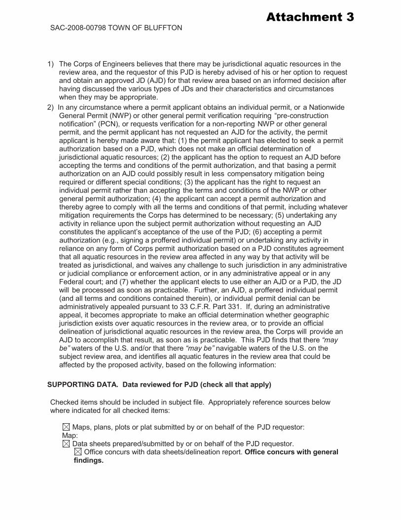
1) The Corps of Engineers believes that there may be jurisdictional aquatic resources in the
review area, and the requestor of this PJD is hereby advised of his or her option to request and obtain an approved JD (AJD) for that review area based on an informed decision after having discussed the various types of JDs and their characteristics and circumstances when they may be appropriate.
2) In any circumstance where a permit applicant obtains an individual permit, or a Nationwide General Permit (NWP) or other general permit verification requiring “pre-construction notification” (PCN), or requests verification for a non-reporting NWP or other general permit, and the permit applicant has not requested an AJD for the activity, the permit applicant is hereby made aware that: (1) the permit applicant has elected to seek a permit authorization based on a PJD, which does not make an official determination of jurisdictional aquatic resources; (2) the applicant has the option to request an AJD before accepting the terms and conditions of the permit authorization, and that basing a permit authorization on an AJD could possibly result in less compensatory mitigation being required or different special conditions; (3) the applicant has the right to request an individual permit rather than accepting the terms and conditions of the NWP or other general permit authorization; (4) the applicant can accept a permit authorization and thereby agree to comply with all the terms and conditions of that permit, including whatever mitigation requirements the Corps has determined to be necessary; (5) undertaking any activity in reliance upon the subject permit authorization without requesting an AJD constitutes the applicant’s acceptance of the use of the PJD; (6) accepting a permit authorization (e.g., signing a proffered individual permit) or undertaking any activity in reliance on any form of Corps permit authorization based on a PJD constitutes agreement that all aquatic resources in the review area affected in any way by that activity will be treated as jurisdictional, and waives any challenge to such jurisdiction in any administrative or judicial compliance or enforcement action, or in any administrative appeal or in any Federal court; and (7) whether the applicant elects to use either an AJD or a PJD, the JD will be processed as soon as practicable. Further, an AJD, a proffered individual permit (and all terms and conditions contained therein), or individual permit denial can be administratively appealed pursuant to 33 C.F.R. Part 331. If, during an administrative appeal, it becomes appropriate to make an official determination whether geographic jurisdiction exists over aquatic resources in the review area, or to provide an official delineation of jurisdictional aquatic resources in the review area, the Corps will provide an AJD to accomplish that result, as soon as is practicable. This PJD finds that there “may be” waters of the U.S. and/or that there “may be” navigable waters of the U.S. on the subject review area, and identifies all aquatic features in the review area that could be affected by the proposed activity, based on the following information:
SUPPORTING DATA. Data reviewed for PJD (check all that apply) Checked items should be included in subject file. Appropriately reference sources below where indicated for all checked items:
Maps, plans, plots or plat submitted by or on behalf of the PJD requestor:
Map: Data sheets prepared/submitted by or on behalf of the PJD requestor.
Office concurs with data sheets/delineation report. Office concurs with general findings.
Attachment 3

Attachment 3

Attachment 3

3/31/2021 Beaufort County, South Carolina
sc-beaufort-county.governmax.com/svc/agency/sc-beaufort-county/tab_summary_report.asp?PrintView=True&r_nm=tab_report&t_wc=revobjid%3D51… 1/1
Beaufort County, South Carolina generated on 3/31/2021 6:23:35 AM EDT
Property ID (PIN) Alternate ID(AIN) Parcel Address
Datarefreshed asof
AssessYear Pay Year
R600 039 000 00500000 00510913 115 BLUFFTON RD, 3/26/2021 2020 2020
Current Parcel Information
Owner TOWN OF BLUFFTONOwner Address PO BOX 386
BLUFFTON SC 29910
Property Class Code CommVacAcreage 9.3400
Legal Description 03/11 0.66 AC DEEDED TO SCDOT ($146,300)
Historic Information
Tax Year Land Building Market Taxes Payment
2020 $1,374,800 $1,374,800 $64.00 $0.00
2019 $1,374,800 $1,374,800 $64.00 $64.00
2018 $1,374,800 $1,374,800 $57.00 $57.00
2017 $1,120,800 $1,120,800 $57.00 $57.00
2016 $1,120,800 $1,120,800 $57.00 $57.00
2015 $1,120,800 $1,120,800 $57.00 $57.00
2014 $1,120,800 $1,120,800 $203.61 $203.61
2013 $1,120,800 $1,120,800 $203.61 $203.61
2012 $1,868,000 $1,868,000 $203.61 $203.61
2011 $1,868,000 $1,868,000 $203.61 $203.61
Sales Disclosure
Grantor Book & Page Date Deed Vacant Sale Price 12/31/1776 Or $0 UNKNOWN OWNER 00510913 12/31/1776 Or $0
Improvements
Building Type Use CodeDescription
ConstructedYear Stories Rooms Square
Footage Improvement
Size
Attachment 4

Kidd Ln
Goeth
e Rd
Grace Ln
Bluffton Pkwy
46
46Bl
ufft
onRd
Bluf
fton
Rd
Bluffton Pkwy
Shady Green Ln
Shady Glen Dr
Shady Way
Kidd Ln
Goet
heRd
US Post Office
46
Shady Marsh Ln
Shady Pine Ln
Thurmond Way
Stat
eSt
Ann Smith Dr
Beaufort CountyGovernment Center
Bluffton Pkwy
Lake Linden DrAnn Smith Dr
ShadyG
len
Cir
LakeLind
enD
r
96 Lake Linden Dr
87 Lake Linden Dr
90 Lake Linden Dr
41 Lake Linden Dr42 Lake Linden Dr
38 Lake Linden Dr
34 Lake Linden Dr
91 Lake Linden Dr
98 Lake Linden Dr
37 Lake Linden Dr
83 Lake Linden Dr
94 Lake Linden Dr
43 Lake Linden Dr
33 Lake Linden Dr
40 Lake Linden Dr
36 Lake Linden Dr
117 Goethe Rd
142 State St
142 Bluffton Rd
146 Bluffton Rd139 State St
1 Thurmond Way
4 Thurmond Way140 State St
17 Grace Ln
123 Goethe Rd Unit B
23 Grace Ln
64 Goethe Rd
7 Godfrey Pl
55 Lake Linden Dr
66 Lake Linden Dr
50 Lake Linden Dr
Bluffton Pkwy
Bluffton Pkwy
52 Lake Linden Dr
84 Lake Linden Dr
54 Lake Linden Dr60 Lake Linden Dr
80 Lake Linden Dr
Bluffton Pkwy
72 Lake Linden Dr
82 Lake Linden Dr
76 Lake Linden Dr
Bluffton Pkwy
78 Lake Linden Dr
47 Lake Linden Dr
67 Lake Linden Dr
4896 Bluffton Pkwy
83 Goethe Rd20 Martha Brown Cir
128 Bluffton Rd
96 Goethe Rd
86 Goethe Rd
4818 Bluffton Pkwy
111 Bluffton Rd
124 Bluffton Rd99 Goethe Rd
22 Martha Brown Cir
132 Bluffton Rd
20 Martha Brown Cir
47 Goethe Rd Unit 2
7 Thurmond Way
75 Goethe Rd
89 Goethe Rd
6 Martha Brown Cir
98 Goethe Rd
95 Goethe Rd
4767 Bluffton Pkwy
93 Goethe Rd
114 Bluffton Rd
68 Goethe Rd
119 Goethe Rd Unit A
119 Bluffton Rd
25 Thurmond Way
94 Bluffton Rd
53 Goethe Rd
91 Goethe Rd
97 Goethe Rd
120 100 Bluffton Rd
76 Goethe Rd
30 Grace Ln
Bluffton Rd
102 Bluffton Rd
212 Shady Way145 Bluffton Rd
111 Bluffton Rd
93 Goethe Rd
115 Goethe Rd
138 Bluffton Rd
80 Goethe Rd
Bluffton Pkwy
100 Bluffton Rd
115 Bluffton Rd
4850 Bluffton Pkwy
15 Lake Linden Ln
66 Goethe Rd
66 Goethe Rd
4 Kidd Ln
64 Goethe Rd
4809 Bluffton Pkwy
4815 Bluffton Pkwy
19 Ann Smith Dr
27 Ann Smith DrAnn Smith Dr
4921 Bluffton Pkwy
Aerial Map
3/31/2021
0 0.05 0.1 0.15 0.2 0.250.03mi
Giroux, AubrieF
Attachment 5

Kidd Ln
Goeth
e Rd
Grace Ln
Bluffton Pkwy
46
46
Bluf
fton
Rd
Bluf
fton
Rd
Bluffton Pkwy
Shady Green Ln
Shady Glen Dr
Shady Way
Kidd LnGo
ethe
Rd
US Post Office
46
Shady Marsh Ln
Shady Pine Ln
Thurmond Way
Stat
eSt
Ann Smith Dr
Beaufort CountyGovernment Center
Bluffton Pkwy
Lake Linden Dr
ShadyG
len
Cir
LakeLind
enD
r
County Zoning
3/31/2021
0 0.05 0.1 0.15 0.2 0.250.03mi
Giroux, AubrieF
Attachment 6

Attachment 7 115 Bluffton Road Annexation
Example Application Meeting Sequence
Created December 7, 2020
Meeting Date Task Description/ Application(s) for Review Action(s)
Pre-Application Meeting TBD Annexation Petition Review of Application Requirements and
Timeline Zoning Map Amendment
Application Submittal Meeting TBD Annexation Petition
Submittal of Applications Zoning Map Amendment
Town Council “Intent to Annex”, Acceptance of Petition TBD Annexation Petition
Town Council acceptance of petition by majority vote if they desire to move forward with the request
Submittal of Revisions for Planning Commission Workshop Packet TBD
Annexation Petition Resubmittal of Applications with Revised Materials Zoning Map Amendment
Planning Commission Workshop TBD Annexation Petition
Discussion and Comments for Consideration. Zoning Map Amendment
Public Hearing Notice 30 days Prior to Public Hearing TBD
Annexation Petition � � �
Mail letters notifying adjacent property owners within 500’ radius of pending applications and upcoming rescheduled Planning Commission Public Hearing � Post the property � Newspaper Notification �
Zoning Map Amendment � � �
Submittal of Revisions for Planning Commission Public Hearing Packet TBD
Annexation Petition Any revisions to plans will need to be resubmitted by this date to provide adequate time for staff to review and comment. Zoning Map Amendment
Planning Commission Public Hearing & Recommendation to Town Council
TBD
Annexation Petition ∆ Public Hearing and Recommendation to Town Council Public Hearing Cases ∆ Zoning Map Amendment ∆
Submittal of Revisions for Town Council 1st Readings Packet TBD
Annexation Petition Any revisions to plans will need to be resubmitted by this date to provide adequate time for staff to review and comment. Zoning Map Amendment
Town Council Ordinance 1st Readings TBD
Annexation Petition Ordinance 1st Readings
Zoning Map Amendment
Public Hearing Notice 30 days Prior to Town Council Public Hearing TBD
Annexation Petition � � � Letters notifying adjacent property owners within 500’ radius of pending applications and upcoming Town Council Public Hearing � Post the property � Newspaper Notification �
Zoning Map Amendment � � �
Submittal of Revisions for Town Council Public Hearing and 2nd & Final Reading Packet
TBD Annexation Petition Any revisions to plans will need to be
resubmitted by this date to provide adequate time for staff to review and comment. Zoning Map Amendment
Town Council Public Hearing & Ordinance 2nd and Final Readings
TBD
Annexation Petition ∆ Public Hearing and Ordinance 2nd and Final Readings Public Hearing Cases ∆ Zoning Map Amendment ∆