Embed Size (px)
Citation preview
TOUR GUIDES SA NEWSLETTER
A monthly newsletter brought to you by Tour Guides SA VOLUME 1, JULY 2019
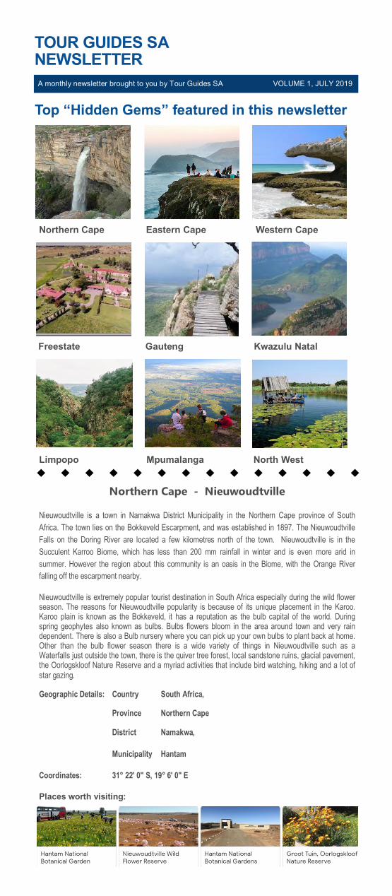
Top “Hidden Gems” featured in this newsletter
Northern Cape Eastern Cape Western Cape
Freestate Gauteng Kwazulu Natal
Limpopo Mpumalanga North West
Northern Cape - Nieuwoudtville
Nieuwoudtville is a town in Namakwa District Municipality in the Northern Cape province of South
Africa. The town lies on the Bokkeveld Escarpment, and was established in 1897. The Nieuwoudtville
Falls on the Doring River are located a few kilometres north of the town. Nieuwoudtville is in the
Succulent Karroo Biome, which has less than 200 mm rainfall in winter and is even more arid in
summer. However the region about this community is an oasis in the Biome, with the Orange River
falling off the escarpment nearby.
Nieuwoudtville is extremely popular tourist destination in South Africa especially during the wild flower season. The reasons for Nieuwoudtville popularity is because of its unique placement in the Karoo. Karoo plain is known as the Bokkeveld, it has a reputation as the bulb capital of the world. During spring geophytes also known as bulbs. Bulbs flowers bloom in the area around town and very rain dependent. There is also a Bulb nursery where you can pick up your own bulbs to plant back at home. Other than the bulb flower season there is a wide variety of things in Nieuwoudtville such as a Waterfalls just outside the town, there is the quiver tree forest, local sandstone ruins, glacial pavement, the Oorlogskloof Nature Reserve and a myriad activities that include bird watching, hiking and a lot of
star gazing.
Geographic Details: Country South Africa,
Province Northern Cape
District Namakwa,
Municipality Hantam
Coordinates: 31° 22′ 0″ S, 19° 6′ 0″ E
Places worth visiting:

VOL. 1 JULY 2019
Places in near vicinity:
Eastern Cape - Coffee Bay
Coffee Bay is a small village situated on the South African "Wild Coast" which stretches for 160 kilometers south from the Kei River mouth to Port Edward in the North and approximately 100 kilometers inland. The nearest large town, Mthatha, is approximately 80 kilometers away. Coffee Bay falls within the King Sabata Dalindyebo (KSD) district of the O.R Tambo District Municipality. The area
is filled with diverse wild flora and fauna.
The community is largely rural and Coffee Bay’s infrastructure includes informal settlements, a trading store, a plain camping site and two resort hotels. The traditional Xhosa lifestyle in Coffee Bay is one of the aspects that draw tourists to the area. At the same time, the Eastern Cape Department of Social Development identified challenges that include high unemployment rates, malnutrition, housing shortages, and infrastructure backlogs, low levels of health facilities, low levels of education, HIV and environmental degradation. The communities’ lives are dominated by poverty and ill-health, and most of the population do not comply with the environmental legislation regarding the use of natural resources. A study has suggested that the high illiteracy and unemployment compels people to use coastal natural
resources to satisfy their basic needs.
The Hole in the Wall, in Coffee Bay, is a large hole which is scored neatly into a cliff that extends over the sea. The hole amplifies the sound of the waves onto the rock, inspiring the local Xhosa people to name it esiKhaleni which means ‘place of sound’. There are many different folklore tales about the Hole in the Wall. Many believe that the hole is a gateway to ancestors. People also believe that the Mpako River once formed a landlocked lagoon blocked by the cliff. Most accept the scientific explanation that
the hole is the result of many years of waves breaking against the cliff.
Geographic Details: Country South Africa,
Province Eastern Cape
District OR Tambo
Municipality The King Sabata Dalindyebo Local Municipality
Coordinates: 31° 34′ 0″ S, 28° 46′ 0″ E
Places worth visiting:
Bulungula Beach Hole in the Wall Hiking Trail Xhosa Village
Coffee Bay Mdumbi Beach Mdumbi River Kayak
VOL. 1 JULY 2019
Places in near vicinity:
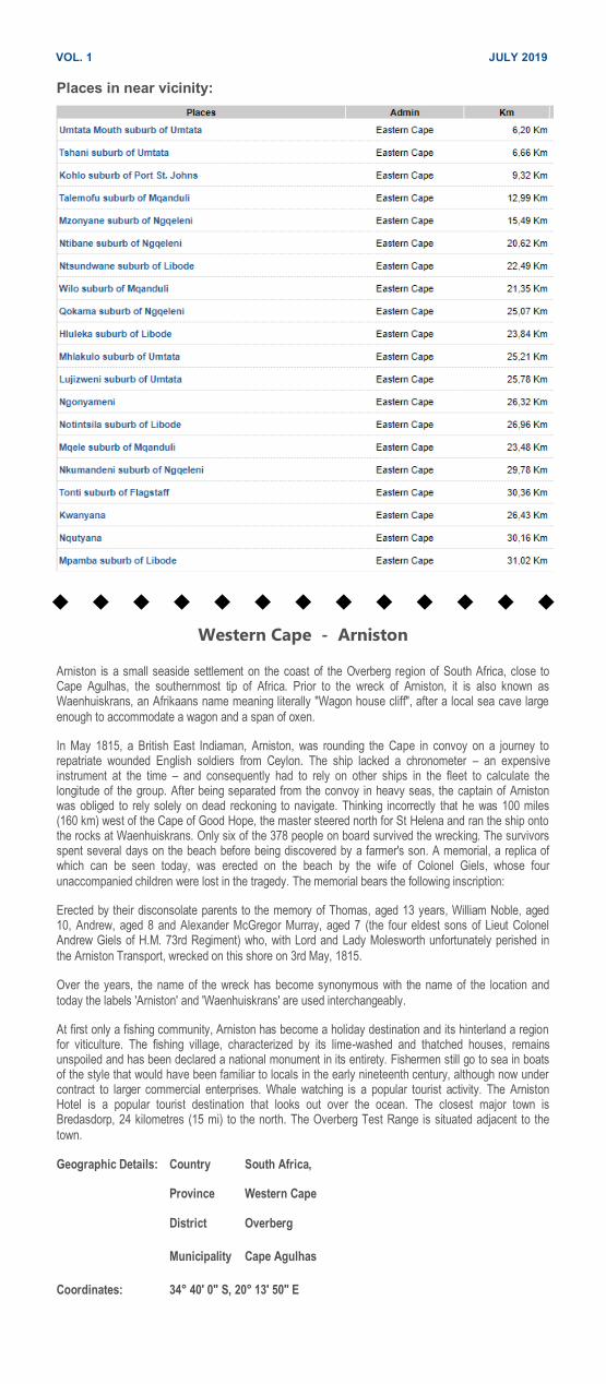
Western Cape - Arniston
Arniston is a small seaside settlement on the coast of the Overberg region of South Africa, close to Cape Agulhas, the southernmost tip of Africa. Prior to the wreck of Arniston, it is also known as Waenhuiskrans, an Afrikaans name meaning literally "Wagon house cliff", after a local sea cave large
enough to accommodate a wagon and a span of oxen.
In May 1815, a British East Indiaman, Arniston, was rounding the Cape in convoy on a journey to repatriate wounded English soldiers from Ceylon. The ship lacked a chronometer – an expensive instrument at the time – and consequently had to rely on other ships in the fleet to calculate the longitude of the group. After being separated from the convoy in heavy seas, the captain of Arniston was obliged to rely solely on dead reckoning to navigate. Thinking incorrectly that he was 100 miles (160 km) west of the Cape of Good Hope, the master steered north for St Helena and ran the ship onto the rocks at Waenhuiskrans. Only six of the 378 people on board survived the wrecking. The survivors spent several days on the beach before being discovered by a farmer's son. A memorial, a replica of which can be seen today, was erected on the beach by the wife of Colonel Giels, whose four
unaccompanied children were lost in the tragedy. The memorial bears the following inscription:
Erected by their disconsolate parents to the memory of Thomas, aged 13 years, William Noble, aged 10, Andrew, aged 8 and Alexander McGregor Murray, aged 7 (the four eldest sons of Lieut Colonel Andrew Giels of H.M. 73rd Regiment) who, with Lord and Lady Molesworth unfortunately perished in
the Arniston Transport, wrecked on this shore on 3rd May, 1815.
Over the years, the name of the wreck has become synonymous with the name of the location and
today the labels 'Arniston' and 'Waenhuiskrans' are used interchangeably.
At first only a fishing community, Arniston has become a holiday destination and its hinterland a region for viticulture. The fishing village, characterized by its lime-washed and thatched houses, remains unspoiled and has been declared a national monument in its entirety. Fishermen still go to sea in boats of the style that would have been familiar to locals in the early nineteenth century, although now under contract to larger commercial enterprises. Whale watching is a popular tourist activity. The Arniston Hotel is a popular tourist destination that looks out over the ocean. The closest major town is Bredasdorp, 24 kilometres (15 mi) to the north. The Overberg Test Range is situated adjacent to the
town.
Geographic Details: Country South Africa,
Province Western Cape
District Overberg
Municipality Cape Agulhas
Coordinates: 34° 40′ 0″ S, 20° 13′ 50″ E
VOL. 1 JULY 2019
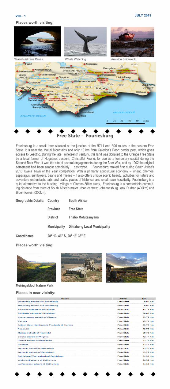
Places worth visiting:
Waenhuiskrans Caves Whale Watching Arniston Shipwreck
Free State - Fouriesburg
Fouriesburg is a small town situated at the junction of the R711 and R26 routes in the eastern Free State. It is near the Maluti Mountains and only 10 km from Caledon's Poort border post, which gives access to Lesotho. During the late nineteenth century, this land was donated to the Orange Free State by a local farmer of Huguenot descent, Christoffel Fourie, for use as a temporary capital during the Second Boer War. It was the site of several engagements during the Boer War, and by 1902 the original settlement had been almost completely destroyed. Fouriesburg ranked first during South Africa's 2013 Kwela Town of the Year competition. With a primarily agricultural economy – wheat, cherries, asparagus, sunflowers, beans and mielies – it also offers unique scenic beauty, activities for nature and adventure enthusiasts, arts and crafts, places of historical and small-town hospitality. Fouriesburg is a quiet alternative to the bustling village of Clarens 35km away, Fouriesburg is a comfortable commut-ing distance from three of South Africa’s major urban centres: Johannesburg km), Durban (400km) and
Bloemfontein (250km).
Geographic Details: Country South Africa,
Province Free State
District Thabo Mofutsanyana
Municipality Dihlabeng Local Municipality
Coordinates: 28° 13′ 46″ S, 28° 18′ 38″ E
Places worth visiting:
Meiringskloof Nature Park
Places in near vicinity:
VOL. 1 JULY 2019
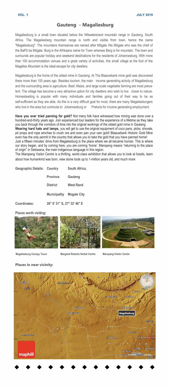
Gauteng - Magaliesburg
Magaliesburg is a small town situated below the Witwatersrand mountain range in Gauteng, South
Africa. The Magaliesberg mountain range is north and visible from town, hence the name
"Magaliesburg". The mountains themselves are named after Môgale Wa Môgale who was the chief of
the BaPô ba Môgale. Burg is the Afrikaans name for Town whereas Berg is for mountain. The town and
surrounds are popular holiday and weekend destinations for the residents of Johannesburg. With more
than 100 accommodation venues and a great variety of activities, this small village at the foot of the
Magalies Mountain is the ideal escape for city dwellers.
Magaliesburg is the home of the oldest mine in Gauteng. At The Blaauwbank mine gold was discovered
there more than 100 years ago. Besides tourism, the main income generating activity of Magaliesburg
and the surrounding area is agriculture. Beef, Maize, and large scale vegetable farming are most preva-
lent. The village has become a very attractive option for city dwellers who wish to live closer to nature.
Homesteading is popular with many individuals and families going out of their way to be as
self-sufficient as they are able. As this is a very difficult goal for most, there are many Magaliesburgers
who live in the area but commute to Johannesburg or Pretoria for income generating employment.
Have you ever tried panning for gold? Not many folk have witnessed how mining was done over a hundred-and-thirty years ago. Join experienced tour leaders for the experience of a lifetime as they take you back through the corridors of time into the original workings of the oldest gold mine in Gauteng. Wearing hard hats and lamps, you will get to use the original equipment of coco pans, picks, shovels, pit props and rope winches to crush ore and even pan your own gold! Blaauwbank Historic Gold Mine even has the only permit in the country that allows you to take the gold that you have panned home! Just a fifteen minutes’ drive from Magaliesburg is the place where we all became human. This is where our story began, and by coming here, you are coming ‘home’. Maropeng means “returning to the place of origin” in Setswana, the main indigenous language in this region.
The Maropeng Visitor Centre is a thrilling, world-class exhibition that allows you to look at fossils, learn
about how humankind was born, view stone tools up to 1-million years old, and much more
Geographic Details: Country South Africa,
Province Gauteng
District West Rand
Municipality Mogale City
Coordinates: 26° 0′ 31″ S, 27° 32′ 46″ E
Places worth visiting:
Places in near vicinity:
Magaliesburg Canopy Tours Margaret Roberts Herbal Centre Maropeng Visitor Centre
VOL. 1 JULY 2019
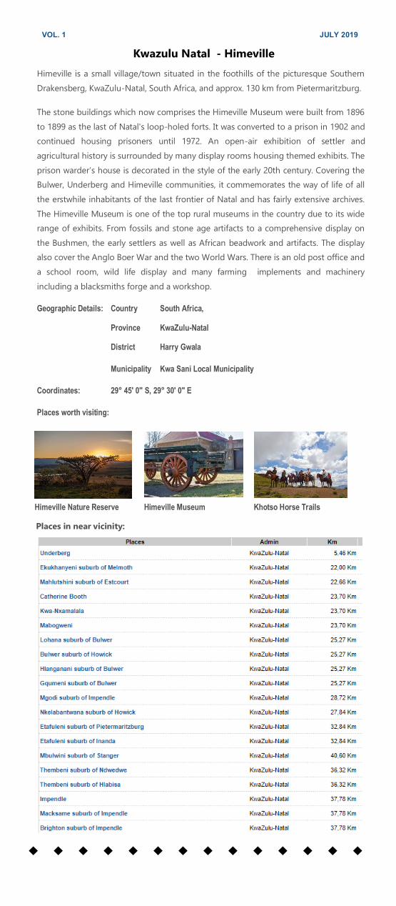
Kwazulu Natal - Himeville
Himeville is a small village/town situated in the foothills of the picturesque Southern
Drakensberg, KwaZulu-Natal, South Africa, and approx. 130 km from Pietermaritzburg.
The stone buildings which now comprises the Himeville Museum were built from 1896
to 1899 as the last of Natal's loop-holed forts. It was converted to a prison in 1902 and
continued housing prisoners until 1972. An open-air exhibition of settler and
agricultural history is surrounded by many display rooms housing themed exhibits. The
prison warder’s house is decorated in the style of the early 20th century. Covering the
Bulwer, Underberg and Himeville communities, it commemorates the way of life of all
the erstwhile inhabitants of the last frontier of Natal and has fairly extensive archives.
The Himeville Museum is one of the top rural museums in the country due to its wide
range of exhibits. From fossils and stone age artifacts to a comprehensive display on
the Bushmen, the early settlers as well as African beadwork and artifacts. The display
also cover the Anglo Boer War and the two World Wars. There is an old post office and
a school room, wild life display and many farming implements and machinery
including a blacksmiths forge and a workshop.
Geographic Details: Country South Africa,
Province KwaZulu-Natal
District Harry Gwala
Municipality Kwa Sani Local Municipality
Coordinates: 29° 45′ 0″ S, 29° 30′ 0″ E
Places worth visiting:
Himeville Nature Reserve Himeville Museum Khotso Horse Trails
Places in near vicinity:

VOL. 1 JULY 2019
Limpopo - Haenertsburg Haenertsburg is a village situated on the edge of the Great Escarpment on the R71 road between
Polokwane and Tzaneen en route to the Kruger National Park. Haenertsburg is also fondly called The
Mountain by the locals due to its in hilly terrain. The Iron Crown Mountain is the highest point in Lim-
popo and is a well-known landmark. Frequent mists and relatively high rainfall have created a
very lush vegetation with Afromontane forest patches occupying the kloofs (gullies) which dot the
rolling grasslands and surrounding mountains. The scenic beauty of the Haenertsburg area attracts
many tourists. It is a favored spot for cycling, biking and fishing. Sailing and other watersport take place
on nearby Ebenezer Dam. The 20th steepest mountain pass in South Africa, the Magoebask-
loofpass, leads one down from the Highveld of the Haenertsburg area to the Lowveld adjoining the
Kruger National Park, gaining/losing 446m altitude in 5.15 km. Haenertsburg is also famous for the
annual Spring Fair where various crafts and flower displays are exhibited. July sees the advent of the
Holistic Fair which displays the diverse creative talents of the Mountain folk. Every Friday and Satur-
day morning the Morning Market is run by the Duchess of Atholl. Himeville is a small village/town
situated in the foothills of the picturesque Southern Drakensberg, KwaZulu-Natal, South Africa, and
approx. 130 km from Pietermaritzburg. The Himeville Museum is one of the top rural museums in the
country due to its wide range of exhibits. From fossils and stone age artifacts to a comprehensive
display on the Bushmen, the early settlers as well as African beadwork and artifacts. The display
also cover the Anglo Boer War and the two World Wars. There is an old post office and a school room,
wild life display and many farming implements and machinery including a blacksmiths forge and a
workshop.
Geographic Details: Country South Africa,
Province Limpopo
District Mopani
Municipality Greater Tzaneen
Coordinates: 23° 56′ 0″ S, 29° 57′ 0″ E
Places worth visiting:
Places in near vicinity:
VOL. 1 JULY 2019
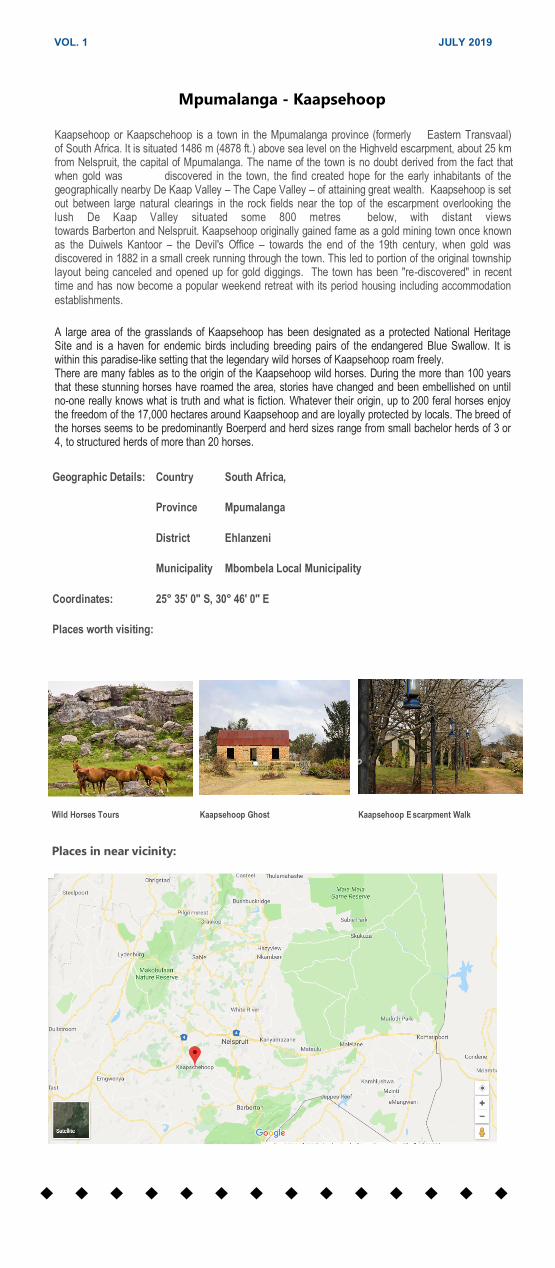
Mpumalanga - Kaapsehoop
Kaapsehoop or Kaapschehoop is a town in the Mpumalanga province (formerly Eastern Transvaal) of South Africa. It is situated 1486 m (4878 ft.) above sea level on the Highveld escarpment, about 25 km from Nelspruit, the capital of Mpumalanga. The name of the town is no doubt derived from the fact that when gold was discovered in the town, the find created hope for the early inhabitants of the geographically nearby De Kaap Valley – The Cape Valley – of attaining great wealth. Kaapsehoop is set out between large natural clearings in the rock fields near the top of the escarpment overlooking the lush De Kaap Valley situated some 800 metres below, with distant views towards Barberton and Nelspruit. Kaapsehoop originally gained fame as a gold mining town once known as the Duiwels Kantoor – the Devil's Office – towards the end of the 19th century, when gold was discovered in 1882 in a small creek running through the town. This led to portion of the original township layout being canceled and opened up for gold diggings. The town has been "re-discovered" in recent time and has now become a popular weekend retreat with its period housing including accommodation
establishments.
A large area of the grasslands of Kaapsehoop has been designated as a protected National Heritage Site and is a haven for endemic birds including breeding pairs of the endangered Blue Swallow. It is within this paradise-like setting that the legendary wild horses of Kaapsehoop roam freely. There are many fables as to the origin of the Kaapsehoop wild horses. During the more than 100 years that these stunning horses have roamed the area, stories have changed and been embellished on until no-one really knows what is truth and what is fiction. Whatever their origin, up to 200 feral horses enjoy the freedom of the 17,000 hectares around Kaapsehoop and are loyally protected by locals. The breed of the horses seems to be predominantly Boerperd and herd sizes range from small bachelor herds of 3 or 4, to structured herds of more than 20 horses.
Geographic Details: Country South Africa,
Province Mpumalanga
District Ehlanzeni
Municipality Mbombela Local Municipality
Coordinates: 25° 35′ 0″ S, 30° 46′ 0″ E
Places worth visiting:
Wild Horses Tours Kaapsehoop Ghost Kaapsehoop E scarpment Walk
Places in near vicinity:

VOL. 1 JULY 2019
North West - Groot Marico Groot Marico is a hamlet in the North West Province of South Africa. The economy
relies heavily on agriculture, mining and tourism. Groot Marico is named after the
Marico River. The topography comprises dry bushveld with a climate that is ideal for
cattle, maize, citrus fruit and tobacco. Open pit quarries in the area extract marble,
slate and andalusite, with prospects of large-scale nickel mining on the banks of the
Groot Marico River as well as the majority of the farms surrounding the hamlet
having sparked a successful regional petition against such development. In 2016 a
new diamond prospecting application was initiated bringing a new round of local
community objections and petitioning. The word "Marico" was made famous in South
Africa by Herman Charles Bosman's writings of this area and later re-enactments of
these tales by actor Patrick Mynhardt. Bosman described the area thus: “There is no
other place I know that is so heavy with atmosphere, so strangely and darkly
impregnated with that stuff of life that bears the authentic stamp of South Africa”. At
least part of Bosman's musings may have been inspired by sips of the mampoer for
which Groot Marico is infamous.
Geographic Details: Country South Africa,
Province North West
District Ngaka Modiri Molema District Municipality
Municipality Ramotshere Moiloa Local Municipality
Coordinates: 25° 35′ 16.8″ S, 26° 24′ 3.6″ E
Places worth visiting:
Marico Mampoer Tasting Groot Marico Game Reserve Groot Marico River Adventures
Places in near vicinity:

VOL. 1 JULY 2019
Food for thought by
Willie Owner of Tour Guides SA
It is a very exciting phase that we at Tour Guides SA are entering. I would
like to believe that you enjoyed learning a bit more about the “hidden
gems” that our nine provinces are so proud of.
Going forward Tour Guides SA will run this newsletter once a month. All
registered Tour Guides advertising on our page as well as registered
members of SATSA will receive a copy. We will have one article on a local
tourist attraction or event in all nine provinces of South Africa every
month.
We will in editions to come elect specific establishment to reserve a spot
in upcoming newsletter and showcase the uniqueness and beauty of your
establishment. You have the opportunity to do a write up and photos
about your pride and joy. This will come at a fee, worth investing into.
If you are interested please contact Willie on 074 259 2053 or email
[email protected] to reserve your space in upcoming newsletter
about your province.
Kindly visit www.tourguidessa.co.za to register as one of our Tour Guides
Warm Tour Guides SA greetings
Willie Lourens